 Block
From the record
One of 68 National Register listings published here for Door County · listed in 2024 · category: Site.
Sources: the National Register database, National Park Service
Listed on the National Register of Historic Places in 2024.
One of 68 National Register listings published here for Door County · listed in 2024 · category: Site.
Sources: the National Register database, National Park Service
The chapter on Sturgeon Bay City in History Of Door County Wisconsin The County Beautiful, published 1917 names Sturgeon Bay. This is what it says, exactly as the scans read.
Sturgeon Bay seems to have been a center for human intercourse long before white men came here and began to do business. The remains of several Indian villages have been discovered in or near Sturgeon Bay which show that it had a large population hundreds of years ago. One of these villages was located on the property of the "Cove" summer resort about three hundred feet south of the boat landing. Another was across the bay at Circle Ridge on block 5. A great many fine relics have been unearthed here. Another village site has been found on block 8 of Wagener's second addition to Sturgeon Bay, just north of the city. Two large village sites are also found at Little Harbor.
Passage source: History Of Door County Wisconsin The County Beautiful, published 1917.
The Indians presumably found this a convenient place of habitation because of its proximity to the waters of both Lake Michigan and Green Bay. When the first settlers came they found a well trodden path leading from the head of Sturgeon Bay to Lake Michigan, just north of the present canal, over which the Indians had portaged their canoes for centuries.
Passage source: History Of Door County Wisconsin The County Beautiful, published 1917.
Machine-read from a century-old scan, so expect the errors a machine makes: misspelled names, dropped words, stray characters.
Read the whole chapter on Sturgeon Bay City - 8,908 words on its settlement, mills, schools and churches.
Regional context, not property-specific evidence. The federal wildfire occurrence database lists 14 fires within 5 miles of PRIDE Shipwreck (Schooner) between 2018 and 2020, burning about 7 acres in total. None started naturally. None was recorded as arson. Distance is straight-line from the map coordinates, so a fire counted here may appear on a neighbouring settlement's page as well.
| Reported cause | Fires |
|---|---|
| Missing data/not specified/undetermined | 7 |
| Debris and open burning | 4 |
| Smoking | 3 |
The most recent of them, most recent first, with the day each was reported and the service that recorded it.
| Date | Cause | Size | Reported by | Name on the report |
|---|---|---|---|---|
| 5 September 2020 | Missing data/not specified/undetermined | 1.0 acres | Wisconsin Department of Natural Resources | 134 |
| 8 June 2020 | Missing data/not specified/undetermined | 1.0 acres | Wisconsin Department of Natural Resources | 580 |
| 18 June 2020 | Smoking | under an acre | Wisconsin Department of Natural Resources | 623 |
| 16 June 2020 | Missing data/not specified/undetermined | under an acre | Wisconsin Department of Natural Resources | 610 |
| 17 May 2018 | Debris and open burning | 1.0 acres | Wisconsin Department of Natural Resources | 497 |
| 30 April 2018 | Debris and open burning | under an acre | Wisconsin Department of Natural Resources | 440 |
| 30 April 2018 | Debris and open burning | under an acre | Wisconsin Department of Natural Resources | 439 |
| 29 April 2018 | Smoking | 1.0 acres | Wisconsin Department of Natural Resources | 71 |
Regional context, not property-specific evidence. The federal mineral resources record lists 15 workings within 5 miles of PRIDE Shipwreck (Schooner): 6 producers, 5 past producers, 3 unknowns, 1 plant. 7 still produce. What was taken out: Sand and Gravel, Construction, Stone, Crushed/Broken, Limestone, Dimension, Stone. Distance is straight-line from the map coordinates, so a quarry counted here may appear on a neighbouring settlement's page as well.
| Where | Site | Commodity | Status | Recorded |
|---|---|---|---|---|
| Adamski Fisher Limestone Quarry | Limestone, Dimension | Past Producer | ||
| Eliason Quarry | Stone | Unknown | ||
| Elliason Quarry | Stone, Crushed/Broken | Past Producer | ||
| Jutting Point Limestone Quarry | Stone, Crushed/Broken | Past Producer | ||
| Kiehnau Quarry | Stone, Crushed/Broken | Past Producer | ||
| The Reef Limestone Quarry | Stone, Crushed/Broken | Past Producer | ||
| Walker Road Quarry | Stone, Crushed/Broken | Producer | ||
| Bissen Quarry | Sand and Gravel, Construction | Producer | ||
| County Pit | Sand and Gravel, Construction | Unknown | ||
| Door Pit South | Sand and Gravel, Construction | Producer |
Regional context, not property-specific evidence. The National Weather Service names Sturgeon Bay, the town this property stands in, in 54 storm reports between 1994 and 2023: 32 thunderstorm wind, 14 hail, 3 lightning, 3 funnel cloud. The reports record 5 injuries. Each account below is quoted exactly as the forecast office filed it, from the NOAA Storm Events Database, and each date opens the federal record of that event.
| When | Event | Place named | Harm | What the report says |
|---|---|---|---|---|
| June 1998 | Thunderstorm Wind | Sturgeon Bay | 3 hurt, $150,000 | no account filed |
| August 2003 | Lightning | Sturgeon Bay | 1 hurt | no account filed |
| June 1998 | Thunderstorm Wind | Sturgeon Bay | 1 hurt | no account filed |
| June 1998 | Thunderstorm Wind | Sturgeon Bay | $150,000 | no account filed |
| September 1994 | Thunderstorm Wind | Sturgeon Bay | $25,000 | no account filed |
| July 2011 | Lightning | Sturgeon Bay | $10,000 | Lightning struck a tree, followed the copper in the underground gas propane line to a house, and ignited the wooden support holding up a pipe in the basement. |
| August 1996 | Thunderstorm Wind | Sturgeon Bay | $5,000 | no account filed |
| June 1998 | Thunderstorm Wind | Sturgeon Bay | $2,000 | no account filed |
| May 1996 | Thunderstorm Wind | Sturgeon Bay | $2,000 | no account filed |
| July 2023 | Hail | Sturgeon Bay | - | Penny size hail fell in Sturgeon Bay. |
| July 2023 | Hail | Sturgeon Bay | - | Half dollar size hail fell near Sturgeon Bay. The time of this report is an estimate based on radar data. |
| August 2023 | Hail | Sturgeon Bay | - | Penny size hail fell near Sturgeon Bay. |
| August 2023 | Thunderstorm Wind | Sturgeon Bay | - | Thunderstorm winds downed trees just north of Sturgeon Bay. |
| June 2022 | Thunderstorm Wind | Sturgeon Bay | - | Thunderstorm winds downed trees and power lines near Sturgeon Bay. The time of this report is an estimate based on radar data. |
| July 2021 | Thunderstorm Wind | Sturgeon Bay | - | Thunderstorm winds downed trees and power lines in Sturgeon Bay, and across Door County. The time of this event is an estimate based on radar data. |
| April 2020 | Hail | Sturgeon Bay | - | Golf ball size hail fell in Sturgeon Bay. |
| July 2020 | Thunderstorm Wind | Sturgeon Bay | - | Thunderstorm winds downed trees in Sturgeon Bay. The time of this report is an estimate based on radar data. |
| August 2018 | Thunderstorm Wind | Sturgeon Bay | - | Thunderstorm winds downed trees and power lines in Sturgeon Bay. The time of this report was estimated based on radar data. |
| June 2017 | Thunderstorm Wind | Sturgeon Bay | - | Thunderstorm winds caused widespread tree damage across Door County. |
| June 2017 | Thunderstorm Wind | Sturgeon Bay | - | Thunderstorm winds downed trees and power lines in Sturgeon Bay, Baileys Harbor, Fish Creek and Sister Bay. The time of this report was estimated for Sturgeon Bay based on radar data. |
| July 2016 | Thunderstorm Wind | Sturgeon Bay | - | Thunderstorm winds downed trees just north of Sturgeon Bay, on Reynolds Road, and just south of Sturgeon Bay, near Clay Banks. |
| July 2011 | Thunderstorm Wind | Sturgeon Bay | - | Law enforcement reported trees and power lines were blown down in the city of Sturgeon Bay and across much of southern Door County. |
| June 2007 | Thunderstorm Wind | Sturgeon Bay | - | Tree uprooted and landed on wires. |
| June 2007 | Hail | Sturgeon Bay | - | Golf ball size hail. |
| June 2007 | Hail | Sturgeon Bay | - | Ping pong ball size hail covered the ground. |
| July 2007 | Thunderstorm Wind | Sturgeon Bay | - | Straight-line winds from thunderstorms knocked down several trees in central Door County. |
| June 2007 | Thunderstorm Wind | Sturgeon Bay | - | Trees and branches down. |
| June 2007 | Hail | Sturgeon Bay | - | no account filed |
| June 2007 | Hail | Sturgeon Bay | - | no account filed |
| October 2006 | Hail | Sturgeon Bay | - | no account filed |
| September 2005 | Thunderstorm Wind | Sturgeon Bay | - | no account filed |
| August 2004 | Thunderstorm Wind | Sturgeon Bay | - | no account filed |
| July 2003 | Thunderstorm Wind | Sturgeon Bay | - | no account filed |
| May 2002 | Hail | Sturgeon Bay | - | no account filed |
| July 2002 | Hail | Sturgeon Bay | - | no account filed |
| September 2001 | Funnel Cloud | Sturgeon Bay | - | no account filed |
| August 2001 | Thunderstorm Wind | Sturgeon Bay | - | no account filed |
| August 2001 | Hail | Sturgeon Bay | - | no account filed |
| August 2001 | Thunderstorm Wind | Sturgeon Bay | - | no account filed |
| July 2000 | Hail | Sturgeon Bay | - | no account filed |
| June 2000 | Thunderstorm Wind | Sturgeon Bay | - | no account filed |
| September 2000 | Thunderstorm Wind | Sturgeon Bay | - | no account filed |
| September 1999 | Funnel Cloud | Sturgeon Bay | - | no account filed |
| September 1999 | Funnel Cloud | Sturgeon Bay | - | no account filed |
| August 1999 | Waterspout | Sturgeon Bay | - | no account filed |
| September 1999 | Waterspout | Sturgeon Bay | - | no account filed |
| June 1999 | Thunderstorm Wind | Sturgeon Bay | - | no account filed |
| July 1999 | Thunderstorm Wind | Sturgeon Bay | - | no account filed |
| July 1999 | Thunderstorm Wind | Sturgeon Bay | - | no account filed |
| July 1999 | Thunderstorm Wind | Sturgeon Bay | - | no account filed |
| June 1999 | Thunderstorm Wind | Sturgeon Bay | - | no account filed |
| June 1998 | Hail | Sturgeon Bay | - | no account filed |
| June 1998 | Lightning | Sturgeon Bay | - | no account filed |
| August 1995 | Thunderstorm Wind | Sturgeon Bay | - | no account filed |
No historic map-sheet match is published for this property yet. That does not mean no map exists. This record needs a coordinate-quality review before it can be joined to a sheet boundary. Browse the county's mapped places while that work is pending.
Other National Register properties close enough to walk or drive between, ordered by distance from this one. Both positions come from the same geocoding pass that matched these properties to their map sheets.
| Photograph | Property | Distance | Listed |
|---|---|---|---|
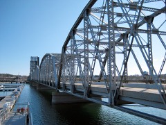 | Sturgeon Bay Bridge | 0.3 miles | 2008 |
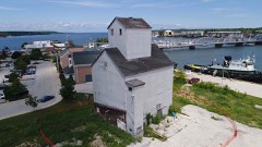 | Teweles and Brandeis Grain Elevator | 0.3 miles | 2018 |
 | Third Avenue Historic District | 0.5 miles | 1983 |
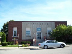 | Sturgeon Bay Post Office | 0.6 miles | 2000 |
 | Carnegie Free Library | 0.6 miles | 1988 |
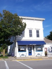 | Larson, L. A., & Co. Store | 0.6 miles | 1985 |
| National Archives record | The nomination case file for reference 100010860 in Record Group 79. |
| Door County | All 68 listed properties in this county. |