 Block
From the record
One of 18 National Register listings published here for Crawford County · listed in 2025 · category: District.
Sources: the National Register database, National Park Service
Listed on the National Register of Historic Places in 2025.
One of 18 National Register listings published here for Crawford County · listed in 2025 · category: District.
Sources: the National Register database, National Park Service
Regional context, not property-specific evidence. The federal wildfire occurrence database lists 56 fires within 5 miles of Blackhawk Avenue Historic District between 1992 and 2020, burning about 75 acres in total. None started naturally. 6 were recorded as arson. Distance is straight-line from the map coordinates, so a fire counted here may appear on a neighbouring settlement's page as well.
| Reported cause | Fires |
|---|---|
| Debris and open burning | 19 |
| Equipment and vehicle use | 11 |
| Missing data/not specified/undetermined | 9 |
| Arson/incendiarism | 6 |
| Smoking | 4 |
| Recreation and ceremony | 3 |
| Fireworks | 2 |
| Railroad operations and maintenance | 1 |
| Other causes | 1 |
The most recent of them, most recent first, with the day each was reported and the service that recorded it.
| Date | Cause | Size | Reported by | Name on the report |
|---|---|---|---|---|
| 6 September 1993 | Missing data/not specified/undetermined | under an acre | Wisconsin Department of Natural Resources | not named |
| 29 September 2004 | Debris and open burning | under an acre | Wisconsin Department of Natural Resources | not named |
| 30 August 2012 | Recreation and ceremony | under an acre | Wisconsin Department of Natural Resources | HORSE CAMP FIRE |
| 29 August 2008 | Arson/incendiarism | under an acre | Wisconsin Department of Natural Resources | not named |
| 6 July 2006 | Missing data/not specified/undetermined | under an acre | Wisconsin Department of Natural Resources | not named |
| 9 June 2012 | Fireworks | under an acre | Wisconsin Department of Natural Resources | FIREWORKS 2 |
| 25 June 1992 | Railroad operations and maintenance | under an acre | Wisconsin Department of Natural Resources | not named |
| 7 May 2007 | Arson/incendiarism | under an acre | Wisconsin Department of Natural Resources | not named |
Regional context, not property-specific evidence. The federal mineral resources record lists 11 workings within 5 miles of Blackhawk Avenue Historic District: 5 producers, 4 unknowns, 2 past producers. 5 still produce. What was taken out: Sand and Gravel, Construction, Stone, Crushed/Broken, Stone. Distance is straight-line from the map coordinates, so a quarry counted here may appear on a neighbouring settlement's page as well.
| Where | Site | Commodity | Status | Recorded |
|---|---|---|---|---|
| Own Crews | Stone | Unknown | ||
| Own Crews | Stone | Unknown | ||
| Marquette Quarry | Stone, Crushed/Broken | Unknown | ||
| Mcgregor Quarry | Stone, Crushed/Broken | Producer | ||
| Unknown | Stone, Crushed/Broken | Unknown | ||
| Wetzel Quarry | Stone, Crushed/Broken | Past Producer | ||
| Croell Sand & Gravel | Sand and Gravel, Construction | Producer | ||
| Lakeside Sand and Gravel Pit | Sand and Gravel, Construction | Past Producer | ||
| Prairie Sand and Gravel Pit | Sand and Gravel, Construction | Producer | ||
| Pretitti Pit | Sand and Gravel, Construction | Producer |
Regional context, not property-specific evidence. The National Weather Service names Prairie du Chien, the town this property stands in, in 43 storm reports between 1994 and 2024: 21 thunderstorm wind, 13 hail, 5 flood, 3 flash flood. The reports record 2 injuries. Each account below is quoted exactly as the forecast office filed it, from the NOAA Storm Events Database, and each date opens the federal record of that event.
| When | Event | Place named | Harm | What the report says |
|---|---|---|---|---|
| May 1998 | Thunderstorm Wind | Prairie Du Chien | 1 hurt, $30,000 | no account filed |
| June 1998 | Thunderstorm Wind | Prairie Du Chien | 1 hurt, $18,000 | A woman suffered a broken leg when a tree fell on the lodge she was staying in. |
| June 2008 | Flood | Prairie Du Chien | $275,000 | Water covered secondary roads and sections of Highway 131. Some mudslides occurred along Highway 35, which resulted in closure of one lane. |
| July 2007 | Flash Flood | Prairie Du Chien | $80,000 | no account filed |
| April 2011 | Flood | Prairie Du Chien | $75,000 | The combination of melting snow and rainfall in late March pushed the Mississippi River out of its banks at Prairie du Chien for most of the month of April. The river gage just across the river at McGregor, Iowa crested over four feet above the flood stage at 21.38 feet on the 18th. During the flood, the city of Prairie du Chien closed access to St. Feriole Island and over 16,000 sand bags were used throughout Crawford county. |
| May 2017 | Thunderstorm Wind | Prairie Du Chien | $50,000 | A couple of machine sheds were blown down north of Prairie du Chien. |
| May 1994 | Thunderstorm Wind | Prairie du Chien | $50,000 | no account filed |
| August 2000 | Thunderstorm Wind | Prairie Du Chien | $35,000 | no account filed |
| May 1999 | Thunderstorm Wind | Prairie Du Chien | $35,000 | no account filed |
| May 2017 | Thunderstorm Wind | Prairie Du Chien | $30,000 | Trees were blown down on the north side of Prairie du Chien. Some of these trees landed on houses and cars. Some roof damage also occurred in the strong winds. |
| May 1999 | Hail | Prairie Du Chien | $20,000 | no account filed |
| August 2019 | Thunderstorm Wind | Prairie Du Chien | $5,000 | The automated weather observing equipment at the Prairie du Chien airport measured a 66 mph wind gust. Trees and power lines were blown down in parts of the city. |
| July 2012 | Thunderstorm Wind | Prairie Du Chien | $5,000 | Trees and power lines were blown down across Prairie du Chien. |
| September 2007 | Thunderstorm Wind | Prairie Du Chien | $5,000 | Trees were blown down. |
| July 2000 | Thunderstorm Wind | Prairie Du Chien | $5,000 | no account filed |
| July 2017 | Thunderstorm Wind | Prairie Du Chien | $3,000 | Trees were blown down and corn damaged just east of Prairie du Chien. |
| May 2013 | Thunderstorm Wind | Prairie Du Chien | $3,000 | Trees and power lines were blown down in Prairie du Chien. |
| April 1997 | Thunderstorm Wind | Prairie Du Chien | $3,000 | no account filed |
| August 1996 | Thunderstorm Wind | Prairie Du Chien | $2,500 | no account filed |
| June 2015 | Thunderstorm Wind | Prairie Du Chien | $2,000 | Trees were blown down in Prairie du Chien. |
| July 2008 | Thunderstorm Wind | Prairie Du Chien | $2,000 | A telephone pole and tree branches were blown down. |
| July 2006 | Thunderstorm Wind | Prairie Du Chien | $1,000 | no account filed |
| May 2000 | Thunderstorm Wind | Prairie Du Chien | $1,000 | no account filed |
| July 2024 | Thunderstorm Wind | Prairie Du Chien | - | A trained spotter measured a 67 mph wind gust north of Prairie Du Chien. |
| April 2023 | Flood | Prairie Du Chien | - | Significant upstream runoff from the combination of rainfall and melting snow resulted in many road closures in Prairie du Chien. These closures included St. Feriole Island, Highway 18, and County Road K. Many homes were affected with residents having to be evacuated from the rising waters. |
| June 2016 | Flash Flood | Prairie Du Chien | - | Heavy rain caused flooding to occur in Prairie du Chien and along State Highway 27 where it comes down off the ridge and into Prairie du Chien. |
| June 2015 | Hail | Prairie Du Chien | - | Up to quarter sized hail fell north of Prairie du Chien. |
| June 2015 | Hail | Prairie Du Chien | - | Up to half dollar sized hail fell in Prairie du Chien. |
| June 2015 | Hail | Prairie Du Chien | - | Multiple reports of quarter sized hail were received from the north side of Prairie du Chien. |
| June 2014 | Flood | Prairie Du Chien | - | Runoff from heavy rain caused street flooding to occur in Prairie du Chien. |
| April 2014 | Heavy Rain | Prairie Du Chien | - | In Prairie du Chien, 2.32 inches of rain fell. |
| June 2014 | Flood | Prairie Du Chien | - | Runoff from heavy rain caused street flooding to occur in Prairie du Chien. |
| June 2013 | Flash Flood | Prairie Du Chien | - | Roads in Prairie du Chien were closed as runoff from locally heavy rains produced flooding. |
| September 2012 | Hail | Prairie Du Chien | - | Half dollar sized hail fell in Prairie du Chien. |
| August 2018 | Hail | Prairie Du Chien | - | no account filed |
| June 2015 | Hail | Prairie Du Chien | - | no account filed |
| September 2012 | Hail | Prairie Du Chien | - | no account filed |
| February 2009 | Hail | Prairie Du Chien | - | no account filed |
| May 2004 | Hail | Prairie Du Chien | - | no account filed |
| April 2002 | Hail | Prairie Du Chien | - | no account filed |
| June 2001 | Hail | Prairie Du Chien | - | no account filed |
| May 1999 | Hail | Prairie Du Chien | - | no account filed |
| July 1994 | Thunderstorm Wind | Prairie du Chien | - | no account filed |
No historic map-sheet match is published for this property yet. That does not mean no map exists. This record needs a coordinate-quality review before it can be joined to a sheet boundary. Browse the county's mapped places while that work is pending.
Other National Register properties close enough to walk or drive between, ordered by distance from this one. Both positions come from the same geocoding pass that matched these properties to their map sheets.
| Photograph | Property | Distance | Listed |
|---|---|---|---|
 | Folsom, W.H.C., House | under 500 feet | 1984 |
 | Commercial Hotel | under 500 feet | 2002 |
 | Prairie du Chien City Hall | under 500 feet | 2002 |
 | Prairie Du Chien Post Office | under 500 feet | 2000 |
 | Crawford County Courthouse | 0.2 miles | 1982 |
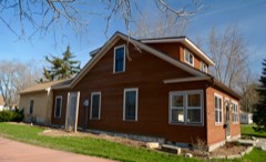 | Strange Powers House | 0.2 miles | 1979 |
| National Archives record | The nomination case file for reference 100012253 in Record Group 79. |
| Crawford County | All 18 listed properties in this county. |