 Block
From the record
18 National Register listings published here, 5 of them National Historic Landmarks.
Sources: the National Register database, National Park Service
54 topographic sheets cover 32 settlements here, and 18 properties are on the National Register of Historic Places.
18 National Register listings published here, 5 of them National Historic Landmarks.
Sources: the National Register database, National Park Service
Every property in this county listed on the National Register of Historic Places, with the year it was listed and the federal nomination document.
| Photograph | Property | Type | Listed | Reference |
|---|---|---|---|---|
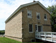 | Astor Fur Warehouse | building | 1966 | 66000800 |
| Blackhawk Avenue Historic District | district | 2025 | 100012253 | |
 | Michael Brisbois House | building | 1966 | 66000801 |
 | Commercial Hotel | building | 2002 | 02001342 |
 | Crawford County Courthouse | building | 1982 | 82000645 |
 | Dousman Hotel | building | 1966 | 66000122 |
| Fay, Benjamin F., and Wilhelmina House | building | 2019 | 100004227 | |
 | Folsom, W.H.C., House | building | 1984 | 84000692 |
 | Fort Crawford Military Hospital | site | 1966 | 66000121 |
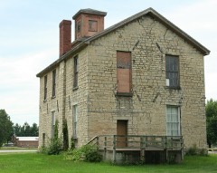 | Old Rock School | building | 1983 | 83004265 |
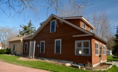 | Strange Powers House | building | 1979 | 79000067 |
 | Prairie Du Chien Post Office | building | 2000 | 00001263 |
 | Prairie du Chien City Hall | building | 2002 | 02001186 |
 | Rolette House | building | 1972 | 72000046 |
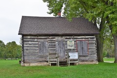 | St. Germain dit Gauthier House | building | 2018 | 100002411 |
 | St. Mary's Academy and College | building | 2017 | 100001380 |
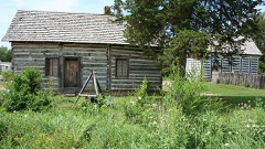 | Francois Vertefeuille House | building | 1993 | 93000142 |
 | Villa Louis | site | 1966 | 66000123 |
Every wildfire the federal occurrence database records inside this county: 397 of them, burning about 1,181 acres. 2 started naturally and 26 were recorded as arson. Each settlement page carries the fires within five miles of it.
| Reported cause | Fires |
|---|---|
| Debris and open burning | 185 |
| Equipment and vehicle use | 80 |
| Missing data/not specified/undetermined | 60 |
| Arson/incendiarism | 26 |
| Smoking | 14 |
| Recreation and ceremony | 12 |
| Power generation/transmission/distribution | 9 |
| Railroad operations and maintenance | 4 |
| Other causes | 3 |
| Fireworks | 2 |
| Natural | 2 |
The five largest, by the area the report gives. One of them was set deliberately.
| Date | Cause | Size | Reported by | Name on the report |
|---|---|---|---|---|
| 19 October 2015 | Missing data/not specified/undetermined | 189 acres | Wisconsin Department of Natural Resources | ONSTINE HILL |
| 29 April 1993 | Debris and open burning | 52 acres | Wisconsin Department of Natural Resources | not named |
| 4 April 2005 | Missing data/not specified/undetermined | 49 acres | Wisconsin Department of Natural Resources | not named |
| 30 March 2005 | Recreation and ceremony | 46 acres | Wisconsin Department of Natural Resources | not named |
| 31 March 2002 | Arson/incendiarism | 42 acres | Wisconsin Department of Natural Resources | not named |
| 23 March 1996 | Debris and open burning | 39 acres | Wisconsin Department of Natural Resources | not named |
| 27 April 2013 | Debris and open burning | 32 acres | Wisconsin Department of Natural Resources | HELGERSON RIDGE |
| 17 March 2007 | Missing data/not specified/undetermined | 28 acres | Wisconsin Department of Natural Resources | not named |
Every settlement page carries the fires within five miles of it - see the settlement index below.
The NOAA Storm Events Database holds 381 reports for this county, causing no deaths, 11 injuries and about $55,947,650 in recorded property damage. Each settlement page carries the reports that name it.
| Kind of event | Reports |
|---|---|
| Thunderstorm Wind | 127 |
| Hail | 94 |
| Flood | 81 |
| Flash Flood | 40 |
| Heavy Rain | 23 |
| Tornado | 14 |
| Funnel Cloud | 2 |
The most serious of them, by death, then injury, then recorded damage. The accounts are quoted exactly as the forecast office filed them.
| When | Event | Place named | Harm | What the report says |
|---|---|---|---|---|
| June 1971 | Tornado (F1) | not stated | 4 hurt, $250,000 | no account filed |
| July 1979 | Tornado (F0) | not stated | 3 hurt, $250 | no account filed |
| May 1964 | Tornado (F2) | not stated | 2 hurt, $250,000 | no account filed |
| May 1998 | Thunderstorm Wind | Prairie Du Chien | 1 hurt, $30,000 | no account filed |
| June 1998 | Thunderstorm Wind | Prairie Du Chien | 1 hurt, $18,000 | A woman suffered a broken leg when a tree fell on the lodge she was staying in. |
| August 2007 | Flash Flood | De Soto | $20,000,000 | Flash flooding and mudslides were reported over mainly the northern half of the county. Hardest hit areas were in the steep terrain and along Highway 35 from Lynxville to De Soto. Some roads were closed due to flood waters and in one case a large boulder fell on to Highway 35.||In Crawford County, about 415 people applied for FEMA assistance. |
| August 2018 | Flood | Bell Center | $8,500,000 | Runoff from heavy rain created historic flooding along the Kickapoo River in Gays Mills. The river established a new crest of record at 22.31 feet, which was over 9 feet above the flood stage. The flooding continued into early September. |
| September 2016 | Flash Flood | De Soto | $5,300,000 | A train derailment occurred near Ferryville when flood waters washed out the roadbed. Around 1,000 gallons of diesel fuel leaked out of one locomotive into the water. Runoff from heavy rains also washed out a portion of State Highway 35 south of Lynxville. A mudslide covered a portion of State Highways 35/82 south of De Soto. A mudslide northeast of Wauzeka sent a large boulder onto State Highway 60. State Highway 35 was closed between De Soto and Prairie du Chien due to flooding and mudslides. Roads were damaged across much of the county with the most damage occurring in the townships of Freeman, Utica, Clayton and Haney. Freeman was hit the hardest with every township road sustaining major damage. A large portion of Rush Creek Road north of Ferryville was washed out. The flooding also caused a large hole to form in State Highway 171 near Gays Mills. Two private structures were destroyed and another 67 damaged by the flooding. |
| June 2013 | Flash Flood | Mt Zion | $4,300,000 | Locally heavy rain produced flash flooding across portions of Crawford County. Water covered roads in the Steuben area. Mudslides occurred that closed U.S. Highway 61 and State Highway 60 in the southeast part of the county. Other mudslides closed State Highway 35 between Lynxville and Prairie du Chien. Numerous streets and basements were flooded in Prairie du Chien. Homes and businesses were evacuated in Gays Mills and Stueben ahead of the expected flooding along the Kickapoo River. |
| August 2007 | Flood | Soldiers Grove | $2,200,000 | The Kickapoo River at Soldiers Grove established the second highest all-time crest of record when it reached 19.35 feet on August 20. Flood stage is 13 feet.||River flooding in many towns was extensive. Over 400 people applied for FEMA assistance. |
| June 2008 | Flood | Star Vly | $2,100,000 | The Kickapoo River at Gays Mills reached a record crest of 20.44 feet around 10 a.m. CDT on June 9. The previous record crest of 19.80 feet occurred on July 2, 1978. Flood stage is 13.0 feet. About 175 homes and businesses were flooded. |
| June 2008 | Flood | Steuben | $2,000,000 | The Kickapoo River at Steuben crested at a record level of 19.15 feet around 2 a.m. CDT on June 10. The previous record crest of 18.0 feet occurred on July 3, 1978. Flood stage is 12.0 feet. |
| June 2008 | Flood | Soldiers Grove | $2,000,000 | The Kickapoo River at Soldiers Grove reached the second highest crest on record of 21.21 feet around 5 a.m. CDT on June 9. The all-time record crest of 21.63 feet was established on July 22, 1951. Flood stage is 13.0 feet. About 50 to 60 homes were flooded. The village park and Highway 131 bridge was badly damaged. |
| August 2007 | Flood | Gays Mills | $1,100,000 | Flooding continued along many creeks, streams and rivers. Law enforcement officials reported numerous roads and bridges were either washed out or still under water. All or portions of highways still closed included Highway 131 from Steuben to Soldiers Grove, Highway 171 at Gays Mills and Highway 179 at Steuben. |
| June 2000 | Flash Flood | Countywide | $1,000,000 | no account filed |
| August 2018 | Flood | Soldiers Grove | $780,000 | Runoff from heavy rains caused extensive flooding to occur along the Kickapoo River that resulted in numerous road closings. State Highway 131 was closed in several locations as it runs parallel to the river. Other road closures included: State Highway 179 in Steuben, State Highway 171 in Gays Mills, State Highway 60 near Wauzeka, County Highway B north of Gays Mills, County Highway C in Soldiers Grove, County Highway S south of Bell Center and County Highway W between Bell Center and Steuben. One water rescue had to be performed when a elderly man drove his vehicle into flood waters. |
| September 2019 | Flash Flood | Ferryville | $600,000 | Runoff from heavy rains caused flash flooding to occur across the southern portion of Crawford County. State Highway 35 was closed between Prairie du Chien and Ferryville because of debris washed down from the nearby bluffs and onto the road. Extensive damage was done to a road construction project just north of Prairie du Chien. U.S. Highway 61 was also closed just north of the Wisconsin River because of debris from the nearby bluffside. Numerous homes in Prairie du Chien sustained damage from the flooding. Because of the large amount of mud that flowed into parts of the city, some residents were unable to leave their neighborhoods until city crews were able to clear the streets. A state of emergency was declared by the mayor. Creeks went out of their banks near Mt. Zion. |
| August 2018 | Flood | Soldiers Grove | $450,000 | Runoff from heavy rain created historic flooding along the Kickapoo River in Soldiers Grove. The river crested at its second highest level at 21.06 feet, which was over 8 feet above the flood stage. The flooding ended just after midnight on September 1st and no entry will be made in September for this site. |
| July 2017 | Flood | Towerville | $438,000 | Runoff from heavy rain caused flooding to occur over the eastern portions of Crawford County, especially along the Kickapoo River. This flooding closed State Highway 131 near Stueben and State Highway 171 near Gays Mills. The flooding waters in Stueben lifted asphalt up and off the road bed. Across the northeast part of the county, numerous bridge approaches were damaged by flood waters. Two homes in the county sustained major damage from the flooding with another two having minor damage. |
| June 2008 | Flash Flood | De Soto | $320,000 | Flash flooding was reported in many of the steep valleys with creeks rising rapidly and water over some roads. Mudslides began along Highway 35 in far western ends of the county. |
| June 2021 | Flash Flood | Lynxville | $305,000 | Several roads across the western and central sections of Crawford County were closed due to flash flooding. Radar estimates of 6 to 9 inches of rainfall that caused mudslides and sent water over roads. Four homes in the Town of Gays Mills sustained minor damage and access was cutoff to one of these until the flood waters receded. |
| July 2009 | Hail | Eastman | $300,000 | no account filed |
| June 2008 | Flood | Prairie Du Chien | $275,000 | Water covered secondary roads and sections of Highway 131. Some mudslides occurred along Highway 35, which resulted in closure of one lane. |
| May 2004 | Flash Flood | Countywide | $200,000 | no account filed |
| May 2004 | Flash Flood | Countywide | $200,000 | no account filed |
| June 1998 | Thunderstorm Wind | Mt Sterling | $200,000 | no account filed |
| July 2017 | Thunderstorm Wind | Prairie Du Chien Arp | $150,000 | Several hangars and vintage World War II plane were damaged at the Prairie du Chien airport. Numerous trees and power lines were damaged or blown down across the city. |
| August 2007 | Flood | Gays Mills | $150,000 | The Kickapoo River at Gays Mills established the second highest all-time crest of record when it reached 19.79 feet on August 20. Flood stage is 13 feet. |
| August 2007 | Flood | Steuben | $150,000 | The Kickapoo River at Steuben established the second highest all-time crest of record when it reached 16.89 feet on August 20. Flood stage is 12 feet. |
| June 2021 | Flash Flood | Charme | $110,000 | Runoff from storms with locally heavy rain caused standing high water, mud and rock slides that caused officials to close State Highway 35 between County Highways D and N west of Eastman. Additional county and township roads and bridges were damaged by floodwaters near Seneca. |
| June 2008 | Flood | De Soto | $100,000 | Sandbagging was being done in Steuben. Flooding was reported on numerous township roads. There were numerous rock and mud slides on Highways 35 and 60. |
| July 1998 | Thunderstorm Wind | Gays Mills | $90,000 | no account filed |
| July 2007 | Flash Flood | Prairie Du Chien | $80,000 | no account filed |
| July 1998 | Thunderstorm Wind | Mt Sterling | $80,000 | no account filed |
| May 2024 | Thunderstorm Wind | Crawford | $75,000 | The public reported 3-inch tree limbs down as well as power poles. Report relayed via mPING. |
| June 2015 | Thunderstorm Wind | Wauzeka | $75,000 | A mobile home was destroyed and another home sustained roof damage in Wauzeka from thunderstorm winds. |
| April 2011 | Flood | Prairie Du Chien | $75,000 | The combination of melting snow and rainfall in late March pushed the Mississippi River out of its banks at Prairie du Chien for most of the month of April. The river gage just across the river at McGregor, Iowa crested over four feet above the flood stage at 21.38 feet on the 18th. During the flood, the city of Prairie du Chien closed access to St. Feriole Island and over 16,000 sand bags were used throughout Crawford county. |
| July 2009 | Hail | Seneca | $70,000 | no account filed |
| May 2000 | Flash Flood | Countywide | $60,000 | no account filed |
| June 1998 | Thunderstorm Wind | Mt Sterling | $55,000 | no account filed |
| September 2018 | Flood | Star Vly | $50,000 | Runoff from heavy rains pushed several streams out of their banks across Crawford County. The flooding closed several roads including State Highways 171, 179 and 131 along with numerous county and township roads. |
| May 2017 | Flood | De Soto | $50,000 | One person drowned when he unknowingly drove his vehicle into a section of washed out road south of De Soto. Persistent high flows along the Mississippi River caused a portion of State Highway 82 to wash out. |
| May 2017 | Thunderstorm Wind | Prairie Du Chien | $50,000 | A couple of machine sheds were blown down north of Prairie du Chien. |
| June 2014 | Flash Flood | Charme | $50,000 | Runoff from heavy rain caused a small creek north of Prairie du Chien to go out of its banks and cause some damage along Mill Coulee Road. Private driveways were washed out along with concrete sections of the road. |
| August 2007 | Flash Flood | Soldiers Grove | $50,000 | Numerous roads and state highways closed, mostly in the northeast section of the county. Nursing home evacuated in Soldiers Grove. Numerous residents evacuated in Gays Mills and Soldiers Grove. |
| July 1998 | Thunderstorm Wind | Mt Sterling | $50,000 | no account filed |
| April 1994 | Thunderstorm Wind | Mt. Sterling | $50,000 | no account filed |
| May 1994 | Thunderstorm Wind | Prairie du Chien | $50,000 | no account filed |
| September 2024 | Thunderstorm Wind | Mt Sterling | $45,000 | Law enforcement reported trees and power lines down between Ferryville and Mount Sterling. |
| July 1998 | Hail | Gays Mills | $45,000 | no account filed |
| August 2016 | Flash Flood | Bell Center | $40,000 | One person had to be rescued near Steuben when an attempt to drive through flood waters caused the vehicle to be swept off the road. Runoff from heavy rain caused a mudslide to occur near Bell Center. The mudslide brought down trees and covered County Highway S. Other mudslides occurred west of Steuben and covered State Highway 179. |
| June 1998 | Thunderstorm Wind | Wauzeka | $40,000 | no account filed |
| May 2011 | Thunderstorm Wind | Eastman | $35,000 | A large tree was blown over onto a house. The house sustained substantial damage from the impact of the tree and the wind also blew out several windows. |
| August 2000 | Thunderstorm Wind | Prairie Du Chien | $35,000 | no account filed |
| May 1999 | Thunderstorm Wind | Prairie Du Chien | $35,000 | no account filed |
| May 2017 | Thunderstorm Wind | Prairie Du Chien | $30,000 | Trees were blown down on the north side of Prairie du Chien. Some of these trees landed on houses and cars. Some roof damage also occurred in the strong winds. |
| July 2017 | Thunderstorm Wind | Bridgeport | $30,000 | A storage building was destroyed in Bridgeport. |
| July 2009 | Tornado (EF1) | Fairview | $30,000 | Initial reports suggested seeing debris flying in the air. The tornado formed near a ridge area but traveled into nearby valleys hitting several farms and knocking down trees and branches in a narrow path. Hail was observed before the tornado as well. |
| June 1998 | Thunderstorm Wind | Eastman | $30,000 | no account filed |
| June 2024 | Flash Flood | De Soto | $25,000 | The public reported mudslides along Highway 35 near Lansing Bridge or Highway 82. Other mudslides were reported in the region as well. |
The Survey's mineral resources record lists 31 workings inside this county. 11 still produce and 20 are closed or unrecorded. Each settlement page carries the workings within five miles of it.
| Commodity | Workings |
|---|---|
| Stone, Crushed/Broken | 17 |
| Stone | 5 |
| Sand and Gravel, Construction | 5 |
| Copper | 4 |
The least common of them first, because a county's hundredth gravel pit says nothing its first ten did not.
| Where | Site | Commodity | Status | Recorded |
|---|---|---|---|---|
| Mount Sterling Prospect | Copper | Occurrence | ||
| Mount Sterling Prospect | Copper | Unknown | ||
| Plum Creek Copper Mine | Copper | Occurrence | ||
| Plum Creek Copper Mine | Copper | Unknown | ||
| Croell Sand & Gravel | Sand and Gravel, Construction | Producer | ||
| Dahman Quarry | Stone | Unknown | ||
| Judy Smith Quarry | Stone | Unknown | ||
| Kraemer Quarry | Stone | Unknown | ||
| Lakeside Sand and Gravel Pit | Sand and Gravel, Construction | Past Producer | ||
| Own Crews | Stone | Unknown | ||
| Own Crews | Stone | Unknown | ||
| Prairie Sand and Gravel Pit | Sand and Gravel, Construction | Producer | ||
| Pretitti Pit | Sand and Gravel, Construction | Producer | ||
| Quality Sand & Gravel Pit & Mill | Sand and Gravel, Construction | Producer | ||
| Achenbach Quarry | Stone, Crushed/Broken | Past Producer | ||
| Cain Quarry | Stone, Crushed/Broken | Past Producer | ||
| Ducharme Quarry | Stone, Crushed/Broken | Producer | ||
| Edward Kraemer and Sons, Inc. | Stone, Crushed/Broken | Past Producer | ||
| Edward Kraemer and Sons, Inc. | Stone, Crushed/Broken | Plant | ||
| Fairview Quarry | Stone, Crushed/Broken | Producer | ||
| Forte Quarry | Stone, Crushed/Broken | Producer | ||
| Hjelle Quarry | Stone, Crushed/Broken | Past Producer | ||
| Kraemer-Hanson Quarry | Stone, Crushed/Broken | Past Producer | ||
| Moran Quarry | Stone, Crushed/Broken | Producer | ||
| O Connel Quarry | Stone, Crushed/Broken | Past Producer | ||
| Posey Hollow Quarry | Stone, Crushed/Broken | Past Producer | ||
| Turner Stone Quarries | Stone, Crushed/Broken | Producer | ||
| Walker Quarry | Stone, Crushed/Broken | Past Producer | ||
| Wauzeka Quarry | Stone, Crushed/Broken | Past Producer | ||
| Webber Quarry | Stone, Crushed/Broken | Producer | ||
| Wetzel Quarry | Stone, Crushed/Broken | Past Producer |
Named settlements recorded in the Geographic Names Information System, each with the topographic sheets covering it. Villages, hamlets and abandoned places alike. Each is shown with the nearest named watercourse or landform and the survey quadrangle it falls on.
Bell Center village · 54631 · Near Dry Hollow · Gays Mills quadrangle
10 sheets, 1924 to 1985
Marietta town · 53826 · In Boydtown Hollow · Wauzeka East quadrangle
10 sheets, 1926 to 1985
Bridgeport town · 53821 · Near Weniger Island · Bridgeport quadrangle
19 sheets, 1903 to 1985
Marietta town · 53805 · Near Rattlesnake Point · Boscobel quadrangle
10 sheets, 1933 to 1985
Gays Mills village · 54631 · Near Caswell Hollow · Gays Mills quadrangle
10 sheets, 1924 to 1985
Lynxville village · 54626 · Near Morgan Hollow · Eastman quadrangle
19 sheets, 1903 to 1985
Clayton town · 54655 · Near Griffin Hollow · Mount Zion quadrangle
10 sheets, 1933 to 1985
Mount Sterling village · 54645 · Near O'Neil Ridge · Mount Sterling quadrangle
10 sheets, 1924 to 1985
Scott town · 53805 · Near Lightfoot Ridge · Mount Zion quadrangle
10 sheets, 1933 to 1985
Clayton town · 54655 · On North Clayton Ridge · Sugar Grove quadrangle
10 sheets, 1933 to 1985
Prairie du Chien city · 53821 · Near Saint Feriole Island · Prairie du Chien quadrangle
20 sheets, 1903 to 1985
Seneca town · 54626 · Near Pleasant Ridge · Mount Sterling quadrangle
10 sheets, 1924 to 1985
Soldiers Grove village · 54655 · On Baker Creek · Readstown quadrangle
10 sheets, 1924 to 1985
Prairie du Chien town · 53821 · Near Irish Ridge · Bridgeport quadrangle
19 sheets, 1903 to 1985