 Block
From the record
One of 57 National Register listings published here for Racine County · listed in 2011 · category: Building · built in 1885.
Sources: the case file at the National Archives · the National Register database, National Park Service
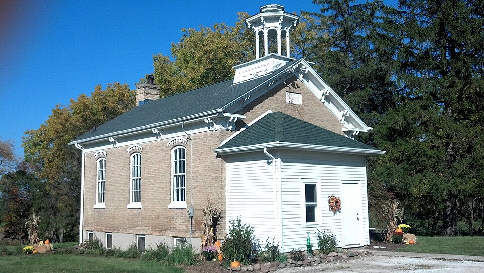
Built in 1885. Listed on the National Register of Historic Places in 2011.
One of 57 National Register listings published here for Racine County · listed in 2011 · category: Building · built in 1885.
Sources: the case file at the National Archives · the National Register database, National Park Service
The chapter on Yorkville Village in The History of Racine and Kenosha Counties, Wisconsin .., published 1879 names Yorkville. This is what it says, exactly as the scans read.
DONAIiD jHUNBOE, farmer. Sec. 19; P.O. Union Grove; bom in Rosshire, Scotland, in 1813 ; came to New York City in 1836 ; worked there, and in Ottawa, III., at stonecutting for about .three y«afs ; came to Racine in 1839 ; bought 160 acres in Yorkville; afterward came to present location and settled on 160 acres; through industry and frugality has a comfortable home, good farm and competency. Married in 1844, in Scotland; have had eight children, six living - William, Isabella, Christiana, Helen, Henry and Mark ; John and David died ; VVilliam is a civil engineer in Colorado. Mr. Munroe and wife are members of the U. P. Church.
Passage source: The History of Racine and Kenosha Counties, Wisconsin .., published 1879.
SAHUEL H. SKE WES, merchant, Union Grove; born in Cornwall, England, in 1817; came to Milwaukee in 1842, to Yorkville, Nov. 9, 1842. Married in Cornwall, England, April 16, 1842, Mary Thomas, then a resident of Cornwall ; when he first came to Ytrrkville, he was carpenUT and builder by trade, and had worked in Milwaukee for Mr. Church, a contrador and builder ; he followed his trade here for fifteen years until 1857, and then engaged in farming; was appoiutcd Agent and Truiitee of the Union Grove Land Co., for the sale of land owned by them, and for the last five years, has been engaged - in the agricultural machinery business. Mr. Skewes was one of the first settlers of this town ; when he came here there was only a shanty sixteen feet square in the whole village, which shanty has stood a relic of old times until the 12th of April, 1879, when it burned down, with several other stores and dwellings. His wife died in May, 1865, and is buried in Yorkville. He married again in Lyons, Iowa, in December, 1873, Caroline Goldsworthy, a resident of Yorkville; she also died, Dec. 29, 1876, and is buried in Yorkville ; has two children - Ella and Howard. Ella married, in 1873, Frank Adams, of Paris, Wis.
Passage source: The History of Racine and Kenosha Counties, Wisconsin .., published 1879.
Machine-read from a century-old scan, so expect the errors a machine makes: misspelled names, dropped words, stray characters.
Read the whole chapter on Yorkville Village - 4,303 words on its settlement, mills, schools and churches.
Regional context, not property-specific evidence. The federal wildfire occurrence database lists 13 fires within 5 miles of Yorkville #4 School between 2018 and 2020, burning about 9 acres in total. None started naturally. None was recorded as arson. Distance is straight-line from the map coordinates, so a fire counted here may appear on a neighbouring settlement's page as well.
| Reported cause | Fires |
|---|---|
| Missing data/not specified/undetermined | 7 |
| Debris and open burning | 4 |
| Recreation and ceremony | 1 |
| Smoking | 1 |
The most recent of them, most recent first, with the day each was reported and the service that recorded it.
| Date | Cause | Size | Reported by | Name on the report |
|---|---|---|---|---|
| 2 August 2020 | Recreation and ceremony | 2.0 acres | Wisconsin Department of Natural Resources | 20065 |
| 10 July 2018 | Missing data/not specified/undetermined | under an acre | Wisconsin Department of Natural Resources | 482 |
| 14 June 2018 | Debris and open burning | under an acre | Wisconsin Department of Natural Resources | 393 |
| 26 April 2018 | Debris and open burning | 4.0 acres | Wisconsin Department of Natural Resources | 18037 |
| 11 April 2018 | Missing data/not specified/undetermined | under an acre | Wisconsin Department of Natural Resources | 25 |
| 9 March 2018 | Missing data/not specified/undetermined | under an acre | Wisconsin Department of Natural Resources | 111 |
| 23 March 2018 | Missing data/not specified/undetermined | 1.0 acres | Wisconsin Department of Natural Resources | 18023 |
| 19 March 2018 | Missing data/not specified/undetermined | under an acre | Wisconsin Department of Natural Resources | 133 |
No historic map-sheet match is published for this property yet. That does not mean no map exists. This record needs a coordinate-quality review before it can be joined to a sheet boundary. Browse the county's mapped places while that work is pending.
Other National Register properties close enough to walk or drive between, ordered by distance from this one. Both positions come from the same geocoding pass that matched these properties to their map sheets.
| Photograph | Property | Distance | Listed |
|---|---|---|---|
| Southern Wisconsin Home Historic District | 4.3 miles | 1991 |
| National Archives record | The nomination case file for reference 11000518 in Record Group 79. |
| Racine County | All 57 listed properties in this county. |