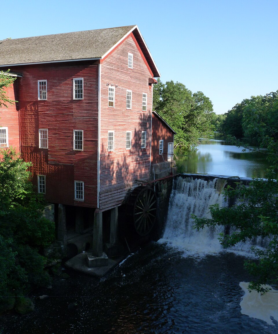
National Register reference number.74000086- the number the National Park Service assigned this property when it was listed, and the key its nomination file is catalogued under at the National Archives.
When Eau Claire county was organized by an act of the legislature in 1856, there were but few settlers in the eastern part thereof. Probably the first settler was Andrew Thompson, who came, it is said, iu 1854, and settled and built a house on what was later Henry Brown's pasture in Otter creek. The valley was named Thompson valley. If he came in 1854, he was here at least a year, perhaps more, before the coming of others. In 1856 when the county was organized, Charles Hale, L. D. McCauley and J. A. Bride had settled in what has since been known as Scott's valley; Lorenzo and William Bennett and Charles and Scribner Chadbourne had located in Thompson valley ; George Diamond had settled on the Diamond farm in Diamond valley, and a little bunch of pioneers, James Woodbury, E. L. Hull, William Young and perhaps a few more, had settled near where the village of Augusta was soon to be. These, together with the first settlers in Augusta, Charles Buckman, S. E. Bills, John P. Stone and a few more, constituted at that time the population of the town of Bridge Creek.
July 4, 1857, the first fourth of .luly celebration in the town was held at the farm of Simon Kaudall. He had bought the William Young place and the people gathered there and had a regular old-fashioned good time. In the evening they had a dance and Alfred Bolton played the fiddle. Allen Randall was a little fellow at that time, five years old, and he had a regular Buster Brown of a time. That celebration and that dance were the first events in the social life of Augusta and Bridge Creek, and for years thereafter the spirit of fellowship and good will grew and the social life was of that wliolesome kind, unmarred by class distinctions that prevails when tlie people live near to Nature's heart. There Avas no fol-de-rol, no nonsensical tommyrot, nor any of that superior culture that marks the upper stratum of the modern social life. The people were hearty in those days, good-souled, and between the hours of toil had sense enough to have a good time.
Regional context, not property-specific
evidence. The
federal wildfire occurrence database
lists 114 fires within 5 miles of Dells Mill
between 1992 and 2020, burning about 118 acres in total. 1 started naturally. 20 were recorded as arson.
Distance is straight-line from the map coordinates, so a fire counted
here may appear on a neighbouring settlement's page as well.
Reported cause
Fires
Debris and open burning
31
Missing data/not specified/undetermined
20
Arson/incendiarism
20
Equipment and vehicle use
20
Recreation and ceremony
7
Other causes
6
Railroad operations and maintenance
5
Power generation/transmission/distribution
2
Smoking
1
Fireworks
1
Natural
1
The most recent of
them, most recent first, with the day each was reported and the service
that recorded it.
Regional context, not property-specific
evidence. The federal mineral resources record lists
1 working within 5 miles of Dells Mill: 1 past producer.
None of them still produces. What was taken out: Stone, Crushed/Broken. Distance is straight-line from the
map coordinates, so a quarry counted here may appear on a neighbouring
settlement's page as well.
Regional context, not property-specific
evidence. The National Weather Service names
Augusta, the town this property stands in, in 27 storm reports between 1996 and 2026: 12 thunderstorm wind, 8 hail, 5 tornado, 2 heavy rain.
No death or injury is recorded in these reports. Each account below is quoted exactly as the forecast office
filed it, from the NOAA Storm Events Database, and each date
opens the federal record of that event.
An EF-1 tornado, with maximum wind speeds of 90 to 100 mph, occurred along a path from northwest of Augusta to north of Augusta, Wisconsin. Numerous trees and power poles were snapped, along with an outbuilding destroyed, and three other outbuildings significantly damaged.
An EF-1 tornado, with maximum wind speeds of 95 to 105 mph occurred from approximately 5 miles southwest of Augusta, to 3.5 miles southwest of Augusta, Wisconsin. Two farmsteads were directly impacted with severe tree damage around the homes. One farmstead had their garage completely destroyed along with a barn heavily damaged.
A brief tornado touched down near the intersection of County Road VV and Senske Road, approximately 4.3 miles west-southwest of Augusta. The tornado only lasted a minute causing damage to apple trees, large oak trees and a nearby corn field as it moved southeast for approximately 1/4 mile. A storm chaser took video of the tornado.
Hundreds of trees, possibly several thousand, were uprooted or broken by the tornado. Some landed on houses, sheds and vehicles, especially along the southeast edge of Lake Eau Claire, where many homes were located. A farm was hit near the end of the tornado. The ending point was determined via Sheriff's Office drone video.
No historic map-sheet match is published
for this property yet. That does not mean no map exists. This record needs
a coordinate-quality review before it can be joined to a sheet boundary.
Browse the county's mapped places while that work is
pending.
Listing record. National Park Service National Register of Historic Places, listed-properties dataset, current to 2026-05-22.
Map join. Address geocoded through the United States Census geocoder, then tested against the published boundary of every sheet in the USGS Historical Topographic Map Collection.
How this page is made. Listing fields come from federal records; map-sheet coverage is a labelled coordinate-to-boundary calculation, not a source-field claim.
Wildfire. Short, Karen C. 2022. Spatial wildfire occurrence data for the United States, 1992-2020 [FPA_FOD_20221014]. 6th Edition. Fort Collins, CO: Forest Service Research Data Archive. https://doi.org/10.2737/RDS-2013-0009.6 Collected with United States Government funding and usable without additional permissions or fees.
Mines and quarries. USGS Mineral Resources Data System (MRDS) https://mrdata.usgs.gov/mrds/ A work of the United States government, no copyright under 17 U.S.C. 105.
Storms. NOAA National Centers for Environmental Information, Storm Events Database https://www.ncei.noaa.gov/stormevents/ A work of the United States government, no copyright under 17 U.S.C. 105. Narratives are quoted verbatim from the National Weather Service report and are not edited or summarised.
 Block