 Block
From the record
One of 52 National Register listings published here for Jefferson County · listed in 1975 · category: Building.
Sources: the case file at the National Archives · the National Register database, National Park Service
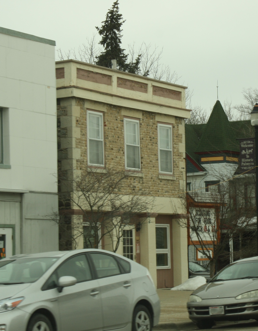
Listed on the National Register of Historic Places in 1975.
One of 52 National Register listings published here for Jefferson County · listed in 1975 · category: Building.
Sources: the case file at the National Archives · the National Register database, National Park Service
Regional context, not property-specific evidence. The federal wildfire occurrence database lists 18 fires within 5 miles of Enterprise Building between 2012 and 2020, burning about 42 acres in total. None started naturally. 8 were recorded as arson. Distance is straight-line from the map coordinates, so a fire counted here may appear on a neighbouring settlement's page as well.
| Reported cause | Fires |
|---|---|
| Arson/incendiarism | 8 |
| Missing data/not specified/undetermined | 6 |
| Debris and open burning | 3 |
| Equipment and vehicle use | 1 |
The most recent of them, most recent first, with the day each was reported and the service that recorded it.
| Date | Cause | Size | Reported by | Name on the report |
|---|---|---|---|---|
| 11 August 2016 | Missing data/not specified/undetermined | under an acre | Wisconsin Department of Natural Resources | MCMILLER RANGE FIRE |
| 3 May 2020 | Debris and open burning | 1.0 acres | Wisconsin Department of Natural Resources | 2018 |
| 7 April 2012 | Missing data/not specified/undetermined | 4.6 acres | Wisconsin Department of Natural Resources | MCMILLER RANGE |
| 4 April 2015 | Missing data/not specified/undetermined | 13 acres | Wisconsin Department of Natural Resources | CARLIN TRAIL |
| 30 April 2018 | Debris and open burning | 5.0 acres | Wisconsin Department of Natural Resources | 18028 |
| 30 April 2018 | Arson/incendiarism | 4.4 acres | Wisconsin Department of Natural Resources | BLUFF ROAD 1 |
| 30 April 2018 | Arson/incendiarism | under an acre | Wisconsin Department of Natural Resources | BLUFF ROAD 2 |
| 30 April 2018 | Missing data/not specified/undetermined | under an acre | Wisconsin Department of Natural Resources | 2018024 |
Regional context, not property-specific evidence. The federal mineral resources record lists 2 workings within 5 miles of Enterprise Building: 2 past producers. None of them still produces. What was taken out: Sand and Gravel, Construction. Distance is straight-line from the map coordinates, so a quarry counted here may appear on a neighbouring settlement's page as well.
| Where | Site | Commodity | Status | Recorded |
|---|---|---|---|---|
| Burlington Pit | Sand and Gravel, Construction | Past Producer | ||
| Pett Construction Co Burton Pit | Sand and Gravel, Construction | Past Producer |
Regional context, not property-specific evidence. The National Weather Service names Palmyra, the town this property stands in, in 36 storm reports between 1995 and 2025: 22 thunderstorm wind, 10 hail, 2 tornado, 1 lightning. No death or injury is recorded in these reports. Each account below is quoted exactly as the forecast office filed it, from the NOAA Storm Events Database, and each date opens the federal record of that event.
| When | Event | Place named | Harm | What the report says |
|---|---|---|---|---|
| March 2023 | Tornado (EF1) | Palmyra | $300,000 | Very short lived tornado with substantial damage to under-construction property and many healthy trees snapped. Heavy debris lofted several hundred yards. Path continued northward and hit a house and bent over a stop sign. |
| June 2014 | Thunderstorm Wind | Palmyra | $5,000 | Trees and power lines down. |
| July 2023 | Thunderstorm Wind | Palmyra | $4,000 | Scattered trees and branches down in Palmyra. |
| May 2012 | Thunderstorm Wind | Palmyra | $3,000 | Large tree branches, up to 12 inches in diameter, were broken off and blown 50 feet by powerful thunderstorm wind gusts about 1.5 miles southwest of Palmyra on Blue Spring Lake. |
| July 2003 | Lightning | Palmyra | $2,000 | no account filed |
| June 1998 | Thunderstorm Wind | Palmyra | $2,000 | no account filed |
| April 2007 | Thunderstorm Wind | Palmyra | $1,000 | A none-severe thunderstorm wind gust to about 45 knots (52 mph) upended and destroyed a patio canopy stucture and a glass table. The time is an estimate, however it did occur overnight after midnight. |
| March 2004 | Thunderstorm Wind | Palmyra | $1,000 | no account filed |
| March 2004 | Thunderstorm Wind | Palmyra | $1,000 | no account filed |
| February 1999 | Thunderstorm Wind | Palmyra | $1,000 | no account filed |
| July 1997 | Thunderstorm Wind | Palmyra | $700 | no account filed |
| July 2023 | Tornado (EF1) | Palmyra | - | NWS damage survey found tree damage in a convergent path east of Palmyra. |
| July 2017 | Hail | Palmyra | - | Estimated 50 mph wind with one inch hail falling. |
| July 2012 | Thunderstorm Wind | Palmyra | - | Numerous trees were blown down along a path from 2 miles south of Palmyra to 2 miles north of Palmyra by damaging thunderstorm wind gusts measured at a mesonet site at 55 knots (63 mph). |
| July 2012 | Thunderstorm Wind | Palmyra | - | A trained spotter in Palmyra reported thunderstorm wind gusts estimated to be 60 mph (52 knots). |
| June 2011 | Thunderstorm Wind | Palmyra | - | A National Weather Service employee reported 12 inch and larger tree limbs blown down by thunderstorm wind gusts estimated at 65 mph (56 knots). |
| June 2008 | Thunderstorm Wind | Palmyra | - | Powerful thunderstorm winds knocked down a few large trees. |
| September 2008 | Heavy Rain | Palmyra | - | Although this heavy rain event was assigned to Jefferson County, the heavy rain also affected parts of the following counties: Waukesha, Milwaukee, Rock, Walworth, Racine, and Kenosha. Ponding of water on roads and in other low spots was reported in many locations. Rainfall amounts include: 3.01 at the NWS Office about 3.8SSE of Sullivan (Jefferson Co.), 2.28 at 1.2SW of Palmyra, 2.60 at Beloit College (Rock Co.), 2.48 in Pell Lake (Walworth Co.), 2.46 in Paddock Lake (Kenosha Co.), 2.37 in Waterford (Racine Co.), 2.11 at 2SE Waukesha (Waukesha Co.), and 1.81 at Milwaukee Mitchell Field (Milwaukee Co.). Rainfall amounts tapered off to 1 to 1.25 in the Madison (Dane Co.) to Sheboygan area (Sheboygan Co.). |
| August 2007 | Thunderstorm Wind | Palmyra | - | Powerful thunderstorm wind gusts to around 52 knots (60 mph) toppled saeveral large trees and branches. |
| October 2006 | Thunderstorm Wind | Palmyra | - | Powerful thunderstorm winds knocked down large trees. |
| April 2025 | Hail | Palmyra | - | no account filed |
| April 2025 | Hail | Palmyra | - | no account filed |
| July 2017 | Hail | Palmyra | - | no account filed |
| March 2017 | Hail | Palmyra | - | no account filed |
| September 2006 | Hail | Palmyra | - | no account filed |
| October 2006 | Hail | Palmyra | - | no account filed |
| October 2006 | Hail | Palmyra | - | no account filed |
| September 2005 | Thunderstorm Wind | Palmyra | - | no account filed |
| October 2004 | Thunderstorm Wind | Palmyra | - | no account filed |
| May 2001 | Hail | Palmyra | - | no account filed |
| September 2001 | Thunderstorm Wind | Palmyra | - | no account filed |
| September 2001 | Thunderstorm Wind | Palmyra | - | no account filed |
| March 2000 | Hail | Palmyra | - | no account filed |
| July 1995 | Thunderstorm Wind | Palmyra | - | no account filed |
| August 1995 | Thunderstorm Wind | Palmyra | - | no account filed |
| August 1995 | Thunderstorm Wind | Palmyra | - | no account filed |
No historic map-sheet match is published for this property yet. That does not mean no map exists. This record needs a coordinate-quality review before it can be joined to a sheet boundary. Browse the county's mapped places while that work is pending.
Other National Register properties close enough to walk or drive between, ordered by distance from this one. Both positions come from the same geocoding pass that matched these properties to their map sheets.
| Photograph | Property | Distance | Listed |
|---|---|---|---|
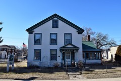 | Monroe McKenzie House | under 500 feet | 1985 |
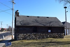 | Palmyra Boy Scout Cabin | 0.2 miles | 2017 |
| Loewe-Weis-Wilson Farm | 0.2 miles | 2024 | |
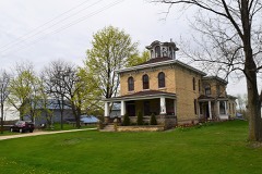 | Knapp-Calkins Farmstead | 1.1 miles | 2018 |
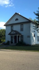 | Hebron Town Hall | 6.2 miles | 2002 |
| National Archives record | The nomination case file for reference 75000068 in Record Group 79. |
| Jefferson County | All 52 listed properties in this county. |