 Block
From the record
One of 141 National Register listings published here for Rock County · listed in 1977 · category: Building.
Sources: the case file at the National Archives · the National Register database, National Park Service
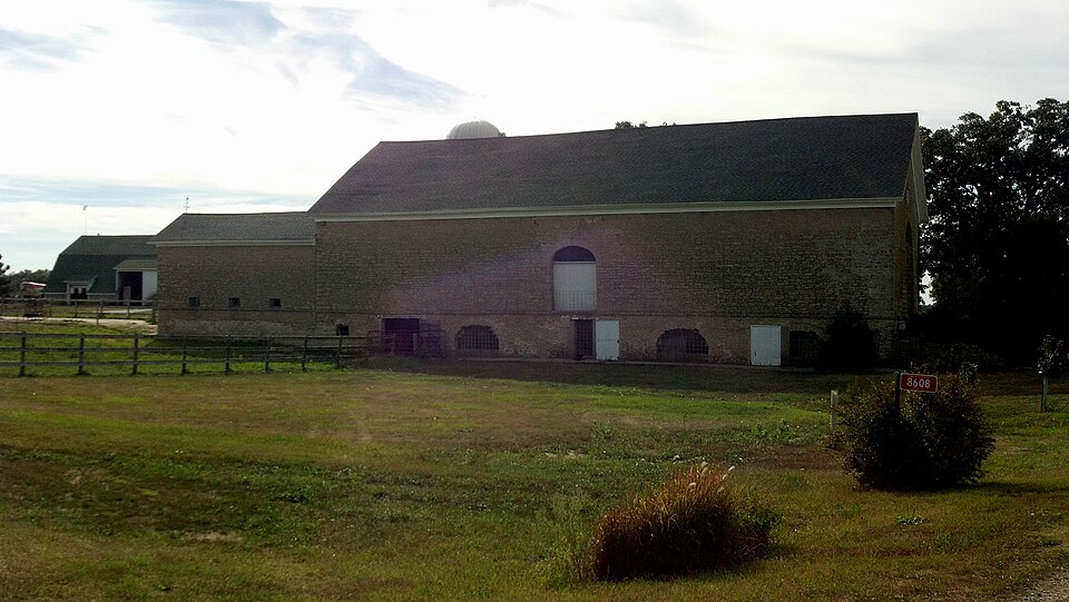
Listed on the National Register of Historic Places in 1977.
One of 141 National Register listings published here for Rock County · listed in 1977 · category: Building.
Sources: the case file at the National Archives · the National Register database, National Park Service
The chapter on Bradford Town in The History of Rock County, Wisconsin; Its Early Settlement, Growth, Development, Resources, Etc., published 1879 names Clinton. This is what it says, exactly as the scans read.
ELIJAH INMAW, farmer. Sees. 21 and 22 ; P. 0. Clinton ; born in Pennsylvania iii 1824 ; came to Wisconsin May 6, 1853, locating in the town of Plymouth, where he remained till 1863, when he moved to Bradford, and purchased 493 acres, his present homestead ; he is considered one of the largest and most successful farmers in the county ; he is also a large property holder in Clinton, where he has two stores and a butcher shop, also two houses and lots and one and one-half acres of residence property. Married, May 1, 1851, Miss Harriet Barney, a native of Pennsylvania; had six children - Milan B., bjrn Sept. 13, 1854; Ziba, Aug. 10, 1857, died Julv 27, 1862; Graizzie, born June 10, 1861; Bertha, Aug. 30, 1867 ; Shirley, May 13, 1870 ; John, Sept. 3, 1872. Chairman of the Board of Supervisors one year ; Side Supervisor two years, and member of the School Board for a number of years. Republican ; member of the Methodist Church.
Passage source: The History of Rock County, Wisconsin; Its Early Settlement, Growth, Development, Resources, Etc., published 1879.
WIIjIjIAM G. WELiLS, farmer. Sec. 34 ; P. 0. Clinton; born in Farmington, Ontario Co., N. Y., Jan. 13, 1824 ; son of Joseph Wells. The family were originally from Berkshire Co., Mass., and settled in New York in 1794, on the Phelps and Gorham purchase - it was a wilderness at that time. Mr. Wm. Wells' grandfather, on mother's side, was a brave soldier in the Revolutionary war, and grandfather, on father's side, was a member of the King's Body Life Guard, in England ; William's father, Joseph, died in April, 1849, aged 70 years ; he was a prominent Royal Arch Mason. William started out for himself Oct. 18, 1 844, came to Milwaukee and then went to McHenry Co., 111. ; was there most of the time till spring of 1853 ; then moved to Bradford, Rock Co., Wis., and settled on 480 acres; in 1864, moved to Sec. 34, Bradford ; now has a fine farm of 187 acres. He has a fine creamery ; churns 600 to 700 pounds of milk at a time ; his butter, which is of the best, finds ready market ; he has also one of the finest springs in the county ; water is pumped up into the house by hydraulic pressure. Mr. Wells married, in March 15, 1854, Betsy Wilkins, daughter of John Wilkins, of New Jersey ; have had eight children - Joseph B., Charles, Frank, Mehitabel, Ralph, Wm. G., Jr., Lois Aletha ; Loren died in infancy. Mr. Wells was Assessor eight years.
Passage source: The History of Rock County, Wisconsin; Its Early Settlement, Growth, Development, Resources, Etc., published 1879.
Machine-read from a century-old scan, so expect the errors a machine makes: misspelled names, dropped words, stray characters.
Read the whole chapter on Bradford Town - 14,060 words on its settlement, mills, schools and churches.
Regional context, not property-specific evidence. The federal wildfire occurrence database lists 5 fires within 5 miles of Wyman-Rye Farmstead between 2018 and 2019, burning about 25 acres in total. None started naturally. None was recorded as arson. Distance is straight-line from the map coordinates, so a fire counted here may appear on a neighbouring settlement's page as well.
| Reported cause | Fires |
|---|---|
| Missing data/not specified/undetermined | 3 |
| Debris and open burning | 2 |
The most recent of them, most recent first, with the day each was reported and the service that recorded it.
| Date | Cause | Size | Reported by | Name on the report |
|---|---|---|---|---|
| 22 June 2019 | Debris and open burning | under an acre | Wisconsin Department of Natural Resources | 2019137 |
| 22 May 2018 | Missing data/not specified/undetermined | under an acre | Wisconsin Department of Natural Resources | 1800001 |
| 5 March 2018 | Debris and open burning | under an acre | Wisconsin Department of Natural Resources | 18067 |
| 18 March 2018 | Missing data/not specified/undetermined | under an acre | Wisconsin Department of Natural Resources | 18075 |
| 11 March 2018 | Missing data/not specified/undetermined | 25 acres | Wisconsin Department of Natural Resources | 2018049 |
Regional context, not property-specific evidence. The federal mineral resources record lists 10 workings within 5 miles of Wyman-Rye Farmstead: 5 past producers, 5 producers. 5 still produce. What was taken out: Stone, Crushed/Broken, Sand and Gravel, Construction, Stone. Distance is straight-line from the map coordinates, so a quarry counted here may appear on a neighbouring settlement's page as well.
| Where | Site | Commodity | Status | Recorded |
|---|---|---|---|---|
| Little Quarry | Stone | Producer | ||
| Bradford Township Pit | Sand and Gravel, Construction | Past Producer | ||
| Rye Pit | Sand and Gravel, Construction | Producer | ||
| Rye Pit | Sand and Gravel, Construction | Past Producer | ||
| Skunk Hollow Pit Number 2 | Sand and Gravel, Construction | Past Producer | ||
| Bjoin Quarry | Stone, Crushed/Broken | Producer | ||
| Braukoff Quarry | Stone, Crushed/Broken | Past Producer | ||
| Dunn Quarry | Stone, Crushed/Broken | Producer | ||
| Dunn Trucking & Limestone Quarry | Stone, Crushed/Broken | Past Producer | ||
| Little Quarry | Stone, Crushed/Broken | Producer |
Regional context, not property-specific evidence. The National Weather Service names Clinton, the town this property stands in, in 25 storm reports between 1996 and 2026: 17 thunderstorm wind, 4 hail, 1 flash flood, 1 funnel cloud. The reports record 3 injuries. Each account below is quoted exactly as the forecast office filed it, from the NOAA Storm Events Database, and each date opens the federal record of that event.
| When | Event | Place named | Harm | What the report says |
|---|---|---|---|---|
| August 1998 | Flash Flood | Clinton | 2 hurt, $250,000 | no account filed |
| July 2009 | Lightning | Clinton | 1 hurt | A 44-year-old woman was struck by lightning while standing in the doorway of a barn holding the reins of a horse. She was taken to Beloit Memorial Hospital and treated in the emergency department. |
| June 1998 | Thunderstorm Wind | Clinton | $57,000 | no account filed |
| March 2004 | Thunderstorm Wind | Clinton | $40,000 | no account filed |
| May 2013 | Thunderstorm Wind | Clinton | $10,000 | Law enforcement officials indicated numerous trees and power lines downed by thunderstorm wind gusts, estimated at 70 mph (61 knots), along a path from 3 miles west-northwest of Clinton to 3 miles southeast of Clinton. |
| July 2003 | Thunderstorm Wind | Clinton | $5,000 | no account filed |
| April 1996 | Thunderstorm Wind | Clinton | $5,000 | no account filed |
| June 2013 | Thunderstorm Wind | Clinton | $4,000 | The Rock County Emergency manager reported many large trees uprooted and branches downed by thunderstorm wind gusts estimated at 65 mph (56 knots) along a path from Clinton to 4 miles south of Clinton. |
| June 2024 | Thunderstorm Wind | Clinton | $2,000 | A couple trees down on powerlines near Clinton. |
| April 2026 | Flood | Clinton | $1,000 | Floodwaters over a portion of highway 140 on the north side of Clinton. |
| March 2004 | Thunderstorm Wind | Clinton | $1,000 | no account filed |
| July 1999 | Thunderstorm Wind | Clinton | $1,000 | no account filed |
| September 1997 | Thunderstorm Wind | Clinton | $300 | no account filed |
| May 2008 | Thunderstorm Wind | Clinton | $100 | Powerful straight-line winds and brief heavy rains uprooted some trees and damaged a mailbox. |
| August 2025 | Hail | Clinton | - | Image of ping-pong ball sized hail. |
| June 2011 | Thunderstorm Wind | Clinton | - | Powerful thunderstorm winds toppled several large trees. |
| June 2008 | Thunderstorm Wind | Clinton | - | Powerful thunderstorms winds knocked down large trees in the Clinton area. |
| August 2025 | Hail | Clinton | - | no account filed |
| July 2016 | Hail | Clinton | - | no account filed |
| May 2004 | Thunderstorm Wind | Clinton | - | no account filed |
| July 2003 | Hail | Clinton | - | no account filed |
| April 2002 | Funnel Cloud | Clinton | - | no account filed |
| June 2002 | Thunderstorm Wind | Clinton | - | no account filed |
| August 2002 | Thunderstorm Wind | Clinton | - | no account filed |
| July 1998 | Thunderstorm Wind | Clinton | - | no account filed |
No historic map-sheet match is published for this property yet. That does not mean no map exists. This record needs a coordinate-quality review before it can be joined to a sheet boundary. Browse the county's mapped places while that work is pending.
Other National Register properties close enough to walk or drive between, ordered by distance from this one. Both positions come from the same geocoding pass that matched these properties to their map sheets.
| Photograph | Property | Distance | Listed |
|---|---|---|---|
 | Clinton Water Tower | 2.1 miles | 1985 |
 | Homer B. DeLong House | 2.3 miles | 1985 |
 | Richardson-Brinkman Cobblestone House | 2.4 miles | 1977 |
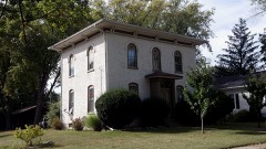 | John Smith House | 2.4 miles | 1985 |
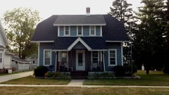 | A. E. Taylor House | 2.4 miles | 1985 |
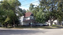 | J. L. Pangborn House | 2.5 miles | 1985 |
| National Archives record | The nomination case file for reference 77000055 in Record Group 79. |
| Rock County | All 141 listed properties in this county. |