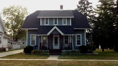
Listed on the National Register of Historic Places in 1978.
From the record
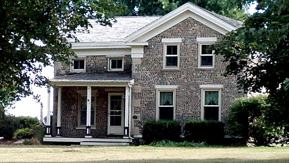
“Jones Cobblestone House is a large Greek Revival-styled farmhouse built in Clinton, Wisconsin in the late 1840s. The house was listed on the National Register of Historic Places in 1978 and on the State Register of Historic Places in 1989.”
Wikipedia article Samuel S. Jones Cobblestone House, CC BY-SA 4.0.
One of 141 National Register listings published here for Rock County · listed in 1978 · category: Building.
Also known as. Cobblestone Buildings of Rock County TR (AD); Cobblestone Buildings of Rock County TR
Town. Clinton town
Architectural style. Greek Revival architecture
National Register reference number.78000133- the number the National Park Service assigned this property when it was listed, and the key its nomination file is catalogued under at the National Archives.
The town of Clinton was organized by an act of the Territorial Legislature, approved February 17, 1842, and comprised the territory of the present town, the south half of Bradford and portions of Turtle and La Prairie. By an act approved March 23, 1843, five sections in the present town of Turtle were annexed and made a part of it. These boundaries were subsequently changed, and at present it comprises the whole of Township 1, north of Range 14 east, being the southeastern township in the county.
REV. O. AKTDREWSON, Minister of Lutheran Norwegian Church, Sec. 24 4 P.O.Clinton; born in Bradsberg, Norway, March 2, 1818 ; Mr. Andrewson graduated at a seminary in the old country, taught school about three years, and came to New York City in 1841; went to Buffalo, thence to Milwaukee, Wis., in 1844 ; moved to Clinton and settled on eighty acres ; now has 280 acres and a good farm well improved ; Mr. Andrewson is Pastor of the Evangelical Lutheran Church in connection with the Norwegian Augusta Synod ; he entered the ministry in 1846 ; has been Pastor of this church twentyfour years, and has organized several churches in Illinois and Wisconsin ; was one of the pioneers in the ministry, and the oldest minister in the Synod ; preached in town of Newark and organized the church there, and also has a church in Woodstock, 111., and has a large congregation in Leland, La Salle Co.; organized that church in 1847. Married Rachel Paulson, 1843 ; have had eleven children - Isabel (married C. R. Matteson, Justice of the Peace at Chicago) ; Paul served with credit in the naval service on the Miss-» issippi River and tributaries during the war and is now at home ; Andrew is living in Clinton (married Cornelia Hawkinson) ; Annie is in Chicago ; Oliver lives at home - he is the patentee of a farm gate which is fast becoming popular; Caroline lives in Chicago ; Rebecca is at home ; Louisa teaches school in Clinton ; Emma Catherina and Henry at home ; Oscar N. died in infancy.
Regional context, not property-specific
evidence. The
federal wildfire occurrence database
lists 5 fires within 5 miles of Samuel S. Jones Cobblestone House
between 2018 and 2019, burning about 2 acres in total. None started naturally. None was recorded as arson.
Distance is straight-line from the map coordinates, so a fire counted
here may appear on a neighbouring settlement's page as well.
Reported cause
Fires
Debris and open burning
4
Missing data/not specified/undetermined
1
The most recent of
them, most recent first, with the day each was reported and the service
that recorded it.
Regional context, not property-specific
evidence. The federal mineral resources record lists
8 workings within 5 miles of Samuel S. Jones Cobblestone House: 5 past producers, 3 producers.
3 still produce. What was taken out: Stone, Crushed/Broken, Sand and Gravel, Construction, Stone. Distance is straight-line from the
map coordinates, so a quarry counted here may appear on a neighbouring
settlement's page as well.
Regional context, not property-specific
evidence. The National Weather Service names
Clinton, the town this property stands in, in 25 storm reports between 1996 and 2026: 17 thunderstorm wind, 4 hail, 1 flash flood, 1 funnel cloud.
The reports record 3 injuries. Each account below is quoted exactly as the forecast office
filed it, from the NOAA Storm Events Database, and each date
opens the federal record of that event.
A 44-year-old woman was struck by lightning while standing in the doorway of a barn holding the reins of a horse. She was taken to Beloit Memorial Hospital and treated in the emergency department.
Law enforcement officials indicated numerous trees and power lines downed by thunderstorm wind gusts, estimated at 70 mph (61 knots), along a path from 3 miles west-northwest of Clinton to 3 miles southeast of Clinton.
The Rock County Emergency manager reported many large trees uprooted and branches downed by thunderstorm wind gusts estimated at 65 mph (56 knots) along a path from Clinton to 4 miles south of Clinton.
No historic map-sheet match is published
for this property yet. That does not mean no map exists. This record needs
a coordinate-quality review before it can be joined to a sheet boundary.
Browse the county's mapped places while that work is
pending.
Listed places nearby
6 within 8 miles
Other National Register properties close
enough to walk or drive between, ordered by distance from this one. Both
positions come from the same geocoding pass that matched these properties
to their map sheets.
Listing record. National Park Service National Register of Historic Places, listed-properties dataset, current to 2026-05-22.
Map join. Address geocoded through the United States Census geocoder, then tested against the published boundary of every sheet in the USGS Historical Topographic Map Collection.
How this page is made. Listing fields come from federal records; map-sheet coverage is a labelled coordinate-to-boundary calculation, not a source-field claim.
Wildfire. Short, Karen C. 2022. Spatial wildfire occurrence data for the United States, 1992-2020 [FPA_FOD_20221014]. 6th Edition. Fort Collins, CO: Forest Service Research Data Archive. https://doi.org/10.2737/RDS-2013-0009.6 Collected with United States Government funding and usable without additional permissions or fees.
Mines and quarries. USGS Mineral Resources Data System (MRDS) https://mrdata.usgs.gov/mrds/ A work of the United States government, no copyright under 17 U.S.C. 105.
Storms. NOAA National Centers for Environmental Information, Storm Events Database https://www.ncei.noaa.gov/stormevents/ A work of the United States government, no copyright under 17 U.S.C. 105. Narratives are quoted verbatim from the National Weather Service report and are not edited or summarised.
 Block