 Block
From the record
One of 141 National Register listings published here for Rock County · listed in 1979 · category: Building.
Sources: the case file at the National Archives · the National Register database, National Park Service
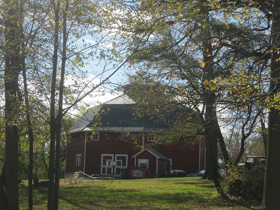
Listed on the National Register of Historic Places in 1979.
One of 141 National Register listings published here for Rock County · listed in 1979 · category: Building.
Sources: the case file at the National Archives · the National Register database, National Park Service
The chapter on Porter Town in The History of Rock County, Wisconsin; Its Early Settlement, Growth, Development, Resources, Etc., published 1879 names Edgerton. This is what it says, exactly as the scans read.
JOHN DA WE, farmer, Sec. 22; P. O. Pulton; born in Devonshire, England, Jan. 15, 1835; he came to America in 1856, locating in Fulton Township, Rock Co., Wis., in September of that year. He engaged in i'arming, which he continued until 1867, when he removed to the village of Edgerton, where he opened a pruduoe and commission business. In 1869, he engaged in general mercantile business^ In 1871, he gave up mercantile business, and went to farming in Albion Township, Dane Co., until 1876 ; he then purchased a farm of 160 acres, in Porter Township, on which he has since remained. He is one of the members of the Board of County Supervisors, and has held several local offices. He married, at Fulton, Rock Co., in 1858, Miss Anna S. Downing, a native of Pennsylvania, who died April 4, 1872, leavin- three children. He married again, in Dunkirk, Dane Co., Oct. 29, 1873, Miss Anna S. Spike, a native of Yorkshire, England. They have two children.
Passage source: The History of Rock County, Wisconsin; Its Early Settlement, Growth, Development, Resources, Etc., published 1879.
Machine-read from a century-old scan, so expect the errors a machine makes: misspelled names, dropped words, stray characters.
Read the whole chapter on Porter Town - 2,525 words on its settlement, mills, schools and churches.
Regional context, not property-specific evidence. The federal wildfire occurrence database lists 4 fires within 5 miles of Gilley-tofsland Octagonal Barn between 2016 and 2020, burning about 20 acres in total. None started naturally. None was recorded as arson. Distance is straight-line from the map coordinates, so a fire counted here may appear on a neighbouring settlement's page as well.
| Reported cause | Fires |
|---|---|
| Debris and open burning | 2 |
| Missing data/not specified/undetermined | 2 |
The most recent of them, most recent first, with the day each was reported and the service that recorded it.
| Date | Cause | Size | Reported by | Name on the report |
|---|---|---|---|---|
| 29 April 2018 | Missing data/not specified/undetermined | under an acre | Wisconsin Department of Natural Resources | 136 |
| 29 March 2016 | Debris and open burning | 10 acres | Leopold Wetland Management District | GRASS LAKE WF |
| 21 March 2018 | Missing data/not specified/undetermined | under an acre | Wisconsin Department of Natural Resources | 83 |
| 7 November 2020 | Debris and open burning | 10 acres | Wisconsin Department of Natural Resources | 201206 |
Regional context, not property-specific evidence. The federal mineral resources record lists 3 workings within 5 miles of Gilley-tofsland Octagonal Barn: 2 past producers, 1 producer. 1 still produces. What was taken out: Sand and Gravel, Construction, Stone, Crushed/Broken. Distance is straight-line from the map coordinates, so a quarry counted here may appear on a neighbouring settlement's page as well.
| Where | Site | Commodity | Status | Recorded |
|---|---|---|---|---|
| Rock County Highway Department | Stone, Crushed/Broken | Past Producer | ||
| Fosdahl Pit | Sand and Gravel, Construction | Producer | ||
| Stearns Pit | Sand and Gravel, Construction | Past Producer |
Regional context, not property-specific evidence. The National Weather Service names Edgerton, the town this property stands in, in 28 storm reports between 1995 and 2025: 14 thunderstorm wind, 9 hail, 2 lightning, 1 flood. No death or injury is recorded in these reports. Each account below is quoted exactly as the forecast office filed it, from the NOAA Storm Events Database, and each date opens the federal record of that event.
| When | Event | Place named | Harm | What the report says |
|---|---|---|---|---|
| May 2012 | Lightning | Edgerton | $75,000 | Fire officials say lightning ignited a fire that damaged a 21-unit senior living facility in Edgerton, displacing 30 residents. |
| August 2003 | Hail | Edgerton | $50,000 | no account filed |
| April 1995 | Thunderstorm Wind | Edgerton | $50,000 | no account filed |
| March 2009 | Thunderstorm Wind | Edgerton | $25,000 | Powerful thunderstorm wind gusts leveled many large trees, and blew down a pole shed that had 30 cows inside. |
| August 1996 | Lightning | Edgerton | $15,000 | no account filed |
| June 1998 | Thunderstorm Wind | Edgerton | $11,000 | no account filed |
| July 2018 | Thunderstorm Wind | Edgerton | $5,000 | A large section of bricks broke loose from the exterior wall facade of the Edgerton Community Outreach building. |
| May 2013 | Thunderstorm Wind | Edgerton | $5,000 | Law enforcement officials reported eight trees and two power lines blown down by thunderstorm wind gusts estimated at 65 mph (56 knots) in Edgerton. |
| August 2020 | Thunderstorm Wind | Edgerton | $3,000 | A large tree down on a home. |
| June 2013 | Flash Flood | Edgerton | $2,000 | A trained spotter reported West Fulton Street in Edgerton was impassable due to 1 foot of water covering the road due to heavy rains. |
| July 1999 | Thunderstorm Wind | Edgerton | $1,000 | no account filed |
| June 1997 | Thunderstorm Wind | Edgerton | $1,000 | no account filed |
| August 2017 | Heavy Rain | Edgerton | - | Street flooding in Edgerton including 3 feet of water at the intersection of Main St. and Ladd Ln. Radar estimate of 2.50 inches. |
| June 2010 | Thunderstorm Wind | Edgerton | - | Law enforcement officials reported numerous trees blown down by thunderstorm wind gusts estimated at 65 knots (74 mph). |
| August 2010 | Thunderstorm Wind | Edgerton | - | Police officials reported tree damage and building damage from thunderstorm wind gusts estimated at 65 knots (75 mph). |
| April 2025 | Hail | Edgerton | - | no account filed |
| April 2025 | Hail | Edgerton | - | no account filed |
| April 2025 | Hail | Edgerton | - | no account filed |
| September 2021 | Hail | Edgerton | - | no account filed |
| March 2016 | Hail | Edgerton | - | no account filed |
| May 2014 | Hail | Edgerton | - | no account filed |
| May 2012 | Hail | Edgerton | - | no account filed |
| March 2007 | Hail | Edgerton | - | no account filed |
| June 2002 | Thunderstorm Wind | Edgerton | - | no account filed |
| July 2002 | Thunderstorm Wind | Edgerton | - | no account filed |
| August 2002 | Thunderstorm Wind | Edgerton | - | no account filed |
| August 2002 | Flood | Edgerton | - | no account filed |
| July 1995 | Thunderstorm Wind | Edgerton | - | no account filed |
No historic map-sheet match is published for this property yet. That does not mean no map exists. This record needs a coordinate-quality review before it can be joined to a sheet boundary. Browse the county's mapped places while that work is pending.
Other National Register properties close enough to walk or drive between, ordered by distance from this one. Both positions come from the same geocoding pass that matched these properties to their map sheets.
| Photograph | Property | Distance | Listed |
|---|---|---|---|
| Harrison Stebbins House | 2.4 miles | 1980 | |
 | Richardson Grout House | 2.6 miles | 1980 |
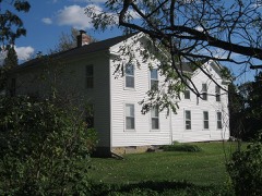 | J. K. Porter Farmstead | 2.7 miles | 1980 |
| Cooksville Historic District | 3.3 miles | 1973 | |
| Cooksville Historic District (Boundary Increase) | 3.3 miles | 1980 | |
| Cooksville Mill and Mill Pond Site | 3.4 miles | 1980 |
| National Archives record | The nomination case file for reference 79000111 in Record Group 79. |
| Rock County | All 141 listed properties in this county. |