BlockBefore
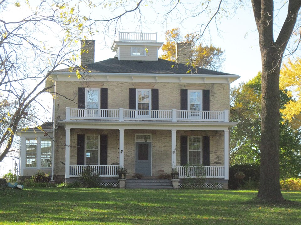
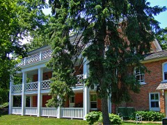
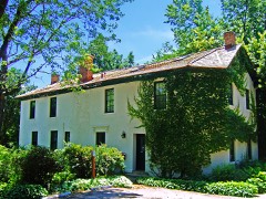
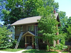
Photograph of McCoy Farmhouse
Photograph by TheCatalyst31, CC0 1.0. Via Wikimedia Commons.

McCoy Farmhouse

Built in 1852 (Italianate architecture). Listed on the National Register of Historic Places in 1980.

From the record

“The McCoy Farmhouse is a historic house located at 2925 Syene Road in Fitchburg, Wisconsin. The Italianate farmhouse was built in 1861 on an early Wisconsin tobacco farm.”

Wikipedia article McCoy Farmhouse (Fitchburg, Wisconsin), CC BY-SA 4.0.

One of 238 National Register listings published here for Dane County · listed in 1980 · category: Building · built in 1852, Italianate architecture.

Sources: the Wikipedia article · the case file at the National Archives · the National Register database, National Park Service · the Wikipedia article

The listing

  • What is counted as historic. The nomination lists 1 building as contributing to the listing.
  • Address. S of Madison at 2925 Syene Rd., Fitchburg, 53711
  • When was it listed? May 1980
  • Category. building
  • City. Fitchburg city
  • When was it built? 1852
  • Architectural style. Italianate architecture
  • National Register reference number. 80000124 - the number the National Park Service assigned this property when it was listed, and the key its nomination file is catalogued under at the National Archives.

Fires near this property

22 since 2007

Regional context, not property-specific evidence. The federal wildfire occurrence database lists 22 fires within 5 miles of McCoy Farmhouse between 2007 and 2020, burning about 42 acres in total. 1 started naturally. 2 were recorded as arson. Distance is straight-line from the map coordinates, so a fire counted here may appear on a neighbouring settlement's page as well.

Reported cause Fires
Missing data/not specified/undetermined12
Debris and open burning5
Arson/incendiarism2
Natural1
Smoking1
Recreation and ceremony1

The most recent of them, most recent first, with the day each was reported and the service that recorded it.

DateCause SizeReported by Name on the report
9 August 2019Debris and open burningunder an acreWisconsin Department of Natural Resources242
7 August 2018Debris and open burningunder an acreWisconsin Department of Natural Resources1289
3 August 2018Missing data/not specified/undeterminedunder an acreWisconsin Department of Natural Resources1818632
24 August 2020Missing data/not specified/undeterminedunder an acreWisconsin Department of Natural Resources2019797
14 August 2020Smokingunder an acreWisconsin Department of Natural Resources2018928
13 August 2020Missing data/not specified/undeterminedunder an acreWisconsin Department of Natural Resources1195
6 May 2018Missing data/not specified/undeterminedunder an acreWisconsin Department of Natural Resources1810606
1 May 2018Missing data/not specified/undeterminedunder an acreWisconsin Department of Natural Resources1810115

Every fire recorded in Dane County

Mines and quarries near this property

10 within 5 miles

Regional context, not property-specific evidence. The federal mineral resources record lists 10 workings within 5 miles of McCoy Farmhouse: 5 producers, 3 unknowns, 2 past producers. 5 still produce. What was taken out: Sand and Gravel, Construction, Stone, Crushed/Broken, Stone. Distance is straight-line from the map coordinates, so a quarry counted here may appear on a neighbouring settlement's page as well.

Where SiteCommodity StatusRecorded
Fess QuarryStoneUnknown
John Hensen QuarryStoneUnknown
Hammersley No. 1 QuarryStone, Crushed/BrokenProducer
Kapel-Marquardt QuarryStone, Crushed/BrokenProducer
Williams QuarryStone, Crushed/BrokenPast Producer
Engelhart Sand & Gravel PitSand and Gravel, ConstructionUnknown
Haen PitSand and Gravel, ConstructionProducer
Hammersly Construction CompanySand and Gravel, ConstructionPast Producer
Norway Grove Gravel PlantSand and Gravel, ConstructionProducer
Yanggen PitSand and Gravel, ConstructionProducer

Every working recorded in Dane County

Storms near this property

13 since 1997

Regional context, not property-specific evidence. The National Weather Service names Fitchburg, the town this property stands in, in 13 storm reports between 1997 and 2023: 5 thunderstorm wind, 3 lightning, 3 hail, 1 flash flood. The reports record 1 death and 23 injuries. Each account below is quoted exactly as the forecast office filed it, from the NOAA Storm Events Database, and each date opens the federal record of that event.

WhenEvent Place namedHarm What the report says
August 2005Tornado (F3)Fitchburg1 killed, 23 hurt, $34,310,000A strong and destructive tornado spun up at 1715CST about 2.8 miles southeast of the geographic center of Fitchburg (or 2.0 miles north of center of Oregon), about 400 yards southwest of the intersection of CTH MM and Schnieder Rd. It continued east-southeast to the southern edge of Lake Kegonsa and tore through residential neighborhoods about 1/3 to 1/2 mile north of CTH B (Civil Towns of Dunn and Pleasant Springs, and far-northern Stoughton). It moved over the crossing of CTH A with Interstate 90/39, and stayed close to CTH A to its exit point at 1905CST where CTH A crosses into Jefferson County, about 2.8 miles south-southwest of Rockdale. One person was crushed to death in their basement from fireplace and chimney bricks that crashed through the floor. Twenty-three (23) other people were directly injured. In addition, Emergency Management officials received reports of 2 other indirectly-related deaths associated with this strong tornado. In these two cases, the people were already very ill or suffering from a life-ending disease. Injuries they received during the tornado contributed (secondary) to their death, but were not the primary cause of death, based on medical examiner reports. Consequently, these additional two deaths do not appear in the official death tally in the header strip of this event. Numerous homes, businesses, farm buildings, vehicles, power-lines, trees, and other personal effects were either damaged or destroyed along its path that grew to a maximum width of about 600 yards north of Stoughton. As for residential structures, 220 sustained minor damage, 84 had major damage, and 69 were destroyed. As for business structures, 6 sustained minor damage, 1 had major damage, and 1 was destroyed. As for agricultural structures, 5 sustained minor damage, 5 had major damage, and 40 were destroyed. Total estimated damage amounts (directly-related) for private and public sectors combined was $35.06 M, broken down to $34.31 M in property damage and $750 K in crop losses, for the tornado segment in Dane County. This tornado was probably the 3rd most costly tornado in Wisconsin's recorded history (1996 Oakfield tornado and 1984 Barneveld tornadoes were more costly). The $34.31 M in property damage was broken down to private losses (total of 32.29 M) and public losses (total of $2.02 M), per Emergency Manager reports and NWS estimates. The private losses included a total of $25.45 M for residential structures, $1.29 M for businesses, $4.25 M for agricultural structures, $1.00 M for damage to vehicles, boats, and other personal effects, $200 K to agricultural machinery and tools, and $96 K in public road system damage. The public losses making up part of the $34.31 M consisted of $2.02 M in damage to public utility systems. The $750 K in damage attributed to crop losses occurred on an estimated 1,550 acres of land. Additional monetary costs incurred in the public sector (totaling $1.84 M) which are considered indirectly-related damage expenses, and not included in the "direct" totals listed in the header-strip of this event, include: $1.38 M in debris clearance, $308 K in protective measures, and miscellaneous damage/expenses of $144 K. Therefore, the grand total of direct and indirect damage amounts and expenses attributed to this tornado segment in Dane county totaled about $36.89 M.Just south of the tornado, extending out another mile or so, tree and power-line damage resulted from rear-flank downdraft damage - in some cases south to STH 51. This damage is separate from tornado damage, and isn't included in the numbers in previous sentences. Debris from this tornado was lofted by the parent's updraft and carried downstream to scattered locations in the counties of Jefferson, Waukesha, Milwaukee, Walworth, Racine, and Kenosha. This tornado was extensively photographed and video-taped by storm spotters (amateur radio operators, etc.), storm chasers, and private citizens. On occasions, this tornado displayed multiple-vortex characteristics. Due to partial back-building (to the west-southwest) of the supercell's updraft tower, this tornado moved slowly, and was described by some eyewitnesses and spotters as being nearly stationary at times north of Stoughton. The overall slow movement (supercell moved at 12-17 knots, or 10-15 mph), coupled with structures that were not thoroughly reinforced (based on NWS damage survey), allowed the tornado's cyclonic winds to more severely damage buildings in its path. Consequently, although some of the worst damage resembled what would be left by a F4 tornado for well-built homes, this tornado was rated at the top of the F3 category with estimated winds near 174 knots (200 mph). The F3 category has estimated wind speeds of 137-179 knots (158-206 mph). A sampling of newspaper headlines and personal quotes included: "The Sky Just Exploded," "Hard to Believe There Weren't More Deaths," "New Technology Lowers Tornado Deaths," "Counting Losses, Blessings," "It Was Probably The Most Intense Storm In The Country This Year," "It's a Mess Out Here," and "I've Never Experienced Anything Like This." The tornado cut electrical power for 1700 customers in the Stoughton area. The estimated average path length was about 175 yards.
August 2007LightningFitchburg$350,000Lightning struck a residential home. The resultant fire severely damaged the home.
May 2004Flash FloodFitchburg$200,000no account filed
May 2000Thunderstorm WindFitchburg$150,000no account filed
August 2007LightningFitchburg$15,000Lightning struck a residential home and damaged its roof, electrical system and telephone line.
July 1997Thunderstorm WindFitchburg$2,100no account filed
June 2015Thunderstorm WindFitchburg$2,000Several large tree branches down on Blizzard Road. One large limb fell onto the back of a car.
June 2002LightningFitchburg$500no account filed
August 2006Thunderstorm WindFitchburg-Trees reported down.
July 2023HailFitchburg-no account filed
March 2006HailFitchburg-no account filed
June 2005Thunderstorm WindFitchburg-no account filed
June 2005HailFitchburg-no account filed

Every storm recorded in Dane County

Map coverage status

No historic map-sheet match is published for this property yet. That does not mean no map exists. This record needs a coordinate-quality review before it can be joined to a sheet boundary. Browse the county's mapped places while that work is pending.

Listed places nearby

6 within 8 miles

Other National Register properties close enough to walk or drive between, ordered by distance from this one. Both positions come from the same geocoding pass that matched these properties to their map sheets.

Photograph PropertyDistance Listed
Nicholas Haight Farmstead1.2 miles1993
Ernest Eggiman House3.0 miles1994
Nakoma Historic District3.0 miles1998
Old Spring Tavern3.3 miles1974
Plough Inn3.3 miles1980
William Ellery Leonard House3.4 miles1993

Sources for this property

National Archives recordThe nomination case file for reference 80000124 in Record Group 79.
Wikipedia articleCommunity-written account of this property, licensed CC BY-SA.
Dane CountyAll 238 listed properties in this county.

Provenance

  • Listing record. National Park Service National Register of Historic Places, listed-properties dataset, current to 2026-05-22.
  • Map join. Address geocoded through the United States Census geocoder, then tested against the published boundary of every sheet in the USGS Historical Topographic Map Collection.
  • How this page is made. Listing fields come from federal records; map-sheet coverage is a labelled coordinate-to-boundary calculation, not a source-field claim.
  • Wildfire. Short, Karen C. 2022. Spatial wildfire occurrence data for the United States, 1992-2020 [FPA_FOD_20221014]. 6th Edition. Fort Collins, CO: Forest Service Research Data Archive. https://doi.org/10.2737/RDS-2013-0009.6 Collected with United States Government funding and usable without additional permissions or fees.
  • Mines and quarries. USGS Mineral Resources Data System (MRDS) https://mrdata.usgs.gov/mrds/ A work of the United States government, no copyright under 17 U.S.C. 105.
  • Storms. NOAA National Centers for Environmental Information, Storm Events Database https://www.ncei.noaa.gov/stormevents/ A work of the United States government, no copyright under 17 U.S.C. 105. Narratives are quoted verbatim from the National Weather Service report and are not edited or summarised.