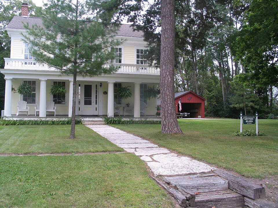
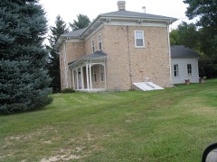
Built in 1847 (Greek Revival architecture). Listed on the National Register of Historic Places in 1980.
From the record
“Levi Godfrey was the first white settler in the town of Rochester. He came into the country on foot, accompanied by John B.”
Official Record of the Old Settlers Society of Racine County, Wisconsin : with the Historical Address of Charles E. Dyer, Delivered at Burlington, Wis., February 22, 1871 (1871). Machine-read text.
One of 57 National Register listings published here for Racine County · listed in 1980 · category: Building · built in 1847, Greek Revival architecture.
National Register reference number.80000181- the number the National Park Service assigned this property when it was listed, and the key its nomination file is catalogued under at the National Archives.
What happened here
An account from the chapter on Rochester village. The inset identifies its exact
source book and publication year.
The Hanging of John McCaffrey. - Capital punishment, as is known, is prohibited by statute in Wisconsin. In two cases only, has it been enforced, and one of these occurred in Kenosha County, when John McCaffrey suffered the extreme penalty of the law, for the murder of his wife. The crime was committed on the night of Monday, July 22, 1850.
Levi Godfrey was the first white settler in the town of Rochester. He came into the country on foot, accompanied by John B. Wade, and arrived in the fall of 1835. He was looking for a waterpower, and upon finding it at the present site of Rochester village, he made a claim on the west side of Fox river. He built a shanty sixteen feet square, the first structure erected for human habitation in the town, and brought out his family to their future western home, in 1836. Mrs. Godfrey did not see a white woman during the first six weeks she spent in her new residence. Her nearest female neighbor at that time, was Mrs Betsey Call, at Call's Grove. G. W. Gamble, Gilman Hoyt, Martin C. Whitman, L. 0. Whitman, and Mary Skinner came into Rochester in 1836, but general emigration to the town did not begin until 1837. Philo Belden came in June of that year but remained only a short time, returning to Rochester, however, in June, 1839, when he made it a permanent home.
Mr. Eleazer Everit purchased two hundred and forty acres of land at the land sales. There was a saw mill at Rochester, and preparatory to the erection of a dwelling on his farm, he hauled two saw logs to mill and got them sawed into lumber. He hauled the lumber back to his farm, cut down some trees for corner posts, and with this material he built his shanty, which constituted the first place of shelter and abode for himself, his wife and two children, in the wild interior region where he was destined to build up a fine estate.
Regional context, not property-specific
evidence. The
federal wildfire occurrence database
lists 21 fires within 5 miles of Whitman-Belden House
between 2018 and 2020, burning about 137 acres in total. 1 started naturally. 1 was recorded as arson.
Distance is straight-line from the map coordinates, so a fire counted
here may appear on a neighbouring settlement's page as well.
Reported cause
Fires
Missing data/not specified/undetermined
13
Debris and open burning
4
Natural
1
Recreation and ceremony
1
Equipment and vehicle use
1
Arson/incendiarism
1
The most recent of
them, most recent first, with the day each was reported and the service
that recorded it.
Regional context, not property-specific
evidence. The federal mineral resources record lists
12 workings within 5 miles of Whitman-Belden House: 8 past producers, 4 producers.
4 still produce. What was taken out: Sand and Gravel, Construction. Distance is straight-line from the
map coordinates, so a quarry counted here may appear on a neighbouring
settlement's page as well.
Regional context, not property-specific
evidence. The National Weather Service names
Rochester, the town this property stands in, in 9 storm reports between 1999 and 2026: 5 thunderstorm wind, 2 hail, 1 flood, 1 tornado.
The reports record 1 injury. Each account below is quoted exactly as the forecast office
filed it, from the NOAA Storm Events Database, and each date
opens the federal record of that event.
Sporadic damage path along Plank Road with mainly tree damage. Some barn/outbuildings had damage to their roofs with sheet metal panels missing/lofted in 2 locations.
A large tree, greater than a foot in diameter, snapped near its base and landed on a nearby residential structure. Additional scattered trees and branches down in the area.
The Fox River at Burlington reached minor flood stage, cresting at 11.9 feet. Floodwaters are into Riverside Park in Burlington. Water is in the parking lot at Veteran's Terrace in Burlington. Water covers a portion of Brever Road about 4 miles south of Burlington. There is lowland flooding in the Burlington and Big Bend areas.
No historic map-sheet match is published
for this property yet. That does not mean no map exists. This record needs
a coordinate-quality review before it can be joined to a sheet boundary.
Browse the county's mapped places while that work is
pending.
Listed places nearby
6 within 8 miles
Other National Register properties close
enough to walk or drive between, ordered by distance from this one. Both
positions come from the same geocoding pass that matched these properties
to their map sheets.
Listing record. National Park Service National Register of Historic Places, listed-properties dataset, current to 2026-05-22.
Map join. Address geocoded through the United States Census geocoder, then tested against the published boundary of every sheet in the USGS Historical Topographic Map Collection.
How this page is made. Listing fields come from federal records; map-sheet coverage is a labelled coordinate-to-boundary calculation, not a source-field claim.
Wildfire. Short, Karen C. 2022. Spatial wildfire occurrence data for the United States, 1992-2020 [FPA_FOD_20221014]. 6th Edition. Fort Collins, CO: Forest Service Research Data Archive. https://doi.org/10.2737/RDS-2013-0009.6 Collected with United States Government funding and usable without additional permissions or fees.
Mines and quarries. USGS Mineral Resources Data System (MRDS) https://mrdata.usgs.gov/mrds/ A work of the United States government, no copyright under 17 U.S.C. 105.
Storms. NOAA National Centers for Environmental Information, Storm Events Database https://www.ncei.noaa.gov/stormevents/ A work of the United States government, no copyright under 17 U.S.C. 105. Narratives are quoted verbatim from the National Weather Service report and are not edited or summarised.
 Block