 Block
From the record
One of 57 National Register listings published here for Racine County · listed in 1982 · category: Building.
Sources: the case file at the National Archives · the National Register database, National Park Service
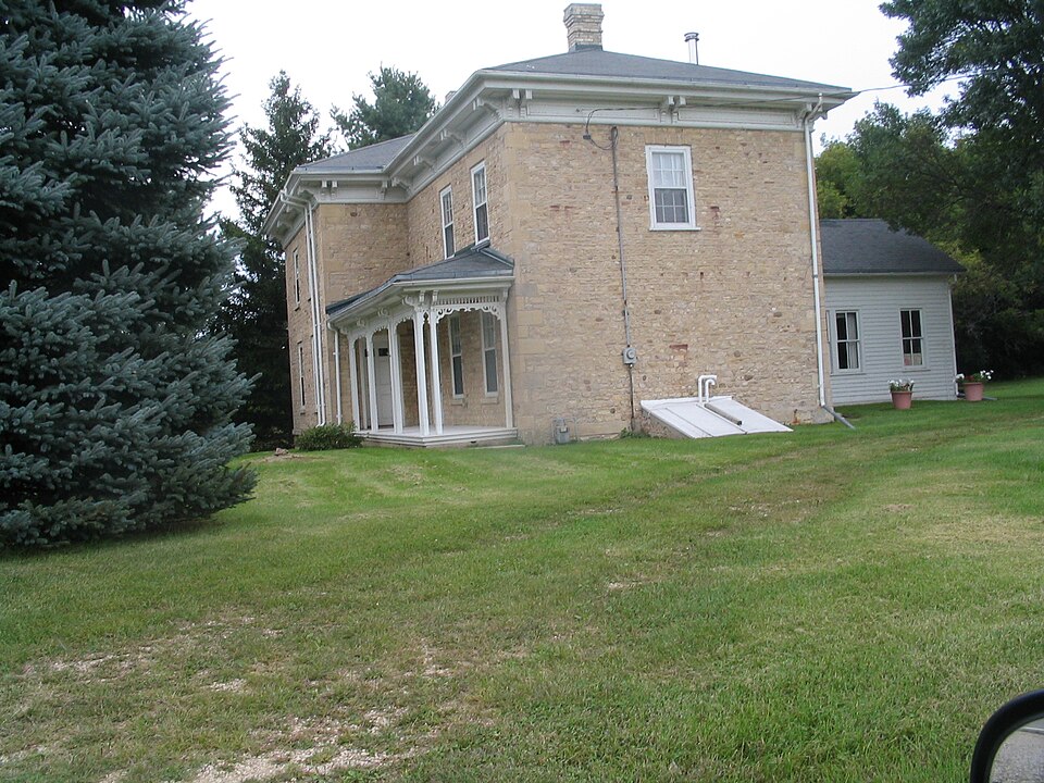
Listed on the National Register of Historic Places in 1982.
One of 57 National Register listings published here for Racine County · listed in 1982 · category: Building.
Sources: the case file at the National Archives · the National Register database, National Park Service
The chapter on Waterford Town in Official Record of the Old Settlers Society of Racine County, Wisconsin : with the Historical Address of Charles E. Dyer, Delivered at Burlington, Wis., February 22, 1871, published 1871 names Waterford. This is what it says, exactly as the scans read.
The settlement of what is now the township and village of Waterford began in 1836. The settlers of that year who yet survive and retain their original residences, are P. R. Mygatt, Samuel E. Chapman, Ira A. Rice, Archibald Cooper and Hiram Page. The first family settled in the town was that of P. R. Mygatt.
Passage source: Official Record of the Old Settlers Society of Racine County, Wisconsin : with the Historical Address of Charles E. Dyer, Delivered at Burlington, Wis., February 22, 1871, published 1871.
The founders of Waterford village were Samuel E. Chapman, Levi Barnes and Samuel C. Russ. 0. W. Barnes and a Mr. Beebe had first made the claim, but Levi Barnes and Mr. Chapman bought them out. At the land sales in 1839, Eliphalet Cramer purchased the lands for Chapman and Barnes, and conveyed to them.
Passage source: Official Record of the Old Settlers Society of Racine County, Wisconsin : with the Historical Address of Charles E. Dyer, Delivered at Burlington, Wis., February 22, 1871, published 1871.
Machine-read from a century-old scan, so expect the errors a machine makes: misspelled names, dropped words, stray characters.
Read the whole chapter on Waterford Town - 11,210 words on its settlement, mills, schools and churches.
Regional context, not property-specific evidence. The federal wildfire occurrence database lists 10 fires within 5 miles of Elam Beardsley Farmhouse between 2018 and 2020, burning about 120 acres in total. None started naturally. 2 were recorded as arson. Distance is straight-line from the map coordinates, so a fire counted here may appear on a neighbouring settlement's page as well.
| Reported cause | Fires |
|---|---|
| Debris and open burning | 3 |
| Missing data/not specified/undetermined | 2 |
| Recreation and ceremony | 2 |
| Arson/incendiarism | 2 |
| Equipment and vehicle use | 1 |
The most recent of them, most recent first, with the day each was reported and the service that recorded it.
| Date | Cause | Size | Reported by | Name on the report |
|---|---|---|---|---|
| 10 May 2020 | Recreation and ceremony | under an acre | Wisconsin Department of Natural Resources | 20031 |
| 23 April 2018 | Missing data/not specified/undetermined | under an acre | Wisconsin Department of Natural Resources | 18031 |
| 20 April 2019 | Debris and open burning | 42 acres | Wisconsin Department of Natural Resources | TICHIGAN |
| 20 April 2018 | Equipment and vehicle use | under an acre | Wisconsin Department of Natural Resources | 1800264 |
| 19 April 2020 | Recreation and ceremony | under an acre | Wisconsin Department of Natural Resources | 20032 |
| 13 April 2019 | Debris and open burning | under an acre | Wisconsin Department of Natural Resources | 1900076 |
| 18 March 2018 | Debris and open burning | under an acre | Wisconsin Department of Natural Resources | 1800097 |
| 1 December 2020 | Arson/incendiarism | 77 acres | Wisconsin Department of Natural Resources | TICHIGAN MARSH |
Regional context, not property-specific evidence. The federal mineral resources record lists 7 workings within 5 miles of Elam Beardsley Farmhouse: 5 past producers, 2 producers. 2 still produce. What was taken out: Sand and Gravel, Construction. Distance is straight-line from the map coordinates, so a quarry counted here may appear on a neighbouring settlement's page as well.
| Where | Site | Commodity | Status | Recorded |
|---|---|---|---|---|
| Alby Pit Number 1 | Sand and Gravel, Construction | Producer | ||
| Alby Pit Number 2 | Sand and Gravel, Construction | Past Producer | ||
| Degraves Pit | Sand and Gravel, Construction | Past Producer | ||
| Oakes Pit | Sand and Gravel, Construction | Past Producer | ||
| Racine County Hwy Dept Frost Pit | Sand and Gravel, Construction | Producer | ||
| Rochester Pit | Sand and Gravel, Construction | Past Producer | ||
| Wuttke Pit | Sand and Gravel, Construction | Past Producer |
Regional context, not property-specific evidence. The National Weather Service names Waterford, the town this property stands in, in 40 storm reports between 1995 and 2025: 16 thunderstorm wind, 15 hail, 3 funnel cloud, 2 flash flood. No death or injury is recorded in these reports. Each account below is quoted exactly as the forecast office filed it, from the NOAA Storm Events Database, and each date opens the federal record of that event.
| When | Event | Place named | Harm | What the report says |
|---|---|---|---|---|
| June 2008 | Flash Flood | Waterford | $2,150,000 | Heavy rains resulted in flash flooding across much of Racine County, especially in the city of Racine. Water depths on road surfaces reached 3 feet or more and there were gravel washouts. Some farm fields remained flooded into early July. The breakdown for residential home losses were: 10 minimally affected, 30 with minor damage, and 15 with major damage (total of $400 thousand for home losses). There were no business losses. Crop losses were estimated at $1.5 million. Public sector damage was about $1.748 million. There were several roads and bridges that sustained damage. |
| August 2009 | Thunderstorm Wind | Waterford | $200,000 | Numerous trees and power lines were blown down in a 10-mile damage swath from just west of Waterford to the city of Racine. The FAA Terminal Doppler radar located in north-central Racine County about 5 miles east of the village of Wind Lake showed 85 knot winds at 250 feet above ground level. In Waterford a large tree fell on and damaged a business building. On the north side of Racine two power-poles came down. Several homes in the swath lost varying amounts of roof shingles. There were several reports of tree debris damaging home siding or portions of a roof. Piers and docks were lifted and twisted and damaged on Wind Lake. About 3.5 miles southwest of the City of Racine a camper was lifted by the wind gusts and slammed into a car. A large section of a corn field near Caledonia was flattned by the winds. |
| August 1998 | Flash Flood | Waterford | $200,000 | no account filed |
| May 2001 | Hail | Waterford | $50,000 | no account filed |
| August 2009 | Lightning | Waterford | $20,000 | Lightning struck a business building and damaged all inside electronic equipment. |
| April 1997 | Thunderstorm Wind | Waterford | $15,000 | no account filed |
| June 2007 | Thunderstorm Wind | Waterford | $10,000 | Large trees were toppled and several power-lines were damaged due to powerful straight-line thunderstorm winds that raked the city of Waterford. |
| July 2006 | Thunderstorm Wind | Waterford | $5,000 | Trees and power lines down. |
| July 2017 | Thunderstorm Wind | Waterford | $4,000 | Trees down and power outages. |
| August 2000 | Thunderstorm Wind | Waterford | $2,000 | no account filed |
| July 1999 | Thunderstorm Wind | Waterford | $2,000 | no account filed |
| August 2005 | Thunderstorm Wind | Waterford | $1,000 | Several large trees were uprooted. |
| July 1997 | Thunderstorm Wind | Waterford | $1,000 | no account filed |
| July 1997 | Thunderstorm Wind | Waterford | $400 | no account filed |
| July 2023 | Hail | Waterford | - | A picture of the hail was provided on social media. |
| July 2013 | Thunderstorm Wind | Waterford | - | An NWS employee reported corn flattened in several fields along a path from 1 mile west-northwest of Waterford to 1 mile west-northwest of Union Grove by thunderstorm wind gusts estimated at 58 mph (50 knots). |
| July 2012 | Thunderstorm Wind | Waterford | - | The Racine 911 Call Center received reports of large trees blown down by thunderstorm wind gusts estimated to be 65 mph (56 knots) in the Caldwell area and in the Tichigan area west and north of Tichigan Lake. There were also reports of power lines arcing from damage due to the severe wind gusts. |
| June 2009 | Thunderstorm Wind | Waterford | - | Several large trees were blown down by thunderstorm winds in Waterford. |
| April 2025 | Hail | Waterford | - | no account filed |
| May 2024 | Hail | Waterford | - | no account filed |
| May 2024 | Hail | Waterford | - | no account filed |
| July 2023 | Hail | Waterford | - | no account filed |
| July 2023 | Hail | Waterford | - | no account filed |
| May 2017 | Hail | Waterford | - | no account filed |
| August 2015 | Hail | Waterford | - | no account filed |
| August 2013 | Hail | Waterford | - | no account filed |
| August 2013 | Hail | Waterford | - | no account filed |
| June 2008 | Funnel Cloud | Waterford | - | no account filed |
| May 2006 | Hail | Waterford | - | no account filed |
| June 2005 | Hail | Waterford | - | no account filed |
| August 2005 | Funnel Cloud | Waterford | - | no account filed |
| June 2004 | Heavy Rain | Waterford | - | no account filed |
| August 2002 | Thunderstorm Wind | Waterford | - | no account filed |
| March 2000 | Hail | Waterford | - | no account filed |
| July 2000 | Flood | Waterford | - | no account filed |
| August 1999 | Hail | Waterford | - | no account filed |
| May 1999 | Thunderstorm Wind | Waterford | - | no account filed |
| May 1998 | Flood | Waterford | - | no account filed |
| July 1997 | Funnel Cloud | Waterford | - | no account filed |
| June 1995 | Thunderstorm Wind | Waterford | - | no account filed |
No historic map-sheet match is published for this property yet. That does not mean no map exists. This record needs a coordinate-quality review before it can be joined to a sheet boundary. Browse the county's mapped places while that work is pending.
Other National Register properties close enough to walk or drive between, ordered by distance from this one. Both positions come from the same geocoding pass that matched these properties to their map sheets.
| Photograph | Property | Distance | Listed |
|---|---|---|---|
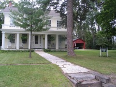 | Whitman-Belden House | 3.8 miles | 1980 |
 | Franklyn Hazelo House | 4.2 miles | 1974 |
 | Norwegian Buildings at Heg Park | 4.6 miles | 1980 |
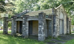 | Burlington Cemetery Chapel | 7.0 miles | 2013 |
 | Burlington Community Swimming Pools and Bathhouse | 7.6 miles | 2013 |
 | Burlington Downtown Historic District | 7.7 miles | 2000 |
| National Archives record | The nomination case file for reference 82000699 in Record Group 79. |
| Racine County | All 57 listed properties in this county. |