 Block
From the record
One of 141 National Register listings published here for Rock County · listed in 1980 · category: Building.
Sources: the case file at the National Archives · the National Register database, National Park Service
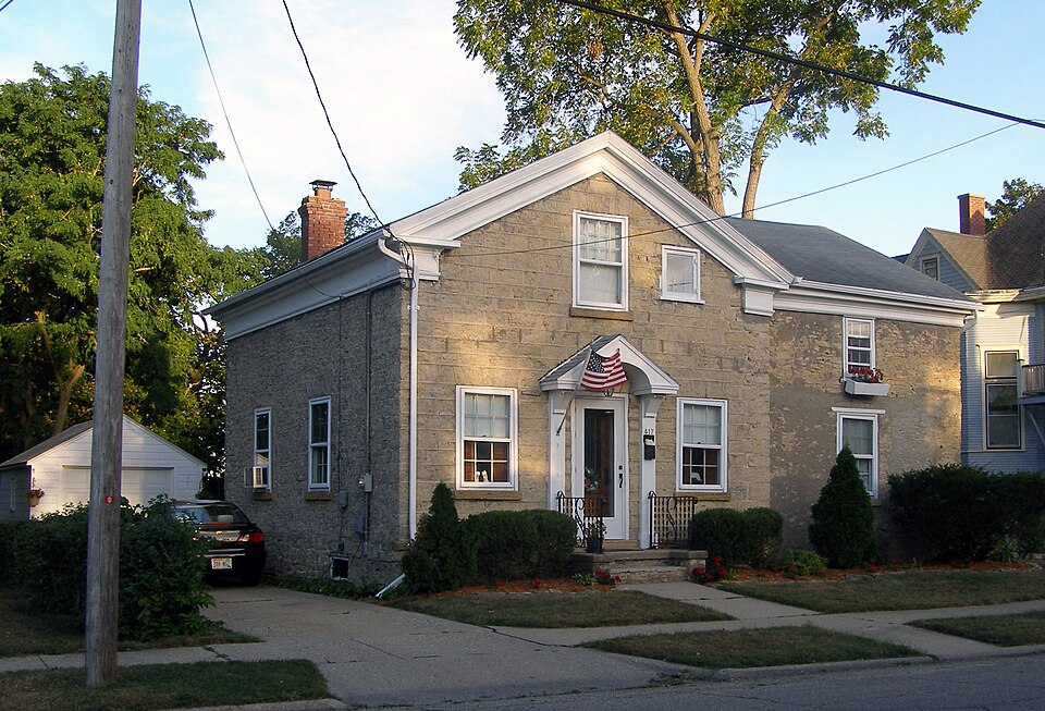
Listed on the National Register of Historic Places in 1980.
One of 141 National Register listings published here for Rock County · listed in 1980 · category: Building.
Sources: the case file at the National Archives · the National Register database, National Park Service
Regional context, not property-specific evidence. The federal wildfire occurrence database lists 31 fires within 5 miles of Selvy Blodgett House between 2018 and 2020, burning about 52 acres in total. 1 started naturally. 2 were recorded as arson. Distance is straight-line from the map coordinates, so a fire counted here may appear on a neighbouring settlement's page as well.
| Reported cause | Fires |
|---|---|
| Missing data/not specified/undetermined | 16 |
| Smoking | 6 |
| Recreation and ceremony | 3 |
| Arson/incendiarism | 2 |
| Debris and open burning | 2 |
| Equipment and vehicle use | 1 |
| Natural | 1 |
The most recent of them, most recent first, with the day each was reported and the service that recorded it.
| Date | Cause | Size | Reported by | Name on the report |
|---|---|---|---|---|
| 25 September 2018 | Missing data/not specified/undetermined | under an acre | Wisconsin Department of Natural Resources | 181293 |
| 22 August 2019 | Debris and open burning | under an acre | Wisconsin Department of Natural Resources | 19941 |
| 5 July 2020 | Missing data/not specified/undetermined | 1.0 acres | Wisconsin Department of Natural Resources | 201883 |
| 30 July 2018 | Missing data/not specified/undetermined | under an acre | Wisconsin Department of Natural Resources | 181021 |
| 26 July 2018 | Smoking | 1.0 acres | Wisconsin Department of Natural Resources | 183149 |
| 18 July 2019 | Arson/incendiarism | under an acre | Wisconsin Department of Natural Resources | 2019-16 |
| 4 June 2018 | Smoking | under an acre | Wisconsin Department of Natural Resources | 182327 |
| 20 June 2020 | Missing data/not specified/undetermined | 1.0 acres | Wisconsin Department of Natural Resources | 201732 |
Regional context, not property-specific evidence. The federal mineral resources record lists 14 workings within 5 miles of Selvy Blodgett House: 11 past producers, 2 producers, 1 plant. 3 still produce. What was taken out: Sand and Gravel, Construction, Stone, Crushed/Broken. Distance is straight-line from the map coordinates, so a quarry counted here may appear on a neighbouring settlement's page as well.
| Where | Site | Commodity | Status | Recorded |
|---|---|---|---|---|
| Escher Quarry | Stone, Crushed/Broken | Past Producer | ||
| Foss Quarry | Stone, Crushed/Broken | Past Producer | ||
| Kelley Quarry Porter & Sons | Stone, Crushed/Broken | Past Producer | ||
| Unnamed Limestone Quarry | Stone, Crushed/Broken | Past Producer | ||
| Wilson & Shipler Quarry | Stone, Crushed/Broken | Producer | ||
| Can-Tex Industries Aggregate Pit | Sand and Gravel, Construction | Past Producer | ||
| Durgon Pit | Sand and Gravel, Construction | Past Producer | ||
| Ellis Pit | Sand and Gravel, Construction | Past Producer | ||
| General Dynamics Pit | Sand and Gravel, Construction | Past Producer | ||
| Illinois Wisconsin Sand & Gravel | Sand and Gravel, Construction | Producer |
Regional context, not property-specific evidence. The National Weather Service names Beloit, the town this property stands in, in 83 storm reports between 1994 and 2026: 43 thunderstorm wind, 18 hail, 7 lightning, 5 flood. No death or injury is recorded in these reports. Each account below is quoted exactly as the forecast office filed it, from the NOAA Storm Events Database, and each date opens the federal record of that event.
| When | Event | Place named | Harm | What the report says |
|---|---|---|---|---|
| August 1998 | Lightning | Beloit | $3,500,000 | no account filed |
| April 1996 | Thunderstorm Wind | Beloit | $800,000 | no account filed |
| March 2023 | Tornado (EF0) | Beloit | $600,000 | Tornado started in the center of Beloit in the Merrill Park area. The tornado uprooted numerous trees along its path through the eastern side of the city toward the Turtle area. The path then went east and appears to have crossed I-39 before ending in a field. |
| April 1995 | Thunderstorm Wind | Beloit | $350,000 | no account filed |
| July 2022 | Lightning | Beloit | $100,000 | A lightning strike and subsequent fire to a residential home resulted in significant damage. |
| April 1997 | Thunderstorm Wind | Beloit | $65,000 | no account filed |
| April 2023 | Thunderstorm Wind | Beloit | $40,000 | A NWS storm survey concluded that straight line winds up to 80 mph caused a path of tree damage from the west side of Beloit through the east side of Beloit. Numerous large trees were uprooted in a starburst pattern. A set of bleachers at Beloit Memorial High School were damaged and a wall was pushed in at a manufacturer. |
| June 1996 | Flash Flood | Beloit | $40,000 | no account filed |
| June 2007 | Flash Flood | Beloit | $30,000 | Repeated rounds of thunderstorms resulted in a flash flood that left water depths on some roads to around 3 feet. Several cars were stalled and sustained water damage. Some basements also flooded. WSR-88D Doppler radar rainfall estimates were in the 2 to 3 inch range. |
| June 2008 | Thunderstorm Wind | Beloit | $25,000 | Powerful thunderstorm winds gusts knocked down several large trees and some power-lines. |
| July 2021 | Thunderstorm Wind | Beloit | $20,000 | Numerous reports of trees, tree limbs, and powerlines down across the Beloit area. |
| June 2008 | Thunderstorm Wind | Beloit | $20,000 | Powerful thunderstorms winds knocked down large trees and power-lines. |
| June 2006 | Thunderstorm Wind | Beloit | $20,000 | Damaging thunderstorm winds caused a tree to topple onto a house which tore an electrical box off the side of the house. When the electrical box began to overheat, the house caught fire. Chimney damage, roof damage, and smoke damage caused around 20,000 dollars in property damage. |
| March 2006 | Flash Flood | Beloit | $20,000 | no account filed |
| October 1996 | Thunderstorm Wind | Beloit | $20,000 | no account filed |
| September 2022 | Thunderstorm Wind | Beloit | $15,000 | Several large trees and branches down, including one on a truck. |
| July 2013 | Thunderstorm Wind | Beloit | $15,000 | Law enforcement officials reported many trees and power lines blown down by thunderstorm wind gusts estimated up to 75 mph (65 knots) along a 5-mile wide swath from 3 miles northwest of Beloit to Beloit. |
| March 2019 | Flood | Beloit | $10,000 | Many roads were flooded and closed in the Township of Avon due to the flooding of the Sugar River and due to lowland flooding. Portions of other roads were closed into central and northeast Rock Co., more specifically in the townships of Spring Valley, Rock, Plymouth, Fulton, and Johnstown due to lowland flooding and creek flooding. A portion of highway 51 was flooded and closed in Edgerton. |
| May 2016 | Thunderstorm Wind | Beloit | $10,000 | Scattered trees and tree limbs down. |
| July 2008 | Thunderstorm Wind | Beloit | $10,000 | Powerful thunderstorm wind gusts toppled several large trees and broke branches that brought down some power-lines. |
| August 2004 | Lightning | Beloit | $10,000 | no account filed |
| September 2001 | Thunderstorm Wind | Beloit | $10,000 | no account filed |
| May 1998 | Lightning | Beloit | $10,000 | no account filed |
| July 1998 | Thunderstorm Wind | Beloit | $10,000 | no account filed |
| April 2024 | Thunderstorm Wind | Beloit | $8,000 | Damage to a historic pump house, trees and branches down, and light poles down. Pictures were provided. |
| July 1998 | Thunderstorm Wind | Beloit | $7,000 | no account filed |
| September 2019 | Flood | Beloit | $5,000 | The Turtle Creek at Beloit reached minor flood stage, cresting at 9.72 feet the morning of September 14th. Floodwaters surround a power substation on Colley Road. Colley Road is closed between Sager Lane and Brewster Ave. Floodwaters are also in the backyards of some homes on Arrowhead Drive, East Ridge Road, Mocassin Drive, Boulder Lane, Rockfence Lane and Stonehedge Lane. Parts of Bootmaker Drive and Moccasin Trail are flooded. |
| October 2010 | Thunderstorm Wind | Beloit | $5,000 | A trained spotter reported sections of a partially destroyed billboard entangled in power lines at the intersection of Milwaukee Road and Freeman Parkway by thunderstorm wind gusts estimated up to 65 knots (75 mph). |
| May 2006 | Thunderstorm Wind | Beloit | $5,000 | Trees down on a house and garage. Light damage to roof and siding. |
| August 2006 | Thunderstorm Wind | Beloit | $5,000 | Trees down. One fell onto a home, resulting in minor damage. |
| August 2006 | Lightning | Beloit | $5,000 | Lightning hit a tree which then fell onto a house causing around 5,000 dollars in damage. |
| May 1998 | Thunderstorm Wind | Beloit | $5,000 | no account filed |
| June 1996 | Thunderstorm Wind | Beloit | $5,000 | no account filed |
| July 2023 | Thunderstorm Wind | Beloit | $3,000 | Several trees and branches down at highway Q near highway 213. |
| June 2019 | Thunderstorm Wind | Beloit | $3,000 | Scattered branches and trees down in the Beloit area. |
| July 2003 | Lightning | Beloit | $3,000 | no account filed |
| July 1999 | Thunderstorm Wind | Beloit | $3,000 | no account filed |
| July 2022 | Thunderstorm Wind | Beloit | $1,000 | Large tree limbs snapped off a large tree. |
| May 2014 | Flash Flood | Beloit | $1,000 | Numerous streets are flooded in the city of Beloit with rainfall rates of 2-3 inches per hour. |
| August 2011 | Lightning | Beloit | $1,000 | Lightning struck an iron gate at the Pierce Distribution facility at 601 Third St. in Beloit around 8 am on August 23rd. The electrical charge from the lightning strike traveled to two nearby electrical panels, producing sparks that caused a minor fire. Minimal damage and no injuries were reported by the Beloit Fire Department. |
| August 1997 | Thunderstorm Wind | Beloit | $1,000 | no account filed |
| June 1997 | Thunderstorm Wind | Beloit | $1,000 | no account filed |
| September 1997 | Thunderstorm Wind | Beloit | $1,000 | no account filed |
| September 1997 | Strong Wind | Beloit | $500 | no account filed |
| May 2014 | Thunderstorm Wind | Beloit | - | Sporadic trees and power lines down. |
| May 2014 | Hail | Beloit | - | Storm spotters and law enforcement reported hail ranging from 1 to 1.75 inches in diameter. |
| April 2014 | Hail | Beloit | - | One inch diameter hail lasted about 5 minutes. |
| July 2012 | Thunderstorm Wind | Beloit | - | A local newspaper reported trees and power lines were blown down all over the county by severe thunderstorm wind gusts estimated at 65 knots (75 mph). The fallen trees blocked roads in residential neighborhoods on the west side of Beloit, as well as on State Highway 213 between Luther Valley Road and Yahara Road. Homes and vehicles were damaged by storm debris. It was estimated 7,000 people were without power. A residential fire on Lincoln Avenue in Beloit was possibly started by lightning. |
| September 2012 | Thunderstorm Wind | Beloit | - | Scattered trees and large branches were reported to have been blown down along a path from 1 mile west of Beloit to 1 mile east of Beloit. |
| May 2011 | Thunderstorm Wind | Beloit | - | A ham radio operator reported severe thunderstorm wind gusts that downed trees and tree limbs along a line from near Beloit to Afton. The downed trees blocked Findley Road for a time. |
| June 2010 | Thunderstorm Wind | Beloit | - | A newspaper report indicated that trees and power lines were down due to powerful thunderstorm wind gusts. |
| September 2010 | Thunderstorm Wind | Beloit | - | Law enforcement officials reported several trees were blown down by thunderstorm wind gusts estimated at 52 knots (60 mph). |
| June 2009 | Thunderstorm Wind | Beloit | - | Seveal large trees were blown down by thunderstorm winds. |
| June 2006 | Thunderstorm Wind | Beloit | - | Widespread tree damage. |
| June 2006 | Thunderstorm Wind | Beloit | - | Trees down. |
| March 2026 | Hail | Beloit | - | no account filed |
| April 2026 | Hail | Beloit | - | no account filed |
| April 2026 | Hail | Beloit | - | no account filed |
| May 2020 | Hail | Beloit | - | no account filed |
| August 2017 | Hail | Beloit | - | no account filed |
No historic map-sheet match is published for this property yet. That does not mean no map exists. This record needs a coordinate-quality review before it can be joined to a sheet boundary. Browse the county's mapped places while that work is pending.
Other National Register properties close enough to walk or drive between, ordered by distance from this one. Both positions come from the same geocoding pass that matched these properties to their map sheets.
| Photograph | Property | Distance | Listed |
|---|---|---|---|
 | Stephen Slaymaker House | under 500 feet | 1983 |
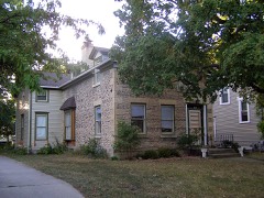 | Lathrop-Munn Cobblestone House | under 500 feet | 1977 |
 | St. Paul's Episcopal Church | 0.1 miles | 1978 |
 | Moran's Saloon | 0.3 miles | 1983 |
 | Strong Building | 0.3 miles | 1983 |
 | Hanchett Block | 0.3 miles | 1980 |
| National Archives record | The nomination case file for reference 80000183 in Record Group 79. |
| Rock County | All 141 listed properties in this county. |