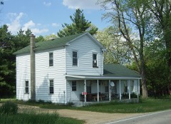
| August 2000 | Thunderstorm Wind | Evansville | 2 hurt, $5,000,000 | no account filed |
| June 1999 | Thunderstorm Wind | Evansville | 2 hurt, $3,000 | no account filed |
| August 2007 | Flash Flood | Evansville | $500,000 | Several rounds of thunderstorms with heavy rains on top of a saturated ground resulted in scattered flash flooding from the Evansville area to the Janesville vicinity. Water damage to basement contents and/or basement walls, as well as fast-flowing water depths of 6 inches to 1 foot on roads, were reported in the Civil Towns of Avon, Fulton, Magnolia, Union, and Plymouth. Some soil erosion, gravel washouts, and crop damage were noted. Badfish Crreek and Allen Creek just east and northeast of Evansville exceeded flood stages by 3 to 5 feet and overflowed adjacent roads.||August, 2007, rainfall totals include: 17.39 at Afton, 13.15 in Beloit, 16.24 in Clinton, 15.22 in Milton, and over 17 in Janesville. |
| August 1993 | Thunderstorm Wind | Evansville | $500,000 | no account filed |
| April 2001 | Thunderstorm Wind | Evansville | $300,000 | no account filed |
| August 2007 | Heavy Rain | Evansville | $150,000 | Urban and small stream flooding occurred across the northern third of Rock County after 3 to 4 inches of rain fell overnight. Water depths on roads reached a foot, especially in the Evansville and Edgerton areas, however no roads were closed. Reports indicated that the flood waters were not fast flowing, nor did they pose a danger to the public. Some crop damage was noted. Overnight rainfall of 6.4 inches were measured by a spotter in Edgerton. Local residents near Badfish Creek, west of Cooksville, noted that this creek flooded and merged with Frog Pond Creek and the water was 3.5 feet deep between the creeks. |
| June 2008 | Thunderstorm Wind | Evansville | $75,000 | Powerful thunderstorm winds knocked down large trees and power-lines. |
| June 2011 | Thunderstorm Wind | Evansville | $50,000 | This was a heat burst - generated by a decaying convective rain shower band which resulted in evaporation of most of the rain that caused gusty southwest winds and rising temperatures of 10 to 20 degrees F. Two trailers in Edgerton were blown over and damaged: one was construction trailer and the other a semi-truck trailer. Also - a racetrack concession stand was demolished by the winds. Additionally, a few large trees were blown down and broken tree limbs knocked some power lines down. The damage swath was about 5 miles wide. |
| May 2006 | Thunderstorm Wind | Evansville | $25,000 | Pole barn, furniture, and tree damage. |
| July 2015 | Thunderstorm Wind | Evansville | $20,000 | Twenty reports of branches and trees down across the county. |
| July 2011 | Lightning | Evansville | $20,000 | Lightning struck a farm outside of Evansville in Rock County. Windows were shattered in the garage as well as double-pane windows on the front of the house. The foundation of the garage cracked. A car stored in the garage was declared a total loss, while a motorcycle incurred minor damage. Glass from kitchen cupboards and from pictures knocked off the wall covered kitchen counters and the floor. Circuit breakers in the home were blown out, and the telephone pedestal box outside the home was blown to the other side of the road. |
| June 2009 | Thunderstorm Wind | Evansville | $15,000 | Seveal large trees were toppled and a couple power-lines down sustained damage due to tree debris. A tree fell on a car. |
| July 2024 | Thunderstorm Wind | Evansville | $10,000 | Scattered trees down across the county including trees down on Weary Rd. southeast of Evansville. Some wooden boards were blown off a horse fence near Weary Rd. A measured 63 mph wind gust on the west side of Evansville and an estimated wind gust of 70 mph on Weary Rd. |
| March 2023 | Thunderstorm Wind | Evansville | $10,000 | Downburst winds just north of Evansville and affecting a portion of a golf course. Numerous trees down leaning in a west to north direction. |
| June 2015 | Thunderstorm Wind | Evansville | $10,000 | Numerous trees down in northern Rock County. |
| July 2008 | Thunderstorm Wind | Evansville | $10,000 | Powerful thunderstorm wind gusts toppled several large trees and broke branches that brought down some power-lines. |
| August 2007 | Heavy Rain | Evansville | $10,000 | Training thunderstorms moved east-southeast across portions of Rock County and dumped heavy rains overnight into the pre-dawn hours of August 5th. Although there wasn't a flash flood event, some basement flooding was noted due to drain-backups and sump pump failures. Consequently some basement contents sustained water damage. Additionally, many small creeks or streams in Rock County reached bankfull or flood stage; although no problems or road closures were noted. Specific rainfall totals include 5.45 at a spotter's location 4.9 miles southeast of Janesville, 4.5 in Evansville, 4.22 at a co-op site in Afton, 3.72 at a co-op site in Clinton, and 3.45 in Milton. Refer to the Flash Flood event for Iowa County on August 5, 2007, for related details. |
| October 1996 | Thunderstorm Wind | Evansville | $10,000 | no account filed |
| July 2016 | Thunderstorm Wind | Evansville | $8,000 | Numerous trees down in Evansville. |
| May 2013 | Thunderstorm Wind | Evansville | $5,000 | Law enforcement officials reported a few trees, tree branches and power lines downed by thunderstorm wind gusts estimated at 60 mph (52 knots). |
| May 2012 | Thunderstorm Wind | Evansville | $5,000 | A trained spotter reported trees were downed by severe thunderstorm winds in the town of Evansville. |
| August 2000 | Tornado (F0) | Evansville | $5,000 | Narrative is incorporated in discussion of August 5th storms below. |
| June 1995 | Thunderstorm Wind | Evansville | $5,000 | no account filed |
| July 2023 | Thunderstorm Wind | Evansville | $4,000 | Trees down in the Evansville area. |
| September 2012 | Thunderstorm Wind | Evansville | $4,000 | A trained spotter reported trees were blown down by damaging thunderstorm wind gusts estimated to be 56 knots (64 mph) along a path from Evansville to 5 miles east-northeast of Milton. |
| June 2000 | Thunderstorm Wind | Evansville | $3,000 | no account filed |
| July 1998 | Thunderstorm Wind | Evansville | $3,000 | no account filed |
| June 1998 | Thunderstorm Wind | Evansville | $3,000 | no account filed |
| July 2025 | Thunderstorm Wind | Evansville | $2,000 | Trees down across a roadway. |
| July 2003 | Thunderstorm Wind | Evansville | $2,000 | no account filed |
| July 2024 | Flood | Evansville | $1,000 | Water had flowed over portions of highway 59 and highway 104 in far western Rock County. Water also had flowed over the intersection of County Road A and Old 92. |
| June 2014 | Thunderstorm Wind | Evansville | $1,000 | A moving car was blown off the road when straight line winds struck. |
| August 1997 | Thunderstorm Wind | Evansville | $1,000 | no account filed |
| April 2025 | Hail | Evansville | - | Picture provided. |
| April 2025 | Hail | Evansville | - | Numerous hail damage to vehicles, siding, and roofs in Evansville. Gusty winds accompanied the very large hail. |
| July 2024 | Tornado (EF0) | Evansville | - | Damage reports from two local storm chasers showed a tornadic path southwest of Evansville. Video from a resident on the SW side of Evansville showed the tornado moving through mainly farmland, which was confirmed via satellite and ground surveys. Main damage was to a wheat field and a tree line. |
| July 2012 | Thunderstorm Wind | Evansville | - | Law enforcement officials reported trees and power lines were blown down by severe thunderstorm wind gusts estimated at 61 knots (70 mph). |
| June 2011 | Thunderstorm Wind | Evansville | - | Officials reported up to 40 large trees uprooted, and numerous branches broken by powerful thunderstorm winds. |
| June 2011 | Thunderstorm Wind | Evansville | - | Powerful thunderstorm winds pushed over dozens of large trees, and broken tree branches snapped several power lines in a 7-mile wide swath from Evansville to Milton. In the Township of Milton, on STH 59, the skeleton of a old barn was blown down. |
| August 2009 | Thunderstorm Wind | Evansville | - | Damaging thunderstorm winds gusts blew trees down over roads in the city of Evansville. |
| June 2008 | Thunderstorm Wind | Evansville | - | Powerful thunderstorm winds gusts knocked down several large trees. |
| August 2007 | Heavy Rain | Evansville | - | Heavy thunderstorm rains resulted in minor small stream and urban street flooding across Rock County for the 2nd straight night. A minor mudslide, about 20 x 30 feet in areal coverage, occurred on the southeast side of Janesville, and temporarily threatened an apartment building. Several streets in Janesville were closed for a few hours until the water drained away. Specific 24-hour rainfall totals ending about 0600CST August 6th include 4.25 at a spotter's location 4.9 miles southeast of Janesville, 3.88 in Janesville, 3.5 just east of Brodhead, and 3.25 at co-op site in Evansville. |
| April 2025 | Hail | Evansville | - | no account filed |
| April 2025 | Hail | Evansville | - | no account filed |
| July 2025 | Thunderstorm Wind | Evansville | - | no account filed |
| May 2018 | Hail | Evansville | - | no account filed |
| May 2012 | Hail | Evansville | - | no account filed |
| July 2012 | Hail | Evansville | - | no account filed |
| June 2008 | Funnel Cloud | Evansville | - | no account filed |
| March 2007 | Hail | Evansville | - | no account filed |
| August 2006 | Hail | Evansville | - | no account filed |
| June 2005 | Thunderstorm Wind | Evansville | - | no account filed |
| May 2005 | Funnel Cloud | Evansville | - | no account filed |
| May 2004 | Funnel Cloud | Evansville | - | no account filed |
| June 2003 | Thunderstorm Wind | Evansville | - | no account filed |
| June 2003 | Thunderstorm Wind | Evansville | - | no account filed |
| April 2002 | Hail | Evansville | - | no account filed |
| May 2001 | Thunderstorm Wind | Evansville | - | no account filed |
| September 2001 | Thunderstorm Wind | Evansville | - | no account filed |
| June 1999 | Hail | Evansville | - | no account filed |
 Block