National Register reference number.80004480- the number the National Park Service assigned this property when it was listed, and the key its nomination file is catalogued under at the National Archives.
MICHAEE MeDONOUtiH, former. Sec. 34 ; P. O. Riehwood or Watertown ; born in County Clare, Ireland, in 1821 ; spent his early life in his native land, and came to America in 1845 ; resided seven and one-half years in Hampden Co., Mass., working for the whole-souled Yankee farmers, and earning money to get his start, earning his first thousand in this laborious way ; after taking a better half, he came to Shields in 1852, locating on eighty acres of land, of which ten were cleared, on which was a log shanty ; here the family lived fifteen years, clearing and breaking the land, pioneer fashion ; the eighty has grown to a well-improved farm of 200 acres ; the log house of pioneer days was replaced by a large modern brick house in 1868. Married Miss Mary Doyle, of County Clare, in 1852; they have five children ; Mary, the eldest, is the wife of Joseph Brooks, of Emmet ; then follow Margaret, Jane, Thomas and Katie. The family arc Catholics ; Mr. McDonough is an Independent Democrat in politics. Beginning at 25 years of age with nothing but health and a brave purpose, he may justly consider his life a success.
NICHOLAS O'CONNELE, former. Sees. 21 and 22 ; P. O. Riehwood ; born near New York City in i845; son of .Michael and Mary O'Connell, who came to Shields from New York in September, 1848, locating on the present homestead; N. O Connell was educated in Shields, living on the i'arm until he was 22 years of age, when he entered the store of E. Sweeney, Watertown, remaining nearly three years. He owns eighty acres of land on Sec. 22, his father owning the eighty-acre homestead on Sec. 21. Mr. O'Connell is Independent in politics, and has Jseen twice Treasurer of Shields; the family belong to the Roman Catholic Church. .Mr. O'Connell has paid much attention for some time past to improved stock, now owning full-blood and grade short-horns from the noted herds of J. Jones and J. Miles, of Waukesha Co. ; he also owns a flock of thoroughbred Leicester sheep from the flocks of J. Whittaker, Oconomowoc, John Jones and J. Smith ; Mr. O'Connell makes a specialty of the Poland- China hogs, selling to Northern Wisconsin breeders, having bought from D. Peck, of Dane Co., and H. Flynn, of Watertown.
Regional context, not property-specific
evidence. The
federal wildfire occurrence database
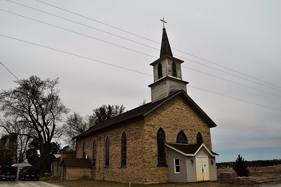
lists 17 fires within 5 miles of St. Joseph's Roman Catholic Church
between 1994 and 2020, burning about 1,181 acres in total. 1 started naturally. 3 were recorded as arson.
Distance is straight-line from the map coordinates, so a fire counted
here may appear on a neighbouring settlement's page as well.
Reported cause
Fires
Missing data/not specified/undetermined
12
Arson/incendiarism
3
Natural
1
Debris and open burning
1
The most recent of
them, most recent first, with the day each was reported and the service
that recorded it.
Regional context, not property-specific
evidence. The federal mineral resources record lists
6 workings within 5 miles of St. Joseph's Roman Catholic Church: 4 unknowns, 1 producer, 1 past producer.
1 still produces. What was taken out: Stone, Stone, Crushed/Broken, Sand and Gravel, Construction. Distance is straight-line from the
map coordinates, so a quarry counted here may appear on a neighbouring
settlement's page as well.
No historic map-sheet match is published
for this property yet. That does not mean no map exists. This record needs
a coordinate-quality review before it can be joined to a sheet boundary.
Browse the county's mapped places while that work is
pending.
Listed places nearby
2 within 8 miles
Other National Register properties close
enough to walk or drive between, ordered by distance from this one. Both
positions come from the same geocoding pass that matched these properties
to their map sheets.
Listing record. National Park Service National Register of Historic Places, listed-properties dataset, current to 2026-05-22.
Map join. Address geocoded through the United States Census geocoder, then tested against the published boundary of every sheet in the USGS Historical Topographic Map Collection.
How this page is made. Listing fields come from federal records; map-sheet coverage is a labelled coordinate-to-boundary calculation, not a source-field claim.
Wildfire. Short, Karen C. 2022. Spatial wildfire occurrence data for the United States, 1992-2020 [FPA_FOD_20221014]. 6th Edition. Fort Collins, CO: Forest Service Research Data Archive. https://doi.org/10.2737/RDS-2013-0009.6 Collected with United States Government funding and usable without additional permissions or fees.
Mines and quarries. USGS Mineral Resources Data System (MRDS) https://mrdata.usgs.gov/mrds/ A work of the United States government, no copyright under 17 U.S.C. 105.
 Block