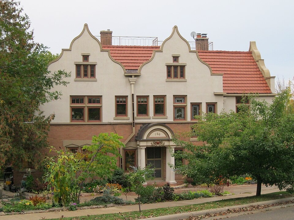
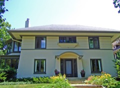
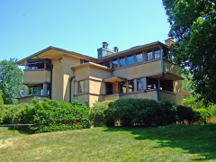
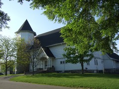
Listed on the National Register of Historic Places in 1982.
From the record
“University Heights Historic District is a historic neighborhood on the west side of Madison, Wisconsin. The 397 contributing structures were built from 1894 to 1965 - many by prominent University of Wisconsin faculty - in various styles of the period, and the subdivision was Madison's first elite residential suburb.”
Wikipedia article University Heights Historic District (Madison, Wisconsin), CC BY-SA 4.0.
One of 238 National Register listings published here for Dane County · listed in 1982 · category: District.
National Register reference number.82001844- the number the National Park Service assigned this property when it was listed, and the key its nomination file is catalogued under at the National Archives.
What happened here
An account from the chapter on Madison city. The inset identifies its exact
source book and publication year.
Village and Town Elections 1846-49 - Water Power - Celebra¬ tion, July 4, 1846 - Public Cemetery - Dr. C. B. Chapman's and J. T. Clark's Reminiscences - Hope Lodge I. O. O. F. - Knapp's Account of Capitol Grounds - L. J. Farwell's Arrival - First Bell in Madison - Organization of Baptist Church 1847 - Trial of Gross for Murder - Growth of Village, 1848 - State Historical Society, 1849 - State University.
The author of this volume has long been impressed with the fact, that much information relative to the early and later history of Madison and adjacent country, had not been written; and that some one should under¬ take the task of compiling the necessary materials for such a work, availing himself of the opportunity now afforded to consult those of our citizens who established themselves here as pioneers and early set¬ tlers, before circumstances should render it impossible to do so. Many of these have passed away ; others have removed to new localities, and the few that now remain, will, in the ordinary course of events, be with us but a short period.
It is true, that a portion of our history has been written. To Maj. H A. Tenney we are indebted for many interesting facts collected in past time, which were published in a small pamphlet in 1851, and subse¬ quently re-printed. In 1857, Hon. L. C. Draper prepared a similar work, much enlarged ; but these pamphlets, while they accomplished the object of their publication, in drawing public attention to the beauty and desirability of Madison as a place of settlement, did not go into the minutiae of our early history, and necessarily were written up only to the date of publication, and are now out of print. The changes and improvements that have since taken place, have been so marked as to entitle Madison to a history more complete and brought down to the present time, and the present work is designed to supply such a deficiency.
Regional context, not property-specific
evidence. The
federal wildfire occurrence database
lists 34 fires within 5 miles of University Heights Historic District
between 2007 and 2020, burning about 47 acres in total. 2 started naturally. 2 were recorded as arson.
Distance is straight-line from the map coordinates, so a fire counted
here may appear on a neighbouring settlement's page as well.
Reported cause
Fires
Missing data/not specified/undetermined
22
Debris and open burning
5
Arson/incendiarism
2
Natural
2
Smoking
2
Recreation and ceremony
1
The most recent of
them, most recent first, with the day each was reported and the service
that recorded it.
Regional context, not property-specific
evidence. The federal mineral resources record lists
8 workings within 5 miles of University Heights Historic District: 5 producers, 3 unknowns.
5 still produce. What was taken out: Sand and Gravel, Construction, Stone, Stone, Crushed/Broken. Distance is straight-line from the
map coordinates, so a quarry counted here may appear on a neighbouring
settlement's page as well.
Regional context, not property-specific
evidence. The National Weather Service names
Madison, the town this property stands in, in 110 storm reports between 1994 and 2026: 40 hail, 33 thunderstorm wind, 16 lightning, 8 flood.
The reports record 7 injuries. Each account below is quoted exactly as the forecast office
filed it, from the NOAA Storm Events Database, and each date
opens the federal record of that event.
A 1-in-a-100-year flash flood occurred from the west side of Madison to around the Capitol Square after 3 to 5 inches of rain fell within a 90 minute timeframe. There were no reports of injuries or deaths. The heavy rain resulted from slow-moving and back-building thunderstorms that essentially remained nearly stationary over the city of Madison. The hilly terrain and a typical urban setting of a lot of concrete and asphalt enable the runoff water to quickly overwhelm the storm sewers and concentrate water in low-lying areas of the city. Water depths reach to the top of small vehicles - 4 to 5 feet deep in spots. Many roads became impassable due to the flood waters, and many residential homes and businesses on or near the UW-Madison campus had flooded basement and first-floor flooding. Some basement apartment units had water depths of 6 to 8 feet. Nearly all campus buildings had flooding of varying degrees of intensity, and the Camp Randall football field sustained damage. Some campus buildings had flat roofs that quickly flooded as storm drains became plugged - which allowed water to run thru the walls and ceilings of buildings. The buildings that sustained the most damage were the Memorial Union, Computer Sciences, and Veterinary Medicine. Numerous vehicles on or near the campus were damaged or totaled by the flood waters, and some were reported to be floating away. Unofficial rain gages measured 4.5 to 5 inches from just west of West High School up to the Capitol Square. WSR-88D Doppler rainfall estimates were in the 3 to 5 inch rain, therefore it appears the unofficial rain gages were very accurate. Rainfall amounts quickly fell off to 1 to 1.5 inches near the south Beltline (STH14/18/151). It is nearly impossible to assess the monetary value of the flash flood damage, therefore, the amount posted in the header strip of this event is only a ballpark estimate.
Bricks were taken off a building in downtown Madison due to severe, hurricane-force wind gusts to an estimated 65 knots (75 mph). Dozens of power-lines were damaged. At least 3 vehicles were either damaged or destroyed by fallen trees. Many roads were blocked by the tree debris. A large tree was toppled onto a home on the near east side of Madison, resulting in minor roof damage.
Lightning struck the middle turret on the south side of the historic 1894 Red Gym on the UW-Madison campus (Dane Co). The outerbrick in a 4' by6' area was blown out, much of the inner brick crumbled, and a hole was knocked out in a ventilation duct, for a total of $25,000 in damage.
More heavy rain of 1 to 2 inches on already saturated ground caused some minor urban flooding from around the Madison area to Cottage Grove. One car was stalled after trying to drive through flood waters.
Scattered severe storms generated powerful winds which knocked down large trees in Cassville (Grant County), and significantly damaged a barn's roof west of Cuba City (Grant County). As another severe storm pushed through Madison (Dane County) it tore numerous large tree branches down throughout the city. Two homes sustained damage to their roofs due to fallen branches. A lightning strike started a fire which destroyed a farm shed, but no animals were hurt. Another lightning strike started a fire which partially destroyed an outbuilding north of Merton (Waukesha County).
No historic map-sheet match is published
for this property yet. That does not mean no map exists. This record needs
a coordinate-quality review before it can be joined to a sheet boundary.
Browse the county's mapped places while that work is
pending.
Listed places nearby
6 within 8 miles
Other National Register properties close
enough to walk or drive between, ordered by distance from this one. Both
positions come from the same geocoding pass that matched these properties
to their map sheets.
Listing record. National Park Service National Register of Historic Places, listed-properties dataset, current to 2026-05-22.
Map join. Address geocoded through the United States Census geocoder, then tested against the published boundary of every sheet in the USGS Historical Topographic Map Collection.
How this page is made. Listing fields come from federal records; map-sheet coverage is a labelled coordinate-to-boundary calculation, not a source-field claim.
Wildfire. Short, Karen C. 2022. Spatial wildfire occurrence data for the United States, 1992-2020 [FPA_FOD_20221014]. 6th Edition. Fort Collins, CO: Forest Service Research Data Archive. https://doi.org/10.2737/RDS-2013-0009.6 Collected with United States Government funding and usable without additional permissions or fees.
Mines and quarries. USGS Mineral Resources Data System (MRDS) https://mrdata.usgs.gov/mrds/ A work of the United States government, no copyright under 17 U.S.C. 105.
Storms. NOAA National Centers for Environmental Information, Storm Events Database https://www.ncei.noaa.gov/stormevents/ A work of the United States government, no copyright under 17 U.S.C. 105. Narratives are quoted verbatim from the National Weather Service report and are not edited or summarised.
 Block