 Block
From the record
One of 153 National Register listings published here for Waukesha County · listed in 1986 · category: Building.
Sources: the case file at the National Archives · the National Register database, National Park Service
Listed on the National Register of Historic Places in 1986.
One of 153 National Register listings published here for Waukesha County · listed in 1986 · category: Building.
Sources: the case file at the National Archives · the National Register database, National Park Service
Regional context, not property-specific evidence. The federal wildfire occurrence database lists 15 fires within 5 miles of Walter L. Peck House between 2018 and 2020, burning about 9 acres in total. None started naturally. 1 was recorded as arson. Distance is straight-line from the map coordinates, so a fire counted here may appear on a neighbouring settlement's page as well.
| Reported cause | Fires |
|---|---|
| Debris and open burning | 5 |
| Missing data/not specified/undetermined | 5 |
| Recreation and ceremony | 2 |
| Smoking | 1 |
| Arson/incendiarism | 1 |
| Equipment and vehicle use | 1 |
The most recent of them, most recent first, with the day each was reported and the service that recorded it.
| Date | Cause | Size | Reported by | Name on the report |
|---|---|---|---|---|
| 21 September 2018 | Debris and open burning | 1.0 acres | Wisconsin Department of Natural Resources | 1802995 |
| 11 July 2019 | Debris and open burning | under an acre | Wisconsin Department of Natural Resources | 1907239 |
| 1 May 2020 | Missing data/not specified/undetermined | under an acre | Wisconsin Department of Natural Resources | 124 |
| 30 April 2018 | Equipment and vehicle use | under an acre | Wisconsin Department of Natural Resources | 1800131 |
| 26 April 2018 | Smoking | under an acre | Wisconsin Department of Natural Resources | 1801151 |
| 24 April 2018 | Debris and open burning | under an acre | Wisconsin Department of Natural Resources | 1801131 |
| 10 April 2018 | Missing data/not specified/undetermined | 1.0 acres | Wisconsin Department of Natural Resources | 1800969 |
| 27 March 2020 | Recreation and ceremony | 1.0 acres | Wisconsin Department of Natural Resources | 2003071 |
Regional context, not property-specific evidence. The federal mineral resources record lists 5 workings within 5 miles of Walter L. Peck House: 3 producers, 2 past producers. 3 still produce. What was taken out: Sand and Gravel, Construction, Clay. Distance is straight-line from the map coordinates, so a quarry counted here may appear on a neighbouring settlement's page as well.
| Where | Site | Commodity | Status | Recorded |
|---|---|---|---|---|
| Oakfield Brick Pit | Clay | Producer | ||
| Fredericks Pit | Sand and Gravel, Construction | Past Producer | ||
| Sand and Gravel Pit | Sand and Gravel, Construction | Producer | ||
| Silver Lake Sand Pit | Sand and Gravel, Construction | Past Producer | ||
| Vogt Pit | Sand and Gravel, Construction | Producer |
Regional context, not property-specific evidence. The National Weather Service names Oconomowoc, the town this property stands in, in 51 storm reports between 1993 and 2025: 22 hail, 21 thunderstorm wind, 6 lightning, 2 flash flood. No death or injury is recorded in these reports. Each account below is quoted exactly as the forecast office filed it, from the NOAA Storm Events Database, and each date opens the federal record of that event.
| When | Event | Place named | Harm | What the report says |
|---|---|---|---|---|
| October 2002 | Thunderstorm Wind | Oconomowoc | $300,000 | no account filed |
| August 2021 | Thunderstorm Wind | Oconomowoc | $150,000 | Numerous reports of a number of large trees snapped and uprooted trees across Waukesha County. Winds were estimated to be upward of 60 mph, with locally higher gusts across the southern portion of the county. Wind measurements near Eagle, WI of 68 to 77 mph were observed. A large tree fell on a house causing significant damage near Eagle, WI. A business marquee sign was knocked over in Waukesha. Hail of three-quarters of an inch was also observed. |
| June 2016 | Lightning | Oconomowoc | $100,000 | The roof of a home was struck by lightning with a resultant fire. Smoke and water damage to the home is extensive. All occupants escaped safely. |
| July 2008 | Lightning | Oconomowoc | $100,000 | Lightning struck a home and started a fire that extensively damaged the structure. |
| July 2008 | Lightning | Oconomowoc | $50,000 | Lightning struck a home and started a fire that damaged the structure. |
| April 2004 | Thunderstorm Wind | Oconomowoc | $50,000 | no account filed |
| August 2004 | Flash Flood | Oconomowoc | $50,000 | no account filed |
| May 2013 | Thunderstorm Wind | Oconomowoc | $30,000 | Law enforcement officials reported numerous trees and power lines downed by thunderstorm wind gusts, measured by a trained spotter at 68 mph (59 knots). The damage was reported along an 8-mile wide swath from 1.5 miles west of Oconomowoc to 1 mile east of Elm Grove. |
| June 1996 | Lightning | Oconomowoc | $30,000 | no account filed |
| August 2007 | Thunderstorm Wind | Oconomowoc | $25,000 | Powerful thunderstorm wind gusts up to 52 knots (60 mph) toppled several large trees and damaged some power-lines. |
| July 1997 | Thunderstorm Wind | Oconomowoc | $15,000 | no account filed |
| August 1996 | Thunderstorm Wind | Oconomowoc | $15,000 | no account filed |
| May 2024 | Thunderstorm Wind | Oconomowoc | $8,000 | A tree down on a vehicle. |
| June 2019 | Thunderstorm Wind | Oconomowoc | $8,000 | Large tree limbs down throughout the southwest portion of Oconomowoc. Some shingles peeled back on homes. |
| August 1993 | Thunderstorm Wind | Oconomowoc | $5,000 | no account filed |
| July 1998 | Lightning | Oconomowoc | $4,000 | no account filed |
| May 1999 | Lightning | Oconomowoc | $2,000 | no account filed |
| August 2024 | Thunderstorm Wind | Oconomowoc | $1,000 | A large tree limb split. |
| August 2020 | Thunderstorm Wind | Oconomowoc | $1,000 | Several tree limbs down. |
| March 2004 | Thunderstorm Wind | Oconomowoc | $1,000 | no account filed |
| June 1999 | Thunderstorm Wind | Oconomowoc | $1,000 | no account filed |
| March 2025 | Thunderstorm Wind | Oconomowoc | - | Estimated based on home weather station and sporadic tree damage. |
| July 2012 | Thunderstorm Wind | Oconomowoc | - | An NWS employee reported a trampoline was blown into a house window by damaging wind gusts estimated at 70 mph (61 knots). |
| June 2010 | Thunderstorm Wind | Oconomowoc | - | A four-foot in diameter elm tree was blown over as well as several other smaller trees. |
| June 2008 | Thunderstorm Wind | Oconomowoc | - | Powerful thunderstorms winds knocked down a few large trees. |
| June 2008 | Flash Flood | Oconomowoc | - | Heavy rains resulted in flash flooding as water reached depths of 3 feet or more and several cars stalled. This was one of 3 flash floods in Waukesha County on June 7th. Some crop damage was noted in nearby rural areas around Pewaukee. Another round of heavy rains on June 8th resulted in flash flooding around North Prairie. Collectively, each of these 4 flash floods resulted in home and business damage along with some crop losses. It was nearly impossible to break down the damages by flash flood. Therefore, the collective breakdown is provided in the June 8th StormData entry for Waukesha County. |
| June 2008 | Hail | Oconomowoc | - | Hail size ranged from 1.00 to 1.75 inches in diameter. |
| March 1994 | Hail | Oconomowoc | - | A storm system brought a variety of weather to far northwest and southeast Wisconsin. In the far north, 6 to 12 inches of snow fell causing accidents, closing schools, and halting city and county government operations. Snow totals included 12 inches at Ashland, Ashland County, 11 inches at Washburn, Bayfield County, and 9.5 inches at Port Wing, Bayfield County. In southeast Wisconsin, isolated severe thunderstorms dropped hail up to the size of golfballs over Jefferson and Waukesha Counties. |
| February 2024 | Hail | Oconomowoc | - | no account filed |
| February 2024 | Hail | Oconomowoc | - | no account filed |
| May 2023 | Hail | Oconomowoc | - | no account filed |
| June 2022 | Hail | Oconomowoc | - | no account filed |
| June 2022 | Hail | Oconomowoc | - | no account filed |
| June 2022 | Hail | Oconomowoc | - | no account filed |
| June 2022 | Hail | Oconomowoc | - | no account filed |
| September 2022 | Hail | Oconomowoc | - | no account filed |
| May 2012 | Hail | Oconomowoc | - | no account filed |
| May 2012 | Hail | Oconomowoc | - | no account filed |
| May 2012 | Hail | Oconomowoc | - | no account filed |
| September 2010 | Hail | Oconomowoc | - | no account filed |
| September 2010 | Hail | Oconomowoc | - | no account filed |
| March 2007 | Hail | Oconomowoc | - | no account filed |
| June 2006 | Hail | Oconomowoc | - | no account filed |
| May 2005 | Hail | Oconomowoc | - | no account filed |
| March 2004 | Hail | Oconomowoc | - | no account filed |
| May 2004 | Hail | Oconomowoc | - | no account filed |
| July 2004 | Hail | Oconomowoc | - | no account filed |
| July 2003 | Thunderstorm Wind | Oconomowoc | - | no account filed |
| May 2001 | Hail | Oconomowoc | - | no account filed |
| September 2001 | Thunderstorm Wind | Oconomowoc | - | no account filed |
| July 1994 | Thunderstorm Wind | Oconomowoc | - | no account filed |
No historic map-sheet match is published for this property yet. That does not mean no map exists. This record needs a coordinate-quality review before it can be joined to a sheet boundary. Browse the county's mapped places while that work is pending.
Other National Register properties close enough to walk or drive between, ordered by distance from this one. Both positions come from the same geocoding pass that matched these properties to their map sheets.
| Photograph | Property | Distance | Listed |
|---|---|---|---|
 | Clarence Peck Residence | 0.8 miles | 1988 |
 | Henry and Mary Schuttler House | 0.9 miles | 1987 |
 | Oconomowoc City Hall | 1.2 miles | 1980 |
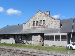 | Oconomowoc Depot | 1.2 miles | 1980 |
 | National Guard Armory 127th Regiment Infantry Company G | 1.4 miles | 1984 |
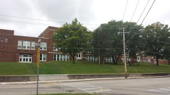 | Oconomowoc High School | 1.6 miles | 2013 |
| National Archives record | The nomination case file for reference 86000715 in Record Group 79. |
| Waukesha County | All 153 listed properties in this county. |