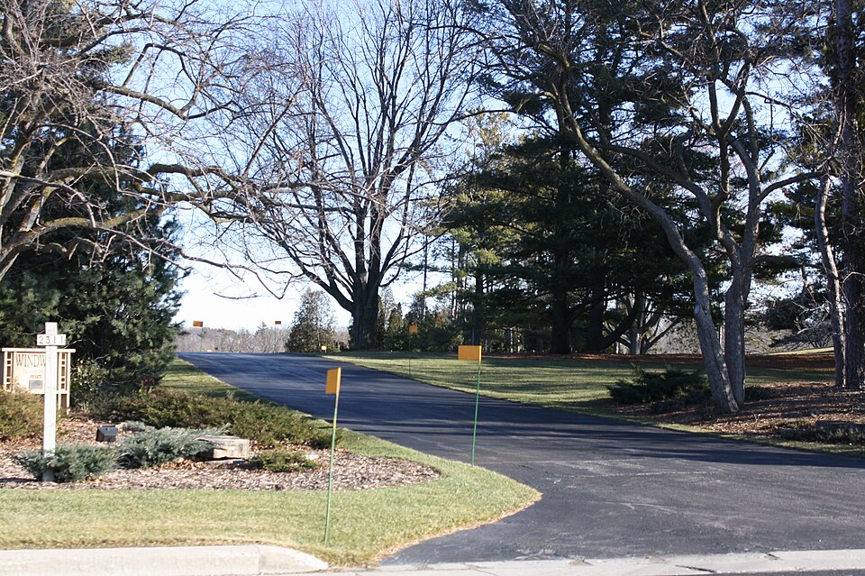
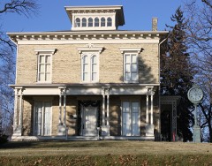
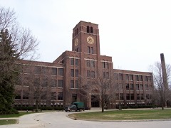
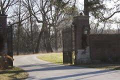
Built in 1938 (modern architecture). Listed on the National Register of Historic Places in 1988.
From the record
“Windway is a historic residential property located north of Kohler, Wisconsin. Kohler Jr., future governor of Wisconsin and an executive of the Kohler Company.”
Wikipedia article Windway, CC BY-SA 4.0.
One of 60 National Register listings published here for Sheboygan County · listed in 1988 · category: Building · built in 1938, modern architecture.
Architectural style. modern architecture, International Style
National Register reference number.88001149- the number the National Park Service assigned this property when it was listed, and the key its nomination file is catalogued under at the National Archives.
At the time Sheboygan became a city there were only two wards, which cast at the first election 427 votes. The city was at this time without financial resources and industries were very much in their infancy. The mode of travel was by stage coach and freightage was by wagons. Traffic with eastern marts was by the lake, bridge piers extending into the lake being used by vessels touching at this port. Public improvements were a negligible quantity. In the years 1854 and 1855 considerable street grading was accomplished and the newly-created city saw a bright future and prosperity was the word until 1857, when the country was overwhelmed by a panic, from which it took the community over a decade to recover. The horizon did not show evidence of clearing until 1868-9, when the city's indebtedness was honorably readjusted by a compromise and a new era was inaugurated. Industries gained a new and grateful impetus, which has continued until the present day and Sheboygan is noted far and wide as an important manufacturing center. The two wards have been increased to eight, the least of which has a population almost equal to the population of the city at its inception. Railroad facilities have so developed that the community has connection with the outer world equal to its demands. Vast sums of money have been expended on the harbor and vessels of immense burthen may enter at any time in season. The bonds of the municipality find a ready and lucrative market. Well appointed and regulated fire and police departments, sewerage, paving, waterworks, electric and gas lighting systems, place the city in the front ranks with others of the state.
The municipal court of Sheboygan was created by law in 1887 and the tenure of its judges is four years. The jurisdiction of the municipal court is over "all actions of law, where the amount claimed shall not exceed the sum of $600 and to try and determine all criminal actions, when the crime was committed in said city ; and that are not punishable by commitment to the state prison and to arrest and examine and to hold to bail all parties charged with other offense against the laws of the state as provided by law. And the said court and judge thereof shall also have exclusive jurisdiction of all offenses and actions under the charter of said city, and the ordinances, rules and by-laws of said city, and exclusive jurisdiction of all criminal trials and examinations for offenses committed within said city, subject to appeal to the circuit court of said county, and the statute of removal of causes, either civil or criminal, applying to justices of the peace, shall not apply to said judge of his court and there. shall be no removal therefrom. He also has jurisdiction co-extensive with justices of the peace and powers to sentence and commit the same as a circuit judge or justice of the peace."
Regional context, not property-specific
evidence. The
federal wildfire occurrence database
lists 19 fires within 5 miles of Windway
between 2018 and 2020, burning about 4 acres in total. None started naturally. 3 were recorded as arson.
Distance is straight-line from the map coordinates, so a fire counted
here may appear on a neighbouring settlement's page as well.
Reported cause
Fires
Missing data/not specified/undetermined
10
Arson/incendiarism
3
Debris and open burning
3
Power generation/transmission/distribution
1
Equipment and vehicle use
1
Smoking
1
The most recent of
them, most recent first, with the day each was reported and the service
that recorded it.
Regional context, not property-specific
evidence. The National Weather Service names
Sheboygan, the town this property stands in, in 37 storm reports between 1993 and 2026: 15 thunderstorm wind, 8 hail, 4 flood, 4 heavy rain.
No death or injury is recorded in these reports. Each account below is quoted exactly as the forecast office
filed it, from the NOAA Storm Events Database, and each date
opens the federal record of that event.
A trained spotter reported 3 feet of water over South Business Drive between Riverdale Avenue and Stahl Road in the town of Wilson 5 miles south-southwest of Sheboygan. Another trained spotter reported street flooding on the south side of the city of Sheboygan near the intersection of Weeden Creek road and 10th Street. The flooding damaged the contents of flooded basements and washed out gravel shoulders of roads.
Street flooding on the south side of Sheboygan, including removed manhole covers from flooding sewers. Pictures of streets and yards flooded on the south side.
The Sheboygan River reached moderate flood stage, cresting at 11.07 feet the morning of May 18th. About 3 miles west of Sheboygan Airport, Woodland Road is flooded and closed between Rio Road and Willow Road due to the flooding of the Sheboygan River. Sections of Alpine Road and Meadowlark Road in the Sheboygan Falls area are flooded and closed. Floodwaters affect Kiwanis and Esslingen Parks in Sheboygan. Other roads and low lying areas are flooded in closed due to areal flooding from the several inches of rain that had fallen.
Large hail the size of pennys to quarters covered the ground white just northwest of the city limits of Sheboygan. No damage was noted. As the storm eventually moved through the city of Sheboygan it dumped heavy rains of 0.81 inches in about 45 minutes. Water accumulated on some roads to a depth of 3 to 5 inches.
No historic map-sheet match is published
for this property yet. That does not mean no map exists. This record needs
a coordinate-quality review before it can be joined to a sheet boundary.
Browse the county's mapped places while that work is
pending.
Listed places nearby
6 within 8 miles
Other National Register properties close
enough to walk or drive between, ordered by distance from this one. Both
positions come from the same geocoding pass that matched these properties
to their map sheets.
Listing record. National Park Service National Register of Historic Places, listed-properties dataset, current to 2026-05-22.
Map join. Address geocoded through the United States Census geocoder, then tested against the published boundary of every sheet in the USGS Historical Topographic Map Collection.
How this page is made. Listing fields come from federal records; map-sheet coverage is a labelled coordinate-to-boundary calculation, not a source-field claim.
Wildfire. Short, Karen C. 2022. Spatial wildfire occurrence data for the United States, 1992-2020 [FPA_FOD_20221014]. 6th Edition. Fort Collins, CO: Forest Service Research Data Archive. https://doi.org/10.2737/RDS-2013-0009.6 Collected with United States Government funding and usable without additional permissions or fees.
Storms. NOAA National Centers for Environmental Information, Storm Events Database https://www.ncei.noaa.gov/stormevents/ A work of the United States government, no copyright under 17 U.S.C. 105. Narratives are quoted verbatim from the National Weather Service report and are not edited or summarised.
 Block