Listed on the National Register of Historic Places in 1990.
From the record
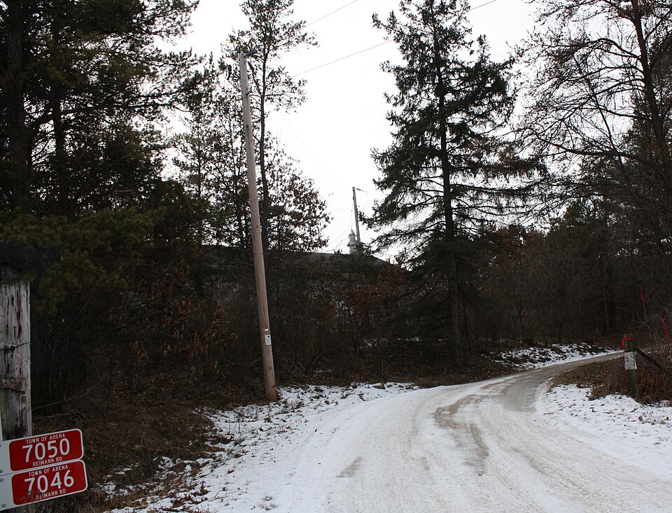
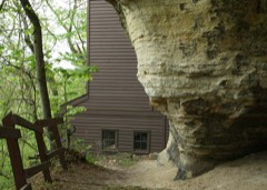
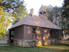
“The William Henry Brisbane House is a historic house at the south end of Reimann Road near the village of Arena, Wisconsin. It was built in 1868 by William Henry Brisbane to replace an earlier house on the property, which he had owned since the 1850s.”
Wikipedia article William Henry Brisbane House, CC BY-SA 4.0.
One of 30 National Register listings published here for Iowa County · listed in 1990 · category: Building.
National Register reference number.90001458- the number the National Park Service assigned this property when it was listed, and the key its nomination file is catalogued under at the National Archives.
Fires near this property
113 since 1992
Regional context, not property-specific
evidence. The
federal wildfire occurrence database
lists 113 fires within 5 miles of William Henry Brisbane House
between 1992 and 2019, burning about 261 acres in total. 3 started naturally. 5 were recorded as arson.
Distance is straight-line from the map coordinates, so a fire counted
here may appear on a neighbouring settlement's page as well.
Reported cause
Fires
Debris and open burning
50
Missing data/not specified/undetermined
21
Equipment and vehicle use
19
Recreation and ceremony
8
Power generation/transmission/distribution
5
Arson/incendiarism
5
Natural
3
Smoking
2
The most recent of
them, most recent first, with the day each was reported and the service
that recorded it.
Regional context, not property-specific
evidence. The federal mineral resources record lists
1 working within 5 miles of William Henry Brisbane House: 1 producer.
All of them still produce. What was taken out: Stone, Crushed/Broken. Distance is straight-line from the
map coordinates, so a quarry counted here may appear on a neighbouring
settlement's page as well.
Regional context, not property-specific
evidence. The National Weather Service names
Arena, the town this property stands in, in 20 storm reports between 1997 and 2026: 10 thunderstorm wind, 5 hail, 3 flash flood, 1 heavy rain.
No death or injury is recorded in these reports. Each account below is quoted exactly as the forecast office
filed it, from the NOAA Storm Events Database, and each date
opens the federal record of that event.
Law enforcement officials reported many flooded roads, with some washed outacross Iowa County. State Highways 130 and 133 were closed by flooding and mudslides.
Overnight rainfalls of 5 to over 10 inches in the Arena to Barneveld to Hollendale vicinity resulted in a low-end flash flood. One significant mudslide occurred on CTH K about 2 miles northeast of Barneveld, and a second mudslide on CTH K about 2.5 miles south fo Barneveld. Soil erosion also occurred between Barneveld and about 4 miles northwest of Barneveld. CTH K was reduced to only 1-lane traffic where the two mudslides occurred (mud and trees), and large front-end loaders were needed to clear the road. Several homes had water in basements in and around Barneveld for the first time ever. A farmer 2 miles west of Barneveld measured at least 10 inches of rain (he had to empty a 5-inch raingage twice and missed some rain). A portion of Amacher Hollow Road in the rural portion of Area Township washed out when culverts filled up around Mill Creek. Water depths on that road reached 3 to 5 feet. Mill Creek also flowed over the bridge on Coon Rock Road near Demby Road. Additionally, most rivers and streams in the eastern third of Iowa County reached bankfull or flood stage for at least a few hours overight. The Wastewater Treatment Plant in Barneveld measured 9.75 inches. Other overnight rainfall amounts include 8.98 at a UW-Madison research site on the upper East Branch Pecatonica River about 2.4 miles south-southeast of Barneveld, 8.13 about 1 mile northeast of Ridgeway, 6.92 about 4 miles north of Hollendale, 6 in Hollendale, and 3.61 about 4 miles north of Dodgeville.
The record flooding of Black Earth Creek caused a rail bridge to fail on Wisconsin & Southern Railroad near Blynn Road east of Arena. Sections of railroad tracks were also washed out. The flooding of Blue Mounds Creek near Arena reached Village Edge Road and Helena Road on the north side of the village. Sandbagging and pumping was employed to protect homes. Highway 14 was inundated and closed by flood waters just west of County Road K due to record flooding of Black Earth and Blue Mounds Creeks.
Broadcast media estimates 60 MPH wind gusts near Arena. Multiple photos of uprooted trees, broken limbs, garage door and barn roof damage provided in support of the estimates.
Flash flooding of creeks flowing over several rural roads. This included a flooded road in Cobb, floodwaters over bridges on Amacher Hollow Rd. and Sawle Rd.
No historic map-sheet match is published
for this property yet. That does not mean no map exists. This record needs
a coordinate-quality review before it can be joined to a sheet boundary.
Browse the county's mapped places while that work is
pending.
Listed places nearby
4 within 8 miles
Other National Register properties close
enough to walk or drive between, ordered by distance from this one. Both
positions come from the same geocoding pass that matched these properties
to their map sheets.
Listing record. National Park Service National Register of Historic Places, listed-properties dataset, current to 2026-05-22.
Map join. Address geocoded through the United States Census geocoder, then tested against the published boundary of every sheet in the USGS Historical Topographic Map Collection.
How this page is made. Listing fields come from federal records; map-sheet coverage is a labelled coordinate-to-boundary calculation, not a source-field claim.
Wildfire. Short, Karen C. 2022. Spatial wildfire occurrence data for the United States, 1992-2020 [FPA_FOD_20221014]. 6th Edition. Fort Collins, CO: Forest Service Research Data Archive. https://doi.org/10.2737/RDS-2013-0009.6 Collected with United States Government funding and usable without additional permissions or fees.
Mines and quarries. USGS Mineral Resources Data System (MRDS) https://mrdata.usgs.gov/mrds/ A work of the United States government, no copyright under 17 U.S.C. 105.
Storms. NOAA National Centers for Environmental Information, Storm Events Database https://www.ncei.noaa.gov/stormevents/ A work of the United States government, no copyright under 17 U.S.C. 105. Narratives are quoted verbatim from the National Weather Service report and are not edited or summarised.
 Block