BlockBefore

Iowa County, Wisconsin

72 topographic sheets cover 25 settlements here, and 30 properties are on the National Register of Historic Places.

Research this county

From the record

30 National Register listings published here, 1 of them a National Historic Landmark · the county-history sources name 3 people · people the book names include A. P. Van Matre (Mineral Point Town, 1881) · General Summary (Dodgeville City, 1881) (machine-read).

Sources: the county history on the Internet Archive · the National Register database, National Park Service

Wisconsin within the United States
Iowa County within Wisconsin

What the record shows

  • 318 topographic sheet readings cover the county's settlements.
  • 30 properties here are on the National Register of Historic Places: 23 buildings, 4 districts, 2 structures and 1 site.
  • 11 of the 30 listings were added during the 1970s.
  • The Geographic Names Information System records 25 populated places in this county; 25 are covered by at least one topographic sheet.
  • 1 public-domain county history, 1881, supplies 119,944 words of narrative reproduced here.

Places on the National Register

30

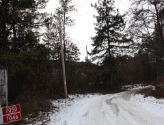
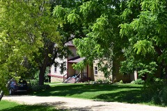
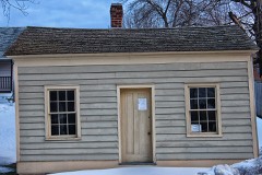
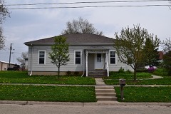
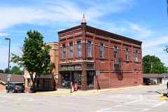
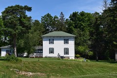
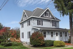
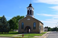
Every property in this county listed on the National Register of Historic Places, with the year it was listed and the federal nomination document.

Photograph PropertyType ListedReference
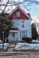
William Henry Brisbane Housebuilding199090001458
Cassidy Farmhousebuilding198686002297
Dodge Mining Camp Cabinbuilding200505000952
Grove Street Historic Districtdistrict198686002313
Harris Housebuilding198686002299
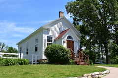
Hyde Chapeldistrict198888002002
Ihm Housebuilding198686002301
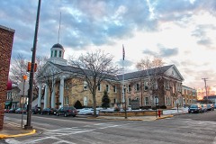
Iowa County Courthousebuilding197272000053
Iowa Street Historic Districtdistrict199696000991
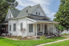
David J. and Maggie Jones Housebuilding199494000447
Kittleson Housebuilding198686002304
Linden High Schoolbuilding199393001168
Linden Methodist Churchbuilding197878000099
Mineral Point Hillsite197272000054
Mineral Point Historic Districtdistrict197171000037
Old Rock Schoolbuilding197878000101
Pendarvisbuilding197171000038
Plum Grove Primitive Methodist Churchbuilding199595000505
Pulaski Presbyterian Church Complexbuilding201313000313
Roberts Housebuilding198886002311
Roethlisberger Housebuilding198686002312
Shot Towerstructure197373000080
Spensley Farmbuilding199797000330
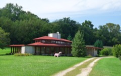
Spring Green Restaurantbuilding2024100009939
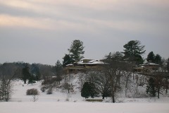
Taliesin Housebuilding197373000081
Taliesin, Entry Bridgestructure197373000081
Taliesin, Hillside Theaterbuilding197373000081
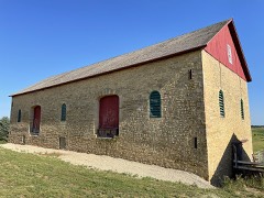
Thomas Stone Barnbuilding200101000299
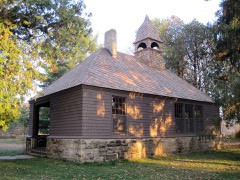
Unity Chapelbuilding197474000092
Wyoming Valley Schoolbuilding201616000377

Wildfire, 1992 to 2020

465 fires

Every wildfire the federal occurrence database records inside this county: 465 of them, burning about 3,105 acres. 6 started naturally and 27 were recorded as arson. Each settlement page carries the fires within five miles of it.

Reported cause Fires
Debris and open burning201
Equipment and vehicle use83
Missing data/not specified/undetermined65
Railroad operations and maintenance37
Arson/incendiarism27
Recreation and ceremony13
Smoking13
Power generation/transmission/distribution12
Natural6
Misuse of fire by a minor4
Other causes2
Fireworks2

The five largest, by the area the report gives. Two of them were set deliberately.

DateCause SizeReported by Name on the report
1 April 1999Arson/incendiarism1,400 acresWisconsin Department of Natural Resourcesnot named
21 March 2018Missing data/not specified/undetermined130 acresWisconsin Department of Natural Resources2018045
30 March 2018Debris and open burning125 acresWisconsin Department of Natural Resources5172
20 May 2009Power generation/transmission/distribution100 acresChequamegon-Nicolet National ForestBLOCKHOUSE
9 April 2005Debris and open burning80 acresWisconsin Department of Natural Resourcesnot named
4 May 2005Railroad operations and maintenance55 acresWisconsin Department of Natural Resourcesnot named
1 April 1994Missing data/not specified/undetermined49 acresWisconsin Department of Natural Resourcesnot named
13 March 2015Arson/incendiarism46 acresWisconsin Department of Natural ResourcesBLUE LAKE FIRE

Every settlement page carries the fires within five miles of it - see the settlement index below.

Storms, 1954 to 2026

60 of 371 shown

The NOAA Storm Events Database holds 371 reports for this county, causing 9 deaths, 206 injuries and about $35,659,830 in recorded property damage. Each settlement page carries the reports that name it.

Kind of event Reports
Thunderstorm Wind195
Hail102
Tornado33
Flash Flood15
Flood9
Funnel Cloud6
Heavy Rain6
Lightning4
Debris Flow1

The most serious of them, by death, then injury, then recorded damage. The accounts are quoted exactly as the forecast office filed them.

WhenEvent Place namedHarm What the report says
June 1984Tornado (F5)not stated9 killed, 200 hurt, $250,000no account filed
April 1954Tornado (F2)not stated4 hurt, $25,000no account filed
May 1965Tornado (F2)not stated1 hurt, $25,000no account filed
September 1963Tornado (F2)not stated1 hurtno account filed
April 2006HailRidgeway$4,440,000no account filed
April 2006HailRewey$4,440,000no account filed
April 2006HailMineral Pt$4,440,000no account filed
April 2006HailDodgeville$4,440,000no account filed
June 2014Tornado (EF2)Montfort Jct$3,500,000A long track swath of sporadic to continuous tornado damage. Hundreds of trees uprooted, snapped, and damaged. Dozens of farm buildings damaged or destroyed, including many silos down. 59 homes damaged with 4 destroyed. Intermittent damaging downburst winds were likely adjacent to the tornado path. An area of corn leveled.
June 1998Thunderstorm WindHelena$950,000no account filed
June 2000Flash FloodNorth Portion$583,000no account filed
May 2000HailLinden$500,000no account filed
July 1994Thunderstorm WindMineral Pt$500,000no account filed
June 2014Tornado (EF2)Edmund$400,000A sporadic path of EF-2 tornado damage. Up to six power poles snapped. A large camper-trailer destroyed and tossed 100 yards. A well-built metal building significantly damaged, with debris landing on cars. Other smaller sheds destroyed.
July 2017Heavy RainAvoca$360,000Washouts of mainly gravel roads and driveways in the northwest portion of the county. About 50 homes with mostly minor water damage. However, the north foundation of a home collapsed while the east and west foundations buckled due to water pressure. Water was briefly over a bridge on Sunny Road at the Dodge Branch of the Pecatonica River. The flooding also led to the loss of crops.
March 2023Tornado (EF1)Rewey$300,000Damage was mainly to a barn lean-to which was distributed through a field behind the facility. Another barn had roofing damage going in the opposite direction on the same grounds.
March 2023Tornado (EF1)Rewey$300,000Tornado damaged a wood supply store outbuilding. Frame was toe-nailed into the baseboards, so lowered the estimated wind speeds based upon this. Debris lofted into farm fields with a couple of other farm outbuildings damaged on this path.
May 2003Tornado (F1)Mineral Pt$300,000The same supercell that spun up a tornado near Belmont (Lafayette Co.), resulted in another tornado in Iowa County. The Iowa County tornado spun up at a location 4.5 miles east of Mineral Point, just southeast of the intersection of County DD and Ferrell Rd. It proceeded northeast to a location 2.7 miles north-northwest of Hollandale, or about 1 mile west of the intersection of Urness Rd and Long Valley Rd. Four barns or pole sheds sustained major damage, two homes had moderate damage, and considerable tree damage was noted.
July 1999Thunderstorm WindBlanchardville$300,000no account filed
May 1985Tornado (F2)not stated$250,000no account filed
June 1984Tornado (F2)not stated$250,000no account filed
June 1973Tornado (F1)not stated$250,000no account filed
June 1969Tornado (F2)not stated$250,000no account filed
April 1956Tornado (F2)not stated$250,000no account filed
July 2007Thunderstorm WindBarneveld$200,000Powerful downburst thundestorm winds gusting to around 65 knots (75 mph) toppled hundreds of large trees in a forested area. Several power-lines came down with tree debris. One large tree fell onto a vehicle. Two small sheds were destroyed by the winds, and one home sustained window damage.
August 2007Flash FloodAvoca$200,000Significant flash flooding affected the northern half of Iowa County, especially in the Avoca and Arena areas. Fast flowing water of 1 to 3 feet was reporte in those two communities and first responders built berms around Avoca. Water depths on STH 133 reached 2 to 4 feet. Sandbagging efforts in Avoca prevented major damage, however 4 homes in Avoca had water in basements. Ten roads in the Civil Town of Arena were closed. The basement of the County Sheriff buidling flooded out with a fair amount of water damage to contents. Several gravel shoulder washouts occurred and crops across the northern part of the county were damaged due to erosion. Overall, at least 20 homes sustained minor flood damage to basement contents. Additionally, a sump pump overflow occurred in the Iowa County Social Services Building in Dodgeville, resulting in minor water damage to basement contents. Rainfall amounts overnight, based on WSR-88D Doppler radar estimates, ranged from 3 to 4 inches over the southeast corner of the county to 8 to 9 inches along the Wisconsin river near Avoca. Unofficially there were reports of 10 inch amounts near Avoca. |
June 2000Flash FloodNorth Portion$200,000no account filed
May 1998Thunderstorm WindCountywide$200,000no account filed
September 2011Thunderstorm WindDodgeville$100,000Law enforcement officials reported damage from severe thunderstorm wind gusts estimated at 70 knots (80 mph) in a 5-mile wide swath from southeast of Dodgeville to northeast of Hollandale. The damaging winds destroyed a cattle shed and caused minor damage to a barn. The winds damaged several corn fields on East Lawinger Road southeast of Dodgeville. A grain bin was knocked off its foundation and destroyed, and a corn field was flattened northeast of Hollandale. Numerous trees and power lines were knocked down by the powerful winds.
August 2007Thunderstorm WindAvoca$100,000Powerful thunderstorm wind gusts to 65 knots (75 mph) toppled many trees and damaged several power-lines.
August 2007Flash FloodMineral Pt$100,000Several rounds of thunderstorms with heavy rains on top of a saturated ground resulted in a flash flood event in hilly Mineral Point. Fast-flowing water quickly flooded the city' streets to a depth of 6 inches to 2 feet. One residential home's driveway was washed out by the flood waters. A few homes in the city sustained water damage to basement contents. Some soil erosion and crop damage were noted in the surrounding countryside.||August, 2007, rainfall totals include: 20.12 in Dodgeville, and an unofficial 25 at a location 2W of Barneveld.
May 2004Flash FloodHighland$100,000no account filed
June 2001LightningMifflan$100,000no account filed
July 1998Thunderstorm WindLivingston$100,000no account filed
October 1996LightningRidgeway$100,000no account filed
July 2025Tornado (EF1)Dodgeville$85,000An EF-1 rated tornado developed near the Farm and Fleet in Dodgeville, first moving northeast through a corn field. The tornado then continued to the northeast, impacting numerous trees and one outbuilding. The strongest damage occurred off of County Road ZZ, where numerous large, healthy hardwood trees were uprooted. The tornado ended near Knobs Road, just west of County Road H.
July 2009Flash FloodAvoca$75,000Heavy rains from severe thunderstorms produced flash flooding that washed out the shoulders of several roads and driveways, causing $75,000 of damage. The AWOS unit at the Mineral Point Airport recorded 1.21 inches of rain between 1830 and 1900 CST.
April 2008LightningDodgeville$75,000LIghtning struck a communications tower belonging to the Iowa County Sheriff Department. Radios and computer equipment were damaged. The time of this event is estimated, since the newspaper article indicated that the event occurred during the morning hours.
May 2024Thunderstorm WindHollandale$70,000A swath of scattered tree damage including snapped trees. Multiple large and empty grain bins were heavily damaged at one location. One of the large poles associated with the grain bins fell onto a small car. At a different location a small portion of a roof was removed from a farm building.
August 2016Thunderstorm WindLinden$70,000Eleven power poles snapped on highway 39 between Linden and county B. Numerous trees and branches down in the same area.
June 2013Flash FloodArena$70,000Law enforcement officials reported many flooded roads, with some washed outacross Iowa County. State Highways 130 and 133 were closed by flooding and mudslides.
June 2017Thunderstorm WindLivingston$60,000Several wooden electrical transmission lines were downed or snapped along highway 80 as a strong line of thunderstorms moved through the area.
June 2013Flash FloodMineral Pt$60,000Law enforcement officials reported many flooded roads due to the heavy rainfall of 5 to 8 inches. A sinkhole was reported near Mineral Point.
May 2013Thunderstorm WindAvoca$60,000Trained spotters reported several homes with roof damage and several outbuildings on farms damaged by powerful thunderstorm wind gusts that were estimated at 80 mph (70 knots). The damaging winds also downed many trees and power lines along the path that extended from 4 miles southwest of Avoca to Avoca.
August 2016Thunderstorm WindHollandale$50,000Trees and power lines down along highway 191 and Long Valley Road. Long Valley |Road was closed with approximately 30 trees down.
September 2011Thunderstorm WindLinden$50,000The Iowa County Emergency manager reported damage from severe thunderstorm wind gusts estimated at 70 knots (80 mph) in a 5-mile wide swath from south of Linden to south-southwest of Dodgeville. The damaging winds blew the roof off of a cattle barn south of Dodgeville and knocked over a grain bin. Numerous trees and power lines were knocked down by the powerful winds.
June 2009Thunderstorm WindDodgeville$50,000Many reports of toppled trees and damaged power-lines were received from within and near Dodgeville to a couple miles east of Mineral Point.
August 2009Thunderstorm WindBlanchardville$50,000A swath of thunderstorm wind damage occurred over southeast Iowa County. This swath extended into northeastern Lafayette County and east/southeast into the counties of Dane and Green. Overall the swath was about 15 miles wide. Numerous large trees were uprooted or large branches broken. Tree debris brought down some power-lines. Some roof shingles were blown off the roofs of a couple homes.
August 2007Thunderstorm WindArena$50,000Powerful thunderstorm wind gusts to 56 knots (65 mph) toppled many trees and damaged several power-lines.
August 2007Flash FloodArena$50,000Overnight rainfalls of 5 to over 10 inches in the Arena to Barneveld to Hollendale vicinity resulted in a low-end flash flood. One significant mudslide occurred on CTH K about 2 miles northeast of Barneveld, and a second mudslide on CTH K about 2.5 miles south fo Barneveld. Soil erosion also occurred between Barneveld and about 4 miles northwest of Barneveld. CTH K was reduced to only 1-lane traffic where the two mudslides occurred (mud and trees), and large front-end loaders were needed to clear the road. Several homes had water in basements in and around Barneveld for the first time ever. A farmer 2 miles west of Barneveld measured at least 10 inches of rain (he had to empty a 5-inch raingage twice and missed some rain). A portion of Amacher Hollow Road in the rural portion of Area Township washed out when culverts filled up around Mill Creek. Water depths on that road reached 3 to 5 feet. Mill Creek also flowed over the bridge on Coon Rock Road near Demby Road. Additionally, most rivers and streams in the eastern third of Iowa County reached bankfull or flood stage for at least a few hours overight. The Wastewater Treatment Plant in Barneveld measured 9.75 inches. Other overnight rainfall amounts include 8.98 at a UW-Madison research site on the upper East Branch Pecatonica River about 2.4 miles south-southeast of Barneveld, 8.13 about 1 mile northeast of Ridgeway, 6.92 about 4 miles north of Hollendale, 6 in Hollendale, and 3.61 about 4 miles north of Dodgeville.
July 2006Thunderstorm WindAvoca$50,000Trees and power lines reported down countywide.
June 1994Tornado (F1)Patch Grove to$50,000A tornado traveled easterly 5 miles across Grant county from 1 mile northeast of Patch Grove to 1 mile south of Mt. Hope. The tornado ripped a roof from a large hay barn, threw over a grain elevator, damaged several homes and leveled numerous trees and power lines. A severe thunderstorm dropped golfball hail and developed intense winds which downed power lines just west of Dodgeville (Iowa county).
July 2004Thunderstorm WindCobb$50,000no account filed
May 1999Flash FloodCountywide$50,000no account filed
October 2018Thunderstorm WindCobb$35,000A barn was pushed off its foundation with damage to the walls and the farm equipment inside the barn. Light-weight farm equipment was blown over. Some tree damage.
August 2018FloodArena$30,000The record flooding of Black Earth Creek caused a rail bridge to fail on Wisconsin & Southern Railroad near Blynn Road east of Arena. Sections of railroad tracks were also washed out. The flooding of Blue Mounds Creek near Arena reached Village Edge Road and Helena Road on the north side of the village. Sandbagging and pumping was employed to protect homes. Highway 14 was inundated and closed by flood waters just west of County Road K due to record flooding of Black Earth and Blue Mounds Creeks.
June 2017Thunderstorm WindCobb$30,000Several electrical transmission lines were downed as a strong line of thunderstorms moved through the area.

Mines and quarries

498 recorded

The Survey's mineral resources record lists 498 workings inside this county. 12 still produce and 486 are closed or unrecorded. Each settlement page carries the workings within five miles of it.

Commodity Workings
Lead381
Zinc232
Lead, Zinc32
Stone, Crushed/Broken21
Copper15
Stone10
Copper, Lead, Zinc5
Zinc, Lead4
Copper, Zinc, Lead2
Copper, Zinc2
Copper, Lead1
Copper, Lead, Nickel1

The least common of them first, because a county's hundredth gravel pit says nothing its first ten did not.

Where SiteCommodity StatusRecorded
Grayville MineZinc, Copper, Lead, NickelPast Producer
Unnamed Prospectnear RidgewayCopper, LeadOccurrence
Graysville MineCopper, Zinc, LeadPast ProducerStratiform
Harris MineCopper, ZincPast Producer1908
Hewitt ProspectLead, Copper, ZincProspect
Steppler Farm ProspectCopper, Zinc, LeadOccurrence
Advance MineZinc, LeadPast Producer
Dodgeville No.2 and 3 MinesZinc, LeadPast Producer1945
Jones MineZinc, LeadPast Producer
Linden MineZinc, LeadPast Producer
Clark Mine Group, Copper ProspectCopper, Lead, ZincOccurrence
Graysville ConcentratorCopper, Lead, ZincPast Producer
Holman ProspectCopper, Lead, ZincProspect
Lampe-Eberle MineCopper, Lead, ZincPast Producer1900
Pierson ProspectCopper, Lead, ZincPast Producer
Durkin QuarryStoneUnknown
Finkelmeyer QuarryStoneUnknown
J Johnson QuarryStoneUnknown
James QuarryStoneUnknown
Johnson QuarryStoneUnknown
Lockwood QuarryStoneUnknown
Mankey QuarryStoneUnknown
Turnell QuarryStoneUnknown
W Thomas QuarryStoneUnknown
Wendtlandt QuarryStoneUnknown
Beach Copper MineCopperUnknownChalcopyrite
Mineral Point Copper DepositsCopperOccurrence
Mineral Point Copper DepositsCopperProspect
Temby Copper MineCopperPast Producer
Unnamed Prospect Along East PecatCopperOccurrence
Unnamed Prospect Along Otter CreeCopperOccurrence
Unnamed Prospect Near Blue RiverCopperOccurrence
Unnamed Prospect Near DodgevilleCopperOccurrence
Unnamed Prospectnear RidgewayCopperOccurrence
Walsey Copper Range MineCopperPast Producer
Walsey Copper Range MineCopper, Lead, ZincPast Producer
Barnveld QuarryStone, Crushed/BrokenProducer
Burgess QuarryStone, Crushed/BrokenProducer
Butteris Limestone QuarryStone, Crushed/BrokenProducer
Cody QuarryStone, Crushed/BrokenPast Producer
Hackl QuarryStone, Crushed/BrokenProducer
Iowa County QuarriesStone, Crushed/BrokenProducer
Ivey Construction Co. QuarryStone, Crushed/BrokenPast Producer
Johnston QuarryStone, Crushed/BrokenProducer
Knight QuarryStone, Crushed/BrokenProducer
Kurth QuarryStone, Crushed/BrokenPast Producer
Landon QuarryStone, Crushed/BrokenPast Producer
Larson QuarryStone, Crushed/BrokenPast Producer
Masters QuarryStone, Crushed/BrokenProducer
Potterton QuarryStone, Crushed/BrokenProducer
Stephens QuarryStone, Crushed/BrokenProducer
Thomas Brothers QuarryStone, Crushed/BrokenPast Producer
Thomas QuarryStone, Crushed/BrokenPast Producer
Turnell QuarryStone, Crushed/BrokenProducer
Watson-Dodgeville QuarryStone, Crushed/BrokenProducer
Wendtlandt QuarryStone, Crushed/BrokenPast Producer
Williams QuarryStone, Crushed/BrokenPast Producer
Arthur Range MineLead, ZincPast Producer
Bickford MineLead, ZincPast Producer
Cherry BranchLead, ZincPast Producer
Depot MineLead, ZincPast Producer
Dodgeville No.1 Group of MinesLead, ZincPast Producer1924, 1926
East GlanvilleLead, ZincPast Producer1905
Ebenezer MineLead, ZincPast Producer
Four S.And B.MineLead, ZincPast Producer1939
Galloway RangeLead, ZincPast Producer
Hazel Patch and Western MinesLead, ZincPast Producer1905
Hewitt ProspectLead, ZincOccurrence
Highland MineLead, ZincPast Producer1846
Holman ProspectLead, ZincProspect
Homesite MineLead, ZincPast Producer
Hugh Jones,Hendy,Gavey,And SobeyLead, ZincPast Producer
McKinley MineLead, ZincPast Producer1903
Milwaukee MineLead, ZincPast Producer1906
Old D.H.And S.MineLead, ZincPast Producer1940
Optimo No.2 MineLead, ZincUnknown
Optimo No.4 MineLead, ZincPast Producer1923
Oxman MineLead, ZincPast Producer1904
Pengelly MineLead, ZincPast Producer1904
Porters Grove MinesLead, ZincPast Producer
Prairie MineLead, ZincPast Producer1930
Red Jacket MineLead, ZincPast Producer1906
Ross MineLead, ZincPast Producer1905
Silver Dollar MineLead, ZincPast Producer1903
South Rule MineLead, ZincPast Producer1923
Spargo MineLead, ZincPast Producer1900
St.Anthony MineLead, ZincPast Producer
4s and B MineZinc, LeadUnknownSphalerite
Ansley Range MineLead, ZincPast Producer
Argall MineZinc, LeadUnknownSphalerite
Ashbank MineLead, ZincPast Producer
Badger Range MineLead, ZincPast Producer
Baggaley PropertyZinc, LeadPast Producer
Baraboo MineLead, ZincPast Producer
Barreltown AditsZincPast Producer1951
Ben Hur MineZinc, LeadUnknownSphalerite
Bennet MineLead, ZincPast Producer
Big Wolfe MineLead, ZincPast Producer
Birdseye MineLead, ZincPast Producer
Black Davys Range MineLead, ZincPast Producer
Bom MineLead, ZincPast Producer
Bracken and Harford ProspectZinc, LeadProspect
Brook LotLead, ZincPast Producer
Brown MineZinc, LeadUnknownSphalerite
Brown RangeLead, ZincPast Producer
Carlson, MineLead, ZincPast Producer
Centerville MineZinc, LeadUnknownSphalerite
Centerville MinesZincPast Producer1894
Chief of Police MineZinc, LeadUnknownSphalerite
Clark No. 1 MineZinc, LeadUnknownSphalerite
Clark No. 2 MineZinc, LeadUnknownSphalerite
Clarke No. 3 MineZinc, LeadUnknownSphalerite
Clayton MineZinc, LeadUnknownSphalerite
Coad Range MineLead, ZincPast Producer
Coker No. 1 MineZinc, LeadUnknownSphalerite
Coker No. 2 MineZinc, LeadUnknownSphalerite
Coker No. 3 MineZinc, LeadUnknownSphalerite
Colliner MineLead, ZincPast Producer
Collins MineLead, ZincPast Producer
Conley RangeLead, ZincPast Producer
Cresent Lead and Zinc MineZinc, LeadPast Producer
D.H. and S. MineZinc, LeadUnknownSphalerite
Dale Rundell MineLead, ZincPast Producer
Dark Horse-Optimo No. 1 MineZinc, LeadUnknownSphalerite
Defense MineZinc, LeadUnknownSphalerite
Demby Weist MineLead, ZincUnknownGalena
Dienemann Lead MineLead, ZincPast Producer
Dodgeville No. 1 MineZinc, LeadUnknownSphalerite
Dodgeville No. 2 MineZinc, LeadUnknownSphalerite
Dolphin MineZinc, LeadPast Producer
Duke Smith RangeLead, ZincPast Producer
Earl MineZinc, LeadUnknownSphalerite
East Glanville MineZinc, LeadUnknownSphalerite
Easy Money MineLead, ZincPast Producer
Ebenezer MineZinc, LeadUnknownSphalerite
Ellis MineZinc, LeadUnknownSphalerite
Elsie Lead MineLead, ZincPast Producer
Essex MineLead, ZincPast Producer
Foster MineLead, ZincPast Producer
Gilman MineZinc, LeadUnknownSphalerite
Gilman MineZincPast Producer1916
Glanville MineZinc, LeadUnknownSphalerite
Glanville MineZincPast Producer1840, 1901
Goebel MineLead, ZincPast Producer
Goldsworthy MineLead, ZincPast Producer
Gray Range MineLead, ZincPast Producer
Gribble MineZinc, LeadPast Producer
Gundeys MineZinc, LeadPast Producer
Happy Home MineZinc, LeadUnknownSphalerite
Happy Home MineZincPast Producer1915
Harris MineZinc, LeadUnknownSphalerite
Hawke MineZinc, LeadPast Producer
Hazel Patch MineZinc, LeadUnknownSphalerite
Healy MineLead, ZincPast Producer
Henry MineZinc, LeadPast Producer
Highland MineZinc, LeadUnknownSphalerite
Hoard MineZinc, LeadPast Producer
Hoare MineZinc, LeadUnknownSphalerite
Hoare MineZincPast Producer1875
Holland MineLead, ZincPast Producer
Hornswoggle MineZincPast Producer
Hoskins Range MineLead, ZincPast Producer
Hugh Jones MineZinc, LeadUnknownSphalerite
Imhoff MineZinc, LeadUnknownSphalerite
Imhoff MineZincPast Producer1904
Imhoff-Egan MineZinc, LeadUnknownSphalerite
Imhoff-Egan MineZincPast Producer1909
Irish DigginsLead, ZincPast Producer
Isabel MineLead, ZincPast Producer
Jackson MineLead, ZincPast Producer
James Range MineLead, ZincPast Producer
Jeffery and May Range MineLead, ZincPast Producer
Jewell MineLead, ZincPast Producer
Jim Dove MineLead, ZincPast Producer
Joe Stegan MineZinc, LeadUnknownSphalerite
John Vivian MineZinc, LeadUnknownSphalerite
John Vivian MineZincPast Producer
Joseph Range MineLead, ZincPast Producer
Kelly ProspectLead, ZincProspect
Kennedy Dry Bone MineZincPast Producer
Kentuck Range MineLead, ZincPast Producer
Kindsman and Davis MineLead, ZincPast Producer
Kodatz MineZinc, LeadUnknownSphalerite
Kodatz MineZincPast Producer
Kroll MineZinc, LeadUnknownSphalerite
Kroll MineZincPast Producer1908
Lampe-Eberle MineZinc, LeadUnknownSphalerite
Leed Range MineLead, ZincPast Producer
Lenahan DiggingssLead, ZincPast Producer
Lewis MineZinc, LeadUnknownSphalerite
Lewis MineZincPast Producer1892
Lily MineLead, ZincPast Producer
Liverpool MineZinc, LeadUnknownSphalerite
Liverpool MineZincPast Producer
Lonyon MineZinc, LeadPast Producer
Lucky Six MineZinc, LeadUnknownSphalerite
Lucky Six MineZinc, LeadPast Producer
Ludd MineLead, ZincPast Producer
Maiva MineLead, ZincPast Producer
Martin Mitchell MineLead, ZincPast Producer
Martin RangeLead, ZincPast Producer
Mason MineZinc, LeadUnknownSphalerite
Mason MineZincPast Producer1833
Mc Fedder Range MineLead, ZincPast Producer
Mc Knight Range MineLead, ZincPast Producer
McKnight and O'Neil RangeLead, ZincPast Producer
Merry Christmas MineZinc, LeadUnknownSphalerite
Milwaukee-Gribble MineZinc, LeadUnknownSphalerite
Milwaukee-Highland MineZinc, LeadUnknownSphalerite
Milwaukee-Highland MineZincPast Producer1906
Mineral Point MineLead, ZincPast Producer
Minter MineZinc, LeadUnknownSphalerite
Mitchell MineZinc, LeadPast Producer
My MineLead, ZincPast Producer
Nagle MineZinc, LeadPast Producer
Nancy Wallace MineLead, ZincPast Producer
Negro DiggingsLead, ZincPast Producer
New Dale Rundell MineZinc, LeadUnknownSphalerite
New Gruno MineZinc, LeadUnknownSphalerite
New McKinley MineZinc, LeadUnknownSphalerite
Nicol and Holmes MineLead, ZincPast Producer
Nicolson and Holman MineLead, ZincPast Producer
North Coker MineZinc, LeadPast Producer
North Rule MineZinc, LeadUnknownSphalerite
North Survey MineZinc, LeadUnknownSphalerite
O'Neill MineLead, ZincPast Producer
O.P. David MineZinc, LeadUnknownSphalerite
Ohlerking MineLead, ZincUnknownGalena
Okay MineZinc, LeadUnknownSphalerite
Old McKinley MineZinc, LeadUnknownSphalerite
Old D.H. and S. MineZinc, LeadUnknownSphalerite
Old Gruno MineZinc, LeadUnknownSphalerite
Old Gruno MineLead, ZincPast Producer
Old Jack MineZinc, LeadPast Producer
Old Slack MineZinc, LeadUnknownSphalerite
Old Squirrel MineLead, ZincPast Producer
Old St.Anthony MineZincPast Producer
Optimo No. 2 MineZinc, LeadUnknownSphalerite
Optimo No. 3 MineZinc, LeadUnknownSphalerite
Optimo No.3 MineZincPast Producer1915
Optimo No.4 MineZinc, LeadUnknownSphalerite
P.M. MineZinc, LeadUnknownSphalerite
P.M.MineZincPast Producer1942
Peacock MineZinc, LeadUnknownSphalerite
Peacock MineZinc, LeadPast Producer
Pengelly MineZinc, LeadUnknownSphalerite
Penitentiary MineZinc, LeadUnknownSphalerite
Penitentiary MineZinc, LeadPast Producer
Persons RangeLead, ZincPast Producer
Pierson ProspectZincPast Producer1957
Plumbum MineLead, ZincPast Producer
Porters Grove MineLead, ZincUnknownGalena
Prairie MineZinc, LeadUnknownSphalerite
Pump DiggingsLead, ZincPast Producer
R.C. Wallace MineLead, ZincPast Producer
Rajah MineZinc, LeadUnknownSphalerite
Rajah MineZincPast Producer1909, 1910
Red Jacket MineZinc, LeadUnknownSphalerite
Renick Range MineLead, ZincPast Producer
Richards RangeLead, ZincPast Producer
Robarts and Wildcat MinesZincPast Producer1830
Robarts-Hinkle MineZinc, LeadUnknownSphalerite
Robert MineLead, ZincPast Producer
Rogers and Mankey Range MineLead, ZincPast Producer
Ross MineZinc, LeadUnknownSphalerite
Rundell MineZinc, LeadPast Producer
Schaumberg Range MineLead, ZincPast Producer
Senator MineZinc, LeadUnknownSphalerite
Shellwin MinesLead, ZincPast Producer
Simpson MineZinc, LeadUnknownSphalerite
Slack MineZinc, LeadUnknownSphalerite
Snowball MineZincPast Producer
Snowden MineLead, ZincPast Producer
South Rule MineZinc, LeadUnknownSphalerite
Spargo MineZinc, LeadUnknownSphalerite
Spensley MineLead, ZincPast Producer
Spring Hill MineZinc, LeadUnknownSphalerite
Spring Hill MineZincPast Producer1915
Squirrel MineZinc, LeadUnknownSphalerite
Squirrel MineLead, ZincPast Producer
St. Anthony MineZinc, LeadUnknownSphalerite
Steppler MineZinc, LeadUnknownSphalerite
Stevens MineZinc, LeadPast Producer
Sunnyside MineLead, ZincPast Producer
Sunrise MineZinc, LeadPast Producer
Sunset MineZinc, LeadPast Producer
Tearill Range MineLead, ZincPast Producer
The Oxman MineZinc, LeadUnknownSphalerite
Tiff Range MineLead, ZincProspect
Treloar MineZinc, LeadUnknownSphalerite
Trio MineZinc, LeadUnknownSphalerite
Tripoli MineZinc, LeadUnknownSphalerite
Twin Peaks Lead MineLead, ZincPast Producer
Tyrer MineZinc, LeadUnknownSphalerite
Unnamed Lead MineLead, ZincPast Producer
Unnamed MineZinc, LeadPast Producer
Unnamed Mine ShaftLead, ZincPast Producer
Unnamed MinesZinc, LeadPast Producer
Unnamed Zinc MineZinc, LeadPast Producer
Van Meter Ranges EastLead, ZincPast Producer
Van Meter RangewestLead, ZincPast Producer
Vial MineZinc, LeadUnknownSphalerite
Victoria MineZinc, LeadUnknownSphalerite
Wagner MineLead, ZincPast Producer
Wallace MineZinc, LeadUnknownSphalerite
Wegler Range MineLead, ZincPast Producer
Weigel MineZinc, LeadUnknownSphalerite
Western MineZincPast Producer
Whitford RangeLead, ZincPast Producer
Wicks MineZinc, LeadUnknownSphalerite
Wicks ProspectLead, ZincProspect
Wildcat MineZinc, LeadUnknownSphalerite
Williams MineZinc, LeadUnknownSphalerite
Williams MineLead, ZincPast Producer
Williams Sulfur MineZinc, LeadPast Producer
Yewdall MineZinc, LeadPast Producer
Andi Hermann MineLeadPast Producer
Barite MineLeadPast Producer
Barton and Reed MineLeadPast Producer
Befock MineLeadPast Producer
Biddick RangeLeadPast Producer
Big Bob MineLeadPast Producer
Blackhawk DiggingsLeadPast Producer
Bondage MineLeadPast Producer
Brown Dry Bone MineLeadPast Producer
Brown MineLeadPast Producer
Cathy B. Wolfe MineLeadPast Producer
Crescent MinesLeadPast Producer
Diamond Grove DiggingsLeadPast Producer
Dodgeville RangeLeadPast Producer
Dr. Law MineLeadPast Producer
Dreadnaught RangeLeadPast Producer
E. Norman MineLeadPast Producer
Ertman MineLeadPast Producer
Fay Ray MineLeadPast Producer
Goldthorpe MineLeadPast Producer
Harris DiggingsLeadPast Producer
Hazel Patch DiggingsLeadPast Producer
Hoerr MineLeadPast Producer
Hutchinson RangeLeadPast Producer
Jackson DiggingsLeadPast Producer
James W. Brown MineLeadPast Producer
Joe Stegan MineLeadPast Producer
Kilburg MineLeadPast Producer
Koop LotLeadPast Producer
Lambly RangeLeadPast Producer
Lathrop RangeLeadPast Producer
Laxley MineLeadPast Producer
Lead Nass MineLeadPast Producer
Lost Grove DiggingsLeadPast Producer
Manning DiggingsLeadPast Producer
Mason RangesLeadPast Producer
Mcshane and Gray RangeLeadPast Producer
Melissa Sandstrom MineLeadPast Producer
Mineral Pt. Branch Lead MineLeadPast Producer
Pemberton RangeLeadPast Producer
Pierce RangeLeadPast Producer
Powell DiggingsLeadPast Producer
Prideaux RangeLeadPast Producer
Rabbit Foot MineLeadPast Producer
Redman DiggingsLeadPast Producer
Reese MineLeadPast Producer
Richards MineLeadPast Producer
Robert B. Wolfe MineLeadPast Producer
Rodersdorp RangeLeadPast Producer
S A Brown MineLeadPast Producer
Scanlon MineLeadPast Producer
Sean Patrick MineLeadPast Producer
Simmons PitsLeadPast Producer
Snake MineLeadPast Producer
South DigginsLeadPast Producer
Steiny MineLeadPast Producer
Tamblin DiggingsLeadPast Producer
Thrasher RangeLeadPast Producer
U.P. Yres MineLeadPast Producer
Unnamed Lead MineLeadPast Producer
Unnamed Lead MineLeadUnknown
Unnamed Lead MineLeadPast Producer
Unnamed Lead PitsLeadPast Producer
Unnamed Lead RangeLeadPast Producer
Unnamed MineLeadPast Producer
Vivian MineLeadPast Producer
W.B. Marvin MineLeadPast Producer
Walker MineLeadPast Producer
Wells MinesLeadPast Producer
Wicks DiggingsLeadPast Producer

The townships, in 1881

119,944 words

History of Iowa County, Wisconsin, Containing an Account of Its Settlement, Growth, Development and Resources...biographical Sketches.. devotes a chapter to each township: its boundaries and streams, who settled it and when, the mills, the schools and the churches. All 5 are reproduced here in full. Each row shows the township's own shape and where it lies in the county, drawn from the Census Bureau's boundary. Which settlements belong to which township is computed from that same boundary, not taken from the book.

Shape and position in the county TownshipSettlements in it LengthSections
Dodgeville CityDodgeville27,097 words22
Mifflin TownMifflin39,439 words38
Mineral Point TownMineral Point40,686 words28
Ridgeway TownHyde, Ridgeway10,004 words13
Wyoming TownWyoming2,718 words2

The county's history books

555,840 words

One book written about this county, cut here where the book itself is cut, at its printed chapters: 15 chapters in all. Every chapter is public domain, machine-read from the scan and reproduced complete. A chapter already given under one of the county's towns is not repeated in this list.

History of Iowa County, Wisconsin, Containing an Account of Its Settlement, Growth, Development and Resources...biographical Sketches.. (1881)

The people it describes

3 named

Everyone History of Iowa County, Wisconsin, Containing an Account of Its Settlement, Growth, Development and Resources...biographical Sketches.. stops to write about, with the section that describes them. Among them are the men who founded the place and governed the Territory. Each name opens the passage itself, in the words of 1881.

Every populated place in the county

25

Named settlements recorded in the Geographic Names Information System, each with the topographic sheets covering it. Villages, hamlets and abandoned places alike. Each is shown with the nearest named watercourse or landform and the survey quadrangle it falls on.

The vanished settlements of Iowa County: the places named above that are no longer on the map.

Provenance

  • Topographic sheets. USGS Historical Topographic Map Collection, county index, measured from the bulk metadata.
  • Fire insurance maps. Library of Congress Sanborn collection, faceted to this county.
  • Photographs. Each place queried individually against the Library of Congress Prints and Photographs search.
  • Wildfire. Short, Karen C. 2022. Spatial wildfire occurrence data for the United States, 1992-2020 [FPA_FOD_20221014]. 6th Edition. Fort Collins, CO: Forest Service Research Data Archive. https://doi.org/10.2737/RDS-2013-0009.6 Collected with United States Government funding and usable without additional permissions or fees.
  • Mines and quarries. USGS Mineral Resources Data System (MRDS) https://mrdata.usgs.gov/mrds/ A work of the United States government, no copyright under 17 U.S.C. 105.
  • Storms. NOAA National Centers for Environmental Information, Storm Events Database https://www.ncei.noaa.gov/stormevents/ A work of the United States government, no copyright under 17 U.S.C. 105. Narratives are quoted verbatim from the National Weather Service report and are not edited or summarised.