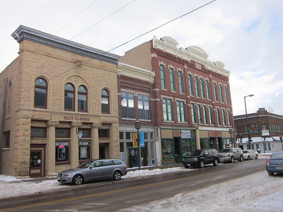
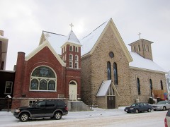
National Register reference number.94000648- the number the National Park Service assigned this property when it was listed, and the key its nomination file is catalogued under at the National Archives.
Fires near this property
14 since 1996
Regional context, not property-specific
evidence. The
federal wildfire occurrence database
lists 14 fires within 5 miles of Bridge Street Commercial Historic District
between 1996 and 2020, burning about 26 acres in total. None started naturally. 1 was recorded as arson.
Distance is straight-line from the map coordinates, so a fire counted
here may appear on a neighbouring settlement's page as well.
Reported cause
Fires
Missing data/not specified/undetermined
7
Debris and open burning
3
Equipment and vehicle use
2
Smoking
1
Arson/incendiarism
1
The most recent of
them, most recent first, with the day each was reported and the service
that recorded it.
Regional context, not property-specific
evidence. The federal mineral resources record lists
9 workings within 5 miles of Bridge Street Commercial Historic District: 5 producers, 2 past producers, 2 unknowns.
5 still produce. What was taken out: Sand and Gravel, Construction, Stone, Crushed/Broken. Distance is straight-line from the
map coordinates, so a quarry counted here may appear on a neighbouring
settlement's page as well.
Regional context, not property-specific
evidence. The National Weather Service names
Chippewa Falls, the town this property stands in, in 65 storm reports between 1995 and 2025: 28 thunderstorm wind, 26 hail, 6 lightning, 2 funnel cloud.
The reports record 1 injury. Each account below is quoted exactly as the forecast office
filed it, from the NOAA Storm Events Database, and each date
opens the federal record of that event.
Narrow swath of wind damage. Roofs blown off 4 barns. Several outbuildings down. Dozens of trees snapped. Windmill twisted. One man sustained minor injuries when his semi truck was blown into the path of another semi. Downburst wind per NWS damage survey.
Duncan Creek Campground, downstream from the dam, sustained some flood damage from the release of water at Tilden Mill Pond. Flood waters were high enough to reach some of the camper trailers and at least one unit camper was destroyed. It appeared to be a fifth wheel unit. No injuries were reported.
A late night tornado hit O'Neill Campground. Some trees fell on camper trailers and manufactured homes. Part of a metal roof was peeled off a large machine shed.
Trees were downed and buildings were damaged south of Chippewa Falls. Emergency management reported an intermittent path of downed trees and power lines from County Highway P and 40th Avenue just south of Chippewa Falls to 220th St. on the Sigel/Lafayette town line.
A HAM radio operator measured an 82 MPH gust from a strong rear flank downdraft that passed about three miles south of the tornado that tracked west of Tilden. A tin roof was ripped off an old house. A shed was downed and numerous trees were also downed.
Lightning hit a home on Bridgewater Avenue, causing an electrical meter to be blown off the wall. Information reported by the Chippewa Herald newspaper.
Lightning hit the RCU building on Bay Street. No damage was reported but most of downtown Chippewa Falls lost power for several hours. Information provided by Eau Claire Leader-Telegram newspaper.
Lightning struck three garages on Prentice Street. An electrical panel on one garage was destroyed, along with some siding. The second garage had a window blown out, and the third had its electrical panel blown off. Lightning struck a 70 foot spruce tree on W. Cedar St. in Chippewa Falls (time unknown), severely damaging the tree, along with blowing out a window on the home. Information partially provided by the Eau Claire Leader-Telegram and the Chippewa Herald Newspapers.
Numerous trees and power lines down, some on houses and vehicles. Boats and docks flipped on Lake Wissota (3 E Chippewa Falls). 70 mph wind measured in Stanley, where a tree fell through one house.
Heavy rain produced 1.71 inches from 2125 to 2150 in Chippewa Falls. NWS cooperative observers reported totals of 6.74 inches at Chippewa Falls and 4.27 inches at Stanley. Flooding was reported at a number of intersections in Chippewa Falls.
No historic map-sheet match is published
for this property yet. That does not mean no map exists. This record needs
a coordinate-quality review before it can be joined to a sheet boundary.
Browse the county's mapped places while that work is
pending.
Listed places nearby
6 within 8 miles
Other National Register properties close
enough to walk or drive between, ordered by distance from this one. Both
positions come from the same geocoding pass that matched these properties
to their map sheets.
Listing record. National Park Service National Register of Historic Places, listed-properties dataset, current to 2026-05-22.
Map join. Address geocoded through the United States Census geocoder, then tested against the published boundary of every sheet in the USGS Historical Topographic Map Collection.
How this page is made. Listing fields come from federal records; map-sheet coverage is a labelled coordinate-to-boundary calculation, not a source-field claim.
Wildfire. Short, Karen C. 2022. Spatial wildfire occurrence data for the United States, 1992-2020 [FPA_FOD_20221014]. 6th Edition. Fort Collins, CO: Forest Service Research Data Archive. https://doi.org/10.2737/RDS-2013-0009.6 Collected with United States Government funding and usable without additional permissions or fees.
Mines and quarries. USGS Mineral Resources Data System (MRDS) https://mrdata.usgs.gov/mrds/ A work of the United States government, no copyright under 17 U.S.C. 105.
Storms. NOAA National Centers for Environmental Information, Storm Events Database https://www.ncei.noaa.gov/stormevents/ A work of the United States government, no copyright under 17 U.S.C. 105. Narratives are quoted verbatim from the National Weather Service report and are not edited or summarised.
 Block