 Block
From the record
13 National Register listings published here.
Sources: the National Register database, National Park Service
56 topographic sheets cover 34 settlements here, and 13 properties are on the National Register of Historic Places.
13 National Register listings published here.
Sources: the National Register database, National Park Service
Every property in this county listed on the National Register of Historic Places, with the year it was listed and the federal nomination document.
| Photograph | Property | Type | Listed | Reference |
|---|---|---|---|---|
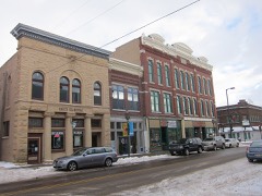 | Bridge Street Commercial Historic District | district | 1994 | 94000648 |
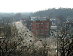 | Chippewa Shoe Manufacturing Company | building | 1994 | 94000133 |
 | Cook-Rutledge House | building | 1974 | 74000060 |
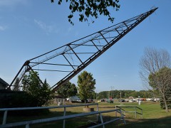 | Cornell Pulpwood Stacker | structure | 1993 | 93001425 |
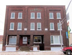 | Hotel Chippewa | building | 1994 | 94000598 |
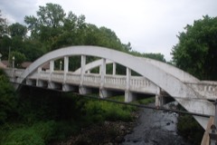 | Marsh Rainbow Arch Bridge | structure | 1982 | 82000642 |
 | McDonell High School | building | 1982 | 82001840 |
 | D. R. Moon Memorial Library | building | 1985 | 85003096 |
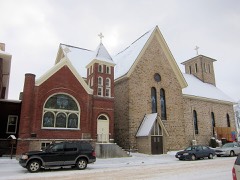 | Notre Dame Church and Goldsmith Memorial Chapel | building | 1983 | 83003369 |
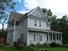 | L.I. Roe House | building | 1980 | 80000112 |
 | Sheeley House | building | 1985 | 85001949 |
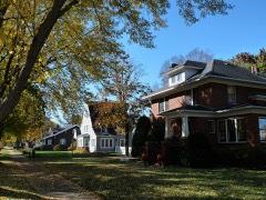 | West Hill Residential Historic District | district | 2021 | 100006503 |
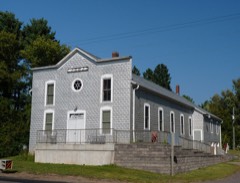 | Z. C. B. J. Hall | building | 1992 | 92000812 |
Every wildfire the federal occurrence database records inside this county: 500 of them, burning about 761 acres. 3 started naturally and 52 were recorded as arson. Each settlement page carries the fires within five miles of it.
| Reported cause | Fires |
|---|---|
| Debris and open burning | 177 |
| Missing data/not specified/undetermined | 99 |
| Equipment and vehicle use | 86 |
| Arson/incendiarism | 52 |
| Recreation and ceremony | 28 |
| Smoking | 18 |
| Other causes | 12 |
| Misuse of fire by a minor | 10 |
| Fireworks | 7 |
| Power generation/transmission/distribution | 6 |
| Natural | 3 |
| Railroad operations and maintenance | 2 |
The five largest, by the area the report gives. One of them was set deliberately.
| Date | Cause | Size | Reported by | Name on the report |
|---|---|---|---|---|
| 16 April 2009 | Equipment and vehicle use | 37 acres | Wisconsin Department of Natural Resources | SAMPSON FIRE |
| 5 October 2011 | Equipment and vehicle use | 28 acres | Wisconsin Department of Natural Resources | not named |
| 6 May 2016 | Equipment and vehicle use | 24 acres | Wisconsin Department of Natural Resources | SAUERKRAUT |
| 14 April 1997 | Debris and open burning | 18 acres | Wisconsin Department of Natural Resources | not named |
| 5 May 1993 | Arson/incendiarism | 18 acres | Wisconsin Department of Natural Resources | not named |
| 4 November 2020 | Missing data/not specified/undetermined | 16 acres | Wisconsin Department of Natural Resources | 20261 |
| 22 April 2004 | Debris and open burning | 16 acres | Wisconsin Department of Natural Resources | not named |
| 15 April 2004 | Missing data/not specified/undetermined | 15 acres | Wisconsin Department of Natural Resources | not named |
Every settlement page carries the fires within five miles of it - see the settlement index below.
The NOAA Storm Events Database holds 444 reports for this county, causing 6 deaths, 119 injuries and about $45,670,530 in recorded property damage. Each settlement page carries the reports that name it.
| Kind of event | Reports |
|---|---|
| Thunderstorm Wind | 224 |
| Hail | 144 |
| Tornado | 35 |
| Flash Flood | 18 |
| Lightning | 10 |
| Heavy Rain | 7 |
| Funnel Cloud | 4 |
| Flood | 2 |
The most serious of them, by death, then injury, then recorded damage. The accounts are quoted exactly as the forecast office filed them.
| When | Event | Place named | Harm | What the report says |
|---|---|---|---|---|
| June 1958 | Tornado (F4) | not stated | 3 killed, 50 hurt, $250,000 | no account filed |
| July 1977 | Tornado (F2) | not stated | 1 killed, 8 hurt, $2,500,000 | no account filed |
| July 1980 | Tornado (F2) | not stated | 1 killed, 5 hurt, $2,500,000 | no account filed |
| June 1987 | Thunderstorm Wind | not stated | 1 killed, 2 hurt | no account filed |
| July 1977 | Tornado (F4) | not stated | 20 hurt, $25,000,000 | no account filed |
| July 1995 | Thunderstorm Wind | Cadot | 10 hurt | Strong thunderstorm winds struck the Chippewa Valley Rock Fest, an outdoor rock festival located about 10 miles northeast of Chippewa Falls. Flying debris injured 10 people. The strong winds knocked over a beer tent and several large speaker towers. |
| July 1995 | Thunderstorm Wind | Cadot | 10 hurt | no account filed |
| September 2019 | Tornado (EF3) | Albertville | 3 hurt, $3,000,000 | This is the continuation track of the tornado in Dunn County that crossed 10th Street, south of 560th Avenue. As the tornado tracked northeast, the tornado intensified to an EF3 where considerable damage occurred near County Road X, or Highway 29, and 30th Street, or County Road M. The tornado crossed Highway 29, and move northeast until dissipating east of 50th Street, north of County Road X. ||Based on the NWS Storm Survey, the most significant damage occurred in Wheaton Township, or east of Elk Mound around the intersection of County Road M, and Highway 29. This area saw entire groves of trees leveled, some stripping of bark, and the destruction of several structures. The destruction of a metal building and two nearby homes were consistent with expected damage from winds of EF3 in strength.||The path length in Chippewa County was 4.7 miles, with a maximum width of 725 yards, or nearly a half mile wide. The maximum wind speed was near 150 mph.||There were three injuries with this tornado, but no fatalities. |
| June 1958 | Tornado (F3) | not stated | 3 hurt, $2,500,000 | no account filed |
| September 1971 | Tornado (F3) | not stated | 3 hurt, $250,000 | no account filed |
| June 2014 | Lightning | Cadott | 2 hurt | Two people sustained minor injuries from lightning while at the Cadott Country Fest. Both injuries occurred when people were leaning against camper trailers during a nearby lightning strike. One man had a minor burn on the hand and refused transport to a hospital. The other man had burns on his arm and was eventually transported to a hospital, then was released four hours later. |
| May 1996 | Thunderstorm Wind | Cadott | 1 hurt, $900,000 | no account filed |
| April 2002 | Thunderstorm Wind | Chippewa Falls | 1 hurt, $300,000 | Narrow swath of wind damage. Roofs blown off 4 barns. Several outbuildings down. Dozens of trees snapped. Windmill twisted. One man sustained minor injuries when his semi truck was blown into the path of another semi. Downburst wind per NWS damage survey. |
| August 1977 | Tornado | not stated | 1 hurt, $2,500 | no account filed |
| May 1953 | Tornado (F4) | not stated | $2,500,000 | no account filed |
| September 2016 | Flash Flood | Albertville | $882,000 | Widespread flash flooding occurred across southern Chippewa County due to extreme rainfall rates, and amounts of 5 to 8 inches fell in less than 6 hours. A 50 foot section of railroad was damaged near Stanley, and there was minor damage to 12 businesses and homes, and 3 more with major damage. Total damages were estimated at $400,000 in the private section, $100,000 in railroad expenses, and $382,000 in roads, bridges and trails infrastructure. |
| May 1996 | Thunderstorm Wind | New Auburn | $800,000 | no account filed |
| June 2001 | Thunderstorm Wind | Bloomer | $600,000 | Several barns and silos down, few garages and sheds destroyed, minor house damage, many hundreds of trees down in a swath several miles wide. About 80 roads were blocked by fallen trees. Damage figure includes totals from all storms in Chippewa County from 1735 to 1850. |
| May 2012 | Thunderstorm Wind | (Eau)Eau Claire Arpt | $500,000 | Numerous trees were uprooted in the Village of Lake Hallie, or northeast of Eau Claire airport. In addition, several of the trees landed on houses and blocked roads, near 20th to 35th Avenue, and along 115th to 130th Street. Several of the trees had bases up to 3 feet in diameter, which caused damage to buildings, flipped over a recreational vehicle, and caused multiple power lines and poles to blow down in Chippewa Falls, Wisconsin. |
| May 2001 | Thunderstorm Wind | Bloomer | $500,000 | Roof blown off Moose Lodge, numerous trees and power lines down. |
| May 1985 | Tornado (F1) | not stated | $250,000 | no account filed |
| June 1984 | Tornado (F2) | not stated | $250,000 | no account filed |
| September 1982 | Tornado (F1) | not stated | $250,000 | no account filed |
| June 1979 | Tornado (F1) | not stated | $250,000 | no account filed |
| August 1967 | Tornado (F1) | not stated | $250,000 | no account filed |
| July 2005 | Thunderstorm Wind | Countywide | $125,000 | Extensive tree and power line damage was reported countywide. At Chippewa Valley Regional Airport a large hangar door was ripped off and planes suffered minor damage. A car window was broken and the side of a hangar was dented by flying debris and/or hail. In Halle 10 orchard trees were damaged. In Cornell the center of three silos was blown down onto a 100 foot barn. A nearby milk house and calf barn were also demolished by the high wind. In Eagleton a corn field was flattened and an Oak tree was uprooted. |
| April 2019 | Flash Flood | Chippewa Falls | $100,000 | Duncan Creek Campground, downstream from the dam, sustained some flood damage from the release of water at Tilden Mill Pond. Flood waters were high enough to reach some of the camper trailers and at least one unit camper was destroyed. It appeared to be a fifth wheel unit. No injuries were reported. |
| July 2015 | Thunderstorm Wind | Stanley | $100,000 | Several trees were toppled in Stanley along with power lines blown down. Portions of the city had no power for several hours. Several of the trees landed on homes and caused some damage to roofs. |
| May 2012 | Thunderstorm Wind | (Eau)Eau Claire Arpt | $100,000 | An airport hangar at the Chippewa Valley Regional Airport was destroyed by severe straight line winds. In addition, several large trees, up to 12 inches in diameter, were blown down near the north side of the airport. |
| June 2008 | Lightning | Chippewa Falls | $100,000 | Lightning struck a home and started a fire, according to fire department investigators. The house burned to an empty shell. |
| August 2007 | Lightning | Cornell | $100,000 | Lightning struck a home, which burned. The home was determined to be a near total loss. |
| July 1997 | Thunderstorm Wind | Cadott | $80,000 | Roof of dairy barn torn off, killing two cows and injuring a dozen other cows. Crops also damaged. |
| May 2017 | Lightning | Bateman | $60,000 | Chippewa Falls fire crews said that a lightning strike caused $60,000 worth of damage to a home in the Town of Lafayette Monday afternoon. |
| July 2023 | Thunderstorm Wind | Cornell | $50,000 | The emergency manager reported that the storm caused scattered trees down across nearly a one mile swath from the northwest side of Cornell. Some trees fell on houses and vehicles. A gazebo was also damaged, several garage doors buckled, and some shingles damaged. |
| August 2013 | Thunderstorm Wind | Boyd | $50,000 | Two barns had roof damage, plus several large trees were blown down northwest of Boyd, Wisconsin. |
| May 2012 | Thunderstorm Wind | (Eau)Eau Claire Arpt | $50,000 | Several trees and power lines down were blown down from near Highway T and 30th Avenue, northeast to 50th Avenue. In addition, a large barn collapsed near County Hwy T and 30th Avenue. |
| September 2002 | Flash Flood | North Portion | $50,000 | Four to seven inches of rain within a few hours resulted in water out of several creeks and over a number of roads. A street and culvert were washed out in New Auburn, with one or two homes flooded. |
| August 2001 | Flash Flood | Countywide | $50,000 | no account filed |
| June 1998 | Thunderstorm Wind | Cadott | $40,000 | Pop-up campers destroyed at local music festival. |
| September 2019 | Thunderstorm Wind | Chippewa Falls | $25,000 | Several trees were blown down across 40th Avenue in Chippewa Falls. Some damage to homes also occurred. |
| July 2017 | Flash Flood | Bateman | $25,000 | The approach on both sides of a bridge were taken out early this morning due to heavy rain. The location was on 20th Avenue approximately .8 miles east of County Hwy K in the Town of Lafayette, Chippewa County. The area reportedly received about three inches of rain overnight. The township also had shoulder damage at County Hwy J and 190th Street. |
| July 2016 | Tornado (EF0) | Chippewa Falls | $25,000 | A late night tornado hit O'Neill Campground. Some trees fell on camper trailers and manufactured homes. Part of a metal roof was peeled off a large machine shed. |
| September 2015 | Flash Flood | Bloomer | $25,000 | Several reports on media and on social media had significant flooding along the Como Creek, near Bloomer. It closed parts of Highway 40, along the creek, west of Bloomer for several hours in the morning. In addition, a social media picture had street flooding on Duncan Creek in the town of Bloomer. The flood waters also had covered up Bloomer High School practice football field, a baseball field and the old playground for elementary school. |
| August 2013 | Tornado (EF0) | Bateman | $25,000 | A storm chaser videotaped a tornado touching down just northwest of Cadott. It touched down about one mile west of the intersection of County Highway O and XX and traveled just south of County O, dissipating as it reached County XX. One barn was heavily damaged and had to be torn down. An unused old barn was also heavily damaged. Tree damage was also noted. |
| July 2010 | Thunderstorm Wind | Holcombe | $25,000 | Numerous trees were blown down around Holcombe, Wisconsin. Some trees were very large in diameter, while others were snapped off three to four feet from their bases. |
| July 2009 | Hail | Norma | $25,000 | The local emergency manager reported that minor car damage occurred with the larger hail stones approximately five miles north of Chippewa Falls. In addition, a local pizza place observed quarter size hail from the same storm. |
| May 1989 | Tornado (F0) | not stated | $25,000 | no account filed |
| September 1982 | Tornado (F1) | not stated | $25,000 | no account filed |
| July 1981 | Tornado (F1) | not stated | $25,000 | no account filed |
| June 1976 | Tornado (F1) | not stated | $25,000 | no account filed |
| June 1971 | Tornado (F1) | not stated | $25,000 | no account filed |
| July 2011 | Thunderstorm Wind | (Eau)Eau Claire Arpt | $15,000 | Several trees and a roof were damaged in the town of Wheaton, Wisconsin, or west of Chippewa Falls, Wisconsin. |
| September 2010 | Lightning | Norma | $15,000 | A residence in the Chippewa County town of Eagle Point, north of Chippewa Falls, Wisconsin, was damaged after lightning caused a fire. |
| May 2013 | Thunderstorm Wind | Bateman | $10,000 | A large tree fell on a home and caused significant damage to the roof and electronic gear on the upper floor. |
| August 1999 | Flood | Cadott | $10,000 | Water over County Roads X and H near Stanley. Culvert on 67th Avenue near Cadott washed out leading to washout of road. Fifteen foot wide and deep crater formed from washout. Citizen's 1985 Chevrolet Celebrity destroyed when road collapsed. |
| September 1995 | Tornado (F0) | Boyd | $10,000 | Barn destroyed and machine shed damaged. Trees were also damaged. |
| July 2011 | Thunderstorm Wind | Stanley | $5,000 | A roof was damaged due to straight line winds. In addition, a few large trees were uprooted in Fandry Park, on the west side of town. |
| June 2005 | Flash Flood | Countywide | $5,000 | County Road OO was washed out just west of County Road K in Lafayette Township about 6 miles southeast of Chippewa Falls. County Road OO had water flowing over the roadway just east of County Road P about 4 miles south of Chippewa Falls. Water flowed over County Road F two miles north of Highway 29 about 5 miles west of Chippewa Falls. On the west side of Chippewa Falls three vehicles became stranded in flood waters under a railroad overpass on Highway 29. |
| June 2021 | Thunderstorm Wind | Holcombe | $3,000 | A few large trees were blown down or uprooted around Holcombe. |
| July 1980 | Tornado (F1) | not stated | $2,500 | no account filed |
The Survey's mineral resources record lists 39 workings inside this county. 27 still produce and 12 are closed or unrecorded. Each settlement page carries the workings within five miles of it.
| Commodity | Workings |
|---|---|
| Sand and Gravel, Construction | 38 |
| Stone, Crushed/Broken | 1 |
The least common of them first, because a county's hundredth gravel pit says nothing its first ten did not.
| Where | Site | Commodity | Status | Recorded |
|---|---|---|---|---|
| Golden Creek Sandstone Quarry | Stone, Crushed/Broken | Past Producer | ||
| 5th 124 Pit | Sand and Gravel, Construction | Producer | ||
| A.E. Stelter Pit | Sand and Gravel, Construction | Producer | ||
| Bloomer Pit | Sand and Gravel, Construction | Unknown | ||
| Bloomer Sand and Gravel | Sand and Gravel, Construction | Producer | ||
| Browns Pit | Sand and Gravel, Construction | Past Producer | ||
| Chippewa County Operations | Sand and Gravel, Construction | Producer | ||
| Chippewa County Operations | Sand and Gravel, Construction | Producer | ||
| Chippewa County Operations | Sand and Gravel, Construction | Producer | ||
| Chippewa County Operations | Sand and Gravel, Construction | Unknown | ||
| Chippewa Cty. Hwy. Dept. Pit | Sand and Gravel, Construction | Unknown | ||
| Churchill Pit | Sand and Gravel, Construction | Producer | ||
| Colony Pit | Sand and Gravel, Construction | Producer | ||
| Cornell Wood Products Pit | Sand and Gravel, Construction | Producer | ||
| Crank Pit | Sand and Gravel, Construction | Producer | ||
| Custer Pit | Sand and Gravel, Construction | Producer | ||
| Derks Pit | Sand and Gravel, Construction | Producer | ||
| Geist Pit | Sand and Gravel, Construction | Producer | ||
| George Bruyette Pit | Sand and Gravel, Construction | Producer | ||
| Hallie Pit | Sand and Gravel, Construction | Producer | ||
| Hazuga Pit | Sand and Gravel, Construction | Past Producer | ||
| J. Dresel Pit | Sand and Gravel, Construction | Producer | ||
| Koch Pit | Sand and Gravel, Construction | Producer | ||
| Lake Pit | Sand and Gravel, Construction | Producer | ||
| Lane Pit | Sand and Gravel, Construction | Producer | ||
| Lohdal Pit | Sand and Gravel, Construction | Past Producer | ||
| Northern Gravel Company Pit | Sand and Gravel, Construction | Producer | ||
| P & B Excavating Pit | Sand and Gravel, Construction | Producer | ||
| Perrenoud Pit | Sand and Gravel, Construction | Producer | ||
| Peterson Pit | Sand and Gravel, Construction | Past Producer | ||
| Petrie Pit | Sand and Gravel, Construction | Past Producer | ||
| Pit #7 | Sand and Gravel, Construction | Past Producer | ||
| Plant No. 2 | Sand and Gravel, Construction | Producer | ||
| Psd Sand & Gravel Pit | Sand and Gravel, Construction | Unknown | ||
| Quinn Pit | Sand and Gravel, Construction | Producer | ||
| Stamper Pit | Sand and Gravel, Construction | Producer | ||
| T Pit Menard Pit | Sand and Gravel, Construction | Unknown | ||
| Toutant Pit | Sand and Gravel, Construction | Producer | ||
| Vaora Pit | Sand and Gravel, Construction | Producer |
Named settlements recorded in the Geographic Names Information System, each with the topographic sheets covering it. Villages, hamlets and abandoned places alike. Each is shown with the nearest named watercourse or landform and the survey quadrangle it falls on.
Chippewa Falls city · 54729 · On Duncan Creek · Chippewa Falls quadrangle
15 sheets, 1934 to 1985
Chippewa Falls city · 54729 · Near Gravel Island · Chippewa Falls quadrangle
15 sheets, 1934 to 1985
Lafayette town · 54729 · On Stillson Creek · Lake Wissota quadrangle
14 sheets, 1934 to 1985
Wheaton town · 54739 · On Big Elk Creek · Colfax South quadrangle
13 sheets, 1934 to 1985