 Block
From the record
19 National Register listings published here.
Sources: the National Register database, National Park Service
64 topographic sheets cover 22 settlements here, and 19 properties are on the National Register of Historic Places.
19 National Register listings published here.
Sources: the National Register database, National Park Service
Every property in this county listed on the National Register of Historic Places, with the year it was listed and the federal nomination document.
| Photograph | Property | Type | Listed | Reference |
|---|---|---|---|---|
| Braehead Ranch | district | 1995 | 95001074 | |
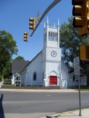 | Christ Episcopal Church and Rectory | building | 1980 | 80004046 |
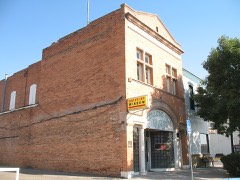 | College Inn Bar | building | 1979 | 79002608 |
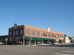 | Commerce Block | building | 2005 | 04001548 |
| Dorr Ranch | district | 2014 | 14001080 | |
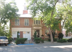 | Douglas City Hall | building | 1994 | 94000167 |
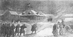 | Fort Fetterman | site | 1969 | 69000187 |
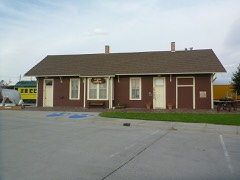 | Fremont, Elkhorn & Missouri Valley Railroad Passenger Depot | building | 1994 | 94000741 |
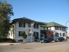 | Hotel Higgins | building | 1983 | 83004280 |
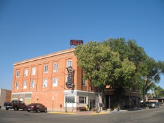 | Hotel LaBonte | building | 2008 | 08001003 |
| Huxtable Ranch Headquarters District | district | 2011 | 10001172 | |
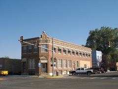 | Jenne Block | building | 1998 | 97001600 |
| La Prele Work Center | district | 1994 | 94000272 | |
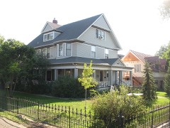 | Morton Mansion | building | 2001 | 00001644 |
| North Douglas Historic District | district | 2002 | 00001470 | |
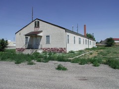 | Officer's Club, Douglas Prisoner of War | building | 2001 | 01000965 |
| Old Douglas Armory | building | 2022 | 100007532 | |
| South Douglas Residential Historic District | district | 2023 | 100008516 | |
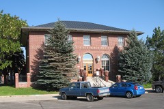 | US Post Office-Douglas Main | building | 1987 | 87000781 |
Every wildfire the federal occurrence database records inside this county: 729 of them, burning about 222,574 acres. 410 started naturally and 4 were recorded as arson. Each settlement page carries the fires within five miles of it.
| Reported cause | Fires |
|---|---|
| Natural | 410 |
| Missing data/not specified/undetermined | 191 |
| Railroad operations and maintenance | 44 |
| Equipment and vehicle use | 31 |
| Debris and open burning | 12 |
| Power generation/transmission/distribution | 10 |
| Smoking | 9 |
| Misuse of fire by a minor | 8 |
| Recreation and ceremony | 7 |
| Arson/incendiarism | 4 |
| Fireworks | 3 |
The five largest, by the area the report gives. None of them was recorded as arson.
| Date | Cause | Size | Reported by | Name on the report |
|---|---|---|---|---|
| 4 September 1996 | Natural | 53,930 acres | Casper Field Office | BONER |
| 4 October 2010 | Equipment and vehicle use | 25,093 acres | Casper Field Office | ORPHA |
| 7 June 2002 | Natural | 14,855 acres | Medicine Bow-Routt National Forests, Thunder Basin National Grassland | HENSEL |
| 16 July 2006 | Natural | 11,083 acres | Casper Field Office | TWENTY MILE |
| 10 August 2000 | Natural | 11,042 acres | Casper Field Office | ORMSBY |
| 4 November 1999 | Equipment and vehicle use | 10,000 acres | Medicine Bow-Routt National Forests, Thunder Basin National Grassland | ANTELOPE |
| 4 September 1996 | Natural | 9,500 acres | Medicine Bow-Routt National Forests, Thunder Basin National Grassland | HENRY'S |
| 9 September 2010 | Missing data/not specified/undetermined | 9,248 acres | Converse County | WILLOW CREEK |
Every settlement page carries the fires within five miles of it - see the settlement index below.
The NOAA Storm Events Database holds 266 reports for this county, causing no deaths, 6 injuries and about $182,090 in recorded property damage. Each settlement page carries the reports that name it.
| Kind of event | Reports |
|---|---|
| Hail | 160 |
| Thunderstorm Wind | 51 |
| Tornado | 47 |
| Flash Flood | 5 |
| Funnel Cloud | 2 |
| Lightning | 1 |
The most serious of them, by death, then injury, then recorded damage. The accounts are quoted exactly as the forecast office filed them.
| When | Event | Place named | Harm | What the report says |
|---|---|---|---|---|
| June 1982 | Tornado (F1) | not stated | 3 hurt, $25,000 | no account filed |
| June 1982 | Tornado (F2) | not stated | 1 hurt, $25,000 | no account filed |
| June 1965 | Tornado (F1) | not stated | 1 hurt, $25,000 | no account filed |
| August 1989 | Hail | not stated | 1 hurt | no account filed |
| August 1996 | Hail | Douglas | $30,000 | no account filed |
| June 1984 | Tornado (F1) | not stated | $25,000 | no account filed |
| July 2009 | Hail | Douglas | $15,000 | Strong wind gusts also reported in Douglas with some trees damaged or down. Some car windows broken. |
| March 2019 | Flash Flood | Bill | $10,000 | An earthen dam near the Fiddle Back Ranch failed causing the release of water that washed out the nearby intersection of Dull Center and Lynch Road. The released water eventually made it downstream into the Cheyenne River causing the level to rise to the top of the river bank. |
| July 1998 | Hail | Douglas | $7,000 | A storm produced golfball to base ball size hail, which covered the ground, on several ranches 40 miles northwest of Douglas. |
| June 1999 | Thunderstorm Wind | Douglas | $5,000 | High winds blew a barn roof over 100 yards 2 miles west of Douglas, WY |
| July 1998 | Hail | Bill | $4,000 | A storm produced golfball size hail 7 miles east of Bill. |
| June 1984 | Tornado (F0) | not stated | $2,500 | no account filed |
| May 1977 | Tornado (F1) | not stated | $2,500 | no account filed |
| July 1998 | Flash Flood | Douglas | $2,000 | A storm produced up to 6 inches of rainfall from 50 miles northwest of Douglas to 30 miles north of Douglas. Water covered many rural roads in the area. |
| August 1997 | Hail | Glenrock | $2,000 | A few golfball size hailstones accompanied a large amount of pea size stones. |
| August 1997 | Hail | Glenrock | $2,000 | no account filed |
| June 1982 | Tornado (F0) | not stated | $30 | no account filed |
| June 1977 | Tornado (F1) | not stated | $30 | no account filed |
| July 1955 | Tornado | not stated | $30 | no account filed |
| July 2025 | Thunderstorm Wind | Birkner Hill | - | Mesonet station PC602 Glen Rock Rolling Hills recorded severe wind gust. |
| July 2025 | Thunderstorm Wind | (Dgw)Converse County Airport | - | ASOS station KDGW Douglas Airport gusted with a passing thunderstorm. |
| July 2025 | Thunderstorm Wind | Bill | - | Upper Missouri River Basin Station at Bill 8NE recorded severe wind gust. |
| July 2025 | Hail | Lost Springs | - | Spotter reports quarter size hail. |
| June 2025 | Hail | (Dgw)Converse County Airport | - | Public reports quarter size hail. |
| June 2025 | Hail | Douglas | - | Public reports quarter size hail. |
| June 2025 | Hail | Clayton | - | Time estimated via radar. Emergency manager reports golf ball size hail. |
| June 2025 | Tornado (EFU) | Clayton | - | Photos and video confirmed a landspout near the power plant at Glenrock. No damage was reported. |
| July 2024 | Thunderstorm Wind | (Dgw)Converse County Airport | - | Douglas Airport ASOS station (KDGW) measure wind gust. |
| April 2023 | Thunderstorm Wind | Glenrock | - | Multiple WYDOT observations near the Converse/Natrona County line recorded thunderstorm wind gusts 55-65 MPH. |
| June 2023 | Hail | Bill | - | Half-dollar sized hail was reported by a trained spotter located approximately 10 miles north of Bill. |
| May 2023 | Hail | Douglas | - | The public reported quarter sized hail in the city of Douglas. |
| May 2023 | Thunderstorm Wind | (Dgw)Converse County Airport | - | Douglas Airport ASOS station (KDGW) measured peak wind gust. |
| May 2023 | Hail | Douglas | - | Received report of dime to penny size hail. |
| July 2023 | Thunderstorm Wind | (Dgw)Converse County Airport | - | Douglas Airport ASOS station (KDGW) measured wind gust. |
| July 2023 | Thunderstorm Wind | (Dgw)Converse County Airport | - | Douglas Airport ASOS station (KDGW) measured wind gust. |
| July 2023 | Hail | Bill | - | Public reported golfball sized hail in and around Bill. |
| July 2023 | Hail | Bill | - | Social media report of 1 inch hail and damage to trees, plants and a broken window. |
| July 2023 | Thunderstorm Wind | Glenrock | - | WYDOT mesonet station Deer Creek (KDRC) along Interstate 25 measured maximum wind gust. |
| July 2023 | Thunderstorm Wind | Irvine | - | CWOP mesonet station EW6313 south of Douglas reported maximum wind gust. |
| July 2023 | Thunderstorm Wind | (Dgw)Converse County Airport | - | Douglas Airport ASOS station KDGW measured maximum wind gust. |
| July 2023 | Thunderstorm Wind | Bill | - | Spotter estimated 50 to 60 mph wind gusts. |
| July 2023 | Hail | Glenrock | - | From Glenrock Police Department. Hail ranged from quarters to half dollar size. |
| July 2023 | Hail | Glenrock | - | Twitter picture with a lot of hail stones. Largest were quarter size. |
| June 2023 | Hail | Bill | - | The public measured hail up to 2.5 inches in diameter 16 miles SSE of Bill. |
| June 2023 | Hail | Esterbrook | - | Public reported on social media a video of hail ranging from dimes to quarters. |
| June 2023 | Hail | Bill | - | The public measured hail up to 2.5 inches in diameter 12 miles SSE of Bill. |
| September 2023 | Hail | Douglas | - | The public reported ping-pong ball sized hail 2 miles S of Douglas. Received via mPING. |
| September 2023 | Hail | Douglas | - | Half dollar sized hail reported 4 miles WSW of Douglas. Minor roof damage reported. |
| September 2023 | Hail | Douglas | - | Golf ball sized hail was reported in Douglas. |
| September 2023 | Hail | Douglas | - | The public reported half dollar sized hail 4 miles W of Douglas. Received via mPING. |
| September 2023 | Hail | Lost Springs | - | A trained spotter reported nickel to quarter sized hail in Lost Springs. |
| June 2023 | Tornado (EFU) | Ross | - | The public reported a tornado near the Converse and Natrona County line approximately 33 miles WNW of Bill. |
| August 2022 | Hail | Bill | - | Received video on social media of ping pong to golf ball size hail with accumulating hail along State Highway 59 south of Bill. |
| May 2021 | Thunderstorm Wind | (Dgw)Converse County Airport | - | Thunderstorm winds measured at Douglas, Converse County Airport. |
| August 2021 | Hail | Douglas | - | Report of penny sized hail received from mPING. |
| May 2020 | Hail | Douglas | - | Observer reported hail via mPING. |
| May 2020 | Hail | Douglas | - | Observer reported hail via mPING. |
| May 2020 | Hail | Orpha | - | Observer reported hail via mPING. |
| May 2020 | Hail | Douglas | - | Observer reported hail via Twitter. |
| June 2020 | Thunderstorm Wind | Glenrock | - | WYDOT mesonet station KDRC - Deer Creek along I-25 reported wind gust. |
The Survey's mineral resources record lists 298 workings inside this county. 36 still produce and 262 are closed or unrecorded. Each settlement page carries the workings within five miles of it.
| Commodity | Workings |
|---|---|
| Uranium | 216 |
| Sand and Gravel, Construction | 17 |
| Copper | 13 |
| Gypsum-Anhydrite | 13 |
| Vermiculite | 7 |
| Iron | 6 |
| Tungsten | 5 |
| Vanadium | 2 |
| Molybdenum | 2 |
| Copper, Zinc | 2 |
| Asbestos | 2 |
| Sodium Carbonate, Sodium Sulfate | 2 |
| Selenium | 1 |
| Uranium, Selenium | 1 |
The least common of them first, because a county's hundredth gravel pit says nothing its first ten did not.
| Where | Site | Commodity | Status | Recorded |
|---|---|---|---|---|
| Deer Creek Canyon Chromite | Magnesite, Silica, Aluminum, Calcium, Chromium, Iron | Past Producer | 1908 | |
| Drill Hole #1 | Uranium, Selenium | Occurrence | Uraninite | |
| Drill Hole #1 Prospect | Uranium, Selenium | Occurrence | Uraninite | |
| Esterbrook Mine | Silver, Calcium, Lead | Past Producer | ||
| Eureka Prospect-Esterbrook Area | Copper, Gold, Lead | Prospect | ||
| Glenrock No. 2 | Titanium, Coal | Past Producer | ||
| Jasper Mine | Bismuth | Occurrence | Garnet, Lepidolite, Mica | |
| Koch asbestos and vermiculite prospect | Asbestos, Vermiculite | Occurrence | Asbestos, Chrysotile, Vermiculite | |
| Kreisley Deposit | Pumice | Prospect | ||
| Maverick Claim | Pyrite | Prospect | ||
| Mcgee Claim | Sulfur, Copper, Zinc | Prospect | ||
| Mormon Canyon | Garnet, Tungsten | Prospect | ||
| Olin Brothers Property | Fluorine-Fluorite | Occurrence | ||
| Sodak Uranium and Mining Co. | Uranium, Manganese | Producer | Stratabound | |
| Tenderfoot Group | Gold, Copper, Zinc | Prospect | ||
| Three Cripples Mine | Nickel, Gold, Copper | Prospect | ||
| Unknown | Stone | Occurrence | ||
| Unknown | Sodium Sulfate, Sodium Carbonate | Occurrence | ||
| Unknown | Chromium | Unknown | ||
| Unknown | Beryllium | Occurrence | ||
| 3 - 10 Mine | Uranium, Vanadium | Past Producer | 1950, 1979 | |
| Monument Hill District | Uranium, Vanadium | Past Producer | 1952, 1953, 1965 | |
| Mormon Canyon | Molybdenum | Occurrence | Molybdenite, Powellite, Scheelite | |
| Stardust Claim | Asbestos, Vermiculite | Occurrence | ||
| Trail Creek Mine | Uranium, Molybdenum | Occurrence | Erythrite, Molybdenite, Uraninite | |
| Unknown | Asbestos | Occurrence | ||
| Unknown | Sodium Carbonate, Sodium Sulfate | Occurrence | ||
| Unknown | Sodium Carbonate, Sodium Sulfate | Occurrence | ||
| Brantford | Tungsten | Unknown | ||
| Brantford Mormon Canyon | Tungsten | Occurrence | Scheelite | |
| Key Claims Mine | Tungsten | Past Producer | ||
| Unknown | Tungsten | Occurrence | ||
| American Mining Co. Property | Iron | Prospect | ||
| Cold Spring-Crazy Horse Creek | Iron | Occurrence | 1900 | |
| Kreisley Deposit Prospect | Iron | Occurrence | Pyrrhotite | |
| Olin Brothers Property | Iron | Occurrence | Hematite | |
| Sheep Mountain | Iron | Occurrence | ||
| Unidentified Prospect | Iron | Occurrence | Hematite | |
| Badger Prospect | Vermiculite | Occurrence | ||
| Beach Prospect | Vermiculite | Occurrence | ||
| Lucky Lode Claim | Vermiculite | Occurrence | ||
| Mccoun,Wells,And Rhoads Deposit | Vermiculite | Occurrence | ||
| Smith Deposit | Vermiculite | Occurrence | ||
| Smith Deposit | Vermiculite | Occurrence | ||
| Copper King Mine | Copper | Past Producer | Chalcopyrite | |
| Cottonwood Creek Prospects | Copper | Occurrence | ||
| French Joe Prospect | Copper | Prospect | Malachite, Azurite | |
| Hoosier Boy Group | Copper | Prospect | ||
| Jasper Mine | Copper | Occurrence | ||
| Kentucky Bell Prospect | Copper | Occurrence | Chalcocite, Chalcopyrite | |
| Maverick Group | Copper | Prospect | ||
| None | Gypsum-Anhydrite | Occurrence | ||
| Oriole Mine | Copper | Past Producer | Chalcopyrite | |
| Perry Claim | Copper | Occurrence | ||
| Saul's Camp | Copper | Past Producer | ||
| Snowbird Group | Copper | Prospect | ||
| Swede Boy Mine | Copper | Past Producer | ||
| Unknow | Gypsum-Anhydrite | Occurrence | ||
| Unknown | Gypsum-Anhydrite | Occurrence | ||
| Unknown | Gypsum-Anhydrite | Occurrence | ||
| Unknown | Gypsum-Anhydrite | Occurrence | ||
| Unknown | Gypsum-Anhydrite | Occurrence | ||
| Unknown | Gypsum-Anhydrite | Occurrence | ||
| Unknown | Gypsum-Anhydrite | Occurrence | ||
| Unknown | Gypsum-Anhydrite | Occurrence | ||
| Unknown | Gypsum-Anhydrite | Occurrence | ||
| Unknown | Gypsum-Anhydrite | Occurrence | ||
| Unknown | Gypsum-Anhydrite | Occurrence | ||
| Unknown | Gypsum-Anhydrite | Occurrence | ||
| Abbott Sand & Gravel Pit | Sand and Gravel, Construction | Producer | ||
| Anderson Pit | Sand and Gravel, Construction | Producer | ||
| Barkdoll Pit #1 | Sand and Gravel, Construction | Producer | ||
| Brubaker Pit | Sand and Gravel, Construction | Producer | ||
| Carmen Pit | Sand and Gravel, Construction | Producer | ||
| Forbis Pit | Sand and Gravel, Construction | Producer | ||
| Fort Fetterman Pit | Sand and Gravel, Construction | Producer | ||
| Irvine Pit | Sand and Gravel, Construction | Producer | ||
| Le Bar Gravel Pit | Sand and Gravel, Construction | Producer | ||
| Lisco Pit | Sand and Gravel, Construction | Producer | ||
| Minter Sand and Gravel Pit | Sand and Gravel, Construction | Producer | ||
| Orin Junction Pit | Sand and Gravel, Construction | Producer | ||
| Pittman Pit | Sand and Gravel, Construction | Producer | ||
| Recluse Pit | Sand and Gravel, Construction | Producer | ||
| Thatcher and Sons Inc | Sand and Gravel, Construction | Producer | ||
| Valentine Pit | Sand and Gravel, Construction | Producer | ||
| Wintermote Pit | Sand and Gravel, Construction | Producer | ||
| Ace #1 Claim | Uranium | Prospect | ||
| Albert Sims Fee Land | Uranium | Prospect | ||
| Allemand Ross | Uranium | Prospect | Roll-front | |
| Anomaly #12 - Kerr Mcgee | Uranium | Occurrence | ||
| Anomaly #38 - Kerr Mcgee | Uranium | Occurrence | ||
| Anomaly #41- Kerr Mcgee | Uranium | Occurrence | ||
| Anomaly #74 - Kerr Mcgee | Uranium | Producer | ||
| Anomaly 43 - Kerr Mcgee | Uranium | Occurrence | ||
| Badger Group | Uranium | Prospect | ||
| Bear Creek | Uranium | Past Producer | 1977 | |
| Betty Lou Group | Uranium | Past Producer | ||
| Betzer Lease | Uranium | Past Producer | ||
| Bill Smith Mine | Uranium | Producer | 1968 | |
| Bill Smith Mine | Uranium | Producer | ||
| Birthday | Uranium | Occurrence | ||
| Bob Cat Claims | Uranium | Prospect | ||
| Bountiful & Spook | Uranium | Past Producer | ||
| Box Claims | Uranium | Past Producer | Stratabound | |
| Box Elder Area | Uranium | Occurrence | ||
| Boyles Pit | Uranium | Occurrence | ||
| Buffalo Shaft | Uranium | Past Producer | Underground | |
| Cactus 4 Claim | Uranium | Past Producer | ||
| Cannon Ball No. 1 | Uranium | Past Producer | ||
| Cannonball No. 10 | Uranium | Occurrence | ||
| Converse County Mine | Uranium | Past Producer | ||
| D-10 Mine | Uranium | Producer | ||
| D-15 Claim | Uranium | Occurrence | Tyuyamunite | |
| D-7 Mine | Uranium | Producer | Stratabound | |
| D-7 Mine | Uranium | Past Producer | ||
| D-85 Mine | Uranium | Past Producer | ||
| D-86 | Uranium | Past Producer | ||
| D-9 Claim | Uranium | Occurrence | Uranophane | |
| D-9 Mine | Uranium | Past Producer | ||
| Dad #17 | Uranium | Prospect | ||
| Dakota-Wyoming Uranium | Uranium | Occurrence | Stratabound | |
| Dead Cow Mine | Uranium | Occurrence | ||
| Denver Mine | Uranium | Past Producer | ||
| Dove | Uranium | Past Producer | ||
| Everett Simon & Joe Keenan Nos.1&2 | Uranium | Occurrence | ||
| Exxon Mill | Uranium | Unknown | ||
| Faith #2 and #3 | Uranium | Prospect | ||
| Fly Group | Uranium | Past Producer | Stratabound | |
| Fox #8 and #10 | Uranium | Occurrence | ||
| Golden Eagle Mine | Uranium | Past Producer | ||
| Great Pine Ridge | Uranium | Unknown | ||
| Hardy | Uranium | Past Producer | ||
| Hardy 1 | Uranium | Past Producer | ||
| Hardy 1 Sec 28 | Uranium | Past Producer | ||
| Hardy Fee Land | Uranium | Occurrence | Stratabound | |
| Hardy Fee Mine | Uranium | Occurrence | ||
| Hardy Lease | Uranium | Past Producer | ||
| Hardy Lease | Uranium | Past Producer | ||
| Hazenville Prospects | Uranium | Prospect | ||
| Henry Reese Fee Land | Uranium | Occurrence | ||
| Highland Flats - Box Creek District | Uranium | Past Producer | Coffinite, Uraninite, Tyuyamunite, Carnotite | |
| Highland Mill | Uranium | Producer | ||
| Highland Uranium Operation | Uranium | Past Producer | 1968 | |
| Horbuckle Ranch | Uranium | Occurrence | Stratabound | |
| Hornbuckle Ranch | Uranium | Occurrence | ||
| Horseshoe Creek | Uranium | Occurrence | ||
| J.B. #1 | Uranium | Occurrence | Uranophane | |
| J.B.No.1 | Uranium | Prospect | ||
| Jack Stany Claims | Uranium | Past Producer | ||
| Jackalope Mine | Uranium | Prospect | ||
| Jackalope No. 13 Claim | Uranium | Prospect | ||
| Jan Claims 1-5 | Uranium | Prospect | ||
| Jenkins and Hand Area 1 | Uranium | Occurrence | ||
| Jenkins and Hand Area 2 | Uranium | Occurrence | Stratabound | |
| Jenkins and Hand Area 3 | Uranium | Occurrence | Stratabound | |
| Jenkins and Hand Area 4 | Uranium | Occurrence | Stratabound | |
| Kerr Mcgee Pat Claim | Uranium | Occurrence | Liebigite, Uraninite, Uranophane | |
| Lamb 3 Mine | Uranium | Occurrence | Stratabound | |
| Lamb Claims | Uranium | Occurrence | Stratabound | |
| Lamb Claims | Uranium | Occurrence | Goethite | |
| Lamb Group | Uranium | Past Producer | ||
| Lamb No.3 Mine | Uranium | Occurrence | ||
| Lila Buzz | Uranium | Past Producer | ||
| Lost Springs | Uranium | Past Producer | ||
| Lost Springs District Prospect | Uranium | Occurrence | ||
| Lucky Ann #1 | Uranium | Occurrence | Stratabound | |
| Lucky Ann 3 | Uranium | Past Producer | ||
| Lux Claims Nos. 1-17 | Uranium | Occurrence | Stratabound | |
| Mesa #23 | Uranium | Occurrence | ||
| Mesa #4 | Uranium | Occurrence | ||
| Mesa #5 | Uranium | Prospect | ||
| Mesa #8 | Uranium | Prospect | ||
| Mickey 1 | Uranium | Past Producer | ||
| Ml-147 | Uranium | Past Producer | ||
| Ml-147 | Uranium | Past Producer | ||
| Ml-191 | Uranium | Past Producer | ||
| Ml-534 | Uranium | Past Producer | ||
| Monument Hill Manganese locality | Uranium | Occurrence | ||
| Moore Fee Claims | Uranium | Occurrence | ||
| Moore Group | Uranium | Prospect | ||
| Morton Ranch Uranium Mine | Uranium | Producer | Carnotite, Tyuyamunite, Uraninite, Uranophane | |
| Nats Nugget | Uranium | Unknown | ||
| North American Eva | Uranium | Occurrence | Stratabound | |
| Open Pit Section 28-33 3-10 | Uranium | Unknown | ||
| Open Pit Sections 28 and 33 | Uranium | Producer | ||
| Pat #8 | Uranium | Occurrence | Stratabound | |
| Pat Mine | Uranium | Occurrence | Stratabound | |
| Pat Mines | Uranium | Past Producer | ||
| Peterson Uranium Project | Uranium | Prospect | Sandstone Roll-front | |
| Pine Ridge | Uranium | Past Producer | ||
| Pivot Rock Uran. Co. | Uranium | Occurrence | Stratabound | |
| Ross Anomaly | Uranium | Occurrence | ||
| Sand Creek JV | Uranium | Occurrence | ||
| Sec 28 | Uranium | Past Producer | ||
| Shawnee Creek Area | Uranium | Past Producer | ||
| Sheep Shed No. 8 | Uranium | Prospect | ||
| Sheepshed #5 | Uranium | Past Producer | ||
| Spook - Skul Claims | Uranium | Past Producer | Stratabound | |
| Spring | Uranium | Past Producer | ||
| State Lease 0-14008 | Uranium | Past Producer | ||
| State Lease 14009 | Uranium | Past Producer | ||
| Tisket #5 & #6 | Uranium | Past Producer | ||
| Tisket #6 | Uranium | Past Producer | ||
| Tisket Group | Uranium | Past Producer | ||
| Trail Creek Mine | Uranium | Prospect | ||
| Triangle Group | Uranium | Past Producer | ||
| Twenty One Mine | Uranium | Past Producer | ||
| Unidentified Occurrence | Uranium | Occurrence | Carnotite, Uranophane | |
| Unknown | Uranium | Occurrence | Stratabound | |
| Unknown | Uranium | Occurrence | ||
| Unknown | Uranium | Occurrence | ||
| Unknown | Uranium | Occurrence | ||
| Unknown | Uranium | Producer | ||
| Unknown | Uranium | Occurrence | Stratabound | |
| Unknown | Uranium | Producer | ||
| Unknown | Uranium | Occurrence | Stratabound | |
| Unknown | Uranium | Occurrence | Stratabound | |
| Unknown | Uranium | Occurrence | Stratabound | |
| Unknown | Uranium | Producer | Stratabound | |
| Unknown | Uranium | Producer | Stratabound | |
| Unknown | Uranium | Occurrence | Stratabound | |
| Unknown | Uranium | Occurrence | Stratabound | |
| Unknown | Uranium | Occurrence | Stratabound | |
| Unknown | Uranium | Producer | Stratabound | |
| Unknown | Uranium | Occurrence | Stratabound | |
| Unknown | Uranium | Occurrence | Stratabound | |
| Unknown | Uranium | Occurrence | Stratabound | |
| Unknown | Uranium | Occurrence | Stratabound | |
| Unknown | Uranium | Occurrence | Stratabound | |
| Unknown | Uranium | Occurrence | Stratabound | |
| Unknown | Uranium | Occurrence | Stratabound | |
| Unknown | Uranium | Producer | Stratabound | |
| Unknown | Uranium | Occurrence | Stratabound | |
| Unknown | Uranium | Occurrence | Stratabound | |
| Unknown | Uranium | Occurrence | Stratabound | |
| Unknown | Uranium | Occurrence | Stratabound | |
| Unknown | Uranium | Occurrence | Stratabound | |
| Unknown | Uranium | Occurrence | Stratabound | |
| Unknown | Uranium | Producer | Stratabound | |
| Unknown | Uranium | Producer | Stratabound | |
| Unknown | Uranium | Producer | Stratabound | |
| Unknown | Uranium | Producer | Stratabound | |
| Unknown | Uranium | Past Producer | ||
| Unknown | Uranium | Occurrence | ||
| Unknown | Uranium | Prospect | ||
| Unknown | Uranium | Occurrence | ||
| Unknown | Uranium | Prospect | ||
| Unknown | Uranium | Occurrence | ||
| Unknown | Uranium | Past Producer | ||
| Unknown | Uranium | Occurrence | ||
| Unknown | Uranium | Past Producer | ||
| Unknown | Uranium | Occurrence | ||
| Unknown | Uranium | Occurrence | ||
| Unknown | Uranium | Occurrence | ||
| Unknown | Uranium | Past Producer | ||
| Unknown | Uranium | Occurrence | ||
| Unknown | Uranium | Occurrence | ||
| Unknown | Uranium | Past Producer | ||
| Unknown | Uranium | Past Producer | ||
| Unknown | Uranium | Past Producer | ||
| Unknown | Uranium | Occurrence | ||
| Unknown | Uranium | Occurrence | ||
| Unknown | Uranium | Occurrence | ||
| Unknown | Uranium | Occurrence | ||
| Unknown | Uranium | Occurrence | ||
| Unknown | Uranium | Past Producer | ||
| Unknown | Uranium | Occurrence | ||
| Unknown | Uranium | Past Producer | ||
| Unknown | Uranium | Occurrence | ||
| Unknown | Uranium | Occurrence | ||
| Unknown | Uranium | Occurrence | ||
| Unknown | Uranium | Occurrence | ||
| Unknown | Uranium | Occurrence | ||
| Unknown | Uranium | Occurrence | ||
| Unknown | Uranium | Past Producer | ||
| Unknown | Uranium | Occurrence | ||
| Unknown | Uranium | Past Producer | ||
| Unknown | Uranium | Occurrence | ||
| Unknown | Uranium | Occurrence | ||
| Unknown | Uranium | Occurrence | ||
| Unknown | Uranium | Occurrence | ||
| Unknown | Uranium | Past Producer | ||
| Unknown | Uranium | Occurrence | ||
| Unknown | Uranium | Occurrence | ||
| Unknown | Uranium | Occurrence | ||
| Unknown | Uranium | Prospect | ||
| Unknown | Uranium | Past Producer | ||
| Unknown | Uranium | Past Producer | ||
| Unknown | Uranium | Unknown | ||
| Unknown | Uranium | Occurrence | ||
| Unknown | Uranium | Occurrence | ||
| Unknown | Uranium | Occurrence | ||
| Unknown-Kerr-Mcgee Prop. | Uranium | Occurrence | ||
| Unnamed Prospect | Uranium | Occurrence | Montmorillonite | |
| Wells Prospect | Uranium | Occurrence | ||
| William Moore | Uranium | Prospect | ||
| Wm.A.Cross Ranch | Uranium | Prospect | ||
| Zee | Uranium | Past Producer |
Named settlements recorded in the Geographic Names Information System, each with the topographic sheets covering it. Villages, hamlets and abandoned places alike. Each is shown with the nearest named watercourse or landform and the survey quadrangle it falls on.
Glenrock census division · 82637 · On Snowshoe Creek · Buffalo Peak quadrangle
9 sheets, 1954 to 1992
Glenrock census division · 82637 · On Bill Young Creek · Buck Peak quadrangle
10 sheets, 1954 to 1992
Glenrock census division · 82637 · On Sand Creek · Glenrock quadrangle
9 sheets, 1949 to 1981
Douglas census division · 82633 · On Lost Creek · Shawnee quadrangle
9 sheets, 1949 to 1981
Douglas census division · 82633 · On East Antelope Creek · Douglas quadrangle
10 sheets, 1949 to 1981
Douglas census division · 82633 · On Esterbrook Hill · Esterbrook quadrangle
12 sheets, 1943 to 1992
Glenrock census division · 82637 · On Deer Creek · Glenrock quadrangle
9 sheets, 1949 to 1981
Glenrock census division · 82637 · On Little Gunnysack Creek · Buck Peak quadrangle
10 sheets, 1954 to 1992
Douglas census division · 82224 · Near Stevenson Draw · Lost Springs quadrangle
7 sheets, 1954 to 1982
Douglas census division · 82633 · On Spring Creek · Orin quadrangle
8 sheets, 1949 to 1981
Douglas census division · 82633 · On Fetterman Creek · Orpha quadrangle
9 sheets, 1949 to 1981
Douglas census division · 82633 · On Keyton Creek · Wagonhound Creek quadrangle
5 sheets, 1955 to 1981