 Block
Douglas, Wyoming
10 topographic sheets cover this place, the earliest surveyed in 1949 and the latest in 1981. It stands in the Douglas census division. It lies in ZIP code area 82633. It stands on East Antelope Creek. The Survey maps it on the Douglas quadrangle. 6,386 people lived here at the 2020 count. It stands 4,836 feet above sea level.
Research this city
On record in Douglas
Buildings and businesses the archive holds for this place. Each opens its own page, with the source record it came from.
On the National Register 12 of 14 shown
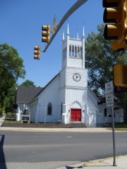 Christ Episcopal Church and Rectorylisted 1980
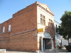 College Inn Barlisted 1979
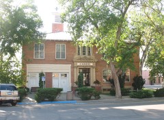 Douglas City Halllisted 1994
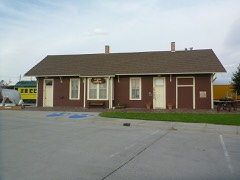 Fremont, Elkhorn & Missouri Valley Railroad Passenger Depotlisted 1994
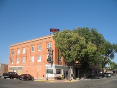 Hotel LaBontelisted 2008
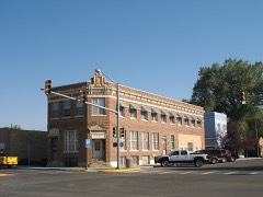 Jenne Blocklisted 1998
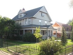 Morton Mansionlisted 2001
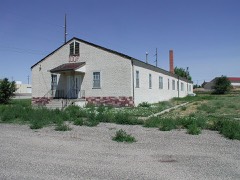 Officer's Club, Douglas Prisoner of Warlisted 2001
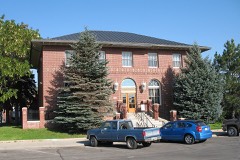 US Post Office-Douglas Mainlisted 1987
- Braehead Ranchlisted 1995
- La Prele Work Centerlisted 1994
- North Douglas Historic Districtlisted 2002
Population over time
2 figuresDouglas grew from 6,120 to 6,386 between 2010 and 2020. These are the recorded population figures Wikidata holds for this place, reached through the Geographic Names Information System number this page is keyed on rather than by name, so they belong to this place and not to another of the same name. Most are census counts, but not all are: an early figure may be a founding or settlement estimate, and an estimate published within five years of a census is left out. The change column is computed, and is left blank where more than 20 years separate a figure from the one before it, because a gap that long is not a change between two counts.
| Year | People | Change |
|---|---|---|
| 2010 | 6,120 | |
| 2020 | 6,386 | +266 (+4%) |
Topographic sheets covering this place
5 surveys from 10 printed sheetsMatched by testing this settlement's coordinate against the published boundary of every sheet in the United States Geological Survey's historical collection. Each opens the scanned sheet at the Survey.
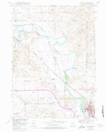
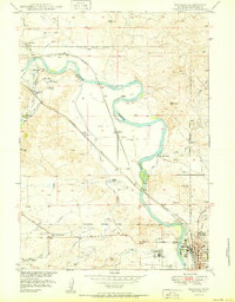
- 1949 USGS Douglas quadrangle1:24000, 3 printings
- 1950 USGS Douglas quadrangle1:24000
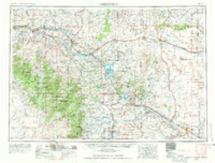
- 1954 USGS Torrington quadrangle1:250000, 4 printings
- 1958 USGS Torrington quadrangle1:250000
- 1981 USGS Douglas quadrangle1:100000
Fires near this place
64 since 1996Regional context, not property-specific evidence. The federal wildfire occurrence database lists 64 fires within 5 miles of Douglas between 1996 and 2020, burning about 7,677 acres in total. 14 started naturally. None was recorded as arson. Distance is straight-line from the map coordinates, so a fire counted here may appear on a neighbouring settlement's page as well.
| Reported cause | Fires |
|---|---|
| Missing data/not specified/undetermined | 19 |
| Natural | 14 |
| Railroad operations and maintenance | 8 |
| Equipment and vehicle use | 8 |
| Misuse of fire by a minor | 4 |
| Smoking | 4 |
| Debris and open burning | 2 |
| Power generation/transmission/distribution | 2 |
| Recreation and ceremony | 2 |
| Fireworks | 1 |
The most recent of them, most recent first, with the day each was reported and the service that recorded it.
| Date | Cause | Size | Reported by | Name on the report |
|---|---|---|---|---|
| 8 September 2003 | Natural | 5.0 acres | Wyoming State Forestry | not named |
| 25 September 2012 | Natural | 30 acres | Wyoming State Forestry | BOBCAT CANYON |
| 2 September 2020 | Power generation/transmission/distribution | under an acre | Converse County | BRIDGER TRAIL |
| 17 September 2018 | Railroad operations and maintenance | 1.0 acres | Converse County | SOUTH BILL |
| 17 September 2018 | Railroad operations and maintenance | 6,000 acres | Converse County | NORTH BILL |
| 17 September 2005 | Equipment and vehicle use | 10 acres | Wyoming State Forestry | not named |
| 12 September 2017 | Missing data/not specified/undetermined | 1.0 acres | Converse County | FETTERMAN/JEFFERSON |
| 8 August 2019 | Missing data/not specified/undetermined | 1.0 acres | Medicine Bow-Routt National Forests, Thunder Basin National Grassland | HIGHWAY 93 FIRE |
Settlements close enough to share some of these fires:
Mines and quarries near this place
9 within 5 milesRegional context, not property-specific evidence. The federal mineral resources record lists 9 workings within 5 miles of Douglas: 7 producers, 2 prospects. 7 still produce. What was taken out: Sand and Gravel, Construction, Uranium. Distance is straight-line from the map coordinates, so a quarry counted here may appear on a neighbouring settlement's page as well.
| Where | Site | Commodity | Status | Recorded |
|---|---|---|---|---|
| Albert Sims Fee Land | Uranium | Prospect | ||
| Unknown | Uranium | Prospect | ||
| Anderson Pit | Sand and Gravel, Construction | Producer | ||
| Carmen Pit | Sand and Gravel, Construction | Producer | ||
| Fort Fetterman Pit | Sand and Gravel, Construction | Producer | ||
| Lisco Pit | Sand and Gravel, Construction | Producer | ||
| Minter Sand and Gravel Pit | Sand and Gravel, Construction | Producer | ||
| Recluse Pit | Sand and Gravel, Construction | Producer | ||
| Wintermote Pit | Sand and Gravel, Construction | Producer |
Storms near this place
60 of 74 shownRegional context, not property-specific evidence. The National Weather Service names Douglas in 74 storm reports between 1996 and 2025: 52 hail, 11 thunderstorm wind, 9 tornado, 2 flash flood. No death or injury is recorded in these reports. Each account below is quoted exactly as the forecast office filed it, from the NOAA Storm Events Database, and each date opens the federal record of that event.
| When | Event | Place named | Harm | What the report says |
|---|---|---|---|---|
| August 1996 | Hail | Douglas | $30,000 | no account filed |
| July 2009 | Hail | Douglas | $15,000 | Strong wind gusts also reported in Douglas with some trees damaged or down. Some car windows broken. |
| July 1998 | Hail | Douglas | $7,000 | A storm produced golfball to base ball size hail, which covered the ground, on several ranches 40 miles northwest of Douglas. |
| June 1999 | Thunderstorm Wind | Douglas | $5,000 | High winds blew a barn roof over 100 yards 2 miles west of Douglas, WY |
| July 1998 | Flash Flood | Douglas | $2,000 | A storm produced up to 6 inches of rainfall from 50 miles northwest of Douglas to 30 miles north of Douglas. Water covered many rural roads in the area. |
| June 2025 | Hail | Douglas | - | Public reports quarter size hail. |
| May 2023 | Hail | Douglas | - | The public reported quarter sized hail in the city of Douglas. |
| May 2023 | Hail | Douglas | - | Received report of dime to penny size hail. |
| September 2023 | Hail | Douglas | - | The public reported ping-pong ball sized hail 2 miles S of Douglas. Received via mPING. |
| September 2023 | Hail | Douglas | - | Half dollar sized hail reported 4 miles WSW of Douglas. Minor roof damage reported. |
| September 2023 | Hail | Douglas | - | Golf ball sized hail was reported in Douglas. |
| September 2023 | Hail | Douglas | - | The public reported half dollar sized hail 4 miles W of Douglas. Received via mPING. |
| August 2021 | Hail | Douglas | - | Report of penny sized hail received from mPING. |
| May 2020 | Hail | Douglas | - | Observer reported hail via mPING. |
| May 2020 | Hail | Douglas | - | Observer reported hail via mPING. |
| May 2020 | Hail | Douglas | - | Observer reported hail via Twitter. |
| July 2018 | Tornado (EF3) | Douglas | - | The first observed evidence of the tornado was near Rattlesnake Hill just north of Wagonhound Road. The tornado moved to the south and quickly grew stronger. The NWS survey team continued to investigate some video evidence that the tornado may have been on the ground prior to Rattlesnake Hill. The tornado snapped several trees and power poles along Wagonhound Road, and blew several large rolls of hay nearly 300 yards from a large hay bale stack. The tornado intensified as it moved south toward a ranch, reaching EF3 intensity through the barn and residence, destroying several buildings and causing significant damage to the ranch house. The ranch house had large sections of roof structure removed, and a quonset hut tractor storage area just west of the house was destroyed. Two large utility trailers weighing several thousand pounds were lofted and had not been located, with the exception of one axel set. Large cottonwood trees were stripped of all vegetation with just the largest limbs near the center of the trees remaining intact. The tornado continued south-southeast before lifting in the vicinity of Poison Lake. Start and end and locations and times of the tornado were estimated from eyewitness accounts and radar data. |
| June 2018 | Hail | Douglas | - | Half dollar size hail was observed north of Douglas. |
| July 2018 | Hail | Douglas | - | Half dollar size hail was observed north of Douglas. |
| June 2017 | Hail | Douglas | - | Hen egg size hail was observed two miles east of Douglas. |
| June 2017 | Hail | Douglas | - | Hen egg size hail was observed at Douglas. |
| June 2017 | Hail | Douglas | - | Ping pong ball size hail dented vehicles and broke house windows. |
| June 2017 | Hail | Douglas | - | Quarter to golf ball size hail was observed at Douglas. |
| June 2017 | Hail | Douglas | - | Softball size hail was observed eight miles of Douglas. |
| June 2016 | Thunderstorm Wind | Douglas | - | Estimated wind gusts of 65 mph were reported seven miles east of Douglas. |
| July 2015 | Hail | Douglas | - | Quarter size hail was observed 12 miles northwest of Douglas. |
| June 2015 | Hail | Douglas | - | Golf ball size hail was observed 17 miles west of Douglas. |
| June 2015 | Hail | Douglas | - | Quarter size hail was observed eight miles east of Douglas. |
| June 2015 | Hail | Douglas | - | Half dollar size hail was reported 12 miles north-northwest of Douglas. |
| June 2015 | Hail | Douglas | - | Half dollar size hail was reported seven miles east-southeast of Douglas. |
| June 2015 | Tornado (EF0) | Douglas | - | An EF0 tornado touched down in open country just east of Box Elder Creek and was on the ground for two minutes before it lifted. No damage was reported. |
| June 2015 | Hail | Douglas | - | Quarter size hail was observed 17 miles northeast of Douglas. |
| May 2014 | Hail | Douglas | - | Quarter size hail was reported southwest of Douglas. |
| May 2014 | Hail | Douglas | - | Quarter size hail was observed northeast of Deer Creek. |
| May 2014 | Hail | Douglas | - | Quarter size hail was observed east of Laprele Reservoir. |
| August 2013 | Hail | Douglas | - | Quarter size hail was reported east of Douglas. |
| June 2013 | Hail | Douglas | - | Quarter to ping pong ball size hail was reported at mile marker 12 on Highway 59. Vehicles pulled off the highway due to the large hail and heavy rain. |
| June 2013 | Hail | Douglas | - | Pea to quarter size hail was reported in Douglas. |
| June 2012 | Thunderstorm Wind | Douglas | - | The ASOS wind sensor at the Converse County Airport measured a peak gust of 64 mph. |
| June 2012 | Thunderstorm Wind | Douglas | - | The ASOS wind sensor at the Converse County Airport north of Douglas measured a peak gust of 82 mph. |
| June 2012 | Thunderstorm Wind | Douglas | - | The ASOS wind sensor measured gusts of 58 mph or greater, with a peak gust of 64 mph at 25/1348L. |
| July 2012 | Thunderstorm Wind | Douglas | - | The ASOS wind sensor at the Converse County Airport measured a peak gust of 59 mph. |
| June 2011 | Hail | Douglas | - | Hail observed 9 miles SSE of Laprele Reservoir. Most stones were smaller. |
| August 2011 | Thunderstorm Wind | Douglas | - | ASOS wind sensor at the Converse County Airport measured a peak wind gust of 63 mph. |
| July 2009 | Flash Flood | Douglas | - | Heavy rains flooded parts of state highways 91 and 94, resulting in closure for a time. |
| August 2007 | Thunderstorm Wind | Douglas | - | Wind gusts from 60 to 70 mph reported around Douglas, WY. |
| August 2007 | Hail | Douglas | - | Many reports received from the public of hail around golf ball size. |
| July 2006 | Tornado (F0) | Douglas | - | Brief tornado reported by airplane pilot. |
| August 2006 | Thunderstorm Wind | Douglas | - | Wind gusts estimated from 60 to 70 mph. |
| August 2005 | Tornado (F0) | Douglas | - | Brief tornado spotted over open country. |
| May 1998 | Tornado (F0) | Douglas | - | A weak tornado moved over open country northwest of Douglas before disipating. |
| June 1998 | Tornado (F0) | Douglas | - | A bief tornado touched down to the northeast of Bill, WY. |
| July 1997 | Tornado (F0) | Douglas | - | Brief touchdown in open country. |
| July 1997 | Tornado (F0) | Douglas | - | Brief touchdown in open country reported by pilot. |
| July 1997 | Tornado (F0) | Douglas | - | Brief touchdown in open country. |
| July 2024 | Thunderstorm Wind | Douglas | - | no account filed |
| May 2020 | Hail | Douglas | - | no account filed |
| August 2019 | Hail | Douglas | - | no account filed |
| August 2019 | Hail | Douglas | - | no account filed |
| July 2018 | Thunderstorm Wind | Douglas | - | no account filed |
Nearest settlements
The eight closest, with where each one stands in the county. Distances are straight-line, computed from the Geographic Names Information System coordinates.
| Map | Place | Distance | Sheets |
|---|---|---|---|
| Irvine | 7.7 miles | 9 | |
| Orpha | 9.2 miles | 9 | |
| Orin | 12.5 miles | 8 | |
| Orin Junction | 12.7 miles | 8 | |
| Ammon | 16.2 miles | 8 | |
| Deadmans Corner | 18.6 miles | 9 | |
| Shawnee | 19.8 miles | 9 | |
| Clayton | 20.6 miles | 9 |
Elsewhere
Matched on this settlement's Geographic Names Information System number rather than its name, so it cannot be a different place of the same name in another state.
| Wikipedia article on Douglas | An encyclopaedic summary. Its text is share-alike, so it is linked here rather than copied. |
| Wikidata item Q983438 | The structured record the population and elevation above come from. Public domain (CC0). |
Provenance
This settlement is recorded in the Geographic Names Information System as feature 1587750. The sheet list is computed by point-in-boundary test against the United States Geological Survey's historical topographic inventory. Both are works of the United States government and carry no copyright under 17 U.S.C. 105.
Wildfire. Short, Karen C. 2022. Spatial wildfire occurrence data for the United States, 1992-2020 [FPA_FOD_20221014]. 6th Edition. Fort Collins, CO: Forest Service Research Data Archive. https://doi.org/10.2737/RDS-2013-0009.6 Collected with United States Government funding and usable without additional permissions or fees.
Mines and quarries. USGS Mineral Resources Data System (MRDS) https://mrdata.usgs.gov/mrds/ A work of the United States government, no copyright under 17 U.S.C. 105.
Storms. NOAA National Centers for Environmental Information, Storm Events Database https://www.ncei.noaa.gov/stormevents/ A work of the United States government, no copyright under 17 U.S.C. 105. Narratives are quoted verbatim from the National Weather Service report and are not edited or summarised.