 Block
From the record
12 National Register listings published here.
Sources: the National Register database, National Park Service
24 topographic sheets cover 11 settlements here, and 12 properties are on the National Register of Historic Places.
12 National Register listings published here.
Sources: the National Register database, National Park Service
Every property in this county listed on the National Register of Historic Places, with the year it was listed and the federal nomination document.
| Photograph | Property | Type | Listed | Reference |
|---|---|---|---|---|
 | 535 Broadway | building | 1984 | 84003668 |
| Bates Battlefield | site | 1974 | 74002286 | |
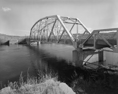 | CQA Four Mile Bridge | structure | 1985 | 85000423 |
| Callaghan Apartments | building | 1993 | 93000231 | |
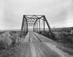 | EFP Bridge over Owl Creek | structure | 1985 | 85000424 |
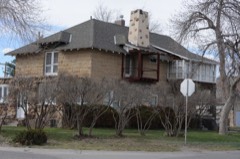 | Alex Halone House | building | 1994 | 93001473 |
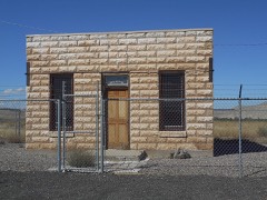 | Kirby Jail and Town Hall | building | 2011 | 11000875 |
| Malta Lodge #17 | building | 1984 | 84003668 |
| Malta Lodge No. 17 AF&AM | building | 2021 | 100007161 | |
| US Post Office-Thermopolis Main | building | 1987 | 87000784 | |
| Woodruff Cabin Site | site | 1970 | 70000671 |
Every wildfire the federal occurrence database records inside this county: 304 of them, burning about 94,824 acres. 158 started naturally and 2 were recorded as arson. Each settlement page carries the fires within five miles of it.
| Reported cause | Fires |
|---|---|
| Natural | 158 |
| Missing data/not specified/undetermined | 84 |
| Power generation/transmission/distribution | 16 |
| Fireworks | 14 |
| Debris and open burning | 13 |
| Equipment and vehicle use | 9 |
| Railroad operations and maintenance | 7 |
| Arson/incendiarism | 2 |
| Recreation and ceremony | 1 |
The five largest, by the area the report gives. None of them was recorded as arson.
| Date | Cause | Size | Reported by | Name on the report |
|---|---|---|---|---|
| 25 August 1996 | Natural | 48,844 acres | Worland Field Office | EBLACK MTN |
| 27 July 2000 | Natural | 13,666 acres | Worland Field Office | MIDDLE ENOS |
| 22 September 2007 | Debris and open burning | 3,978 acres | Worland Field Office | COPPER MTN |
| 9 July 2000 | Natural | 3,840 acres | Wind River Agency | MUDDYCRK |
| 18 August 2001 | Natural | 2,974 acres | Worland Field Office | RENNER DRA |
| 13 September 2018 | Missing data/not specified/undetermined | 2,104 acres | Worland Field Office | BLACK MOUNTAIN |
| 12 September 2018 | Equipment and vehicle use | 2,047 acres | Hotsprings County | RED HOLE |
| 9 September 2005 | Missing data/not specified/undetermined | 2,000 acres | Worland Field Office | BLACK MOUNTAIN |
Every settlement page carries the fires within five miles of it - see the settlement index below.
The NOAA Storm Events Database holds 129 reports for this county, causing 1 death, 1 injury and about $2,698,000 in recorded property damage. Each settlement page carries the reports that name it.
| Kind of event | Reports |
|---|---|
| Hail | 65 |
| Thunderstorm Wind | 35 |
| Funnel Cloud | 12 |
| Flash Flood | 8 |
| Tornado | 6 |
| Wildfire | 3 |
The most serious of them, by death, then injury, then recorded damage. The accounts are quoted exactly as the forecast office filed them.
| When | Event | Place named | Harm | What the report says |
|---|---|---|---|---|
| August 2000 | Wildfire | Thermopolis | 1 killed, 1 hurt | no account filed |
| May 2015 | Flash Flood | Thermopolis | $1,500,000 | Very heavy rain fell in southern Hot Springs County. This triggered numerous mud and rock slides, some tumbling several hundred feet or more to the bottom of the Wind River Canyon. State Highway 789 through the canyon was covered with mud, rock, and debris in several locations between mileposts 120 and 123. One Wyoming Department of Transportation employee was briefly trapped in his front-end loader as he tried to clear away small slides at the onset of the event. The massive amount of debris on the highway resulted in the closure of the road from Sunday afternoon, May 24, until Wednesday morning, May 27. Additional slides on the west side of the Wind River Canyon destroyed several sections of railroad track that resulted in a halt of train traffic for several days. |
| July 2019 | Hail | Anchor Reservoir | $1,000,000 | A storm developed over the Lee of the Absarokas and quickly became severe as it moved eastward into Hot Springs County. On a long path there were numerous reports of golf ball sized hail, with a maximum size of over two inches in diameter at Hot Springs State Park, just east of Thermopolis, Wyoming. There were numerous reports of damaged siding as well as broken windows on cars and buildings along the hail path. |
| July 2009 | Flash Flood | Hamilton Dome | $75,000 | Heavy rain from a severe thunderstorm produced widespread flash flooding northwest of Thermopolis. Radar estimated 30 to 40 minute rainfall amounts to be from 1.00 to 1.75 inches. The flash flooding was primarily concentrated along state highways 120 and 170 near Owl Creek. Areas hardest hit along highway 120 extended from mile markers five to nine. Six homes were evacuated in this four mile stretch and at least two of the homes were flooded. One resident estimated water depth to be three to six feet, which damaged outbuildings, a well house, and a cistern. Some hay fields were reported to be waist deep in water. |
| September 2024 | Tornado (EF0) | Thermopolis | $50,000 | A brief landspout tornado touched down in downtown Thermopolis, near the intersection of US Hwy 20 and WY Hwy 120. Maximum winds were estimated between 65 to 75 mph as it caused damage to sheet metal roofing and car windows. |
| June 2023 | Thunderstorm Wind | Lucerne | $25,000 | Damage to a barn and several outbuildings from a strong thunderstorm wind gust at a ranch between Thermopolis and Kirby WY. Estimated wind gust of 50 to 60 mph based on damage. Damage estimated to have occurred around 426 PM MDT June 4 2023 based on radar. Nearest surface observation was a personal weather sensor 4 miles away, which showed a gust to 22 mph at the 445 pm reporting time, but storm did not directly affect this sensor location. Sheds, items, and debris were blown east to west generally with no indication of distinct rotation. Outbuildings had openings to the east, making them especially susceptible to easterly wind gusts. Little to no damage to nearby farms or trees, as the downdraft was from a small storm, leading to very localized damage, likely from an individual downdraft. |
| June 1985 | Tornado (F0) | not stated | $25,000 | no account filed |
| June 2015 | Hail | East Thermopolis | $20,000 | Two inch diameter hail fell in the Wind River Canyon knocking out windows in vehicles traveling State Highway 789. |
| July 2009 | Thunderstorm Wind | Thermopolis | $3,000 | Microburst winds of 50 to 60 mph uprooted a 50-foot Cottonwood tree and blew a one-foot diameter branch about 50 feet in Hot Springs State Park. The wind was also responsible for moving a metal shed across a street near the Hot Springs County fairgrounds. |
| May 2025 | Thunderstorm Wind | Grass Creek | - | The Grass Creek RAWS site had a wind gust of 66 mph. |
| July 2025 | Thunderstorm Wind | Thermopolis | - | A 63 mph wind gust was reported on Boysen Peak. |
| July 2025 | Hail | Thermopolis | - | The public reported penny to quarter size hail in north end of Wind River Canyon. |
| August 2025 | Thunderstorm Wind | Thermopolis | - | Wind gusts as high as 60 mph were reported around Thermopolis. At Hot Springs State Park, large tree branches were downed. |
| June 2023 | Hail | Grass Creek | - | A picture of ping pong ball size hail at the Gooseberry Creek Rest Area was posted to Facebook. |
| June 2022 | Funnel Cloud | Thermopolis Arpt | - | A reporter for a local newspaper sent a picture of a funnel cloud over the Owl Creek Mountains to the southwest of Thermopolis, WY. |
| May 2019 | Hail | Thermopolis | - | A trained spotter reported penny size hail in Thermopolis. |
| July 2019 | Thunderstorm Wind | Thermopolis Arpt | - | A trained spotter reported a 67 mph when a high based shower collapsed over the spotters house. |
| July 2019 | Hail | Thermopolis Arpt | - | There were numerous reports of quarter to ping pong ball sized hail from west of Thermopolis to Thermopolis to Hot Springs State Park in Hot Springs County, Wyoming. |
| July 2019 | Hail | Thermopolis Arpt | - | Trained spotters reported penny sized hail from Thermopolis to 5 miles SE of Thermopolis, Wyoming. |
| July 2019 | Flash Flood | Grass Creek | - | Flash flooding occurred with washouts on BLM road 1304 off of State Route 120 to the south of Meeteetse, Wyoming. |
| August 2019 | Thunderstorm Wind | Thermopolis | - | An outflow boundary moved through Thermopolis, Wyoming and brought a 61 mph wind gust to the fire station just south of downtown Thermopolis. |
| July 2018 | Hail | Thermopolis | - | Trained spotters reported up to quarter size hail around Thermopolis. |
| May 2018 | Thunderstorm Wind | Dickie | - | A wind gust of 64 mph was recorded at the Grass Creek RAWS site. |
| May 2018 | Funnel Cloud | East Thermopolis | - | Several trained spotters reported a funnel cloud to the east-southeast of Thermopolis over the Owl Creek Range. |
| June 2018 | Funnel Cloud | Meeteetse | - | A trained spotter reported a funnel cloud 8 miles SE of Meeteetse. |
| June 2018 | Hail | Grass Creek | - | A video showing nickel size hail was posted on Facebook along WY 431 near the Hot Springs / Washakie County line. |
| June 2018 | Funnel Cloud | Hamilton Dome | - | Trained spotters reported a funnel cloud northwest of Thermopolis. |
| June 2018 | Hail | Grass Creek | - | A trained spotter reported south-southeast of Meeteetse. |
| June 2017 | Thunderstorm Wind | Kirby | - | A weather station in Kirby reported a wind gust of 63 mph. |
| August 2016 | Thunderstorm Wind | Hamilton Dome | - | Two power poles were snapped three to four feet off the ground and a large cottonwood tree was toppled along State Highway 170 west of the junction with State Highway 120 northwest of Thermopolis. The thunderstorm outflow winds were measured at 63 mph at the Hot Springs County Airport and 74 mph at a mesonet station in Thermopolis. |
| August 2016 | Hail | Thermopolis | - | Hail up to the size of nickels was reported in Thermopolis. Most of the hail was pea-sized and it accumulated up to an inch deep in some places. |
| May 2015 | Flash Flood | Thermopolis | - | Heavy rain caused flooding near the town of Thermopolis. South of Thermopolis, Buffalo Creek overflowed its banks and flooded nearby low lying areas. A mobile home community experienced flooding in East Thermopolis as small creeks and streams were inundated with water. |
| June 2015 | Hail | Rairden | - | Quarter sized hail fell near Missouri Flat Road west-northwest of Thermopolis. |
| June 2015 | Hail | Kirby | - | Pea to nickel sized hail fell just west of Kirby. |
| July 2015 | Hail | Grass Creek | - | Trained spotters reported quarter to golf ball sized hail just east of State Highway 120 near the Gooseberry Creek Rest Stop. |
| July 2015 | Thunderstorm Wind | Thermopolis | - | Several wind gusts over 58 mph were recorded at Thermopolis with a peak speed of 67 mph. The gusts were the result of weak convection and a strong pressure gradient ahead of an approaching cold front. |
| June 2015 | Hail | Grass Creek | - | The Hot Springs County Emergency Manager reported nickel sized hail along State Highway 431 just east of State Highway 120 toward Gooseberry Creek. |
| September 2014 | Hail | Thermopolis | - | A long-track thunderstorm produced penny sized hail in Thermopolis. |
| June 2014 | Tornado (EF0) | Dickie | - | A rancher north of Anchor Reservoir observed a brief tornado near Putney Flat in the Owl Creek drainage. The tornado remained over open country and did no damage. |
| July 2014 | Thunderstorm Wind | Dickie | - | An 80 mph wind gust was measured at the Grass Creek Divide RAWS in the foothills of the southern Absaroka Range. |
| June 2014 | Hail | Hamilton Dome | - | Nickel sized hail was reported at a ranch along Sand Draw Road. |
| June 2014 | Funnel Cloud | Hamilton Dome | - | Worland Fire Department personnel reported a funnel cloud in Hot Springs County that was about three-quarters of the way to the ground. |
| July 2013 | Thunderstorm Wind | Kirby | - | The Hot Springs County emergency manager reported a 60 mph wind gust at Kirby. |
| July 2013 | Hail | Kirby | - | Penny to nickel sized hail was reported in Kirby. |
| June 2012 | Thunderstorm Wind | Thermopolis | - | A thunderstorm formed over the Wind River Basin and moved north over the Owl Creek Mountains producing a 63 mph wind gust at an automated station on Boysen Peak. |
| June 2012 | Thunderstorm Wind | Thermopolis | - | A thunderstorm formed over the Wind River Basin and moved north over the Owl Creek Mountains producing a wind gust of 62 mph at an automated station on the west side of Thermopolis. |
| September 2012 | Thunderstorm Wind | Thermopolis Arpt | - | An individual with an automated wind sensor reported a thunderstorm wind gust of 72 mph. |
| July 2012 | Thunderstorm Wind | Thermopolis | - | A strong thunderstorm produced wind gusts to 69 mph at an observation site atop Boysen Peak. |
| July 2012 | Thunderstorm Wind | Thermopolis | - | A strong thunderstorm produced a 59 mph wind gust at an automated weather station on Boysen Peak. |
| July 2012 | Thunderstorm Wind | Dickie | - | A thunderstorm moved across the southern Absaroka Range and sent strong outflow wind southeast across the western Owl Creek Mountains. A remote weather station recorded a peak wind gust of 64 mph. |
| July 2012 | Thunderstorm Wind | Thermopolis Arpt | - | A 73 mph wind gust was reported in association with a thunderstorm eight miles west of Thermopolis. The gust was recorded at a residence with an automated weather station. |
| September 2012 | Thunderstorm Wind | Dickie | - | A strong thunderstorm moved off the Absaroka Range and produced a severe wind gust of 60 mph at the Grass Creek Divide RAWS site. |
| August 2011 | Hail | Lucerne | - | A thunderstorm moved through central Hot Springs County producing quarter sized hail. |
| July 2011 | Hail | Grass Creek | - | A strong thunderstorm moved across the southern Absaroka mountains producing quarter sized hail at a residence in the Grass Creek drainage south of Meeteetse. |
| August 2011 | Hail | Lucerne | - | A trained spotter reported one inch diameter hail for several minutes. |
| August 2010 | Hail | Crosby | - | Ping pong ball sized hail fell just east of State Highway 789 near Lucerne. |
| August 2010 | Hail | Hamilton Dome | - | The Hot Springs County emergency manager reported penny sized hail along State Highway 120 approximately 23 miles northwest of Thermopolis. |
| July 2009 | Hail | East Thermopolis | - | Quarter sized hail fell at a ranch near Buffalo Creek Road in eastern Hot Springs County. |
| July 2009 | Hail | Thermopolis | - | Penny sized hail was reported west of Thermopolis near Missouri Flat Road. |
| August 2009 | Thunderstorm Wind | Grass Creek | - | Estimated wind gusts of 60 mph broke several three inch diameter limbs from Cottonwood trees at a ranch along Gooseberry Creek. Also, dime sized hail accumulated to a depth of two to three inches at the ranch. |
The Survey's mineral resources record lists 34 workings inside this county. 5 still produce and 29 are closed or unrecorded. Each settlement page carries the workings within five miles of it.
| Commodity | Workings |
|---|---|
| Sand and Gravel, Construction | 14 |
| Uranium | 5 |
| Copper | 3 |
| Tungsten | 2 |
| Titanium | 2 |
| Zirconium, Thorium | 2 |
| Iron | 2 |
| Dolomite | 2 |
| Sulfur | 1 |
| Titanium-Heavy Minerals | 1 |
| Zirconium, Thorium, Iron | 1 |
| Titanium, Metal, Zirconium, Thorium, Iron | 1 |
| Gold, Silver | 1 |
| Bentonite | 1 |
The least common of them first, because a county's hundredth gravel pit says nothing its first ten did not.
| Where | Site | Commodity | Status | Recorded |
|---|---|---|---|---|
| Brutch Sulphur Deposit | Sulfur | Producer | Sulfur | |
| Cottonwood Creek | Titanium-Heavy Minerals, Zirconium, Thorium, Iron | Occurrence | 1956 | |
| Lucerne Mine | Bentonite | Producer | ||
| N-Vam Mine and Mile | Calcium | Past Producer | ||
| Unknown | Copper, Gold, Silver | Occurrence | ||
| Waugh | Titanium, Metal, Zirconium, Thorium, Iron | Occurrence | ||
| Willow Creek Deposit | Gold, Silver, Copper | Occurrence | Copper, Gold, Silver | |
| Copper Mountain Deposits | Tungsten | Occurrence | Scheelite | |
| Durner and Keys Deposit | Tungsten | Occurrence | Scheelite | |
| Grass Creek Deposit, southern segment | Titanium, Zirconium, Thorium, Iron | Unknown | Magnetite, Ilmenite, Anatase, Monazite, Rutile, Zircon | |
| Grass Creek Deposits, northern segment | Titanium, Zirconium, Thorium, Iron | Unknown | Magnetite, Ilmenite, Anatase, Monazite, Rutile, Zircon | |
| Unknown | Dolomite | Occurrence | ||
| Unknown | Dolomite | Occurrence | ||
| Mc Gowan - Le Clair Group | Copper | Occurrence | ||
| Mtn View Liberty & Orebin Claims | Copper | Occurrence | ||
| Anomaly 5 | Uranium | Occurrence | ||
| Dubois Uranium Claims | Uranium | Occurrence | ||
| Grass Creek Basin | Uranium | Unknown | ||
| Unknown | Uranium | Occurrence | ||
| Unknown | Uranium | Past Producer | ||
| Andreen Pit | Sand and Gravel, Construction | Producer | ||
| Brewer Pit | Sand and Gravel, Construction | Past Producer | ||
| Brown Pit | Sand and Gravel, Construction | Producer | ||
| Cottonwood #1 | Sand and Gravel, Construction | Past Producer | ||
| Cottonwood #2 | Sand and Gravel, Construction | Past Producer | ||
| Government | Sand and Gravel, Construction | Past Producer | ||
| Harvey | Sand and Gravel, Construction | Past Producer | ||
| Kelley | Sand and Gravel, Construction | Past Producer | ||
| Kirby Borrow Area | Sand and Gravel, Construction | Past Producer | ||
| Owl Creek Pit | Sand and Gravel, Construction | Past Producer | ||
| Park Pit | Sand and Gravel, Construction | Past Producer | ||
| Shafer | Sand and Gravel, Construction | Past Producer | ||
| Talovich | Sand and Gravel, Construction | Past Producer | ||
| Wilson Pit | Sand and Gravel, Construction | Producer |
Named settlements recorded in the Geographic Names Information System, each with the topographic sheets covering it. Villages, hamlets and abandoned places alike. Each is shown with the nearest named watercourse or landform and the survey quadrangle it falls on.
Thermopolis East census division · 82443 · On Warm Springs Creek · Thermopolis quadrangle
8 sheets, 1955 to 1981
Thermopolis West census division · 82443 · Grass Creek quadrangle
12 sheets, 1913 to 1985
Thermopolis West census division · 82443 · Hamilton Dome quadrangle
12 sheets, 1913 to 1985
Thermopolis West census division · 82430 · Near Coal Draw · Kirby quadrangle
10 sheets, 1945 to 1985
Thermopolis West census division · 82443 · On Kirby Creek · Thermopolis quadrangle
8 sheets, 1955 to 1981
Thermopolis West census division · 82443 · On Red Canyon Creek · Wedding of the Waters quadrangle
8 sheets, 1955 to 1981
Thermopolis East census division · 82443 · On Antelope Creek · Devil Slide quadrangle
8 sheets, 1955 to 1981
Thermopolis West census division · 82443 · Hamilton Dome quadrangle
12 sheets, 1913 to 1985
Thermopolis West census division · 82443 · In Red Lane Gulch · Thermopolis quadrangle
8 sheets, 1955 to 1981
Thermopolis West census division · 82443 · On Warm Springs Creek · Thermopolis quadrangle
8 sheets, 1955 to 1981