 Block
From the record
One of 12 National Register listings published here for Hot Springs County · listed in 2021 · category: Building.
Sources: the National Register database, National Park Service
Listed on the National Register of Historic Places in 2021.
One of 12 National Register listings published here for Hot Springs County · listed in 2021 · category: Building.
Sources: the National Register database, National Park Service
Regional context, not property-specific evidence. The federal wildfire occurrence database lists 71 fires within 5 miles of Malta Lodge No. 17 AF&AM between 1992 and 2020, burning about 134 acres in total. 31 started naturally. None was recorded as arson. Distance is straight-line from the map coordinates, so a fire counted here may appear on a neighbouring settlement's page as well.
| Reported cause | Fires |
|---|---|
| Natural | 31 |
| Missing data/not specified/undetermined | 21 |
| Fireworks | 9 |
| Power generation/transmission/distribution | 4 |
| Debris and open burning | 4 |
| Railroad operations and maintenance | 1 |
| Equipment and vehicle use | 1 |
The most recent of them, most recent first, with the day each was reported and the service that recorded it.
| Date | Cause | Size | Reported by | Name on the report |
|---|---|---|---|---|
| 6 September 2009 | Natural | under an acre | Worland Field Office | SAGE VALLEY |
| 6 September 2009 | Natural | under an acre | Worland Field Office | TOWER |
| 4 September 1995 | Natural | under an acre | Worland Field Office | WILLOW DRW |
| 11 September 2018 | Fireworks | 1.0 acres | Hotsprings County | FISH |
| 10 September 1995 | Natural | under an acre | Worland Field Office | RED CANYON |
| 8 August 2020 | Natural | under an acre | Wind River / Bighorn Basin District | COYOTE 2 |
| 8 August 2020 | Natural | under an acre | Wind River / Bighorn Basin District | COYOTE 1 |
| 8 August 2020 | Natural | under an acre | Wind River / Bighorn Basin District | SAGE VALLEY |
Regional context, not property-specific evidence. The federal mineral resources record lists 7 workings within 5 miles of Malta Lodge No. 17 AF&AM: 4 past producers, 3 producers. 3 still produce. What was taken out: Sand and Gravel, Construction, Sulfur, Bentonite, Calcium. Distance is straight-line from the map coordinates, so a quarry counted here may appear on a neighbouring settlement's page as well.
| Where | Site | Commodity | Status | Recorded |
|---|---|---|---|---|
| Brutch Sulphur Deposit | Sulfur | Producer | Sulfur | |
| Lucerne Mine | Bentonite | Producer | ||
| N-Vam Mine and Mile | Calcium | Past Producer | ||
| Andreen Pit | Sand and Gravel, Construction | Producer | ||
| Park Pit | Sand and Gravel, Construction | Past Producer | ||
| Shafer | Sand and Gravel, Construction | Past Producer | ||
| Talovich | Sand and Gravel, Construction | Past Producer |
Regional context, not property-specific evidence. The National Weather Service names Thermopolis, the town this property stands in, in 55 storm reports between 1996 and 2025: 25 hail, 18 thunderstorm wind, 5 flash flood, 3 funnel cloud. The reports record 1 death and 1 injury. Each account below is quoted exactly as the forecast office filed it, from the NOAA Storm Events Database, and each date opens the federal record of that event.
| When | Event | Place named | Harm | What the report says |
|---|---|---|---|---|
| August 2000 | Wildfire | Thermopolis | 1 killed, 1 hurt | no account filed |
| May 2015 | Flash Flood | Thermopolis | $1,500,000 | Very heavy rain fell in southern Hot Springs County. This triggered numerous mud and rock slides, some tumbling several hundred feet or more to the bottom of the Wind River Canyon. State Highway 789 through the canyon was covered with mud, rock, and debris in several locations between mileposts 120 and 123. One Wyoming Department of Transportation employee was briefly trapped in his front-end loader as he tried to clear away small slides at the onset of the event. The massive amount of debris on the highway resulted in the closure of the road from Sunday afternoon, May 24, until Wednesday morning, May 27. Additional slides on the west side of the Wind River Canyon destroyed several sections of railroad track that resulted in a halt of train traffic for several days. |
| September 2024 | Tornado (EF0) | Thermopolis | $50,000 | A brief landspout tornado touched down in downtown Thermopolis, near the intersection of US Hwy 20 and WY Hwy 120. Maximum winds were estimated between 65 to 75 mph as it caused damage to sheet metal roofing and car windows. |
| June 2015 | Hail | East Thermopolis | $20,000 | Two inch diameter hail fell in the Wind River Canyon knocking out windows in vehicles traveling State Highway 789. |
| July 2009 | Thunderstorm Wind | Thermopolis | $3,000 | Microburst winds of 50 to 60 mph uprooted a 50-foot Cottonwood tree and blew a one-foot diameter branch about 50 feet in Hot Springs State Park. The wind was also responsible for moving a metal shed across a street near the Hot Springs County fairgrounds. |
| July 2025 | Thunderstorm Wind | Thermopolis | - | A 63 mph wind gust was reported on Boysen Peak. |
| July 2025 | Hail | Thermopolis | - | The public reported penny to quarter size hail in north end of Wind River Canyon. |
| August 2025 | Thunderstorm Wind | Thermopolis | - | Wind gusts as high as 60 mph were reported around Thermopolis. At Hot Springs State Park, large tree branches were downed. |
| May 2019 | Hail | Thermopolis | - | A trained spotter reported penny size hail in Thermopolis. |
| August 2019 | Thunderstorm Wind | Thermopolis | - | An outflow boundary moved through Thermopolis, Wyoming and brought a 61 mph wind gust to the fire station just south of downtown Thermopolis. |
| July 2018 | Hail | Thermopolis | - | Trained spotters reported up to quarter size hail around Thermopolis. |
| May 2018 | Funnel Cloud | East Thermopolis | - | Several trained spotters reported a funnel cloud to the east-southeast of Thermopolis over the Owl Creek Range. |
| August 2016 | Hail | Thermopolis | - | Hail up to the size of nickels was reported in Thermopolis. Most of the hail was pea-sized and it accumulated up to an inch deep in some places. |
| May 2015 | Flash Flood | Thermopolis | - | Heavy rain caused flooding near the town of Thermopolis. South of Thermopolis, Buffalo Creek overflowed its banks and flooded nearby low lying areas. A mobile home community experienced flooding in East Thermopolis as small creeks and streams were inundated with water. |
| July 2015 | Thunderstorm Wind | Thermopolis | - | Several wind gusts over 58 mph were recorded at Thermopolis with a peak speed of 67 mph. The gusts were the result of weak convection and a strong pressure gradient ahead of an approaching cold front. |
| September 2014 | Hail | Thermopolis | - | A long-track thunderstorm produced penny sized hail in Thermopolis. |
| June 2012 | Thunderstorm Wind | Thermopolis | - | A thunderstorm formed over the Wind River Basin and moved north over the Owl Creek Mountains producing a 63 mph wind gust at an automated station on Boysen Peak. |
| June 2012 | Thunderstorm Wind | Thermopolis | - | A thunderstorm formed over the Wind River Basin and moved north over the Owl Creek Mountains producing a wind gust of 62 mph at an automated station on the west side of Thermopolis. |
| July 2012 | Thunderstorm Wind | Thermopolis | - | A strong thunderstorm produced wind gusts to 69 mph at an observation site atop Boysen Peak. |
| July 2012 | Thunderstorm Wind | Thermopolis | - | A strong thunderstorm produced a 59 mph wind gust at an automated weather station on Boysen Peak. |
| July 2009 | Hail | East Thermopolis | - | Quarter sized hail fell at a ranch near Buffalo Creek Road in eastern Hot Springs County. |
| July 2009 | Hail | Thermopolis | - | Penny sized hail was reported west of Thermopolis near Missouri Flat Road. |
| July 2009 | Hail | Thermopolis | - | Hot Springs County Dispatch and a spotter reported quarter sized hail in Thermopolis. |
| August 2009 | Hail | Thermopolis | - | Hail as large as nickels fell in the town of Thermopolis. |
| July 1998 | Thunderstorm Wind | Thermopolis | - | Large tree/power line down |
| August 2007 | Hail | Thermopolis | - | no account filed |
| July 2006 | Flash Flood | Thermopolis | - | no account filed |
| May 2005 | Hail | Thermopolis | - | no account filed |
| August 2005 | Hail | Thermopolis | - | no account filed |
| July 2004 | Hail | Thermopolis | - | no account filed |
| September 2002 | Thunderstorm Wind | Thermopolis | - | no account filed |
| June 2001 | Thunderstorm Wind | Thermopolis | - | no account filed |
| July 2001 | Flash Flood | Thermopolis | - | no account filed |
| August 2001 | Hail | Thermopolis | - | no account filed |
| July 2001 | Thunderstorm Wind | Thermopolis | - | no account filed |
| May 2000 | Hail | Thermopolis | - | no account filed |
| July 2000 | Wildfire | Thermopolis | - | no account filed |
| July 2000 | Hail | Thermopolis | - | no account filed |
| August 2000 | Wildfire | Thermopolis | - | no account filed |
| August 1999 | Thunderstorm Wind | Thermopolis | - | no account filed |
| August 1999 | Flash Flood | Thermopolis | - | no account filed |
| August 1999 | Thunderstorm Wind | Thermopolis | - | no account filed |
| August 1999 | Funnel Cloud | Thermopolis | - | no account filed |
| June 1999 | Hail | Thermopolis | - | no account filed |
| August 1999 | Thunderstorm Wind | Thermopolis | - | no account filed |
| July 1998 | Hail | Thermopolis | - | no account filed |
| July 1998 | Hail | Thermopolis | - | no account filed |
| July 1998 | Hail | Thermopolis | - | no account filed |
| August 1998 | Thunderstorm Wind | Thermopolis | - | no account filed |
| August 1998 | Hail | Thermopolis | - | no account filed |
| August 1997 | Hail | Thermopolis | - | no account filed |
| June 1997 | Funnel Cloud | Thermopolis | - | no account filed |
| June 1997 | Hail | Thermopolis | - | no account filed |
| July 1996 | Hail | Thermopolis | - | no account filed |
| July 1996 | Thunderstorm Wind | Thermopolis | - | no account filed |
No historic map-sheet match is published for this property yet. That does not mean no map exists. This record needs a coordinate-quality review before it can be joined to a sheet boundary. Browse the county's mapped places while that work is pending.
Other National Register properties close enough to walk or drive between, ordered by distance from this one. Both positions come from the same geocoding pass that matched these properties to their map sheets.
| Photograph | Property | Distance | Listed |
|---|---|---|---|
 | Malta Lodge #17 | under 500 feet | 1984 |
| US Post Office-Thermopolis Main | under 500 feet | 1987 | |
| 535 Broadway | under 500 feet | 1984 |
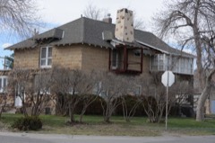 | Alex Halone House | 0.5 miles | 1994 |
| Callaghan Apartments | 0.6 miles | 1993 |
| National Archives record | The nomination case file for reference 100007161 in Record Group 79. |
| Hot Springs County | All 12 listed properties in this county. |