Block
From the record
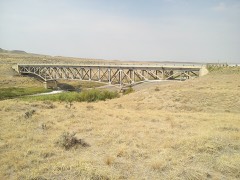
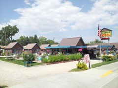
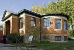
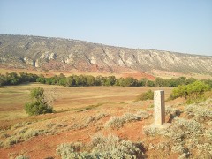
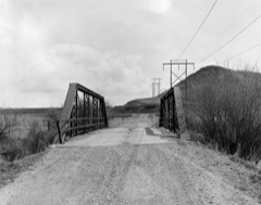
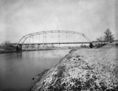
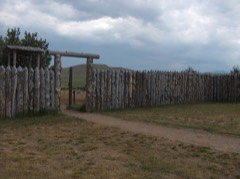
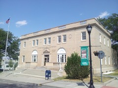
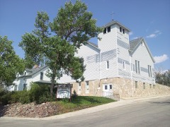
22 National Register listings published here, 1 of them a National Historic Landmark.
Sources: the National Register database, National Park Service
43 topographic sheets cover 11 settlements here, and 22 properties are on the National Register of Historic Places.
22 National Register listings published here, 1 of them a National Historic Landmark.
Sources: the National Register database, National Park Service
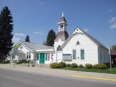
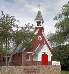
Every property in this county listed on the National Register of Historic Places, with the year it was listed and the federal nomination document.
Every wildfire the federal occurrence database records inside this county: 757 of them, burning about 99,683 acres. 325 started naturally and 3 were recorded as arson. Each settlement page carries the fires within five miles of it.
| Reported cause | Fires |
|---|---|
| Natural | 325 |
| Missing data/not specified/undetermined | 238 |
| Recreation and ceremony | 104 |
| Equipment and vehicle use | 31 |
| Debris and open burning | 19 |
| Power generation/transmission/distribution | 17 |
| Fireworks | 9 |
| Railroad operations and maintenance | 4 |
| Smoking | 4 |
| Arson/incendiarism | 3 |
| Misuse of fire by a minor | 2 |
| Firearms and explosives use | 1 |
The five largest, by the area the report gives. None of them was recorded as arson.
| Date | Cause | Size | Reported by | Name on the report |
|---|---|---|---|---|
| 25 June 2012 | Natural | 27,677 acres | Buffalo Field Office | CATO |
| 22 August 2006 | Natural | 12,309 acres | Buffalo Field Office | OUTLAW 2 |
| 14 June 2020 | Natural | 11,635 acres | Johnson County | RENO |
| 14 August 2012 | Natural | 8,189 acres | Bighorn National Forest | GILEAD |
| 26 August 1996 | Natural | 3,400 acres | Bighorn National Forest | STOCKWELL |
| 19 July 2003 | Natural | 3,338 acres | Buffalo Field Office | BIG SPRING |
| 14 August 2003 | Natural | 2,000 acres | Casper Field Office | FOUR MILE |
| 16 July 2020 | Missing data/not specified/undetermined | 1,960 acres | Johnson County | 25 |
Every settlement page carries the fires within five miles of it - see the settlement index below.
The NOAA Storm Events Database holds 290 reports for this county, causing no deaths, 2 injuries and about $2,360,430 in recorded property damage. Each settlement page carries the reports that name it.
| Kind of event | Reports |
|---|---|
| Hail | 152 |
| Thunderstorm Wind | 61 |
| Flash Flood | 27 |
| Tornado | 23 |
| Funnel Cloud | 14 |
| Flood | 11 |
| Wildfire | 2 |
The most serious of them, by death, then injury, then recorded damage. The accounts are quoted exactly as the forecast office filed them.
| When | Event | Place named | Harm | What the report says |
|---|---|---|---|---|
| August 1974 | Tornado (F1) | not stated | 2 hurt, $2,500 | no account filed |
| June 2015 | Flash Flood | Buffalo Arpt | $1,500,000 | The last in a series of thunderstorms on Wednesday, June 3, brought very heavy rain to Buffalo and the surrounding area. The ASOS at Johnson County Airport measured 0.98 inches of rain in less than 25 minutes as the storm moved north and then stalled over Buffalo. The ASOS recorded a grand total of 1.26 inches in less than one hour. Saturated soils were unable to absorb the rain which quickly ran through the streets of Buffalo and filled area creeks. Five Buffalo homes were declared destroyed, and the senior center and BLM office sustained flood damage. Some reports indicated water four feet deep in low-lying areas. The water was running fast enough to lift and carry the top layer of pavement on a couple of Buffalo streets. A few county roads and some private bridges were washed out due to culvert failures as a result of the raging flood waters. |
| August 2002 | Flash Flood | Kaycee | $459,000 | no account filed |
| June 2003 | Flash Flood | Buffalo | $60,000 | no account filed |
| May 2015 | Flood | Kaycee | $50,000 | Heavy rain fell in the tributaries of the Powder River in southern Johnson and northern Natrona counties. The South Fork of the Powder River along with Salt Creek were two of the major contributors to a rapid rise in the water level of the Powder River near Sussex. High water on both the North and Middle forks of the Powder River also served to flood the main stem. The river climbed more than 10 feet in less than 24 hours at Sussex and crested at 15.63 feet around 0500MST on Monday, May 25. This crest topped the previous record crest of 15.16 feet set in May 1978. Agricultural land downstream of Kaycee near Sussex was completely inundated and several ranches and vehicles were surrounded by water. |
| July 2013 | Flash Flood | Kaycee | $50,000 | Heavy rainfall estimated by radar to be 1 to 1.5 inches in less than 30 minutes inundated areas south of Barnum and into northern Natrona County. Blue Creek was flooded as were Poker Creek and some smaller streams feeding the Middle Fork of the Powder River. Several corrals were lost and damage was done to at least one out-building. One observer said it was the worst flooding they had seen in 27 years at their residence. Bar C Gap ran 6 to 7 feet deep and Bar C Ranch Road was covered with mud and debris.||Another hard hit area centered on Willow Creek and nearby drainages along the TTT-Lone Bear Road and West Willow Creek Road. Water was running over the roads in more than one location. |
| May 2008 | Flood | Buffalo Arpt | $50,000 | The combination of heavy rainfall of three to five inches and snowmelt from the nearby Bighorn Mountains caused Rock and Clear creeks to flood near Buffalo. The high water levels flooded some homes along Rock Creek where it flows beneath Interstate 90. |
| July 2007 | Flash Flood | Kaycee | $50,000 | The North Fork of the Powder River flooded northwest of Kaycee as five inches of rain fell in about two hours. State Highway 191, Mayoworth Road, had water flowing both over and under portions of the road. Traffic was reduced to one lane on the road due to the flood waters. A ranch bridge was washed out and 300 bales of hay were destroyed. |
| July 2001 | Flash Flood | Kaycee | $18,000 | no account filed |
| June 2010 | Hail | Lake De Smet | $15,000 | Severe thunderstorms skirted the Johnson/Sheridan County line. Hail up to baseball size was observed along Interstate 90. Six vehicles were reported pulled over on the side of the highway with shattered windshields. |
| July 2009 | Thunderstorm Wind | Lake De Smet | $15,000 | Thunderstorm winds toppled a semi-truck on Interstate 90 near mile marker 44 north of Buffalo. |
| July 2018 | Hail | Buffalo | $10,000 | A thunderstorm became severe and dropped large hail across central Johnson County, including along Interstate 25. A trained spotter 13 miles SSE of Buffalo reported golf ball sized hail and had two windows and a skylight broken by the hail. A farm along Trabing Road reported broken windows, truck mirrors and damaged siding on a house and barn. |
| June 2017 | Tornado (EF2) | Kaycee Gosney Arpt | $10,000 | A storm survey was conducted near Kaycee and confirmed a tornado. The tornado touched down on a hill just west of Interstate 25 and just north of the Middle Fork of the Powder River. The tornado downed many trees moving down the hill. The tornado then strengthened as it crossed a field. An abandoned trailer was destroyed with the base thrown over 200 yards. Trees in the field were snapped off above the bases with some ground scouring noted. The tornado then crossed Barnum Road and moved northward toward Pine Ridge. The tornado narrowly missed a house and a barn as it moved up the ridge. Numerous trees were downed along both sides of the ridgeline before the funnel lifted. Winds were estimated at 110 to 120 mph, a minimal EF2 tornado. |
| June 2015 | Flash Flood | Buffalo | $10,000 | Strong thunderstorms produced heavy rain across eastern Johnson and western Campbell counties near Interstate 90. The heaviest rain, estimated at three inches, fed Dead Horse Creek, a small tributary of the Powder River. Dead Horse Creek overflowed and eventually inundated a stretch of Interstate 90 around mileposts 90 and 91, which resulted in the closure of the road from late Wednesday evening, June 3, until the morning of June 4. |
| July 2009 | Thunderstorm Wind | Buffalo | $10,000 | Johnson County Dispatch reported estimated wind gusts of 70 to 80 mph which downed numerous trees and power lines in Buffalo. |
| August 1999 | Tornado (F1) | Kaycee | $8,000 | no account filed |
| September 2022 | Thunderstorm Wind | Mayoworth | $5,000 | A thunderstorm produced a microburst that brought tree damage in the vicinity of Doyle Creek Campground to the south of Hazelton in the Bighorn Range. Several trees were uprooted or snapped off above the ground. |
| May 2015 | Flood | Sussex | $5,000 | A flood wave moved north down the Powder River as a result of heavy rain over the Memorial Day Weekend. For the most part, impacts were confined to low lying land nearest the river. However, there was flooding of some infrastructure near the Interstate 90 Powder River bridge in eastern Johnson County. |
| June 2014 | Hail | Sussex | $5,000 | Golf ball sized and larger hail fell at a ranch east of Kaycee along State Highway 192. The largest stones were 3 inches in diameter. The large hail broke windows and screens, cracked a few windshields, and caused minor damage to ranch buildings. |
| July 2009 | Flash Flood | Mayoworth | $5,000 | Robinson Road near the mouth of Robinson Canyon was impacted by flash flood waters when culverts became inundated due to heavy rain. Radar estimated rainfall of three to four inches occurred in the Poison Creek and Middle Fork Crazy Woman Creek drainages at the foot of the Bighorn Mountains. A county road and bridge crew was required to clear the culvert and roadway. |
| June 1994 | Thunderstorm Wind | not stated | $5,000 | Strong winds erupted from a thunderstorm near Sussex uprooting trees and causing damage to several area ranches. These winds blew a 1000 lb gas tank off its stand and through a nearby fence. |
| June 2015 | Hail | Buffalo | $4,000 | Golf ball sized hail was reported at a pair of rural ranches along Tipperary Road east of Buffalo. The hail caused body damage to some vehicles. |
| June 1971 | Tornado (F1) | not stated | $2,500 | no account filed |
| June 2019 | Tornado (EF1) | Buffalo | $2,000 | An EF1 tornado touched down in the Big Horn Mountains near Powder River Pass and traveled east. Please see event summary for details. |
| May 2013 | Hail | Kaycee | $2,000 | One inch diameter hail was reported about 3 miles north-northeast of Kaycee. The hail broke out windows in an antique car. |
| August 2006 | Flash Flood | Buffalo | $1,400 | no account filed |
| May 2020 | Thunderstorm Wind | Buffalo Arpt | $1,000 | Pictures were posted on social media of a toppled outdoor play set and a roof was torn off a horse corral near Buffalo, Wyoming. |
| June 2015 | Hail | Buffalo | $1,000 | Golf ball sized hail fell at a ranch along Tipperary Road east of Buffalo. The hail broke one window at a home on the ranch. |
| July 2013 | Hail | Mayoworth | $1,000 | A near severe thunderstorm moved south-southeast across southern Johnson County. Ranchers reported hail up to the size of nickels. Heavy rain caused minor flooding at ranches around Mayoworth. Several hay and barley fields were damaged due to the combination of hail and rain. Other damage included broken camper windows and rear-view mirrors. |
| June 2013 | Hail | Buffalo Arpt | $1,000 | A trained spotter reported half dollar sized hail approximately six miles northwest of Buffalo. |
| August 2009 | Hail | Kaycee Gosney Arpt | $1,000 | Hail of 1.75 to 2.00 inches in diameter fell at a ranch northwest of Kaycee on State Highway 191. The hail broke a vehicle window. |
| July 2007 | Thunderstorm Wind | Kaycee | $500 | Four large cottonwoods were downed on a ranch northwest of Kaycee. The trees narrowly missed a trailer, but did crush a ranch fence. |
| July 1982 | Tornado (F0) | not stated | $250 | no account filed |
| May 1977 | Tornado (F1) | not stated | $250 | no account filed |
| June 1977 | Tornado (F1) | not stated | $30 | no account filed |
| April 2026 | Thunderstorm Wind | Buffalo | - | A 63 mph gust was recorded on the south side of Buffalo. A 59 mph wind gust occurred at the Johnson County airport. |
| May 2025 | Thunderstorm Wind | Buffalo Arpt | - | A CWOP site in Buffalo reported a 65 mph wind gust. The ASOS at the Johnson County airport had a 60 mph gust. |
| May 2025 | Thunderstorm Wind | Buffalo Arpt | - | Wind gusts of 60 mph occurred at the Johnson County Airport. |
| July 2025 | Hail | Kaycee | - | The public reported penny sized hail at a gas station in Kaycee. |
| July 2025 | Hail | Buffalo | - | The public reported ping pong ball sized hail along Interstate 25 to the south of Buffalo. |
| August 2025 | Thunderstorm Wind | Linch | - | Wind gusts as high as 65 mph occurred at sensors near I-25 in southern Johnson County. |
| July 2025 | Thunderstorm Wind | Mayoworth | - | A sheephearders monument was blown down near Tabletop Mountain in the Bighorn Mountain Range. Wind measurements from nearby sensors and structure damage support a 60 to 75 mph wind speed estimate. |
| August 2024 | Hail | Linch | - | A trained spotter reported hail up to quarter size that accumulated 1 to 2 inches on the ground. |
| July 2024 | Thunderstorm Wind | Buffalo Arpt | - | The Johnson County airport near Buffalo reported a wind gust of 60 mph. |
| August 2024 | Thunderstorm Wind | Buffalo Arpt | - | A severe thunderstorm moved eastward across northern Johnson County and brought high wind gusts. Gusts as high as 73 mph occurred along Interstate 90 to the southeast of Buffalo. A 64 mph wind gust was measured at the Johnson County Airport near Buffalo. |
| June 2023 | Flash Flood | Barnum | - | See episode for a description. |
| June 2023 | Tornado (EF0) | Kaycee | - | A rancher reported a brief touchdown of a tornado north of Kaycee to the Johnson County Sheriffs office. |
| July 2023 | Hail | Buffalo | - | Half dollar to golf ball size hail fell in and around Buffalo. |
| September 2023 | Flash Flood | Barnum | - | Reports to Sheriffs office of minor flooding across some of the dirt roads in southwestern portions of Johnson county. |
| June 2023 | Funnel Cloud | Buffalo | - | The public reported a funnel cloud to the east of Buffalo near TW Road. |
| June 2023 | Hail | Barnum | - | A supercell thunderstorm developed in the lee of the Bighorn range and brought large hail from Barnum to Kaycee. Hail the size of baseballs fell near Barnum with quarter size hail reported in Kaycee. |
| June 2022 | Thunderstorm Wind | Buffalo Arpt | - | A wind gust of 58 mph was reported at the Johnson County Airport near Buffalo, WY. |
| July 2022 | Thunderstorm Wind | Buffalo Arpt | - | A maximum wind gust of 61 mph was reported at the Johnson County Airport near Buffalo. |
| June 2022 | Thunderstorm Wind | Buffalo | - | A maximum wind gust of 61 mph was reported at the Johnson County Airport near Buffalo, WY. In the city of Buffalo, the public reported small limbs snapped off trees and a few shingles blown off roofs. |
| June 2022 | Hail | Barnum | - | A trained spotter reported quarter size hail near Barnum, WY. |
| June 2022 | Hail | Lake De Smet | - | Near Ucross, WY, ping pong ball sized hail was reported. |
| May 2021 | Hail | Buffalo | - | The public reported penny size hail in eastern Johnson County, Wyoming. |
| July 2021 | Hail | Buffalo | - | Trained spotters reported quarter-sized hail across portions of northern Johnson County to the east of Buffalo. |
| September 2021 | Thunderstorm Wind | Buffalo Arpt | - | ASOS recorded a peak wind gust of 63 mph. |
| May 2020 | Hail | Buffalo | - | A trained spotter reported nickel sized hail to the southeast of Buffalo, Wyoming. |
The Survey's mineral resources record lists 410 workings inside this county. 14 still produce and 396 are closed or unrecorded. Each settlement page carries the workings within five miles of it.
| Commodity | Workings |
|---|---|
| Uranium | 171 |
| Bentonite | 150 |
| Sand and Gravel, Construction | 51 |
| Gypsum-Anhydrite | 18 |
| Manganese | 5 |
| Copper | 3 |
| Manganese, Gold | 2 |
| Stone, Crushed/Broken | 2 |
| Vanadium | 2 |
| Vanadium, Uranium | 1 |
| Gold | 1 |
| Uranium, Selenium | 1 |
| Selenium | 1 |
| Gold, Copper | 1 |
The least common of them first, because a county's hundredth gravel pit says nothing its first ten did not.
| Where | Site | Commodity | Status | Recorded |
|---|---|---|---|---|
| Horn Venture | Thorium, REE | Occurrence | Allanite | |
| Kell Roy #3 Prospect | Uranium, Selenium | Occurrence | Coffinite, Tyuyamunite, Uraninite | |
| Kelly Creek | Gold | Past Producer | Placer | |
| Mosier Gulch | Limestone, General, Dolomite | Unknown | ||
| Pass Reservoir Area | Limestone, General, Gypsum-Anhydrite | Unknown | ||
| Roe Bros Group | Gold, Copper | Occurrence | ||
| Sad Sack Claims | Uranium, Selenium | Occurrence | Jarosite | |
| Unknown | Vanadium, Uranium | Occurrence | Stratabound | |
| Unknown | Magnesite | Occurrence | ||
| Big Horn Mine | Manganese, Gold | Past Producer | Gold | |
| Greenlee Nos. 1 & 2 | Uranium, Vanadium | Past Producer | ||
| Powder River Mine | Manganese, Gold | Past Producer | ||
| Tyjil No.1 | Uranium, Vanadium | Past Producer | ||
| Unknown | Stone, Crushed/Broken | Prospect | ||
| Unknown | Stone, Crushed/Broken | Prospect | ||
| Bull Camp Group | Copper | Prospect | ||
| Powder River Pass | Copper | Occurrence | ||
| Top Hand Group | Copper | Occurrence | ||
| Mangan Mine | Manganese | Occurrence | ||
| Taylor Prospect | Manganese | Occurrence | ||
| Unknown | Manganese | Prospect | ||
| Unknown | Manganese | Occurrence | ||
| Unknown | Manganese | Occurrence | ||
| Big Horn Mountains # 1 | Gypsum-Anhydrite | Unknown | ||
| Big Horn Mountains # 2 | Gypsum-Anhydrite | Unknown | ||
| Cottonwood Creek | Gypsum-Anhydrite | Unknown | ||
| Middle Fork, Crazy Woman Creek | Gypsum-Anhydrite | Unknown | ||
| Near Beaver Creek | Gypsum-Anhydrite | Unknown | ||
| North Fork, Powder River # 2 | Gypsum-Anhydrite | Unknown | ||
| North Rock Creek | Gypsum-Anhydrite | Unknown | ||
| Red Fork # 2 | Gypsum-Anhydrite | Unknown | ||
| Red Fork #1 | Gypsum-Anhydrite | Unknown | ||
| Red Fork Powder River Area # 1 | Gypsum-Anhydrite | Unknown | ||
| Red Fork Powder River Area #2 | Gypsum-Anhydrite | Unknown | ||
| Shell Creek | Gypsum-Anhydrite | Occurrence | ||
| Sisters Hill | Gypsum-Anhydrite | Unknown | ||
| South Fork Crazy Woman | Gypsum-Anhydrite | Unknown | ||
| Spring Creek | Gypsum-Anhydrite | Unknown | ||
| Unknown | Gypsum-Anhydrite | Unknown | ||
| Unknown | Gypsum-Anhydrite | Occurrence | ||
| Unknown | Gypsum-Anhydrite | Occurrence | ||
| Arno Pit | Sand and Gravel, Construction | Producer | ||
| Buffalo Sand and Gravel Pit | Sand and Gravel, Construction | Producer | ||
| Carter Pit | Sand and Gravel, Construction | Producer | ||
| Cellar Number Four | Sand and Gravel, Construction | Unknown | ||
| City Pit | Sand and Gravel, Construction | Unknown | ||
| Cross H Mesa D Pit | Sand and Gravel, Construction | Unknown | ||
| Cross H Mesa Pit C | Sand and Gravel, Construction | Unknown | ||
| Cross H Pit Number Two # 1 | Sand and Gravel, Construction | Unknown | ||
| Cross H Pit Number Two # 2 | Sand and Gravel, Construction | Unknown | ||
| Daniel's Pit Number Two | Sand and Gravel, Construction | Unknown | ||
| Dull Knife Dam | Sand and Gravel, Construction | Unknown | ||
| Gashey Pit Number Three | Sand and Gravel, Construction | Unknown | ||
| Gorden Pit | Sand and Gravel, Construction | Past Producer | ||
| Gunderman Pit | Sand and Gravel, Construction | Unknown | ||
| H. N. Thompson | Sand and Gravel, Construction | Unknown | ||
| Harriett Pit | Sand and Gravel, Construction | Unknown | ||
| Hepp Pit | Sand and Gravel, Construction | Unknown | ||
| Husen Pit B | Sand and Gravel, Construction | Unknown | ||
| Husen Pit Number A | Sand and Gravel, Construction | Unknown | ||
| Jarrard Extension | Sand and Gravel, Construction | Unknown | ||
| Jarrard Rock Pile | Sand and Gravel, Construction | Unknown | ||
| John Christian Pit | Sand and Gravel, Construction | Producer | ||
| Kearney Pit | Sand and Gravel, Construction | Unknown | ||
| Keith Pit Number One # 1 | Sand and Gravel, Construction | Unknown | ||
| Keith Pit Number One # 2 | Sand and Gravel, Construction | Unknown | ||
| Kershner | Sand and Gravel, Construction | Unknown | ||
| Marton Powder River Pit | Sand and Gravel, Construction | Unknown | ||
| Meike Pit Number Three | Sand and Gravel, Construction | Unknown | ||
| Microwave Pit | Sand and Gravel, Construction | Unknown | ||
| Morton Pit Number Two | Sand and Gravel, Construction | Unknown | ||
| Muir-Moor Head | Sand and Gravel, Construction | Unknown | ||
| Osborne | Sand and Gravel, Construction | Unknown | ||
| Pass Creek | Sand and Gravel, Construction | Unknown | ||
| Pelloux Pit | Sand and Gravel, Construction | Unknown | ||
| Rhodds Pit | Sand and Gravel, Construction | Unknown | ||
| Schiffer | Sand and Gravel, Construction | Unknown | ||
| Schmidt Pit | Sand and Gravel, Construction | Unknown | ||
| Shambaugh Number Two | Sand and Gravel, Construction | Unknown | ||
| Shell Creek | Sand and Gravel, Construction | Unknown | ||
| Site B | Sand and Gravel, Construction | Unknown | ||
| Skiles Pit Number One | Sand and Gravel, Construction | Unknown | ||
| Skiles-Reno Pit | Sand and Gravel, Construction | Unknown | ||
| Smith Pit Number One | Sand and Gravel, Construction | Unknown | ||
| Soldiers & Sailors Pit Number Three | Sand and Gravel, Construction | Unknown | ||
| South Fork Powder River | Sand and Gravel, Construction | Unknown | ||
| State Pit | Sand and Gravel, Construction | Unknown | ||
| Taylor | Sand and Gravel, Construction | Unknown | ||
| Thompson | Sand and Gravel, Construction | Unknown | ||
| Thompson Pit | Sand and Gravel, Construction | Unknown | ||
| Ullery | Sand and Gravel, Construction | Unknown | ||
| Ullery Pit Number Three | Sand and Gravel, Construction | Unknown | ||
| Benton Clay Bentonite Mine & Mill | Bentonite | Producer | ||
| Bentonite Draw | Bentonite | Producer | ||
| Crazy Woman Creek | Bentonite | Unknown | ||
| Durand #1 | Bentonite | Occurrence | ||
| Durand #2 | Bentonite | Occurrence | ||
| Durande Mine | Bentonite | Producer | ||
| Kaycee Bent Corp #19 | Bentonite | Occurrence | ||
| Kaycee Bent Corp #34 | Bentonite | Occurrence | ||
| Kaycee Bent Corp #40 | Bentonite | Occurrence | ||
| Kaycee Bent Corp #6 | Bentonite | Occurrence | ||
| Kaycee Bent Corp #7 | Bentonite | Occurrence | ||
| Kaycee Bent Corp #70 | Bentonite | Occurrence | ||
| Kaycee Bent Corp #92 | Bentonite | Occurrence | ||
| Kaycee Bent Corp #96 | Bentonite | Occurrence | ||
| Kaycee Bentonite Corp #1 | Bentonite | Occurrence | ||
| Kaycee Bentonite Corp #10 | Bentonite | Occurrence | ||
| Kaycee Bentonite Corp #11 | Bentonite | Occurrence | ||
| Kaycee Bentonite Corp #12 | Bentonite | Occurrence | ||
| Kaycee Bentonite Corp #13 | Bentonite | Occurrence | ||
| Kaycee Bentonite Corp #14 | Bentonite | Occurrence | ||
| Kaycee Bentonite Corp #15 | Bentonite | Occurrence | ||
| Kaycee Bentonite Corp #16 | Bentonite | Occurrence | ||
| Kaycee Bentonite Corp #17 | Bentonite | Occurrence | ||
| Kaycee Bentonite Corp #18 | Bentonite | Occurrence | ||
| Kaycee Bentonite Corp #2 | Bentonite | Occurrence | ||
| Kaycee Bentonite Corp #20 | Bentonite | Occurrence | ||
| Kaycee Bentonite Corp #21 | Bentonite | Occurrence | ||
| Kaycee Bentonite Corp #22 | Bentonite | Occurrence | ||
| Kaycee Bentonite Corp #23 | Bentonite | Occurrence | ||
| Kaycee Bentonite Corp #24 | Bentonite | Occurrence | ||
| Kaycee Bentonite Corp #25 | Bentonite | Occurrence | ||
| Kaycee Bentonite Corp #26 | Bentonite | Occurrence | ||
| Kaycee Bentonite Corp #27 | Bentonite | Occurrence | ||
| Kaycee Bentonite Corp #28 | Bentonite | Occurrence | ||
| Kaycee Bentonite Corp #29 | Bentonite | Occurrence | ||
| Kaycee Bentonite Corp #3 | Bentonite | Occurrence | ||
| Kaycee Bentonite Corp #30 | Bentonite | Occurrence | ||
| Kaycee Bentonite Corp #31 | Bentonite | Occurrence | ||
| Kaycee Bentonite Corp #32 | Bentonite | Occurrence | ||
| Kaycee Bentonite Corp #33 | Bentonite | Occurrence | ||
| Kaycee Bentonite Corp #35 | Bentonite | Occurrence | ||
| Kaycee Bentonite Corp #36 | Bentonite | Occurrence | ||
| Kaycee Bentonite Corp #37 | Bentonite | Occurrence | ||
| Kaycee Bentonite Corp #38 | Bentonite | Occurrence | ||
| Kaycee Bentonite Corp #4 | Bentonite | Occurrence | ||
| Kaycee Bentonite Corp #41 | Bentonite | Occurrence | ||
| Kaycee Bentonite Corp #42 | Bentonite | Producer | ||
| Kaycee Bentonite Corp #43 | Bentonite | Occurrence | ||
| Kaycee Bentonite Corp #44 | Bentonite | Occurrence | ||
| Kaycee Bentonite Corp #45 | Bentonite | Occurrence | ||
| Kaycee Bentonite Corp #46 | Bentonite | Occurrence | ||
| Kaycee Bentonite Corp #47 | Bentonite | Occurrence | ||
| Kaycee Bentonite Corp #48 | Bentonite | Occurrence | ||
| Kaycee Bentonite Corp #49 | Bentonite | Occurrence | ||
| Kaycee Bentonite Corp #5 | Bentonite | Occurrence | ||
| Kaycee Bentonite Corp #50 | Bentonite | Occurrence | ||
| Kaycee Bentonite Corp #51 | Bentonite | Occurrence | ||
| Kaycee Bentonite Corp #52 | Bentonite | Occurrence | ||
| Kaycee Bentonite Corp #53 | Bentonite | Occurrence | ||
| Kaycee Bentonite Corp #54 | Bentonite | Occurrence | ||
| Kaycee Bentonite Corp #55 | Bentonite | Occurrence | ||
| Kaycee Bentonite Corp #57 | Bentonite | Occurrence | ||
| Kaycee Bentonite Corp #58 | Bentonite | Occurrence | ||
| Kaycee Bentonite Corp #59 | Bentonite | Occurrence | ||
| Kaycee Bentonite Corp #60 | Bentonite | Occurrence | ||
| Kaycee Bentonite Corp #61 | Bentonite | Unknown | ||
| Kaycee Bentonite Corp #62 | Bentonite | Occurrence | ||
| Kaycee Bentonite Corp #64 | Bentonite | Occurrence | ||
| Kaycee Bentonite Corp #65 | Bentonite | Occurrence | ||
| Kaycee Bentonite Corp #66 | Bentonite | Occurrence | ||
| Kaycee Bentonite Corp #67 | Bentonite | Occurrence | ||
| Kaycee Bentonite Corp #68 | Bentonite | Occurrence | ||
| Kaycee Bentonite Corp #71 | Bentonite | Occurrence | ||
| Kaycee Bentonite Corp #72 | Bentonite | Occurrence | ||
| Kaycee Bentonite Corp #73 | Bentonite | Occurrence | ||
| Kaycee Bentonite Corp #74 | Bentonite | Occurrence | ||
| Kaycee Bentonite Corp #75 | Bentonite | Occurrence | ||
| Kaycee Bentonite Corp #76 | Bentonite | Occurrence | ||
| Kaycee Bentonite Corp #77 | Bentonite | Occurrence | ||
| Kaycee Bentonite Corp #78 | Bentonite | Occurrence | ||
| Kaycee Bentonite Corp #79 | Bentonite | Occurrence | ||
| Kaycee Bentonite Corp #8 | Bentonite | Occurrence | ||
| Kaycee Bentonite Corp #80 | Bentonite | Occurrence | ||
| Kaycee Bentonite Corp #81 | Bentonite | Occurrence | ||
| Kaycee Bentonite Corp #82 | Bentonite | Occurrence | ||
| Kaycee Bentonite Corp #83 | Bentonite | Occurrence | ||
| Kaycee Bentonite Corp #84 | Bentonite | Occurrence | ||
| Kaycee Bentonite Corp #85 | Bentonite | Occurrence | ||
| Kaycee Bentonite Corp #86 | Bentonite | Occurrence | ||
| Kaycee Bentonite Corp #87 | Bentonite | Occurrence | ||
| Kaycee Bentonite Corp #88 | Bentonite | Occurrence | ||
| Kaycee Bentonite Corp #89 | Bentonite | Occurrence | ||
| Kaycee Bentonite Corp #9 | Bentonite | Occurrence | ||
| Kaycee Bentonite Corp #90 | Bentonite | Occurrence | ||
| Kaycee Bentonite Corp #91 | Bentonite | Occurrence | ||
| Kaycee Bentonite Corp #93 | Bentonite | Occurrence | ||
| Kaycee Bentonite Corp #94 | Bentonite | Occurrence | ||
| Kaycee Bentonite Corp #95 | Bentonite | Occurrence | ||
| Kaycee Bentonite Corp #97 | Bentonite | Occurrence | ||
| Kaycee Bentonite Corp #98 | Bentonite | Occurrence | ||
| Kaycee Bentonite Corp #99 | Bentonite | Occurrence | ||
| Kaycee Bentonite Corp.#39 | Bentonite | Occurrence | ||
| Kaycee Bentonite Corp.#63 | Bentonite | Occurrence | ||
| Kaycee Bentonite Corp.#69 | Bentonite | Occurrence | ||
| Kaycee Bentonite Mine #100 | Bentonite | Producer | ||
| Kaycee Bentonite Mine #56 | Bentonite | Occurrence | ||
| Keith Ditch | Bentonite | Past Producer | ||
| Kidd Ranch North End | Bentonite | Occurrence | ||
| Mayoworth #11 | Bentonite | Unknown | ||
| Mayworth #5 | Bentonite | Occurrence | ||
| Mayworth # 10 | Bentonite | Unknown | ||
| Mayworth #1 | Bentonite | Occurrence | ||
| Mayworth #2 | Bentonite | Occurrence | ||
| Mayworth #6 | Bentonite | Occurrence | ||
| Mayworth #7 & 8 | Bentonite | Occurrence | ||
| Mayworth #9 | Bentonite | Occurrence | ||
| Muddy Creek | Bentonite | Unknown | ||
| Murphy Creek Area | Bentonite | Unknown | ||
| North Fork Powder River # 1 | Bentonite | Unknown | ||
| Peterson Draw | Bentonite | Unknown | ||
| Posey Creek Area | Bentonite | Producer | ||
| Slate Ridge #1 | Bentonite | Occurrence | ||
| Slate Ridge #10 | Bentonite | Occurrence | ||
| Slate Ridge #3 | Bentonite | Occurrence | ||
| Slate Ridge #5 | Bentonite | Occurrence | ||
| Slate Ridge #7 | Bentonite | Occurrence | ||
| Slate Ridge #8 | Bentonite | Occurrence | ||
| Slate Ridge #9 | Bentonite | Occurrence | ||
| Slate Ridge Number Eleven | Bentonite | Occurrence | ||
| Slate Ridge Number Four | Bentonite | Occurrence | ||
| Slate Ridge Number Six | Bentonite | Occurrence | ||
| Slate Ridge Number Two | Bentonite | Occurrence | ||
| South Fork, Crazy Woman Creek | Bentonite | Past Producer | ||
| South Kaycee Mine | Bentonite | Producer | ||
| Tisdale # 1 | Bentonite | Occurrence | ||
| Tisdale # 2 | Bentonite | Occurrence | ||
| Tisdale # 3 | Bentonite | Occurrence | ||
| Tisdale # 4 | Bentonite | Occurrence | ||
| Tisdale # 5 | Bentonite | Occurrence | ||
| Tisdale # 6 | Bentonite | Occurrence | ||
| Tisdale # 7 | Bentonite | Occurrence | ||
| Tisdale # 8 | Bentonite | Occurrence | ||
| Tisdale # 9 | Bentonite | Occurrence | ||
| Tisdale #10 | Bentonite | Occurrence | ||
| Tisdale #11 | Bentonite | Occurrence | ||
| Unknown | Bentonite | Unknown | ||
| Unknown | Bentonite | Prospect | ||
| Unknown | Bentonite | Prospect | ||
| Unknown | Bentonite | Unknown | ||
| Unknown | Bentonite | Occurrence | ||
| Alice Mae | Uranium | Past Producer | ||
| Antelope Group | Uranium | Past Producer | ||
| Bear Lodge | Uranium | Occurrence | ||
| Betsey Bass Claim | Uranium | Occurrence | ||
| Chabot Mine | Uranium | Producer | ||
| Channel Deposit | Uranium | Unknown | ||
| Charlie Ore Body | Uranium | Unknown | ||
| Christensen Lease No.2 | Uranium | Unknown | ||
| Columbus Group | Uranium | Past Producer | ||
| Craney Draw | Uranium | Unknown | ||
| Del | Uranium | Past Producer | ||
| Del 1 Or Lucky Lady 2 | Uranium | Past Producer | ||
| Del Linch Claim | Uranium | Occurrence | Carnotite | |
| Del Linch Claim | Uranium | Occurrence | Stratabound | |
| Desert Queen | Uranium | Occurrence | Stratabound | |
| Desert Queen | Uranium | Unknown | ||
| Figure 8 #3 | Uranium | Occurrence | Stratabound | |
| Forest Group | Uranium | Unknown | ||
| Forked Canyon No 2 | Uranium | Occurrence | ||
| Frank Claims | Uranium | Occurrence | ||
| Hanna 1 | Uranium | Prospect | ||
| Hanna 4 | Uranium | Occurrence | ||
| Hannah #1 | Uranium | Occurrence | Stratabound | |
| Happy No. 1 | Uranium | Occurrence | ||
| Irigaray Mine | Uranium | Producer | stratabound | |
| Irvine Ranch Area | Uranium | Occurrence | Stratabound | |
| Irvine Ranch Area | Uranium | Occurrence | Carnotite, Pyrolusite | |
| J L Masek #1 | Uranium | Occurrence | ||
| J.L. Masek's Lode #1 | Uranium | Occurrence | ||
| Jack Christansen | Uranium | Past Producer | ||
| Jack Rabbit Nos. 1+2 Claims | Uranium | Occurrence | ||
| Jane 1 | Uranium | Occurrence | ||
| Jarris-Marie #1 | Uranium | Occurrence | ||
| Jeri Meri Mine | Uranium | Past Producer | ||
| Jerrie Marie | Uranium | Occurrence | Stratabound | |
| Jerrie Marie Prospect | Uranium | Occurrence | Coffinite | |
| Jim Dandy | Uranium | Prospect | ||
| Karl 3 Claim | Uranium | Occurrence | ||
| Kay Cee Project | Uranium | Prospect | ||
| Kel-Roy | Uranium | Past Producer | ||
| Kell Roy #3 | Uranium | Occurrence | Stratabound | |
| Kerr-Mcgee Stan 7 Or 8 Claims | Uranium | Occurrence | ||
| Lem 3 and 4 and Moe 3 and 4 Claims | Uranium | Occurrence | ||
| Loc. 111 | Uranium | Occurrence | Stratabound | |
| Loc. 115 | Uranium | Occurrence | Stratabound | |
| Loc. 118 | Uranium | Occurrence | ||
| Loc. 157 | Uranium | Occurrence | Stratabound | |
| Loc. 77. | Uranium | Occurrence | Stratabound | |
| Loc. 90 | Uranium | Occurrence | Stratabound | |
| Lode #1 | Uranium | Occurrence | Stratabound | |
| Lucky 7 | Uranium | Unknown | ||
| Lucky Three Group | Uranium | Prospect | ||
| Missy #1 | Uranium | Past Producer | ||
| Moe 14 | Uranium | Past Producer | ||
| Mountain #1 U Co. | Uranium | Past Producer | ||
| Ole Claims | Uranium | Prospect | ||
| Opal Claims | Uranium | Occurrence | ||
| P Claim | Uranium | Past Producer | ||
| Quincy Claims | Uranium | Occurrence | ||
| Ram #3 & #4 | Uranium | Occurrence | ||
| Ramsbottom Prospect | Uranium | Occurrence | ||
| Ramshorn #1 | Uranium | Prospect | ||
| Ray Claims | Uranium | Prospect | ||
| Sad Sack 6 | Uranium | Occurrence | ||
| Sad Sack Claim | Uranium | Occurrence | Stratabound | |
| Snakebite No.2 | Uranium | Past Producer | ||
| South Peak Mining Property | Uranium | Past Producer | ||
| Sunset Claim Group | Uranium | Prospect | ||
| Sunset Mines | Uranium | Past Producer | Stratabound | |
| Taylor | Uranium | Unknown | ||
| Unknown | Uranium | Occurrence | Stratabound | |
| Unknown | Uranium | Occurrence | ||
| Unknown | Uranium | Occurrence | Stratabound | |
| Unknown | Uranium | Occurrence | ||
| Unknown | Uranium | Occurrence | ||
| Unknown | Uranium | Occurrence | ||
| Unknown | Uranium | Occurrence | ||
| Unknown | Uranium | Occurrence | ||
| Unknown | Uranium | Occurrence | ||
| Unknown | Uranium | Occurrence | ||
| Unknown | Uranium | Unknown | ||
| Unknown | Uranium | Occurrence | ||
| Unknown | Uranium | Occurrence | ||
| Unknown | Uranium | Occurrence | ||
| Unknown | Uranium | Occurrence | ||
| Unknown | Uranium | Occurrence | ||
| Unknown | Uranium | Occurrence | ||
| Unknown | Uranium | Occurrence | ||
| Unknown | Uranium | Occurrence | ||
| Unknown | Uranium | Past Producer | ||
| Unknown | Uranium | Occurrence | ||
| Unknown | Uranium | Occurrence | ||
| Unknown | Uranium | Occurrence | ||
| Unknown | Uranium | Occurrence | ||
| Unknown | Uranium | Unknown | ||
| Unknown | Uranium | Occurrence | ||
| Unknown | Uranium | Occurrence | ||
| Unknown | Uranium | Past Producer | ||
| Unknown | Uranium | Occurrence | ||
| Unknown | Uranium | Occurrence | ||
| Unknown | Uranium | Occurrence | ||
| Unknown | Uranium | Occurrence | ||
| Unknown | Uranium | Occurrence | ||
| Unknown | Uranium | Occurrence | ||
| Unknown | Uranium | Past Producer | ||
| Unknown | Uranium | Occurrence | ||
| Unknown | Uranium | Occurrence | ||
| Unknown | Uranium | Occurrence | ||
| Unknown | Uranium | Occurrence | ||
| Unknown | Uranium | Occurrence | ||
| Unknown | Uranium | Occurrence | ||
| Unknown | Uranium | Past Producer | ||
| Unknown | Uranium | Past Producer | ||
| Unknown | Uranium | Occurrence | ||
| Unknown | Uranium | Occurrence | ||
| Unknown | Uranium | Past Producer | ||
| Unknown | Uranium | Past Producer | ||
| Unknown | Uranium | Occurrence | ||
| Unknown | Uranium | Occurrence | ||
| Unknown | Uranium | Past Producer | ||
| Unknown | Uranium | Occurrence | ||
| Unknown | Uranium | Occurrence | ||
| Unknown | Uranium | Occurrence | ||
| Unknown | Uranium | Occurrence | ||
| Unknown | Uranium | Occurrence | ||
| Unknown | Uranium | Occurrence | ||
| Unknown | Uranium | Occurrence | ||
| Unknown | Uranium | Occurrence | ||
| Unknown | Uranium | Occurrence | ||
| Unknown | Uranium | Past Producer | ||
| Unknown | Uranium | Occurrence | ||
| Unknown | Uranium | Past Producer | ||
| Unknown | Uranium | Occurrence | ||
| Unknown | Uranium | Occurrence | ||
| Unknown | Uranium | Past Producer | ||
| Unknown | Uranium | Occurrence | ||
| Unknown | Uranium | Occurrence | ||
| Unknown | Uranium | Occurrence | ||
| Unknown | Uranium | Occurrence | ||
| Unknown | Uranium | Unknown | ||
| Unknown | Uranium | Occurrence | ||
| Unknown | Uranium | Past Producer | ||
| Unknown | Uranium | Occurrence | ||
| Unknown | Uranium | Occurrence | ||
| Unknown | Uranium | Occurrence | ||
| Unknown | Uranium | Occurrence | ||
| Unknown | Uranium | Occurrence | ||
| Unknown | Uranium | Occurrence | ||
| Unknown | Uranium | Occurrence | ||
| Unknown | Uranium | Occurrence | ||
| Unknown | Uranium | Past Producer | ||
| Unknown | Uranium | Past Producer | ||
| Unknown | Uranium | Occurrence | ||
| Unknown | Uranium | Occurrence | ||
| Unknown | Uranium | Occurrence | ||
| Unknown | Uranium | Past Producer | ||
| Unknown | Uranium | Past Producer | ||
| Unknown | Uranium | Occurrence | ||
| Unknown | Uranium | Occurrence | ||
| Unknown | Uranium | Occurrence | ||
| Unknown (sample anomaly #248) | Uranium | Occurrence | ||
| Unknown No.1 | Uranium | Past Producer | ||
| Unknown No.2 | Uranium | Past Producer | ||
| Unknown No.3 | Uranium | Past Producer | ||
| Unknown No.4 | Uranium | Past Producer | ||
| Unknown-Kerr-Mcgee Prop. | Uranium | Past Producer | ||
| Unnamed | Uranium | Occurrence | ||
| Unnamed | Uranium | Producer |
Named settlements recorded in the Geographic Names Information System, each with the topographic sheets covering it. Villages, hamlets and abandoned places alike. Each is shown with the nearest named watercourse or landform and the survey quadrangle it falls on.
Buffalo census division · 82834 · Near Dump Draw · Buffalo quadrangle
12 sheets, 1900 to 1978
Buffalo census division · 82834 · On Basco Creek · Hazelton quadrangle
12 sheets, 1900 to 1993
Buffalo census division · 82832 · Near Pilot Knob · Banner quadrangle
13 sheets, 1909 to 1979
Kaycee census division · 82639 · Near Linstead Flats · Wall Creek quadrangle
6 sheets, 1955 to 1962
Kaycee census division · 82639 · On Willow Creek · Mayoworth quadrangle
6 sheets, 1955 to 1979
Buffalo census division · 82834 · On Spring Creek · Stone Mountain quadrangle
13 sheets, 1900 to 1993
Kaycee census division · 82640 · Near Reeves Draw · Linch quadrangle
7 sheets, 1954 to 1962