Block
From the record
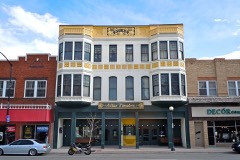
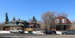
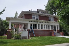
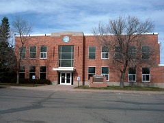
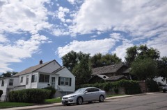
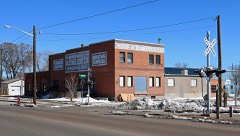
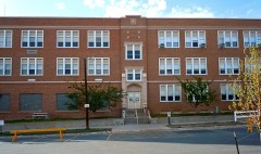
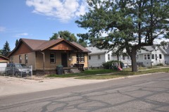
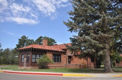
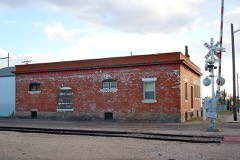
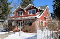
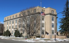
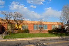
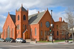
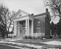
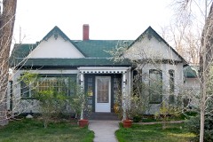
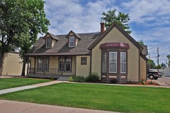
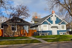
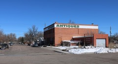
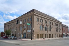
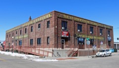
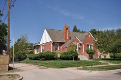
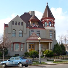
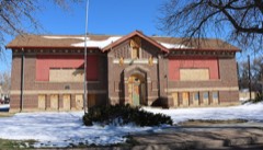
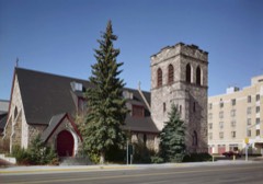
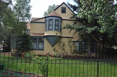
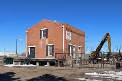
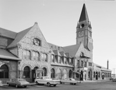
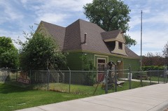
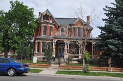
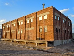
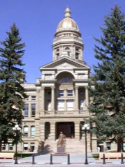
60 National Register listings published here, 4 of them National Historic Landmarks.
Sources: the National Register database, National Park Service
75 topographic sheets cover 27 settlements here, and 60 properties are on the National Register of Historic Places.
60 National Register listings published here, 4 of them National Historic Landmarks.
Sources: the National Register database, National Park Service
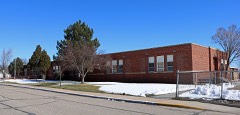
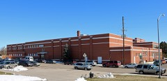
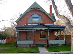
Every property in this county listed on the National Register of Historic Places, with the year it was listed and the federal nomination document.
Every wildfire the federal occurrence database records inside this county: 555 of them, burning about 22,467 acres. 46 started naturally and 4 were recorded as arson. Each settlement page carries the fires within five miles of it.
| Reported cause | Fires |
|---|---|
| Missing data/not specified/undetermined | 180 |
| Debris and open burning | 99 |
| Fireworks | 52 |
| Natural | 46 |
| Equipment and vehicle use | 41 |
| Railroad operations and maintenance | 41 |
| Recreation and ceremony | 28 |
| Misuse of fire by a minor | 28 |
| Smoking | 22 |
| Power generation/transmission/distribution | 14 |
| Arson/incendiarism | 4 |
The five largest, by the area the report gives. None of them was recorded as arson.
| Date | Cause | Size | Reported by | Name on the report |
|---|---|---|---|---|
| 27 January 2004 | Missing data/not specified/undetermined | 6,400 acres | Wyoming State Forestry | not named |
| 27 January 2004 | Missing data/not specified/undetermined | 3,014 acres | Casper Interagency Dispatch Center | ROSETTA LANE |
| 17 September 2005 | Missing data/not specified/undetermined | 3,000 acres | Fort Laramie National Historic Site | LITTLEBEAR |
| 23 March 2015 | Natural | 1,892 acres | Wyoming State Forestry | 2 TRACK |
| 29 October 2018 | Debris and open burning | 1,575 acres | Laramie County | 124 FIRE |
| 14 April 2017 | Missing data/not specified/undetermined | 500 acres | Laramie County | SOUTH GREELEY HIGHWAY FIRE |
| 25 August 2020 | Missing data/not specified/undetermined | 450 acres | Laramie County | CHALK BLUFF |
| 1 October 2016 | Missing data/not specified/undetermined | 440 acres | Laramie County | OTTO ROAD |
Every settlement page carries the fires within five miles of it - see the settlement index below.
The NOAA Storm Events Database holds 1,592 reports for this county, causing 1 death, 46 injuries and about $68,290,200 in recorded property damage. Each settlement page carries the reports that name it.
| Kind of event | Reports |
|---|---|
| Hail | 1104 |
| Thunderstorm Wind | 233 |
| Tornado | 128 |
| Flash Flood | 86 |
| Funnel Cloud | 19 |
| Heavy Rain | 15 |
| Flood | 6 |
| Lightning | 1 |
The most serious of them, by death, then injury, then recorded damage. The accounts are quoted exactly as the forecast office filed them.
| When | Event | Place named | Harm | What the report says |
|---|---|---|---|---|
| July 1979 | Tornado (F3) | not stated | 1 killed, 40 hurt, $25,000,000 | no account filed |
| August 1987 | Hail | not stated | 3 hurt | no account filed |
| April 1960 | Tornado (F3) | not stated | 1 hurt, $25,000 | no account filed |
| June 1977 | Tornado (F1) | not stated | 1 hurt, $30 | no account filed |
| June 1994 | Thunderstorm Wind | Cheyenne | 1 hurt | Microburst winds roared across central and eastern Laramie county, including the city of Cheyenne, producing damage and downing trees. One woman broke her arm when the winds knocked her off balance and to the ground. Major roof damage occurred at Cheyenne Central High School, while windows were blown out of the west side of a home in northeast Cheyenne. Winds in the northeast part of the city were estimated at 100 mph! A gust of 84 mph was clocked at the Cheyenne airport. Nineteen power poles were snapped off in east Cheyenne leaving hundreds of homes without power there for up to eight hours. Several homes under construction and barns in east Cheyenne were leveled by the winds. Funnel clouds were also reported by a sheriffs deputy as the storm moved through eastern Laramie county, but none touched down. |
| August 2002 | Hail | Cheyenne | $30,000,000 | Hail from 1 inch up to 2.75 inches in diameter fell over mainly the central and western parts of the city of Cheyenne, WY. Significant damage was reported to automobiles and roofs. |
| July 1996 | Hail | Cheyenne | $4,000,000 | no account filed |
| July 1996 | Hail | Cheyenne | $3,400,000 | no account filed |
| August 1996 | Hail | Cheyenne | $2,400,000 | no account filed |
| August 2025 | Hail | Cheyenne | $1,000,000 | Emergency manager reported base ball sized hail in Cheyenne.|Estimated property damage citywide from all reports with this event total at least $1 million per Laramie County EMA. |
| July 1996 | Hail | Albin | $1,000,000 | no account filed |
| June 2024 | Hail | Archer | $400,000 | A trained weather spotter measured 2-inch diameter hail 9 miles SSW of Hillsdale. |
| May 1991 | Tornado (F1) | not stated | $250,000 | no account filed |
| July 2023 | Flash Flood | Federal | $60,000 | Received reports via Facebook of outbuilding surrounded by water and garages flooding. |
| May 2010 | Thunderstorm Wind | Burns | $50,000 | Damage to houses and signs in town. |
| May 2010 | Tornado (EF2) | Burns | $50,000 | A National Weather Service storm survey determined a tornado that struck Burns Wyoming the evening of May 18 was rated an EF-2. One house lost its roof. Additionally, the storm that spawned the tornado produced hail the size of golfballs which accumulated to over 3 feet in depth. |
| August 1996 | Hail | Albin | $50,000 | no account filed |
| May 2007 | Thunderstorm Wind | Cheyenne | $30,000 | Strong microburst winds produced some damage to mainly the western side of Cheyenne, including a report of a trailer blown into a power pole. Some|damage to signage occurred along with damage to a dugout building at a local ballpark. Some hail up to 3/4 inch in diameter was also reported. |
| June 2003 | Hail | Cheyenne | $30,000 | 1 1/2 to 2 inch diameter hail reported. |
| August 2002 | Tornado (F0) | Burns | $30,000 | Tornado moved over open country but caused some damage to power lines and out buildings. |
| June 2001 | Hail | Burns | $30,000 | no account filed |
| August 1996 | Hail | Cheyenne | $30,000 | no account filed |
| August 1996 | Flood | Cheyenne | $30,000 | no account filed |
| June 2024 | Thunderstorm Wind | (Cys)Cheyenne Airport | $25,000 | A trained weather spotter reported pole barns destroyed northeast of the intersection of Iron Mountain Road and Powderhouse Road in North Cheyenne. Wind gusts were estimated at 80 MPH. |
| June 2007 | Hail | Cheyenne | $25,000 | A slow moving severe thunderstorm produced hail from 1 to 1.75 inches in diameter along a track from south of Cheyenne to Hillsdale, Wyoming, about 16 miles east of Cheyenne. Some windows and skylights were broken in Hillsdale, WY. |
| June 1997 | Hail | Cheyenne | $25,000 | no account filed |
| June 1991 | Tornado (F0) | not stated | $25,000 | no account filed |
| June 2009 | Hail | Cheyenne | $20,000 | Hail from 1 to 1.75 inches in diameter fell northeast of Cheyenne, WY, damaging some roofs and cars. |
| May 2008 | Tornado (EF1) | Cheyenne | $20,000 | Tornado tracked over open country, but did destroy a pole barn. |
| July 2006 | Flash Flood | Cheyenne | $20,000 | A thunderstorm produced very heavy rain over far western Laramie county. Floodwaters producedsevere wash-away damage to county roads 110 and 110-A near Happy Jack Road with water reported to have flowed almost a foot deep over Happy Jack Road. |
| August 2000 | Flash Flood | West Portion | $20,000 | Heavy rains fell over parts of western Laramie county west of Cheyenne, with estimatesof 4 to 6 inches over an area southwest of Federal, WY. Some flooding was reported onHappy Jack Road, with parts of county road 109 washed out. |
| June 1997 | Hail | Cheyenne | $20,000 | no account filed |
| August 1996 | Hail | Cheyenne | $20,000 | no account filed |
| August 1996 | Hail | Cheyenne | $20,000 | no account filed |
| July 1998 | Hail | Cheyenne | $15,000 | A storm produced quarter size hail 9 miles south of Cheyenne. The hail covered the ground and wind driven hail broke some automobile windshields. |
| July 2006 | Thunderstorm Wind | Burns | $10,000 | Thunderstorm winds blew shingles off a roof west-southwest of Burns, WY, and removed a barn roof3 miles south of Burns, WY. |
| May 1999 | Hail | Hillsdale | $10,000 | no account filed |
| July 1997 | Hail | Cheyenne | $10,000 | no account filed |
| July 1997 | Hail | Burns | $10,000 | no account filed |
| July 1996 | Flood | Cheyenne | $10,000 | no account filed |
| August 1996 | Hail | Cheyenne | $10,000 | no account filed |
| August 1996 | Flood | Cheyenne | $10,000 | no account filed |
| May 2010 | Thunderstorm Wind | Burns | $5,000 | Several power poles knocked down. |
| July 1996 | Thunderstorm Wind | Cheyenne | $5,000 | no account filed |
| August 1996 | Hail | Cheyenne | $5,000 | no account filed |
| May 2010 | Thunderstorm Wind | Cheyenne | $4,000 | House had roof damage. |
| May 1998 | Hail | Cheyenne | $4,000 | A storm produced golf ball size hail 20 miles north of Cheyenne. |
| July 1995 | Thunderstorm Wind | not stated | $4,000 | Strong, small scale winds from a thunderstorm tore the metal roof off of a barn six miles southeast of Cheyenne. Debris was scattered 200 yards. Damage area was 200 feet long and 40 feet wide. |
| May 2010 | Thunderstorm Wind | Pine Bluffs | $3,000 | Center pivots blown over at intersection of County Roads 212 and 158. |
| July 1998 | Hail | Cheyenne | $3,000 | Spotters reported quarter size hail on the Terry Bison Ranch 10 miles southwest of Cheyenne. |
| June 1997 | Hail | Cheyenne | $3,000 | Hail piled to a 4 inch depth. |
| May 2010 | Hail | Burns | $2,500 | Ground covered in hail. Damage to siding of house. |
| May 2010 | Thunderstorm Wind | Cheyenne | $2,500 | Out building had roof removed. |
| May 1990 | Tornado (F2) | not stated | $2,500 | no account filed |
| May 1990 | Tornado (F1) | not stated | $2,500 | no account filed |
| July 1979 | Tornado (F0) | not stated | $2,500 | no account filed |
| August 1974 | Tornado (F1) | not stated | $2,500 | no account filed |
| April 1971 | Tornado (F1) | not stated | $2,500 | no account filed |
| June 1968 | Tornado (F1) | not stated | $2,500 | no account filed |
| June 1968 | Tornado (F1) | not stated | $2,500 | no account filed |
The Survey's mineral resources record lists 49 workings inside this county. 11 still produce and 38 are closed or unrecorded. Each settlement page carries the workings within five miles of it.
| Commodity | Workings |
|---|---|
| Copper | 15 |
| Sand and Gravel, Construction | 11 |
| Silver, Gold | 3 |
| Silver | 3 |
| Stone, Crushed/Broken | 2 |
| Gold, Silver | 2 |
| Gold | 2 |
| Dolomite | 2 |
| Feldspar | 2 |
| Flagstone | 2 |
| Limestone, Dimension | 2 |
| Molybdenum | 1 |
| Manganese, Lithium, Tellurium, Uranium, Lead, Silver, Gold | 1 |
| Lead, Selenium, Uranium | 1 |
The least common of them first, because a county's hundredth gravel pit says nothing its first ten did not.
| Where | Site | Commodity | Status | Recorded |
|---|---|---|---|---|
| Bear Deposit | Feldspar, Fluorine-Fluorite | Past Producer | ||
| CK Gold | Gold, Copper, Silver | Past Producer | 1879, 1881 | |
| Carbonate Belle Claim | Manganese, Lithium, Tellurium, Uranium, Lead, Silver, Gold | Occurrence | Psilomelane, Torbernite, Triphylite | |
| Globe Prospect | Copper, Iron | Occurrence | ||
| Grant Claim | Lead, Selenium, Uranium | Occurrence | ||
| Great Standard Group | Gold, Copper, Silver | Past Producer | Bornite, Chalcopyrite, Copper, Malachite, Pyrite | |
| Great Standard Group | Copper, Gold, Iron, Silver | Prospect | ||
| Hermosetta Mine | Uranium | Occurrence | Torbernite | |
| Lenox Mine | Copper, Zinc | Occurrence | Aurichalcite | |
| Monte Cristo | Molybdenum | Occurrence | Vein | |
| Pacific Lode | Manganese, Lithium, Uranium, Selenium, Lead | Occurrence | Psilomelane, Torbernite, Triphylite, Uraninite | |
| Rambler | Copper, Iron, Zinc | Prospect | ||
| Silver Crown District | Gold, Silver, Copper, Lead, Palladium, Zinc, Tungsten, Titanium, Mercury, Platinum | Producer | PORPHYRY COPPER, HYDROTHERMAL | |
| Thunder Cloud Claim | Uranium, Manganese | Occurrence | Psilomelane | |
| Yellow Bird Mine | Sulfur-Pyrite, Gold | Occurrence | Unknown | |
| Beaver Claim | Feldspar | Past Producer | ||
| Comstock Mine | Copper, Gold, Silver | Past Producer | Chrysocolla, Gold, Malachite, Silver | |
| Fairview Mine | Copper, Gold, Silver | Past Producer | Chalcocite, Gold, Silver | |
| Granite Canyon Quarry | Stone, Crushed/Broken | Producer | 1940 | |
| Great Western Sugar Co 1926 | Limestone, Dimension | Past Producer | ||
| Horse Creek Quarry | Limestone, Dimension | Past Producer | ||
| Horse Creek placer | Gold | Occurrence | ||
| Julia Lode | Gold | Past Producer | Gold | |
| Lyle Faith Quarry | Stone, Crushed/Broken | Producer | ||
| Unknown | Dolomite | Prospect | ||
| Unknown | Dolomite | Prospect | ||
| Unknown | Flagstone | Past Producer | ||
| Unknown | Flagstone | Past Producer | ||
| Agat Mine | Silver, Gold | Past Producer | Gold, Silver | |
| Arizona Mine | Copper, Silver | Past Producer | ||
| Arizona Mine | Copper, Silver | Past Producer | ||
| London Mine | Copper, Silver, Gold | Past Producer | Copper, Gold, Silver | |
| Louise Mine | Copper, Silver, Gold | Past Producer | Copper, Gold, Silver | |
| Dean Fogg Pit | Sand and Gravel, Construction | Producer | ||
| Hereford Pit | Sand and Gravel, Construction | Past Producer | ||
| Kunau Pit | Sand and Gravel, Construction | Producer | ||
| Mccard Pit No 1 | Sand and Gravel, Construction | Past Producer | ||
| Read Ready-Mix Pit & Plant | Sand and Gravel, Construction | Producer | ||
| Rocky Mtn. Sand & Gravel | Sand and Gravel, Construction | Producer | ||
| Sand and Gravel | Sand and Gravel, Construction | Producer | ||
| Sand and Gravel Pit | Sand and Gravel, Construction | Past Producer | ||
| Teton Gravel & Washing | Sand and Gravel, Construction | Producer | ||
| Teton Pit #1 | Sand and Gravel, Construction | Producer | ||
| Yramius Paul Tracy Ranch | Sand and Gravel, Construction | Producer | ||
| Copper Prospect | Copper | Occurrence | ||
| Gold Crater Group | Copper | Occurrence | Chalcopyrite, Copper, Pyrite | |
| Good Hope | Copper | Occurrence | ||
| Hecla Mine and Prospects | Copper | Past Producer | ||
| Kopper Krown Group | Copper | Past Producer |
Named settlements recorded in the Geographic Names Information System, each with the topographic sheets covering it. Villages, hamlets and abandoned places alike. Each is shown with the nearest named watercourse or landform and the survey quadrangle it falls on.
Cheyenne East census division · 82007 · On Dry Creek · Altvan quadrangle
12 sheets, 1911 to 1981
Cheyenne census division · 82001 · On Clear Creek · Cheyenne North quadrangle
17 sheets, 1911 to 1994
Cheyenne West census division · 82009 · On Spring Creek · Farthing quadrangle
8 sheets, 1954 to 1982
Cheyenne West census division · 82007 · Near Terry Anticline · Cheyenne South quadrangle
18 sheets, 1911 to 1994
Cheyenne West census division · 82061 · On South Fork Horse Creek · Horse Creek quadrangle
12 sheets, 1905 to 1981
Cheyenne West census division · 82009 · On Threemile Creek · Hirsig Ranch quadrangle
7 sheets, 1954 to 1982
Cheyenne East census division · 82081 · On Herrick Creek · Meriden quadrangle
12 sheets, 1899 to 1990
Cheyenne West census division · 82061 · On Mill Creek · Horse Creek quadrangle
12 sheets, 1905 to 1981
Pine Bluffs census division · 82082 · On Muddy Creek · Pine Bluffs quadrangle
12 sheets, 1954 to 1992
Cheyenne East census division · 82009 · Cheyenne North quadrangle
17 sheets, 1911 to 1994