 Block
Cheyenne, Wyoming
17 topographic sheets cover this place, the earliest surveyed in 1911 and the latest in 1994. It stands in the Cheyenne census division. It lies in ZIP code area 82001. It stands on Clear Creek. The Survey maps it on the Cheyenne North quadrangle. 65,132 people lived here at the 2020 count. It stands 6,063 feet above sea level.
Research this city
On record in Cheyenne
Buildings and businesses the archive holds for this place. Each opens its own page, with the source record it came from.
On the National Register 12 of 56 shown
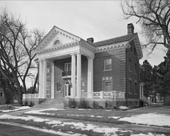 Fort David A. RussellNational Historic Landmark · listed 1969
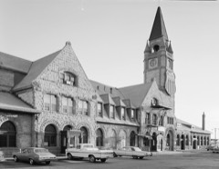 Union Pacific Railroad DepotNational Historic Landmark · listed 1973
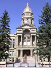 Wyoming State CapitolNational Historic Landmark
 Atlas Theatrelisted 1973
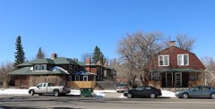 Baxter Ranch Headquarters Buildingslisted 1979
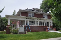 Charles L. Beatty Houselisted 1990
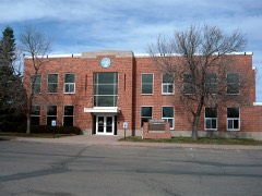 Boeing/United Airlines Terminal Building, Hangar and Fountainlisted 1985
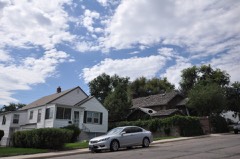 Capitol North Historic Districtlisted 2023
 Castle on 19th Streetlisted 1979
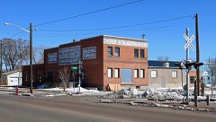 Cheyenne Flour Milling Companylisted 2003
 Cheyenne High Schoollisted 2005
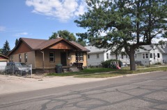 Cheyenne South Side Historic Districtlisted 2006
Population over time
2 figuresCheyenne grew from 59,466 to 65,132 between 2010 and 2020. These are the recorded population figures Wikidata holds for this place, reached through the Geographic Names Information System number this page is keyed on rather than by name, so they belong to this place and not to another of the same name. Most are census counts, but not all are: an early figure may be a founding or settlement estimate, and an estimate published within five years of a census is left out. The change column is computed, and is left blank where more than 20 years separate a figure from the one before it, because a gap that long is not a change between two counts.
| Year | People | Change |
|---|---|---|
| 2010 | 59,466 | |
| 2020 | 65,132 | +5,666 (+10%) |
Topographic sheets covering this place
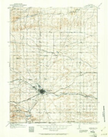
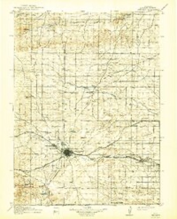
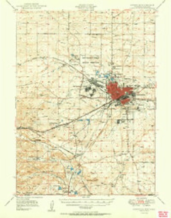
9 surveys from 17 printed sheetsMatched by testing this settlement's coordinate against the published boundary of every sheet in the United States Geological Survey's historical collection. Each opens the scanned sheet at the Survey.
- 1911 USGS Cheyenne quadrangle1:125000
- 1914 USGS Cheyenne quadrangle1:125000, 3 printings
- 1950 USGS Cheyenne quadrangle1:62500
- 1954 USGS Cheyenne quadrangle1:250000, 3 printings
- 1958 USGS Cheyenne quadrangle1:250000, 2 printings
- 1961 USGS Cheyenne quadrangle1:62500
- 1961 USGS Cheyenne North quadrangle1:24000, 3 printings
- 1981 USGS Cheyenne quadrangle1:100000, 2 printings
- 1994 USGS Cheyenne North quadrangle1:24000
Fires near this place
300 since 1992Regional context, not property-specific evidence. The federal wildfire occurrence database lists 300 fires within 5 miles of Cheyenne between 1992 and 2020, burning about 2,021 acres in total. 9 started naturally. 3 were recorded as arson. Distance is straight-line from the map coordinates, so a fire counted here may appear on a neighbouring settlement's page as well.
| Reported cause | Fires |
|---|---|
| Missing data/not specified/undetermined | 101 |
| Debris and open burning | 61 |
| Fireworks | 38 |
| Railroad operations and maintenance | 24 |
| Misuse of fire by a minor | 19 |
| Recreation and ceremony | 17 |
| Equipment and vehicle use | 15 |
| Smoking | 11 |
| Natural | 9 |
| Arson/incendiarism | 3 |
| Power generation/transmission/distribution | 2 |
The most recent of them, most recent first, with the day each was reported and the service that recorded it.
| Date | Cause | Size | Reported by | Name on the report |
|---|---|---|---|---|
| 8 September 2004 | Railroad operations and maintenance | under an acre | Wyoming State Forestry | not named |
| 30 September 2006 | Debris and open burning | under an acre | Wyoming State Forestry | not named |
| 3 September 2006 | Smoking | under an acre | Wyoming State Forestry | not named |
| 26 September 2020 | Natural | 100 acres | Wyoming State Forestry | MULLEN FIRE |
| 26 September 2008 | Missing data/not specified/undetermined | under an acre | Wyoming State Forestry | not named |
| 24 September 2003 | Missing data/not specified/undetermined | 1.0 acres | Wyoming State Forestry | not named |
| 24 September 2003 | Debris and open burning | under an acre | Wyoming State Forestry | not named |
| 22 September 2018 | Power generation/transmission/distribution | 5.0 acres | Laramie County | ROAD 124 FIRE |
Settlements close enough to share some of these fires:
Mines and quarries near this place
5 within 5 milesRegional context, not property-specific evidence. The federal mineral resources record lists 5 workings within 5 miles of Cheyenne: 4 producers, 1 past producer. 4 still produce. What was taken out: Sand and Gravel, Construction. Distance is straight-line from the map coordinates, so a quarry counted here may appear on a neighbouring settlement's page as well.
| Where | Site | Commodity | Status | Recorded |
|---|---|---|---|---|
| Mccard Pit No 1 | Sand and Gravel, Construction | Past Producer | ||
| Read Ready-Mix Pit & Plant | Sand and Gravel, Construction | Producer | ||
| Teton Gravel & Washing | Sand and Gravel, Construction | Producer | ||
| Teton Pit #1 | Sand and Gravel, Construction | Producer | ||
| Yramius Paul Tracy Ranch | Sand and Gravel, Construction | Producer |
Storms near this place
60 of 438 shownRegional context, not property-specific evidence. The National Weather Service names Cheyenne in 438 storm reports between 1993 and 2025: 334 hail, 47 thunderstorm wind, 25 flash flood, 11 tornado. The reports record 1 injury. Each account below is quoted exactly as the forecast office filed it, from the NOAA Storm Events Database, and each date opens the federal record of that event.
| When | Event | Place named | Harm | What the report says |
|---|---|---|---|---|
| June 1994 | Thunderstorm Wind | Cheyenne | 1 hurt | Microburst winds roared across central and eastern Laramie county, including the city of Cheyenne, producing damage and downing trees. One woman broke her arm when the winds knocked her off balance and to the ground. Major roof damage occurred at Cheyenne Central High School, while windows were blown out of the west side of a home in northeast Cheyenne. Winds in the northeast part of the city were estimated at 100 mph! A gust of 84 mph was clocked at the Cheyenne airport. Nineteen power poles were snapped off in east Cheyenne leaving hundreds of homes without power there for up to eight hours. Several homes under construction and barns in east Cheyenne were leveled by the winds. Funnel clouds were also reported by a sheriffs deputy as the storm moved through eastern Laramie county, but none touched down. |
| August 2002 | Hail | Cheyenne | $30,000,000 | Hail from 1 inch up to 2.75 inches in diameter fell over mainly the central and western parts of the city of Cheyenne, WY. Significant damage was reported to automobiles and roofs. |
| July 1996 | Hail | Cheyenne | $4,000,000 | no account filed |
| July 1996 | Hail | Cheyenne | $3,400,000 | no account filed |
| August 1996 | Hail | Cheyenne | $2,400,000 | no account filed |
| August 2025 | Hail | Cheyenne | $1,000,000 | Emergency manager reported base ball sized hail in Cheyenne.|Estimated property damage citywide from all reports with this event total at least $1 million per Laramie County EMA. |
| May 2007 | Thunderstorm Wind | Cheyenne | $30,000 | Strong microburst winds produced some damage to mainly the western side of Cheyenne, including a report of a trailer blown into a power pole. Some|damage to signage occurred along with damage to a dugout building at a local ballpark. Some hail up to 3/4 inch in diameter was also reported. |
| June 2003 | Hail | Cheyenne | $30,000 | 1 1/2 to 2 inch diameter hail reported. |
| August 1996 | Hail | Cheyenne | $30,000 | no account filed |
| August 1996 | Flood | Cheyenne | $30,000 | no account filed |
| June 2007 | Hail | Cheyenne | $25,000 | A slow moving severe thunderstorm produced hail from 1 to 1.75 inches in diameter along a track from south of Cheyenne to Hillsdale, Wyoming, about 16 miles east of Cheyenne. Some windows and skylights were broken in Hillsdale, WY. |
| June 1997 | Hail | Cheyenne | $25,000 | no account filed |
| June 2009 | Hail | Cheyenne | $20,000 | Hail from 1 to 1.75 inches in diameter fell northeast of Cheyenne, WY, damaging some roofs and cars. |
| May 2008 | Tornado (EF1) | Cheyenne | $20,000 | Tornado tracked over open country, but did destroy a pole barn. |
| July 2006 | Flash Flood | Cheyenne | $20,000 | A thunderstorm produced very heavy rain over far western Laramie county. Floodwaters producedsevere wash-away damage to county roads 110 and 110-A near Happy Jack Road with water reported to have flowed almost a foot deep over Happy Jack Road. |
| June 1997 | Hail | Cheyenne | $20,000 | no account filed |
| August 1996 | Hail | Cheyenne | $20,000 | no account filed |
| August 1996 | Hail | Cheyenne | $20,000 | no account filed |
| July 1998 | Hail | Cheyenne | $15,000 | A storm produced quarter size hail 9 miles south of Cheyenne. The hail covered the ground and wind driven hail broke some automobile windshields. |
| July 1997 | Hail | Cheyenne | $10,000 | no account filed |
| July 1996 | Flood | Cheyenne | $10,000 | no account filed |
| August 1996 | Hail | Cheyenne | $10,000 | no account filed |
| August 1996 | Flood | Cheyenne | $10,000 | no account filed |
| July 1996 | Thunderstorm Wind | Cheyenne | $5,000 | no account filed |
| August 1996 | Hail | Cheyenne | $5,000 | no account filed |
| May 2010 | Thunderstorm Wind | Cheyenne | $4,000 | House had roof damage. |
| May 1998 | Hail | Cheyenne | $4,000 | A storm produced golf ball size hail 20 miles north of Cheyenne. |
| July 1998 | Hail | Cheyenne | $3,000 | Spotters reported quarter size hail on the Terry Bison Ranch 10 miles southwest of Cheyenne. |
| June 1997 | Hail | Cheyenne | $3,000 | Hail piled to a 4 inch depth. |
| May 2010 | Thunderstorm Wind | Cheyenne | $2,500 | Out building had roof removed. |
| May 2010 | Hail | Cheyenne | $2,000 | Windows on south side of house are broken. |
| July 2007 | Flash Flood | Cheyenne | $2,000 | County road 109 washed out in 2 places with up to a foot of water across the road. |
| May 1998 | Hail | Cheyenne | $2,000 | A thunderstorm produced golf ball size hail along interstate 25, 22 miles north of Cheyenne. |
| June 1997 | Tornado (F1) | Cheyenne | $2,000 | Anticyclonic tornado touched near intersection of Four Mile Road and College Drive, destroying a storage shed. |
| May 1999 | Tornado (F0) | Cheyenne | $2,000 | no account filed |
| June 1997 | Hail | Cheyenne | $2,000 | no account filed |
| May 2010 | Thunderstorm Wind | Cheyenne | $1,000 | Three quarters of a mile of fence was pulled out of ground by strong thunderstorm winds. |
| May 2010 | Flash Flood | Cheyenne | $1,000 | Flooding on access roads between Archer and Hillsdale at exits 370 and 377 of Interstate 80. |
| August 1997 | Flood | Cheyenne | $1,000 | Two to three feet of water flooded intersections in southern Cheyenne. |
| August 1996 | Hail | Cheyenne | $1,000 | no account filed |
| May 2010 | Hail | Cheyenne | $900 | Strong winds overturned storage building. Also broke small trees, windows and screens. |
| May 2010 | Thunderstorm Wind | Cheyenne | $600 | Shop doors blown off. Wind gust measured by Davis Instruments equipment. |
| May 2010 | Hail | Cheyenne | $500 | Windshield broken. |
| August 1997 | Thunderstorm Wind | Cheyenne | $500 | Large cottonwood tree blown down at F.E. Warren Air Force Base. |
| July 1996 | Thunderstorm Wind | Cheyenne | $500 | no account filed |
| June 2025 | Hail | Cheyenne | - | Public reported 1.00 to 1.25 inch diameter hail east of Cheyenne. |
| August 2025 | Hail | Cheyenne | - | Mping report of ping pong ball sized hail. |
| August 2025 | Hail | Cheyenne | - | Mping report of hen egg sized hail. |
| August 2025 | Hail | Cheyenne | - | Public report of golf ball sized hail. |
| August 2025 | Hail | Cheyenne | - | Mping report of ping pong ball sized hail. |
| August 2025 | Hail | Cheyenne | - | Mping report of tennis ball sized hail. |
| July 2025 | Flash Flood | Cheyenne | - | Report from mPING of street flooding. |
| July 2025 | Flash Flood | Cheyenne | - | Emergency manager reported street flooding throughout entire drive up to Frontier Park. |
| July 2025 | Flash Flood | Cheyenne | - | Social media report of a car that stalled attempting to drive through the Ames underpass in downtown Cheyenne. Report states that there was a foot of water on the shallow side and 2 feet on the deep side. |
| June 2025 | Hail | Cheyenne | - | Public reports quarter size hail. |
| August 2024 | Thunderstorm Wind | Cheyenne | - | UPR site UP226, EMKAY reported this peak wind gust. |
| May 2023 | Hail | Cheyenne | - | Received report from mPING. |
| July 2023 | Thunderstorm Wind | Cheyenne | - | Roof damage to an apartment complex where a portion of the roof was blown off the structure. |
| July 2023 | Hail | Cheyenne | - | Public reports of half dollar sized hail. |
| July 2023 | Hail | Cheyenne | - | Public reports of half dollar sized hail. |
Nearest settlements
The eight closest, with where each one stands in the county. Distances are straight-line, computed from the Geographic Names Information System coordinates.
| Map | Place | Distance | Sheets |
|---|---|---|---|
| Orchard Valley | 3.0 miles | 18 | |
| South Greeley | 3.1 miles | 18 | |
| Ranchettes | 5.7 miles | 17 | |
| Altvan | 6.5 miles | 12 | |
| Speer | 7.1 miles | 16 | |
| Athol | 8.8 miles | 18 | |
| Gleason | 9.5 miles | 18 | |
| Durham | 12.7 miles | 13 |
Elsewhere
Matched on this settlement's Geographic Names Information System number rather than its name, so it cannot be a different place of the same name in another state.
| Wikipedia article on Cheyenne | An encyclopaedic summary. Its text is share-alike, so it is linked here rather than copied. |
| Wikidata item Q39042 | The structured record the population and elevation above come from. Public domain (CC0). |
Provenance
This settlement is recorded in the Geographic Names Information System as feature 1609077. The sheet list is computed by point-in-boundary test against the United States Geological Survey's historical topographic inventory. Both are works of the United States government and carry no copyright under 17 U.S.C. 105.
Wildfire. Short, Karen C. 2022. Spatial wildfire occurrence data for the United States, 1992-2020 [FPA_FOD_20221014]. 6th Edition. Fort Collins, CO: Forest Service Research Data Archive. https://doi.org/10.2737/RDS-2013-0009.6 Collected with United States Government funding and usable without additional permissions or fees.
Mines and quarries. USGS Mineral Resources Data System (MRDS) https://mrdata.usgs.gov/mrds/ A work of the United States government, no copyright under 17 U.S.C. 105.
Storms. NOAA National Centers for Environmental Information, Storm Events Database https://www.ncei.noaa.gov/stormevents/ A work of the United States government, no copyright under 17 U.S.C. 105. Narratives are quoted verbatim from the National Weather Service report and are not edited or summarised.