 Block
From the record
4 National Register listings published here.
Sources: the National Register database, National Park Service
19 topographic sheets cover 10 settlements here, and 4 properties are on the National Register of Historic Places.
4 National Register listings published here.
Sources: the National Register database, National Park Service
Every property in this county listed on the National Register of Historic Places, with the year it was listed and the federal nomination document.
| Photograph | Property | Type | Listed | Reference |
|---|---|---|---|---|
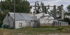 | C and H Refinery Historic District | district | 2001 | 00001672 |
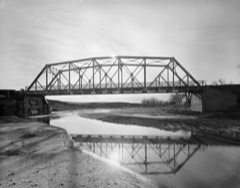 | DSD Bridge over Cheyenne River | structure | 1985 | 85000429 |
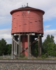 | Lusk Water Tower | structure | 1991 | 91000997 |
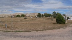 | Site of Ferdinand Branstetter Post No. 1, American Legion | site | 1969 | 69000194 |
Every wildfire the federal occurrence database records inside this county: 115 of them, burning about 45,079 acres. 50 started naturally and none was recorded as arson. Each settlement page carries the fires within five miles of it.
| Reported cause | Fires |
|---|---|
| Missing data/not specified/undetermined | 55 |
| Natural | 50 |
| Power generation/transmission/distribution | 7 |
| Debris and open burning | 1 |
| Railroad operations and maintenance | 1 |
| Equipment and vehicle use | 1 |
The five largest, by the area the report gives. None of them was recorded as arson.
| Date | Cause | Size | Reported by | Name on the report |
|---|---|---|---|---|
| 25 August 2011 | Natural | 12,000 acres | Niobrara County | THOMPSON |
| 5 September 2010 | Missing data/not specified/undetermined | 6,102 acres | New Castle Field Office | COOLEY DRAW |
| 2 August 2002 | Natural | 5,025 acres | New Castle Field Office | TOLLMAN |
| 25 August 2011 | Natural | 5,000 acres | Niobrara County | CHEYENNE RIVER |
| 30 July 2001 | Natural | 3,798 acres | Casper Field Office | KAYE FIELD |
| 31 August 2011 | Natural | 2,200 acres | Casper Field Office | SMITH |
| 2 September 2007 | Natural | 1,815 acres | New Castle Field Office | 77 HILL |
| 1 October 1992 | Missing data/not specified/undetermined | 1,500 acres | Wyoming State Forestry | not named |
Every settlement page carries the fires within five miles of it - see the settlement index below.
The NOAA Storm Events Database holds 303 reports for this county, causing no deaths, 5 injuries and about $2,534,090 in recorded property damage. Each settlement page carries the reports that name it.
| Kind of event | Reports |
|---|---|
| Hail | 214 |
| Thunderstorm Wind | 41 |
| Tornado | 36 |
| Flash Flood | 5 |
| Funnel Cloud | 3 |
| Lightning | 2 |
| Heavy Rain | 2 |
The most serious of them, by death, then injury, then recorded damage. The accounts are quoted exactly as the forecast office filed them.
| When | Event | Place named | Harm | What the report says |
|---|---|---|---|---|
| June 1982 | Tornado (F2) | not stated | 3 hurt, $250,000 | no account filed |
| June 1984 | Tornado (F2) | not stated | 1 hurt, $250,000 | no account filed |
| May 1960 | Tornado (F1) | not stated | 1 hurt, $25,000 | no account filed |
| June 2015 | Flash Flood | Van Tassell | $1,500,000 | As much as eight inches of rain fell from slow moving thunderstorms across south and southeast Niobrara County during the predawn hours, which resulted in widespread flash flooding. Excessive runoff upstream into the Niobrara River and nearby creeks caused them to overflow their banks. Law enforcement officials evacuated residents of Lusk as well as those living along the Niobrara River downstream to Van Tassel several hours in advance of the flood wave. The worst damage occurred in Lusk where 20 to 30 homes and 15 to 20 businesses were destroyed. Flood waters and debris rushed down Main Street in Lusk, swamped four blocks, and shut down the town's water supply. The US Highway 85 bridge on the north side of Lusk collapsed onto the railroad tracks below. Flash flooding closed a 20-mile stretch of US Highway 20 from Lusk to the Nebraska border, US Highway 85 from Lusk to the Goshen County line, and a 35-mile stretch of Highway 270 from Manville north to Lance Creek. WYDOT closed traffic into and out of Lusk, except for residents and emergency responders. Various state agencies, including the Red Cross and Wyoming National Guard, assisted in the flood cleanup efforts. A local command center was established at the Lusk Fairgrounds with water, food and shelter. The governor declared a state of emergency for Niobrara County. Fortunately, there were no injuries or fatalities. |
| July 1978 | Tornado (F2) | not stated | $250,000 | no account filed |
| August 2006 | Flash Flood | Redbird | $40,000 | Heavy rainfall produced flash flooding along Dogie, Spring and Lance creeks, washing outa bridge and road. |
| June 1984 | Tornado (F1) | not stated | $25,000 | no account filed |
| June 1984 | Tornado (F1) | not stated | $25,000 | no account filed |
| June 1984 | Tornado (F1) | not stated | $25,000 | no account filed |
| August 1979 | Tornado (F0) | not stated | $25,000 | no account filed |
| April 1976 | Tornado (F1) | not stated | $25,000 | no account filed |
| July 1962 | Tornado (F1) | not stated | $25,000 | no account filed |
| July 2001 | Thunderstorm Wind | Lance Creek | $10,000 | Strong wind gusts damaged corrals and sheds as well as removed some roof shingles. |
| August 1996 | Thunderstorm Wind | Lusk | $10,000 | no account filed |
| August 1996 | Hail | Lusk | $10,000 | no account filed |
| July 1997 | Lightning | Northern | $5,000 | Fire started in northern Niobrara County evening of 7/24 put out 7/26 after firefighters logged 28 hrs of duty and used 50000-60000 gallons of water; grass and cottonwood trees were consumed; no livestock lost. |
| August 1996 | Hail | Redbird | $5,000 | no account filed |
| August 1996 | Hail | Redbird | $5,000 | no account filed |
| August 1996 | Hail | Lusk | $5,000 | no account filed |
| May 1998 | Hail | Lusk | $4,000 | A storm produced quarter size hail in Lusk. |
| July 1995 | Thunderstorm Wind | not stated | $4,000 | Strong thunderstorm winds destroyed a garage just west of Lusk. Lightning caused a power outage for an hour in Lusk. |
| July 1985 | Tornado (F0) | not stated | $2,500 | no account filed |
| July 1985 | Tornado (F0) | not stated | $2,500 | no account filed |
| June 1960 | Tornado (F1) | not stated | $2,500 | no account filed |
| June 1953 | Tornado (F1) | not stated | $2,500 | no account filed |
| July 2001 | Thunderstorm Wind | Lance Creek | $1,000 | Thunderstorm wind took roof off storage shed. |
| June 1983 | Tornado (F1) | not stated | $30 | no account filed |
| May 1952 | Tornado (F1) | not stated | $30 | no account filed |
| June 1950 | Tornado (F1) | not stated | $30 | no account filed |
| July 2025 | Hail | Manville | - | Emergency manager reports baseball size hail. Multiple reports of broken windows in homes and vehicles. |
| July 2025 | Hail | Hat Creek | - | Emergency manager reports quarter size hail. Report came from just outside the main hail core of the storm. |
| June 2025 | Tornado (EFU) | Manville | - | Multiple reports of funnel clouds and brief tornado near Manville. Verified with pictures, with location and time estimated by radar. Rated EF-U in coordination with emergency management. |
| June 2025 | Tornado (EFU) | Lusk | - | Numerous spotter reports of funnels and occasional touchdowns. |
| July 2024 | Thunderstorm Wind | Van Tassell | - | WYDOT mesonet station along US Highway 20 near Van Tassell (WY60) reported wind gust. |
| June 2024 | Hail | Manville | - | The public reported significant hail accumulation between 3 and 6 inches deep along Highway 18 between Manville and Lusk. |
| June 2024 | Thunderstorm Wind | Whitman | - | A trained weather spotter estimated wind gusts between 70 and 80 MPH. |
| June 2023 | Hail | Van Tassell | - | Trained weather spotters observed quarter sized hail 3 miles NNE of Van Tassel. |
| June 2023 | Hail | (Lsk)Lusk Airport | - | A trained spotter reported drifts of penny to quarter sized hail approximately 9 miles south of Lusk. |
| July 2023 | Hail | Lance Creek | - | CoCoRaHS observer located 12.1N Manville reported 2 inch hail resulting in damage to cars and roof shingles. |
| July 2023 | Hail | Lusk | - | Emergency manager reported quarter size hail along US-18 north of Lusk between mile markers 153 and 155. |
| July 2023 | Thunderstorm Wind | Node | - | Spotter estimated 75 mph winds with wind driven half dollar size hail. |
| July 2023 | Hail | Lusk | - | Hail reports ranged from pea to ping pong ball size. |
| July 2023 | Hail | Lusk | - | Quarter sized hail. Visibility 50 yards in mostly hail. |
| July 2023 | Thunderstorm Wind | Lusk | - | Emergency manager estimated winds of 70 to 80 mph across the town of Lusk. Cedar tree (80 feet tall) reported broken in half. |
| June 2023 | Flash Flood | Lusk | - | Niobrara County Emergency Manager reported 3 inches of rain in Manville that flowed east into the Niobrara River that runs into Lusk. Niobrara River in Lusk was out of its banks. |
| September 2023 | Hail | Lusk | - | Local Emergency Management reported nickel to quarter sized hail along US Highway 85, 10 miles NNE of Lusk. |
| September 2023 | Hail | Lusk | - | The public reported tennis ball sized hail 15 miles NE of Lusk. |
| September 2023 | Hail | Lusk | - | The public reported racquetball sized hail 12 miles NE of Lusk. |
| April 2022 | Hail | Keeline | - | Quarter-sized hail reported west of Manville along Highway 20. |
| April 2022 | Hail | Manville | - | Quarter-sized hail reported north of Manville. |
| May 2022 | Hail | Lance Creek | - | Reports of shredded leaves and car dents. |
| July 2022 | Thunderstorm Wind | Redbird | - | Tree limbs (3-inch diameter) broken off numerous trees. |
| August 2022 | Hail | (Lsk)Lusk Airport | - | Nickel size hail accumulation of 3-4 inches 6 miles south of Lusk along US Highway 85. |
| August 2022 | Thunderstorm Wind | Lusk | - | Received report of strong winds causing a parked camper to move. |
| June 2022 | Tornado (EF1) | Node | - | A supercell thunderstorm developed east of Lusk, WY near 2PM MDT on|7 June 2022 north of Highway 20 that exhibited broad rotation from|KCYS radar. This rotation tightened near 2:20pm MDT just north of|Highway 20 west-northwest of Duck Creek Ranch. First indications of|ground damage start at west side of Duck Creek Ranch with wood fencing|blown down. The tornado intensified and widened as it approached|Duck Creek Ranch with metal sheeting fencing pulled from metal|posts and roof damage occurring on a large ranch shed. A|convergent damage pattern was apparent with the debris of the wood|fencing being blown west and the solid sheet metal fencing blown|north and bent backwards to the west with the roof damage facing|south. Hardwood trees were snapped at the base along with softwood|pines both snapped and uprooted in proximity to a single family|home. The snapped pine tree and the uprooted pine tree were facing|opposite directions. The more impressive damage was a barn roof|and partial second level were torn off and thrown 50 to 100 yards|to the southeast. Additional tin roof peeling damage was noted on|another farm building and a large side sheet metal and wood|section on the southern end of the tornado path was torn from the|facade. Duck Creek Ranch is where the more intense damage was|noted. Farther southeast along, Highway 20, sporadic pockets of|cattle windbreak fencing damage was noted near a WYDOT road sensor|that gusted to 78mph during this time frame. Lastly, near mile|marker 59 on Highway 20, four (4) power poles were leaning south|and marks the end of the tornado path. No additional damage was|seen or reported in Van Tassell and along South Van Tassell Road. |
| June 2021 | Thunderstorm Wind | Van Tassell | - | Wyoming Department of Transportation sensor along United States Highway 20 at Van Tassell measured the outflow winds from the thunderstorm to its east. |
| May 2021 | Thunderstorm Wind | Van Tassell | - | Wyoming Department of Transportation sensor three miles west of Van Tassell along United States Highway 20 measured the reported thunderstorm wind gust. |
| May 2021 | Thunderstorm Wind | Van Tassell | - | Wyoming Department of Transportation sensor located roughly three and a half miles from Van Tassell measured the reported wind speed. |
| September 2021 | Hail | Node | - | Quarter size hail was reported at mile marker 48 on US Highway 20. |
| June 2020 | Hail | Whitman | - | Observer noted that hail and thunderstorm wind contributed to downed tree limbs on their property. |
The Survey's mineral resources record lists 96 workings inside this county. 2 still produce and 94 are closed or unrecorded. Each settlement page carries the workings within five miles of it.
| Commodity | Workings |
|---|---|
| Uranium | 78 |
| Iron | 11 |
| Tantalum | 4 |
| Copper | 2 |
| Uranium, Silver, Radium, Gold, Copper | 1 |
The least common of them first, because a county's hundredth gravel pit says nothing its first ten did not.
| Where | Site | Commodity | Status | Recorded |
|---|---|---|---|---|
| Silver Cliff Mine | Uranium, Silver, Radium, Gold, Copper | Past Producer | 1879, 1880, 1953 | |
| Unknown | Copper | Unknown | ||
| Unnamed Prospect | Copper | Occurrence | Chrysocolla, Malachite | |
| Unknown | Tantalum | Occurrence | ||
| Unknown | Tantalum | Occurrence | ||
| Unknown | Tantalum | Occurrence | ||
| Unknown | Tantalum | Occurrence | ||
| Rawhide Creek | Iron | Occurrence | ||
| Unidentified Prospect | Iron | Occurrence | Hematite | |
| Unknown | Iron | Occurrence | ||
| Unknown | Iron | Occurrence | ||
| Unknown | Iron | Occurrence | ||
| Unknown | Iron | Occurrence | ||
| Unknown | Iron | Occurrence | ||
| Unknown | Iron | Occurrence | ||
| Unknown | Iron | Occurrence | ||
| Unknown | Iron | Occurrence | ||
| Unknown | Iron | Occurrence | ||
| Ace High 1 Claim | Uranium | Occurrence | ||
| Airborne Anomaly 3 | Uranium | Occurrence | ||
| Allsup | Uranium | Unknown | ||
| Alter | Uranium | Unknown | ||
| Apex Mine | Uranium | Past Producer | ||
| Bob Cat 2 Claim | Uranium | Occurrence | ||
| Bowers Claims | Uranium | Occurrence | ||
| Clark Group | Uranium | Past Producer | ||
| Davis Fee Land | Uranium | Occurrence | Barite, Tyuyamunite, Uranophane | |
| Davis Fee Land | Uranium | Occurrence | Tyuyamunite, Uranophane | |
| Drifter | Uranium | Unknown | ||
| Duck Claims | Uranium | Occurrence | ||
| George Storey Claim | Uranium | Prospect | ||
| Happy Jack 122 | Uranium | Occurrence | ||
| Happy Jack 48 | Uranium | Occurrence | ||
| Happy Jack Claims | Uranium | Past Producer | ||
| Harney Claim | Uranium | Occurrence | ||
| Hornice | Uranium | Occurrence | ||
| Lightning Creek Area | Uranium | Unknown | ||
| Lillian 4 | Uranium | Occurrence | ||
| Locality #88 | Uranium | Occurrence | ||
| Locality #98 | Uranium | Occurrence | ||
| Locality 105 | Uranium | Occurrence | ||
| Locality 92 | Uranium | Occurrence | ||
| Locality No.104 | Uranium | Occurrence | ||
| Locality No.106 | Uranium | Occurrence | ||
| Locality No.82 | Uranium | Occurrence | ||
| Locality No.83 | Uranium | Occurrence | ||
| Locality No.86 | Uranium | Occurrence | ||
| Locality No.87 | Uranium | Occurrence | ||
| Locality No.91 | Uranium | Occurrence | ||
| Locality Number 84 | Uranium | Occurrence | ||
| Lucky Seven | Uranium | Occurrence | ||
| Meng Property | Uranium | Occurrence | ||
| Miller 1 | Uranium | Occurrence | ||
| Moore Claim | Uranium | Occurrence | ||
| N. Edge of Town Cemetery | Uranium | Prospect | ||
| Nelson Fee Land | Uranium | Occurrence | ||
| Nelson Ranch | Uranium | Past Producer | ||
| New Hope | Uranium | Unknown | ||
| Old Rocky | Uranium | Occurrence | ||
| Old Woman Anticline | Uranium | Occurrence | ||
| Old Woman Anticline | Uranium | Unknown | ||
| Ran Claims | Uranium | Occurrence | ||
| Rolph Fee Land | Uranium | Occurrence | ||
| Scott Group 1-7 | Uranium | Occurrence | ||
| Unidentified Occurrence | Uranium | Occurrence | Uranophane | |
| Unknow-G.Storey Prop. | Uranium | Occurrence | ||
| Unknown | Uranium | Occurrence | ||
| Unknown | Uranium | Occurrence | Vein | |
| Unknown | Uranium | Occurrence | ||
| Unknown | Uranium | Occurrence | ||
| Unknown | Uranium | Occurrence | ||
| Unknown | Uranium | Producer | ||
| Unknown | Uranium | Occurrence | ||
| Unknown | Uranium | Occurrence | ||
| Unknown | Uranium | Occurrence | ||
| Unknown | Uranium | Occurrence | ||
| Unknown | Uranium | Occurrence | Vein | |
| Unknown | Uranium | Occurrence | ||
| Unknown | Uranium | Occurrence | ||
| Unknown | Uranium | Occurrence | ||
| Unknown | Uranium | Occurrence | ||
| Unknown | Uranium | Occurrence | ||
| Unknown | Uranium | Occurrence | ||
| Unknown | Uranium | Producer | ||
| Unknown | Uranium | Prospect | ||
| Unknown | Uranium | Occurrence | ||
| Unknown | Uranium | Occurrence | ||
| Unknown | Uranium | Occurrence | ||
| Unknown | Uranium | Occurrence | ||
| Unknown | Uranium | Past Producer | ||
| Unknown | Uranium | Past Producer | ||
| Unknown-No.1 | Uranium | Occurrence | ||
| Unknown-No.1 | Uranium | Occurrence | ||
| Unknown-No.2 | Uranium | Occurrence | ||
| Unknown-No.2 | Uranium | Occurrence | ||
| Walt Claim #2 | Uranium | Occurrence |
Named settlements recorded in the Geographic Names Information System, each with the topographic sheets covering it. Villages, hamlets and abandoned places alike. Each is shown with the nearest named watercourse or landform and the survey quadrangle it falls on.
East Niobrara census division · 82225 · Hat Creek quadrangle
7 sheets, 1954 to 1982
No longer a settlement
West Niobrara census division · 82222 · On Rusty Creek · Lance Creek quadrangle
5 sheets, 1955 to 1981
West Niobrara census division · 82225 · On Quinn Creek · Lusk quadrangle
7 sheets, 1954 to 1982
West Niobrara census division · 82227 · Near Shelton Peak · Manville quadrangle
7 sheets, 1954 to 1982
East Niobrara census division · 82225 · On Antelope Creek · Redbird quadrangle
5 sheets, 1955 to 1981
East Niobrara census division · 82242 · On Van Tassell Creek · Van Tassell quadrangle
7 sheets, 1954 to 1982
West Niobrara census division · 82222 · Lance Creek quadrangle
5 sheets, 1955 to 1981
East Niobrara census division · 82225 · On Fitzsimmons Creek · Sherrill Hills quadrangle
7 sheets, 1954 to 1982
The vanished settlements of Niobrara County: the places named above that are no longer on the map.