Block
From the record
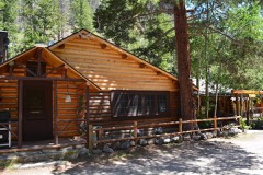
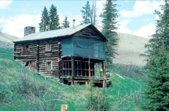
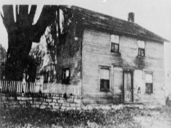
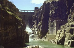
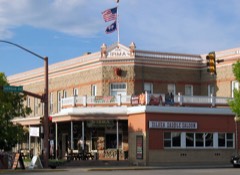
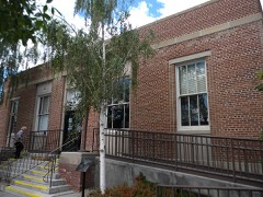
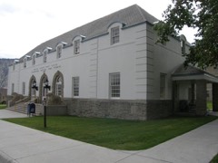
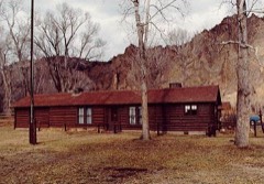
38 National Register listings published here, 6 of them National Historic Landmarks.
Sources: the National Register database, National Park Service
128 topographic sheets cover 28 settlements here, and 38 properties are on the National Register of Historic Places.
38 National Register listings published here, 6 of them National Historic Landmarks.
Sources: the National Register database, National Park Service
Every property in this county listed on the National Register of Historic Places, with the year it was listed and the federal nomination document.
Every wildfire the federal occurrence database records inside this county: 1,312 of them, burning about 371,555 acres. 504 started naturally and 7 were recorded as arson. Each settlement page carries the fires within five miles of it.
| Reported cause | Fires |
|---|---|
| Natural | 504 |
| Missing data/not specified/undetermined | 233 |
| Recreation and ceremony | 217 |
| Debris and open burning | 150 |
| Power generation/transmission/distribution | 54 |
| Equipment and vehicle use | 42 |
| Fireworks | 41 |
| Misuse of fire by a minor | 23 |
| Railroad operations and maintenance | 20 |
| Smoking | 15 |
| Arson/incendiarism | 7 |
| Other causes | 4 |
| Firearms and explosives use | 2 |
The five largest, by the area the report gives. None of them was recorded as arson.
| Date | Cause | Size | Reported by | Name on the report |
|---|---|---|---|---|
| 26 July 2008 | Natural | 68,148 acres | Shoshone National Forest | GUNBARREL |
| 8 August 2016 | Natural | 51,556 acres | Yellowstone National Park | MAPLE |
| 23 June 2006 | Natural | 34,581 acres | Shoshone National Forest | LITTLE VENUS |
| 20 July 2013 | Natural | 24,515 acres | Shoshone National Forest | HARDLUCK |
| 11 August 2003 | Natural | 18,762 acres | Yellowstone National Park | EAST |
| 9 August 2007 | Natural | 18,595 acres | Shoshone National Forest | COLUMBINE |
| 13 August 2016 | Natural | 13,697 acres | Yellowstone National Park | BUFFALO |
| 2 August 2016 | Equipment and vehicle use | 12,387 acres | Cody Field Office | WHIT |
Every settlement page carries the fires within five miles of it - see the settlement index below.
The NOAA Storm Events Database holds 199 reports for this county, causing 1 death, 9 injuries and about $26,954,750 in recorded property damage. Each settlement page carries the reports that name it.
| Kind of event | Reports |
|---|---|
| Thunderstorm Wind | 74 |
| Hail | 65 |
| Flash Flood | 15 |
| Flood | 12 |
| Tornado | 10 |
| Wildfire | 10 |
| Lightning | 6 |
| Funnel Cloud | 5 |
| Heavy Rain | 2 |
The most serious of them, by death, then injury, then recorded damage. The accounts are quoted exactly as the forecast office filed them.
| When | Event | Place named | Harm | What the report says |
|---|---|---|---|---|
| June 2010 | Lightning | Pitchfork | 1 killed | A developing thunderstorm produced a single bolt of lightning that killed a 70-year-old man during a camping and fishing trip to Upper Sunshine Reservoir southwest of Meeteetse. The man and his son went to shore to avoid the developing storm. The man was struck when he attempted to gain better cell phone reception from a hill. Bystanders and emergency responders performed CPR but to no avail. |
| August 2000 | Lightning | Cody | 5 hurt | no account filed |
| June 2014 | Lightning | Garland | 4 hurt | Lightning struck near the 3rd green at the Powell Golf Club near Garland. The strike affected four golfers, one of which was knocked to the ground. The hole they were finishing was on an elevated portion of the course at the far north end of the property. |
| June 2022 | Flood | Mt Washburn | $25,000,000 | Part of the northeastern entrance road to Yellowstone National Park was washed out near the Soda Butte Picnic Area. There were also mudslides and downed trees in the area. Yellowstone National Park press releases estimated preliminary repair costs to be 25 million for the northeast entrance road. |
| June 2000 | Hail | Powell | $500,000 | no account filed |
| July 2001 | Flash Flood | Clark | $400,000 | no account filed |
| July 2002 | Flash Flood | South Portion | $275,000 | no account filed |
| July 2023 | Thunderstorm Wind | Canyon | $200,000 | A thunderstorm produced a microburst that caused damage in the Lake Village area of Yellowstone Park, along the north shore of Yellowstone Lake. Several hundred trees were downed by the wind. Some trees landed on vehicles. The Lake Yellowstone Hotel also suffered minor damage from falling trees. Some portions of the Lake Village had no power for two days. Damage estimates based on Yellowstone National Park News Release dated July 5, 2023. |
| June 2011 | Flood | Mt Washburn | $160,000 | no account filed |
| July 2019 | Lightning | Norris | $50,000 | A lightning strike set the historic Mount Holmes fire lookout on fire, resulting in a total loss. The lightning strike also damaged a radio repeater on the mountain. |
| July 1995 | Hail | not stated | $50,000 | Hail damaged crops and fields south and east of Powell. Some crops were totally destroyed. Some roofs south of Powell were also damaged. |
| July 2007 | Flash Flood | Valley | $50,000 | no account filed |
| July 1998 | Hail | Cody | $35,000 | no account filed |
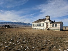
| July 2007 | Flash Flood | Valley | $25,000 | Heavy rainfall caused three separate mudslides near Valley. The mud enveloped the Valley School and trapped 15 vehicles on the South Fork Road. The slides were not entirely cleared for two days. |
| August 1986 | Tornado (F1) | not stated | $25,000 | no account filed |
| July 1978 | Tornado (F2) | not stated | $25,000 | no account filed |
| June 1964 | Tornado (F2) | not stated | $25,000 | no account filed |
| August 2022 | Flash Flood | Pahaska Tepee | $20,000 | A tributary of Kitty Creek rose out of its banks and pushed mud and debris from the higher elevations onto local roads and a cabin area south of US Hwy 14 (North Fork Highway). A WYDOT official reported mud and debris were 3 feet deep in some locations just upstream along US Hwy 14. Many people were stranded in the area as local roads and the highway were impassable. A car was totaled when the driver attempted to drive through the flooded road. A private cabin was also damaged by the flooding. Hwy 14 was closed over the next 12 hours, opening back up the following morning. |
| June 2017 | Flood | Valley | $20,000 | Snow melt flowing downstream from the Absarokas brought flooding and high water along the South Fork of the Shoshone River. At the Ishawooa Bridge, downstream from Valley and near Aldrich Creek, the high water severely damaged the bridge. The bridge remained open, but was reduced to one lane while repairs were made. Waters receded on the 11th as cooler mountain temperatures slowed snow melt. |
| June 2010 | Lightning | Wapiti | $20,000 | Lightning struck a house southwest of Cody along the South Fork of the Shoshone River. The lightning strike started a fire in the attic of the home, which caused extensive damage. |
| June 2017 | Lightning | Norris | $10,000 | The Park Service reported two cars were damaged by a lightning strike in the Old Faithful Parking Lot. No injuries were reported. |
| May 2015 | Flash Flood | Cody | $10,000 | A thunderstorm rapidly developed to the south of Cody and tracked north over the city producing heavy rain and copious amounts of small hail. Hail drifts were measured in feet in some areas with a few low spots accumulating close to six feet of hail. The hail prevented the heavy rain from draining easily and water accumulated on area roads. Several business owners in downtown Cody reported minor flooding as the water piled up in the streets, especially along Sheridan Avenue. A bakery had water on the floors and in the basement and a gift shop flooded. |
| July 2011 | Thunderstorm Wind | (Cod)Yellowstone Apt | $10,000 | Wind damage was reported in and east of Cody as a result of outflow wind from collapsing thunderstorms. A recreational trailer was toppled at a residence and large limbs were felled at another causing damage to an automobile and power lines. |
| July 2007 | Flash Flood | East Entrance | $10,000 | Heavy rain caused a mudslide across East Entrance Road near Sylvan Pass. The slide varied in depth from one to five feet, was about 50 feet long, and covered both lanes of the road. The road remained closed for about 14 hours until crews could open a single lane. |
| August 2009 | Thunderstorm Wind | Powell | $6,000 | An automated weather station on the far west side of Powell recorded a peak thunderstorm wind gust of 58.3 mph at 1708MST. The wind dropped a tree on North Douglas Street in Powell and stopped traffic for 30 minutes. Seven other toppled trees in an older section of town blocked streets for approximately three hours until city crews could clear the debris using chainsaws. |
| May 2023 | Hail | Meeteetse | $5,000 | Trained spotters reported golf ball-sized to lime-sized hail in the vicinity of Meeteetse, WY. Several people reported damaged skylights and cracked windshields from the hail. |
| June 2012 | Thunderstorm Wind | Mammoth Hot Springs | $5,000 | Several trees were downed as strong thunderstorm outflow wind reached Yellowstone National Park Headquarters at Mammoth Hot Springs. |
| August 2007 | Flash Flood | Pahaska Tepee | $5,000 | no account filed |
| August 2007 | Thunderstorm Wind | Canyon | $4,000 | Several trees downed near Canyon. |
| September 1995 | Thunderstorm Wind | not stated | $3,000 | Thunderstorm winds toppled 30 trees in the Squaw Creek Cabin group on the upper Clark's Fork River. That area is 35 miles northwest of Cody. Two cabins were damaged by falling trees. |
| June 1976 | Tornado (F1) | not stated | $2,500 | no account filed |
| July 2022 | Thunderstorm Wind | Cody | $2,000 | Strong thunderstorm winds blew down trees onto power lines that caused power outages to 400 customers. A maximum wind gust of 68 mph was reported at the Powell airport. |
| August 2007 | Thunderstorm Wind | Norris | $2,000 | Several downed trees caused a power outage at Norris Junction. |
| June 1984 | Tornado (F0) | not stated | $250 | no account filed |
| April 2026 | Thunderstorm Wind | Wapiti | - | A 62 mph wind gust was reported to the southeast of Wapati. |
| May 2025 | Thunderstorm Wind | Powell Arpt | - | The Powell airport reported a wind gust of 62 mph. |
| May 2025 | Thunderstorm Wind | Wapiti | - | A 65 mph wind gust was reported at Irma Lake. |
| May 2025 | Thunderstorm Wind | Wapiti | - | A thunderstorm brought wind gusts as high as 79 mph at Irma Lake. A 61 mph wind gust was reported 9 miles SSE of Wapati. |
| May 2025 | Thunderstorm Wind | Cody | - | Wind gust to 66 mph on the mesonet station PC261 Cedar Mountain near Cody, WY. |
| August 2025 | Thunderstorm Wind | Wapiti | - | Wind gusts as high was 64 mph were reported southeast of Wapiti. |
| June 2025 | Hail | Mammoth Hot Springs | - | At Mammoth, quarter size hail was reported. |
| August 2024 | Thunderstorm Wind | Meeteetse | - | Wind gusts as high as 59 mph were reported along Highway 120 to the north of Meeteetse. |
| April 2023 | Thunderstorm Wind | Powell Arpt | - | A 60 mph wind gust was reported at the Powell airport. |
| May 2023 | Hail | (Cod)Yellowstone Apt | - | A trained spotter reported 1 inch hail along Highway 14 to the east of Cody. |
| May 2022 | Thunderstorm Wind | East Entrance | - | An 82 mph wind gust was reported at the East Entrance of Yellowstone Park. Many trees were downed and power was knocked out. The road was closed until 7 pm due to an avalanche. |
| June 2022 | Hail | Powell | - | In Park County, a trained spotter reported nickel-sized hail with a thunderstorm near Powell, WY. |
| June 2022 | Flood | Mammoth Hot Springs | - | A combination of heavy rain and rapid snowmelt led to severe flooding in Yellowstone Park. Along the road to the northern entrance to Yellowstone Park, the road was completely washed out in several locations. Yellowstone National Park created an online video and picture album to highlight the extensive damage. |
| June 2022 | Flood | Mt Washburn | - | The road between Tower Junction and Canyon Junction was closed by a mudslide on the road. |
| June 2022 | Flood | Canyon | - | A section of road to the south of Canyon Village collapsed to heavy rain and flooding. |
| June 2022 | Flood | Mt Washburn | - | The USGS river gauge on the Lamar River near Tower Falls surged well above the previous record of 12.15', cresting near 16.79' around 6:30 AM MST, which is over 4' higher than the previous record. |
| May 2019 | Hail | Meeteetse | - | The public reported nickel size hail west of Meeteetse. |
| June 2019 | Hail | Norris | - | A park ranger at Yellowstone Park reported penny size hail at Madison Junction. |
| July 2019 | Flash Flood | Powell | - | Nearly an inch of rain and a large amount of large hail fell in only 20 minutes around Powell, Wyoming. The result were numerous areas that were flooded, including streets, businesses and homes. The main damage was from water in basements and flooded roads. |
| May 2018 | Flash Flood | Meeteetse | - | A foot of water was reported to be flowing across Highway 120 around 5 miles south of Meeteetse. |
| May 2018 | Thunderstorm Wind | Meeteetse | - | The weather sensor north of Meeteetse reported several wind gusts past 58 mph, including a maximum gust of 76 mph. |
| May 2018 | Hail | Cody | - | A television station forwarded a report of quarter size hail to the east of Cody. |
| June 2018 | Hail | Pitchfork | - | Hail fell along the path of a severe thunderstorm. The maximum hail size reported was quarter size 7 miles east of Pitchfork. |
| June 2018 | Funnel Cloud | Meeteetse | - | The public reported a funnel cloud to the west of Meeteetse. |
| June 2017 | Flood | Valley | - | The South Fork of the Shoshone River crested at around 9.4 feet on June 18th and June 21st. The flooding remained in the low lands around the river and caused little to no damage. |
| June 2017 | Flood | Meeteetse | - | Emergency management reported flooding along the Greybull River. The flooding remained over low lying areas and caused little or no damage. |
The Survey's mineral resources record lists 110 workings inside this county. 10 still produce and 100 are closed or unrecorded. Each settlement page carries the workings within five miles of it.
| Commodity | Workings |
|---|---|
| Sand and Gravel, Construction | 36 |
| Uranium | 24 |
| Gypsum-Anhydrite | 13 |
| Copper | 7 |
| Sulfur | 6 |
| Gold | 3 |
| Lead | 3 |
| Silver, Gold | 3 |
| Iron | 2 |
| Sodium Sulfate | 2 |
| Dolomite | 2 |
| Molybdenum, Copper | 2 |
| Gold, Copper, Silver | 1 |
| Copper, Silver, Gold | 1 |
The least common of them first, because a county's hundredth gravel pit says nothing its first ten did not.
| Where | Site | Commodity | Status | Recorded |
|---|---|---|---|---|
| Big Goose Vein | Silver, Gold, Zinc, Lead | Occurrence | Chalcopyrite, Galena, Gold, Pyrite, Sphalerite, Sylvanite, Tetrahedrite | |
| Butte Claim | Gold, Copper, Silver | Occurrence | Copper, Gold, Silver | |
| Copper King | Copper, Silver, Gold, Lead | Occurrence | Bornite, Famatinite, Galena, Tetrahedrite | |
| Crater Mountain | Molybdenum, Copper, Lead, Zinc, Silver, Gold | Prospect | 1893 | |
| Crouch Prospect | Copper, Gold, Lead, Zinc | Past Producer | ||
| Evening Star and Silver Tip | Gold, Silver, Copper | Producer | Chalcopyrite, Sylvanite, Tetrahedrite | |
| Kirwin | Copper, Silver, Molybdenum, Gold, Lead, Zinc | Past Producer | 1892 | |
| Sunlight District | Tungsten, Gold, Silver | Occurrence | QUARTZ-SILVER VEIN | |
| Unknown | REE, Thorium | Unknown | ||
| Unknown | Copper, Sulfur-Pyrite | Occurrence | ||
| Unknown | Potassium | Unknown | ||
| Unknown | Copper, Lead | Occurrence | ||
| Unknown | Calcium, Copper, Sulfur | Unknown | ||
| Unknown | Copper, Iron, Lead | Occurrence | ||
| Unknown | Stone, Crushed/Broken | Unknown | ||
| Unknown | Kaolin | Unknown | ||
| Iron King Claims | Iron | Occurrence | 1951 | |
| Red Butte | Dolomite | Unknown | ||
| Shoshone Canyon | Dolomite | Unknown | ||
| Silver Creek | Molybdenum, Copper | Prospect | Porphyry Cu | |
| Unidentified Prospect | Iron | Occurrence | Hematite | |
| Unknown | Sodium Sulfate | Occurrence | ||
| Unknown (Holmes Lake) | Sodium Sulfate | Occurrence | Mirabilite | |
| Crouch Gold Prospect | Gold | Past Producer | 1930 | |
| Hoodoo Claim | Lead, Silver, Gold, Copper | Occurrence | Copper, Galena, Gold, Silver | |
| Tip Top Claim | Silver, Gold, Lead, Copper | Occurrence | Galena, Proustite, Stromeyerite | |
| Unknown | Gold | Unknown | ||
| Cody Deposits | Sulfur | Past Producer | ||
| Continental Sulphur | Sulfur | Producer | Sulfur | |
| Sweetwater Creek | Sulfur | Unknown | ||
| Unknown | Sulfur | Unknown | ||
| Unknown | Sulfur | Unknown | ||
| Unknown | Sulfur | Unknown | ||
| Kirwin District | Copper | Past Producer | PORPHYRY UNKNOWN | |
| Unknown | Copper | Occurrence | ||
| Unknown | Copper | Occurrence | ||
| Unknown | Copper | Occurrence | ||
| Big Horn Gypsum Co Quarry & Mill | Gypsum-Anhydrite | Plant | ||
| Celotex Bighorn Gypsum Mine | Gypsum-Anhydrite | Producer | ||
| Celotex Quarry | Gypsum-Anhydrite | Producer | ||
| Cody Mill | Gypsum-Anhydrite | Producer | ||
| Pat O'Hara Gypsum Quarry No.1 | Gypsum-Anhydrite | Producer | ||
| Unknown | Gypsum-Anhydrite | Unknown | ||
| Unknown | Gypsum-Anhydrite | Unknown | ||
| Unknown | Gypsum-Anhydrite | Past Producer | ||
| Unknown | Gypsum-Anhydrite | Occurrence | ||
| Unknown | Gypsum-Anhydrite | Past Producer | ||
| Unknown | Gypsum-Anhydrite | Past Producer | ||
| Unknown | Gypsum-Anhydrite | Unknown | ||
| Unknown | Gypsum-Anhydrite | Past Producer | ||
| Angie Claims | Uranium | Occurrence | ||
| Big Wind | Uranium | Occurrence | ||
| Big Wind | Uranium | Prospect | ||
| Dead Indian | Uranium | Occurrence | ||
| Gail Group | Uranium | Occurrence | ||
| Spirit Mountain Uranium Company | Uranium | Unknown | ||
| Spirit Mountains | Uranium | Occurrence | ||
| Sunlight Basin | Uranium | Occurrence | ||
| Tibbs Butte | Uranium | Occurrence | ||
| Unidentified Occurrence | Uranium | Occurrence | ||
| Unknown | Uranium | Occurrence | ||
| Unknown | Uranium | Occurrence | ||
| Unknown | Uranium | Occurrence | ||
| Unknown | Uranium | Occurrence | ||
| Unknown | Uranium | Prospect | ||
| Unknown | Uranium | Occurrence | ||
| Unknown | Uranium | Occurrence | ||
| Unknown | Uranium | Occurrence | ||
| Unknown | Uranium | Occurrence | ||
| Unknown | Uranium | Occurrence | ||
| Unknown | Uranium | Occurrence | ||
| Unknown | Uranium | Occurrence | ||
| Waggoner Claims | Uranium | Prospect | ||
| Waggoner Group | Uranium | Occurrence | ||
| Airport Topsoil Pit | Sand and Gravel, Construction | Unknown | ||
| Andy Martin | Sand and Gravel, Construction | Unknown | ||
| Barling | Sand and Gravel, Construction | Unknown | ||
| Barling West Pit | Sand and Gravel, Construction | Unknown | ||
| Bennion Pit | Sand and Gravel, Construction | Unknown | ||
| Borrow Pit #1 | Sand and Gravel, Construction | Past Producer | ||
| Borrow Pit 430+00 - 460+00 | Sand and Gravel, Construction | Unknown | ||
| Borrow Pit No 2 | Sand and Gravel, Construction | Past Producer | ||
| Borrow Pit No 4 | Sand and Gravel, Construction | Past Producer | ||
| Borrow Pit No 5 | Sand and Gravel, Construction | Past Producer | ||
| Borrow Pit No.3 | Sand and Gravel, Construction | Past Producer | ||
| Boulder Creek Pit | Sand and Gravel, Construction | Unknown | ||
| Camp Creek Quarry | Sand and Gravel, Construction | Unknown | ||
| Cary Pit | Sand and Gravel, Construction | Unknown | ||
| Chapman Creek | Sand and Gravel, Construction | Unknown | ||
| Crusher Pit | Sand and Gravel, Construction | Past Producer | ||
| Dutton Pit | Sand and Gravel, Construction | Past Producer | ||
| Eagle Pass | Sand and Gravel, Construction | Unknown | ||
| Gov'T Pit #2 | Sand and Gravel, Construction | Unknown | ||
| Greybull Hill Pit | Sand and Gravel, Construction | Unknown | ||
| Hogg Pit | Sand and Gravel, Construction | Unknown | ||
| Meeteetse Creek | Sand and Gravel, Construction | Unknown | ||
| New Eagle Pass Pit | Sand and Gravel, Construction | Unknown | ||
| North Pit | Sand and Gravel, Construction | Producer | ||
| Northfork Pit | Sand and Gravel, Construction | Unknown | ||
| Pat O'Hara Sand and Gravel Pit | Sand and Gravel, Construction | Producer | ||
| Rocky Ford Borrow Area | Sand and Gravel, Construction | Unknown | ||
| Sixty Eight Mile Pit State of Wyo | Sand and Gravel, Construction | Unknown | ||
| Sixty Seven Mile Pit Blm | Sand and Gravel, Construction | Unknown | ||
| Sleeper | Sand and Gravel, Construction | Past Producer | ||
| State Topsoil Pit | Sand and Gravel, Construction | Unknown | ||
| Swamp Lake Borrow Pit | Sand and Gravel, Construction | Unknown | ||
| Torezon | Sand and Gravel, Construction | Past Producer | ||
| Two Dot | Sand and Gravel, Construction | Unknown | ||
| Windy Flat Pit | Sand and Gravel, Construction | Unknown | ||
| Younglove Pit | Sand and Gravel, Construction | Producer |
Named settlements recorded in the Geographic Names Information System, each with the topographic sheets covering it. Villages, hamlets and abandoned places alike. Each is shown with the nearest named watercourse or landform and the survey quadrangle it falls on.
Yellowstone National Park census division · 82190 · On Antelope Creek · Tower Junction quadrangle
24 sheets, 1886 to 1986
Yellowstone National Park census division · 82190 · Near Junction Butte · Tower Junction quadrangle
24 sheets, 1886 to 1986
Yellowstone National Park census division · 82190 · Near Cascade Meadows · Canyon Village quadrangle
22 sheets, 1886 to 1986
Yellowstone National Park census division · 82190 · Near Cascade Meadows · Canyon Village quadrangle
22 sheets, 1886 to 1986
Meeteetse census division · 82433 · On Cascade Creek · Francs Peak quadrangle
14 sheets, 1904 to 1991
Meeteetse census division · On North Fork Dry Creek · Y U Bench NW quadrangle
7 sheets, 1951 to 1982
Yellowstone National Park census division · 82190 · On Primrose Creek · Mammoth quadrangle
20 sheets, 1885 to 1986
Meeteetse census division · 82433 · On Spring Creek · Meeteetse East quadrangle
10 sheets, 1911 to 1985
Cody census division · 82414 · On Middle Creek · Pahaska Tepee quadrangle
19 sheets, 1896 to 1991
Powell census division · 82435 · On North Alkali Creek · Ralston quadrangle
7 sheets, 1955 to 1980
Yellowstone National Park census division · 82190 · On Soda Butte · Mount Hornaday quadrangle
21 sheets, 1886 to 1989
No longer a settlement
Yellowstone National Park census division · 82190 · Near Grand Canyon of the Yellowstone · Tower Junction quadrangle
24 sheets, 1886 to 1986
Powell census division · 82435 · On Buck Creek · Vocation quadrangle
7 sheets, 1955 to 1980
Powell census division · 82435 · In Willwood Draw · Ralston quadrangle
7 sheets, 1955 to 1980
Yellowstone National Park census division · 82190 · On Lost Creek · Tower Junction quadrangle
24 sheets, 1886 to 1986
The vanished settlements of Park County: the places named above that are no longer on the map.