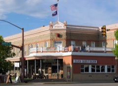
 Block
From the record
One of 38 National Register listings published here for Park County · listed in 2024 · category: Building.
Sources: the National Register database, National Park Service
Listed on the National Register of Historic Places in 2024.
One of 38 National Register listings published here for Park County · listed in 2024 · category: Building.
Sources: the National Register database, National Park Service
Regional context, not property-specific evidence. The federal wildfire occurrence database lists 212 fires within 5 miles of Sage Creek Community Club between 1996 and 2020, burning about 3,227 acres in total. 16 started naturally. 1 was recorded as arson. Distance is straight-line from the map coordinates, so a fire counted here may appear on a neighbouring settlement's page as well.
| Reported cause | Fires |
|---|---|
| Missing data/not specified/undetermined | 79 |
| Recreation and ceremony | 34 |
| Debris and open burning | 30 |
| Natural | 16 |
| Misuse of fire by a minor | 13 |
| Railroad operations and maintenance | 12 |
| Fireworks | 12 |
| Equipment and vehicle use | 8 |
| Power generation/transmission/distribution | 4 |
| Smoking | 2 |
| Firearms and explosives use | 1 |
| Arson/incendiarism | 1 |
The most recent of them, most recent first, with the day each was reported and the service that recorded it.
| Date | Cause | Size | Reported by | Name on the report |
|---|---|---|---|---|
| 7 September 2014 | Equipment and vehicle use | under an acre | Wyoming State Forestry | WILSON |
| 29 September 2017 | Debris and open burning | 1.0 acres | Park County | 6 SCHNEIDER RD |
| 28 September 2012 | Natural | 1,122 acres | Cody Field Office | SAGE CREEK |
| 26 September 2003 | Misuse of fire by a minor | under an acre | Wyoming State Forestry | not named |
| 25 September 2015 | Equipment and vehicle use | under an acre | Wyoming State Forestry | BLESSING |
| 25 September 2015 | Missing data/not specified/undetermined | 1.0 acres | Wyoming State Forestry | WILSON |
| 24 September 2020 | Missing data/not specified/undetermined | 1.0 acres | Park County | 14A & LANE 18 |
| 21 September 2016 | Missing data/not specified/undetermined | 1.0 acres | Wyoming State Forestry | not named |
Regional context, not property-specific evidence. The federal mineral resources record lists 14 workings within 5 miles of Sage Creek Community Club: 4 occurrences, 4 unknowns, 3 producers, 3 past producers. 3 still produce. What was taken out: Uranium, Gypsum-Anhydrite, Sand and Gravel, Construction. Distance is straight-line from the map coordinates, so a quarry counted here may appear on a neighbouring settlement's page as well.
| Where | Site | Commodity | Status | Recorded |
|---|---|---|---|---|
| Airport Topsoil Pit | Sand and Gravel, Construction | Unknown | ||
| Dutton Pit | Sand and Gravel, Construction | Past Producer | ||
| Greybull Hill Pit | Sand and Gravel, Construction | Unknown | ||
| Windy Flat Pit | Sand and Gravel, Construction | Unknown | ||
| Celotex Bighorn Gypsum Mine | Gypsum-Anhydrite | Producer | ||
| Cody Mill | Gypsum-Anhydrite | Producer | ||
| Pat O'Hara Gypsum Quarry No.1 | Gypsum-Anhydrite | Producer | ||
| Spirit Mountain Uranium Company | Uranium | Unknown | ||
| Spirit Mountains | Uranium | Occurrence | ||
| Unknown | Gypsum-Anhydrite | Past Producer |
Regional context, not property-specific evidence. The National Weather Service names Cody, the town this property stands in, in 31 storm reports between 1997 and 2025: 10 hail, 9 thunderstorm wind, 5 wildfire, 4 flash flood. The reports record 5 injuries. Each account below is quoted exactly as the forecast office filed it, from the NOAA Storm Events Database, and each date opens the federal record of that event.
| When | Event | Place named | Harm | What the report says |
|---|---|---|---|---|
| August 2000 | Lightning | Cody | 5 hurt | no account filed |
| July 1998 | Hail | Cody | $35,000 | no account filed |
| May 2015 | Flash Flood | Cody | $10,000 | A thunderstorm rapidly developed to the south of Cody and tracked north over the city producing heavy rain and copious amounts of small hail. Hail drifts were measured in feet in some areas with a few low spots accumulating close to six feet of hail. The hail prevented the heavy rain from draining easily and water accumulated on area roads. Several business owners in downtown Cody reported minor flooding as the water piled up in the streets, especially along Sheridan Avenue. A bakery had water on the floors and in the basement and a gift shop flooded. |
| July 2022 | Thunderstorm Wind | Cody | $2,000 | Strong thunderstorm winds blew down trees onto power lines that caused power outages to 400 customers. A maximum wind gust of 68 mph was reported at the Powell airport. |
| May 2025 | Thunderstorm Wind | Cody | - | Wind gust to 66 mph on the mesonet station PC261 Cedar Mountain near Cody, WY. |
| May 2018 | Hail | Cody | - | A television station forwarded a report of quarter size hail to the east of Cody. |
| June 2014 | Hail | Cody | - | The public reported nickel sized hail on the west side of Cody. |
| May 2013 | Hail | Cody | - | Nickel sized hail was reported by a CoCoRaHs observer on the west side of Cody. |
| July 2011 | Hail | Cody | - | Hail to the size of quarters was observed in and near Cody. |
| July 2003 | Wildfire | Cody | - | no account filed |
| August 2003 | Wildfire | Cody | - | no account filed |
| August 2003 | Wildfire | Cody | - | no account filed |
| September 2003 | Wildfire | Cody | - | no account filed |
| September 2003 | Wildfire | Cody | - | no account filed |
| August 2002 | Hail | Cody | - | no account filed |
| August 2002 | Hail | Cody | - | no account filed |
| May 2001 | Hail | Cody | - | no account filed |
| June 2001 | Thunderstorm Wind | Cody | - | no account filed |
| June 2001 | Heavy Rain | Cody | - | no account filed |
| June 2001 | Thunderstorm Wind | Cody | - | no account filed |
| July 2001 | Flash Flood | Cody | - | no account filed |
| May 2000 | Flood | Cody | - | no account filed |
| June 2000 | Thunderstorm Wind | Cody | - | no account filed |
| June 2000 | Hail | Cody | - | no account filed |
| August 2000 | Thunderstorm Wind | Cody | - | no account filed |
| July 1998 | Thunderstorm Wind | Cody | - | no account filed |
| July 1998 | Hail | Cody | - | no account filed |
| August 1997 | Thunderstorm Wind | Cody | - | no account filed |
| June 1997 | Flash Flood | Cody | - | no account filed |
| May 1997 | Thunderstorm Wind | Cody | - | no account filed |
| June 1997 | Flash Flood | Cody | - | no account filed |
No historic map-sheet match is published for this property yet. That does not mean no map exists. This record needs a coordinate-quality review before it can be joined to a sheet boundary. Browse the county's mapped places while that work is pending.
Other National Register properties close enough to walk or drive between, ordered by distance from this one. Both positions come from the same geocoding pass that matched these properties to their map sheets.
| Photograph | Property | Distance | Listed |
|---|---|---|---|
| Quintin Blair House | 2.6 miles | 1991 | |
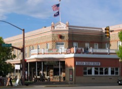 | Irma Hotel | 3.7 miles | 1973 |
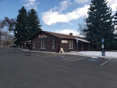 | Stock Center | 4.3 miles | 1976 |
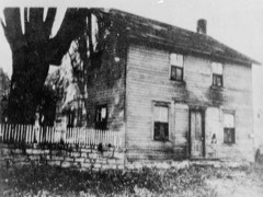 | Buffalo Bill Boyhood Home | 4.4 miles | 1975 |
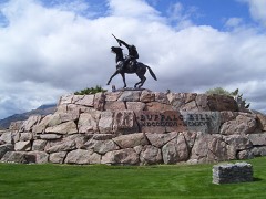 | Buffalo Bill Statue | 4.5 miles | 1974 |
 | Downtown Cody Historic District | 4.8 miles | 1983 |
| National Archives record | The nomination case file for reference 100009599 in Record Group 79. |
| Park County | All 38 listed properties in this county. |