 Block
From the record
29 National Register listings published here, 1 of them a National Historic Landmark.
Sources: the National Register database, National Park Service
61 topographic sheets cover 22 settlements here, and 29 properties are on the National Register of Historic Places.
29 National Register listings published here, 1 of them a National Historic Landmark.
Sources: the National Register database, National Park Service
Every property in this county listed on the National Register of Historic Places, with the year it was listed and the federal nomination document.
| Photograph | Property | Type | Listed | Reference |
|---|---|---|---|---|
| 160-166 N. Main | building | 1982 | 82001837 | |
| Big Red Ranch Complex | building | 1984 | 84000437 | |
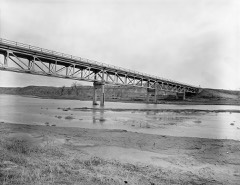 | CKW Bridge over Powder River | structure | 1985 | 85000432 |
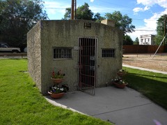 | Clearmont Jail | building | 1984 | 84003698 |
| Connor Battlefield | site | 1971 | 71000891 | |
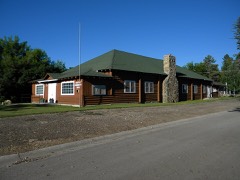 | Dayton Community Hall | building | 2005 | 05001338 |
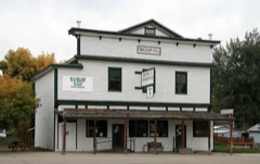 | Dayton Mercantile | building | 2016 | 16000264 |
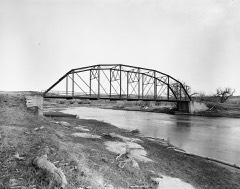 | EAU Arvada Bridge | structure | 1985 | 85000433 |
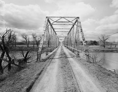 | EBF Bridge over Powder River | structure | 1985 | 85000434 |
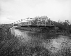 | ECR Kooi Bridge | structure | 1985 | 85000436 |
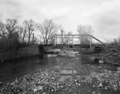 | ECS Bridge over Big Goose Creek | structure | 1985 | 85000435 |
| First Congregational Church | building | 2023 | 100008515 | |
| Fort MacKenzie | district | 1981 | 81000612 | |
| Stephen George Homestead | building | 2023 | 100008514 | |
 | Holy Name Catholic School | building | 2013 | 13000212 |
| Johnson Street Historic District | district | 1984 | 84003701 | |
 | Mount View | building | 1997 | 97001534 |
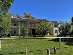 | Odd Fellows Hall | building | 1980 | 80004052 |
| Quarter Circle A Ranch | building | 1976 | 76001961 | |
 | Robinson-Smith House | building | 2016 | 16000207 |
 | Sheridan County Courthouse | site | 1982 | 82001836 |
| Sheridan County Fairgrounds Historic District | district | 2011 | 11000533 | |
 | Sheridan Flouring Mills, Inc. | building | 1997 | 97001533 |
 | Sheridan Inn | building | 1966 | 66000762 |
| Sheridan Railroad Historic District | district | 2004 | 04001234 | |
 | St. Peter's Episcopal Church | building | 2013 | 13000266 |
| Stone House, The | building | 2022 | 100008015 | |
 | Trail End | building | 1970 | 70000675 |
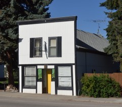 | Susan Wissler House | building | 1984 | 84003703 |
Every wildfire the federal occurrence database records inside this county: 708 of them, burning about 174,128 acres. 225 started naturally and 1 was recorded as arson. Each settlement page carries the fires within five miles of it.
| Reported cause | Fires |
|---|---|
| Missing data/not specified/undetermined | 263 |
| Natural | 225 |
| Debris and open burning | 75 |
| Recreation and ceremony | 54 |
| Equipment and vehicle use | 36 |
| Railroad operations and maintenance | 17 |
| Smoking | 15 |
| Fireworks | 11 |
| Power generation/transmission/distribution | 6 |
| Misuse of fire by a minor | 3 |
| Other causes | 2 |
| Arson/incendiarism | 1 |
The five largest, by the area the report gives. None of them was recorded as arson.
| Date | Cause | Size | Reported by | Name on the report |
|---|---|---|---|---|
| 30 August 2017 | Natural | 40,266 acres | Buffalo Field Office | DEER CREEK |
| 13 July 2006 | Natural | 29,966 acres | Buffalo Field Office | BUFFALO CREEK FIRE |
| 17 August 2020 | Missing data/not specified/undetermined | 25,590 acres | Sheridan County | WADDLE CREEK |
| 22 August 1994 | Natural | 13,400 acres | Casper Field Office | BARREL SPR |
| 9 August 2003 | Natural | 7,400 acres | Bighorn National Forest | LITTLE HORN II |
| 11 July 2015 | Debris and open burning | 5,724 acres | Buffalo Field Office | BALES |
| 28 July 2001 | Natural | 5,207 acres | Casper Field Office | THUNDER CH |
| 10 August 2007 | Natural | 4,742 acres | Bighorn National Forest | LITTLE GOOSE |
Every settlement page carries the fires within five miles of it - see the settlement index below.
The NOAA Storm Events Database holds 385 reports for this county, causing 1 death, no injuries and about $758,060 in recorded property damage. Each settlement page carries the reports that name it.
| Kind of event | Reports |
|---|---|
| Hail | 215 |
| Thunderstorm Wind | 121 |
| Flash Flood | 12 |
| Heavy Rain | 11 |
| Tornado | 10 |
| Flood | 10 |
| Funnel Cloud | 4 |
| Lightning | 1 |
| Debris Flow | 1 |
The most serious of them, by death, then injury, then recorded damage. The accounts are quoted exactly as the forecast office filed them.
| When | Event | Place named | Harm | What the report says |
|---|---|---|---|---|
| July 2010 | Lightning | Dayton | 1 killed | no account filed |
| May 2011 | Flood | Parkman | $520,000 | Heavy rains of 3 to 5 inches in the Big Horn Mountains and Foothills caused area streams and creeks to rise and result in localized flooding. Small streams and creeks around Dayton were reported to be flooded. In addition, flooding was reported along the Tongue River and Little Goose Creek and on creeks in the Ranchester area resulting in the closing of some county roads. During the height of the heavy rainfall, Pass Creek Road, far northern Sheridan County near the Montana border, flooded and was eventually washed out. Several culverts were also reported as washed out. |
| May 2019 | Flood | Ranchester | $125,000 | Several days of heavy rainfall over the Big Horn Mountains and adjacent foothills, as well as the lower elevations resulted in widespread flooding and major impacts along the foothills of Sheridan County. The State Engineers Office Water Division Office measured up to 4 inches of rain between May 26th and May 28th. The following are some of the multiple impacts that occurred across the area:|-Sheridan County Commissioners issued an Emergency Declaration.|- It was reported that Goose Creek saw stream levels rise 3 feet in 15 minutes in Kendrick Subdivision on the 28th. |-The Connor Battlefield State Historic site in Ranchester estimated cost of the damage to roads in that area of $25,000.|-Ranchester City Park was closed due to the flooding. |-Jackson Creek overtopped the road in the town of Big Horn. |-Water covered portions of Tongue Canyon Road. |-Flooding on the Little Goose resulted in the following road closures:| -Soldier Creek road 11 miles west of Sheridan| -Woodland Park Road south of Sheridan| -67 by Wolf Creek in Ranchester| -County Road 116 near Smith Creek.|-One observer reported it was the worse flooding they had seen since 1978. |-The Woodland Park Village (a trailer park of 250 homes) was severely impacted by the | flooding. Other homes in the area were under water.||On May 30th, waters receded below flood stage on all of the gauges in Sheridan County. Local emergency officials did not report any additional flooding concerns. However, some roads remained closed. |
| May 1993 | Hail | not stated | $50,000 | Hail up to an inch was recorded at the airport as well as the Law Enforcement Center in town. Damage was slight with no injuries. |
| May 1961 | Tornado (F1) | not stated | $25,000 | no account filed |
| August 1998 | Flood | Sheridan | $20,000 | The Little Goose Creek flooded a small subdivision when a slow moving thunderstorm produced over 1.50 inches of rainfall in 20 minutes. A house basement was reported to have been flooded. |
| June 1998 | Thunderstorm Wind | Sheridan | $10,000 | no account filed |
| July 1995 | Thunderstorm Wind | not stated | $3,000 | Three short lived funnel clouds were sighted just north of Sheridan. In addition, thunderstorm winds gusted to 68 MPH in Dayton. The strong winds downed tree limbs, some of which damaged a house and a vehicle. |
| June 1968 | Tornado (F1) | not stated | $2,500 | no account filed |
| June 1968 | Tornado | not stated | $2,500 | no account filed |
| June 1976 | Tornado (F0) | not stated | $30 | no account filed |
| June 1976 | Tornado (F0) | not stated | $30 | no account filed |
| May 2025 | Thunderstorm Wind | (Shr)Sheridan Co Arp | - | Asos station kshr. |
| June 2025 | Hail | Wakeley | - | One and a quarter inch hail reported. |
| June 2025 | Hail | Parkman | - | Estimated 60 mph wind gust (no confirmation). |
| July 2025 | Debris Flow | Dayton | - | At least 4 debris flows within the Elk Burn Scar occurred along US-14 that closed the road for 3-4 hours. Also caused a log jam along the Little Tongue Canyon on Little Tongue Ranch, which caused localized flooding and damage to a barn. 0.7 inches of rain fell from 7 to 7:30pm. |
| July 2025 | Thunderstorm Wind | Dayton | - | Downed power lines and tree damage near Dayton. |
| June 2024 | Thunderstorm Wind | Sheridan | - | Downed power lines and tree limbs were reported. |
| July 2023 | Hail | Wyarno | - | Some broken windows were reported. |
| May 2023 | Hail | Acme | - | Nickel to quarter size hail was reported. |
| June 2022 | Funnel Cloud | Story | - | A brief funnel cloud was reported by law enforcement north of Lake Desmet. |
| June 2022 | Hail | Leiter | - | Pea to quarter size hail was reported. |
| July 2021 | Hail | Ranchester | - | There was a lot of pea-size hail with some quarter-size. |
| July 2019 | Thunderstorm Wind | Arvada | - | Some tree damage occurred. |
| July 2019 | Thunderstorm Wind | Leiter | - | Some trees were snapped. |
| July 2019 | Flash Flood | Lariat | - | Several feet of fast flowing water over-topped Powder River Road at Cottonwood Creek. |
| June 2019 | Hail | Parkman | - | Quarter size hail was reported 12 miles northwest of Dayton. |
| June 2019 | Hail | Parkman | - | A large amount of hail resulted in leaf damage to bushes. |
| July 2019 | Hail | Leiter | - | Some skylights were broken. |
| July 2018 | Thunderstorm Wind | Clearmont | - | Some trees fell onto power lines in Clearmont. |
| July 2018 | Thunderstorm Wind | Ft Mackenzie | - | Several large tree limbs were blown down in Sheridan. |
| July 2018 | Thunderstorm Wind | Big Horn | - | There were reports of many Cottonwood trees down with some on homes. |
| May 2018 | Flood | Ft Mackenzie | - | Heavy rain on the 27th and 28th resulted in the rapid rise of Big Goose Creek in Sheridan. |This resulted in many flooded areas with numerous basements flooded, as well as water flowing down streets adjacent to the creek. |
| June 2018 | Hail | Dayton | - | Quarter size hail was reported between Parkman and Dayton. |
| July 2017 | Thunderstorm Wind | Sheridan | - | Winds were estimated to be 50 to 60 mph just north of Sheridan. |
| June 2016 | Thunderstorm Wind | Ranchester | - | A truck was blown over at the Wyoming Point of Entry Station. |
| June 2015 | Flash Flood | Big Horn | - | A heavy, slow-moving thunderstorm resulted in flash flooding to portions of western Sheridan County. Highway 14 had water flowing across it at mile marker 84 1/2 resulting in the highway being closed. |
| June 2015 | Flash Flood | (Shr)Sheridan Co Arp | - | A very heavy thunderstorm moved over the Sheridan Foothills. As a result of the storm, Little Goose Creek and Maverick Creek breached their banks with fast moving water. Several roads were completely flooded and washed out. In addition, Bird Farm Road between Big Horn and Banner flooded. There was also a report of a foot of water that rushed into homes 6 miles south of Sheridan. |
| May 2015 | Flood | (Shr)Sheridan Co Arp | - | Heavy rains combined with snow melt out of the Big Horn Mountains brought flooding to portions of Sheridan. Little Goose Creek reached moderate flooding levels. Two subdivisions south of Sheridan were hit hard. Woodland Hills experienced water, up to about two feet deep, running over the road. Just to the north, water at Woodland Park Village reached about 8 feet at the bridge. Volunteers pulled debris out of water to prevent the bridge from washing out. In Sheridan proper, South Park was almost completely underwater, as was a portion of the field directly south of Brundage. There were also reports of flooding along Big Goose Creek above Kendrick Park. In addition, Mavrakis Pond near 8th in Sheridan flowed over its banks on the east side. |
| July 2015 | Thunderstorm Wind | Parkman | - | A severe thunderstorm moved over the northwest portion of the Big Horn Mountains during the late afternoon on the 27th. A National Weather Service storm survey concluded that a microburst with winds estimated at 90-100 mph hit the area. Damage from this microburst occurred near Highway 14A near mile marker 81. The approximate damage area was 1/4 mile wide and 2-3 miles in length. Two camper trailers were completely destroyed (tossed and turned) and two others were severely damaged. Numerous large trees, up to one foot in diameter, were snapped. In addition, ping pong to golf ball size hail occurred with this thunderstorm. |
| June 2013 | Hail | Wyarno | - | Damage to a vehicle was reported. |
| June 2013 | Thunderstorm Wind | Leiter | - | Some downed tree limbs were reported. |
| June 2013 | Thunderstorm Wind | Leiter | - | Thunderstorm winds knocked down a flag pole and fence. Significant tree damage was also reported. |
| June 2013 | Thunderstorm Wind | Leiter | - | Driving rain and small hail were also reported. |
| June 2013 | Flash Flood | Ft Mackenzie | - | The area received close to an inch of rain in less than an hour. This resulted in severe street flooding in the town of Sheridan. |
| September 2013 | Thunderstorm Wind | Ranchester | - | A wind gust of 60 mph was estimated in Ranchester. In addition, two inches of rain in a half hour was also estimated. |
| July 2013 | Thunderstorm Wind | Wyarno | - | A wind gust of 60 mph was estimated 11 miles southeast of Decker. |
| July 2013 | Thunderstorm Wind | Banner | - | A wind gust of 65 mph was estimated 5 miles north of Banner. |
| May 2013 | Thunderstorm Wind | Story | - | A thunderstorm wind gust around 70 mph resulted in about 8 trees either toppled or broken in the Story area. |
| May 2013 | Hail | Sheridan | - | Numerous reports of hail ranging in size from pea to quarter were received in and around the Sheridan area. |
| February 2012 | Flood | Clearmont | - | Periods of steady rain falling onto frozen ground resulted in some minor flooding during the afternoon and early evening hours on the 22nd. Flooding of low lying areas, as well as creeks and streams was reported across Eastern Sheridan County including Buffalo Creek near Leiter. Stream gages on Wild Horse Creek near Arvada showed a steep rise of over 3 feet from noon into the early evening hours. In addition, a few basements and a county road were flooded north of Leiter. |
| July 2011 | Hail | Kleenburn | - | Estimated winds of 65-70 mph resulting in 3-4 inch Cottonwood tree limbs breaking off were also reported. |
| July 2011 | Thunderstorm Wind | Wakeley | - | An estimated wind gust of 70 mph was reported 8 miles northeast of Sheridan. |
| July 2011 | Thunderstorm Wind | Clearmont | - | An estimated wind gust of 65 mph was reported 3 miles southeast of Clearmont. |
| June 2011 | Hail | Banner | - | In addition to the hail, 0.70 inches of rain was reported. |
| June 2011 | Hail | Leiter | - | Extensive 1/4 to 1/2 hail was also reported. |
| May 2011 | Flash Flood | Ft Mackenzie | - | Excessive rainfall during the evening of the 24th resulted in the overflowing of a stock pond, as well as flooding along Soldier Creek in western Sheridan. Law enforcement reported some homes in the Downer Addition Subdivision were flooded. |
| June 2011 | Flood | Ranchester | - | County officials and spotters reported flooding in the southern end of Ranchester on the Tongue River and Five Mile Creek. Several locations in Ranchester had high water with flooding in low lands and back yards of some homes. In addition, rises on the Tongue River caused the streams and creeks feeding into the river to rise as well. |
| May 2011 | Flood | Dayton | - | Heavy rainfall in the foothills of the Big Horn Mountains resulted in high flows and localized flooding on all rivers and streams across Sheridan County. County dispatch reported Soldier Creek was out of its banks and flooding homes in Downer Addition subdivision on the west side of Sheridan. |
| July 2011 | Thunderstorm Wind | Wakeley | - | An estimated wind gust of 65 mph was reported 13 miles northeast of Story. |
The Survey's mineral resources record lists 58 workings inside this county. 10 still produce and 48 are closed or unrecorded. Each settlement page carries the workings within five miles of it.
| Commodity | Workings |
|---|---|
| Iron | 11 |
| Gold | 9 |
| Stone | 6 |
| Uranium | 6 |
| Bentonite | 5 |
| Gypsum-Anhydrite | 3 |
| Copper | 2 |
| Sand and Gravel, Construction | 2 |
| Dolomite | 2 |
| Stone, Dimension | 2 |
| Tungsten, Gold, Sulfides | 1 |
| Niobium (Columbium), Tantalum, REE | 1 |
| Silver, Gold | 1 |
| Tungsten | 1 |
The least common of them first, because a county's hundredth gravel pit says nothing its first ten did not.
| Where | Site | Commodity | Status | Recorded |
|---|---|---|---|---|
| Bald Mountain Thorium-Rare Earth Deposit | Titanium, Thorium, REE, Gold, Zirconium, Iron | Past Producer | Monazite | |
| Cooper Claim | Nickel | Occurrence | ||
| East Fork, Big Goose Creek Mine | Silver, Gold, Copper | Past Producer | Copper, Gold, Silver | |
| Grubstake Syndicate | Vermiculite | Occurrence | ||
| Guernsey Stone Quarry | Pumice | Producer | ||
| Little Falls Claim | Talc-Soapstone | Past Producer | ||
| Mosaic Claim | Tungsten, Gold, Sulfides | Occurrence | Gold, Scheelite, Wolframite | |
| Mosaic Claim | Tungsten | Unknown | ||
| Mosaic Claim | Vanadium, Gold | Past Producer | ||
| Rainbow Claims | Niobium (Columbium), Tantalum, REE | Occurrence | Euxenite | |
| Unknown | Limestone, General | Occurrence | ||
| Unknown | Clay | Producer | ||
| Unknown | Copper, Iron | Occurrence | ||
| Walkers Mine | Gold, Copper | Occurrence | ||
| Dygert Pit | Sand and Gravel, Construction | Producer | ||
| Mullinax Sand & Gravel Plant | Sand and Gravel, Construction | Producer | ||
| Unknown | Copper | Occurrence | ||
| Unknown | Dolomite | Occurrence | ||
| Unknown | Dolomite | Occurrence | ||
| Unnamed | Stone, Dimension | Occurrence | ||
| Unnamed | Stone, Dimension | Occurrence | ||
| Unknown | Gypsum-Anhydrite | Occurrence | ||
| Unnamed | Gypsum-Anhydrite | Occurrence | ||
| Unnamed | Gypsum-Anhydrite | Occurrence | ||
| Unknown | Bentonite | Producer | ||
| Unknown | Bentonite | Producer | ||
| Unknown | Bentonite | Producer | ||
| Unknown | Bentonite | Producer | ||
| Unknown | Bentonite | Producer | ||
| Arno Quarry | Stone | Past Producer | ||
| Big Horn Mountain | Uranium | Unknown | ||
| Tongue River Stone Co | Stone | Producer | ||
| Unidentified Prospect | Stone, Iron | Past Producer | Pyrrhotite | |
| Unknown | Stone | Past Producer | ||
| Unknown | Stone | Occurrence | ||
| Unknown | Uranium | Past Producer | ||
| Unknown | Uranium | Occurrence | ||
| Unknown | Stone | Occurrence | ||
| Unknown | Uranium | Past Producer | ||
| Unknown | Uranium, Gold | Occurrence | ||
| Wilcox-People Prospect | Uranium | Prospect | ||
| Gold Standard Placers | Gold | Past Producer | Placer | |
| Madalynna Claim | Gold | Occurrence | Gold | |
| Madalynna Claim | Gold | Past Producer | ||
| Nickel and Copper Refining Co | Gold | Past Producer | ||
| Nickel and Copper Refining Co. Occurrence | Gold | Occurrence | Gold | |
| Unnamed | Gold | Past Producer | ||
| Unnamed | Gold | Past Producer | ||
| Unidentified Occurrence | Iron | Occurrence | Hematite | |
| Unidentified Prospect | Iron | Occurrence | Specularite | |
| Unknown | Iron | Occurrence | ||
| Unknown | Iron | Occurrence | ||
| Unnamed | Iron | Occurrence | ||
| Unnamed | Iron | Occurrence | ||
| Unnamed | Iron | Occurrence | ||
| Unnamed | Iron | Occurrence | ||
| Unnamed | Iron | Occurrence | ||
| Unnamed | Iron | Occurrence |
Named settlements recorded in the Geographic Names Information System, each with the topographic sheets covering it. Villages, hamlets and abandoned places alike. Each is shown with the nearest named watercourse or landform and the survey quadrangle it falls on.
Sheridan West census division · 82801 · On Hidden Water Creek · Acme quadrangle
11 sheets, 1909 to 1979
Sheridan census division · 82831 · On Wild Horse Creek · Arvada quadrangle
7 sheets, 1955 to 1979
Sheridan South census division · 82832 · Near Spring Draw · Banner quadrangle
13 sheets, 1909 to 1979
Sheridan South census division · 82801 · On Park Creek · Beckton quadrangle
17 sheets, 1895 to 1993
Sheridan South census division · 82801 · On Kusel Creek · Big Horn quadrangle
13 sheets, 1909 to 1979
Sheridan West census division · On Little Willow Creek · Burgess Junction quadrangle
17 sheets, 1898 to 1993
Sheridan census division · 82835 · On Thompson Creek · Clearmont quadrangle
7 sheets, 1955 to 1979
Sheridan West census division · 82836 · On Little Tongue River · Dayton North quadrangle
15 sheets, 1895 to 1979
Sheridan West census division · 82839 · On South Dry Creek · Monarch quadrangle
15 sheets, 1895 to 1979
Sheridan West census division · 82839 · On South Dry Creek · Monarch quadrangle
15 sheets, 1895 to 1979
Sheridan West census division · 82838 · On Dry Twin Creek · Dayton North quadrangle
15 sheets, 1895 to 1979
Sheridan South census division · 82801 · Near Denio Draw · Big Horn quadrangle
13 sheets, 1909 to 1979
Sheridan West census division · 82839 · On Fivemile Creek · Ranchester quadrangle
15 sheets, 1895 to 1979
Sheridan census division · 82801 · On Little Goose Creek · Sheridan quadrangle
13 sheets, 1909 to 1979
Sheridan South census division · 82842 · On Spring Creek · Story quadrangle
12 sheets, 1909 to 1993
Sheridan census division · 82835 · On Piney Creek · Ucross quadrangle
12 sheets, 1909 to 1979
Sheridan census division · 82845 · Near Roode Draw · Verona quadrangle
11 sheets, 1909 to 1979
Sheridan West census division · 82844 · On Red Canyon Creek · Wolf quadrangle
15 sheets, 1895 to 1993
Sheridan census division · 82845 · In Wyarno Draw · Wyarno quadrangle
12 sheets, 1909 to 1979