Block
From the record
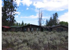
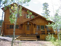
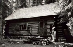
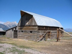
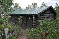
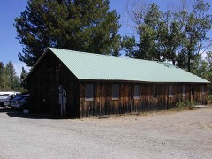
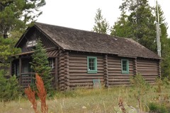
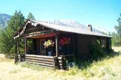
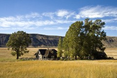
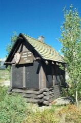
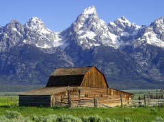
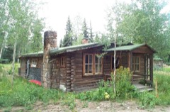
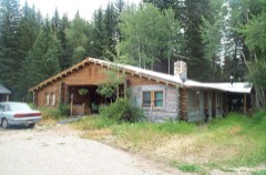
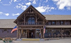
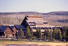
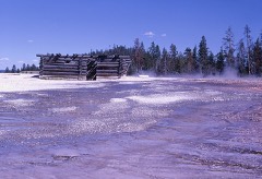
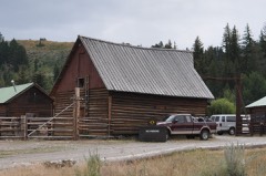
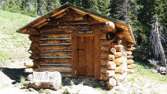
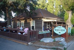
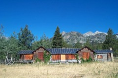
65 National Register listings published here, 4 of them National Historic Landmarks.
Sources: the National Register database, National Park Service
91 topographic sheets cover 20 settlements here, and 65 properties are on the National Register of Historic Places.
65 National Register listings published here, 4 of them National Historic Landmarks.
Sources: the National Register database, National Park Service
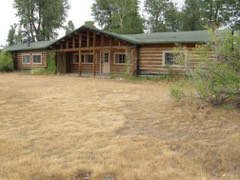
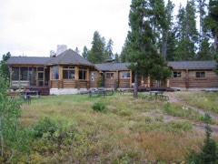
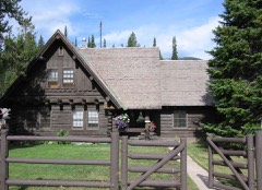
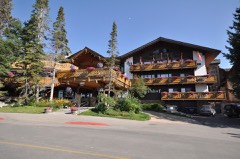
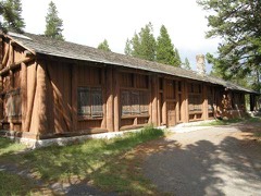
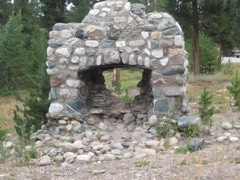
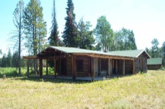
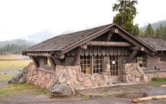
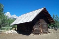
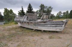
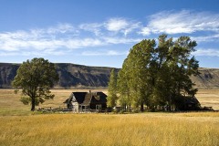
Every property in this county listed on the National Register of Historic Places, with the year it was listed and the federal nomination document.
Every wildfire the federal occurrence database records inside this county: 1,379 of them, burning about 202,696 acres. 837 started naturally and 15 were recorded as arson. Each settlement page carries the fires within five miles of it.
| Reported cause | Fires |
|---|---|
| Natural | 837 |
| Recreation and ceremony | 298 |
| Missing data/not specified/undetermined | 75 |
| Smoking | 35 |
| Power generation/transmission/distribution | 34 |
| Equipment and vehicle use | 30 |
| Debris and open burning | 28 |
| Arson/incendiarism | 15 |
| Fireworks | 10 |
| Misuse of fire by a minor | 8 |
| Other causes | 4 |
| Firearms and explosives use | 3 |
| Railroad operations and maintenance | 2 |
The five largest, by the area the report gives. None of them was recorded as arson.
| Date | Cause | Size | Reported by | Name on the report |
|---|---|---|---|---|
| 24 August 2012 | Recreation and ceremony | 29,950 acres | Bridger-Teton National Forest | NORTH BUFFALO |
| 25 July 2016 | Natural | 20,825 acres | Grand Teton National Park | BERRY |
| 5 August 2006 | Natural | 16,906 acres | Bridger-Teton National Forest | PURDY |
| 23 September 2009 | Natural | 10,700 acres | Yellowstone National Park | ARNICA |
| 30 July 2008 | Power generation/transmission/distribution | 10,361 acres | Yellowstone National Park | LEHARDY |
| 20 August 2011 | Natural | 9,670 acres | Bridger-Teton National Forest | RED ROCK |
| 9 August 2000 | Natural | 6,600 acres | Bridger-Teton National Forest | ENOS |
| 23 July 2010 | Natural | 5,429 acres | Bridger-Teton National Forest | BULL |
Every settlement page carries the fires within five miles of it - see the settlement index below.
The NOAA Storm Events Database holds 118 reports for this county, causing 2 deaths, 56 injuries and about $3,113,000 in recorded property damage. Each settlement page carries the reports that name it.
| Kind of event | Reports |
|---|---|
| Thunderstorm Wind | 54 |
| Hail | 34 |
| Lightning | 10 |
| Wildfire | 7 |
| Flood | 4 |
| Flash Flood | 4 |
| Tornado | 3 |
| Heavy Rain | 1 |
| Debris Flow | 1 |
The most serious of them, by death, then injury, then recorded damage. The accounts are quoted exactly as the forecast office filed them.
| When | Event | Place named | Harm | What the report says |
|---|---|---|---|---|
| July 2003 | Lightning | Jackson | 1 killed, 5 hurt | no account filed |
| August 2022 | Lightning | Moran | 1 killed, 1 hurt | On Tuesday evening, August 2, 2022 lightning struck a group of backpackers camped at Enos Lake in the Teton Wilderness. One person, a 22-year-old male, died in the incident, while another, an adult male, sustained major injuries. The lightning bolt reportedly hit the backpackers at camp. The men were part of a group of 14 adults on an organized wilderness trip. This information is directly from a Teton County Search and Rescue press release describing the event. |
| July 2010 | Lightning | Jenny Lake | 17 hurt | Lightning struck Grand Teton mountain in Grand Teton National Park injuring 17 climbers that were among three separate private climbing parties. One of the injured ultimately fell 2,000 feet to his death as an indirect result of the lightning strike. The climbers were all above 13,000 feet MSL when the lightning storm hit about 1100MST. Helicopters ferried National Park Service rangers to the famed mountain to rescue the injured climbers and search for the body of the deceased. Moderate to severe injuries, ranging from burns to numbness, were suffered by the surviving climbers. The rescue involved the efforts of 83 people. |
| June 2005 | Lightning | Fishing Bridge | 11 hurt | no account filed |
| June 2010 | Lightning | Old Faithful | 9 hurt | A single lightning bolt injured nine visitors at Old Faithful in Yellowstone National Park. The visitors were on walkways and boardwalks surrounding Old Faithful Geyser when the strike occurred around 1430MST. One victim was air lifted to an Idaho medical center to receive treatment for burns and a ruptured eardrum. He also had his hat burned and his shoes had holes in them. The other eight victims were treated for minor injuries. |
| June 2002 | Lightning | Moran | 5 hurt | no account filed |
| August 1999 | Lightning | Jackson Arpt | 2 hurt | no account filed |
| June 2013 | Thunderstorm Wind | Colter Bay Village | 1 hurt, $20,000 | Gusty outflow wind from a collapsing rain shower blew down or broke over 100 trees at Colter Bay Campground and RV Park. Three or four of the falling trees struck and damaged vehicles at the park. One large branch, estimated to be 40 feet long and nearly one foot in diameter, struck a 30-year-old woman. The woman was life-flighted to a regional hospital with critical injuries. |
| July 2019 | Lightning | (Jac)Jackson Hole Ar | 1 hurt | A man was struck by lightning in the parking lot of the Jackson Hole airport. The man survived but suffered a broken nose and jaw as well as three broken ribs. |
| July 2008 | Hail | Jenny Lake | 1 hurt | Nickel to quarter sized hail accumulated to a depth of three to four inches at Jenny Lake in Grand Teton National Park. One person received lacerations and several other people had welts. |
| July 2008 | Hail | Alta | 1 hurt | A cooperative observer near Alta observed nickel sized hail. |
| July 2007 | Lightning | Moose | 1 hurt | no account filed |
| July 1999 | Lightning | Jackson | 1 hurt | no account filed |
| July 1987 | Tornado (F4) | not stated | $2,500,000 | no account filed |
| July 2023 | Thunderstorm Wind | Wilson | $250,000 | Hundreds of trees were downed in and around Wilson WY. Some trees landed on power lines, resulting in a loss of power for several hours in Wilson. Pictures shared by emergency management showed fallen trees which had damaged homes, businesses, and vehicles. |
| June 2015 | Thunderstorm Wind | Wilson | $80,000 | Thunderstorm outflow wind descended the east slopes of the Teton Range and generated a swath of damage from near Wilson north along the Moose-Wilson Road and through Grand Teton National Park. The damage began near Wilson around 1645MST and spread north until shortly after 1700MST. Downed trees damaged power lines, crushed parked vehicles, made roads impassable, and even stranded park visitors on the Signal Mountain Summit Road. Just under 1000 customers were impacted by power outages due to the downed power lines, including park employee housing at Beaver Creek. In all, over 150 trees were cleared and all park visitors were rescued by 2200MST. |
| June 2012 | Thunderstorm Wind | Jackson | $75,000 | A microburst associated with a strong thunderstorm that developed near Rafter J Ranch and swept north caused widespread tree and property damage. Most of the damage was concentrated in Jackson and in a swath from south of town to the northwest of town toward Teton Village. Dozens of uprooted trees caused minor roof damage and a carport collapsed at Jackson Hole Lodge in Jackson. |
| July 2007 | Flash Flood | Wilson | $50,000 | Heavy rain triggered a debris flow in Jensen Canyon shortly before 3:00 p.m. Eyewitness reports indicated that entire trees, boulders, and mud were moved by the debris flow which was three to eight feet deep. The flow pushed an automobile for 20 to 30 feet before flipping it onto its side. A small outbuilding near one residence was also damaged. A geologist measured a mud line 40 feet up the sides of the canyon upstream from the canyon mouth. |
| August 2007 | Flash Flood | Jackson | $20,000 | Rainfall of around one inch fell in less than one hour causing street flooding east of Town Square in Jackson. At least one basement was flooded during the storm. Additionally, pea-size to one-half inch diameter hail occurred for about 15 minutes with the thunderstorm. The hail covered the ground to a depth of one inch. |
| June 2011 | Thunderstorm Wind | Moran | $15,000 | A collapsing thunderstorm produced damaging outflow wind. Several large trees and power poles were blown down, especially in the area of Colter Bay and Pilgrim Creek in Grand Teton National Park. Several interior service roads in the park were temporarily blocked by downed trees. Large plate-glass windows were blown out in the Mural Room of Jackson Lake Lodge but no injuries were reported. |
| December 2011 | Flood | Jackson | $15,000 | no account filed |
| March 2018 | Flood | (Jac)Jackson Hole Ar | $10,000 | The Teton County emergency manager reported flooding around the Moulton Loop and the north end of Spring Gulch Road from a combination of rain and rapid snow melt. Several side roads had water across them and a house had basement flooding from the floodwater. |
| February 2017 | Heavy Rain | (Jac)Jackson Hole Ar | $10,000 | Up to two inches of rain fell onto deep snow pack in the Jackson Valley. The very heavy weight on roofs caused some minor damage to buildings, including to the police station. The rain also caused rapid snow melt that led to areas of minor flooding. |
| September 2014 | Thunderstorm Wind | Jackson | $10,000 | Trees 50 to 60 feet tall were toppled in the town of Jackson by outflow from a collapsing thunderstorm. At least one vehicle was damaged. |
| August 2014 | Flash Flood | Jenny Lake | $10,000 | Rainfall of one-half to one inch fell in 20 to 30 minutes in the steep terrain of Paintbrush Canyon. A National Park Service backcountry trail crew working in the canyon reported hearing a rumbling sound before witnessing a large mudslide. The slide washed out multiple sections of the popular Paintbrush Canyon trail. The crew sought higher ground and all were safe, but the slide did destroy some gear and equipment. |
| June 2009 | Thunderstorm Wind | Jenny Lake | $10,000 | Multiple trees were downed around Jenny Lake and across Grand Teton National Park. One vehicle on the Jenny Lake Scenic Loop lost its windshield because of a fallen tree. Most trees were less than one foot in diameter. A mesonet station about four miles south recorded a peak wind gust of 54 mph from the west-northwest. |
| June 2009 | Thunderstorm Wind | Moose | $10,000 | Several trees were downed in a swath from the Death Canyon Trailhead east across the Moose-Wilson Road. Motorists were trapped on the road by fallen trees which were blocking passage. One vehicle was damaged near Death Canyon due to a fallen tree. |
| June 2009 | Thunderstorm Wind | Wilson | $10,000 | Power lines were reported down in Wilson as was a six inch diameter tree just west of town. A local energy company had to install one new pole and rebuild six others. One power line fell on Fish Creek Road and stopped traffic. |
| August 2007 | Flash Flood | Hoback Junction | $10,000 | no account filed |
| August 2007 | Thunderstorm Wind | South Entrance | $6,000 | At least 12 trees were downed between the South Entrance and Grant Village along the South Entrance Road. Park Service personnel estimated wind of 60 mph. |
| October 2025 | Tornado (EF1) | Alta | $1,000 | On 10/15/25 from 1:35 to 1:37 PM MDT, a thunderstorm produced an EF1 tornado near Alta, WY in the Teton Canyon portion of the Caribou-Targhee National Forest. Reports from social media after the event mentioned tree damage in the Teton Canyon area. Later drone footage taken by the local sheriff's office during the week after this event, as well as satellite imagery, identified a swath of tree damage consistent with 87-104 mph winds (EF1). ||Wind speed was determined using the Enhanced Fujita Scale Damage Indicator for #28 Tree - Softwood, since this tornado occurred in a dense coniferous portion of the Caribou-Targhee National Forest. No structures were in the path. Aerial drone photography showed hundreds of trees blown down by the tornado, with a clear damage swath/path through the forest. A majority of trees in the path were uprooted (Degree of Damage 3, 87 mph) or had their trunks snapped (DoD 4, 104 mph). Bark was visible on trees, and there was no notable debarking or stripping of branches seen in imagery (DoD 5). Given relatively healthy trees with no reason to believe trees were stronger or weaker than average, the lower and upper bounds for the DoDs were not utilized, and expected values were referenced. This led to a wind speed estimate of 87 to 104 mph, which is rated EF1 on the Enhanced Fujita Scale.||The tornado damage path is approximately 1.0 miles long, with a maximum width of 125 yards. The tornado damage path started at an elevation of 7900 ft ASL and ended around 6900 ft. |
| July 2019 | Thunderstorm Wind | Jackson | $1,000 | Several trees were damaged at the Colter Elementary School south of Jackson, Wyoming. One tree fell on the school, causing minor roof damage. |
| May 2025 | Thunderstorm Wind | (Jac)Jackson Hole Ar | - | The Jackson Hole airport reported a wind gust of 67 mph. |
| June 2024 | Thunderstorm Wind | Wilson | - | The public reported limbs down in Jackson. Downed trees knocked out power to 383 customers in Wilson. |
| July 2024 | Thunderstorm Wind | Moose | - | A 60 mph wind gust was reported at the weather station at the Teton Saddle. |
| February 2023 | Flood | Valley | - | A skier-triggered avalanche occurred and deposited snow in Flat Creek. This snow created a temporary dam and lead to the creek rising out of its banks, bringing minor flooding to a townhome development and the parking lot of a gas station. Heavy equipment was called that night and dug a channel through the snow to release water from behind the avalanche-deposited snow dam. The creek was flowing again by 4 AM MST, and the water returned to normal levels. No damage was reported. |
| July 2023 | Thunderstorm Wind | Alta | - | Trees were reported down by the public between Alta and the Grand Targhee Ski Resort. |
| July 2023 | Thunderstorm Wind | Jenny Lake | - | A 73 mph was measured at the Teton Saddle weather sensor. |
| May 2022 | Thunderstorm Wind | Jenny Lake | - | Time of event is based on observations sites in the region, and the time of discovery of trees down. |
| June 2022 | Thunderstorm Wind | Kelly | - | A supercell thunderstorm moved over the Bridger Teton National Forest to the east of Jackson, WY. Strong outflow winds from the supercell downed hundreds of trees over an approximately 6 mile path. There was extensive damage to the Crystal Creek Campground, where people were trapped until the road could be cleared 24 hours later. The Grizzly Lake Trail and Gros Ventre River Road were affected by tree damage. Maximum wind gusts were estimated to be in the 80 to 120 mph range based on tree damage. This damage is in addition to the tornado that occurred at higher elevations to the southwest of this lower-elevation campground damage and road damage. |
| June 2022 | Tornado (EF2) | Kelly | - | Several months after this event, Bridger Teton National Forest staff reached out to the NWS Riverton office and shared images and helicopter footage of a distinct path of tree damage through a thickly-forested high-elevation area that coincided with a supercell path from June 12, 2022. This area of widespread tree damage was inaccessible and not viewable to the NWS damage survey team that visited the valley nearby immediately following the event.||Post-event interrogation of radar imagery from the event shows a strong rotation couplet above this damage area. After consulting with other Great Plains NWS staff with more than 20 years of tornado-damage-determining experience, this was determined to be tornado damage. The tree fall pattern and path were consistent with strong tornadic rotation. ||The EF2 designation comes from looking at the softwood damage indicator of the Enhanced Fujita Scale. Pictures show thousands of pine trees snapped at various heights, with hardly any trees remaining upright. There was some evidence of debarking in photos as well. For this reason, wind speeds were estimated to be between 128 and 131 mph, based on the upper bound for softwood trunks snapped and the expected damage for softwood debarked. ||Path length and width were determined from polar-orbiting satellite data from the summer months after the event. Notable decreases in vegetation could be seen, with a clearly defined damage path. |
| June 2022 | Hail | Wilson | - | The public reported quarter size hail on Teton Pass. |
| June 2022 | Thunderstorm Wind | Jackson | - | The Teton County Emergency Manager reported a tree down in the town of Jackson, WY. |
| August 2021 | Hail | Jackson | - | The Teton County Emergency Manager reported penny-sized hail in Jackson. |
| August 2020 | Thunderstorm Wind | (Jac)Jackson Hole Ar | - | A 61 mph wind gust was reported at the Jackson Hole Airport. |
| August 2020 | Thunderstorm Wind | Teton Village | - | Early morning, high based showers developed over the Tetons and moved into the Jackson Valley. A downdraft off of one of the shower caused 3 balloons to crash to the ground south of Teton Village. People were thrown from the baskets with the hard landings. In total 11 people went to the hospital, with 4 who were admitted and 1 that had to be evacuated by helicopter to a hospital in Idaho Falls. |
| August 2019 | Debris Flow | Hoback Junction | - | A heavy rain and hailstorm caused a mudslide in Hoback Canyon. The mud and rockslide closed US 26/89 for several hours on the evening of July 1st. |
| July 2017 | Hail | Teton Village | - | A trained spotter reported nickel size hail north of Teton Village. |
| August 2016 | Hail | Colter Bay Village | - | The public reported quarter sized hail at Colter Bay Village. |
| May 2014 | Hail | Colter Bay Village | - | Numerous spotters reported nickel to quarter sized hail in and around Colter Bay. |
| July 2013 | Thunderstorm Wind | Teton Village | - | A wind gust to 72 mph was recorded at the Jackson Hole Mountain Resort. |
| June 2013 | Hail | Wilson | - | Nickel sized hail was reported a few miles south of Wilson. |
| July 2013 | Hail | Wilson | - | A public report indicated hail of penny to nickel size fell a few miles west of Jackson. |
| June 2013 | Thunderstorm Wind | Teton Village | - | A wind gust of 58 mph was measured at the Jackson Hole Mountain Resort. |
| June 2013 | Hail | Wilson | - | Numerous storm spotters reported pea to quarter sized hail in Jackson. |
| June 2013 | Thunderstorm Wind | Wilson | - | The Teton County Sheriff's Office relayed that thunderstorm winds downed several trees in Wilson. |
| July 2013 | Hail | Moose | - | Nickel sized hail was seen at Moose by a trained spotter. |
| August 2009 | Hail | Moran | - | Hail to the size of nickels was reported at Signal Mountain Lodge. |
| August 2009 | Hail | Moran | - | Nickel sized hail and wind gusts approaching 50 mph were reported at the Signal Mountain Marina. |
| July 2008 | Hail | Teton Village | - | Hail of one inch in diameter fell near Teton Village. |
The Survey's mineral resources record lists 105 workings inside this county. 3 still produce and 102 are closed or unrecorded. Each settlement page carries the workings within five miles of it.
| Commodity | Workings |
|---|---|
| Phosphorus-Phosphates | 40 |
| Gold | 39 |
| Uranium | 12 |
| Pumice | 3 |
| Bentonite | 3 |
| Geothermal | 3 |
| Sand and Gravel, Construction | 3 |
| Vanadium | 2 |
| Platinum, Silver, Gold | 1 |
| Titanium, Metal, Iron | 1 |
| Molybdenum, Gemstone | 1 |
| Copper | 1 |
| Petroleum (Oil) | 1 |
| Phosphorus-Phosphates, Vanadium | 1 |
The least common of them first, because a county's hundredth gravel pit says nothing its first ten did not.
| Where | Site | Commodity | Status | Recorded |
|---|---|---|---|---|
| Brown Bear Deposit | Asbestos | Prospect | ||
| Buffalo Fork Prospect | Copper | Occurrence | ||
| Dry Cottonwood Creek | Titanium, Metal, Iron | Occurrence | ||
| Fox Creek Quarry | Limestone, General | Producer | ||
| Gros Ventre Mountains Prospect | Molybdenum, Gemstone | Occurrence | Molybdenite, Nephrite | |
| Gros Ventre Nos. 1-16 Group | Platinum, Silver, Gold | Occurrence | Stream Placer | |
| Pass Peak Formation | Gold, Silver | Occurrence | ||
| Snow King Mountain Trench | Phosphorus-Phosphates, Vanadium, Silver, Mercury, Chromium | Occurrence | 1966 | |
| South Fork Fall Creek Trench Cp-57 | Phosphorus-Phosphates, Vanadium | Occurrence | ||
| Unidentified Occurrence | Phosphorus-Phosphates, Petroleum (Oil) | Occurrence | 1911 | |
| Unknown | Talc-Soapstone | Occurrence | ||
| Unknown | Semiprecious Gemstone, Molybdenum | Prospect | ||
| Unknown Quarry | Stone, Crushed/Broken | Unknown | ||
| Unnamed Prospect | Gold, Mercury | Occurrence | Placer | |
| Mosquito Creek Trench | Phosphorus-Phosphates, Vanadium | Occurrence | ||
| South Fork Elk Creek Trench | Phosphorus-Phosphates, Vanadium | Occurrence | ||
| Black Rock Meadows | Bentonite | Occurrence | Bentonite | |
| Black Rock Meadows | Bentonite | Occurrence | ||
| Corridor Pumicite Occurrence | Pumice | Occurrence | ||
| Crescent H Fall Creek Pit | Sand and Gravel, Construction | Past Producer | ||
| Granite Hot Springs | Geothermal | Unknown | ||
| Huckleberry Hot Springs | Geothermal | Unknown | ||
| Teton Canyon Occurrence | Bentonite | Occurrence | Bentonite | |
| Tucker Pit | Sand and Gravel, Construction | Producer | ||
| Unknown | Pumice | Prospect | ||
| Unknown | Pumice | Prospect | ||
| Unnamed | Geothermal | Unknown | ||
| Wilson South Pit and Plant | Sand and Gravel, Construction | Producer | ||
| 3R Mine | Uranium | Occurrence | ||
| Ben F. Coe | Uranium | Occurrence | ||
| Buck Creek Occurrence | Phosphorus-Phosphates, Uranium | Occurrence | ||
| Cowboy Lode | Uranium | Occurrence | ||
| Crystal Creek Prospect No. 1 | Phosphorus-Phosphates, Uranium | Occurrence | 1951 | |
| Crystal Creek Prospect No. 2 | Phosphorus-Phosphates, Uranium | Occurrence | 1951 | |
| Flat Creek Occurrence No. 2 | Phosphorus-Phosphates, Uranium | Occurrence | ||
| Gros Ventre Slide Prospect | Phosphorus-Phosphates, Uranium | Occurrence | ||
| Hoback Range Combined | Phosphorus-Phosphates, Uranium | Prospect | Apatite | |
| Kelly Slide Area | Uranium | Occurrence | ||
| Six Lakes Occurrence | Phosphorus-Phosphates, Uranium | Occurrence | ||
| Snake River Range Combined | Phosphorus-Phosphates, Uranium | Prospect | Surface, Underground | |
| Falcona Claims | Gold | Occurrence | ||
| Hoback placer occurrence | Gold | Occurrence | Placer | |
| Pilgrim Creek | Gold | Occurrence | 1870 | |
| Unidentified Gold Occurrence | Gold | Occurrence | Gold | |
| Unknown | Gold | Occurrence | ||
| Unknown | Gold | Occurrence | ||
| Unknown | Gold | Occurrence | ||
| Unknown | Gold | Occurrence | ||
| Unknown | Gold | Occurrence | ||
| Unknown | Gold | Occurrence | ||
| Unknown | Gold | Occurrence | ||
| Unknown | Gold | Occurrence | ||
| Unknown | Gold | Occurrence | ||
| Unknown | Gold | Occurrence | ||
| Unknown | Gold | Occurrence | ||
| Unknown | Gold | Occurrence | ||
| Unknown | Gold | Occurrence | ||
| Unknown | Gold | Occurrence | ||
| Unknown | Gold | Occurrence | ||
| Unknown | Gold | Occurrence | ||
| Unknown | Gold | Occurrence | ||
| Unknown | Gold | Occurrence | ||
| Unknown | Gold | Occurrence | ||
| Unknown | Gold | Occurrence | ||
| Unknown | Gold | Occurrence | ||
| Unknown | Gold | Occurrence | ||
| Unknown | Gold | Occurrence | ||
| Unknown | Gold | Occurrence | ||
| Unknown | Gold | Occurrence | ||
| Unknown | Gold | Occurrence | ||
| Unknown | Gold | Occurrence | ||
| Unknown | Gold | Occurrence | ||
| Unknown | Gold | Occurrence | ||
| Unknown | Gold | Occurrence | ||
| Unknown | Gold | Occurrence | ||
| Unknown | Gold | Occurrence | ||
| Unknown | Gold | Occurrence | ||
| Buck Creek Occurrence | Phosphorus-Phosphates | Occurrence | ||
| East Cream Puff Mountain | Phosphorus-Phosphates | Occurrence | ||
| Flat Creek Occurrence No. 1 | Phosphorus-Phosphates | Occurrence | ||
| Gros Ventre Slide Occurrence | Phosphorus-Phosphates | Occurrence | ||
| Location C Occurrence | Phosphorus-Phosphates | Occurrence | ||
| Location D Occurrence | Phosphorus-Phosphates | Occurrence | ||
| Location F Occurrence | Phosphorus-Phosphates | Occurrence | ||
| Snake River Canyon Occurrence | Phosphorus-Phosphates | Occurrence | ||
| Talbot Canyon Occurrence | Phosphorus-Phosphates | Occurrence | ||
| Unidentified Occurrence | Phosphorus-Phosphates | Occurrence | 1893 | |
| Unidentified Occurrence | Phosphorus-Phosphates | Occurrence | ||
| Unidentified Occurrence | Phosphorus-Phosphates | Occurrence | 1910 | |
| Unidentified Occurrence | Phosphorus-Phosphates | Occurrence | ||
| Unidentified Occurrence | Phosphorus-Phosphates | Occurrence | ||
| Unidentified Occurrence | Phosphorus-Phosphates | Occurrence | ||
| Unidentified Occurrence | Phosphorus-Phosphates | Occurrence | ||
| Unidentified Occurrence | Phosphorus-Phosphates | Occurrence | ||
| Unidentified Occurrence | Phosphorus-Phosphates | Occurrence | ||
| Unidentified Occurrence | Phosphorus-Phosphates | Occurrence | ||
| Unknown | Phosphorus-Phosphates | Prospect | ||
| Unknown | Phosphorus-Phosphates | Prospect | ||
| Unknown | Phosphorus-Phosphates | Prospect | ||
| Unknown | Phosphorus-Phosphates | Prospect | ||
| Unknown | Phosphorus-Phosphates | Prospect | ||
| Unknown | Phosphorus-Phosphates | Prospect | ||
| Unknown | Phosphorus-Phosphates | Prospect | ||
| Unknown | Phosphorus-Phosphates | Prospect | ||
| Unknown (in Snake River Canyon) | Phosphorus-Phosphates | Occurrence |
Named settlements recorded in the Geographic Names Information System, each with the topographic sheets covering it. Villages, hamlets and abandoned places alike. Each is shown with the nearest named watercourse or landform and the survey quadrangle it falls on.
Jackson Hole census division · 83012 · On Taggart Creek · Moose quadrangle
15 sheets, 1899 to 1981
Jackson Hole census division · 83013 · Near Moose Island · Colter Bay quadrangle
15 sheets, 1899 to 1981
Jackson Hole census division · 83001 · On Sawpit Creek · Munger Mountain quadrangle
13 sheets, 1931 to 1996
Jackson Hole census division · 83001 · On Hoback River · Camp Davis quadrangle
12 sheets, 1931 to 1996
Jackson Hole census division · 83001 · On Jack Pine Creek · Granite Falls quadrangle
13 sheets, 1907 to 1996
Jackson Hole census division · 83001 · On Cache Creek · Jackson quadrangle
14 sheets, 1931 to 1996
Jackson Hole census division · 83012 · On Ditch Creek · Moose quadrangle
15 sheets, 1899 to 1981
Jackson Hole census division · 83014 · On Lake Creek · Teton Village quadrangle
17 sheets, 1899 to 1996
Jackson Hole census division · 83013 · On Buffalo Fork · Moran quadrangle
16 sheets, 1899 to 1996
Jackson Hole census division · 83001 · Near South Park · Jackson quadrangle
14 sheets, 1931 to 1996
Jackson Hole census division · 83001 · On South Park · Jackson quadrangle
14 sheets, 1931 to 1996
Jackson Hole census division · 83025 · On Granite Creek · Teton Village quadrangle
17 sheets, 1899 to 1996
Yellowstone National Park census division · 82190 · On Ferris Fork · Trischman Knob quadrangle
18 sheets, 1886 to 1986
Yellowstone National Park census division · 82190 · On Big Thumb Creek · West Thumb quadrangle
19 sheets, 1886 to 1986
Jackson Hole census division · 83014 · On Fish Creek · Rendezvous Peak quadrangle
17 sheets, 1899 to 1996