 Block
Arminto, Wyoming
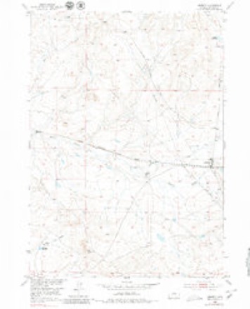
8 topographic sheets cover this place, the earliest surveyed in 1952 and the latest in 1982. It stands in the Hells Half Acre census division. It lies in ZIP code area 82630. The Survey maps it on the Arminto quadrangle. It stands 6,053 feet above sea level.
On record in Arminto
Buildings and businesses the archive holds for this place. Each opens its own page, with the source record it came from.
On the National Register 1 record
- Big Horn Hotellisted 1978
Topographic sheets covering this place
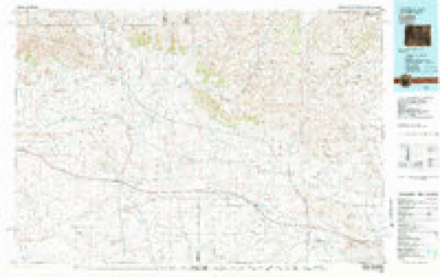
5 surveys from 8 printed sheetsMatched by testing this settlement's coordinate against the published boundary of every sheet in the United States Geological Survey's historical collection. Each opens the scanned sheet at the Survey.
- 1952 USGS Arminto quadrangle1:24000, 3 printings
- 1955 USGS Arminto quadrangle1:250000, 2 printings
- 1958 USGS Arminto quadrangle1:250000
- 1962 USGS Arminto quadrangle1:250000
- 1982 USGS Lysite quadrangle1:100000
Fires near this place
3 since 1996Regional context, not property-specific evidence. The federal wildfire occurrence database lists 3 fires within 5 miles of Arminto between 1996 and 2016, burning about 4 acres in total. None started naturally. None was recorded as arson. Distance is straight-line from the map coordinates, so a fire counted here may appear on a neighbouring settlement's page as well.
| Reported cause | Fires |
|---|---|
| Missing data/not specified/undetermined | 3 |
The most recent of them, most recent first, with the day each was reported and the service that recorded it.
| Date | Cause | Size | Reported by | Name on the report |
|---|---|---|---|---|
| 6 August 2016 | Missing data/not specified/undetermined | 2.1 acres | Casper Field Office | FLY RANCH |
| 1 October 1996 | Missing data/not specified/undetermined | under an acre | Wyoming State Forestry | not named |
| 1 October 1996 | Missing data/not specified/undetermined | 2.0 acres | Wyoming State Forestry | not named |
Settlements close enough to share some of these fires:
Mines and quarries near this place
2 within 5 milesRegional context, not property-specific evidence. The federal mineral resources record lists 2 workings within 5 miles of Arminto: 2 occurrences. None of them still produces. What was taken out: Manganese. Distance is straight-line from the map coordinates, so a quarry counted here may appear on a neighbouring settlement's page as well.
Storms near this place
5 since 2002Regional context, not property-specific evidence. The National Weather Service names Arminto in 5 storm reports between 2002 and 2015: 2 hail, 2 flash flood, 1 wildfire. No death or injury is recorded in these reports. Each account below is quoted exactly as the forecast office filed it, from the NOAA Storm Events Database, and each date opens the federal record of that event.
| When | Event | Place named | Harm | What the report says |
|---|---|---|---|---|
| August 2014 | Flash Flood | Arminto | $200,000 | Slow-moving thunderstorms produced very heavy rain near the Red Wall and Gray Wall in northern Natrona County. Radar estimated up to 3.5 inches of rain fell within one hour in the Hackett Creek drainage, while widespread 1.5 inch amounts were estimated across a larger area near the walls. The Alkali, Indian, and Willow creek drainages were significantly impacted.||Damage to county roads was extensive as culverts could not handle the volume of water and debris which washed down hillsides and across the roads. There were numerous instances of water, mud, and debris across Willow Creek and Baker Cabin roads. Small reservoirs quickly filled with water and overflow channels were utilized. Large hail also occurred with the thunderstorms which further complicated the situation. Hail stones larger than a quarter were still visible in deep drifts the morning after the deluge. Hay meadows, backcountry roads, and ranch fence line were all damaged by the flood waters and hail.||Near the Willow Creek Ranch and downstream near the rural Willow Creek School, the flood waters on Willow Creek were estimated at over 100 yards wide and at least 4 to 5 feet deep. The high water re-routed the creek and left a large amount of sediment and debris behind. Farther upstream near the two walls, the flood waters tore loose the soil and grass of Hackett Creek scouring out the creek bed. Numerous fences were destroyed and at least one residence reported flooding near the school. The school itself was damaged when a small drainage overflowed a county road sending water and debris cascading into the building. |
| October 2015 | Flash Flood | Arminto | $40,000 | West-northwest moving showers and thunderstorms tracked up the south slope of the Bighorn Mountains during the late afternoon of October 2. Heavy rain estimated at 0.75 inch to around 1.00 inch fell in a 20 to 30 minute period in the Buffalo Creek drainage. The water quickly ran off the steep slopes into creeks and streams feeding Buffalo Creek. Eyewitness reports indicated the creek went from a dry creek to well outside its banks in just minutes. The raging waters damaged a county road in several spots, overtopped and damaged a ranch road, and ruined fence line at a rural ranch. |
| August 2014 | Hail | Arminto | - | Large hail fell along the western edge of a violent thunderstorm that produced widespread flash flooding. The hail was estimated to be 1.5 in diameter. The rain washed the hail into large piles and drifts within meadows at the western base of the Red Wall. |
| June 2005 | Hail | Arminto | - | no account filed |
| August 2002 | Wildfire | Arminto | - | no account filed |
Nearest settlements
The eight closest, with where each one stands in the county. Distances are straight-line, computed from the Geographic Names Information System coordinates.
| Map | Place | Distance | Sheets |
|---|---|---|---|
| Hiland | 6.5 miles | 7 | |
| Waltman | 8.6 miles | 7 | |
| Osborne Place | 10.3 miles | 7 | |
| Swaim Place | 13.3 miles | 8 | |
| Badwater | 13.4 miles | 8 | |
| Powder River | 17.5 miles | 6 | |
| Raderville | 19.9 miles | 9 | |
| Natrona | 25.9 miles | 6 |
Elsewhere
Matched on this settlement's Geographic Names Information System number rather than its name, so it cannot be a different place of the same name in another state.
| Wikipedia article on Arminto | An encyclopaedic summary. Its text is share-alike, so it is linked here rather than copied. |
| Wikidata item Q4793585 | The structured record the population and elevation above come from. Public domain (CC0). |
Provenance
This settlement is recorded in the Geographic Names Information System as feature 1584934. The sheet list is computed by point-in-boundary test against the United States Geological Survey's historical topographic inventory. Both are works of the United States government and carry no copyright under 17 U.S.C. 105.
Wildfire. Short, Karen C. 2022. Spatial wildfire occurrence data for the United States, 1992-2020 [FPA_FOD_20221014]. 6th Edition. Fort Collins, CO: Forest Service Research Data Archive. https://doi.org/10.2737/RDS-2013-0009.6 Collected with United States Government funding and usable without additional permissions or fees.
Mines and quarries. USGS Mineral Resources Data System (MRDS) https://mrdata.usgs.gov/mrds/ A work of the United States government, no copyright under 17 U.S.C. 105.
Storms. NOAA National Centers for Environmental Information, Storm Events Database https://www.ncei.noaa.gov/stormevents/ A work of the United States government, no copyright under 17 U.S.C. 105. Narratives are quoted verbatim from the National Weather Service report and are not edited or summarised.