Block
From the record
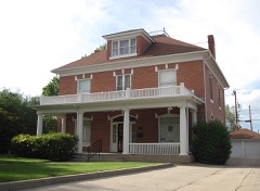
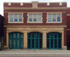
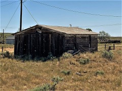
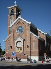
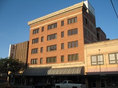
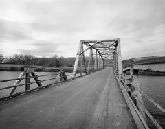
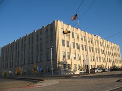
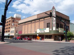
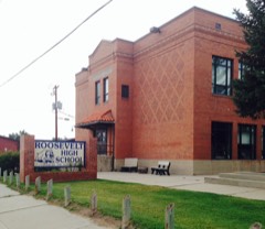
36 National Register listings published here, 1 of them a National Historic Landmark.
Sources: the county history on the Internet Archive · the National Register database, National Park Service
81 topographic sheets cover 47 settlements here, and 36 properties are on the National Register of Historic Places.
36 National Register listings published here, 1 of them a National Historic Landmark.
Sources: the county history on the Internet Archive · the National Register database, National Park Service
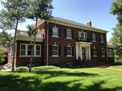
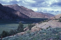
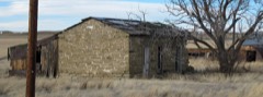
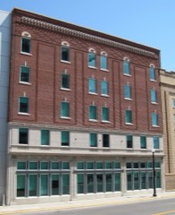
Every property in this county listed on the National Register of Historic Places, with the year it was listed and the federal nomination document.
Every wildfire the federal occurrence database records inside this county: 1,233 of them, burning about 151,736 acres. 431 started naturally and 6 were recorded as arson. Each settlement page carries the fires within five miles of it.
| Reported cause | Fires |
|---|---|
| Missing data/not specified/undetermined | 553 |
| Natural | 431 |
| Equipment and vehicle use | 60 |
| Power generation/transmission/distribution | 44 |
| Debris and open burning | 29 |
| Fireworks | 27 |
| Railroad operations and maintenance | 25 |
| Recreation and ceremony | 17 |
| Smoking | 17 |
| Misuse of fire by a minor | 14 |
| Firearms and explosives use | 9 |
| Arson/incendiarism | 6 |
| Other causes | 1 |
The five largest, by the area the report gives. None of them was recorded as arson.
| Date | Cause | Size | Reported by | Name on the report |
|---|---|---|---|---|
| 18 July 2006 | Natural | 16,503 acres | Casper Field Office | SAWMILL |
| 9 September 2012 | Missing data/not specified/undetermined | 15,556 acres | Casper Field Office | SHEEPHERDER HILL |
| 2 August 1996 | Natural | 14,700 acres | Casper Field Office | GEARY D. 2 |
| 14 August 2006 | Natural | 11,765 acres | Casper Field Office | JACKSON CANYON |
| 11 October 2015 | Missing data/not specified/undetermined | 9,516 acres | Casper Field Office | STATION |
| 30 September 1996 | Equipment and vehicle use | 9,290 acres | Casper Field Office | COLE CREEK |
| 19 August 2000 | Natural | 8,390 acres | Casper Field Office | HENDERSON |
| 29 July 2000 | Natural | 5,900 acres | Casper Field Office | DEADHORSE |
Every settlement page carries the fires within five miles of it - see the settlement index below.
The NOAA Storm Events Database holds 400 reports for this county, causing 1 death, 10 injuries and about $10,842,680 in recorded property damage. Each settlement page carries the reports that name it.
| Kind of event | Reports |
|---|---|
| Hail | 165 |
| Thunderstorm Wind | 142 |
| Tornado | 40 |
| Flash Flood | 29 |
| Funnel Cloud | 17 |
| Wildfire | 3 |
| Lightning | 3 |
| Dust Devil | 1 |
The most serious of them, by death, then injury, then recorded damage. The accounts are quoted exactly as the forecast office filed them.
| When | Event | Place named | Harm | What the report says |
|---|---|---|---|---|
| June 2008 | Dust Devil | Casper | 1 killed, $1,000 | A 34-year-old woman was killed when a dust devil flipped a small scorer's shed next to a team dugout at a youth ball field complex. The woman apparently sought shelter from the dust devil by positioning herself behind the shed. The shed was flipped one-half revolution, crushing her on the first flip and then rolling off of her. The woman was found about 10 minutes later as teams begin arriving for their evening games. Resuscitation efforts failed and she was declared dead at the scene. |
| June 1962 | Tornado (F2) | not stated | 4 hurt, $25,000 | no account filed |
| May 1971 | Tornado (F2) | not stated | 3 hurt | no account filed |
| July 2009 | Flash Flood | Mountain View | 1 hurt, $5,000,000 | A vicious thunderstorm struck the city of Casper between about 1715 and 1800MST at the start of the July 4th holiday weekend. Extreme rainfall rates falling on the urbanized landscape produced flash flooding throughout Casper, with the most extensive inundation centered around the intersection of Poplar and Collins streets.||Nearly one inch of rain fell in 21 minutes at the Natrona County International Airport northwest of the city. A precipitation gauge along the North Platte River in Casper reported 1.79 inches of rain in 30 minutes. Final tallies around town showed rainfall from around one inch up to a high of about 2.25 inches occurred within about a 35 minute time frame.||Several streets, including Poplar and McKinley were reported to be rivers carrying rocks and other debris toward downtown Casper. Reports indicated one to three feet of water was present on some city streets. The flash flooding floated several cars and sent storm drains shooting wildly into the air. One storm drain cover injured an individual as the surging water displaced it. Emergency management estimated anywhere from 800 to 1000 structures, mainly homes, were impacted by the flooding.||In addition to hundreds of impacted homes, many well known locations also sustained damage, including the Nicolaysen Art Museum, Wyoming Medical Center, Central Wyoming Fairgrounds, Three Crowns Golf Course, and several city school buildings. Major damage also occurred at Casper College where five buildings, including the gymnasium and theater, were significantly impacted. Retaining wall bricks and landscape gravel were washed from a hillside at the college and cascaded to neighboring residences and streets below. The Hall of Justice on North David Street also sustained significant damage when water poured through a door into an underground garage. The building's elevator shafts and the ceilings in several sheriff's offices were also damaged. |
| July 2000 | Hail | Midwest | 1 hurt, $108,000 | no account filed |
| July 1978 | Tornado (F2) | not stated | 1 hurt, $25,000 | no account filed |
| June 2023 | Flash Flood | Bessemer Bend | $2,866,000 | Rainfall reports for the 24 hour period including the flash flood event ranged from 1.30 to 3.47 inches. Flooding was initially reported in downtown Casper where cars where were reported as floating in flowing water. On the south side of Casper, a house was reported as shifted off of its foundation. Interstate 25 became flooded at the peak of the event, and was closed for until well after rainfall ended. Low-lying tunnels on the south side of Casper had as much as 5 feet of water in them at the height of the storm. Damage values have been updated as of Oct 2023 and are from the FEMA presidential disaster declaration, FEMA-4739-DR-WY. No injuries or fatalities were reported to the NWS. |
| August 2007 | Flash Flood | (Cpr)Natrona Co Arpt | $500,000 | no account filed |
| July 2005 | Flash Flood | Casper | $500,000 | no account filed |
| July 2007 | Flash Flood | Mills | $300,000 | Rainfall estimated by radar to be three inches or more fell in a swath from Emigrant Gap to Bar Nunn. The heavy rain caused flash flooding along Poison Spider Road and other nearby roads as culverts could not handle the large volume of water. Portions of a ranch along Poison Spider Road were under several feet of water. A mobile home park south of Bar Nunn was flooded as water flowed from surrounding higher terrain. The lower floor of the rural Poison Spider Elementary School sustained flood damage as the water poured in through several doorways. |
| June 1987 | Tornado (F2) | not stated | $250,000 | no account filed |
| August 2014 | Flash Flood | Arminto | $200,000 | Slow-moving thunderstorms produced very heavy rain near the Red Wall and Gray Wall in northern Natrona County. Radar estimated up to 3.5 inches of rain fell within one hour in the Hackett Creek drainage, while widespread 1.5 inch amounts were estimated across a larger area near the walls. The Alkali, Indian, and Willow creek drainages were significantly impacted.||Damage to county roads was extensive as culverts could not handle the volume of water and debris which washed down hillsides and across the roads. There were numerous instances of water, mud, and debris across Willow Creek and Baker Cabin roads. Small reservoirs quickly filled with water and overflow channels were utilized. Large hail also occurred with the thunderstorms which further complicated the situation. Hail stones larger than a quarter were still visible in deep drifts the morning after the deluge. Hay meadows, backcountry roads, and ranch fence line were all damaged by the flood waters and hail.||Near the Willow Creek Ranch and downstream near the rural Willow Creek School, the flood waters on Willow Creek were estimated at over 100 yards wide and at least 4 to 5 feet deep. The high water re-routed the creek and left a large amount of sediment and debris behind. Farther upstream near the two walls, the flood waters tore loose the soil and grass of Hackett Creek scouring out the creek bed. Numerous fences were destroyed and at least one residence reported flooding near the school. The school itself was damaged when a small drainage overflowed a county road sending water and debris cascading into the building. |
| July 2013 | Flash Flood | Brookhurst | $200,000 | Heavy rain began falling around 1900MST over east Casper and the east end of Casper Mountain. Thunderstorms had approached the area from the southwest and a low-level northeast flow made for a slower progression over east Casper. The result was rainfall of one-half to one-inch in about 25 minutes. Street flooding was observed along East 2nd Street from Wyoming Boulevard toward Hat Six Road. The water was up to two feet deep near the intersection of Blackmore Road and East 2nd Street. Hail around one-half inch in diameter accumulated to a depth of several inches.||The most significant flooding occurred at the Hat Six Ranch at the east end of Casper Mountain. The steep canyons and hillsides above the ranch were torched the previous September by the Sheep Herder Hill Wildfire. Excessive rainfall quickly brought a mix of rock, mud, and debris down one canyon and another draw damaging two homes, at least three vehicles, and two all-terrain vehicles. Water and debris eventually found the Clear Fork Muddy Creek channel and spread out to be anywhere from 50 to 100 yards wide. One additional ranch received damage as the creek swept northeast and eventually topped the Hat Six Road. |
| May 2009 | Lightning | Mills | $150,000 | A lightning strike destroyed or damaged five oil tanks about 20 miles west of Casper near the intersection of county roads 201 and 210. The strike occurred about 1300MST blowing the lid off one tank containing about 400 barrels of crude oil. The fire quickly spread to a nearby tank and burning crude oil ignited the other tanks. Two additional propane tanks were burned but did not explode. A nearly century old storage building at the site was also completely destroyed. |
| June 2023 | Tornado (EF1) | Midwest | $100,000 | There were numerous reports, pictures, and video of a cone tornado that touched down to the south of Midwest, WY. The tornado remained over open country for the most part. However, the tornado damaged one home where a large section of the roof was removed. Exterior walls remained standing. A trailer was overturned, fuel tanks were blown away, and trees near the residence were damaged.||Based on the FR12 damage indicator category, this tornado was rated EF1 using a low to middle end DOD estimate for the type of construction. Winds are estimated to have been around 110 mph. Stronger winds could have occurred elsewhere along the track, but open country prevented any further evidence of wind damage. Damage survey completed by county emergency management officials. |
| May 2015 | Flash Flood | Salt Creek Columbine | $100,000 | Several storm spotters reported flash flooding on Salt Creek and Castle Creek in the vicinity of Midwest. Some county and Bureau of Land Management roads were washed out. At least one fracking trailer was destroyed south of town. |
| August 2005 | Flash Flood | Casper | $85,000 | no account filed |
| May 2006 | Lightning | Casper | $65,000 | no account filed |
| July 2007 | Flash Flood | Mills | $50,000 | Flooding was reported along Poison Spider Road where water of one foot depth covered the road in four or five places. |
| August 2007 | Flash Flood | Casper | $50,000 | One to two inches of rain fell on already saturated ground west of Casper along Poison Spider Road. Also, rainfall of 0.50 to 1.50 inches fell in less than one hour in and near the city of Casper. The rain produced flash flooding along Poison Spider and Paradise Valley roads and in some locales around Paradise Valley. Urban flooding was also observed along Interstate 25 in Casper. |
| October 2015 | Flash Flood | Arminto | $40,000 | West-northwest moving showers and thunderstorms tracked up the south slope of the Bighorn Mountains during the late afternoon of October 2. Heavy rain estimated at 0.75 inch to around 1.00 inch fell in a 20 to 30 minute period in the Buffalo Creek drainage. The water quickly ran off the steep slopes into creeks and streams feeding Buffalo Creek. Eyewitness reports indicated the creek went from a dry creek to well outside its banks in just minutes. The raging waters damaged a county road in several spots, overtopped and damaged a ranch road, and ruined fence line at a rural ranch. |
| August 2013 | Lightning | Freeland | $35,000 | A 160-ton haystack was set ablaze by a lightning strike. The fire burned through the night but did not spread beyond the stack. The value of the 190 bales of hay that were burned was estimated at about $35,000. |
| July 2013 | Thunderstorm Wind | Merino | $30,000 | Five large cottonwood trees were toppled and limbs up to one foot in diameter were ripped to the ground by wind gusts estimated up to 80 mph. At a ranch along West Willow Creek Road, one large feeding shed was gradually torn apart by the wind while another was rolled. |
| June 2012 | Thunderstorm Wind | Allendale | $25,000 | An isolated thunderstorm formed west of Casper and tracked along the south side of town. The storm produced a microburst that blew out car windows and caused damage to about 20 vehicles at Casper Country Club. The wind also snapped a 70-foot-tall tree at the golf course and damaged a tall chain link fence surrounding the tennis courts. |
| June 1962 | Tornado | not stated | $25,000 | no account filed |
| June 1962 | Tornado (F1) | not stated | $25,000 | no account filed |
| August 2013 | Flash Flood | Badwater | $17,000 | Heavy rain fell in the Buffalo and Cottonwood creek drainages in northwest Natrona County along the extreme southeast slope of the Bighorn Mountains. A nearly stationary thunderstorm dropped rainfall estimated at over one to two inches in one hour. Run-off quickly reached Buffalo Creek along the Buffalo Creek Road near a rural ranch. The creek swelled to be many times its normal size and flooded the road near the ranch. Debris was left on the roadway in the wake of the flood and a five-mile stretch of the road needed repair. |
| August 2007 | Flash Flood | Casper | $15,000 | Rainfall of 1.38 inches in 20 minutes produced flash flooding about three miles north-northeast of downtown Casper. A private road was washed out, and mud and silt surrounded at least one garage. |
| June 2013 | Hail | Powder River | $10,000 | Vehicles were forced to pull over near Powder River as baseball sized hail fell from a second severe thunderstorm. |
| August 2007 | Thunderstorm Wind | Casper | $10,000 | A semi-tractor trailer was overturned on Interstate 25 at mile marker 195 because of thunderstorm wind. |
| August 2007 | Thunderstorm Wind | Casper | $10,000 | Thunderstorm wind toppled a semi-tractor trailer on Interstate 25 near mile marker 182. |
| July 2007 | Flash Flood | Goose Egg | $5,000 | Heavy rain earlier in the day caused ash, mud, and debris from the Jackson Canyon Fire burn scar to cover private driveways near Goose Egg. Access to State Highway 220 was cut-off due to the debris flow. |
| July 1994 | Hail | not stated | $5,000 | Numerous car windshields were damaged by hail up to one inch in diameter from a lone thunderstorm over central Wyoming. |
| June 2011 | Thunderstorm Wind | Casper | $3,000 | The public reported several healthy three inch diameter tree branches down in Casper. |
| July 1988 | Tornado (F1) | not stated | $2,500 | no account filed |
| June 2013 | Hail | Petrie | $2,000 | Hail up to the size of golf balls produced vehicle damage just east of Natrona. |
| June 2013 | Hail | Powder River | $2,000 | Ping pong ball sized hail broke windows at a residence in Powder River. |
| June 2009 | Flash Flood | Casper | $2,000 | Rainfall of one to two inches fell in and around Casper. One location at Wyoming Medical Center recorded 1.75 inches of rain. The water accumulated at the intersection of Poplar and CY avenues and flooded the area. |
| July 2018 | Hail | Bar Nunn | $1,000 | Trained spotters reported hail ranging from quarter to ping pong ball size from Bar Nunn into the east side of Casper. Some of larger hail damaged a carport in Casper. |
| August 2007 | Thunderstorm Wind | Mills | $1,000 | Power lines reported down at 6th Avenue and Poison Spider Road. |
| August 2007 | Thunderstorm Wind | Casper | $1,000 | A power line was toppled near the intersection of Mystery Bridge Road and East Yellowstone Road. |
| June 2006 | Thunderstorm Wind | Casper | $1,000 | no account filed |
| June 1982 | Tornado (F0) | not stated | $30 | no account filed |
| May 1975 | Tornado (F1) | not stated | $30 | no account filed |
| August 1974 | Tornado (F1) | not stated | $30 | no account filed |
| May 1969 | Tornado | not stated | $30 | no account filed |
| September 1968 | Tornado | not stated | $30 | no account filed |
| June 1962 | Tornado (F1) | not stated | $30 | no account filed |
| April 2026 | Thunderstorm Wind | Casper | - | A wind gust of 64 mph was recorded along Scenic Drive on the South Side of Casper. |
| April 2026 | Thunderstorm Wind | Midwest | - | A 58 mph wind gust was recorded to the northwest of Midwest. |
| June 2025 | Hail | (Cpr)Natrona Co Arpt | - | Government official reported egg size hail near the Natrona County Airport. |
| June 2025 | Thunderstorm Wind | Hiland | - | Wind gusts of 58 mph were reported along US 20 26 near Hiland. |
| July 2025 | Thunderstorm Wind | Casper | - | Wind gusts as high as 61 mph occurred on the south side of Casper. |
| July 2025 | Thunderstorm Wind | Hiland | - | A line of severe thunderstorms moved through Natrona County and brought high wind from Highland through Evansville. The strongest wind gust reported was 76 mph at Natrona. A wind gust of 69 mph was reported near Hiland with numerous reports of 60 mph or greater wind gusts on the south side of Casper. |
| July 2025 | Thunderstorm Wind | Midwest | - | A 58 mph wind gust was reported south of Midwest. |
| July 2025 | Hail | Mills | - | A trained spotter reported nickel size hail to the west of Mills. |
| July 2025 | Hail | Bar Nunn | - | A trained spotter reported nickel size hail north of Bar Nunn. |
| August 2025 | Thunderstorm Wind | Midwest | - | Wind gusts of 58 mph occurred at Smokey Gap along Interstate 25 near Midwest. |
| August 2025 | Thunderstorm Wind | Midwest | - | Wind gusts as high as 65 mph occurred at sensors near I-25 in northern Natrona County. |
| August 2025 | Thunderstorm Wind | Natrona | - | Wind gusts as high as 65 mph occurred along US 20 26 in Natrona. |
The Survey's mineral resources record lists 379 workings inside this county. 36 still produce and 343 are closed or unrecorded. Each settlement page carries the workings within five miles of it.
| Commodity | Workings |
|---|---|
| Uranium | 181 |
| Bentonite | 125 |
| Gypsum-Anhydrite | 12 |
| Sand and Gravel, Construction | 10 |
| Iron | 6 |
| Pumice | 4 |
| Thorium, Zirconium, Iron | 3 |
| Manganese | 3 |
| Magnesite | 3 |
| Asbestos | 3 |
| Vermiculite | 3 |
| Sodium Sulfate | 3 |
| Titanium-Heavy Minerals | 2 |
| Gold | 2 |
The least common of them first, because a county's hundredth gravel pit says nothing its first ten did not.
| Where | Site | Commodity | Status | Recorded |
|---|---|---|---|---|
| Alcova Hot Spring | Geothermal | Unknown | ||
| Allie Claims | Thorium | Occurrence | ||
| Berthaton Claims | Halite, Sodium Carbonate, Salt, Sodium Sulfate | Prospect | ||
| Black Mountain Spodumene Prospect | Lithium | Occurrence | ||
| Casper Mountain Mine | Chromium | Prospect | 1911 | |
| Coalbank Hills | Titanium, Thorium, Zirconium, Iron | Occurrence | 1955 | |
| Durner & Keys | Tungsten | Unknown | ||
| Koch feldspar deposit | Feldspar | Past Producer | ||
| Koch gold and silver deposit | Gold, Silver | Occurrence | Gold, Silver | |
| Midwest-Thoeming & Wakem | Clay | Producer | ||
| Morgan Deposit | Sodium Sulfate, Sodium, Sodium Carbonate, Halite | Prospect | ||
| Omaha Soda Deposit | Sodium Sulfate, Sodium Carbonate, Salt | Past Producer | ||
| Rattlesnake Hills #1 | Sulfur | Occurrence | ||
| Skyline Claims | Uranium, Selenium | Unknown | ||
| Unknown | Sodium Carbonate, Sodium Sulfate, Sodium | Occurrence | ||
| Unknown | Fluorine-Fluorite | Occurrence | ||
| Unknown | Vanadium | Occurrence | ||
| Unknown | Fire Clay (Refractory) | Occurrence | ||
| Unknown | Zeolites | Unknown | ||
| Unknown | Mica | Occurrence | ||
| Vermiculite Sales Corp Deposit #1 | Kaolin, Vermiculite | Past Producer | ||
| Clarkson Hill | Titanium-Heavy Minerals, Thorium, Zirconium, Iron | Occurrence | ||
| New York & Philadelphia Claims | Sodium Carbonate, Sodium Sulfate, Salt | Prospect | ||
| Poison Spider | Titanium-Heavy Minerals, Thorium, Zirconium, Iron | Occurrence | 1955 | |
| Rattlesnake Hills Gold property | Gold | Prospect | 1982 | |
| Unknown | Semiprecious Gemstone | Occurrence | ||
| Unknown | Semiprecious Gemstone | Occurrence | ||
| Wilmington and Wilkesbarre Deposits | Sodium Carbonate, Sodium Sulfate, Salt | Prospect | ||
| Casper Mtn Asbestos Deposits | Asbestos | Past Producer | ||
| Green Hill Deposit | Asbestos | Prospect | ||
| Koch's manganese deposit | Manganese | Occurrence | ||
| Platte Canyon | Magnesite | Occurrence | ||
| Pratt Sodium Mine | Sodium Sulfate | Past Producer | 1992 | |
| Smith Creek Deposit | Asbestos | Prospect | ||
| Unknown | Manganese | Occurrence | ||
| Unknown | Magnesite | Occurrence | ||
| Unknown | Manganese | Occurrence | ||
| Unknown | Vermiculite | Unknown | ||
| Unknown | Vermiculite | Past Producer | ||
| Unknown | Sodium Sulfate | Occurrence | Mirabilite | |
| Unknown | Magnesite | Occurrence | ||
| Vermiculite Sales Corp Deposit #2 | Vermiculite | Past Producer | ||
| Rawlins Draw | Pumice | Unknown | ||
| Unknown | Pumice | Occurrence | ||
| Unknown | Pumice | Occurrence | ||
| Unnamed | Pumice | Occurrence | ||
| Goat Mountain Area | Iron | Occurrence | ||
| Koch hematite deposit on Casper Mountain | Iron | Occurrence | Replacement | |
| Koch siliceous iron prospect | Iron | Occurrence | ||
| Unidentified Occurrence | Iron | Occurrence | Replacement | |
| Unknown | Iron | Occurrence | ||
| Unknown | Iron | Occurrence | ||
| Boels-Rimrock Pit | Sand and Gravel, Construction | Producer | ||
| Bradshaw Pit | Sand and Gravel, Construction | Producer | ||
| Casper Concrete Pit & Plant | Sand and Gravel, Construction | Producer | ||
| East Pit | Sand and Gravel, Construction | Producer | ||
| Hidebrand Pit | Sand and Gravel, Construction | Producer | ||
| Lathrop L-3 Pit | Sand and Gravel, Construction | Producer | ||
| Lower Pit | Sand and Gravel, Construction | Producer | ||
| Rim Rock Ranch Pit | Sand and Gravel, Construction | Producer | ||
| State Land Pit | Sand and Gravel, Construction | Producer | ||
| Sun Ray Pit | Sand and Gravel, Construction | Past Producer | ||
| Alcova Area | Gypsum-Anhydrite | Unknown | ||
| Beaver Creek | Gypsum-Anhydrite | Unknown | ||
| Big Red Creek | Gypsum-Anhydrite | Unknown | ||
| Corral Creek | Gypsum-Anhydrite | Unknown | ||
| Goose Egg #2 | Gypsum-Anhydrite | Prospect | ||
| Muddy Creek | Gypsum-Anhydrite | Unknown | ||
| Rattlesnake Mountains | Gypsum-Anhydrite | Unknown | ||
| Red Buttes | Gypsum-Anhydrite | Unknown | ||
| Twin Buttes | Gypsum-Anhydrite | Unknown | ||
| Unknown | Gypsum-Anhydrite | Occurrence | ||
| Unknown | Gypsum-Anhydrite | Occurrence | ||
| Unknown | Gypsum-Anhydrite | Occurrence | ||
| Bates Creek Area #1 | Bentonite | Prospect | ||
| Bates Creek Area No 2 | Bentonite | Prospect | ||
| Benton Clay Co Mill | Bentonite | Producer | ||
| Blue Hill Deposit | Bentonite | Prospect | ||
| Cottonwood Creek | Bentonite | Occurrence | ||
| Goose Egg #1 | Bentonite | Occurrence | ||
| Hemingway #1 | Bentonite | Occurrence | ||
| Hemingway #10 | Bentonite | Occurrence | ||
| Hemingway #11 | Bentonite | Occurrence | ||
| Hemingway #12 | Bentonite | Occurrence | ||
| Hemingway #13 | Bentonite | Occurrence | ||
| Hemingway #14 | Bentonite | Occurrence | ||
| Hemingway #15 | Bentonite | Occurrence | ||
| Hemingway #16 | Bentonite | Occurrence | ||
| Hemingway #17 | Bentonite | Occurrence | ||
| Hemingway #18 | Bentonite | Occurrence | ||
| Hemingway #19 | Bentonite | Occurrence | ||
| Hemingway #2 | Bentonite | Occurrence | ||
| Hemingway #20 | Bentonite | Occurrence | ||
| Hemingway #21 | Bentonite | Occurrence | ||
| Hemingway #22 | Bentonite | Occurrence | ||
| Hemingway #23 | Bentonite | Occurrence | ||
| Hemingway #24 | Bentonite | Occurrence | ||
| Hemingway #25 | Bentonite | Occurrence | ||
| Hemingway #26 | Bentonite | Occurrence | ||
| Hemingway #27 | Bentonite | Occurrence | ||
| Hemingway #28 | Bentonite | Occurrence | ||
| Hemingway #29 | Bentonite | Occurrence | ||
| Hemingway #3 | Bentonite | Occurrence | ||
| Hemingway #30 | Bentonite | Occurrence | ||
| Hemingway #31 | Bentonite | Occurrence | ||
| Hemingway #32 | Bentonite | Occurrence | ||
| Hemingway #33 | Bentonite | Occurrence | ||
| Hemingway #4 | Bentonite | Occurrence | ||
| Hemingway #5 | Bentonite | Occurrence | ||
| Hemingway #6 | Bentonite | Occurrence | ||
| Hemingway #7 | Bentonite | Occurrence | ||
| Hemingway #8 | Bentonite | Occurrence | ||
| Hemingway #9 | Bentonite | Occurrence | ||
| Kaycee Bentonite Corp #1 | Bentonite | Occurrence | ||
| Kaycee Bentonite Corp #2 | Bentonite | Occurrence | ||
| Kaycee Bentonite Corp #3 | Bentonite | Occurrence | ||
| Kaycee Bentonite Corp #4 | Bentonite | Occurrence | ||
| Kaycee Bentonite Corp. #5 | Bentonite | Occurrence | ||
| Kaycee Clay Mine | Bentonite | Producer | ||
| Kaycee Mine | Bentonite | Producer | ||
| Kidd Ranch North End #4 | Bentonite | Occurrence | ||
| Kidd Ranch North End #1 | Bentonite | Occurrence | ||
| Kidd Ranch North End #2 | Bentonite | Occurrence | ||
| Kidd Ranch North End #3 | Bentonite | Occurrence | ||
| Kidd Ranch North End #31 | Bentonite | Occurrence | ||
| Kidd Ranch North End #5 | Bentonite | Occurrence | ||
| Kidd Ranch North End #6 | Bentonite | Occurrence | ||
| Kidd Ranch North End #7 | Bentonite | Occurrence | ||
| Kidd Ranch North End#10 | Bentonite | Occurrence | ||
| Kidd Ranch North End#11 | Bentonite | Occurrence | ||
| Kidd Ranch North End#12 | Bentonite | Occurrence | ||
| Kidd Ranch North End#16 | Bentonite | Occurrence | ||
| Kidd Ranch North End#17 | Bentonite | Occurrence | ||
| Kidd Ranch North End#18 | Bentonite | Occurrence | ||
| Kidd Ranch North End#19 | Bentonite | Occurrence | ||
| Kidd Ranch North End#8 | Bentonite | Occurrence | ||
| Kidd Ranch/South End#27 | Bentonite | Occurrence | ||
| Kidd Ranchnorth End#13 | Bentonite | Occurrence | ||
| Kidd Ranchnorth End#14 | Bentonite | Occurrence | ||
| Kidd Ranchnorth End#20 | Bentonite | Occurrence | ||
| Kidd Ranchnorth End#21 | Bentonite | Occurrence | ||
| Kidd Ranchnorth End#22 | Bentonite | Occurrence | ||
| Kidd Ranchnorth End#23 | Bentonite | Occurrence | ||
| Kidd Ranchnorth End#24 | Bentonite | Occurrence | ||
| Kidd Ranchnorth End#25 | Bentonite | Occurrence | ||
| Kidd Ranchnorth End#26 | Bentonite | Occurrence | ||
| Kidd Ranchnorth End#27 | Bentonite | Occurrence | ||
| Kidd Ranchnorth End#28 | Bentonite | Occurrence | ||
| Kidd Ranchnorth End#29 | Bentonite | Occurrence | ||
| Kidd Ranchnorth End#30 | Bentonite | Occurrence | ||
| Kidd Ranchnorth End#9 | Bentonite | Occurrence | ||
| Kidd Ranchsouth End#1 | Bentonite | Occurrence | ||
| Kidd Ranchsouth End#10 | Bentonite | Occurrence | ||
| Kidd Ranchsouth End#11 | Bentonite | Occurrence | ||
| Kidd Ranchsouth End#12 | Bentonite | Occurrence | ||
| Kidd Ranchsouth End#13 | Bentonite | Occurrence | ||
| Kidd Ranchsouth End#14 | Bentonite | Occurrence | ||
| Kidd Ranchsouth End#15 | Bentonite | Occurrence | ||
| Kidd Ranchsouth End#16 | Bentonite | Occurrence | ||
| Kidd Ranchsouth End#17 | Bentonite | Occurrence | ||
| Kidd Ranchsouth End#18 | Bentonite | Occurrence | ||
| Kidd Ranchsouth End#19 | Bentonite | Occurrence | ||
| Kidd Ranchsouth End#2 | Bentonite | Occurrence | ||
| Kidd Ranchsouth End#20 | Bentonite | Occurrence | ||
| Kidd Ranchsouth End#21 | Bentonite | Occurrence | ||
| Kidd Ranchsouth End#22 | Bentonite | Occurrence | ||
| Kidd Ranchsouth End#23 | Bentonite | Occurrence | ||
| Kidd Ranchsouth End#24 | Bentonite | Occurrence | ||
| Kidd Ranchsouth End#25 | Bentonite | Occurrence | ||
| Kidd Ranchsouth End#26 | Bentonite | Occurrence | ||
| Kidd Ranchsouth End#28 | Bentonite | Occurrence | ||
| Kidd Ranchsouth End#29 | Bentonite | Occurrence | ||
| Kidd Ranchsouth End#3 | Bentonite | Occurrence | ||
| Kidd Ranchsouth End#30 | Bentonite | Occurrence | ||
| Kidd Ranchsouth End#4 | Bentonite | Occurrence | ||
| Kidd Ranchsouth End#5 | Bentonite | Occurrence | ||
| Kidd Ranchsouth End#6 | Bentonite | Occurrence | ||
| Kidd Ranchsouth End#7 | Bentonite | Occurrence | ||
| Kidd Ranchsouth End#8 | Bentonite | Occurrence | ||
| Kidd Ranchsouth End#9 | Bentonite | Occurrence | ||
| Rattlesnake Hills #2 | Bentonite | Occurrence | ||
| Soap Creek #1 | Bentonite | Producer | ||
| Soap Creek #2 | Bentonite | Producer | ||
| Southwest of Casper | Bentonite | Occurrence | ||
| Steele Formation | Bentonite | Prospect | ||
| Unknown | Bentonite | Occurrence | ||
| Unknown | Bentonite | Prospect | ||
| Unknown | Bentonite | Prospect | ||
| Unknown | Bentonite | Prospect | ||
| Unknown | Bentonite | Prospect | ||
| Unknown | Bentonite | Occurrence | ||
| Unknown | Bentonite | Prospect | ||
| Unknown | Bentonite | Prospect | ||
| Unknown | Bentonite | Prospect | ||
| Unknown | Bentonite | Occurrence | ||
| Unknown | Bentonite | Prospect | ||
| Unknown | Bentonite | Prospect | ||
| Unknown | Bentonite | Occurrence | ||
| Unknown | Bentonite | Unknown | ||
| Airstrike | Uranium | Prospect | ||
| Al-Job Mine | Uranium | Occurrence | Apatite, Torbernite, Uraninite | |
| Alich #9 Claim | Uranium | Prospect | ||
| Aljob #10 | Uranium | Past Producer | ||
| Aljob #12 | Uranium | Past Producer | ||
| Aljob #9 | Uranium | Past Producer | ||
| Aljob Mines | Uranium | Producer | ||
| Aljob No. 9 | Uranium | Occurrence | Torbernite | |
| B-1 | Uranium | Past Producer | ||
| B-2 Pit | Uranium | Past Producer | ||
| Bacon | Uranium | Prospect | ||
| Baker Nos. 3, 4, and 5 | Uranium | Prospect | ||
| Bates Creek | Uranium | Unknown | ||
| Bengal Mars No.1 | Uranium | Past Producer | ||
| Bengal Mine | Uranium | Occurrence | ||
| Black Cat Claims | Uranium | Prospect | ||
| Black Cat Group | Uranium | Occurrence | ||
| Blackstone No. 5 Mine | Uranium | Unknown | ||
| Blackstone No. 51 (unverified) | Uranium | Past Producer | ||
| Boss Mine | Uranium | Unknown | ||
| Boundary Overstrip of Fed-Amer.Mine | Uranium | Past Producer | ||
| Boundary Overstrip of Tee Mine #1 | Uranium | Producer | ||
| Boundary Overstrip of Tee Mine No.2 | Uranium | Producer | ||
| Bountiful #1 and #9 | Uranium | Past Producer | Jarosite, Uraninite | |
| Bountiful Number 9 | Uranium | Past Producer | ||
| Bountiful Number 9-B | Uranium | Past Producer | ||
| Bridge No. 1 | Uranium | Occurrence | ||
| Bridger Trail No. 1 | Uranium | Past Producer | ||
| Burnt Wagon Draw | Uranium | Unknown | ||
| Buss D & F | Uranium | Past Producer | ||
| Buss Mines | Uranium | Producer | ||
| Buss No. 6 | Uranium | Prospect | ||
| Calek No 53 and 55 | Uranium | Prospect | ||
| Casper Creek | Uranium | Unknown | ||
| Cedar Breaks #1 | Uranium | Occurrence | ||
| Clarkson Hill Uranium Project | Uranium | Prospect | roll-front sandstone U | |
| Coalbanc No. 1 | Uranium | Occurrence | ||
| Csg No. 1 | Uranium | Occurrence | ||
| Cyclone Ridge | Uranium | Occurrence | ||
| D-8 Pit | Uranium | Unknown | ||
| Deacon's Prayer | Uranium | Occurrence | ||
| Diamond M | Uranium | Occurrence | ||
| Dick #1 | Uranium | Occurrence | ||
| Dick Claims | Uranium | Occurrence | Apatite | |
| Dick No. 5 | Uranium | Prospect | ||
| Dick No. 6 | Uranium | Occurrence | ||
| Doc No. 13 | Uranium | Occurrence | ||
| Dry Lake | Uranium | Prospect | ||
| Dry Lake Claim | Uranium | Occurrence | Carnotite | |
| Dry Lake and Zero Claims | Uranium | Occurrence | Carnotite | |
| Dyper Bar Mac #7 | Uranium | Occurrence | ||
| Dyper-Bar-Mac Group | Uranium | Occurrence | ||
| Gay Claim | Uranium | Prospect | ||
| Globe Mill (Facility) | Uranium | Producer | ||
| Hiland Channel Deposit | Uranium | Unknown | ||
| Hope No 1 | Uranium | Producer | ||
| Hope No.2 | Uranium | Producer | ||
| Jackneese No. 9 | Uranium | Prospect | ||
| Last Chance | Uranium | Producer | ||
| Last Chance | Uranium | Occurrence | ||
| Lee Mine | Uranium | Unknown | ||
| Lisbon | Uranium | Past Producer | ||
| Lisbon | Uranium | Past Producer | ||
| Locality 13 | Uranium | Occurrence | ||
| Lyberger Claims | Uranium | Occurrence | Carnotite | |
| M F and K No. 12 | Uranium | Occurrence | ||
| Mars #1 | Uranium | Past Producer | ||
| Meyers | Uranium | Occurrence | ||
| Middle Fork | Uranium | Unknown | ||
| Niball No. 11 and 12 | Uranium | Occurrence | ||
| Nine Mile Lake Project | Uranium | Producer | ||
| Nine Mile Lake Project Processing Plant | Uranium | Producer | ||
| Pat N' Bill Mine | Uranium | Producer | ||
| Pat No. 2 | Uranium | Prospect | ||
| Pat Underground | Uranium | Producer | ||
| Pay #11 | Uranium | Occurrence | ||
| Pay #5 #6 #3 | Uranium | Past Producer | ||
| Pay #7 | Uranium | Prospect | ||
| Pay #7, #8 | Uranium | Occurrence | ||
| Pay #8 | Uranium | Prospect | ||
| Pay #9 | Uranium | Occurrence | ||
| Pay #9 | Uranium | Past Producer | ||
| Pay Nos. 8 & 9 | Uranium | Past Producer | ||
| Pay-Aljob Mine | Uranium | Producer | ||
| Phyllis | Uranium | Occurrence | ||
| Phyllis #15 | Uranium | Prospect | ||
| Pine Tree | Uranium | Prospect | ||
| Pine Tree No. 2 and No. 4 | Uranium | Occurrence | ||
| Pipe Dream | Uranium | Occurrence | ||
| Pipe Dream Claims | Uranium | Occurrence | ||
| Pit A-10 | Uranium | Past Producer | ||
| Pit A-2 | Uranium | Past Producer | ||
| Pit A-5 | Uranium | Past Producer | ||
| Pit A-7 & A-8 | Uranium | Past Producer | ||
| Pit A-9 | Uranium | Past Producer | ||
| Pit B-2 | Uranium | Past Producer | ||
| Pit C-3 | Uranium | Past Producer | ||
| Pix #1,#2,#9,#9-A & #9-B | Uranium | Past Producer | ||
| Pix No. 7 | Uranium | Prospect | ||
| Poison Creek | Uranium | Unknown | ||
| Ran-Rex | Uranium | Producer | ||
| Ranger #1 | Uranium | Occurrence | ||
| Rani-Rex | Uranium | Unknown | ||
| Ranrex Mine | Uranium | Occurrence | Ilsemannite, Tyuyamunite | |
| Ranrex Mine | Uranium | Occurrence | Ilsemannite, Tyuyamunite | |
| Ridge #1 | Uranium | Past Producer | ||
| Rl #1 | Uranium | Prospect | ||
| Rox | Uranium | Past Producer | ||
| Russ 8 Claim | Uranium | Unknown | ||
| Russ Mine | Uranium | Unknown | ||
| Russ-Buss | Uranium | Unknown | ||
| Sagebrush No. 15 | Uranium | Occurrence | ||
| Shot Nos 9 and 10 | Uranium | Occurrence | ||
| Split Rock Mine | Uranium | Unknown | ||
| Star #1 | Uranium | Producer | ||
| Star 7 | Uranium | Past Producer | ||
| Star No. 3 | Uranium | Occurrence | ||
| Star No.1-A | Uranium | Past Producer | ||
| Star No.1-B | Uranium | Past Producer | ||
| T Bone Mine | Uranium | Past Producer | ||
| Tee | Uranium | Past Producer | ||
| Tee #2 | Uranium | Past Producer | ||
| Tee #3 | Uranium | Prospect | ||
| Tee #4 | Uranium | Prospect | ||
| Tee Claims | Uranium | Past Producer | ||
| Teton | Uranium | Occurrence | ||
| Twin Arrow | Uranium | Past Producer | ||
| Two Pits | Uranium | Past Producer | ||
| U.M.S.I.N.C. Claim #8 | Uranium | Occurrence | ||
| Union Carbide Corp. Mill (Facility) | Uranium | Past Producer | ||
| Unknown | Uranium | Producer | ||
| Unknown | Uranium | Occurrence | ||
| Unknown | Uranium | Occurrence | ||
| Unknown | Uranium | Occurrence | ||
| Unknown | Uranium | Occurrence | ||
| Unknown | Uranium | Occurrence | ||
| Unknown | Uranium | Occurrence | ||
| Unknown | Uranium | Occurrence | Stratabound | |
| Unknown | Uranium | Occurrence | ||
| Unknown | Uranium | Occurrence | ||
| Unknown | Uranium | Occurrence | ||
| Unknown | Uranium | Occurrence | ||
| Unknown | Uranium | Occurrence | ||
| Unknown | Uranium | Occurrence | ||
| Unknown | Uranium | Producer | Carnotite, Tyuyamunite | |
| Unknown | Uranium | Occurrence | ||
| Unknown | Uranium | Occurrence | ||
| Unknown | Uranium | Occurrence | ||
| Unknown | Uranium | Occurrence | ||
| Unknown | Uranium | Occurrence | ||
| Unknown | Uranium | Occurrence | ||
| Unknown | Uranium | Past Producer | ||
| Unknown | Uranium | Occurrence | ||
| Unknown | Uranium | Past Producer | ||
| Unknown | Uranium | Prospect | ||
| Unknown | Uranium | Past Producer | ||
| Unknown | Uranium | Unknown | ||
| Unknown | Uranium | Past Producer | ||
| Unknown | Uranium | Occurrence | ||
| Unknown | Uranium | Occurrence | ||
| Unknown | Uranium | Unknown | ||
| Unknown | Uranium | Occurrence | ||
| Unknown | Uranium | Occurrence | ||
| Unknown | Uranium | Past Producer | ||
| Unknown | Uranium | Occurrence | ||
| Unknown | Uranium | Past Producer | ||
| Unknown | Uranium | Occurrence | ||
| Uranebow No. 4 | Uranium | Prospect | ||
| Valley-Dean Mine | Uranium | Producer | ||
| Veca | Uranium | Past Producer | ||
| Veca Mine | Uranium | Producer | ||
| Verna Bell Claim | Uranium | Prospect | ||
| Verne Bell Claims | Uranium | Occurrence | ||
| Verua Sell ? | Uranium | Prospect | ||
| Walt No. 3 | Uranium | Prospect | ||
| Wentz Mine | Uranium | Producer | Stratabound | |
| Wentz Mine | Uranium | Unknown | ||
| West Area Pit | Uranium | Producer | ||
| Windy Kay No. 9 | Uranium | Occurrence | ||
| Xlnt No. 1 | Uranium | Occurrence |
The part of each published history that is about one town: 1 chapter, each reproduced complete.
| Town | Chapter | From | Length |
|---|---|---|---|
| Mills | History | History of Natrona County, Wyoming, 1888-1922; True Portrayal of the Yesterdays of a New County and a Typical Frontier Town of the Middle West. Fortunes and Misfortunes, Tragedies and Comedies, Struggles and Triumphs of the Pioneers .. (1923) | 1,733 words |
One book written about this county, cut here where the book itself is cut, at its printed chapters: 1 chapter in all. Every chapter is public domain, machine-read from the scan and reproduced complete. A chapter already given under one of the county's towns is not repeated in this list.
| Chapter | Length |
|---|---|
| The whole text | 229,061 words in 15 parts |
Named settlements recorded in the Geographic Names Information System, each with the topographic sheets covering it. Villages, hamlets and abandoned places alike. Each is shown with the nearest named watercourse or landform and the survey quadrangle it falls on.
Hells Half Acre census division · 82604 · Near Sixmile Draw · Bishop quadrangle
11 sheets, 1952 to 1988
Hells Half Acre census division · 82620 · On Eagle Creek · Alcova quadrangle
7 sheets, 1950 to 1988
Hells Half Acre census division · 82620 · On Eagle Creek · Alcova quadrangle
7 sheets, 1950 to 1988
Casper North census division · 82601 · McPherson Draw quadrangle
7 sheets, 1955 to 1981
Hells Half Acre census division · 82642 · On Dry Fork Badwater Creek · Badwater quadrangle
8 sheets, 1952 to 1982
Hells Half Acre census division · 82604 · Reynolds Reservoir quadrangle
6 sheets, 1955 to 1981
Hells Half Acre census division · 82604 · Emigrant Gap quadrangle
11 sheets, 1950 to 1988
No longer a settlement
Hells Half Acre census division · 82604 · Near Red Buttes · Emigrant Gap quadrangle
11 sheets, 1950 to 1988
Hells Half Acre census division · 82604 · On South Fork Casper Creek · Bishop quadrangle
11 sheets, 1952 to 1988
Casper North census division · On Lone Tree Creek · Fiftymile Flat quadrangle
7 sheets, 1955 to 1981
No longer a settlement
Casper South census division · 82636 · On Elkhorn Creek · Brookhurst quadrangle
11 sheets, 1949 to 1988
Hells Half Acre census division · 82604 · Near Tie Bridge Gulch · Burlington Lake quadrangle
6 sheets, 1955 to 1981
Casper North census division · 82601 · On Sage Creek · Casper quadrangle
11 sheets, 1951 to 1988
Casper South census division · 82601 · On Casper Mountain · Crimson Dawn quadrangle
8 sheets, 1955 to 1988
Casper South census division · 82636 · On Dry Creek · Lockett quadrangle
11 sheets, 1950 to 1988
Casper South census division · 82601 · Near Casper Mountain · Crimson Dawn quadrangle
8 sheets, 1955 to 1988
No longer a settlement
Casper North census division · 82635 · On North Cottonwood Creek · Edgerton quadrangle
7 sheets, 1955 to 1984
Casper South census division · 82636 · Near Scott Hill · Casper quadrangle
11 sheets, 1951 to 1988
Hells Half Acre census division · 82604 · Near Jackson Canyon · Goose Egg quadrangle
11 sheets, 1950 to 1988
Casper South census division · 82636 · On Dry Creek · Lockett quadrangle
11 sheets, 1950 to 1988
Casper North census division · 82643 · On Castle Creek · Midwest quadrangle
7 sheets, 1955 to 1981
Casper census division · 82601 · On Casper Creek · Casper quadrangle
11 sheets, 1951 to 1988
Casper census division · 82604 · On Platte Creek · Goose Egg quadrangle
11 sheets, 1950 to 1988
Hells Half Acre census division · 82648 · Near Wyatt Draw · Powder River quadrangle
6 sheets, 1955 to 1981
Hells Half Acre census division · 82604 · Near Webb Draw · Goose Egg quadrangle
11 sheets, 1950 to 1988
Hells Half Acre census division · 82604 · Near Webb Draw · Goose Egg quadrangle
11 sheets, 1950 to 1988
Casper North census division · 82601 · The Reefs quadrangle
11 sheets, 1951 to 1988
Casper North census division · Salt Creek quadrangle
7 sheets, 1955 to 1981
No longer a settlement
Casper South census division · 82636 · Near Scott Hill · Brookhurst quadrangle
11 sheets, 1949 to 1988
Hells Half Acre census division · 82638 · In Waltman Draw · Waltman quadrangle
7 sheets, 1952 to 1982
The vanished settlements of Natrona County: the places named above that are no longer on the map.