 Block
Laramie, Wyoming
19 topographic sheets cover this place, the earliest surveyed in 1895 and the latest in 1981. It stands in the Laramie census division. It lies in ZIP code area 82070. It lies near Undine Park. The Survey maps it on the Laramie quadrangle. 31,407 people lived here at the 2020 count. It stands 7,165 feet above sea level.
Research this city
On record in Laramie
Buildings and businesses the archive holds for this place. Each opens its own page, with the source record it came from.
On the National Register 12 of 25 shown
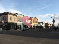 100-102 Ivinsonlisted 1988
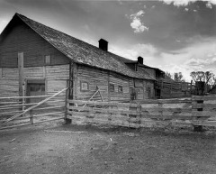 Barn at Oxford Horse Ranchlisted 1986
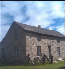 Bath Ranchlisted 1985
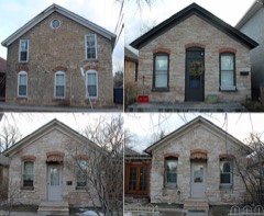 Bath Rowlisted 1986
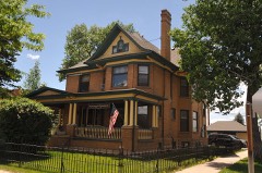 Charles E. Blair Houselisted 1980
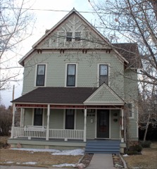 John D. Conley Houselisted 1980
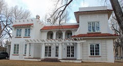 Cooper Mansionlisted 1983
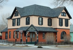 Durlacher Houselisted 2011
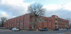 East Side Schoollisted 1981
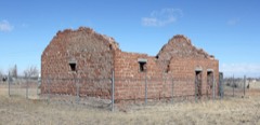 Fort Sanders Guardhouselisted 1980
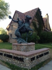 William Goodale Houselisted 1991
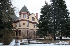 Ivinson Mansion and Groundslisted 1972
Population over time
3 figuresLaramie grew from 828 to 31,407 between 1870 and 2020. These are the recorded population figures Wikidata holds for this place, reached through the Geographic Names Information System number this page is keyed on rather than by name, so they belong to this place and not to another of the same name. Most are census counts, but not all are: an early figure may be a founding or settlement estimate, and an estimate published within five years of a census is left out. The change column is computed, and is left blank where more than 20 years separate a figure from the one before it, because a gap that long is not a change between two counts.
| Year | People | Change |
|---|---|---|
| 1870 | 828 | |
| 2010 | 30,816 | |
| 2020 | 31,407 | +591 (+2%) |
Topographic sheets covering this place
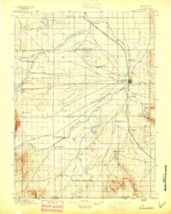
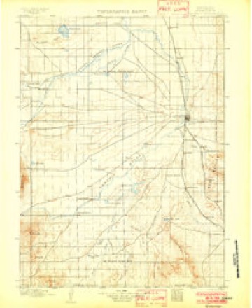
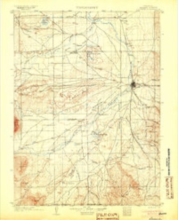
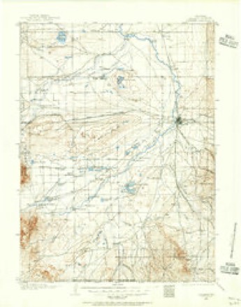
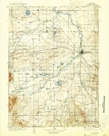
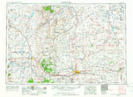
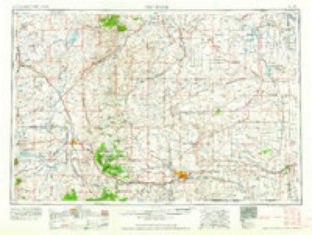
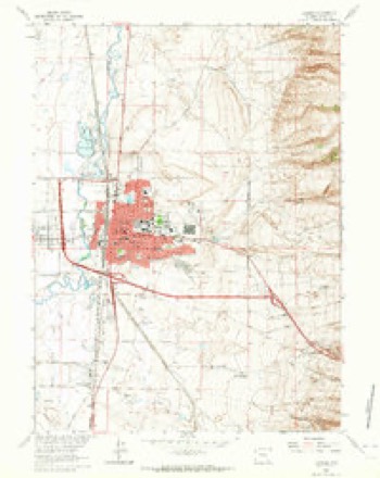
9 surveys from 19 printed sheetsMatched by testing this settlement's coordinate against the published boundary of every sheet in the United States Geological Survey's historical collection. Each opens the scanned sheet at the Survey.
- 1895 USGS Laramie quadrangle1:125000
- 1902 USGS Laramie quadrangle1:125000
- 1905 USGS Laramie quadrangle1:125000
- 1906 USGS Laramie quadrangle1:125000
- 1908 USGS Laramie quadrangle1:125000, 5 printings
- 1954 USGS Cheyenne quadrangle1:250000, 3 printings
- 1958 USGS Cheyenne quadrangle1:250000, 2 printings
- 1963 USGS Laramie quadrangle1:24000, 3 printings
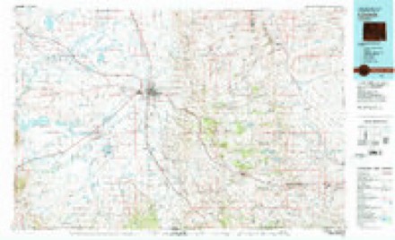
- 1981 USGS Laramie quadrangle1:100000, 2 printings
What the histories say of this town
7,718 words1 chapter about Laramie from the published histories of the county, public domain and reproduced complete.
| Chapter | From | Length |
|---|---|---|
| History | History and Directory of Laramie City, Wyoming Territory (1875) | 7,718 words |
Fires near this place
72 since 1994Regional context, not property-specific evidence. The federal wildfire occurrence database lists 72 fires within 5 miles of Laramie between 1994 and 2020, burning about 291 acres in total. 5 started naturally. None was recorded as arson. Distance is straight-line from the map coordinates, so a fire counted here may appear on a neighbouring settlement's page as well.
| Reported cause | Fires |
|---|---|
| Missing data/not specified/undetermined | 29 |
| Debris and open burning | 7 |
| Equipment and vehicle use | 7 |
| Misuse of fire by a minor | 6 |
| Railroad operations and maintenance | 6 |
| Natural | 5 |
| Recreation and ceremony | 4 |
| Smoking | 4 |
| Fireworks | 4 |
The most recent of them, most recent first, with the day each was reported and the service that recorded it.
| Date | Cause | Size | Reported by | Name on the report |
|---|---|---|---|---|
| 5 September 2015 | Missing data/not specified/undetermined | under an acre | Wyoming State Forestry | not named |
| 25 September 2018 | Railroad operations and maintenance | 2.0 acres | Laramie County | RR517 |
| 25 September 2017 | Missing data/not specified/undetermined | 1.0 acres | Laramie County | I-80 |
| 13 September 2020 | Missing data/not specified/undetermined | 10 acres | Albany County | CORTHELL |
| 12 September 2018 | Missing data/not specified/undetermined | 1.0 acres | Crook County | PAHLOW FIRE |
| 11 September 2012 | Missing data/not specified/undetermined | under an acre | Wyoming State Forestry | not named |
| 3 August 2008 | Misuse of fire by a minor | 3.0 acres | Wyoming State Forestry | not named |
| 26 August 2019 | Missing data/not specified/undetermined | under an acre | Albany County | CORTHALL FIRE |
Settlements close enough to share some of these fires:
Mines and quarries near this place
10 of 11 shownRegional context, not property-specific evidence. The federal mineral resources record lists 11 workings within 5 miles of Laramie: 8 producers, 2 past producers, 1 occurrence. 8 still produce. What was taken out: Stone, Crushed/Broken, Sand and Gravel, Construction, Aluminum, Gypsum-Anhydrite. Distance is straight-line from the map coordinates, so a quarry counted here may appear on a neighbouring settlement's page as well.
| Where | Site | Commodity | Status | Recorded |
|---|---|---|---|---|
| Monolith Portland Midwest Co | Aluminum | Past Producer | ||
| Unknown | Gypsum-Anhydrite | Occurrence | ||
| Unknown (near Laramie) | Silica | Past Producer | ||
| Carroll Pit | Sand and Gravel, Construction | Producer | ||
| Cement Rock Quarry | Stone, Crushed/Broken | Producer | ||
| Easterling Pit | Sand and Gravel, Construction | Producer | ||
| Justin Pit | Sand and Gravel, Construction | Producer | ||
| Kay Pit | Sand and Gravel, Construction | Producer | ||
| Monolith Limestone Quarry | Stone, Crushed/Broken | Producer | ||
| Monolith Portland Cement Plant | Stone, Crushed/Broken | Producer |
Storms near this place
60 of 95 shownRegional context, not property-specific evidence. The National Weather Service names Laramie in 95 storm reports between 1993 and 2025: 51 hail, 20 thunderstorm wind, 6 tornado, 6 funnel cloud. No death or injury is recorded in these reports. Each account below is quoted exactly as the forecast office filed it, from the NOAA Storm Events Database, and each date opens the federal record of that event.
| When | Event | Place named | Harm | What the report says |
|---|---|---|---|---|
| July 2001 | Hail | Laramie | $50,000 | no account filed |
| May 1996 | Tornado (F0) | Laramie | $50,000 | no account filed |
| June 2002 | Thunderstorm Wind | Laramie | $25,000 | Microburst winds resulted in several downed trees, some onto homes, in Laramie, WY. |
| October 1996 | Thunderstorm Wind | Laramie | $20,000 | no account filed |
| September 2025 | Thunderstorm Wind | Laramie | $10,000 | Emergency Management reported downed power lines with power loss in Laramie and Univ of Wyoming. Strongest wind gusts were estimated. |
| August 2001 | Hail | Laramie | $10,000 | Hail cracked windshields east of Laramie, WY. |
| July 1998 | Thunderstorm Wind | Laramie | $4,000 | Thunderstorms produced wind gusts up to 70 mph in Laramie, which downed two power poles on the southeast side of town. |
| June 1996 | Lightning | Laramie | $4,000 | no account filed |
| July 1996 | Lightning | Laramie | $2,000 | no account filed |
| July 1994 | Hail | Laramie | $500 | no account filed |
| August 2025 | Thunderstorm Wind | Laramie | - | Corrects previous non-tstm wnd gst report from 7 E Laramie. Mesonet station PC236 Pilot Hill. |
| June 2025 | Tornado (EF1) | Laramie | - | Multiple spotters reported a tornado. |A thunderstorm approached the ridges just east of Laramie, |producing a funnel cloud near I-80 and ultimately a tornado. |The tornado produced a swath of pine tree damage near |Pilot Hill, including uprooted and snapped trees. The heaviest |damage occurred along the Pilot Hill connector trail. Photos of |damage estimate the maximum path width of nearly one-quarter mile,|while radar and storm reports were also used for path length. |
| June 2025 | Hail | Laramie | - | Accumulating quarter sized hail on the east side of Laramie. Report received via Facebook. |
| June 2025 | Hail | Laramie | - | Photos of hail next to measuring tape. Location estimated based on radar. |
| May 2023 | Tornado (EFU) | Laramie | - | In the late morning hours of Thursday, 18 May, 2023,|a semi-sustained updraft was able to maximize the local near-surface|vorticity of a low-topped thunderstorm in Laramie Valley north of|the town of Laramie. As a result, several funnel clouds occurred near|11:20am to 11:25am MDT. Funnel pictures were initially elevated and|horizontal in nature. Additional pictures and several videos then showed|clear evidence of a more vertical circulation taking place. This vertical|circulation was able to connect with the ground per evidence of a|large dust circulation from several videos and pictures. Approximate|touchdown points have been officially updated in the NWS Damage|Assessment Toolkit Viewer based on radar, pictures, videos, and|emergency management accounts. No known damage occurred as a result|of this tornado as it remained in open space NE of Laramie, WY. NWS|meteorologists surveyed the accessible areas NE of Laramie and determined|no damage indicators were impacted. Thus, a tornado rating of EF-Unknown|(EF-U) has been determined. No injuries or fatalities. |
| July 2023 | Flash Flood | West Laramie | - | Received reports via social media of water completely covering roads and coming over curbs and sidewalks in northwest Laramie west of Interstate 80. |
| July 2023 | Flash Flood | Laramie | - | Emergency manager reported 4th Street in downtown Laramie was underwater. |
| June 2023 | Flood | West Laramie | - | Pioneer Canal overflowed due to rainfall in recent days flooding adjacent Laramie mobile home park. Storm drains were clogged keeping water in place. Adjacent country road was flooded, but Wyoming Highway 230 remained above water level. |
| August 2023 | Thunderstorm Wind | Laramie | - | WYDOT sensor WY27 (Herrick Lane) reported thunderstorm wind gust of 60 mph. |
| June 2023 | Hail | Laramie | - | Hail report of 1 inch 1 mile southeast of Laramie. |
| June 2023 | Hail | Laramie | - | Received image of 1 inch hail from Twitter. |
| June 2023 | Hail | Laramie | - | Trained spotter reported 1.25 inch hail south southwest of Laramie. |
| June 2023 | Hail | Laramie | - | Quarter to half dollar sized hail at University of Wyoming Campus. |
| June 2023 | Hail | Laramie | - | Received video and text report from Twitter of golf ball sized hail at intersection of 4th and Reynolds in Laramie. |
| August 2022 | Flash Flood | Laramie | - | Widespread flash flooding across the city with heavy rainfall from stationary thunderstorms. Numerous CoCoRaHS observers across the city measured between 1.5 to 2.75 inches of rainfall. Flooding was ongoing from 22nd Street to 1st Street and from Harney Street south to Spring Creek. |
| August 2022 | Flash Flood | Laramie | - | Received report via Facebook that the park behind the middle school was flooded. |
| August 2021 | Flash Flood | Laramie | - | Streets flooded. Spring Creek running out of its banks and a third of the way up flood control levees. Numerous reports of basements flooding. 0.85 to 1.20 inches of rainfall. |
| April 2020 | Thunderstorm Wind | Laramie | - | Strong thunderstorm outflow winds were measured at the Laramie Regional Airport. |
| July 2019 | Hail | Laramie | - | Photo sent in showing hail damage to car windshield. |
| October 2018 | Thunderstorm Wind | Laramie | - | Estimated wind gusts of 55 to 60 mph were observed west of Laramie. |
| July 2018 | Hail | Laramie | - | Golf ball size hail was observed south of Laramie. |
| May 2018 | Hail | Laramie | - | Penny to quarter size hail was observed north of Laramie. |
| June 2017 | Hail | Laramie | - | Dime to quarter size hail covered the ground northwest of Laramie. |
| June 2016 | Hail | Laramie | - | Quarter size hail was reported a mile north of Laramie. |
| July 2015 | Hail | Laramie | - | Half dollar size hail was observed two miles east-southeast of Laramie. |
| June 2015 | Thunderstorm Wind | Laramie | - | Estimated wind gusts of 55 to 60 mph were observed eight miles northeast of Laramie. |
| June 2015 | Thunderstorm Wind | Laramie | - | Estimated wind gusts of 55 to 60 mph were observed 10 miles east-southeast of Laramie. |
| July 2015 | Hail | Laramie | - | Ping pong ball size hail was observed three miles southeast of Laramie. |
| August 2014 | Hail | Laramie | - | Quarter size hail was observed in Laramie. |
| September 2014 | Heavy Rain | Laramie | - | Two inches of rain was observed. |
| September 2014 | Heavy Rain | Laramie | - | An observer just north of Laramie measured 1.6 inches of rain. |
| September 2014 | Heavy Rain | Laramie | - | Two inches of rain was observed. |
| June 2013 | Hail | Laramie | - | Marble to quarter size hail was reported in Laramie. |
| June 2013 | Hail | Laramie | - | Nickel to ping pong ball size hail was reported just west of Laramie. |
| July 2012 | Flash Flood | Laramie | - | Fourth Street in Laramie was barricaded due to high water. |
| June 2011 | Thunderstorm Wind | Laramie | - | A trained spotter estimated wind gusts of 60 mph. |
| June 2011 | Thunderstorm Wind | Laramie | - | WYDOT sensor at Vedauwoo measured wind gusts of 61 mph. |
| July 2011 | Thunderstorm Wind | Laramie | - | The ASOS at the Laramie Regional Airport measured a peak wind gust of 61 mph. |
| June 2010 | Hail | Laramie | - | Estimated time of report. |
| June 2010 | Hail | Laramie | - | Hail occurred at the northwest side of town. |
| July 2009 | Hail | Laramie | - | Hail from 1 to 1.75 inches in diameter reported. |
| May 2007 | Hail | Laramie | - | Also estimated wind gusts 60-70 mph. |
| July 2005 | Thunderstorm Wind | Laramie | - | Wind gust from dry microburst. |
| July 2005 | Thunderstorm Wind | Laramie | - | 2 inch diameter tree limbs blown down. |
| June 2004 | Thunderstorm Wind | Laramie | - | Dry microburst wind. |
| June 2003 | Hail | Laramie | - | Nickel size hail at Interstate 80 and Grand Street Exit. |
| August 2002 | Tornado (F0) | Laramie | - | Brief tornado touchdown in open country. |
| August 2002 | Tornado (F0) | Laramie | - | Weak tornado briefly touched down in open country. |
| August 2002 | Tornado (F0) | Laramie | - | Weak tornado spotted in Pole Mountain military reservation. |
| May 2000 | Thunderstorm Wind | Laramie | - | 62 mph wind gust at the Laramie airport. |
Nearest settlements
The eight closest, with where each one stands in the county. Distances are straight-line, computed from the Geographic Names Information System coordinates.
| Map | Place | Distance | Sheets |
|---|---|---|---|
| West Laramie | 1.6 miles | 19 | |
| Howell | 7.5 miles | 18 | |
| Red Buttes | 8.9 miles | 18 | |
| The Buttes | 9.7 miles | 18 | |
| Wyoming | 11.7 miles | 18 | |
| Tie Siding | 16.6 miles | 19 | |
| Hermosa | 16.7 miles | 16 | |
| Bosler Junction | 17.3 miles | 8 |
Elsewhere
Matched on this settlement's Geographic Names Information System number rather than its name, so it cannot be a different place of the same name in another state.
| Wikipedia article on Laramie | An encyclopaedic summary. Its text is share-alike, so it is linked here rather than copied. |
| Wikidata item Q327515 | The structured record the population and elevation above come from. Public domain (CC0). |
Provenance
This settlement is recorded in the Geographic Names Information System as feature 1590526. The sheet list is computed by point-in-boundary test against the United States Geological Survey's historical topographic inventory. Both are works of the United States government and carry no copyright under 17 U.S.C. 105.
Wildfire. Short, Karen C. 2022. Spatial wildfire occurrence data for the United States, 1992-2020 [FPA_FOD_20221014]. 6th Edition. Fort Collins, CO: Forest Service Research Data Archive. https://doi.org/10.2737/RDS-2013-0009.6 Collected with United States Government funding and usable without additional permissions or fees.
Mines and quarries. USGS Mineral Resources Data System (MRDS) https://mrdata.usgs.gov/mrds/ A work of the United States government, no copyright under 17 U.S.C. 105.
Storms. NOAA National Centers for Environmental Information, Storm Events Database https://www.ncei.noaa.gov/stormevents/ A work of the United States government, no copyright under 17 U.S.C. 105. Narratives are quoted verbatim from the National Weather Service report and are not edited or summarised.