 Block
From the record
42 National Register listings published here.
Sources: the county history on the Internet Archive · the National Register database, National Park Service
113 topographic sheets cover 40 settlements here, and 42 properties are on the National Register of Historic Places.
42 National Register listings published here.
Sources: the county history on the Internet Archive · the National Register database, National Park Service
Every property in this county listed on the National Register of Historic Places, with the year it was listed and the federal nomination document.
| Photograph | Property | Type | Listed | Reference |
|---|---|---|---|---|
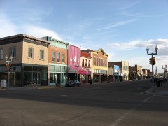 | 100-102 Ivinson | building | 1988 | 88002541 |
| 123 Ivinson | building | 1988 | 88002541 |
| 214 S Second Street | building | 1988 | 88002541 |
| Ames Monument (NHL) | structure | 2016 | 16000860 | |
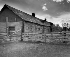 | Barn at Oxford Horse Ranch | building | 1986 | 86001398 |
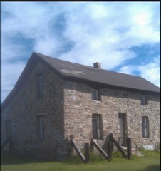 | Bath Ranch | building | 1985 | 85003211 |
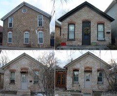 | Bath Row | district | 1986 | 86001015 |
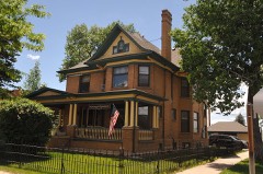 | Charles E. Blair House | building | 1980 | 80004298 |
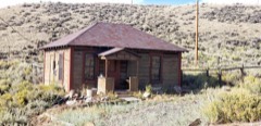 | N. K. Boswell Ranch | building | 1977 | 77001381 |
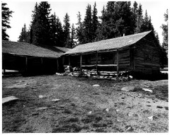 | Brooklyn Lodge | building | 1989 | 89001068 |
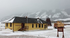 | Centennial Depot | building | 1982 | 82001828 |
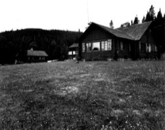 | Centennial Work Center | district | 1994 | 94000273 |
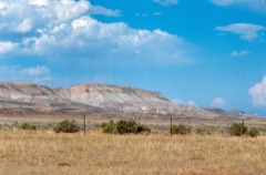 | Como Bluff | district | 1973 | 73001925 |
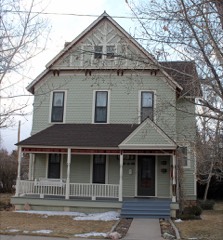 | John D. Conley House | building | 1980 | 80004299 |
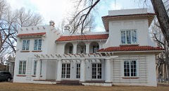 | Cooper Mansion | building | 1983 | 83003359 |
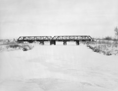 | DOE Bridge over Laramie River | structure | 1985 | 85000411 |
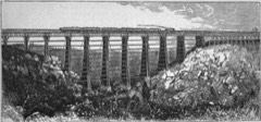 | Dale Creek Crossing (48AB145) | site | 1986 | 86001027 |
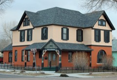 | Durlacher House | building | 2011 | 11000097 |
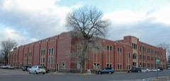 | East Side School | building | 1981 | 81000610 |
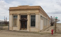 | First National Bank of Rock River | building | 1988 | 88002532 |
| Flying Horseshoe Ranch | district | 2000 | 00001226 | |
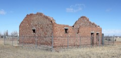 | Fort Sanders Guardhouse | building | 1980 | 80004300 |
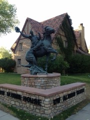 | William Goodale House | building | 1991 | 91000996 |
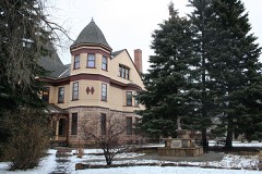 | Ivinson Mansion and Grounds | building | 1972 | 72001295 |
| Jelm-Frank Smith Ranch Historic District | district | 1978 | 78002816 | |
| Keystone Work Center | district | 1994 | 94000275 | |
| Laramie West Side Historic District | district | 2025 | 100012058 | |
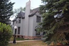 | Lehman-Tunnell Mansion | building | 1982 | 82001829 |
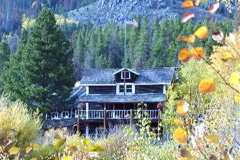 | Libby Lodge | building | 1976 | 76001947 |
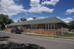 | Lincoln School | building | 2003 | 03001252 |
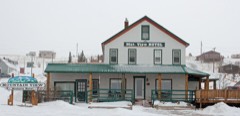 | Mountain View Hotel | building | 2007 | 07000541 |
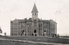 | Old Main | building | 1986 | 86001536 |
| Richardson's Overland Trail Ranch | district | 1992 | 92000122 | |
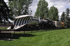 | Snow Train Rolling Stock | district | 2013 | 13000265 |
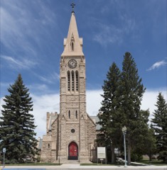 | St. Matthew's Cathedral Close | district | 1984 | 84003622 |
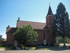 | St. Paulus Kirche | building | 1983 | 83004266 |
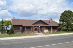 | Union Pacific Athletic Club | building | 1978 | 78002814 |
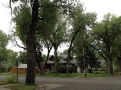 | University Neighborhood Historic District | district | 2009 | 09001109 |
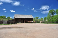 | Vee Bar Ranch Lodge | building | 1986 | 86001468 |
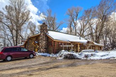 | Woods Landing Dance Hall | building | 1985 | 85003210 |
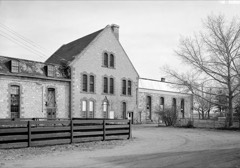 | Wyoming Territorial Penitentiary | building | 1978 | 78002815 |
Every wildfire the federal occurrence database records inside this county: 956 of them, burning about 223,748 acres. 478 started naturally and 6 were recorded as arson. Each settlement page carries the fires within five miles of it.
| Reported cause | Fires |
|---|---|
| Natural | 478 |
| Missing data/not specified/undetermined | 187 |
| Recreation and ceremony | 158 |
| Debris and open burning | 40 |
| Equipment and vehicle use | 29 |
| Railroad operations and maintenance | 16 |
| Smoking | 12 |
| Misuse of fire by a minor | 12 |
| Fireworks | 9 |
| Power generation/transmission/distribution | 8 |
| Arson/incendiarism | 6 |
| Other causes | 1 |
The five largest, by the area the report gives. None of them was recorded as arson.
| Date | Cause | Size | Reported by | Name on the report |
|---|---|---|---|---|
| 27 June 2012 | Natural | 98,115 acres | Medicine Bow-Routt National Forests, Thunder Basin National Grassland | ARAPAHO FIRE |
| 26 August 2018 | Natural | 32,089 acres | Medicine Bow-Routt National Forests, Thunder Basin National Grassland | BRITANIA MOUNTAIN FIRE |
| 10 June 2018 | Equipment and vehicle use | 21,357 acres | Medicine Bow-Routt National Forests, Thunder Basin National Grassland | BADGER CREEK |
| 27 June 2002 | Natural | 18,677 acres | Rawlins Field Office | REESE |
| 30 June 2012 | Missing data/not specified/undetermined | 10,517 acres | Medicine Bow-Routt National Forests, Thunder Basin National Grassland | SQUIRREL CREEK |
| 4 June 2012 | Natural | 8,334 acres | Medicine Bow-Routt National Forests, Thunder Basin National Grassland | COW CAMP |
| 5 August 1996 | Natural | 3,776 acres | Medicine Bow-Routt National Forests, Thunder Basin National Grassland | MURPHY RIDGE |
| 5 August 1996 | Natural | 3,718 acres | Medicine Bow-Routt National Forests, Thunder Basin National Grassland | BEAR CREEK |
Every settlement page carries the fires within five miles of it - see the settlement index below.
The NOAA Storm Events Database holds 287 reports for this county, causing 2 deaths, 3 injuries and about $867,530 in recorded property damage. Each settlement page carries the reports that name it.
| Kind of event | Reports |
|---|---|
| Hail | 126 |
| Thunderstorm Wind | 90 |
| Tornado | 32 |
| Flash Flood | 21 |
| Funnel Cloud | 7 |
| Lightning | 5 |
| Heavy Rain | 4 |
| Flood | 2 |
The most serious of them, by death, then injury, then recorded damage. The accounts are quoted exactly as the forecast office filed them.
| When | Event | Place named | Harm | What the report says |
|---|---|---|---|---|
| July 1999 | Lightning | Centennial | 2 killed | no account filed |
| May 2008 | Tornado (EF2) | Perkins | 1 hurt, $300,000 | Tornado skipped along it's path north-northwest and moved across eastern and northeastern sections of Laramie, WY. Strong winds also overturned a tractor-trailer on Interstate 80 near Laramie and blew a boat off another trailer. |
| July 2023 | Lightning | Buford | 1 hurt | An active-duty member of the U.S. Air Force was struck by lightning while outdoors on the grounds at Francis E. Warren Air Force Base. The lightning strike hit a military vehicle while the individual was in contact with the vehicle frame. |
| July 1960 | Tornado (F1) | not stated | 1 hurt | no account filed |
| August 1996 | Lightning | Wheatland | $300,000 | no account filed |
| August 2022 | Flash Flood | Albany | $76,380 | Heavy rainfall and hail resulting in creek flooding near Lake Owen on the eastern side of the Mullen Burn Scar. Fox Creek Road between Albany and Woods Landing flooded and was closed after a 5 mile stretch was washed out. Road damage of $76,381 was reported with this flash flood. |
| July 2001 | Hail | Laramie | $50,000 | no account filed |
| May 1996 | Tornado (F0) | Laramie | $50,000 | no account filed |
| June 2002 | Thunderstorm Wind | Laramie | $25,000 | Microburst winds resulted in several downed trees, some onto homes, in Laramie, WY. |
| October 1996 | Thunderstorm Wind | Laramie | $20,000 | no account filed |
| June 2023 | Flash Flood | Garrett | $15,000 | Received a video of flash flooding outside of a residence at Cross C Ranch that was estimated 5 feet deep swiftly carrying away a horse trailer. Also received a report from local emergency manager of a partial road washout on Tunnel Road. |
| September 2025 | Thunderstorm Wind | Laramie | $10,000 | Emergency Management reported downed power lines with power loss in Laramie and Univ of Wyoming. Strongest wind gusts were estimated. |
| August 2001 | Hail | Laramie | $10,000 | Hail cracked windshields east of Laramie, WY. |
| July 1998 | Thunderstorm Wind | Laramie | $4,000 | Thunderstorms produced wind gusts up to 70 mph in Laramie, which downed two power poles on the southeast side of town. |
| June 1996 | Lightning | Laramie | $4,000 | no account filed |
| July 1996 | Lightning | Laramie | $2,000 | no account filed |
| July 1994 | Hail | Laramie | $500 | no account filed |
| July 1994 | Hail | not stated | $500 | no account filed |
| August 1983 | Tornado (F0) | not stated | $30 | no account filed |
| June 1982 | Tornado (F0) | not stated | $30 | no account filed |
| June 1977 | Tornado (F1) | not stated | $30 | no account filed |
| August 1974 | Tornado (F1) | not stated | $30 | no account filed |
| August 1974 | Tornado (F1) | not stated | $30 | no account filed |
| August 2025 | Thunderstorm Wind | Laramie | - | Corrects previous non-tstm wnd gst report from 7 E Laramie. Mesonet station PC236 Pilot Hill. |
| August 2025 | Thunderstorm Wind | Sherman | - | Mesonet station UR535 Sherws gustted to 64 mph. |
| August 2025 | Thunderstorm Wind | Milbrook | - | Mesonet station WY27 14.5 SW Bosler. |
| July 2025 | Hail | Wyoming | - | Picture from social media measuring 1 inch hail. |
| July 2025 | Hail | Bosler | - | Report from mPING of quarter size hail. |
| July 2025 | Thunderstorm Wind | Milbrook | - | Herrick Lane WYDOT sensor along Interstate 80 gusted 61 MPH. |
| July 2025 | Hail | Buford | - | Public report of accumulating dime size hail along Interstate 80. Hail about 1 to 3 inches deep in some areas. A few estimated ping pong ball sized hailstones mixed in with the smaller hail. |
| July 2025 | Hail | Wilcox | - | Spotter drove through the area after the storm. Noted that snow plow was clearing away accumulated hail on US-287. Saw a few quarter size hailstones on the side of the road. Time estimated from radar. |
| June 2025 | Tornado (EFU) | Reed Place | - | Photos from Albany County Emergency Management show a tornado of unknown strength touch down in open ranchland. No damage reported. Location estimated from radar, photos and topographic maps. |
| June 2025 | Tornado (EF1) | Laramie | - | Multiple spotters reported a tornado. |A thunderstorm approached the ridges just east of Laramie, |producing a funnel cloud near I-80 and ultimately a tornado. |The tornado produced a swath of pine tree damage near |Pilot Hill, including uprooted and snapped trees. The heaviest |damage occurred along the Pilot Hill connector trail. Photos of |damage estimate the maximum path width of nearly one-quarter mile,|while radar and storm reports were also used for path length. |
| June 2025 | Hail | Laramie | - | Accumulating quarter sized hail on the east side of Laramie. Report received via Facebook. |
| June 2025 | Hail | Laramie | - | Photos of hail next to measuring tape. Location estimated based on radar. |
| August 2024 | Hail | (Lar)Breese Field | - | Reported 8 miles west of Laramie along highway WY130. Time estimated based on radar. |
| August 2024 | Thunderstorm Wind | (Lar)Breese Field | - | Laramie Airport ASOS station (KLAR) measured wind gust. |
| August 2024 | Thunderstorm Wind | Vedauwoo | - | WYDOT mesonet site at Vedauwoo reported this peak wind gust. |
| May 2023 | Tornado (EFU) | Toltec | - | Several reports and angles shared of a tornado west of Esterbrook, WY|in the mountains and open space near Laramie Peak. These accounts were|shared from Douglas, Irvine, Wheatland, and Esterbrook areas. Timing|is estimated based on radar, time stamp pictures, and reports received.|No damage has been reported from Platte or Converse County Emergency|Management agencies. This tornado stayed over mountainous and open|space for the duration of it`s estimated 7.1 mile track. No injuries|or fatalities reported along with no damage. |
| May 2023 | Tornado (EFU) | Laramie | - | In the late morning hours of Thursday, 18 May, 2023,|a semi-sustained updraft was able to maximize the local near-surface|vorticity of a low-topped thunderstorm in Laramie Valley north of|the town of Laramie. As a result, several funnel clouds occurred near|11:20am to 11:25am MDT. Funnel pictures were initially elevated and|horizontal in nature. Additional pictures and several videos then showed|clear evidence of a more vertical circulation taking place. This vertical|circulation was able to connect with the ground per evidence of a|large dust circulation from several videos and pictures. Approximate|touchdown points have been officially updated in the NWS Damage|Assessment Toolkit Viewer based on radar, pictures, videos, and|emergency management accounts. No known damage occurred as a result|of this tornado as it remained in open space NE of Laramie, WY. NWS|meteorologists surveyed the accessible areas NE of Laramie and determined|no damage indicators were impacted. Thus, a tornado rating of EF-Unknown|(EF-U) has been determined. No injuries or fatalities. |
| July 2023 | Thunderstorm Wind | Jelm | - | A Mesonet station near the WY/CO state line south of Laramie recorded a wind gust to 74 MPH. |
| July 2023 | Flash Flood | West Laramie | - | Received reports via social media of water completely covering roads and coming over curbs and sidewalks in northwest Laramie west of Interstate 80. |
| July 2023 | Flash Flood | Laramie | - | Emergency manager reported 4th Street in downtown Laramie was underwater. |
| July 2023 | Flood | Red Buttes | - | Flooded county roads with a neighborhood entrance blocked due to a clogged culvert. |
| June 2023 | Tornado (EFU) | Lookout | - | Received reports of 2 to 3 brief touchdowns southeast of Rock River. |
| June 2023 | Flood | West Laramie | - | Pioneer Canal overflowed due to rainfall in recent days flooding adjacent Laramie mobile home park. Storm drains were clogged keeping water in place. Adjacent country road was flooded, but Wyoming Highway 230 remained above water level. |
| August 2023 | Thunderstorm Wind | Laramie | - | WYDOT sensor WY27 (Herrick Lane) reported thunderstorm wind gust of 60 mph. |
| August 2023 | Thunderstorm Wind | Vedauwoo | - | WYDOT sensor at Vedauwoo reported thunderstorm wind gust of 58 mph. |
| June 2023 | Hail | Laramie | - | Hail report of 1 inch 1 mile southeast of Laramie. |
| June 2023 | Hail | Laramie | - | Received image of 1 inch hail from Twitter. |
| June 2023 | Hail | Laramie | - | Trained spotter reported 1.25 inch hail south southwest of Laramie. |
| June 2023 | Hail | Laramie | - | Quarter to half dollar sized hail at University of Wyoming Campus. |
| June 2023 | Hail | Laramie | - | Received video and text report from Twitter of golf ball sized hail at intersection of 4th and Reynolds in Laramie. |
| July 2022 | Flash Flood | Keystone | - | Post-event survey revealed evidence of 2-3 foot water flows and washed out ATV trails west and southwest of Albany. The USFS was in the process of grading several dirt roads to repair small washouts and erosion spots, especially on Forest Roads 500 and 527. |
| August 2022 | Flash Flood | Laramie | - | Widespread flash flooding across the city with heavy rainfall from stationary thunderstorms. Numerous CoCoRaHS observers across the city measured between 1.5 to 2.75 inches of rainfall. Flooding was ongoing from 22nd Street to 1st Street and from Harney Street south to Spring Creek. |
| August 2022 | Flash Flood | Laramie | - | Received report via Facebook that the park behind the middle school was flooded. |
| August 2022 | Flash Flood | Deerwood | - | Reported flooding across low lying areas south of Centennial near the North Fork Little Laramie River after 2 inches of heavy rain fell in less than an hour just north of Centennial and on the west slopes of Sheep Mountain. |
| July 2021 | Flash Flood | Woods Landing | - | Heavy rainfall over portions of the Mullen Burn Scar with estimated rainfall of two to three inches. Subsequent mudslide and debris flow led to a road washout near Highway 230. The Woods Landing Resort also had nearby stream rise out of its bank with water on area campgrounds and a few inches of water were reported in the resort kitchen. |
| July 2021 | Flash Flood | Centennial | - | Spotter reported one inch of rainfall in thirty minutes along with pea size hail. |
| July 2021 | Flash Flood | Keystone | - | Received video from Wyoming Game and Fish Biologist of flash flooding along Lake Creek in the Mullen Burn Scar. |
The Survey's mineral resources record lists 312 workings inside this county. 23 still produce and 289 are closed or unrecorded. Each settlement page carries the workings within five miles of it.
| Commodity | Workings |
|---|---|
| Uranium | 73 |
| Gold | 40 |
| Copper | 29 |
| Iron | 22 |
| Titanium, Iron | 13 |
| Gypsum-Anhydrite | 11 |
| Diamond | 9 |
| Feldspar | 8 |
| Platinum | 8 |
| Gold, Copper | 7 |
| Garnet | 6 |
| Stone, Crushed/Broken | 6 |
| Sand and Gravel, Construction | 6 |
| Corundum | 6 |
The least common of them first, because a county's hundredth gravel pit says nothing its first ten did not.
| Where | Site | Commodity | Status | Recorded |
|---|---|---|---|---|
| Archer Placer Claim | Gold, Iridium, Platinum, Osmium, Palladium | Producer | Stream Placer | |
| Blanche Mine | Copper, Platinum, Palladium, Gold | Past Producer | hydrothermal vein | |
| Brooklyn Lake-Rock Creek Lakes | Magnesium Compounds, Sodium Sulfate, Salt | Prospect | Epsomite, Mirabilite | |
| Centennial Ridge District | Gold, Platinum, Palladium | Past Producer | 1874, 1875 | |
| Colorado Mine | Gold, Copper, Iron, Lead, Silver | Past Producer | Chalcopyrite, Copper, Galena, Silver | |
| Columbine Mine | Copper, Silver, Gold, Platinum | Past Producer | 1927 | |
| Copper King Mine | Copper, Molybdenum | Occurrence | Chalcopyrite, Molybdenite | |
| Cuprite Mine | Silver, Gold, Copper, Cobalt, Chromium | Past Producer | Chalcopyrite, Copper, Cuprite, Gold, Pyrite, Silver | |
| Douglas Creek Placer Mining District | Gold, Palladium, Tungsten, Silver, Platinum | Past Producer | 1868 | |
| Empire Mine | Silver, Gold, Copper, Platinum, Palladium, Osmium, Ruthenium, Rhodium, Iridium | Past Producer | Chalcopyrite, Chrysocolla, Malachite, Pyrite | |
| Eureka Prospect | Copper, Iron, Gold | Occurrence | Chalcopyrite, Gold, Pyrrhotite | |
| Fall Creek Placer | Gold, Rhodium, Osmium, Platinum | Past Producer | Stream Placer | |
| Gold Crater Mine | Gold, Copper, Cobalt, Sulfur-Pyrite | Past Producer | 1937 | |
| Grizzly Creek Prospect | Kyanite, Clay, Peat | Prospect | ||
| Halleck Canyon Area | Stone, Dimension | Prospect | ||
| Halleck Canyon Area | Asbestos | Prospect | ||
| Independence Mine | Gold, Copper, Bismuth | Prospect | Bismuth, Chalcanthite, Chalcopyrite | |
| Independence Mine | Silver, Copper, Gold, Platinum, Palladium, Rhodium, Nickel, Osmium, Iridium | Past Producer | Gold, Pyrite | |
| Independence Placer | Gold, Osmium, Ruthenium, Rhodium, Palladium, Platinum | Occurrence | Stream Placer | |
| Ione Prospect | Garnet, Tantalum, Niobium (Columbium), Beryllium, Mica, Feldspar | Occurrence | Beryl | |
| Iron Mountain | Iron, Titanium, Chromium, Vanadium, Zirconium | Past Producer | 1850, 1897 | |
| Jelm Mountain | Copper, Gold, Bismuth | Prospect | contact vein | |
| Jelm Mountain District | Copper, Gold, Lead, Zinc, Bismuth, Molybdenum | Past Producer | 1870 | |
| Kentucky Derby Mine | Copper, Gold, Silver, Iridium, Osmium, Palladium, Platinum | Past Producer | Chalcopyrite, Chrysocolla, Gold, Malachite, Pyrite | |
| Lake Creek Mines | Copper, Gold, Silver, Rhodium, Palladium, Platinum | Past Producer | Chalcopyrite, Pyrite | |
| Lake Owen Complex | Iron, Titanium, Metal, Silver, Cobalt, Nickel, PGE, Gold, Copper, Vanadium | Occurrence | Magnetite, Ilmenite | |
| Laramie Range | Magnesite | Occurrence | ||
| Laramie Range Anorthosite area | Aluminum, Titanium, Silica, Iron, Water, Free, Sodium, Calcium | Prospect | 1870 | |
| Lewis Lake quartz vein | Gold, Thorium, Uranium | Prospect | ||
| Maggie Murphy Group Prospect | Iron, Copper, Graphite, Zinc | Prospect | Chalcopyrite, Hematite, Marcasite, Pyrrhotite, Sphalerite | |
| Many Values Pegmatite Prospect | Mica, Beryllium, Tantalum, Garnet, REE, Niobium (Columbium), Uranium | Past Producer | 1930, 1942 | |
| Mc Ghee Prospect | Iron, Zinc, Copper | Occurrence | Chalcopyrite, Pyrrhotite, Sphalerite | |
| Mill Creek Chromite | Iron, Chromium, Talc-Soapstone | Occurrence | 1961 | |
| Moore's Gulch | Gold, Platinum, Palladium | Past Producer | 1868 | |
| Muscovite Claim | Mica, Tungsten, Pumice, Feldspar, Garnet | Past Producer | Beryl, Columbite, Tantalite, Muscovite | |
| New Rambler Mine | Copper, Palladium, Platinum, Gold, Silver, Nickel | Past Producer | 1877, 1900, 1918 | |
| New Rambler Mining District | Gold, Palladium, Silver, Platinum, Copper | Past Producer | Covellite, Sperrylite, Chalcopyrite, Chalcocite, Malachite | |
| Nippr #1 Prospect | Perlite | Prospect | ||
| Poverty Mining Co. | Manganese, Barium-Barite | Past Producer | 1917 | |
| Queen Mill Run | Gold, Palladium, Osmium, Iridium, Platinum | Past Producer | Stream Placer | |
| Queen Mine | Gold, Platinum, Silver, Copper, Iridium | Past Producer | Gold | |
| Red Mountain | Calcium | Occurrence | ||
| Rock Springs Phosphoric Acid Plant | Phosphorus-Phosphates | Producer | 1987 | |
| Roff Deposit | Kyanite, Corundum, Vermiculite | Unknown | ||
| Sheep Mountain | Titanium-Heavy Minerals, Iron, Thorium, Zirconium | Occurrence | Fossil beach placer | |
| Smaller Deposit #6-Iron Mtn Area | Iron, Titanium | Prospect | Magnetite, Ilmenite | |
| Strong Mine | Tungsten, Copper | Occurrence | Scheelite | |
| Strong Mine | Tungsten | Unknown | ||
| Strong Mine | Lead, Copper, Gold, Molybdenum | Past Producer | ||
| Tenderfoot Prospect | Copper, Zinc, Silver, Gold | Occurrence | Chalcopyrite, Gold, Pyrite, Silver, Sphalerite | |
| Three Cripples Mine | Gold, Silver, Copper, Zinc, Nickel | Occurrence | Copper, Gold, Pyrrhotite, Silver, Sphalerite | |
| Ulcahomo Mine | Gold, Copper, Nickel, Silver | Past Producer | Chalcopyrite, Copper, Gold, Pyrite, Silver | |
| Ulcanomo | Gold, Copper, Nickel, Sulfur | Unknown | ||
| Unknown | Niobium (Columbium) | Prospect | ||
| Unknown | REE | Prospect | ||
| Unknown | Thorium | Prospect | ||
| Unknown | Strontium | Prospect | ||
| Unknown | Dolomite | Prospect | ||
| Unknown | Flagstone | Prospect | ||
| Unnamed Prospect | Platinum, Palladium, Copper, Silver, Gold | Occurrence | Gold | |
| Unnamed Prospect | Zinc, Palladium, Platinum | Occurrence | Sphalerite | |
| Utopia Mine | Gold, Silver, Platinum, Copper | Past Producer | vein | |
| American Copper Mine | Copper, Silver | Prospect | Malachite, Azurite | |
| Big Five Prospect | Copper, Zinc | Prospect | Chalcopyrite, Sphalerite, Pyrrhotite | |
| Cliff Mine | Silver, Gold, Copper, Platinum | Past Producer | Chalcopyrite, Chrysocolla, Gold, Malachite, Pyrite | |
| Free Gold Claim | Gold, Copper, Silver, Platinum | Past Producer | Chalcopyrite, Chrysocolla, Gold, Malachite, Pyrite | |
| Libby Flats prospect | Gold, Silver | Prospect | ||
| Medicine Bow Mountains | Lithium | Prospect | ||
| Medicine Bow Mountains | Lithium | Prospect | ||
| Monolith Portland Midwest,Inc | Limestone, Dimension | Producer | ||
| Pazeka Lake | Magnesium Compounds | Prospect | Epsomite | |
| Plumbago Creek silica sand deposit | Silica | Prospect | ||
| Rock Creek Station,Taylor Mine | Beryllium | Past Producer | ||
| Sand Creek | Beryllium | Prospect | ||
| Shanton Prospect | Iron, Titanium, Metal | Past Producer | 1850, 1958 | |
| Taylor Deposit | Iron, Titanium, Metal | Prospect | Ilmenite, Magnetite | |
| Unidentified Occurrence | Iron, Titanium, Metal | Occurrence | Ilmenite, Magnetite | |
| University of Wyoming | Limestone, Dimension | Producer | ||
| Unknown | Manganese | Prospect | ||
| Unknown | Chromium | Prospect | ||
| Unknown | Abrasive | Prospect | ||
| Unknown | Chromium | Past Producer | ||
| Unknown (near Laramie) | Silica | Past Producer | ||
| Unnamed | Abrasive | Occurrence | ||
| Bear Creek | Gold, Palladium, Platinum | Past Producer | Stream Placer | |
| Centennial Mine | Gold, Silver, Platinum | Past Producer | 1875, 1876, 1877 | |
| Daves Creek | Gold, Palladium, Platinum | Past Producer | Stream Placer | |
| Douglas Mine | Gold, Copper, Cobalt | Past Producer | Chalcocite, Chalcopyrite, Cobaltite, Copper, Gold, Malachite | |
| Elk Creek | Gold, Palladium, Platinum | Past Producer | Stream Placer | |
| Keystone Mining District | Gold, Copper, Cobalt | Past Producer | ||
| Medicine Bow Mines Company Prospect | Gold, Copper, Cobalt | Occurrence | Copper, Gold | |
| Mica Hill Mining Co. | Mica | Producer | ||
| Morning Star Claim | Gold, Copper, Platinum | Occurrence | ||
| Albany Mine | Copper, Gold | Past Producer | 1903 | |
| Big Mac Nos. 1, 2 and 3 Group | Marble, Dimension | Occurrence | 1958 | |
| Cassa Mining Co.Claims | Clay | Prospect | ||
| Cosgriff's Claim Near Chalk Bluff | Clay | Prospect | ||
| Halleck Canyon Area | Graphite | Prospect | ||
| Halleck Canyon Area | Graphite | Prospect | ||
| Laramie Range | Graphite | Prospect | ||
| Laramie Range Kyn Occurrence | Kyanite | Occurrence | Metamorphic | |
| Linscott Claim | Clay | Past Producer | ||
| Mark Claim - Annie Mine | Copper, Gold | Occurrence | ||
| Mcgill Anticline | Titanium | Past Producer | ||
| Mcgill Anticline | Clay | Past Producer | ||
| Palmer Lode | Kyanite | Occurrence | Kyanite | |
| Pioneer, Pink Marble No. 1 and No. 2 Group | Marble, Dimension | Occurrence | 1958 | |
| Plumbago Canyon | Graphite | Prospect | ||
| Riverside Ranch | Titanium | Prospect | ||
| Rock Creek | Titanium | Past Producer | ||
| Sherman Group Prospect | Copper, Gold | Occurrence | Gold | |
| Unknown | Marble, Dimension | Prospect | ||
| Unknown | Marble, Dimension | Occurrence | ||
| Iron Mountain (anorthosite) | Aluminum | Prospect | Plagioclase | |
| Long Jack Claim | Vermiculite | Past Producer | ||
| May Deposit | Vermiculite | Past Producer | ||
| Monolith Portland Midwest Co | Aluminum | Prospect | ||
| Monolith Portland Midwest Co | Aluminum | Past Producer | ||
| Nipper #1 Claim | Talc-Soapstone | Prospect | ||
| Nipper #2 Claim | Talc-Soapstone | Prospect | ||
| Nipper #4 Claim | Talc-Soapstone | Prospect | ||
| Owen Creek Area | Talc-Soapstone | Occurrence | ||
| Palmer Canyon | Talc-Soapstone, Vermiculite | Prospect | ||
| Unknown | Aluminum | Occurrence | ||
| Unknown | Vermiculite | Prospect | ||
| Unknown | Vermiculite | Prospect | ||
| Carroll Pit | Sand and Gravel, Construction | Producer | ||
| Cement Rock Quarry | Stone, Crushed/Broken | Producer | ||
| Easterling Pit | Sand and Gravel, Construction | Producer | ||
| Fay Pit | Sand and Gravel, Construction | Producer | ||
| Justin Pit | Sand and Gravel, Construction | Producer | ||
| Kay Pit | Sand and Gravel, Construction | Producer | ||
| Middle Downey Lake | Corundum | Prospect | ||
| Monolith Limestone Quarry | Stone, Crushed/Broken | Producer | ||
| Monolith Portland Cement Plant | Stone, Crushed/Broken | Producer | ||
| Monolith Portland Midwest Co | Stone, Crushed/Broken | Producer | ||
| North Downey Lake | Corundum | Prospect | ||
| Owen Creek Area | Garnet | Occurrence | ||
| Philadelphia Lake-Rock Creek Lakes | Corundum | Prospect | ||
| Rock Creek Lakes-Soda Lakes | Corundum | Producer | ||
| South Downey Lake | Corundum | Prospect | ||
| State Rock Pit | Stone, Crushed/Broken | Producer | ||
| Sterling Limestone Quarry | Stone, Crushed/Broken | Producer | ||
| Tie Siding Area | Feldspar, Garnet | Past Producer | ||
| Tie Siding Area | Feldspar, Garnet | Past Producer | ||
| Tie Siding Area | Feldspar, Garnet | Past Producer | ||
| Tie Siding Area | Feldspar, Garnet | Past Producer | ||
| Tie Siding Area | Feldspar, Garnet | Past Producer | ||
| Tuffa Pit | Sand and Gravel, Construction | Producer | ||
| Union Pacific Lakes-Gibbs Pond | Corundum | Past Producer | ||
| Annie Mine | Gold, Copper | Past Producer | Chalcopyrite, Gold | |
| Maudem Group Mine | Gold, Copper | Past Producer | Chalcocite, Chalcopyrite, Gold | |
| Duchess Mine | Copper, Gold, Platinum | Prospect | Hematite, Limonite, Pyrite, Tetrahedrite | |
| Golden Crown Mining Syndicate | Gold, Platinum | Occurrence | Gold | |
| Hermosa Prospect | Feldspar | Prospect | ||
| Horse Creek Area | Feldspar | Past Producer | ||
| Lincoln Gulch | Gold, Platinum | Producer | Stream Placer | |
| Platinum City Mine | Gold, Copper, Platinum | Past Producer | Gold, Pyrite | |
| Aultman Pipe 1 Prospect | Diamond | Occurrence | 1961 | |
| Ferris 1 Prospect | Diamond | Occurrence | 1960 | |
| Radichal 1 Kimberlite Occurrence | Diamond | Occurrence | 1980 | |
| Schaffer 10 Prospect | Diamond | Occurrence | Diamond | |
| Schaffer 13 Prospect | Diamond | Occurrence | Diamond | |
| Schaffer 15 Prospect | Diamond | Occurrence | Diamond | |
| Schaffer 16 Prospect | Diamond | Occurrence | ||
| Schaffer 19 Prospect | Diamond | Occurrence | Diamond | |
| Schaffer 3 Prospect | Diamond | Occurrence | 1976 | |
| Como Bluffs | Gypsum-Anhydrite | Occurrence | ||
| Harney Creek Valley | Gypsum-Anhydrite | Producer | ||
| Laramie | Gypsum-Anhydrite | Past Producer | ||
| Laramie Area | Gypsum-Anhydrite | Past Producer | ||
| Red Buttes Area | Gypsum-Anhydrite | Past Producer | ||
| Red Mountain Gypsom Mine | Gypsum-Anhydrite | Producer | ||
| Red Mtn Area | Gypsum-Anhydrite | Prospect | ||
| Sportsman Lake | Gypsum-Anhydrite | Prospect | ||
| Sprotsman Lake | Gypsum-Anhydrite | Occurrence | ||
| Unknown | Gypsum-Anhydrite | Occurrence | ||
| Unknown | Gypsum-Anhydrite | Occurrence | ||
| Smaller Deposit #1-Iron Mtn Area | Titanium, Iron | Prospect | Magnetite, Ilmenite | |
| Smaller Deposit #10-Iron Mtn Area | Titanium, Iron | Prospect | Magnetite, Ilmenite | |
| Smaller Deposit #11-Iron Mtn Area | Titanium, Iron | Prospect | Magnetite, Ilmenite | |
| Smaller Deposit #12-Iron Mtn area | Titanium, Iron | Prospect | Magnetite, Ilmenite | |
| Smaller Deposit #13-Iron Mtn Area | Titanium, Iron | Prospect | Magnetite, Ilmenite | |
| Smaller Deposit #14-Iron Mtn Area | Titanium, Iron | Prospect | Magnetite, Ilmenite | |
| Smaller Deposit #15-Iron Mtn Area | Titanium, Iron | Prospect | Magnetite, Ilmenite | |
| Smaller Deposit #3-Iron Mtn Area | Titanium, Iron | Prospect | Magnetite, Ilmenite | |
| Smaller Deposit #4-Iron Mtn Area | Titanium, Iron | Prospect | Magnetite, Ilmenite | |
| Smaller Deposit #5-Iron Mtn Area | Titanium, Iron | Prospect | Magnetite, Ilmenite | |
| Smaller Deposit #7-Iron Mtn Area | Titanium, Iron | Prospect | Magnetite, Ilmenite | |
| Smaller Deposit #8-Iron Mtn Area | Titanium, Iron | Prospect | Magnetite, Ilmenite | |
| Smaller Deposit #9-Iron Mtn Area | Titanium, Iron | Prospect | Magnetite, Ilmenite | |
| Bucaneer Prospect | Copper, Iron | Occurrence | Iron, Malachite | |
| Cobar No. 1 | Iron | Past Producer | 1850, 1956 | |
| Fish Creek | Iron | Occurrence | ||
| Grant Creek, Deposit No.4 | Iron | Occurrence | 1850 | |
| Lake Creek | Iron | Past Producer | ||
| Middle Sybille Creek,Deposit No.2 | Iron | Occurrence | 1850 | |
| North Iron Mountain | Iron | Occurrence | 1850 | |
| Pelton Creek | Iron | Occurrence | ||
| Plumbago Canyon | Iron | Occurrence | 1850 | |
| Pyramid Mine | Copper, Iron | Past Producer | Copper | |
| Smaller Deposit #2-Iron Mtn Area | Iron | Prospect | Magnetite | |
| Spring Creek | Iron | Occurrence | 1850 | |
| Unidentified Occurrence | Iron | Occurrence | Magnetite | |
| Unidentified Prospect | Iron | Occurrence | Magnetite | |
| Unidentified Prospect | Iron | Occurrence | Magnetite | |
| Unidentified Prospect | Iron | Occurrence | Magnetite | |
| Unknown | Iron | Prospect | ||
| Bellamy Lake copper prospect | Copper | Prospect | Chalcopyrite | |
| Copper Float Group (Tie Siding) | Copper | Prospect | ||
| Kansas Group | Copper, Gold | Prospect | ||
| Kansas Group Mine | Copper, Gold | Past Producer | Copper, Gold | |
| King Solomen Claim | Copper | Prospect | ||
| King Solomon Claim | Copper | Occurrence | Copper | |
| Mammoth Prospect | Copper | Occurrence | ||
| Mammoth-Warbonnet Group | Copper | Prospect | ||
| Maudem Group | Gold, Copper | Prospect | ||
| Percis Claims | Copper | Past Producer | Replacement | |
| Silver King Copper Mine | Copper | Past Producer | ||
| Unidentified Prospect | Copper | Occurrence | Copper | |
| Unidentified Prospect | Copper | Occurrence | Copper | |
| Unidentified Prospect | Copper | Occurrence | Replacement | |
| Unknown | Copper | Occurrence | Contact Metasomatic | |
| Unknown | Copper | Prospect | ||
| Wyoming Copper Co. | Copper | Past Producer | ||
| Albany Development Co | Gold | Past Producer | ||
| Billie Class stamp mill and prospects | Gold | Past Producer | ||
| Fairview Claim | Gold | Occurrence | ||
| Florence Mine | Gold | Past Producer | Underground | |
| Golden Crown Mining Syndicate | Gold | Prospect | ||
| Golden Key | Gold | Past Producer | Gold | |
| Home Placers | Gold | Past Producer | Placer | |
| Hub Load Claim | Gold | Prospect | ||
| Hub Lode Claim | Gold | Occurrence | Gold | |
| Keystone Mine | Gold | Past Producer | 1876, 1877, 1893 | |
| LaPlata District | Gold | Past Producer | ||
| Moore's Gulch | Gold | Past Producer | ||
| Red Mask Mine | Gold | Past Producer | ||
| Spring Creek Placers | Gold | Producer | Placer | |
| Unknown | Gold | Past Producer | ||
| Airborne Anomaly #36-19 | Uranium | Prospect | ||
| Airborne Anomaly #56-20 | Uranium | Occurrence | ||
| Airborne Anomaly #57-14 | Uranium | Occurrence | ||
| Airborne Anomaly #57-15 | Uranium | Occurrence | ||
| Albany Claims | Uranium | Past Producer | Uranophane | |
| Annie Mine | Uranium | Occurrence | ||
| Big Chief Mica | Uranium | Occurrence | ||
| Big Smith Claims | Uranium | Occurrence | Carnotite | |
| Bootheel Project | Uranium | Prospect | sandstone roll-front uranium | |
| Buford Area | Uranium | Unknown | ||
| Cliff Mine | Uranium | Unknown | ||
| Copper Float Group | Uranium | Unknown | ||
| Cowboy Claim #1 | Uranium | Prospect | ||
| Crescent Lode No 1 | Uranium | Prospect | ||
| Dell Roper Mine | Uranium | Unknown | ||
| Desert Rose | Uranium | Past Producer | ||
| Diamond Bell Mine | Uranium | Prospect | ||
| Diamond Bell Mine | Uranium | Occurrence | ||
| Dick Riley Claim | Uranium | Occurrence | Vein | |
| Dick Riley Claim | Uranium | Occurrence | ||
| Esterbrook Mines and Prospects | Uranium | Past Producer | ||
| Gem #1 | Uranium | Prospect | ||
| Independence Mine & Prospects | Uranium | Prospect | ||
| Inversion Cabin Prospects | Uranium | Unknown | ||
| Keystone | Uranium | Prospect | ||
| Kreisley Group Claims and Prospects | Uranium | Occurrence | ||
| Lake Resort Area | Uranium | Unknown | ||
| Libby Creek | Uranium | Unknown | ||
| Magnolia Lode | Uranium | Unknown | ||
| Mahoney #1 | Uranium | Occurrence | ||
| Marshall Area | Uranium | Occurrence | ||
| Maudem Group | Uranium | Prospect | ||
| Night Owl Claims | Uranium | Past Producer | Carnotite | |
| No Name Pegmatites | Uranium | Prospect | ||
| No Name Pegmatites | Uranium | Past Producer | ||
| Nobo Mine and Prospect | Uranium | Prospect | ||
| Praeger Ranch Prospects | Uranium | Occurrence | ||
| Pyramid Prospects No.1 | Uranium | Prospect | ||
| Pyramid Prospects No.2 | Uranium | Prospect | ||
| Rock Creek | Uranium | Occurrence | Jarosite, Wulfenite | |
| Sheep Creek | Uranium | Unknown | ||
| Sherman Group | Uranium | Prospect | ||
| Stargeon Ranch Prospects | Uranium | Occurrence | ||
| Tenderfoot Mine and Prospects | Uranium | Prospect | ||
| Three Cripples Mine | Uranium | Prospect | ||
| Tie Siding Feldspar Pegmatite #1 | Uranium | Unknown | ||
| Tie Siding Feldspar Pegmatite #2 | Uranium | Unknown | ||
| Tie Siding Pegmatite No. 3 | Uranium | Prospect | ||
| Unidentified Occurence | Uranium | Occurrence | Uranophane | |
| Unknown | Uranium | Occurrence | ||
| Unknown | Uranium | Occurrence | ||
| Unknown | Uranium | Occurrence | ||
| Unknown | Uranium | Occurrence | ||
| Unknown | Uranium | Occurrence | Jarosite, Wulfenite | |
| Unknown | Uranium | Occurrence | ||
| Unknown | Uranium | Occurrence | ||
| Unknown | Uranium | Occurrence | ||
| Unknown | Uranium | Occurrence | ||
| Unknown | Uranium | Producer | ||
| Unknown | Uranium | Occurrence | ||
| Unknown | Uranium | Occurrence | ||
| Unknown | Uranium | Occurrence | ||
| Unknown | Uranium | Occurrence | ||
| Unknown | Uranium | Unknown | ||
| Unknown | Uranium | Occurrence | ||
| Unknown | Uranium | Unknown | ||
| Unknown | Uranium | Past Producer | ||
| Unknown | Uranium | Unknown | ||
| Unknown Copper Mine | Uranium | Prospect | ||
| Unnamed | Uranium | Prospect | ||
| Weddle Claims | Uranium | Occurrence | ||
| West Dale Creek | Uranium | Unknown |
The part of each published history that is about one town: 1 chapter, each reproduced complete.
| Town | Chapter | From | Length |
|---|---|---|---|
| Laramie | History | History and Directory of Laramie City, Wyoming Territory (1875) | 7,718 words |
Named settlements recorded in the Geographic Names Information System, each with the topographic sheets covering it. Villages, hamlets and abandoned places alike. Each is shown with the nearest named watercourse or landform and the survey quadrangle it falls on.
Rock River census division · 82201 · Near Harris Park · Harris Park quadrangle
12 sheets, 1943 to 1992
South Albany census division · 82055 · On Mullen Creek · Centennial quadrangle
17 sheets, 1906 to 1992
South Albany census division · 82070 · Near Lincoln Gulch · Foxpark quadrangle
17 sheets, 1906 to 1992
No longer a settlement
Rock River census division · 82051 · Cooper Lake North quadrangle
8 sheets, 1954 to 1982
South Albany census division · 82070 · On Evans Creek · Foxpark quadrangle
17 sheets, 1906 to 1992
Rock River census division · Near Lower Pine Ridge · Rock River quadrangle
8 sheets, 1954 to 1982
South Albany census division · 82070 · Near Table Mountain · Millbrook quadrangle
23 sheets, 1895 to 1992
South Albany census division · 82070 · On Jelm Creek · Woods Landing quadrangle
16 sheets, 1906 to 1992
South Albany census division · 82070 · On Little Beaver Creek · Keystone quadrangle
17 sheets, 1906 to 1992
Laramie census division · 82070 · Near Undine Park · Laramie quadrangle
19 sheets, 1895 to 1981
Rock River census division · On Bell Creek · Rock Creek quadrangle
10 sheets, 1954 to 1992
South Albany census division · 82063 · Near Pollock Draw · Woods Landing quadrangle
16 sheets, 1906 to 1992
Rock River census division · 82058 · On Beaver Dam Creek · Toltec quadrangle
10 sheets, 1954 to 1992
Rock River census division · 82083 · On Spring Creek · Cannonball Cut quadrangle
8 sheets, 1954 to 1982
No longer a settlement
South Albany census division · 82070 · On Spring Creek · Red Buttes quadrangle
18 sheets, 1895 to 1981
South Albany census division · 82084 · Near Dirty Woman Draw · Best Ranch quadrangle
19 sheets, 1895 to 1981
Laramie census division · 82070 · On Spring Creek · Laramie quadrangle
19 sheets, 1895 to 1981
South Albany census division · 82063 · On Woods Creek · Woods Landing quadrangle
16 sheets, 1906 to 1992
The vanished settlements of Albany County: the places named above that are no longer on the map.