 Block
Riverton, Wyoming
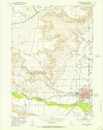
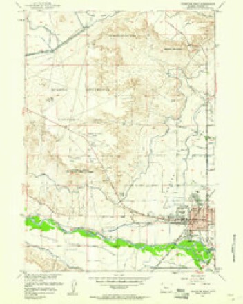
8 topographic sheets cover this place, the earliest surveyed in 1951 and the latest in 1962. It stands in the Wind River Reservation census division. It lies in ZIP code area 82501. The Survey maps it on the Riverton West quadrangle. 10,682 people lived here at the 2020 count. It stands 4,951 feet above sea level.
Research this city
On record in Riverton
Buildings and businesses the archive holds for this place. Each opens its own page, with the source record it came from.
On the National Register 2 records
 Delfelder Schoolhouselisted 1978
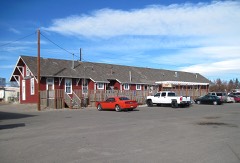 Riverton Railroad Depotlisted 1978
Population over time
2 figuresRiverton grew from 10,615 to 10,682 between 2010 and 2020. These are the recorded population figures Wikidata holds for this place, reached through the Geographic Names Information System number this page is keyed on rather than by name, so they belong to this place and not to another of the same name. Most are census counts, but not all are: an early figure may be a founding or settlement estimate, and an estimate published within five years of a census is left out. The change column is computed, and is left blank where more than 20 years separate a figure from the one before it, because a gap that long is not a change between two counts.
| Year | People | Change |
|---|---|---|
| 2010 | 10,615 | |
| 2020 | 10,682 | +67 (+1%) |
Topographic sheets covering this place
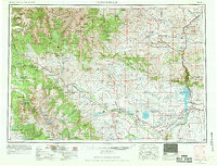
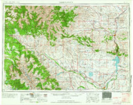
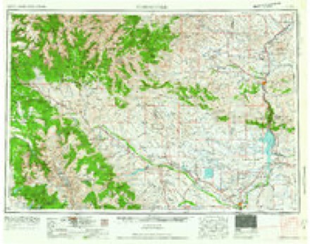
5 surveys from 8 printed sheetsMatched by testing this settlement's coordinate against the published boundary of every sheet in the United States Geological Survey's historical collection. Each opens the scanned sheet at the Survey.
- 1951 USGS Riverton West quadrangle1:24000
- 1955 USGS Thermopolis quadrangle1:250000, 2 printings
- 1958 USGS Thermopolis quadrangle1:250000, 2 printings
- 1959 USGS Riverton West quadrangle1:24000, 2 printings
- 1962 USGS Thermopolis quadrangle1:250000
Fires near this place
276 since 2000Regional context, not property-specific evidence. The federal wildfire occurrence database lists 276 fires within 5 miles of Riverton between 2000 and 2020, burning about 390 acres in total. 2 started naturally. None was recorded as arson. Distance is straight-line from the map coordinates, so a fire counted here may appear on a neighbouring settlement's page as well.
| Reported cause | Fires |
|---|---|
| Missing data/not specified/undetermined | 89 |
| Debris and open burning | 86 |
| Misuse of fire by a minor | 39 |
| Fireworks | 34 |
| Equipment and vehicle use | 8 |
| Recreation and ceremony | 8 |
| Smoking | 5 |
| Other causes | 2 |
| Natural | 2 |
| Power generation/transmission/distribution | 2 |
| Railroad operations and maintenance | 1 |
The most recent of them, most recent first, with the day each was reported and the service that recorded it.
| Date | Cause | Size | Reported by | Name on the report |
|---|---|---|---|---|
| 9 September 2019 | Missing data/not specified/undetermined | under an acre | Fremont County | 2019-154 |
| 28 September 2009 | Misuse of fire by a minor | 1.0 acres | Wyoming State Forestry | not named |
| 27 September 2020 | Misuse of fire by a minor | under an acre | Fremont County | 2020-214 |
| 24 September 2018 | Debris and open burning | 1.0 acres | Fremont County | 2018-193 |
| 24 September 2015 | Smoking | under an acre | Wind River Agency | BEAVER CREEK 2 |
| 23 September 2012 | Equipment and vehicle use | under an acre | Wind River Agency | TOBACCO |
| 22 September 2012 | Other causes | under an acre | Wind River Agency | GAS HILLS |
| 20 September 2020 | Missing data/not specified/undetermined | under an acre | Fremont County | 2020-212 |
Settlements close enough to share some of these fires:
Mines and quarries near this place
3 within 5 milesRegional context, not property-specific evidence. The federal mineral resources record lists 3 workings within 5 miles of Riverton: 2 producers, 1 past producer. 2 still produce. What was taken out: Sand and Gravel, Construction, Gemstone. Distance is straight-line from the map coordinates, so a quarry counted here may appear on a neighbouring settlement's page as well.
| Where | Site | Commodity | Status | Recorded |
|---|---|---|---|---|
| Fremont Jade Quarry | Gemstone | Past Producer | ||
| Crusher No. 1-35 | Sand and Gravel, Construction | Producer | ||
| Riverton Pit | Sand and Gravel, Construction | Producer |
Storms near this place
60 of 65 shownRegional context, not property-specific evidence. The National Weather Service names Riverton in 65 storm reports between 1997 and 2025: 27 hail, 18 thunderstorm wind, 13 flood, 5 flash flood. The reports record 1 death. Each account below is quoted exactly as the forecast office filed it, from the NOAA Storm Events Database, and each date opens the federal record of that event.
| When | Event | Place named | Harm | What the report says |
|---|---|---|---|---|
| February 2017 | Flood | Riverton | 1 killed, $10,000 | Law enforcement reported flooding ditches and sheet flooding north of Riverton on the evening of February 21st. A 33-year old man fell into the flood waters and drowned. A Coroners report noted that the man was under the influence of alcohol, marijuana, amphetamines and anti-depressants. |
| July 2009 | Flash Flood | Riverton | $500,000 | Rainfall estimated at 1 to 2.5 inches fell in about 30 minutes along Gas Hills Road. WYDOT engineers reported 500 feet of shoulder was eroded from the road due to running water near mile marker 6.5. Two culverts in the area could not handle the extreme volume of water. Approximately three to four feet of the shoulder and road surface was swept away leaving a vertical drop of 12 to 14 feet. Witnesses said three feet of water was above the road surface along a quarter-mile stretch of the road for several hours. |
| June 2011 | Flood | Riverton | $415,000 | Melting snow caused the Wind River at Dubois to reach flood stage early on the morning of Friday, June 24. The flood waters surrounded sandbagged homes, inundating yards and a local campground. Continued snowmelt above the 9,000 foot elevation initiated a second surge of water toward the end of the month and early July.||Downstream the river rose several feet as other tributaries brought additional water to the Wind River. Also, increased water releases from the Bureau of Reclamation's Bull Lake Dam, which was quickly filling, allowed for additional water to reach the river channel. The Wind River gauge at Crowheart reached at least 10.86 feet during the early evening of Thursday, June 30, before failing. The Wind River flowed into its old river channel downstream of the Crowheart gauge. This caused water to surround several homes near the U.S. Highway 26 Wind River bridge crossing between Diversion Dam and Morton. Rising water overtopped and subsequently closed a good portion of a one mile section of the highway between mileposts 104 and 105. Traffic was diverted around this closure for most of the next week.||Through late June most of the flooding impacted farm and pasture land near the river from the Johnstown Bridge to Hidden Valley near Boysen Dam. Gauges on this stretch of river at Kinnear and Riverton continued to climb in early July. Similarly, the Little Wind River at Riverton also climbed above flood stage on June 30 and continued to rise during the first few days of July. High waters on tributaries of the Little Wind coupled with record flows on the Wind River created flooding near the confluence with the Wind River. |
| June 2011 | Lightning | Riverton | $200,000 | no account filed |
| July 2011 | Flood | Riverton | $100,000 | Flood waters continued to travel down the Wind River through Fremont County in early July. Continued mountain temperatures in the 60s and lower 70s allowed for an unprecedented late-season snowpack to rapidly melt. This active snowmelt quickly filled creeks, streams, and smaller reservoirs feeding the Wind River. The result was record and near record flows on the Wind River from Dubois to Riverton.||The river crested at 5.59 feet in Dubois around 0600MST on Friday, July 1. This was just short of the 5.66 foot record set in June 1956. Flow at the Dubois gauge was calculated at nearly 2,000 cfs. Homes near the river in Dubois were surrounded by water but, other than crawl spaces, no homes were flooded.||Farther downstream at Kinnear the river rose to a record height of 9.69 feet at 0130MST on Saturday, July 2. This reading easily surpassed the previous record of 8.97 feet set in June 1997. Flow on the morning of the 2nd measured 13,586 cfs. Farm and pasture land near the river was completely inundated, in some cases 1/4 to 1/2 mile away from the main channel.||The peak river stage of 11.80 feet occurred on the Wind River at Riverton at 1000MST on July 2. This stage completely shattered by nearly one foot the previous record set in June 1997. Peak flow was measured at 11,759 cfs. Water inundated the Riverton Rendezvous site between Friday and Saturday and disrupted the annual rendezvous. Otherwise, flooding was confined to farm and pasture land, which was particularly pronounced on the east side of Riverton north to Hidden Valley. Flooding of the Little Wind River near the confluence with the Wind River produced much of the same in terms of lowland flooding. The Little Wind River crested just short of 9.0 feet early on July 2, nearly one foot above flood stage. The river fell below flood stage early on Sunday, July 3, following the passage of the Wind River crest wave through Riverton. |
| July 2009 | Flash Flood | Riverton | $25,000 | Measured rainfall in Riverton ranged from 0.99 inches to 1.58 inches in a span of 20 to 40 minutes. Storm drains could not keep up with the intense rain which produced two to three feet of standing water at the intersection of Federal Boulevard and Monroe Avenue and nearby parking lots. Other impacted streets in Riverton included North 8th West, East Pershing, and North 16th Street. |
| April 2006 | Thunderstorm Wind | Riverton | $15,000 | no account filed |
| August 2007 | Thunderstorm Wind | Riverton | $10,000 | no account filed |
| June 2011 | Thunderstorm Wind | Riverton | $5,000 | Two large healthy trees were blown onto a building causing minor damage. |
| July 2012 | Thunderstorm Wind | Riverton | $1,000 | An individual with an automated weather station measured a wind gust of 84 mph on the northwest side of Riverton. A 15-foot-tall tree was uprooted at the same location. |
| June 2011 | Thunderstorm Wind | Riverton | $1,000 | A large spruce tree fell onto the US Bank building with minor damage reported. |
| August 2007 | Thunderstorm Wind | Riverton | $1,000 | A large window was blown-out of a house from thunderstorm wind. |
| June 2011 | Thunderstorm Wind | Riverton | $500 | Wind damaged a door at the local Wal-Mart. |
| July 2025 | Thunderstorm Wind | Riverton | - | An onsite weather station at the Riverton weather office reported wind a 58 mph wind gust. |
| August 2024 | Hail | Riverton | - | A retired National Weather Service meteorologist reported quarter size hail along Gas Hills Road to the east of Riverton. Hail covered the road to a depth of 1 to 2 inches in some locations. |
| June 2023 | Flood | Riverton | - | Minor flooding occurred along the Wind River near Riverton. The flooding remained in low lying areas near the river and caused no damage. |
| May 2023 | Hail | Riverton | - | A trained spotter reported 1 inch hail along Gas Hills Road to the east of Riverton. |
| June 2022 | Flood | Riverton | - | The Wind River at Riverton, WY peaked around 10 feet. The flood remained over low-lying areas near the river and caused no known damage. |
| May 2020 | Hail | Riverton | - | An off duty NWS Employee reported nickel sized hail near Riverton, Wyoming. |
| July 2018 | Hail | Riverton | - | A National Weather Service employee reported nickel size hail west of Riverton near the Riverton Country Club. |
| February 2017 | Flood | Riverton | - | A combination of rapid snow melt from a chinook wind and ice jams caused the Little Wind River near Riverton to rise to 10.8 feet, 2.8 feet above flood stage. The water for the most part remained in low lying areas and caused little damage. |
| June 2015 | Flood | Riverton | - | Minor flooding occurred along the Wind River near Riverton. The river crested to 9.12 feet at 0345MST on Wednesday, June 3. Heavy rain of the previous week and increased snowmelt run-off combined to cause the high water. The flooding only impacted lowlands nearest the river on the south side of Riverton. |
| June 2015 | Hail | Riverton | - | An off-duty NWS Meteorologist reported penny sized hail covering Gas Hills Road to a depth of one inch. |
| June 2015 | Flood | Riverton | - | The gauge on the Wind River near Riverton briefly crested at 9.10 feet at 2330MST on Wednesday, June 17. No damage was reported as the flooding only impacted bottomland nearest the river. |
| June 2015 | Flood | Riverton | - | The Wind River gauge near Riverton was above flood stage for over a week because of run-off from melting snow and recent rainfall. Water levels fluctuated each day with the daily peak occurring during the early to mid morning hours. The river crested at 10.27 feet at 0700MST on Friday, June 12. |
| May 2014 | Flood | Riverton | - | Water from melting snow traveled down the main stem of the Wind River to Riverton and produced minor flooding. The river gauge at Riverton climbed above flood stage of 9.0 feet late on Wednesday, May 28. The river hovered around or just above flood stage through the end of the month. The peak stage was 9.52 feet between 0415 and 0430MST on May 31. The flooding only impacted lowland areas nearest the river. |
| June 2014 | Hail | Riverton | - | Numerous trained spotters reported penny to nickel sized hail in and around Riverton. |
| June 2014 | Flood | Riverton | - | Cooler air behind a cold front and a decreasing mountain snowpack helped the Wind River recede to below flood stage of 9.0 feet at 0645MST on Sunday, June 1. The only areas impacted by the flood waters were lowlands nearest the river. |
| September 2013 | Hail | Riverton | - | Several reports of penny sized hail were received from the east side of Riverton. |
| May 2012 | Thunderstorm Wind | Riverton | - | Strong thunderstorm outflow caused minor damage to displays and collapsible awnings at the Walmart Outdoor Expo where NWS employees were staffing an outreach booth. |
| June 2011 | Thunderstorm Wind | Riverton | - | An off-duty NWS employee recorded a 62 mph wind gust on his home weather station. |
| June 2009 | Hail | Riverton | - | Hail up to 1.50 inches in diameter was measured by a storm chaser. |
| August 2009 | Hail | Riverton | - | Hailstones of penny to nickel size fell on the city of Riverton for a little more than 10 minutes. |
| June 2009 | Thunderstorm Wind | Riverton | - | Thunderstorm winds were estimated at 55 to 65 mph along State Highway 135 near Sand Draw. |
| August 2009 | Hail | Riverton | - | Hail of penny to quarter size, with some slightly larger than one inch in diameter, fell for about 10 minutes at a residence near Riverton. |
| July 2008 | Hail | Riverton | - | One inch diameter hail fell at the Riverton Little League Ball Field shortly before a planned end-of-the-season fireworks show. |
| July 2008 | Hail | Riverton | - | A thunderstorm that strengthened rapidly over downtown Riverton produced 0.75 to 0.88 inch diameter hail and a quick half-inch of rain. |
| July 1998 | Thunderstorm Wind | Riverton | - | Large tree limbs down |
| June 2020 | Flood | Riverton | - | no account filed |
| June 2006 | Hail | Riverton | - | no account filed |
| June 2005 | Thunderstorm Wind | Riverton | - | no account filed |
| September 2005 | Hail | Riverton | - | no account filed |
| June 2004 | Thunderstorm Wind | Riverton | - | no account filed |
| August 2003 | Hail | Riverton | - | no account filed |
| August 2003 | Hail | Riverton | - | no account filed |
| August 2003 | Hail | Riverton | - | no account filed |
| August 2003 | Hail | Riverton | - | no account filed |
| August 2003 | Hail | Riverton | - | no account filed |
| August 2003 | Hail | Riverton | - | no account filed |
| June 2003 | Hail | Riverton | - | no account filed |
| July 2002 | Hail | Riverton | - | no account filed |
| July 2002 | Thunderstorm Wind | Riverton | - | no account filed |
| July 2002 | Thunderstorm Wind | Riverton | - | no account filed |
| June 2002 | Thunderstorm Wind | Riverton | - | no account filed |
| June 2001 | Hail | Riverton | - | no account filed |
| June 2000 | Hail | Riverton | - | no account filed |
| June 2000 | Hail | Riverton | - | no account filed |
| June 1998 | Thunderstorm Wind | Riverton | - | no account filed |
| June 1998 | Hail | Riverton | - | no account filed |
| September 1998 | Flood | Riverton | - | no account filed |
Nearest settlements
The eight closest, with where each one stands in the county. Distances are straight-line, computed from the Geographic Names Information System coordinates.
Elsewhere
Matched on this settlement's Geographic Names Information System number rather than its name, so it cannot be a different place of the same name in another state.
| Wikipedia article on Riverton | An encyclopaedic summary. Its text is share-alike, so it is linked here rather than copied. |
| Wikidata item Q603240 | The structured record the population and elevation above come from. Public domain (CC0). |
Provenance
This settlement is recorded in the Geographic Names Information System as feature 1593489. The sheet list is computed by point-in-boundary test against the United States Geological Survey's historical topographic inventory. Both are works of the United States government and carry no copyright under 17 U.S.C. 105.
Wildfire. Short, Karen C. 2022. Spatial wildfire occurrence data for the United States, 1992-2020 [FPA_FOD_20221014]. 6th Edition. Fort Collins, CO: Forest Service Research Data Archive. https://doi.org/10.2737/RDS-2013-0009.6 Collected with United States Government funding and usable without additional permissions or fees.
Mines and quarries. USGS Mineral Resources Data System (MRDS) https://mrdata.usgs.gov/mrds/ A work of the United States government, no copyright under 17 U.S.C. 105.
Storms. NOAA National Centers for Environmental Information, Storm Events Database https://www.ncei.noaa.gov/stormevents/ A work of the United States government, no copyright under 17 U.S.C. 105. Narratives are quoted verbatim from the National Weather Service report and are not edited or summarised.