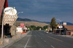
Block
From the record
31 National Register listings published here, 1 of them a National Historic Landmark.
Sources: the county history on the Internet Archive · the National Register database, National Park Service
147 topographic sheets cover 42 settlements here, and 31 properties are on the National Register of Historic Places.
31 National Register listings published here, 1 of them a National Historic Landmark.
Sources: the county history on the Internet Archive · the National Register database, National Park Service
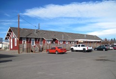
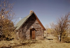
Every property in this county listed on the National Register of Historic Places, with the year it was listed and the federal nomination document.
Every wildfire the federal occurrence database records inside this county: 2,848 of them, burning about 301,526 acres. 479 started naturally and 69 were recorded as arson. Each settlement page carries the fires within five miles of it.
| Reported cause | Fires |
|---|---|
| Debris and open burning | 835 |
| Missing data/not specified/undetermined | 572 |
| Natural | 479 |
| Recreation and ceremony | 254 |
| Fireworks | 207 |
| Smoking | 149 |
| Misuse of fire by a minor | 130 |
| Equipment and vehicle use | 101 |
| Arson/incendiarism | 69 |
| Power generation/transmission/distribution | 23 |
| Railroad operations and maintenance | 15 |
| Other causes | 10 |
| Firearms and explosives use | 4 |
The five largest, by the area the report gives. None of them was recorded as arson.
| Date | Cause | Size | Reported by | Name on the report |
|---|---|---|---|---|
| 7 August 2000 | Natural | 137,069 acres | Wind River Agency | KATES BASIN |
| 9 August 2012 | Natural | 45,877 acres | Shoshone National Forest | ALPINE LAKE |
| 23 July 2011 | Natural | 24,237 acres | Shoshone National Forest | NORTON POINT |
| 30 June 2002 | Natural | 15,000 acres | Wind River Agency | SOUTHFRKII |
| 11 July 2016 | Natural | 14,651 acres | Shoshone National Forest | LAVA MOUNTAIN |
| 24 August 2002 | Natural | 13,433 acres | Shoshone National Forest | PASS CREEK |
| 3 July 2012 | Natural | 6,493 acres | Bridger-Teton National Forest | BEAR CUB |
| 31 July 2001 | Smoking | 2,432 acres | Shoshone National Forest | DINWOODY |
Every settlement page carries the fires within five miles of it - see the settlement index below.
The NOAA Storm Events Database holds 452 reports for this county, causing 2 deaths, 5 injuries and about $20,885,000 in recorded property damage. Each settlement page carries the reports that name it.
| Kind of event | Reports |
|---|---|
| Thunderstorm Wind | 207 |
| Hail | 136 |
| Flood | 44 |
| Tornado | 22 |
| Flash Flood | 22 |
| Funnel Cloud | 10 |
| Wildfire | 6 |
| Lightning | 4 |
| Heavy Rain | 1 |
The most serious of them, by death, then injury, then recorded damage. The accounts are quoted exactly as the forecast office filed them.
| When | Event | Place named | Harm | What the report says |
|---|---|---|---|---|
| February 2017 | Flood | Riverton | 1 killed, $10,000 | Law enforcement reported flooding ditches and sheet flooding north of Riverton on the evening of February 21st. A 33-year old man fell into the flood waters and drowned. A Coroners report noted that the man was under the influence of alcohol, marijuana, amphetamines and anti-depressants. |
| July 2023 | Thunderstorm Wind | (Lnd)Hunt Fld Lander | 1 killed | A line of thunderstorms moved eastward across the Wind River Basin and Lander Foothills and brought high wind gusts. The maximum gust reported was 69 mph at the Riverton airport. Other notable gusts included 66 mph at the Lander airport and 58 mph at Shoshoni. There were numerous reports of large tree limbs blown down in Riverton with the strong wind. On Ocean Lake near Riverton WY, a kayak was capsized and two men were thrown into the water. One was rescued by a nearby boater, but the other could not be found and was presumed dead by the Fremont County Sheriff (Sheriff Office press release from July 5, 2023). |
| June 1967 | Tornado (F2) | not stated | 2 hurt, $250 | no account filed |
| June 1967 | Tornado (F1) | not stated | 1 hurt, $25,000 | no account filed |
| May 2008 | Tornado (EF0) | Dubois | 1 hurt, $10,000 | A brief tornado occurred just north of the central business district in Dubois. A roof was torn from a public restroom facility and subsequently sheared off an 8x8-inch pole used for a sign at a local business. Flying debris also smashed a large window at a nearby residence. The broken glass slightly injured one woman in the home. |
| June 2012 | Lightning | Milford | 1 hurt | Lightning injured a 25-year-old man when it struck next to him as he was helping set a manufactured home north of Lander. The man was on his hands and knees on wet ground when the bolt struck near him and traveled through his body around 1300MST. The bolt exited his back leaving a large blister and he was hospitalized for three days as a result. After returning home the man was still experiencing chest pain, blurry eyesight, and pain in his extremities. |
| June 2010 | Flood | Sinks Canyon Sp | $12,000,000 | Heavy snow and cool temperatures in May allowed snowpack to remain at unseasonably high levels across the southern end of the Wind River Range. With over 100 years of weather records, the month of May 2010 ranked as the third coldest at Riverton and tied as the fifth coldest at Lander, both neighboring basin towns. The first warm stretch of the early summer season came on June 2, 3, and 4, as basin temperatures finally climbed into the 70s. In turn, the large snowpack begin a rapid melt that quickly inundated area rivers and streams.||The Middle Fork of the Popo Agie River experienced a rapid rise on Friday afternoon, June 4. The rising waters caused flooding by late evening in the Popo Agie Ranch Estates subdivision south of Lander. Neighbors assisted each other with sandbagging efforts as the water rose through the evening hours. By mid-morning Saturday, June 5, water was causing flooding downstream to the town of Hudson at the confluence of the Middle Fork and Little Popo Agie rivers. Homeowners on the town's west side and farmers and ranchers upstream of Hudson frantically worked to sandbag areas that were not yet inundated by the rapidly rising waters.||Snow continued to melt through the weekend and into Monday, June 7, further exacerbating the flooding. The Mortimore Lane bridge south of Lander was effectively rendered unusable by late morning, June 7. At least five other private bridges in the area were destroyed, as well. Campgrounds in Sinks Canyon State Park were flooded as were Fremont and Third streets in Lander. The Wyoming governor declared all of Fremont County a disaster area on June 7. The Middle Fork of the Popo Agie River near Lander finally crested at 7.50 feet around 2230MST on June 7. This was short of the record of 7.69 feet achieved in June 1963.||As water begin to recede along the Middle Fork, the attention shifted to areas downstream along the Little Wind River. Water levels near the confluence of the Popo Agie and Little Wind rivers around Arapahoe caused 14 homes and several roads to be damaged in that area. A private campground and the historic 1838 Rendezvous site near Riverton were flooded. Farther west along the Little Wind River, the safety of the 17 Mile Road bridge was compromised as the water rose to a record crest. Around 0045MST Wednesday, June 9, the Little Wind River topped out at 11.91 feet, completely shattering the previous record crest of 10.9 feet set in June 1963.||In the end, over 32 square miles of land was impacted by the flood waters, including 38 homes. None of the homes were destroyed. The Wyoming National Guard deployed 400 soldiers to assist in the flood fighting efforts at the peak of the event and over 400,000 sandbags were used. The president declared the county a disaster area on July 14. Public infrastructure damage totaled at least $7.6 million and flood response efforts were estimated at $1.6 million. |
| June 2023 | Hail | St Stephens | $3,000,000 | There were numerous reports of quarter to golf ball size hail in around around Riverton, with the largest hail stones reported on the east side of Riverton. Many vehicles sustained windshield and body damage from the hail. Dozens of homes on the east side of Riverton had roof shingle damage, with roof replacements occurring regularly over the next 4 months. |
| June 2017 | Flood | (Riw)Riverton Rgnl A | $2,000,000 | Abnormally large snowpack melted across the mountains of western and central Wyoming and caused the Wind River to Flood. At the Gauge at Riverton, the river crested above 12 feet, a new record. Along the Riverton Irrigation Canal, the water got high enough to flow directly into the canal, threatening the city of Riverton with flooding. The canal had to be breached to prevent the flooding. As a result, many farmers along the canal were left without irrigation water into July. The repairs to the canal cost around an estimated $2 million dollars. In addition, there was extensive flooding of agricultural land along the Wind River to it's confluence with the Little Wind River. |
| May 2016 | Flood | Sweetwater Station | $1,200,000 | Widespread heavy rain of 2.50 to 4.50 fell in a broad swath across Fremont County during a 48-hour period from Friday evening, May 6, through Sunday evening, May 8. There was a peak rainfall amount of 6.88 at a rain gauge about 6 miles west of Fort Washakie on the Little Wind River. The heavy rain fell over the lower elevations of the Wind River Basin and in the lower foothills of the Wind River Range.||The heaviest rainfall occurred between 1900MST Friday, May 6, and 1700MST Saturday, May 7. The rain gauge at Lander Hunt Field reported 3.82 in this 22-hour period, with 1.12 falling between 0800MST and 1100MST Saturday. The heavy rainfall contributed to significant rises along the Little Wind River and its tributaries, particularly the Little Popo Agie River through Lyons Valley. The rapid river rises produced substantial flooding from Lyons Valley, to Hudson, to Arapahoe.||Overland flow was a significant contributor to the rapidly rising rivers. Recent rains had left soils relatively wet, so as rainfall piled up on Saturday morning water began to flow across fields, overwhelm ditches, and fill ravines. These waters made their way to the larger rivers and quickly filled them. By early Saturday afternoon, there were reports of water covering low-lying areas of roads north and northwest of Lander. The rain was so heavy that water seeped through the walls at the hospital in Lander prompting the evacuation of patients. Some basement flooding was reported in residential areas of Lander. By mid-afternoon Saturday, reports were received of flood waters on the Little Popo Agie River surrounding homes in Lyons Valley. Several rural roads were either covered with water or damaged by the flood waters in the valley. The flood waters on this tributary combined with the already high water on the Popo Agie River to cause water levels to surge in Hudson late Saturday evening and early Sunday morning. The subsequent flooding damaged or destroyed several mobile homes along the river on the west side of Hudson. Sunday afternoon saw the retreat of water levels on these rivers with a subsequent decrease in flood-related problems.||Multiple tributaries and overland flow to small creeks, streams, and ditches quickly filled the Little Wind River near Arapahoe downstream to around Riverton. The river topped flood stage of 8 feet at 0605MST Sunday, May 8, and climbed about 1 foot every three to four hours during the morning and early afternoon. The river crested at 10.19 feet between 1545MST and 1600MST Sunday as residents along the river scrambled to fill sandbags and move property to a safer location. Flood waters on the Little Wind River retreated slowly on Monday, May 9, before falling below flood stage at 0120MST on Tuesday, May 10. The river fell below action stage by the end of Tuesday. |
| July 2009 | Flash Flood | Riverton | $500,000 | Rainfall estimated at 1 to 2.5 inches fell in about 30 minutes along Gas Hills Road. WYDOT engineers reported 500 feet of shoulder was eroded from the road due to running water near mile marker 6.5. Two culverts in the area could not handle the extreme volume of water. Approximately three to four feet of the shoulder and road surface was swept away leaving a vertical drop of 12 to 14 feet. Witnesses said three feet of water was above the road surface along a quarter-mile stretch of the road for several hours. |
| June 2011 | Flood | Riverton | $415,000 | Melting snow caused the Wind River at Dubois to reach flood stage early on the morning of Friday, June 24. The flood waters surrounded sandbagged homes, inundating yards and a local campground. Continued snowmelt above the 9,000 foot elevation initiated a second surge of water toward the end of the month and early July.||Downstream the river rose several feet as other tributaries brought additional water to the Wind River. Also, increased water releases from the Bureau of Reclamation's Bull Lake Dam, which was quickly filling, allowed for additional water to reach the river channel. The Wind River gauge at Crowheart reached at least 10.86 feet during the early evening of Thursday, June 30, before failing. The Wind River flowed into its old river channel downstream of the Crowheart gauge. This caused water to surround several homes near the U.S. Highway 26 Wind River bridge crossing between Diversion Dam and Morton. Rising water overtopped and subsequently closed a good portion of a one mile section of the highway between mileposts 104 and 105. Traffic was diverted around this closure for most of the next week.||Through late June most of the flooding impacted farm and pasture land near the river from the Johnstown Bridge to Hidden Valley near Boysen Dam. Gauges on this stretch of river at Kinnear and Riverton continued to climb in early July. Similarly, the Little Wind River at Riverton also climbed above flood stage on June 30 and continued to rise during the first few days of July. High waters on tributaries of the Little Wind coupled with record flows on the Wind River created flooding near the confluence with the Wind River. |
| June 1986 | Tornado (F2) | not stated | $250,000 | no account filed |
| August 1980 | Tornado (F1) | not stated | $250,000 | no account filed |
| July 2007 | Flash Flood | Lander | $200,000 | A thunderstorm produced 1.70 inches of rain in less than 30 minutes in Red Canyon. The learning center at Red Canyon Ranch was inundated with six inches of mud and water causing extensive damage. The mud, rock, and water also flooded a barn, shop, and several corrals at the ranch. Red Canyon Creek and other small tributaries were out of their banks. Road damage on the ranch was widespread. The county portion of Red Canyon Road was covered with a three-foot-deep mud flow which closed the road for much of the next week. At least one nearby residence sustained damage to a basement and destruction of their backyard landscaping due to a mud and water flow. |
| June 2011 | Lightning | Riverton | $200,000 | no account filed |
| February 2017 | Flood | Hudson | $100,000 | Chinook winds caused rapid snow melt in the Lander Foothills that brought rapid snow melt. The warm temperatures caused rapid snow melt that rapidly increased river levels. In addition, the frozen Little Popo Agie and Popo Agie rivers broke up rapidly and ice jams caused flooding of the flood prone areas in Lyons Valley. Many homes in the flood prone north and west sides of towns along with surrounding low lying areas were flooded. Many of the side roads in the aforementioned areas of Hudson also saw flooding and minor wash outs. |
| July 2011 | Flood | Riverton | $100,000 | Flood waters continued to travel down the Wind River through Fremont County in early July. Continued mountain temperatures in the 60s and lower 70s allowed for an unprecedented late-season snowpack to rapidly melt. This active snowmelt quickly filled creeks, streams, and smaller reservoirs feeding the Wind River. The result was record and near record flows on the Wind River from Dubois to Riverton.||The river crested at 5.59 feet in Dubois around 0600MST on Friday, July 1. This was just short of the 5.66 foot record set in June 1956. Flow at the Dubois gauge was calculated at nearly 2,000 cfs. Homes near the river in Dubois were surrounded by water but, other than crawl spaces, no homes were flooded.||Farther downstream at Kinnear the river rose to a record height of 9.69 feet at 0130MST on Saturday, July 2. This reading easily surpassed the previous record of 8.97 feet set in June 1997. Flow on the morning of the 2nd measured 13,586 cfs. Farm and pasture land near the river was completely inundated, in some cases 1/4 to 1/2 mile away from the main channel.||The peak river stage of 11.80 feet occurred on the Wind River at Riverton at 1000MST on July 2. This stage completely shattered by nearly one foot the previous record set in June 1997. Peak flow was measured at 11,759 cfs. Water inundated the Riverton Rendezvous site between Friday and Saturday and disrupted the annual rendezvous. Otherwise, flooding was confined to farm and pasture land, which was particularly pronounced on the east side of Riverton north to Hidden Valley. Flooding of the Little Wind River near the confluence with the Wind River produced much of the same in terms of lowland flooding. The Little Wind River crested just short of 9.0 feet early on July 2, nearly one foot above flood stage. The river fell below flood stage early on Sunday, July 3, following the passage of the Wind River crest wave through Riverton. |
| July 2019 | Flash Flood | Burris | $75,000 | A second day of slow moving thunderstorms brought a second day of mud and water flowing across US 20 26 southeast of Dubois. The Wyoming Department of Transportation was once again called out to clear mud and debris from the road. A nearby resident had two culverts damaged on his property as well as roads and landscaping. |
| July 2001 | Wildfire | Lander | $70,000 | no account filed |
| September 2013 | Thunderstorm Wind | (Riw)Riverton Rgnl A | $50,000 | A 40x50 foot pole barn was ripped from its foundation and destroyed at a Missouri Valley ranch north of Riverton. Two nearby trees were toppled and blocked one lane of Paradise Valley Road. |
| July 2007 | Flash Flood | Dubois | $50,000 | Heavy rainfall of over one inch fell in about 30 minutes on the west side of Dubois. Hardest hit were locations between the golf course and U.S. Highway 26. Culverts were unable to handle the heavy rain, so water flowed over the top of at least one road. Overflowing washes created temporary waterfalls pushing water and mud across Ramshorn Street (U.S. Highway 26 in Dubois). A gas station along Warm Springs Drive reported two inches of mud and water inside the associated convenience store. An antique pool table store had over one-half foot of water inside. The Dubois cooperative observer recorded 1.39 inches of rainfall during the storm. This set an all-time daily precipitation record for the station, which has recorded weather observations for nearly 90 years. |
| July 2009 | Lightning | Sand Draw | $40,000 | Lightning struck four tanks about 15 miles southeast of Riverton causing two to explode and all to rupture. Contents of the containers were spilled on the ground during the incident. |
| May 2023 | Thunderstorm Wind | Boysen State Park | $25,000 | Very strong winds occurred with a thunderstorm outflow gust front on Boysen Reservoir As the gust front hit the northeastern shore near the marina, the winds tipped several campers setup at a campground, at least two of which were severely damaged. The winds also blew a carport over 100 yards. A NWS storm survey determined that straight line wind speeds of 70 to 80 mph likely caused the damage. No injuries were reported with this event. |
| July 2009 | Hail | Kinnear | $25,000 | Penny sized hail accumulated to a depth of three or four inches along U.S. Highway 26 and nearby areas. The combination of rain and accumulating hail destroyed at least 200 tons of hay in fields around Kinnear. |
| July 2009 | Flash Flood | Riverton | $25,000 | Measured rainfall in Riverton ranged from 0.99 inches to 1.58 inches in a span of 20 to 40 minutes. Storm drains could not keep up with the intense rain which produced two to three feet of standing water at the intersection of Federal Boulevard and Monroe Avenue and nearby parking lots. Other impacted streets in Riverton included North 8th West, East Pershing, and North 16th Street. |
| June 2008 | Flood | Lost Cabin | $25,000 | Flood waters from Elkhorn Creek damaged Strube Loop Road and inundated neighboring areas to a depth of two feet across a 30-foot wide swath. Some buildings at the Lion's Camp on Casper Mountain sustained damage. During the afternoon, Elkhorn Creek was reported to be 50 yards wide and two feet deep in spots. The creek eventually flooded portions of two fairways at Casper Country Club as the waterway emptied down the north-face of Casper Mountain. |
| August 1973 | Tornado (F2) | not stated | $25,000 | no account filed |
| June 1968 | Tornado (F1) | not stated | $25,000 | no account filed |
| April 1964 | Tornado (F1) | not stated | $25,000 | no account filed |
| July 2025 | Flash Flood | Moneta | $20,000 | WYDOT employee reported water was 4 feet deep flowing across the highway near Frenchie Draw. Water was on road for about 2 hours, which was the length of the closure. Damages estimated. |
| February 2017 | Flood | (Lnd)Hunt Fld Lander | $20,000 | Chinook winds warmed temperatures into the 50s early in the morning on the 10th and caused rapid snow melt that caused flooding in Lander. The flooding was concentrated around Baldwin Creek. Highway 287 between Lander and Fort Washakie was shut down for several hours. Water also flooded Smith Road, Main Street and Tweed Lane at times. Water surrounded some homes and forced a few evacuations. A few businesses as well as the Lander Museum experienced minor flooding during the event. |
| June 2009 | Thunderstorm Wind | Morton | $20,000 | Measured wind gusts of 57 to 61 mph lifted a 16x40 foot metal structure which was staked to the ground and tossed it 60 to 70 feet downwind. |
| April 2006 | Thunderstorm Wind | Riverton | $15,000 | no account filed |
| May 2014 | Tornado (EF1) | Midvale | $12,000 | A tornado was observed near Sand Mesa Road in northern Fremont County. Several power poles were toppled as the tornado traveled northeast toward a rural ranch before dissipating. |
| August 2021 | Thunderstorm Wind | (Lnd)Hunt Fld Lander | $10,000 | A maximum wind gust of 79 mph was measured by the ASOS at Hunt Field in Lander. Numerous limbs were downed in the city of Lander. There was damage report to one large metal-sided structure on the west side of town. |
| July 2009 | Thunderstorm Wind | (Riw)Riverton Rgnl A | $10,000 | Thunderstorm wind gusts measured as high as 74 mph caused damage to more than a dozen mature trees at the Riverton Country Club. A 40-foot spruce tree was toppled and several limbs up to nine inches in diameter were brought down during the storm. Rainfall of one-half inch to upwards of one inch came down in sheets. The storm generally followed Riverview Road on the south side of U.S. Highway 26. One rancher claimed it was the hardest he had seen it rain in his 35 years at his location near Kinnear. |
| July 2007 | Thunderstorm Wind | Lander | $10,000 | Gables on a pole barn under construction were destroyed on Iiams Road. A home under construction near U.S. Highway 287 and Lyons Valley Road was toppled. |
| August 2007 | Thunderstorm Wind | Riverton | $10,000 | no account filed |
| May 2006 | Thunderstorm Wind | (Riw)Riverton Rgnl A | $7,500 | no account filed |
| July 2024 | Thunderstorm Wind | (Lnd)Hunt Fld Lander | $5,000 | A severe thunderstorm moved from Lander to Hudson and brought high winds, including a maximum wind gust of 67 mph at the Lander airport. The wind blow a tree on a truck at the Lander courthouse. In Hudson, numerous trees were uprooted or snapped. |
| June 2012 | Thunderstorm Wind | Crowheart | $5,000 | An automated sensor at Crowheart recorded a thunderstorm wind gust of 81 mph. The storm damaged several healthy trees, snapping off six to eight inch diameter limbs. |
| June 2011 | Thunderstorm Wind | Riverton | $5,000 | Two large healthy trees were blown onto a building causing minor damage. |
| June 1968 | Tornado (F1) | not stated | $2,500 | no account filed |
| June 1962 | Tornado (F3) | not stated | $2,500 | no account filed |
| September 2012 | Thunderstorm Wind | St Stephens | $2,000 | A severe thunderstorm produced damaging wind at a local golf course and at the home of an NWS employee. |
| September 2013 | Thunderstorm Wind | Midvale | $1,000 | The public reported a downed power line down near the intersection of 8 Mile and Missouri Valley roads. A well house was also blown down. |
| July 2012 | Thunderstorm Wind | Ft Washakie | $1,000 | A strong thunderstorm produced wind that snapped healthy branches two to three inches in diameter off trees north of Fort Washakie. |
| July 2012 | Thunderstorm Wind | Pavillion | $1,000 | Strong wind snapped healthy tree branches up to two inches in diameter in the town of Pavillion. |
| July 2012 | Thunderstorm Wind | Kinnear | $1,000 | Many healthy tree branches up to three inches in diameter were snapped off by strong wind at a home north of Kinnear. |
| July 2012 | Thunderstorm Wind | Riverton | $1,000 | An individual with an automated weather station measured a wind gust of 84 mph on the northwest side of Riverton. A 15-foot-tall tree was uprooted at the same location. |
| June 2011 | Thunderstorm Wind | Riverton | $1,000 | A large spruce tree fell onto the US Bank building with minor damage reported. |
| August 2007 | Thunderstorm Wind | Riverton | $1,000 | A large window was blown-out of a house from thunderstorm wind. |
| August 2019 | Hail | Moneta | $500 | Up to ping pong ball size hail fell near Moneta. A man reported his truck was damaged by the falling hail. |
| June 2011 | Thunderstorm Wind | Riverton | $500 | Wind damaged a door at the local Wal-Mart. |
| June 1977 | Tornado (F1) | not stated | $250 | no account filed |
| April 2026 | Thunderstorm Wind | Atlantic City | - | A maximum wind gust of 83 mph was reported along Red Canyon along Highway 28. |
| April 2026 | Thunderstorm Wind | (Lnd)Hunt Fld Lander | - | A 61 mph wind gust was recorded at the Lander airport. |
| April 2026 | Thunderstorm Wind | Lander | - | A weather station to the northeast of Lander recorded a 67 mph wind gust. |
| May 2025 | Thunderstorm Wind | Dubois Muni Arpt | - | A 66 mph wind gust occurred at the Dubois airport. |
The Survey's mineral resources record lists 905 workings inside this county. 51 still produce and 854 are closed or unrecorded. Each settlement page carries the workings within five miles of it.
| Commodity | Workings |
|---|---|
| Uranium | 603 |
| Gypsum-Anhydrite | 61 |
| Phosphorus-Phosphates | 58 |
| Gold | 37 |
| Tungsten | 18 |
| Iron | 17 |
| Pumice | 15 |
| Sand and Gravel, Construction | 14 |
| Feldspar | 6 |
| Copper | 5 |
| Magnesite | 5 |
| Silver | 4 |
| Zeolites | 4 |
| Stone, Crushed/Broken | 4 |
The least common of them first, because a county's hundredth gravel pit says nothing its first ten did not.
| Where | Site | Commodity | Status | Recorded |
|---|---|---|---|---|
| Abernathy Deposit #1 | Semiprecious Gemstone, Corundum, Feldspar | Occurrence | ||
| Abernathy Deposit #2 | Vermiculite, Asbestos, Talc-Soapstone | Prospect | ||
| Abernathy Deposit #3 | Sulfur-Pyrite, Calcium, Asbestos | Prospect | ||
| Beaver Creek Deposit | Magnesite, Talc-Soapstone, Asbestos, Vermiculite | Occurrence | ||
| Burr Placer Claim | Tungsten, Gold | Occurrence | 1879 | |
| Carissa Mine | Gold, Arsenic, Nickel | Past Producer | 1850 | |
| Clarke's Camp and Union Pass placer prospects | Gold, Thorium | Occurrence | Placer | |
| Copper Glance Group | Silver, Gold, Copper | Past Producer | ||
| Copper Mountain #2 | Niobium (Columbium), Beryllium, Feldspar, Mica, Tantalum | Past Producer | ||
| Duncan Mine | Gold, Silver | Past Producer | ||
| Golden Dome | Mercury | Occurrence | Cinnabar | |
| Marion Claim | Ruby | Prospect | ||
| May and Jump Claims | Copper, Gold, Silver | Occurrence | ||
| Mechanic &Emerald Lode | Sulfur-Pyrite, Copper | Occurrence | ||
| Miners Delight Mine | Gold, Graphite | Past Producer | Gold | |
| Oil Mountain #1 | Kaolin | Occurrence | ||
| Quien Sabe Mine | Niobium (Columbium), Beryllium, Feldspar, Tantalum | Past Producer | ||
| Rock Creek Placers | Gold, Silver, Copper, Platinum, Mica | Producer | Stream Placer | |
| Shotgun Bench | Iron, Titanium, Metal | Occurrence | ||
| Southeast Wind River Range Combined | Phosphorus-Phosphates, Uranium, Water, Free | Prospect | Surface, Underground | |
| St Louis Mine | Gold, Manganese | Occurrence | ||
| Stardust Mine | Tungsten, Aluminum, Garnet | Past Producer | ||
| Tabor Grand Mine | Arsenic, Gold | Prospect | ||
| Unknown | Aluminum, Sulfur | Occurrence | ||
| Unknown | Abrasive | Occurrence | ||
| Unknown | Gold, Silver, Copper | Producer | ||
| Unknown | Zirconium | Occurrence | ||
| Unknown | Gold, Silver, Copper | Prospect | ||
| Western Nuclear Mill | Sulfur, Uranium | Past Producer | ||
| Whippet No. 1 Prospect | Mica, Feldspar, Beryllium, Tantalum, Niobium (Columbium) | Prospect | Beryl, Columbite, Feldspar, Albite, Muscovite, Lepidolite, Tantalite | |
| Whippet No. 8 Prospect | Beryllium, Tantalum, Feldspar | Prospect | Beryl, Tantalite | |
| Whiskey Mountain #2 | Fluorine-Fluorite, Barium-Barite | Unknown | ||
| Wind River Canyon #1 | Magnesite, Stone, Crushed/Broken | Unknown | ||
| Wind River Canyon #2 | Limestone, General, Dolomite | Unknown | ||
| Yankee Jack Mine | Silver, Bismuth | Occurrence | Vein | |
| Atlantic City District | Gold, Tungsten | Past Producer | Gold, Scheelite | |
| Burr (lode) Mine | Gold, Tungsten | Past Producer | ||
| Copper Chief Gold Mine | Gold, Garnet | Occurrence | ||
| Fannie May, C-Land Pits | Molybdenum, Uranium | Occurrence | Ilsemannite, Jordisite | |
| Fort Washakie Hot Spring | Geothermal | Unknown | ||
| Fremont Jade Quarry | Gemstone | Past Producer | ||
| Helt Claims | Beryllium, Tungsten | Occurrence | ||
| Hoodoo Creek Claims | Tungsten, Garnet | Past Producer | ||
| J H Carpenter Prospect | Manganese | Prospect | Pyrolusite | |
| Lucky Mac | Molybdenum, Uranium | Occurrence | Jordisite, Umohoite | |
| Riverton Mining Company Prospect | Silver, Gold, Copper | Occurrence | Chalcopyrite, Gold, Silver | |
| Unknown | Manganese | Prospect | ||
| Unknown | Gemstone | Unknown | ||
| Unknown | Corundum | Occurrence | ||
| Unknown | Thorium | Prospect | ||
| Unknown | Thorium | Prospect | ||
| Unknown | Beryllium | Occurrence | ||
| Unnamed Springs | Geothermal | Unknown | ||
| Williams-Luman Mine | Copper, Silver, Gold | Occurrence | ||
| Wl Marion & Lb Curtis Jade Claim | Corundum, Semiprecious Gemstone | Occurrence | ||
| Abernathy Claim | Tungsten, Garnet | Unknown | ||
| B&H Mining Company | Gold, Sulfur-Pyrite, Arsenic | Past Producer | ||
| Bald Mountain Area | Dolomite | Unknown | ||
| Beaver Creek | Bentonite | Unknown | ||
| Beaver Divide Area | Bentonite | Unknown | ||
| Dawn Claim | Tungsten, Garnet | Occurrence | ||
| Diana Mine | Gold, Sulfur-Pyrite, Arsenic | Past Producer | ||
| East Fork Sheep Creek (glass sand occurrence) | Silica | Occurrence | ||
| East Fork Wind River | Bentonite | Unknown | ||
| Lucky Mc Mine | Uranium, Selenium | Producer | 1953 | |
| Lucky Strike Claim | Semiprecious Gemstone, Silica | Occurrence | ||
| Midas Mine | Gold, Sulfur-Pyrite, Arsenic | Past Producer | ||
| Selenium Corporation of America | Uranium, Selenium | Occurrence | Uranophane | |
| South Fork- Willow Creek #1 | Dolomite | Unknown | ||
| South of Crater Lake | Vermiculite | Unknown | ||
| Unknown | Tungsten, Garnet | Occurrence | ||
| Unknown | Silica | Occurrence | ||
| Unknown | Clay | Occurrence | ||
| Unknown | Clay | Occurrence | ||
| Unknown | Clay | Occurrence | ||
| Unknown | Selenium | Prospect | ||
| Unknown | Semiprecious Gemstone | Occurrence | ||
| Abernathy Deposit #4 | Asbestos | Occurrence | ||
| Beaver Divide | Zeolites | Unknown | ||
| Beaver Rim Annex | Zeolites | Unknown | ||
| Dubois # 1 | Stone, Crushed/Broken | Unknown | ||
| Duncan Mine | Gold, Silver | Past Producer | Gold, Silver | |
| Empire State Mine | Gold, Silver | Past Producer | Gold, Arsenopyrite | |
| Fire King Deposit | Asbestos | Past Producer | ||
| Middle Fork Popo Agie River # 3 | Zeolites | Unknown | ||
| Rock Creek | Asbestos | Past Producer | ||
| South Fork-Willow Creek #2 | Stone, Crushed/Broken, Magnesite | Unknown | ||
| South Fork-Willow Creek #3 | Stone, Crushed/Broken | Unknown | ||
| Unknown | Zeolites | Occurrence | ||
| Unknown | Stone, Crushed/Broken | Prospect | ||
| Anderson Mining Company | Copper, Uranium | Past Producer | ||
| Fremont Group | Copper, Gold | Occurrence | ||
| Unknown | Magnesite | Prospect | ||
| Unknown | Magnesite | Occurrence | ||
| Unknown | Magnesite | Occurrence | ||
| Unknown | Copper | Past Producer | ||
| Unknown | Magnesite | Occurrence | ||
| Arm Group | Feldspar | Occurrence | ||
| Bonneville Mill | Feldspar | Producer | ||
| Gray Ghost Group | Feldspar | Occurrence | ||
| Pole Creek Group | Feldspar | Occurrence | ||
| Unknown | Feldspar | Occurrence | ||
| Albright Wash Plant | Sand and Gravel, Construction | Producer | ||
| BLM | Sand and Gravel, Construction | Producer | ||
| Countryman Pit | Sand and Gravel, Construction | Past Producer | ||
| Crusher No. 1-35 | Sand and Gravel, Construction | Producer | ||
| East Fork Sheep Creek #2 | Sand and Gravel, Construction | Unknown | ||
| Gilpatrick Sand and Gravel Pit | Sand and Gravel, Construction | Producer | ||
| Graham Ranch Pit | Sand and Gravel, Construction | Past Producer | ||
| Midvale Irrigation Pit | Sand and Gravel, Construction | Producer | ||
| Milford Pit | Sand and Gravel, Construction | Producer | ||
| Riverton Airport Pit | Sand and Gravel, Construction | Producer | ||
| Riverton Pit | Sand and Gravel, Construction | Producer | ||
| Triangle C Pit | Sand and Gravel, Construction | Past Producer | ||
| Unknown Gravel Pit | Sand and Gravel, Construction | Unknown | ||
| Wypo Pit | Sand and Gravel, Construction | Producer | ||
| Beaver Divide | Pumice | Unknown | ||
| Lava Mtn #1 | Pumice | Unknown | ||
| Oregon Buttes Area | Pumice | Unknown | ||
| Pacific Butte Area | Pumice | Unknown | ||
| Split Rock Area | Pumice | Unknown | ||
| Split Rock Area #1 | Pumice | Unknown | ||
| Split Rock Area #2 | Pumice | Unknown | ||
| Unknown | Pumice | Occurrence | ||
| Unknown | Pumice | Occurrence | ||
| Unknown | Pumice | Occurrence | ||
| Unknown | Pumice | Occurrence | ||
| Unknown | Pumice | Occurrence | ||
| Unknown | Pumice | Occurrence | ||
| Unknown | Pumice | Occurrence | ||
| Unknown | Pumice | Unknown | ||
| Atlantic City Iron Mine | Iron | Past Producer | 1962, 1982 | |
| Atlantic City Ore Operations Plant | Iron | Producer | ||
| Copper Mountain Area | Iron | Occurrence | 1956 | |
| Lewiston area magnetite-taconite | Iron | Occurrence | 1895 | |
| Red Creek | Iron | Occurrence | 1950 | |
| Unidentified Occurrence | Iron | Occurrence | Hematite | |
| Unidentified Prospect | Iron | Occurrence | Hematite, Limonite | |
| Unidentified Prospect | Iron | Occurrence | Underground | |
| Unknown | Iron | Prospect | ||
| Unknown | Iron | Occurrence | ||
| Unknown | Iron | Occurrence | ||
| Unknown | Iron | Prospect | ||
| Unknown | Iron | Occurrence | ||
| Unknown | Iron | Occurrence | ||
| Unknown | Iron | Occurrence | ||
| Unnamed Mine | Iron | Past Producer | Magnetite | |
| Wildcat Creek | Iron | Occurrence | 1950 | |
| Amanda Mine | Tungsten | Occurrence | ||
| Comet Mine | Tungsten | Past Producer | ||
| Copper Mtn | Tungsten | Unknown | ||
| Hidden Hand Mine | Tungsten | Prospect | ||
| Iron Duke Mine | Tungsten | Occurrence | ||
| Keahey Mines | Tungsten | Past Producer | ||
| Lewiston District | Gold, Tungsten | Past Producer | GOLD-QUARTZ VEINS | |
| Maxwell Claim | Tungsten | Prospect | ||
| Metterling Prospect | Tungsten | Prospect | ||
| Olive 5 Claim | Tungsten | Past Producer | ||
| Romur Claims | Tungsten | Prospect | ||
| Shooting Star Claim | Tungsten | Occurrence | ||
| South Pass Mines | Tungsten | Occurrence | Scheelite | |
| Unknown | Tungsten | Occurrence | ||
| Victory Claim | Tungsten | Occurrence | ||
| Anaconda Mine | Gold | Occurrence | ||
| Anderson Mine | Gold | Occurrence | Gold | |
| Anderson Mine | Gold | Occurrence | ||
| Big Nugget placer claim | Gold | Occurrence | Placer | |
| Carrie Shields Mine | Gold | Past Producer | Gold | |
| Carrie Shields Mine | Gold | Past Producer | ||
| Diana Mine | Gold | Past Producer | Gold | |
| Dickie Springs-Oregon Basin | Gold | Prospect | ||
| Dickie Springs-Oregon Gulch # 1 | Gold | Prospect | ||
| Dickie Springs-Oregon Gulch # 2 | Gold | Prospect | ||
| Gold Nugget Mine | Gold | Past Producer | ||
| Ground Hog Group | Gold | Past Producer | Gold | |
| Ground Hog Group | Gold | Past Producer | ||
| King Solomon Claim | Gold | Occurrence | Gold | |
| King Solomon Claim | Gold | Occurrence | ||
| Mary Ellen Mine | Gold | Past Producer | Gold | |
| Midas Mine | Gold | Past Producer | Gold | |
| Rock Creek Placers | Gold | Past Producer | ||
| St. Lawrence Creek Deposit | Gold | Occurrence | Gold | |
| Unknown | Gold | Occurrence | ||
| Unknown | Gold | Occurrence | ||
| Unknown | Gold | Prospect | ||
| Unknown | Gold | Occurrence | ||
| Unknown | Gold | Occurrence | ||
| Baldwin Creek | Phosphorus-Phosphates | Unknown | ||
| Barrett Creek | Phosphorus-Phosphates | Unknown | ||
| Beaver Creek | Phosphorus-Phosphates | Unknown | ||
| Bull Ridge | Phosphorus-Phosphates | Unknown | ||
| Cherry Creek | Phosphorus-Phosphates | Unknown | ||
| Hornecker Ranch | Phosphorus-Phosphates | Unknown | ||
| Little Popo Agie River | Phosphorus-Phosphates | Unknown | ||
| Macfie Ranch | Phosphorus-Phosphates | Unknown | ||
| Mat Weed Canyon | Phosphorus-Phosphates | Unknown | ||
| Mexican Creek | Phosphorus-Phosphates | Unknown | ||
| Middle Fork, Popo Agie # 1 | Phosphorus-Phosphates | Unknown | ||
| Middle Fork, Popo Agie # 2 | Phosphorus-Phosphates | Unknown | ||
| North Fork Canyon #1 | Phosphorus-Phosphates | Unknown | ||
| North Fork Canyon #2 | Phosphorus-Phosphates | Unknown | ||
| Red Canyon Rim | Phosphorus-Phosphates | Unknown | ||
| Sand Draw | Phosphorus-Phosphates | Unknown | ||
| Sinks Canyon | Phosphorus-Phosphates | Unknown | ||
| South Fork - Sage Creek | Phosphorus-Phosphates | Unknown | ||
| South Fork, Little Wind River | Phosphorus-Phosphates | Unknown | ||
| Southeast Wind River Range #1 | Phosphorus-Phosphates | Prospect | ||
| Southeast Wind River Range #2 | Phosphorus-Phosphates | Prospect | ||
| Southeast Wind River Range #3 | Phosphorus-Phosphates | Prospect | ||
| Squaw Creek | Phosphorus-Phosphates | Unknown | ||
| St. Lawrence Ridge | Phosphorus-Phosphates | Unknown | ||
| Table Mountain #2 | Phosphorus-Phosphates | Unknown | ||
| Table Mtn #1 | Phosphorus-Phosphates | Unknown | ||
| Thompson Creek | Phosphorus-Phosphates | Unknown | ||
| Twin Creek #1 | Phosphorus-Phosphates | Unknown | ||
| Twin Creek #2 | Phosphorus-Phosphates | Unknown | ||
| Twin Creek #3 | Phosphorus-Phosphates | Unknown | ||
| Twin Creek #4 | Phosphorus-Phosphates | Unknown | ||
| Twin Creek #5 | Phosphorus-Phosphates | Unknown | ||
| Twin Creek #6 | Phosphorus-Phosphates | Unknown | ||
| Unknown | Phosphorus-Phosphates | Unknown | ||
| Unknown | Phosphorus-Phosphates | Prospect | ||
| Unknown | Phosphorus-Phosphates | Prospect | ||
| Unknown | Phosphorus-Phosphates | Unknown | ||
| Unknown | Phosphorus-Phosphates | Prospect | ||
| Unknown | Phosphorus-Phosphates | Prospect | ||
| Unknown | Phosphorus-Phosphates | Prospect | ||
| Unknown | Phosphorus-Phosphates | Prospect | ||
| Unknown | Phosphorus-Phosphates | Unknown | ||
| Unknown | Phosphorus-Phosphates | Prospect | ||
| Unknown | Phosphorus-Phosphates | Prospect | ||
| Unknown | Phosphorus-Phosphates | Prospect | ||
| Unknown | Phosphorus-Phosphates | Prospect | ||
| Unknown | Phosphorus-Phosphates | Prospect | ||
| Unknown | Phosphorus-Phosphates | Prospect | ||
| Unknown | Phosphorus-Phosphates | Prospect | ||
| Unknown | Phosphorus-Phosphates | Prospect | ||
| Unknown | Phosphorus-Phosphates | Unknown | ||
| Unknown | Phosphorus-Phosphates | Occurrence | ||
| Unknown | Phosphorus-Phosphates | Unknown | ||
| Unknown | Phosphorus-Phosphates | Unknown | ||
| Unknown | Phosphorus-Phosphates | Prospect | ||
| Usher Creek | Phosphorus-Phosphates | Unknown | ||
| Willow Creek | Phosphorus-Phosphates | Unknown | ||
| Absaroka Mountains #1 | Gypsum-Anhydrite | Unknown | ||
| Absaroka Mtns #2 | Gypsum-Anhydrite | Unknown | ||
| Absaroka Mtns #3 | Gypsum-Anhydrite | Unknown | ||
| Absaroka Mtns #4 | Gypsum-Anhydrite | Unknown | ||
| Absaroka Mtns #5 | Gypsum-Anhydrite | Unknown | ||
| Antelope Ridge Area #1 | Gypsum-Anhydrite | Occurrence | ||
| Antelope Ridge Area #2 | Gypsum-Anhydrite | Occurrence | ||
| Antelope Ridge Area #3 | Gypsum-Anhydrite | Occurrence | ||
| Circle Ridge Anticline # 1 | Gypsum-Anhydrite | Occurrence | ||
| Circle Ridge Anticline # 2 | Gypsum-Anhydrite | Occurrence | ||
| Circle Ridge Anticline # 3 | Gypsum-Anhydrite | Occurrence | ||
| Circle Ridge Anticline # 4 | Gypsum-Anhydrite | Occurrence | ||
| Circle Ridge Anticline # 5 | Gypsum-Anhydrite | Occurrence | ||
| Connant Creek | Gypsum-Anhydrite | Occurrence | ||
| Dallas Anticline # 2 | Gypsum-Anhydrite | Occurrence | ||
| Dallas Anticline #1 | Gypsum-Anhydrite | Occurrence | ||
| Derby Anticline | Gypsum-Anhydrite | Occurrence | ||
| Ethete # 1 | Gypsum-Anhydrite | Unknown | ||
| Ethete #2 | Gypsum-Anhydrite | Unknown | ||
| Lander Area # 1 | Gypsum-Anhydrite | Occurrence | ||
| Lander Area # 2 | Gypsum-Anhydrite | Unknown | ||
| Maverick Spring Anticline # 1 | Gypsum-Anhydrite | Occurrence | ||
| Maverick Spring Anticline # 2 | Gypsum-Anhydrite | Occurrence | ||
| Maverick Spring Anticline # 3 | Gypsum-Anhydrite | Occurrence | ||
| Maverick Spring Anticline # 4 | Gypsum-Anhydrite | Occurrence | ||
| Maverick Spring Anticline1# 5 | Gypsum-Anhydrite | Occurrence | ||
| Maverick Springs Area | Gypsum-Anhydrite | Unknown | ||
| Mill Creek | Gypsum-Anhydrite | Producer | ||
| Muddy Creek-Red Antelope Basin Area | Gypsum-Anhydrite | Occurrence | ||
| Noble Ranch | Gypsum-Anhydrite | Occurrence | ||
| Phlox Mtn Area #1 | Gypsum-Anhydrite | Occurrence | ||
| Phlox Mtn Area #2 | Gypsum-Anhydrite | Occurrence | ||
| Red Creek #1 | Gypsum-Anhydrite | Occurrence | ||
| Red Creek #2 | Gypsum-Anhydrite | Occurrence | ||
| Red Creek #3 | Gypsum-Anhydrite | Occurrence | ||
| Sage Creek #1 | Gypsum-Anhydrite | Unknown | ||
| Sage Creek #2 | Gypsum-Anhydrite | Unknown | ||
| Sage Creek #3 | Gypsum-Anhydrite | Unknown | ||
| Sage Creek Anticline | Gypsum-Anhydrite | Producer | ||
| Sears Ranch #1 | Gypsum-Anhydrite | Occurrence | ||
| Sears Ranch #2 | Gypsum-Anhydrite | Occurrence | ||
| Sheep Creek | Gypsum-Anhydrite | Producer | ||
| Southwest of Lander | Gypsum-Anhydrite | Unknown | ||
| Unknown | Gypsum-Anhydrite | Occurrence | ||
| Unknown | Gypsum-Anhydrite | Prospect | ||
| Unknown | Gypsum-Anhydrite | Unknown | ||
| Unknown | Gypsum-Anhydrite | Occurrence | ||
| Unknown | Gypsum-Anhydrite | Occurrence | ||
| Unknown | Gypsum-Anhydrite | Occurrence | ||
| Unknown | Gypsum-Anhydrite | Unknown | ||
| Unknown | Gypsum-Anhydrite | Prospect | ||
| Unknown | Gypsum-Anhydrite | Unknown | ||
| Unknown | Gypsum-Anhydrite | Occurrence | ||
| Unknown | Gypsum-Anhydrite | Producer | ||
| Unknown | Gypsum-Anhydrite | Occurrence | ||
| Wind River Mtn Front #1 | Gypsum-Anhydrite | Occurrence | ||
| Wind River Mtn Front #2 | Gypsum-Anhydrite | Occurrence | ||
| Wind River Mtn Front #3 | Gypsum-Anhydrite | Occurrence | ||
| Wind River Mtn Front #4 | Gypsum-Anhydrite | Occurrence | ||
| Wind River Mtn Front #5 | Gypsum-Anhydrite | Occurrence | ||
| Wind River Mtn Front #6 | Gypsum-Anhydrite | Occurrence | ||
| 6,900 Trend | Uranium | Prospect | ||
| Airline #2 | Uranium | Unknown | ||
| Al Claim Group | Uranium | Occurrence | ||
| Allied Group Dead Horse 29 | Uranium | Occurrence | ||
| Anderson-Hawke | Uranium | Prospect | ||
| Andria | Uranium | Past Producer | ||
| Andria 2 | Uranium | Past Producer | ||
| Andria A,B,C,&D | Uranium | Past Producer | ||
| Andria A,B,C,&D No.1 | Uranium | Past Producer | ||
| Antelope Mines (Ann, Ames, and Ray Groups of Claims) | Uranium | Prospect | ||
| Arabic #7 | Uranium | Prospect | ||
| Arrowhead Mine | Uranium | Past Producer | 1955, 1964 | |
| B & H #1 | Uranium | Past Producer | ||
| B 17-18 | Uranium | Occurrence | ||
| B 17-63,65 | Uranium | Occurrence | ||
| B 17-64 | Uranium | Occurrence | ||
| B 17-66 | Uranium | Occurrence | ||
| B 17-67 | Uranium | Occurrence | ||
| B 17-75 | Uranium | Unknown | ||
| B 17-76 | Uranium | Unknown | ||
| B 17-77 | Uranium | Unknown | ||
| B 17-85,89 | Uranium | Occurrence | ||
| B&H Group | Uranium | Occurrence | ||
| B.H. Hall #5 | Uranium | Occurrence | Coffinite, Montmorillonite | |
| B.T.W. #18 | Uranium | Occurrence | ||
| Baby #1 | Uranium | Occurrence | ||
| Bart #1 | Uranium | Occurrence | ||
| Bart Mine | Uranium | Unknown | ||
| Bearspring Area | Uranium | Unknown | ||
| Beatrice Claims | Uranium | Past Producer | ||
| Bebe Claims | Uranium | Occurrence | ||
| Betty Claim | Uranium | Occurrence | ||
| Betty Mae Claims | Uranium | Prospect | ||
| Big Bertha | Uranium | Occurrence | ||
| Big Bull #3 | Uranium | Prospect | ||
| Big Eagle Mine | Uranium | Past Producer | 1953, 1978 | |
| Big Horn Claims | Uranium | Unknown | ||
| Big Horn No 1 | Uranium | Unknown | ||
| Big Red #6 | Uranium | Occurrence | ||
| Bill Eykamp #2 | Uranium | Occurrence | ||
| Bison Basin Project | Uranium | Past Producer | roll front | |
| Blarca | Uranium | Past Producer | ||
| Blarco | Uranium | Unknown | ||
| Blarco Group | Uranium | Occurrence | Unknown | |
| Blue Buck | Uranium | Occurrence | ||
| Blue Buck #1 and Rim Op. #59 | Uranium | Prospect | ||
| Blue Feather | Uranium | Unknown | ||
| Blue Hole Creek | Uranium | Unknown | ||
| Blue Star #20 | Uranium | Prospect | ||
| Bobcat | Uranium | Prospect | ||
| Bobcat #18 | Uranium | Prospect | ||
| Bobcat Group | Uranium | Occurrence | ||
| Bonanza Mine | Uranium | Past Producer | ||
| Bray-Kile Claim | Uranium | Unknown | ||
| Bridger Mine | Uranium | Unknown | ||
| Bull Rush | Uranium | Past Producer | Uranophane | |
| Bullrush #2 | Uranium | Prospect | ||
| Bum Steer #1 | Uranium | Unknown | ||
| Bus Rus | Uranium | Prospect | ||
| Butte | Uranium | Occurrence | ||
| C & E #1 | Uranium | Occurrence | ||
| C&B #2 | Uranium | Occurrence | ||
| Cal | Uranium | Past Producer | ||
| Cal #15 | Uranium | Unknown | ||
| Cal #7 | Uranium | Occurrence | ||
| Canary #2 | Uranium | Prospect | ||
| Cannel #9 | Uranium | Occurrence | ||
| Casper Creek | Uranium | Past Producer | ||
| Cdm #1 & Hardluck No.1-B | Uranium | Occurrence | ||
| Cheyenne Strip Mine | Uranium | Unknown | ||
| Cinch Claim #14 | Uranium | Occurrence | ||
| Cirrus Claims | Uranium | Prospect | ||
| Claimed #1 | Uranium | Unknown | ||
| Clark #2 | Uranium | Prospect | ||
| Clark #3 | Uranium | Prospect | ||
| Cliff #1 | Uranium | Occurrence | ||
| Cliff #4 | Uranium | Occurrence | ||
| Climax #19 | Uranium | Prospect | ||
| Clyde #3 | Uranium | Occurrence | ||
| Clyde #5 | Uranium | Occurrence | ||
| Clyde & Clyde Bret No.1 | Uranium | Producer | ||
| Clyde & Clyde Bret No.2 | Uranium | Producer | ||
| Clyde Bret And/Or Clyde B1 & B2? | Uranium | Past Producer | ||
| Clyde Mines | Uranium | Past Producer | ||
| Clyde Underground | Uranium | Producer | ||
| Clyde, Marsh, Longport Claims | Uranium | Occurrence | Uraninite | |
| Clyde,A,B, A-1,A2c | Uranium | Past Producer | ||
| Cochan Mine | Uranium | Occurrence | Coffinite, Jarosite | |
| Cochran Mine | Uranium | Past Producer | ||
| Coco #1 Underground | Uranium | Past Producer | ||
| Common School Sec. Lease | Uranium | Past Producer | ||
| Congo Incline | Uranium | Past Producer | ||
| Continental Sec. 16 | Uranium | Past Producer | ||
| Continental, Continental #4 | Uranium | Past Producer | ||
| Coohow #1 | Uranium | Occurrence | ||
| Coors Claims | Uranium | Occurrence | ||
| Copper Mountain #1 | Uranium | Occurrence | ||
| Copper Mountain District | Uranium | Past Producer | ||
| Cotton Ferguson Mine | Uranium | Unknown | ||
| Crooks Gap - Green Mountain Uranium District | Uranium | Past Producer | Uraninite, Coffinite, Uranophane, Autunite | |
| Crooks Gap Pit 1 | Uranium | Past Producer | ||
| Crooks Gap Pit 2 | Uranium | Past Producer | ||
| D #1,#3,#5,#7,#10 | Uranium | Past Producer | ||
| D & M #1 | Uranium | Occurrence | ||
| D-#6 | Uranium | Past Producer | ||
| D-1 | Uranium | Unknown | ||
| D-3 Uranium Pit | Uranium | Unknown | ||
| D-6 No.1 | Uranium | Producer | ||
| D-6 No.2 | Uranium | Producer | ||
| D-6 No.3 | Uranium | Producer | ||
| Day | Uranium | Past Producer | ||
| Day D-1, D-3 & D-4 | Uranium | Past Producer | ||
| Day No.26 | Uranium | Producer | ||
| Dee #1 & #2 | Uranium | Past Producer | ||
| Depass Mine | Uranium | Past Producer | ||
| Deseret No. 1 | Uranium | Occurrence | ||
| Dick #1 | Uranium | Past Producer | ||
| Dick #11 | Uranium | Past Producer | ||
| Dick #14, Ola #8 | Uranium | Past Producer | ||
| Dick #2 | Uranium | Occurrence | ||
| Dick #21 Prospect | Uranium | Occurrence | ||
| Dick #5 | Uranium | Occurrence | Coffinite, Pyrite | |
| Dick #5 | Uranium | Past Producer | ||
| Dick #7 | Uranium | Past Producer | ||
| Dick #9 | Uranium | Past Producer | ||
| Dick No 15 & No 16 | Uranium | Past Producer | ||
| Dick No. 1 | Uranium | Occurrence | Uranophane | |
| Dick No. 15-A | Uranium | Past Producer | ||
| Dick No. 17-B | Uranium | Past Producer | ||
| Dick No. 17-C | Uranium | Past Producer | ||
| Dick No. 17-D | Uranium | Past Producer | ||
| Dick No. 18 | Uranium | Past Producer | ||
| Dick No. 19 | Uranium | Past Producer | ||
| Dick No.17 | Uranium | Past Producer | ||
| Dick No.21 | Uranium | Past Producer | ||
| Discovery Pit #1 | Uranium | Past Producer | vein? | |
| Donna Lee | Uranium | Past Producer | ||
| Dry Lake Area | Uranium | Unknown | ||
| E Pits | Uranium | Unknown | ||
| E-2 and E-4 | Uranium | Past Producer | ||
| E-20 Claim | Uranium | Prospect | ||
| Eagle #5 | Uranium | Occurrence | ||
| East Area Pit | Uranium | Past Producer | ||
| East Fork | Uranium | Unknown | ||
| East Fork | Uranium | Unknown | ||
| Echo | Uranium | Prospect | ||
| Ellsworth Claim | Uranium | Prospect | ||
| Eu-Ro #1 | Uranium | Unknown | ||
| Eureka 2 | Uranium | Past Producer | ||
| Eureka Group | Uranium | Past Producer | ||
| Eureka-Imperial | Uranium | Past Producer | ||
| Fannie #4 | Uranium | Unknown | ||
| Fannie #4 Claim | Uranium | Occurrence | Uraninite | |
| Fannie 4 | Uranium | Occurrence | ||
| Fanny May | Uranium | Past Producer | ||
| Fanny May No. 1 | Uranium | Past Producer | ||
| Fanny May No. 2 | Uranium | Past Producer | ||
| Fanny May No. 3 | Uranium | Past Producer | ||
| Fanny May No.4 | Uranium | Past Producer | ||
| Federal #10, #11, #12, #13 | Uranium | Past Producer | ||
| Federal American Mines | Uranium | Past Producer | 1953 | |
| Federal American Open Pit | Uranium | Producer | ||
| Federal American Partner Mill | Uranium | Producer | ||
| Federal American Underground Mine | Uranium | Producer | ||
| Federal-American Partners Mill (Facility) | Uranium | Producer | ||
| Findlay Springs | Uranium | Producer | ||
| Fluke #1 | Uranium | Prospect | ||
| Fraiser-Lamac | Uranium | Past Producer | ||
| Fraiser-Lamac,#5,#9,#10 | Uranium | Past Producer | ||
| Franciscan Claims | Uranium | Prospect | ||
| Frazer, La Mac | Uranium | Occurrence | Uraninite | |
| Friday #13 Claims | Uranium | Prospect | ||
| Fuller #2 | Uranium | Occurrence | Vein | |
| Fuller #2 | Uranium | Unknown | ||
| Gem #1 Claim | Uranium | Occurrence | Uranophane, Becquerelite, Schoepite, Sabugalite | |
| George #11 | Uranium | Past Producer | ||
| George #12 | Uranium | Past Producer | ||
| George #13 | Uranium | Past Producer | ||
| George #14 | Uranium | Past Producer | ||
| George #2 | Uranium | Past Producer | ||
| George #6 | Uranium | Unknown | ||
| George and Ver Group | Uranium | Past Producer | ||
| Globe Pit | Uranium | Producer | ||
| Golden Goose Mine | Uranium | Past Producer | Uraninite | |
| Gr Claims | Uranium | Prospect | ||
| Green River | Uranium | Past Producer | ||
| Green River 2f2-3 Mine | Uranium | Past Producer | ||
| Green River Mine of Western Nuclear | Uranium | Past Producer | ||
| Groveland #1 | Uranium | Prospect | ||
| H G F #7 | Uranium | Occurrence | ||
| H-1 | Uranium | Past Producer | ||
| Hades #19 | Uranium | Occurrence | ||
| Hades No. 17 | Uranium | Unknown | ||
| Hal, Bart, Eagle Mine Group | Uranium | Producer | ||
| Hale #1 | Uranium | Prospect | ||
| Halt #1 | Uranium | Occurrence | ||
| Harold Reach Prop.No.1 | Uranium | Past Producer | ||
| Harold Reach Prop.No2 | Uranium | Past Producer | ||
| Hayes #7 | Uranium | Occurrence | ||
| Hazel Claims | Uranium | Past Producer | Uranophane | |
| Heald | Uranium | Past Producer | ||
| Helen May Mine | Uranium | Past Producer | ||
| Hesitation #1 | Uranium | Past Producer | ||
| Hesitation Claim | Uranium | Occurrence | Uranophane | |
| Hilmer Mining Co Prop #1 | Uranium | Past Producer | ||
| Hope | Uranium | Past Producer | ||
| Hope #1 | Uranium | Unknown | ||
| Hope and Star | Uranium | Prospect | ||
| Horntoad No. 6 | Uranium | Occurrence | ||
| Hunter Lease | Uranium | Past Producer | ||
| Hylite No. 3 | Uranium | Occurrence | ||
| Idiot's Delight | Uranium | Unknown | ||
| Interruption Claims Nos. 1, 2, 3 | Uranium | Occurrence | ||
| Ion Exchange | Uranium | Past Producer | ||
| J-3 #15 | Uranium | Occurrence | ||
| J.Wade Claims | Uranium | Occurrence | ||
| Jack #2 | Uranium | Past Producer | ||
| Jack #9 | Uranium | Prospect | ||
| Jackpot Mine | Uranium | Past Producer | 1979 | |
| Jan | Uranium | Prospect | ||
| Jay Z | Uranium | Past Producer | ||
| Jeep | Uranium | Prospect | ||
| Jeffrey City Mine (Facility) | Uranium | Past Producer | ||
| Jent #6 | Uranium | Occurrence | ||
| Jiggs No 4 Claim | Uranium | Unknown | ||
| Jim D No. 6 | Uranium | Occurrence | ||
| John | Uranium | Past Producer | ||
| John #2 Prospect | Uranium | Occurrence | Uranophane | |
| John Jay | Uranium | Past Producer | ||
| John-C | Uranium | Past Producer | ||
| Jonebell #10 | Uranium | Prospect | ||
| Joy #4 | Uranium | Prospect | ||
| Joy #6 | Uranium | Unknown | ||
| Joy No. 8 and Bart No. 1, Jenkins & Hand | Uranium | Past Producer | ||
| Joy No.6-A | Uranium | Past Producer | ||
| Joy No.6-B | Uranium | Past Producer | ||
| Jsj #1 | Uranium | Occurrence | ||
| Keeno #1 | Uranium | Occurrence | ||
| Kermac | Uranium | Occurrence | ||
| Kerr Mac | Uranium | Occurrence | ||
| Kewit-Four Corners Property | Uranium | Past Producer | ||
| King | Uranium | Unknown | ||
| King #9 | Uranium | Occurrence | ||
| Last Chance | Uranium | Prospect | ||
| Lease #0-15536 | Uranium | Past Producer | ||
| Lerp #8 | Uranium | Prospect | ||
| Levi Mine | Uranium | Unknown | ||
| Linda L #2 | Uranium | Prospect | ||
| Lisbon No.1 | Uranium | Past Producer | ||
| Lisbon No.2 | Uranium | Past Producer | ||
| Little Mac | Uranium | Occurrence | Uranophane | |
| Little Story #1 and #6 | Uranium | Occurrence | Carnotite, Collophane | |
| Little Story #36 | Uranium | Occurrence | ||
| Little Story #6 | Uranium | Prospect | ||
| Little Warm Springs Creek | Uranium | Past Producer | ||
| Locality 17 | Uranium | Occurrence | ||
| Lock | Uranium | Prospect | ||
| Loco #1 | Uranium | Past Producer | ||
| Loco Bret A2c,C-2 #1 | Uranium | Past Producer | ||
| Loco C | Uranium | Past Producer | ||
| Loco C | Uranium | Past Producer | ||
| Loco D | Uranium | Past Producer | ||
| Loco M,L, & K No.2 | Uranium | Past Producer | ||
| Loco M,L,& K No.1 | Uranium | Past Producer | ||
| Loco M,L,K | Uranium | Past Producer | ||
| Loco N-1 & N-2 | Uranium | Past Producer | ||
| Loco N-1,N-2 | Uranium | Past Producer | ||
| Loco Pits | Uranium | Unknown | ||
| Loma Uranium Property | Uranium | Occurrence | ||
| Loma-Day Claims | Uranium | Past Producer | ||
| Lone Wolf | Uranium | Unknown | ||
| Lucky 13 | Uranium | Occurrence | ||
| Lucky Cliff #1 | Uranium | Occurrence | ||
| Lucky Mac | Uranium | Past Producer | ||
| Lucky Mac #16 | Uranium | Prospect | ||
| Lucky Mc | Uranium | Producer | ||
| Lucky Mc Mill (Facility) | Uranium | Producer | ||
| Lucky Mc Mill (Facillity) | Uranium | Producer | ||
| Lucky Mc Mine | Uranium | Producer | ||
| Lucky Mc Mine Operations & Maintena | Uranium | Producer | ||
| Lucky Mc No.1 | Uranium | Past Producer | ||
| Lucky Mc No.2 | Uranium | Past Producer | ||
| Lucky Mc No.3 | Uranium | Past Producer | ||
| Lucky Mc No.4 | Uranium | Past Producer | ||
| Lucky Mc No.5 | Uranium | Past Producer | ||
| Lucky Mc No.6 | Uranium | Past Producer | ||
| Lucky Mc No.7 | Uranium | Past Producer | ||
| Lucky Mc Underground Operations | Uranium | Producer | ||
| Lucky Mcnoble Mine | Uranium | Producer | ||
| Lucky Penny #1 | Uranium | Prospect | ||
| Lucky Strike | Uranium | Prospect | ||
| Lucky.Mac # 15 | Uranium | Prospect | ||
| M F and K Group #7 and #15 | Uranium | Occurrence | ||
| M-9 Claim | Uranium | Prospect | ||
| Mac | Uranium | Occurrence | ||
| Mag #1 | Uranium | Occurrence | ||
| Mbw #1 | Uranium | Prospect | ||
| Mcalele-Mcalester Fuel Prop. | Uranium | Past Producer | ||
| Mcclaim | Uranium | Unknown | ||
| Mcintosh Pit | Uranium | Past Producer | ||
| Mcniece Discovery | Uranium | Unknown | ||
| Mine #1 | Uranium | Past Producer | ||
| Mine #4 | Uranium | Past Producer | ||
| Mine #5 | Uranium | Past Producer | ||
| Mine #6 | Uranium | Past Producer | ||
| Mine No.4-A | Uranium | Producer | ||
| Mine No.4-B | Uranium | Producer | ||
| Mint Group (Claims Nos. 1-25, exclusive of 8 and 22). | Uranium | Occurrence | Uranophane | |
| Missed A Lick No 1 | Uranium | Past Producer | ||
| Mohawk #2 | Uranium | Prospect | ||
| Mtn. Mesa Uranium Property | Uranium | Past Producer | ||
| Muskrat Creek | Uranium | Occurrence | ||
| N H | Uranium | Past Producer | ||
| Necessity #8 | Uranium | Occurrence | ||
| Nel's Group | Uranium | Occurrence | ||
| Nels #20 | Uranium | Past Producer | ||
| Nels #20-A | Uranium | Past Producer | ||
| Nels #20-B | Uranium | Past Producer | ||
| Nels #8 | Uranium | Occurrence | ||
| Noble #30 | Uranium | Prospect | ||
| Noble #7 | Uranium | Prospect | ||
| Nose #1 + Butch #2 | Uranium | Occurrence | ||
| Ola #8 | Uranium | Prospect | ||
| One No. 17-24 | Uranium | Prospect | ||
| P C Mine | Uranium | Unknown | ||
| P-3 and P-2 | Uranium | Producer | ||
| Pan Group | Uranium | Unknown | ||
| Pat #2 | Uranium | Occurrence | ||
| Pay Dirt Claim Group | Uranium | Past Producer | ||
| Pay Dirt North Incline | Uranium | Past Producer | ||
| Pch #16 | Uranium | Occurrence | ||
| Peach Mine | Uranium | Unknown | ||
| Phil #12 | Uranium | Past Producer | ||
| Phil #2 | Uranium | Prospect | ||
| Phil #3 | Uranium | Past Producer | ||
| Phil #4 | Uranium | Past Producer | ||
| Phil #6 Prospect | Uranium | Occurrence | Uranophane | |
| Phil #8 | Uranium | Past Producer | ||
| Phillips #25 | Uranium | Unknown | ||
| Pinky #5 | Uranium | Unknown | ||
| Pit S-1 | Uranium | Past Producer | ||
| Pix #1 #9 #2 | Uranium | Past Producer | ||
| Pole Creek No 2 | Uranium | Prospect | ||
| Prong Horn #14 | Uranium | Prospect | ||
| Puc #26 | Uranium | Prospect | ||
| Pyramid Prospects No.3 | Uranium | Prospect | ||
| R #8 Or #9 | Uranium | Occurrence | ||
| R F D #3 | Uranium | Occurrence | ||
| RS Property | Uranium | Prospect | ||
| Rainbow #1 | Uranium | Prospect | ||
| Ravine Mine | Uranium | Prospect | ||
| Ray #6 | Uranium | Past Producer | ||
| Red Hen #16 | Uranium | Occurrence | ||
| Red Hill | Uranium | Occurrence | ||
| Red Horse #3 | Uranium | Past Producer | ||
| Red Rock #1 | Uranium | Occurrence | ||
| Red Rock #2 | Uranium | Occurrence | ||
| Reno #1 | Uranium | Occurrence | ||
| Reserve Mine | Uranium | Past Producer | ||
| Rex | Uranium | Past Producer | ||
| Rex.#2 | Uranium | Occurrence | ||
| Rfd #1 | Uranium | Occurrence | ||
| Rim Group | Uranium | Past Producer | ||
| Ring #2 | Uranium | Occurrence | ||
| Rmcc #8 | Uranium | Prospect | ||
| Robeson Mine | Uranium | Unknown | ||
| Rock Hill Project | Uranium | Unknown | ||
| Roger No. 1 and No. 2 Claims | Uranium | Prospect | ||
| Roman | Uranium | Prospect | ||
| Rough #17 | Uranium | Occurrence | ||
| Rox | Uranium | Past Producer | ||
| S.E.Erickson Pit #2 | Uranium | Past Producer | ||
| Sage Brush Mines & Workings | Uranium | Past Producer | ||
| Sage Hen Creek | Uranium | Occurrence | ||
| Sagebrush | Uranium | Occurrence | ||
| Sagebrush A | Uranium | Occurrence | ||
| Sailboat No. 1 | Uranium | Prospect | ||
| Sand Creek | Uranium | Unknown | ||
| School Section Mine | Uranium | Past Producer | ||
| Sec 36 #1 | Uranium | Producer | ||
| Sec 36 No.2 | Uranium | Producer | ||
| Sec 36 No.3 | Uranium | Producer | ||
| Sec. 36 | Uranium | Past Producer | ||
| Section 16 Adit | Uranium | Past Producer | ||
| Seismic #1 | Uranium | Producer | ||
| Seismic Mine | Uranium | Past Producer | ||
| Shawver Group | Uranium | Prospect | ||
| Sheep Mountain Area | Uranium | Past Producer | Carnotite | |
| Sheep Mountain Operation | Uranium | Past Producer | Surface/Underground | |
| Sheep Mtn No 1 | Uranium | Unknown | ||
| Shinkolobwe | Uranium | Unknown | ||
| Shoe String #1 | Uranium | Unknown | ||
| Shoestring | Uranium | Unknown | ||
| Shortcut #1 | Uranium | Occurrence | Vein | |
| Shortcut #1 | Uranium | Occurrence | ||
| Silver Spider #2 | Uranium | Prospect | ||
| Sioux and Mary No 1 | Uranium | Prospect | ||
| Skoal #1 | Uranium | Occurrence | ||
| Sky Uranium (ISL) Property | Uranium | Prospect | ||
| Slow Mc | Uranium | Occurrence | Uraninite | |
| Slow Mo | Uranium | Occurrence | Uraninite | |
| Snoball-#1 | Uranium | Past Producer | ||
| Snoball-#2 | Uranium | Past Producer | ||
| Snoball-#3 | Uranium | Past Producer | ||
| Snowball Mine | Uranium | Past Producer | Uranophane | |
| Speck Nos 1 2 and 3 | Uranium | Prospect | ||
| Split Rock Mill | Uranium | Past Producer | ||
| Split Rock Mill | Uranium | Producer | ||
| Split Rock Mine | Uranium | Past Producer | ||
| Stan #1 | Uranium | Past Producer | ||
| Stan #3 | Uranium | Past Producer | ||
| Stan #7 | Uranium | Occurrence | ||
| Stan #9 | Uranium | Past Producer | ||
| Stan Group | Uranium | Occurrence | Apatite, Biotite, Jarosite | |
| Stan Group | Uranium | Occurrence | Jarosite | |
| Strubel #14-A | Uranium | Occurrence | ||
| Strubel #14-B | Uranium | Occurrence | ||
| Summit Claim | Uranium | Occurrence | ||
| Sun #4 | Uranium | Prospect | ||
| Sun and Sunday Claims | Uranium | Prospect | ||
| Sundog Mine | Uranium | Prospect | Uraninite, Coffinite, Uranophane, Metatyuyamunite | |
| Sunset #2 | Uranium | Past Producer | ||
| Sunset #5 | Uranium | Past Producer | ||
| Sunset #6 | Uranium | Prospect | ||
| Sunset #7 | Uranium | Past Producer | ||
| Sunset #7-A | Uranium | Past Producer | ||
| Sunset #7-B | Uranium | Past Producer | ||
| Sunset Mines & Workings | Uranium | Past Producer | ||
| Sweet #4 | Uranium | Unknown | ||
| T#5,T#6 | Uranium | Past Producer | ||
| T.Nos. 1&2 | Uranium | Unknown | ||
| Tablerstakes 1-B | Uranium | Past Producer | ||
| Tec Pit | Uranium | Producer | ||
| Thunderbird Claims | Uranium | Past Producer | ||
| Troy #13 | Uranium | Prospect | ||
| Two Pits | Uranium | Unknown | ||
| Two States Mine | Uranium | Occurrence | Tyuyamunite | |
| U Mine | Uranium | Past Producer | ||
| Unknown | Uranium | Occurrence | ||
| Unknown | Uranium | Occurrence | ||
| Unknown | Uranium | Occurrence | Uranophane | |
| Unknown | Uranium | Occurrence | ||
| Unknown | Uranium | Occurrence | ||
| Unknown | Uranium | Past Producer | ||
| Unknown | Uranium | Occurrence | ||
| Unknown | Uranium | Past Producer | ||
| Unknown | Uranium | Occurrence | ||
| Unknown | Uranium | Occurrence | ||
| Unknown | Uranium | Occurrence | ||
| Unknown | Uranium | Past Producer | ||
| Unknown | Uranium | Past Producer | ||
| Unknown | Uranium | Occurrence | ||
| Unknown | Uranium | Past Producer | ||
| Unknown | Uranium | Past Producer | ||
| Unknown | Uranium | Occurrence | ||
| Unknown | Uranium | Past Producer | ||
| Unknown | Uranium | Occurrence | ||
| Unknown | Uranium | Occurrence | ||
| Unknown | Uranium | Occurrence | ||
| Unknown | Uranium | Past Producer | ||
| Unknown | Uranium | Occurrence | ||
| Unknown | Uranium | Occurrence | ||
| Unknown | Uranium | Past Producer | ||
| Unknown | Uranium | Occurrence | ||
| Unknown | Uranium | Past Producer | ||
| Unknown | Uranium | Past Producer | ||
| Unknown | Uranium | Occurrence | ||
| Unknown | Uranium | Past Producer | ||
| Unknown | Uranium | Occurrence | ||
| Unknown | Uranium | Unknown | ||
| Unknown | Uranium | Past Producer | ||
| Unknown | Uranium | Occurrence | ||
| Unknown | Uranium | Past Producer | ||
| Unknown | Uranium | Producer | ||
| Unknown | Uranium | Occurrence | ||
| Unknown | Uranium | Past Producer | ||
| Unknown | Uranium | Past Producer | ||
| Unknown | Uranium | Occurrence | ||
| Unknown | Uranium | Occurrence | ||
| Unknown | Uranium | Occurrence | ||
| Unknown | Uranium | Past Producer | ||
| Unknown | Uranium | Past Producer | ||
| Unknown | Uranium | Occurrence | ||
| Unknown | Uranium | Occurrence | ||
| Unknown | Uranium | Past Producer | ||
| Unknown | Uranium | Occurrence | ||
| Unknown | Uranium | Past Producer | ||
| Unknown | Uranium | Past Producer | ||
| Unknown | Uranium | Past Producer | ||
| Unknown | Uranium | Past Producer | ||
| Unknown | Uranium | Occurrence | ||
| Unknown | Uranium | Past Producer | ||
| Unknown | Uranium | Past Producer | ||
| Unknown | Uranium | Past Producer | ||
| Unknown | Uranium | Occurrence | ||
| Unknown | Uranium | Prospect | ||
| Unknown | Uranium | Occurrence | ||
| Unknown | Uranium | Occurrence | ||
| Unknown | Uranium | Occurrence | ||
| Unknown | Uranium | Past Producer | ||
| Unknown | Uranium | Past Producer | ||
| Unknown | Uranium | Occurrence | ||
| Unknown | Uranium | Occurrence | ||
| Unknown | Uranium | Occurrence | ||
| Unknown | Uranium | Past Producer | ||
| Unknown | Uranium | Occurrence | ||
| Unknown | Uranium | Occurrence | ||
| Unknown | Uranium | Past Producer | ||
| Unknown | Uranium | Occurrence | ||
| Unknown | Uranium | Past Producer | ||
| Unknown | Uranium | Occurrence | ||
| Unknown | Uranium | Producer | ||
| Unknown | Uranium | Past Producer | ||
| Unknown | Uranium | Occurrence | ||
| Unknown | Uranium | Past Producer | ||
| Unknown | Uranium | Occurrence | ||
| Unknown | Uranium | Occurrence | ||
| Unknown | Uranium | Occurrence | ||
| Unknown | Uranium | Past Producer | ||
| Unknown | Uranium | Past Producer | ||
| Unknown | Uranium | Occurrence | ||
| Unknown | Uranium | Occurrence | ||
| Unknown | Uranium | Occurrence | ||
| Unknown | Uranium | Past Producer | ||
| Unknown | Uranium | Occurrence | ||
| Unknown | Uranium | Past Producer | ||
| Unknown | Uranium | Occurrence | ||
| Unknown | Uranium | Past Producer | ||
| Unknown | Uranium | Occurrence | ||
| Unknown | Uranium | Past Producer | ||
| Unknown | Uranium | Occurrence | ||
| Unknown | Uranium | Past Producer | ||
| Unknown | Uranium | Occurrence | ||
| Unknown | Uranium | Occurrence | ||
| Unknown | Uranium | Occurrence | ||
| Unknown | Uranium | Past Producer | ||
| Unknown | Uranium | Prospect | ||
| Unknown | Uranium | Unknown | ||
| Unknown | Uranium | Occurrence | ||
| Unknown | Uranium | Past Producer | ||
| Unknown | Uranium | Occurrence | ||
| Unknown | Uranium | Occurrence | ||
| Unknown | Uranium | Occurrence | ||
| Unknown | Uranium | Occurrence | ||
| Unknown | Uranium | Occurrence | ||
| Unknown | Uranium | Past Producer | ||
| Unknown | Uranium | Occurrence | ||
| Unknown | Uranium | Prospect | ||
| Unknown | Uranium | Past Producer | ||
| Unknown | Uranium | Occurrence | ||
| Unknown | Uranium | Past Producer | ||
| Unknown | Uranium | Occurrence | ||
| Unknown | Uranium | Past Producer | ||
| Unknown | Uranium | Past Producer | ||
| Unknown | Uranium | Producer | ||
| Unknown | Uranium | Occurrence | ||
| Unknown | Uranium | Occurrence | ||
| Unknown | Uranium | Past Producer | ||
| Unknown | Uranium | Occurrence | ||
| Unknown | Uranium | Occurrence | ||
| Unknown | Uranium | Occurrence | ||
| Unknown | Uranium | Occurrence | ||
| Unknown #1 | Uranium | Past Producer | ||
| Unknown #1 | Uranium | Past Producer | ||
| Unknown #2 | Uranium | Past Producer | ||
| Unknown #3 | Uranium | Past Producer | ||
| Unknown No.2 | Uranium | Past Producer | ||
| Unknown No.3 | Uranium | Past Producer | ||
| Unnamed Claim | Uranium | Past Producer | ||
| Unnamed Claims | Uranium | Occurrence | ||
| Upetco | Uranium | Unknown | ||
| Upetco Mine | Uranium | Occurrence | ||
| Uranium Claim #1 | Uranium | Occurrence | Allanite, Uraninite, Uranophane | |
| Uranium Point #9 | Uranium | Occurrence | ||
| Uranium Point and Zone Claims | Uranium | Occurrence | ||
| Utah Mine | Uranium | Prospect | ||
| Veca | Uranium | Past Producer | ||
| Verhaalen & Assoc Unnamed Claims | Uranium | Occurrence | ||
| Verhaalen & Associates Unnamed Clms | Uranium | Occurrence | ||
| Viola #1 | Uranium | Prospect | ||
| Vitro | Uranium | Unknown | ||
| Vitro Minerals Veca #1 | Uranium | Past Producer | ||
| Vitro Minerals Veca #2 | Uranium | Past Producer | ||
| Vitro Uranium Open Pit | Uranium | Occurrence | Ilsemannite, Opal | |
| Vitro's John #2 Pit | Uranium | Occurrence | Uraninite | |
| Warm Spring Mountain | Uranium | Unknown | ||
| Washakie Claims | Uranium | Occurrence | Uranophane | |
| Whiskey Mountain | Uranium | Occurrence | Vein | |
| White Rock #1 | Uranium | Occurrence | ||
| Wildgoose | Uranium | Unknown | ||
| Willie O | Uranium | Occurrence | ||
| Willow #14 | Uranium | Occurrence | ||
| Wind River Group | Uranium | Occurrence | ||
| Wind River Indian Reservation No.1 | Uranium | Occurrence | ||
| Windblown | Uranium | Prospect | ||
| Windy #3 | Uranium | Occurrence | ||
| Wing #1 | Uranium | Prospect | ||
| Yellowbuck | Uranium | Past Producer | ||
| Z #2 | Uranium | Occurrence | ||
| Zelda | Uranium | Occurrence |
The part of each published history that is about one town: 1 chapter, each reproduced complete.
| Town | Chapter | From | Length |
|---|---|---|---|
| Lander | The Resources of Fremont County, Wyoming, 1891 ... | The Resources of Fremont County, Wyoming, 1891 ... (1891) | 6,269 words |
Named settlements recorded in the Geographic Names Information System, each with the topographic sheets covering it. Villages, hamlets and abandoned places alike. Each is shown with the nearest named watercourse or landform and the survey quadrangle it falls on.
Wind River Reservation census division · 82501 · On Popo Agie River · Arapahoe quadrangle
10 sheets, 1953 to 1978
Lander census division · 82520 · Near Anthony Gulch · Atlantic City quadrangle
10 sheets, 1953 to 1984
Wind River Reservation census division · 82513 · Near Bain Draw · Bain Draw quadrangle
13 sheets, 1904 to 1978
Wind River Reservation census division · 82520 · Ray Lake quadrangle
10 sheets, 1952 to 1978
Wind River Reservation census division · 82649 · On Boysen Creek · Boysen quadrangle
8 sheets, 1951 to 1962
Wind River Reservation census division · 82512 · On Little Dry Creek · Burris quadrangle
11 sheets, 1952 to 1978
Wind River Reservation census division · 82523 · On Little Dry Creek · Circle Ridge quadrangle
12 sheets, 1904 to 1978
Wind River Reservation census division · 82512 · Near Kane Draw · Crowheart quadrangle
10 sheets, 1952 to 1978
Dubois census division · 82513 · On Wildcat Creek · Warm Spring Mountain quadrangle
18 sheets, 1905 to 1991
Lander census division · 82520 · On Dead Ox Creek · South Pass City quadrangle
13 sheets, 1953 to 1991
Wind River Reservation census division · 82520 · On Trout Creek · Ethete quadrangle
8 sheets, 1951 to 1962
Wind River Reservation census division · 82514 · On South Fork Little Wind River · Fort Washakie quadrangle
8 sheets, 1951 to 1962
Wind River Reservation census division · 82515 · In Hudson Draw · Hudson quadrangle
11 sheets, 1952 to 1978
Wind River Reservation census division · 82516 · Near Mule Butte · Mule Butte quadrangle
9 sheets, 1951 to 1962
Wind River Reservation census division · 82516 · In Kinnear Valley · Pavillion quadrangle
8 sheets, 1950 to 1962
Lander census division · 82520 · On Twin Creek · Weiser Pass quadrangle
11 sheets, 1953 to 1978
Lander census division · 82520 · On Popo Agie Creek · Lander quadrangle
12 sheets, 1952 to 1978
Lander census division · 82520 · Near Slaughterhouse Gulch · Atlantic City quadrangle
10 sheets, 1953 to 1984
Shoshoni census division · 82642 · On South Fork Badwater Creek · Lysite quadrangle
7 sheets, 1952 to 1982
Shoshoni census division · 82642 · On Alkali Creek · Lysite quadrangle
7 sheets, 1952 to 1982
Wind River Reservation census division · 82501 · On Ocean Drain · Lost Wells Butte quadrangle
9 sheets, 1952 to 1962
Lander census division · 82520 · Near Lander Hill · Ray Lake quadrangle
10 sheets, 1952 to 1978
Lander census division · 82520 · Near Yankee Gulch · Miners Delight quadrangle
12 sheets, 1954 to 1991
Jeffrey City census division · 82520 · Near Government Meadows Draw · Myers Ranch quadrangle
8 sheets, 1951 to 1978
No longer a settlement
Wind River Reservation census division · 82523 · Pavillion quadrangle
8 sheets, 1950 to 1962
Wind River Reservation census division · 82501 · Riverton West quadrangle
8 sheets, 1951 to 1962
Wind River Reservation census division · 82501 · Arapahoe quadrangle
10 sheets, 1953 to 1978
Lander census division · 82520 · Near Big Hermit Gulch · South Pass City quadrangle
13 sheets, 1953 to 1991
Jeffrey City census division · 82520 · On Crooked Creek · Sweetwater Station quadrangle
9 sheets, 1953 to 1978
Jeffrey City census division · 82520 · On Crooked Creek · Sweetwater Station quadrangle
9 sheets, 1953 to 1978
Wind River Reservation census division · 82512 · On Meadow Creek · Crowheart quadrangle
10 sheets, 1952 to 1978
Wind River Reservation census division · 82514 · On Crooked Creek · Wind River quadrangle
10 sheets, 1952 to 1978
The vanished settlements of Fremont County: the places named above that are no longer on the map.