 Block
Sweetwater Station, Wyoming
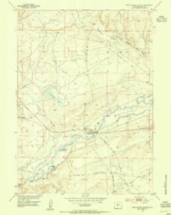
9 topographic sheets cover this place, the earliest surveyed in 1953 and the latest in 1978. It stands in the Jeffrey City census division. It lies in ZIP code area 82520. It stands on Crooked Creek. The Survey maps it on the Sweetwater Station quadrangle.
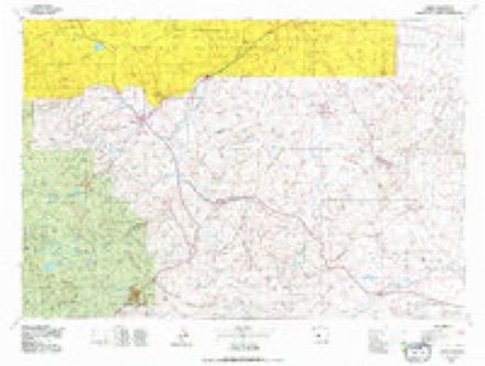
Topographic sheets covering this place
5 surveys from 9 printed sheetsMatched by testing this settlement's coordinate against the published boundary of every sheet in the United States Geological Survey's historical collection. Each opens the scanned sheet at the Survey.
- 1953 USGS Sweetwater Station quadrangle1:24000, 2 printings
- 1955 USGS Lander quadrangle1:250000, 2 printings
- 1958 USGS Lander quadrangle1:250000
- 1961 USGS Lander quadrangle1:250000, 2 printings
- 1978 USGS Lander quadrangle1:100000, 2 printings
Fires near this place
3 since 2002Regional context, not property-specific evidence. The federal wildfire occurrence database lists 3 fires within 5 miles of Sweetwater Station between 2002 and 2020, burning about 2 acres in total. None started naturally. None was recorded as arson. Distance is straight-line from the map coordinates, so a fire counted here may appear on a neighbouring settlement's page as well.
| Reported cause | Fires |
|---|---|
| Missing data/not specified/undetermined | 3 |
The most recent of them, most recent first, with the day each was reported and the service that recorded it.
| Date | Cause | Size | Reported by | Name on the report |
|---|---|---|---|---|
| 4 September 2002 | Missing data/not specified/undetermined | under an acre | Lander Field Office | ASSIST 18 |
| 24 June 2015 | Missing data/not specified/undetermined | 1.0 acres | Wyoming State Forestry | not named |
| 9 October 2020 | Missing data/not specified/undetermined | under an acre | Wind River / Bighorn Basin District | ICE |
Settlements close enough to share some of these fires:
Mines and quarries near this place
2 within 5 milesRegional context, not property-specific evidence. The federal mineral resources record lists 2 workings within 5 miles of Sweetwater Station: 1 past producer, 1 unknown. None of them still produces. What was taken out: Sand and Gravel, Construction, Uranium. Distance is straight-line from the map coordinates, so a quarry counted here may appear on a neighbouring settlement's page as well.
| Where | Site | Commodity | Status | Recorded |
|---|---|---|---|---|
| Countryman Pit | Sand and Gravel, Construction | Past Producer | ||
| King | Uranium | Unknown |
Storms near this place
4 since 2011Regional context, not property-specific evidence. The National Weather Service names Sweetwater Station in 4 storm reports between 2011 and 2023: 2 flood, 2 thunderstorm wind. No death or injury is recorded in these reports. Each account below is quoted exactly as the forecast office filed it, from the NOAA Storm Events Database, and each date opens the federal record of that event.
| When | Event | Place named | Harm | What the report says |
|---|---|---|---|---|
| May 2016 | Flood | Sweetwater Station | $1,200,000 | Widespread heavy rain of 2.50 to 4.50 fell in a broad swath across Fremont County during a 48-hour period from Friday evening, May 6, through Sunday evening, May 8. There was a peak rainfall amount of 6.88 at a rain gauge about 6 miles west of Fort Washakie on the Little Wind River. The heavy rain fell over the lower elevations of the Wind River Basin and in the lower foothills of the Wind River Range.||The heaviest rainfall occurred between 1900MST Friday, May 6, and 1700MST Saturday, May 7. The rain gauge at Lander Hunt Field reported 3.82 in this 22-hour period, with 1.12 falling between 0800MST and 1100MST Saturday. The heavy rainfall contributed to significant rises along the Little Wind River and its tributaries, particularly the Little Popo Agie River through Lyons Valley. The rapid river rises produced substantial flooding from Lyons Valley, to Hudson, to Arapahoe.||Overland flow was a significant contributor to the rapidly rising rivers. Recent rains had left soils relatively wet, so as rainfall piled up on Saturday morning water began to flow across fields, overwhelm ditches, and fill ravines. These waters made their way to the larger rivers and quickly filled them. By early Saturday afternoon, there were reports of water covering low-lying areas of roads north and northwest of Lander. The rain was so heavy that water seeped through the walls at the hospital in Lander prompting the evacuation of patients. Some basement flooding was reported in residential areas of Lander. By mid-afternoon Saturday, reports were received of flood waters on the Little Popo Agie River surrounding homes in Lyons Valley. Several rural roads were either covered with water or damaged by the flood waters in the valley. The flood waters on this tributary combined with the already high water on the Popo Agie River to cause water levels to surge in Hudson late Saturday evening and early Sunday morning. The subsequent flooding damaged or destroyed several mobile homes along the river on the west side of Hudson. Sunday afternoon saw the retreat of water levels on these rivers with a subsequent decrease in flood-related problems.||Multiple tributaries and overland flow to small creeks, streams, and ditches quickly filled the Little Wind River near Arapahoe downstream to around Riverton. The river topped flood stage of 8 feet at 0605MST Sunday, May 8, and climbed about 1 foot every three to four hours during the morning and early afternoon. The river crested at 10.19 feet between 1545MST and 1600MST Sunday as residents along the river scrambled to fill sandbags and move property to a safer location. Flood waters on the Little Wind River retreated slowly on Monday, May 9, before falling below flood stage at 0120MST on Tuesday, May 10. The river fell below action stage by the end of Tuesday. |
| July 2023 | Thunderstorm Wind | Sweetwater Station | - | Around a half an hour period of severe thunderstorm winds occurred at Beaver Rim, with a maximum gust of 69 mph. A 68 mph wind gust was reported at the Camp Creek RAWS site. |
| June 2020 | Thunderstorm Wind | Sweetwater Station | - | Severe thunderstorm winds occurred in eastern Fremont County. The maximum wind gust was 65 mph at Shoshoni, Wyoming. |
| May 2011 | Flood | Sweetwater Station | - | Several ranchers along the Sweetwater River in southern Fremont County reported minor flooding as a result of rapid snowmelt. Much of the flooding occurred around Sweetwater Station. Occasional afternoon and evening showers and thunderstorms added to the rise of the river. Cooler temperatures and a loss of low elevation snow slowed the rising water before the end of May. |
Nearest settlements
The eight closest, with where each one stands in the county. Distances are straight-line, computed from the Geographic Names Information System coordinates.
| Map | Place | Distance | Sheets |
|---|---|---|---|
| Sweetwater Crossing | 0.2 miles | 9 | |
| Myersville (historical) | 4.4 miles | 8 | |
| Sand Draw | 15.1 miles | 11 | |
| Jeffrey City | 19.2 miles | 9 | |
| Kotey Place | 25.6 miles | 11 | |
| Miners Delight | 26.3 miles | 12 | |
| Atlantic City | 29.2 miles | 10 | |
| Last Crossing Ford Number 9 | 30.7 miles | 10 |
Elsewhere
Matched on this settlement's Geographic Names Information System number rather than its name, so it cannot be a different place of the same name in another state.
| Wikidata item Q122597051 | The structured record the population and elevation above come from. Public domain (CC0). |
Provenance
This settlement is recorded in the Geographic Names Information System as feature 1595249. The sheet list is computed by point-in-boundary test against the United States Geological Survey's historical topographic inventory. Both are works of the United States government and carry no copyright under 17 U.S.C. 105.
Wildfire. Short, Karen C. 2022. Spatial wildfire occurrence data for the United States, 1992-2020 [FPA_FOD_20221014]. 6th Edition. Fort Collins, CO: Forest Service Research Data Archive. https://doi.org/10.2737/RDS-2013-0009.6 Collected with United States Government funding and usable without additional permissions or fees.
Mines and quarries. USGS Mineral Resources Data System (MRDS) https://mrdata.usgs.gov/mrds/ A work of the United States government, no copyright under 17 U.S.C. 105.
Storms. NOAA National Centers for Environmental Information, Storm Events Database https://www.ncei.noaa.gov/stormevents/ A work of the United States government, no copyright under 17 U.S.C. 105. Narratives are quoted verbatim from the National Weather Service report and are not edited or summarised.