BlockBefore
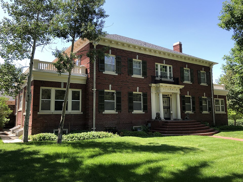
Photograph of South Wolcott Street Historic District
Photograph by Drmccreedy, CC BY-SA 4.0. Via Wikimedia Commons.

South Wolcott Street Historic District

Listed on the National Register of Historic Places in 1988.

From the record

“The South Wolcott Street Historic District in Casper, Wyoming is a 61 acres (25 ha) historic district covering about 22 residential blocks south of downtown. It was listed on the National Register of Historic Places in 1988.”

Wikipedia article South Wolcott Street Historic District, CC BY-SA 4.0.

One of 36 National Register listings published here for Natrona County · listed in 1988 · category: District.

Sources: the Wikipedia article · the case file at the National Archives · the National Register database, National Park Service

The listing

Fires near this property

170 since 1992

Regional context, not property-specific evidence. The federal wildfire occurrence database lists 170 fires within 5 miles of South Wolcott Street Historic District between 1992 and 2020, burning about 15,592 acres in total. 19 started naturally. 3 were recorded as arson. Distance is straight-line from the map coordinates, so a fire counted here may appear on a neighbouring settlement's page as well.

Reported cause Fires
Missing data/not specified/undetermined89
Natural19
Power generation/transmission/distribution10
Fireworks10
Smoking9
Debris and open burning8
Railroad operations and maintenance7
Equipment and vehicle use7
Misuse of fire by a minor6
Arson/incendiarism3
Recreation and ceremony2

The most recent of them, most recent first, with the day each was reported and the service that recorded it.

DateCause SizeReported by Name on the report
9 September 2017Recreation and ceremony1.0 acresNatrona CountyPOWERLINE
7 September 2019Naturalunder an acreCasper Field OfficeCOMPOST
5 September 2020Equipment and vehicle use1.0 acresNatrona CountyLANDMARK
4 September 2020Power generation/transmission/distributionunder an acreNatrona CountyMORADO
4 September 2020Power generation/transmission/distributionunder an acreNatrona CountySE WYOMING BLVD
4 September 1992Missing data/not specified/undeterminedunder an acreWyoming State Forestrynot named
30 September 2018Equipment and vehicle use28 acresNatrona CountyPOWER LINE
26 September 2019Missing data/not specified/undeterminedunder an acreCasper Field OfficeCY FIRE

Every fire recorded in Natrona County

Mines and quarries near this property

10 within 5 miles

Regional context, not property-specific evidence. The federal mineral resources record lists 10 workings within 5 miles of South Wolcott Street Historic District: 9 producers, 1 past producer. 9 still produce. What was taken out: Sand and Gravel, Construction, Bentonite, Clay. Distance is straight-line from the map coordinates, so a quarry counted here may appear on a neighbouring settlement's page as well.

Where SiteCommodity StatusRecorded
Midwest-Thoeming & WakemClayProducer
Benton Clay Co MillBentoniteProducer
Kaycee Clay MineBentoniteProducer
Kaycee MineBentoniteProducer
Boels-Rimrock PitSand and Gravel, ConstructionProducer
Casper Concrete Pit & PlantSand and Gravel, ConstructionProducer
Hidebrand PitSand and Gravel, ConstructionProducer
Lathrop L-3 PitSand and Gravel, ConstructionProducer
Rim Rock Ranch PitSand and Gravel, ConstructionProducer
Sun Ray PitSand and Gravel, ConstructionPast Producer

Every working recorded in Natrona County

Storms near this property

60 of 67 shown

Regional context, not property-specific evidence. The National Weather Service names Casper, the town this property stands in, in 67 storm reports between 1994 and 2026: 32 hail, 18 thunderstorm wind, 7 flash flood, 5 funnel cloud. The reports record 1 death. Each account below is quoted exactly as the forecast office filed it, from the NOAA Storm Events Database, and each date opens the federal record of that event.

WhenEvent Place namedHarm What the report says
June 2008Dust DevilCasper1 killed, $1,000A 34-year-old woman was killed when a dust devil flipped a small scorer's shed next to a team dugout at a youth ball field complex. The woman apparently sought shelter from the dust devil by positioning herself behind the shed. The shed was flipped one-half revolution, crushing her on the first flip and then rolling off of her. The woman was found about 10 minutes later as teams begin arriving for their evening games. Resuscitation efforts failed and she was declared dead at the scene.
July 2005Flash FloodCasper$500,000no account filed
August 2005Flash FloodCasper$85,000no account filed
May 2006LightningCasper$65,000no account filed
August 2007Flash FloodCasper$50,000One to two inches of rain fell on already saturated ground west of Casper along Poison Spider Road. Also, rainfall of 0.50 to 1.50 inches fell in less than one hour in and near the city of Casper. The rain produced flash flooding along Poison Spider and Paradise Valley roads and in some locales around Paradise Valley. Urban flooding was also observed along Interstate 25 in Casper.
August 2007Flash FloodCasper$15,000Rainfall of 1.38 inches in 20 minutes produced flash flooding about three miles north-northeast of downtown Casper. A private road was washed out, and mud and silt surrounded at least one garage.
August 2007Thunderstorm WindCasper$10,000A semi-tractor trailer was overturned on Interstate 25 at mile marker 195 because of thunderstorm wind.
August 2007Thunderstorm WindCasper$10,000Thunderstorm wind toppled a semi-tractor trailer on Interstate 25 near mile marker 182.
June 2011Thunderstorm WindCasper$3,000The public reported several healthy three inch diameter tree branches down in Casper.
June 2009Flash FloodCasper$2,000Rainfall of one to two inches fell in and around Casper. One location at Wyoming Medical Center recorded 1.75 inches of rain. The water accumulated at the intersection of Poplar and CY avenues and flooded the area.
August 2007Thunderstorm WindCasper$1,000A power line was toppled near the intersection of Mystery Bridge Road and East Yellowstone Road.
June 2006Thunderstorm WindCasper$1,000no account filed
April 2026Thunderstorm WindCasper-A wind gust of 64 mph was recorded along Scenic Drive on the South Side of Casper.
July 2025Thunderstorm WindCasper-Wind gusts as high as 61 mph occurred on the south side of Casper.
July 2019HailCasper-Penny sized hail was reported 18 miles north of Casper, Wyoming.
July 2018HailCasper-A trained spotter reported golf ball sized hail.
May 2018HailCasper-Trained spotters reported from quarter to golf ball size hail throughout much of Casper.
August 2018HailCasper-The Natrona County Emergency Manager reported up to nickel size hail at the Bear Trap Music Festival on Casper Mountain.
June 2017Thunderstorm WindCasper-A trained spotter reported a tree blown down on a car in downtown Casper.
May 2010HailCasper-A strong thunderstorm formed on Casper Mountain and produced penny sized hail as it moved north through Casper.
August 2010Thunderstorm WindCasper-A 73 mph wind gust was recorded atop the Wyoming Medical Center.
July 2009Thunderstorm WindCasper-Thunderstorm wind gusts of 60 to 65 mph were estimated near the Wyoming Medical Center in association with a thunderstorm that produced widespread flash flooding in Casper.
September 2009HailCasper-Penny sized hail was observed in Casper.
May 2008Funnel CloudCasper-A funnel cloud was observed by trained spotters over Casper.
August 2007HailCasper-Nickel size hail was measured by a Cooperative Observer near Bates Creek.
August 2007HailCasper-One inch diameter hail occurred in Casper.
August 2007Thunderstorm WindCasper-Wind gusts estimated at 60 mph occurred at the helipad in Casper.
August 2007HailCasper-Penny-sized hail fell for 10 minutes in association with a thunderstorm. The parent thunderstorm produced 1.15 inches of rain.
August 2007HailCasper-Hail the size of nickels fell near Paradise Valley.
August 2007HailCasper-The public and a Bureau of Reclamation employee measured one inch diameter hail on Casper Mountain.
August 2007HailCasper-A CoCoRaHS spotter estimated hail to be the size of golf balls.
August 2007HailCasper-The Natrona County Sheriff's Office relayed a report of 1.50 inch diameter hail on Casper Mountain.
June 1994Thunderstorm WindCasper-A thunderstorm produced a brief gust of 61 mph at the Casper Airport which did no damage.
July 1994HailCasper-A late evening thunderstorm produced one inch hail in west Casper.
July 1994HailCasper-A severe thunderstorm moved over Casper dropping dime-size hail first at Natrona International Airport and then in downtown Casper.
July 2006HailCasper-no account filed
June 2006Thunderstorm WindCasper-no account filed
August 2006HailCasper-no account filed
May 2004HailCasper-no account filed
July 2004HailCasper-no account filed
July 2004Flash FloodCasper-no account filed
July 2004HailCasper-no account filed
July 2003HailCasper-no account filed
September 2003Tornado (F0)Casper-no account filed
June 2003Funnel CloudCasper-no account filed
June 2003HailCasper-no account filed
June 2003Flash FloodCasper-no account filed
June 2003HailCasper-no account filed
July 2002Thunderstorm WindCasper-no account filed
June 2002Thunderstorm WindCasper-no account filed
April 2001Thunderstorm WindCasper-no account filed
June 2001Funnel CloudCasper-no account filed
June 2001HailCasper-no account filed
July 2001WildfireCasper-no account filed
July 2000WildfireCasper-no account filed
July 2000HailCasper-no account filed

Every storm recorded in Natrona County

Map coverage status

No historic map-sheet match is published for this property yet. That does not mean no map exists. This record needs a coordinate-quality review before it can be joined to a sheet boundary. Browse the county's mapped places while that work is pending.

Listed places nearby

6 within 8 miles

Other National Register properties close enough to walk or drive between, ordered by distance from this one. Both positions come from the same geocoding pass that matched these properties to their map sheets.

Photograph PropertyDistance Listed
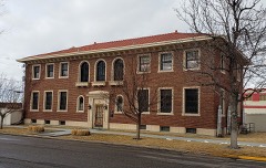
Elks Lodge No. 13530.2 miles1997
Grant Street Grocery and Market0.2 miles2008
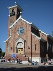
Church of Saint Anthony0.2 miles1997
Midwest Oil Company Hotel0.2 miles1983
Ormsby Home0.3 miles2025
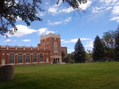
Natrona County High School0.4 miles1994

Sources for this property

National Archives recordThe nomination case file for reference 88002609 in Record Group 79.
Wikipedia articleCommunity-written account of this property, licensed CC BY-SA.
Natrona CountyAll 36 listed properties in this county.

Provenance

  • Listing record. National Park Service National Register of Historic Places, listed-properties dataset, current to 2026-05-22.
  • Map join. Address geocoded through the United States Census geocoder, then tested against the published boundary of every sheet in the USGS Historical Topographic Map Collection.
  • How this page is made. Listing fields come from federal records; map-sheet coverage is a labelled coordinate-to-boundary calculation, not a source-field claim.
  • Wildfire. Short, Karen C. 2022. Spatial wildfire occurrence data for the United States, 1992-2020 [FPA_FOD_20221014]. 6th Edition. Fort Collins, CO: Forest Service Research Data Archive. https://doi.org/10.2737/RDS-2013-0009.6 Collected with United States Government funding and usable without additional permissions or fees.
  • Mines and quarries. USGS Mineral Resources Data System (MRDS) https://mrdata.usgs.gov/mrds/ A work of the United States government, no copyright under 17 U.S.C. 105.
  • Storms. NOAA National Centers for Environmental Information, Storm Events Database https://www.ncei.noaa.gov/stormevents/ A work of the United States government, no copyright under 17 U.S.C. 105. Narratives are quoted verbatim from the National Weather Service report and are not edited or summarised.