 Block
From the record
One of 43 National Register listings published here for Carbon County · listed in 1999 · category: District.
Sources: the case file at the National Archives · the National Register database, National Park Service
Listed on the National Register of Historic Places in 1999.
One of 43 National Register listings published here for Carbon County · listed in 1999 · category: District.
Sources: the case file at the National Archives · the National Register database, National Park Service
Regional context, not property-specific evidence. The federal wildfire occurrence database lists 71 fires within 5 miles of Downtown Rawlins Historic District (Boundary Increase) between 1996 and 2020, burning about 44 acres in total. 7 started naturally. 2 were recorded as arson. Distance is straight-line from the map coordinates, so a fire counted here may appear on a neighbouring settlement's page as well.
| Reported cause | Fires |
|---|---|
| Missing data/not specified/undetermined | 20 |
| Fireworks | 13 |
| Equipment and vehicle use | 8 |
| Natural | 7 |
| Railroad operations and maintenance | 6 |
| Debris and open burning | 5 |
| Misuse of fire by a minor | 4 |
| Recreation and ceremony | 2 |
| Arson/incendiarism | 2 |
| Power generation/transmission/distribution | 2 |
| Smoking | 2 |
The most recent of them, most recent first, with the day each was reported and the service that recorded it.
| Date | Cause | Size | Reported by | Name on the report |
|---|---|---|---|---|
| 29 September 2006 | Misuse of fire by a minor | under an acre | Wyoming State Forestry | not named |
| 28 September 2007 | Missing data/not specified/undetermined | under an acre | Rawlins Field Office | MILE POST 213 |
| 23 September 1996 | Fireworks | 1.1 acres | Rawlins Field Office | RAWLINS |
| 17 September 2010 | Debris and open burning | 1.0 acres | Wyoming State Forestry | CHEROKEE ROAD |
| 10 September 2011 | Recreation and ceremony | under an acre | Rawlins Field Office | BONFIRE |
| 6 August 2020 | Missing data/not specified/undetermined | under an acre | Carbon County | 215 |
| 6 August 2004 | Missing data/not specified/undetermined | under an acre | Wyoming State Forestry | not named |
| 29 August 2010 | Missing data/not specified/undetermined | under an acre | Rawlins Field Office | RV PARK |
Regional context, not property-specific evidence. The federal mineral resources record lists 21 workings within 5 miles of Downtown Rawlins Historic District (Boundary Increase): 17 unknowns, 2 past producers, 1 producer, 1 prospect. 1 still produces. What was taken out: Sand and Gravel, Construction, Stone, Crushed/Broken, Uranium, Stone, Limestone, Crushed/Broken. Distance is straight-line from the map coordinates, so a quarry counted here may appear on a neighbouring settlement's page as well.
| Where | Site | Commodity | Status | Recorded |
|---|---|---|---|---|
| Rawlins Area | Fire Clay (Refractory) | Unknown | ||
| Unknown Quarries | Stone, Crushed/Broken, Sandstone, Dimension | Past Producer | ||
| Unknown | Uranium | Past Producer | ||
| Unknown | Uranium | Prospect | ||
| Unknown - Rawlins Area 1 | Stone, Limestone, Crushed/Broken | Unknown | ||
| Unknown - Rawlins Area 3 | Stone, Limestone, Crushed/Broken | Unknown | ||
| Unknown | Stone, Crushed/Broken | Unknown | ||
| Unknown | Stone, Crushed/Broken | Unknown | ||
| Unknown Quarries | Stone, Crushed/Broken | Unknown | ||
| Unknown Quarry | Stone, Crushed/Broken | Unknown |
Regional context, not property-specific evidence. The National Weather Service names Rawlins, the town this property stands in, in 26 storm reports between 1994 and 2021: 11 thunderstorm wind, 11 hail, 2 tornado, 1 flash flood. The reports record 4 injuries. Each account below is quoted exactly as the forecast office filed it, from the NOAA Storm Events Database, and each date opens the federal record of that event.
| When | Event | Place named | Harm | What the report says |
|---|---|---|---|---|
| April 2001 | Thunderstorm Wind | Rawlins | 3 hurt, $50,000 | Strong thunderstorm wind gust rolled a mobile home 3 times in Echo Springs, resulting in 3 injuries. |
| June 1998 | Lightning | Rawlins | 1 hurt | A motorcycle rider was hit by lightning as he was riding west on Interstate 80. He was struck in the back of the neck and the strike caused him to lose control of his mototcycle and crash into the median. The motorcyclist recieved a ruptured eardrum and burns to his eyes, chest and shoulder. The victim was taken to the hospital for treatment and released. |
| May 2021 | Tornado (EFU) | Rawlins | - | Brief landspout tornado was observed with photos disseminated by Carbon County Emergency Manager south of Rawlins. According to reports by the public via social media, landspout tornado remained over open areas with no discernable damage to rank only as EFU. Given limited evidence, specific location, width, length and timing are all estimates. |
| July 2020 | Thunderstorm Wind | Rawlins | - | RAWS site at Cow Creek in southwestern Carbon County measured the reported wind speed. |
| June 2020 | Thunderstorm Wind | Rawlins | - | RAWS mesonet station COWW4 - Cow Creek reported gust 21 miles north-northeast of Baggs. |
| April 2019 | Thunderstorm Wind | Rawlins | - | Winds measured at the Cow Creek site. |
| September 2019 | Thunderstorm Wind | Rawlins | - | Wind speeds were measured by the sensor at Rawlins Municipal Airport. |
| August 2017 | Thunderstorm Wind | Rawlins | - | Estimated wind gusts of 55 to 60 mph were observed southwest of Rawlins. |
| June 2010 | Hail | Rawlins | - | Water standing in yard due to heavy rain. Estimated time of report. |
| July 2008 | Hail | Rawlins | - | Nickel to half dollar sized hail reported in the vicinity of Rawlins, WY. |
| August 1997 | Tornado (F0) | Rawlins | - | Touched down in open country causing no damage. |
| May 1995 | Hail | Rawlins | - | A thunderstorm in northern Carbon County produced a funnel cloud and hailstones up to one inch in diameter. No damage was reported as a result of the hail. |
| May 1995 | Thunderstorm Wind | Rawlins | - | A slow moving tornado was reported by the public 13 miles north of Rawlins. No damage occurred and the path length and width were estimated. The Rawlins airport recorded a wind gust of 67 mph from a thunderstorm. No damage was reported at the airport. |
| June 1994 | Thunderstorm Wind | Rawlins | - | The airport in Rawlins measured a wind gust of 65 mph as a thunderstorm passed through. No damage was reported from the winds. |
| May 2021 | Hail | Rawlins | - | no account filed |
| May 2018 | Hail | Rawlins | - | no account filed |
| May 2018 | Hail | Rawlins | - | no account filed |
| May 2018 | Hail | Rawlins | - | no account filed |
| May 2018 | Hail | Rawlins | - | no account filed |
| May 2018 | Hail | Rawlins | - | no account filed |
| June 2003 | Thunderstorm Wind | Rawlins | - | no account filed |
| August 2002 | Hail | Rawlins | - | no account filed |
| April 2001 | Hail | Rawlins | - | no account filed |
| June 1996 | Thunderstorm Wind | Rawlins | - | no account filed |
| May 1996 | Flash Flood | Rawlins | - | no account filed |
| July 1994 | Thunderstorm Wind | Rawlins | - | no account filed |
No historic map-sheet match is published for this property yet. That does not mean no map exists. This record needs a coordinate-quality review before it can be joined to a sheet boundary. Browse the county's mapped places while that work is pending.
Other National Register properties close enough to walk or drive between, ordered by distance from this one. Both positions come from the same geocoding pass that matched these properties to their map sheets.
| Photograph | Property | Distance | Listed |
|---|---|---|---|
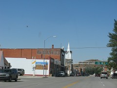 | Downtown Rawlins Historic District | under 500 feet | 1985 |
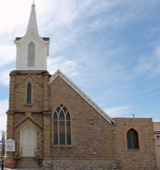 | France Memorial United Presbyterian Church | under 500 feet | 1984 |
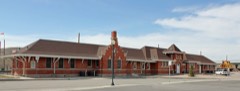 | Union Pacific Railroad Depot | 0.1 miles | 1993 |
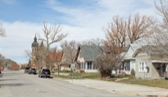 | Rawlins Residential Historic District | 0.2 miles | 1999 |
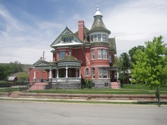 | George Ferris Mansion | 0.3 miles | 1982 |
| National Archives record | The nomination case file for reference 99001221 in Record Group 79. |
| Carbon County | All 43 listed properties in this county. |