Block
From the record
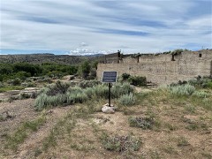
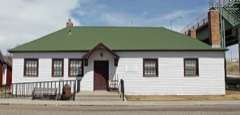
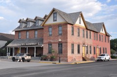
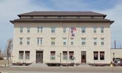
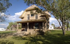
43 National Register listings published here, 1 of them a National Historic Landmark.
Sources: the National Register database, National Park Service
160 topographic sheets cover 50 settlements here, and 43 properties are on the National Register of Historic Places.
43 National Register listings published here, 1 of them a National Historic Landmark.
Sources: the National Register database, National Park Service
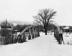
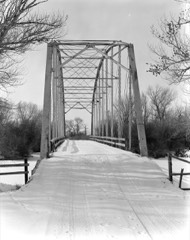
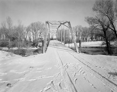
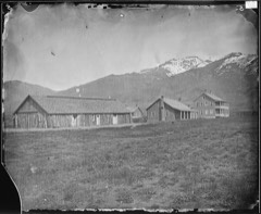
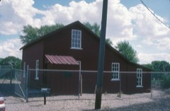
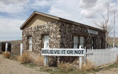
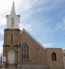
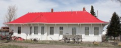
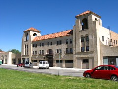
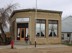
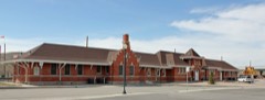
Every property in this county listed on the National Register of Historic Places, with the year it was listed and the federal nomination document.
Every wildfire the federal occurrence database records inside this county: 767 of them, burning about 251,752 acres. 353 started naturally and 6 were recorded as arson. Each settlement page carries the fires within five miles of it.
| Reported cause | Fires |
|---|---|
| Natural | 353 |
| Missing data/not specified/undetermined | 155 |
| Equipment and vehicle use | 69 |
| Railroad operations and maintenance | 50 |
| Recreation and ceremony | 48 |
| Debris and open burning | 25 |
| Fireworks | 23 |
| Smoking | 18 |
| Power generation/transmission/distribution | 10 |
| Misuse of fire by a minor | 8 |
| Arson/incendiarism | 6 |
| Other causes | 2 |
The five largest, by the area the report gives. None of them was recorded as arson.
| Date | Cause | Size | Reported by | Name on the report |
|---|---|---|---|---|
| 17 September 2020 | Missing data/not specified/undetermined | 176,878 acres | Arapaho National Wildlife Refuge | MULLEN |
| 24 August 2019 | Natural | 23,408 acres | Rawlins Field Office | PEDRO MOUNTAIN |
| 5 September 2020 | Railroad operations and maintenance | 14,201 acres | Carbon County | RR 316 |
| 27 July 2012 | Natural | 8,796 acres | Rawlins Field Office | FERRIS |
| 21 July 2012 | Natural | 3,829 acres | Rawlins Field Office | SEMINOE |
| 10 July 1993 | Natural | 2,910 acres | Rawlins Field Office | DUNES |
| 10 September 2016 | Equipment and vehicle use | 2,565 acres | Medicine Bow-Routt National Forests, Thunder Basin National Grassland | SNAKE |
| 14 August 2016 | Natural | 2,121 acres | Medicine Bow-Routt National Forests, Thunder Basin National Grassland | BROADWAY |
Every settlement page carries the fires within five miles of it - see the settlement index below.
The NOAA Storm Events Database holds 228 reports for this county, causing 6 deaths, 7 injuries and about $450,650 in recorded property damage. Each settlement page carries the reports that name it.
| Kind of event | Reports |
|---|---|
| Thunderstorm Wind | 161 |
| Hail | 35 |
| Tornado | 18 |
| Flash Flood | 6 |
| Lightning | 3 |
| Flood | 3 |
| Funnel Cloud | 2 |
The most serious of them, by death, then injury, then recorded damage. The accounts are quoted exactly as the forecast office filed them.
| When | Event | Place named | Harm | What the report says |
|---|---|---|---|---|
| July 2011 | Flash Flood | Ryan Park | 4 killed, 2 hurt | Thunderstorms with heavy rain moved across the Snowy Range and Brush Creek area on State Highway 130 between 9 pm and midnight on July 18. Debris carried down Brush Creek by runoff from the heavy rainfall clogged the drainage culvert at milepost 55.8 on State Highway 130, about 13 miles east of the junction with State Highway 230. As a result, water washed away the pavement around the culvert and created a 25-foot wide, 9-foot deep trench in the road just before 1 am on July 19. Four members of a Colorado Springs family died after their van drove into the washout and was swept downstream by the raging creek as they fled flash flooding at a nearby campground shortly after 1 am. The driver of the van managed to escape from the van, which was submerged to its rooftop. Minutes later, the Carbon County emergency manager who responded to the flash flooding, drove his vehicle into the same washout and plunged into the creek. Firefighters rescued both drivers about two hours later, and were transported to a hospital in Rawlins. Both men were treated for their injuries and later released. After floodwaters receded, State Highway 130 between mileposts 36 and 68 was closed for repairs. |
| August 1998 | Lightning | Arlington | 1 killed, 1 hurt | A woman was killed by a lightning bolt while hiking in the Snowy Range. A friend that was hiking with her was injured. The two were trying to get to lower levels of the mountains after spotting the storm, but the storm caught them in the open. |
| September 2002 | Lightning | Encampment | 1 killed | Lightning struck a tree and woman standing under it at the Pickaroon Campground inMedicine Bow National Forest. |
| April 2001 | Thunderstorm Wind | Rawlins | 3 hurt, $50,000 | Strong thunderstorm wind gust rolled a mobile home 3 times in Echo Springs, resulting in 3 injuries. |
| June 1998 | Lightning | Rawlins | 1 hurt | A motorcycle rider was hit by lightning as he was riding west on Interstate 80. He was struck in the back of the neck and the strike caused him to lose control of his mototcycle and crash into the median. The motorcyclist recieved a ruptured eardrum and burns to his eyes, chest and shoulder. The victim was taken to the hospital for treatment and released. |
| July 1976 | Tornado (F2) | not stated | $250,000 | no account filed |
| April 2000 | Thunderstorm Wind | Rawlins Arpt | $100,000 | no account filed |
| July 1967 | Tornado | not stated | $25,000 | no account filed |
| June 1966 | Tornado (F1) | not stated | $25,000 | no account filed |
| August 1995 | Thunderstorm Wind | Hanna | $500 | Thunderstorm winds damaged a shed and broke some windows in Hanna. |
| June 1982 | Tornado (F0) | not stated | $30 | no account filed |
| June 1982 | Tornado (F0) | not stated | $30 | no account filed |
| June 1982 | Tornado (F0) | not stated | $30 | no account filed |
| June 1982 | Tornado (F0) | not stated | $30 | no account filed |
| July 1958 | Tornado (F1) | not stated | $30 | no account filed |
| May 2025 | Thunderstorm Wind | Walcott | - | Wydot station 7 NW of Elk Mountain. |
| May 2025 | Thunderstorm Wind | Walcott | - | Mesonet station WY18 at Halleck Ridge. |
| May 2025 | Thunderstorm Wind | Walcott | - | Mesonet station WY18 at Halleck Ridge. |
| May 2025 | Thunderstorm Wind | Walcott | - | Mesonet station WY18 at Halleck Ridge. |
| May 2025 | Thunderstorm Wind | (Rwl)Rawlins Airport | - | Automated surface observing station KRWL 1 ENE of Rawlins. |
| August 2025 | Thunderstorm Wind | (Rwl)Rawlins Airport | - | The Rawlins Airport reported a 61 mph wind gust 1 mile east-northeast of Rawlins. |
| August 2025 | Thunderstorm Wind | Walcott | - | Mesonet station WY18 at Halleck Ridge reported a 70 mph wind gust 7 miles northwest of Elk Mountain. |
| August 2025 | Thunderstorm Wind | Arlington | - | Corrects previous non-tstm wnd gst report from 3 NW Arlington. Mesonet station WY22 2.7 NW Arlington. |
| July 2025 | Thunderstorm Wind | Walcott | - | A shower passing over Interstate 80 resulted in strong, gusty winds. A WYDOT sensor at Walcott Junction on Interstate 80 gusted 64 MPH. |
| September 2025 | Thunderstorm Wind | Arlington | - | WYDOT sensor near Arlington along Interstate 80. |
| June 2025 | Thunderstorm Wind | (Rwl)Rawlins Airport | - | Rawlins Airport reported two gusts of 67 mph. |
| June 2025 | Thunderstorm Wind | Walcott | - | Mesonet station WY18 Halleck Ridge. |
| June 2025 | Thunderstorm Wind | Riverside | - | Mesonet station KSKL Skyline along WY-230. |
| June 2025 | Thunderstorm Wind | Arlington | - | Mesonet station WY22 2.7 NW Arlington. |
| June 2025 | Thunderstorm Wind | Arlington | - | Mesonet station 3 miles northwest of Arlington from a decaying thundershower. |
| May 2024 | Thunderstorm Wind | Walcott | - | WYDOT mesonet station Halleck Ridge (WY18) along Interstate 80 measured maximum wind gust. |
| May 2024 | Thunderstorm Wind | Arlington | - | WYDOT mesonet station Arlington (KARL) along Interstate 80 measured wind gust. |
| July 2024 | Thunderstorm Wind | Elk Mountain | - | WYDOT mesonet station along Interstate 80 at Elk Mountain (WY19) reported maximum wind gust. |
| July 2024 | Thunderstorm Wind | Walcott | - | WYDOT mesonet station along Interstate 80 at Halleck Ridge (WY18) measured wind gust. |
| July 2024 | Thunderstorm Wind | (Rwl)Rawlins Airport | - | Rawlins Airport ASOS station (KRWL) measured wind gust. |
| July 2024 | Thunderstorm Wind | Walcott | - | WYDOT mesonet station along Interstate 80 at Halleck Ridge (WY18) measured wind gust 7 miles northwest of Elk Mountain. |
| July 2024 | Thunderstorm Wind | Walcott | - | WYDOT mesonet station along Interstate 80 at Halleck Ridge (WY18) measured wind gust 7 miles northwest of Elk Mountain. |
| June 2024 | Hail | Oil Springs | - | A storm chaser reported half dollar sized hail 9 miles N of Medicine Bow. |
| June 2024 | Hail | Medicine Bow | - | A storm chaser reported 2-inch diameter hail 4 miles NE of Medicine Bow. |
| June 2024 | Thunderstorm Wind | Walcott | - | A wind gust to 68 MPH was measured 7 miles NW of Elk Mountain. |
| August 2024 | Thunderstorm Wind | Elk Mountain | - | WYDOT mesonet station along Interstate 80 at County Road 402 (WY20) measured wind gust 3 miles east-southeast of Elk Mountain. |
| August 2024 | Thunderstorm Wind | Walcott | - | WYDOT mesonet station along Interstate 80 at Halleck Ridge (WY18) measured wind gust 7 miles northwest of Elk Mountain. |
| August 2024 | Thunderstorm Wind | Riverside | - | WYDOT mesonet station Skyline (KSKL) along WY Highway 230 measured wind gust 12 miles east-southeast of Encampment. |
| August 2024 | Thunderstorm Wind | (Rwl)Rawlins Airport | - | Rawlins Airport ASOS station (KRWL) measured wind gust. |
| August 2024 | Thunderstorm Wind | Walcott | - | WYDOT mesonet station Halleck Ridge (WY18) along Interstate 80 measured wind gust 7 miles northwest of Elk Mountain. |
| August 2024 | Thunderstorm Wind | Arlington | - | WYDOT mesonet station along Interstate 80 at Foote Creek (WY22) measured wind gust 3 miles northwest of Arlington. |
| July 2023 | Thunderstorm Wind | Dana Ridge | - | WYDOT mesonet station Dana Ridge (WY16) along Interstate 80 reported wind gust. |
| July 2023 | Thunderstorm Wind | Walcott | - | WYDOT mesonet station along Interstate 80 at mile marker 249 reported wind gust. |
| July 2023 | Thunderstorm Wind | (Mbw)Medicine Bow Airport | - | Union Pacific Railroad mesonet station MEDIC1 (UP087) measured maximum wind gust. |
| July 2023 | Thunderstorm Wind | Arlington | - | WYDOT mesonet station Wagonhound (WY21) along Interstate 80 measured maximum wind gust. |
| July 2023 | Thunderstorm Wind | Elk Mountain | - | WYDOT mesonet station along Interstate 80 at County Road 402 measured maximum wind gust. |
| July 2023 | Thunderstorm Wind | (Rwl)Rawlins Airport | - | Rawlins Airport ASOS station KRWL reported maximum wind gust. |
| July 2023 | Thunderstorm Wind | Muddy Gap | - | Camp Creek RAWS mesonet station reported maximum wind gust. |
| August 2023 | Flood | Lamont | - | Bairoil Gas Plant flooded and suspending operations until water can by pumped out. Nearby roadways also flooded. |
| August 2022 | Flash Flood | Jays Roost | - | Radar estimates of up to 2 inches of rainfall fell over a severely burned area of the Mullen Fire Burn Scar west and south of Rob Roy Reservoir. Evidence of debris flow with ash at A Bar A Ranch on the Mullen Creek. |
| August 2022 | Flash Flood | Jays Roost | - | Mullen Creek, Savage Run, and Cottonwood Creek all flooded with the Mullen Creek rising 3 feet near the confluence with the North Platte River near A Bar A Ranch. Heavy rain was reported higher upstream over the Mullen Fire Burn Scar Area with 1 hour rainfall accumulation near 1 inch. A Bar A Ranch measured 0.58 inches of rainfall. |
| June 2021 | Thunderstorm Wind | Shirley Basin | - | Wind speed measured by the Shirley Rim Wyoming Department of Transportation sensor. |
| May 2021 | Thunderstorm Wind | (Rwl)Rawlins Airport | - | Thunderstorm winds measured at the Rawlins Airport. |
| May 2021 | Tornado (EFU) | Rawlins | - | Brief landspout tornado was observed with photos disseminated by Carbon County Emergency Manager south of Rawlins. According to reports by the public via social media, landspout tornado remained over open areas with no discernable damage to rank only as EFU. Given limited evidence, specific location, width, length and timing are all estimates. |
| September 2021 | Thunderstorm Wind | Coyote Springs | - | WYDOT mesonet station WY15 - Walcott Junction 14 miles east of Sinclair measured wind gust. |
The Survey's mineral resources record lists 411 workings inside this county. 11 still produce and 400 are closed or unrecorded. Each settlement page carries the workings within five miles of it.
| Commodity | Workings |
|---|---|
| Uranium | 151 |
| Sand and Gravel, Construction | 66 |
| Copper | 60 |
| Gold | 35 |
| Iron | 22 |
| Stone, Crushed/Broken | 7 |
| Gypsum-Anhydrite | 7 |
| Bentonite | 5 |
| Kyanite | 5 |
| Mica | 5 |
| Marble, Dimension | 5 |
| Lead | 5 |
| Silver, Gold | 4 |
| Silver | 4 |
The least common of them first, because a county's hundredth gravel pit says nothing its first ten did not.
| Where | Site | Commodity | Status | Recorded |
|---|---|---|---|---|
| Ak-Sar-Ben Group | Manganese, Iron | Prospect | ||
| Albion Mine | Silver, Copper, Lead, Gold, Zinc | Occurrence | Chalcopyrite, Chalcocite, Bornite, Galena | |
| Baggot Rocks | Vermiculite, Corundum | Past Producer | 1937, 1941 | |
| Bell Springs Canyon | Dolomite | Unknown | ||
| Big Creek District | Gold, Copper, REE | Past Producer | ||
| Boden Placer | Diamond | Prospect | 1977 | |
| Bridger Mine | Silver, Lead, Gold, Zinc, Copper, Selenium, Nickel, Tellurium | Past Producer | 1876 | |
| Broadway Mine | Silver, Lead, Zinc, Gold, Copper, PGE | Past Producer | 1904 | |
| Carlton, Big Chief, Pinyon and Pardelco Claims | Kyanite, Vermiculite, Mica | Past Producer | Kyanite | |
| Cherry Creek Prospect | Copper, Thorium, Sulfur-Pyrite, Tungsten | Prospect | Allanite, Chalcopyrite, Malachite, Scheelite | |
| Colorado Belle Group | Silver, Copper, Manganese, Zinc, Gold | Unknown | ||
| Cooper Hill District | Gold, Silver, Lead, Copper | Past Producer | Pyrite, Chalcopyrite, Chalcocite, Galena, Polybasite, Gold, Malachite, Cerrusite, Limonite, Bornite, Chrysocolla | |
| Creede Prospect | Copper, Iron, Nickel, Cobalt | Occurrence | Magnetite, Pyrrhotite, Chalcopyrite | |
| Doane-Rambler Mine (including Rex Mine) | Silver, Gold, Copper, Cobalt, Uranium | Past Producer | stratabound | |
| Encampment District | Copper, Zinc, Lead, Silver, Gold | Past Producer | ||
| Express Lode copper property | Copper, Gold, Lead, Silver | Occurrence | 1902 | |
| Gertrude | Copper, Iron, Gold | Past Producer | Vein | |
| Gold Coin Prospect | Copper, Lead, Gold | Occurrence | Galena, Pyrite, Chalcopyrite, Gold, Silver | |
| Heath Peak claims nos. 1, 2, 3, and 4 | Graphite | Prospect | ||
| King Claims | Uranium, REE, Thorium | Occurrence | ||
| Kurtz-Chatterton Mine | Gold, Copper, Silver | Past Producer | Chalcocite, Chalcopyrite | |
| Leighton-Gentry Mine | Copper, Cobalt, Nickel | Past Producer | Pyrite, Pyrrhotite, Chalcopyrite | |
| Little Man Mine | Uranium, Graphite, Copper, Molybdenum | Past Producer | Uraninite, Uranophane, Kasolite | |
| Lone Fisherman No. 1 Lode | Gold, Silver, Copper | Prospect | 1905 | |
| Meta Mine | Lead, Zinc, Silver, Gold, Copper, Barium-Barite, Iron | Past Producer | 1905 | |
| North Fork Group | Silver, Lead, Gold, Copper, Zinc, Iron | Prospect | 1906 | |
| Platt Mine | REE, Tantalum, Niobium (Columbium), Uranium | Past Producer | Pegmatite | |
| Poison Basin Uranium District | Uranium, Vanadium | Past Producer | 1954, 1963 | |
| Portland Mine and Hercules Mine | Copper, Palladium, Platinum, Gold, Silver | Prospect | Chalcopyrite, Chalcocite, Bornite | |
| Rankin Area | Sodium Carbonate, Sodium Sulfate, Sodium | Occurrence | ||
| Rawlins Area | Fire Clay (Refractory) | Unknown | ||
| Saratoga Hot Springs | Geothermal | Unknown | ||
| Shawano Poison Basin Mine | Uranium, Selenium | Occurrence | Uranophane | |
| Spanish Mines | Lead, Gold, Silver, Iron, Copper | Prospect | 1870 | |
| Standard Park Area | Stone, Granite, Dimension | Occurrence | ||
| Swanson (Lone Tree Claims) | Feldspar, REE, Uranium | Prospect | Pegmatite | |
| Swanson (Red Rocks Claims) | REE, Uranium, Feldspar | Prospect | Pegmatite | |
| Taylor Claim | Copper, Gold, Bismuth | Occurrence | Bismutite, Bismite, Gold, Copper | |
| Tennant Property | Copper, Lead, Silver, Gold | Prospect | Gold, Lead, Silver, Copper | |
| Three Forks Group | Copper, Iron, Silver, Zinc, Lead, Gold | Occurrence | Galena, Sphalerite, Hematite, Quartz, Cerargyrite | |
| Unidentified Prospect area | Silver, Iron, Gold | Occurrence | Gold, Hematite, Silver | |
| Unknown | Sodium Sulfate, Sodium Carbonate | Occurrence | ||
| Unknown | Beryllium | Prospect | ||
| Unknown | Limestone, Dimension | Past Producer | ||
| Unknown | Barium-Barite | Occurrence | ||
| Unknown | Thorium, REE | Occurrence | ||
| Unknown | Talc-Soapstone | Occurrence | ||
| Unknown | REE, Thorium | Occurrence | ||
| Unknown | Calcium | Occurrence | ||
| Unknown (and unverified) | Silica | Occurrence | ||
| Unknown Quarries | Stone, Crushed/Broken, Sandstone, Dimension | Past Producer | ||
| Unknown Sand | Sand and Gravel, Industrial, Silica | Occurrence | ||
| Bull Lake | Sodium Sulfate | Past Producer | Mirabilite | |
| Elk Mountain mine | Copper, Gold, Silver | Past Producer | 1902 | |
| Fiddler's Green | Iron, Titanium, Metal | Occurrence | ||
| Island City Group Prospect | Copper, Silver, Gold, Iron | Prospect | Copper, Pyrrhotite | |
| Penn Mines | Gold, Copper, Silver | Past Producer | ||
| Seminoe (black sand deposit) | Iron, Titanium, Metal | Occurrence | ||
| Shirley Mountains Prospect | Gold, Silver | Prospect | Gold, Silver | |
| Unknown | Sodium Sulfate | Prospect | ||
| Unknown | Sodium Carbonate, Sodium Sulfate | Occurrence | ||
| Unknown - Rawlins Area 1 | Stone, Limestone, Crushed/Broken | Unknown | ||
| Unknown - Rawlins Area 3 | Stone, Limestone, Crushed/Broken | Unknown | ||
| Unknown Sandpit | Sand | Unknown | ||
| Unknown Sandpit | Sand | Unknown | ||
| Encampment area (unnamed) | Garnet | Occurrence | ||
| Hidden Treasure Mine | Copper, Gold, Iron | Past Producer | Vein | |
| Hinton-Verde Mine | Copper, Gold, Iron | Past Producer | Chalcopyrite, Pyrite, Magnetite | |
| Mineralwod Inc Mine | Vermiculite | Past Producer | ||
| Paine Deposit | Vermiculite, Mica | Past Producer | Sericite, Vermiculite | |
| Seminoe District | Gold, Copper, Asbestos | Past Producer | ||
| Seminoe Mountains area (asbestos occurrence) | Asbestos | Occurrence | ||
| Silver Queen Mine | Copper, Gold | Prospect | Chalcopyrite, Cuprite, Malachite, Chrysocolla, Limonite | |
| Sunday Morning Prospect | Copper, Gold, Silver | Past Producer | Chalcopyrite, Chrysocolla, Cuprite, Gold, Malachite | |
| Union Asbestos and Rubber Co. Deposit | Vermiculite | Past Producer | ||
| Unknown | Garnet | Occurrence | ||
| Unknown | Gemstone | Prospect | Jade | |
| Unknown | Copper, Garnet | Occurrence | ||
| Unknown | Asbestos | Occurrence | ||
| Unknown | Gemstone | Occurrence | ||
| Unknown | Gemstone | Occurrence | Jade | |
| Bentley | Feldspar | Prospect | ||
| Cody Resources (Feldspar) | Feldspar | Past Producer | ||
| Copper King | Lead, Gold, Silver | Prospect | ||
| Ferris-Haggarty Mine | Copper, Silver, Gold, Uranium | Past Producer | 1897 | |
| Homestake prospect group | Copper, Silver, Gold | Prospect | 1906 | |
| Itmay Mine | Copper, Silver, Gold | Occurrence | Chalcopyrite, Magnetite, Pyrite | |
| King Mine | Gold, Silver | Past Producer | ||
| Pease Placers | Silver, Gold | Past Producer | Placer | |
| Unknown | Mica, Feldspar | Occurrence | ||
| Unknown | Lead, Silver | Prospect | ||
| Unknown (Mineral Technology Corp) | Feldspar | Past Producer | ||
| Baggot Hills Area | Mica | Past Producer | ||
| Como Ridge | Bentonite | Prospect | ||
| Ferris Mountains (bentonite occurrence) | Bentonite | Prospect | ||
| Hog Park Area | Lead | Occurrence | Galena | |
| Medicine Bow Mountains Area (marble) | Marble, Dimension | Prospect | ||
| Pinyon Claims | Kyanite | Prospect | ||
| Sage Basin area | Bentonite | Prospect | ||
| Unknown | Bentonite | Occurrence | ||
| Unknown | Mica | Past Producer | ||
| Unknown | Marble, Dimension | Occurrence | ||
| Unknown | Marble, Dimension | Occurrence | ||
| Unknown | Marble, Dimension | Occurrence | ||
| Unknown | Marble, Dimension | Occurrence | ||
| Unknown | Kyanite | Occurrence | ||
| Unknown | Mica | Prospect | ||
| Unknown | Kyanite | Occurrence | ||
| Unknown (near Medicine Bow) | Bentonite | Past Producer | Bentonite | |
| Unnamed | Kyanite | Occurrence | ||
| Elk Mountain gypsum area | Gypsum-Anhydrite | Occurrence | ||
| Flattop Anticline Area | Gypsum-Anhydrite | Occurrence | ||
| Freeze-Out Seminoe Area | Gypsum-Anhydrite | Occurrence | ||
| Freezeout Hills Area | Gypsum-Anhydrite | Occurrence | ||
| Freezeout-Seminoe Area | Gypsum-Anhydrite | Occurrence | ||
| The Goose Egg | Gypsum-Anhydrite | Occurrence | ||
| Unknown | Stone, Crushed/Broken | Unknown | ||
| Unknown | Stone, Crushed/Broken | Unknown | ||
| Unknown | Gypsum-Anhydrite | Occurrence | ||
| Unknown (crushed stone for ballast) | Stone, Crushed/Broken | Past Producer | ||
| Unknown Quarries | Stone, Crushed/Broken | Unknown | ||
| Unknown Quarry | Stone, Crushed/Broken | Unknown | ||
| Unknown Quarry | Stone, Crushed/Broken | Unknown | ||
| Unknown Quarry | Stone, Crushed/Broken | Unknown | ||
| Bradley Peak Area (iron prospects) | Iron | Occurrence | Hematite, Magnetite | |
| Charter Oak | Copper, Iron | Past Producer | Chalcopyrite, Chalcocite, Bornite, Azurite | |
| Copper Rock Group | Copper, Iron | Prospect | ||
| D & L Group | Copper, Iron | Occurrence | Chalcocite, Hematite | |
| Hawkeye | Iron, Gold | Past Producer | Vein | |
| Lorain Group | Iron | Occurrence | Metamorphic | |
| Monarch Group Prospect | Iron | Occurrence | Pyrrhotite | |
| Octavia Prospect | Copper, Iron | Prospect | Calcite, Pyrite, Chalcopyrite | |
| Raven Group | Copper, Iron | Prospect | 1903 | |
| Rawlins Area | Iron | Past Producer | Hematite, Azurite | |
| Unidentified Prospect | Iron | Prospect | Hematite | |
| Unidentified Prospect | Iron | Occurrence | Hematite | |
| Unidentified Prospect | Iron | Past Producer | Hematite | |
| Unidentified Prospect | Iron | Prospect | Hematite | |
| Unidentified Prospect | Iron | Prospect | Hematite | |
| Unidentified Prospect | Iron | Occurrence | Hematite | |
| Unidentified Prospect | Iron | Prospect | Hematite | |
| Unknown | Iron | Prospect | ||
| Unknown Iron Mine | Iron | Prospect | pegmatite | |
| Apex Mine | Gold | Prospect | ||
| Bonita Prospect | Copper, Gold | Prospect | Malachite, Gold | |
| Bonita Prospect 2 | Copper, Gold | Prospect | ||
| Brush Creek | Gold | Past Producer | Placer | |
| Charlie's Glory Hole | Gold | Prospect | Gold | |
| Clara B. prospect | Gold | Prospect | ||
| Cooper Creek adit | Gold | Prospect | ||
| Cortez Creek placers | Gold | Past Producer | ||
| Deserted Treasure No. 2 Mine | Gold, Copper | Past Producer | 1871, 1873, 1896 | |
| Dreamland King Group | Copper, Gold | Occurrence | Azurite, Malachite, Gold | |
| Emma G. Mine | Gold | Prospect | ||
| Gold Hill District | Gold | Past Producer | ||
| Junk Creek Prospects | Copper, Gold | Past Producer | Malachite, Bornite, Chrysocolla, Chalcopyrite, Covellite | |
| King of the Camp Prospect | Copper, Gold | Past Producer | Hydrothermal vein | |
| Mullison Creek | Gold | Past Producer | ||
| Nature's Mint | Gold | Past Producer | Vein | |
| Purgatory Gulch mines | Gold | Past Producer | ||
| Richmond Mine | Gold | Past Producer | ||
| Rip Van Winkle mine | Gold | Prospect | ||
| Silver King prospect | Gold | Prospect | ||
| Snake River placers | Gold | Occurrence | ||
| Spring Creek Prospect | Gold | Occurrence | Gold | |
| Stud Creek Mine | Gold | Prospect | Hydrothermal vein | |
| Sunday Morning Mine | Gold | Past Producer | 1882 | |
| Teddy Creek Gold Prospect | Gold | Prospect | ||
| Waterloo Prospect 1 | Copper, Gold | Prospect | ||
| Azurite | Copper | Past Producer | Vein | |
| Batchelder Mine | Copper | Prospect | Underground | |
| Beaver Group | Copper | Occurrence | ||
| Beulah Prospect | Copper | Prospect | Replacement | |
| Big Blue No. 1 | Copper | Past Producer | Vein | |
| Big Chief Group | Copper | Prospect | ||
| Big Creek Mine | Copper, Uranium | Past Producer | Bornite, Chalcocite, Malachite, Chrysocolla, Chalcopyrite | |
| Boston-Wyoming Smelter and Concentrating Mill (Facility) | Copper | Plant | ||
| Cascade Mine | Copper | Past Producer | Chalcopyrite, Malachite, Azurite | |
| Century Group | Copper | Prospect | 1908 | |
| Comstock, Homestake, and Black Gracie Lodes | Copper | Past Producer | Vein | |
| Continental Group | Copper | Prospect | 1899 | |
| E Pluribus No. 1 Lode | Copper | Past Producer | Pyrite, Chalcopyrite, Bornite | |
| Hamilton Group | Copper | Past Producer | ||
| Iron King Prospect | Copper | Prospect | ||
| Jesse Prospect | Copper | Prospect | 1902 | |
| Lena Shields Group | Copper | Occurrence | 1903 | |
| Mohawk Lode | Copper | Prospect | 1903 | |
| Mohawk Prospect 1 | Copper | Prospect | 1903 | |
| Newton Group | Copper | Prospect | 1906 | |
| Rambler Mine | Copper | Past Producer | stratabound | |
| Syndicate Property | Copper | Prospect | 1905 | |
| Umslopagus Group | Copper | Occurrence | Replacement (?) | |
| Unknown | Copper | Prospect | Bornite, Chalcopyrite | |
| Unknown | Copper | Prospect | ||
| Unknown | Copper | Prospect | Malachite, Azurite | |
| Unknown | Copper | Prospect | hydrothermal vein | |
| Unknown | Copper | Occurrence | vein | |
| Unknown | Copper | Prospect | ||
| Unknown | Copper | Occurrence | ||
| Unnamed Prospect | Copper | Prospect | Hydrothermal vein | |
| BLM | Sand and Gravel, Construction | Past Producer | ||
| Brokaw | Sand and Gravel, Construction | Producer | ||
| Bucholz | Sand and Gravel, Construction | Producer | ||
| Cobb | Sand and Gravel, Construction | Unknown | ||
| Corson Wilson | Sand and Gravel, Construction | Producer | ||
| Fort Steele Pit | Sand and Gravel, Construction | Producer | ||
| Ft. Steele Pit | Sand and Gravel, Construction | Producer | ||
| Heward | Sand and Gravel, Construction | Prospect | ||
| Jaure | Sand and Gravel, Construction | Past Producer | ||
| Lonesome Fox Corp | Sand and Gravel, Construction | Past Producer | ||
| Martinez Max Sand and Gravel | Sand and Gravel, Construction | Producer | ||
| Miller Pit | Sand and Gravel, Construction | Past Producer | ||
| Peterson Livestock | Sand and Gravel, Construction | Producer | ||
| Randy Stevens | Sand and Gravel, Construction | Producer | ||
| Rawlins Sand & Gravel Pit | Sand and Gravel, Construction | Past Producer | ||
| Rawlins Sand and Gravel B.L.M. Pit | Sand and Gravel, Construction | Past Producer | ||
| Rock River State Pit | Sand and Gravel, Construction | Producer | ||
| Sand Creek Pit | Sand and Gravel, Construction | Producer | ||
| Schmid Oilfield | Sand and Gravel, Construction | Past Producer | ||
| Seahorn Brothers Sand & Gravel Pit | Sand and Gravel, Construction | Past Producer | ||
| Southern Cross Ranch | Sand and Gravel, Construction | Prospect | ||
| State Pit | Sand and Gravel, Construction | Past Producer | ||
| Toothacher Pit | Sand and Gravel, Construction | Past Producer | ||
| Unknown Borrow Pits | Sand and Gravel, Construction | Unknown | ||
| Unknown Borrow Pits | Sand and Gravel, Construction | Unknown | ||
| Unknown Gravel Pit | Sand and Gravel, Construction | Unknown | ||
| Unknown Gravel Pit | Sand and Gravel, Construction | Unknown | ||
| Unknown Gravel Pit | Sand and Gravel, Construction | Unknown | ||
| Unknown Gravel Pit | Sand and Gravel, Construction | Unknown | ||
| Unknown Gravel Pit | Sand and Gravel, Construction | Unknown | ||
| Unknown Gravel Pit | Sand and Gravel, Construction | Unknown | ||
| Unknown Gravel Pit | Sand and Gravel, Construction | Unknown | ||
| Unknown Gravel Pit | Sand and Gravel, Construction | Unknown | ||
| Unknown Gravel Pit | Sand and Gravel, Construction | Unknown | ||
| Unknown Gravel Pit | Sand and Gravel, Construction | Unknown | ||
| Unknown Gravel Pit | Sand and Gravel, Construction | Unknown | ||
| Unknown Gravel Pit | Sand and Gravel, Construction | Unknown | ||
| Unknown Gravel Pit | Sand and Gravel, Construction | Unknown | ||
| Unknown Gravel Pit | Sand and Gravel, Construction | Unknown | ||
| Unknown Gravel Pit | Sand and Gravel, Construction | Unknown | ||
| Unknown Gravel Pit | Sand and Gravel, Construction | Unknown | ||
| Unknown Gravel Pit | Sand and Gravel, Construction | Unknown | ||
| Unknown Gravel Pit | Sand and Gravel, Construction | Unknown | ||
| Unknown Gravel Pit | Sand and Gravel, Construction | Unknown | ||
| Unknown Gravel Pit | Sand and Gravel, Construction | Past Producer | ||
| Unknown Gravel Pit | Sand and Gravel, Construction | Past Producer | ||
| Unknown Gravel Pit | Sand and Gravel, Construction | Unknown | ||
| Unknown Gravel Pit | Sand and Gravel, Construction | Unknown | ||
| Unknown Gravel Pit | Sand and Gravel, Construction | Unknown | ||
| Unknown Gravel Pit | Sand and Gravel, Construction | Unknown | ||
| Unknown Gravel Pit | Sand and Gravel, Construction | Unknown | ||
| Unknown Gravel Pits | Sand and Gravel, Construction | Unknown | ||
| Unknown Gravel Pits | Sand and Gravel, Construction | Unknown | ||
| Unknown Gravel Pits | Sand and Gravel, Construction | Unknown | ||
| Unknown Gravel Pits | Sand and Gravel, Construction | Unknown | ||
| Unknown Gravel Pits | Sand and Gravel, Construction | Unknown | ||
| Unknown Gravel Pits | Sand and Gravel, Construction | Unknown | ||
| Unknown Gravel Pits | Sand and Gravel, Construction | Unknown | ||
| Unknown Gravel Pits | Sand and Gravel, Construction | Unknown | ||
| Unknown Gravel Pits | Sand and Gravel, Construction | Unknown | ||
| Unknown Gravel Pits | Sand and Gravel, Construction | Unknown | ||
| Unknown Gravel Pits | Sand and Gravel, Construction | Unknown | ||
| WYUTE | Sand and Gravel, Construction | Unknown | ||
| Weber | Sand and Gravel, Construction | Prospect | ||
| Wood Mountain Crushing | Sand and Gravel, Construction | Past Producer | ||
| Wyoming Highway Dept. | Sand and Gravel, Construction | Past Producer | ||
| 2 D Pit | Uranium | Past Producer | ||
| A #1 Claim | Uranium | Occurrence | ||
| A Ore Body | Uranium | Prospect | ||
| A-B Claims | Uranium | Occurrence | Marcasite, Pyrite, Uraninite | |
| Aec Airb Anom #6 Martha #7 Claims | Uranium | Unknown | ||
| Ajo Claims | Uranium | Past Producer | Tyuyamunite | |
| Alpha Claim Group | Uranium | Prospect | ||
| Arbob #4&5 Claims | Uranium | Prospect | ||
| Arbob Claims | Uranium | Unknown | ||
| Arbob Pit | Uranium | Occurrence | ||
| Bald Knob | Uranium | Past Producer | ||
| Beaver #1 Claim | Uranium | Occurrence | ||
| Beckey Lode | Uranium | Occurrence | ||
| Beckey Lynn Claim | Uranium | Occurrence | Uranopilite, Schoepite, Becquerelite | |
| Becky Lynn Claim | Uranium | Unknown | ||
| Big Bug Claim | Uranium | Unknown | ||
| Big Smith No 1 | Uranium | Prospect | ||
| Brook Deposit | Uranium | Occurrence | ||
| Canyon Claims #1 | Uranium | Prospect | ||
| Cedar Hills 1-12 | Uranium | Past Producer | Liebigite, Coffinite, Rutherfordine | |
| Charlie Claim Group | Uranium | Prospect | ||
| Chim Claims | Uranium | Prospect | 1954 | |
| Chimney Rock | Uranium | Occurrence | Tyuyamunite, Metatyuyamunite | |
| Chimney Rock Claim | Uranium | Occurrence | Carnotite | |
| Cloudy Group Claims | Uranium | Past Producer | Torbernite | |
| County Line Claims | Uranium | Prospect | ||
| Cresent Uranium Group | Uranium | Occurrence | ||
| Dee #1 Claim | Uranium | Occurrence | ||
| Del Oro | Uranium | Past Producer | ||
| Del Oro #2 Claim | Uranium | Past Producer | ||
| Del Oro #6 | Uranium | Past Producer | ||
| Discovery Location | Uranium | Unknown | ||
| Doozle #3 | Uranium | Prospect | ||
| Dry Creek | Uranium | Unknown | ||
| E Ore Body | Uranium | Prospect | ||
| Elk #1 Claim | Uranium | Occurrence | ||
| Fee Land School Section, Lease | Uranium | Prospect | ||
| Friday Claim Group | Uranium | Prospect | ||
| Gafco Claim | Uranium | Prospect | ||
| Getty Oil's Boundary Overstripping | Uranium | Prospect | ||
| Hard Head | Uranium | Prospect | Pegmatite | |
| Hurda Group Claims | Uranium | Prospect | ||
| Ivory Uranium | Uranium | Occurrence | Stratabound | |
| Jack Rabbit Group | Uranium | Past Producer | ||
| Jenie Claim #1 | Uranium | Prospect | ||
| Jenkins Project | Uranium | Past Producer | ||
| Jim Claims | Uranium | Prospect | ||
| Juniper Ridge Uranium Project | Uranium | Prospect | ||
| Ketchum Butte | Uranium | Past Producer | 1954, 1955 | |
| Ketchum Buttes Uranium District | Uranium | Past Producer | Uranophane | |
| Little Buck Claims | Uranium | Unknown | ||
| Lucky Annie Claims | Uranium | Occurrence | Tyuyamunite, Metatyuyamunite | |
| Lucky Strike Claims | Uranium | Prospect | ||
| Martha Claims | Uranium | Unknown | ||
| Medicine Bow Rim | Uranium | Unknown | ||
| Miller Hill area | Uranium | Past Producer | Uranophane | |
| Murphy | Uranium | Past Producer | ||
| Nall Lease | Uranium | Past Producer | ||
| Norb Claims | Uranium | Prospect | ||
| North Walker Mine | Uranium | Past Producer | Roll-front Uranium | |
| Nu-Hot Spot No 7 Claim. | Uranium | Unknown | ||
| Nw Ore Body | Uranium | Prospect | ||
| Omega Claim Group | Uranium | Prospect | ||
| Petrotomics Mill (Facility) | Uranium | Past Producer | ||
| Petrotomics Mine | Uranium | Past Producer | 1957, 1960 | |
| Pit #1 | Uranium | Past Producer | ||
| Pit #10 | Uranium | Past Producer | ||
| Pit #11 | Uranium | Past Producer | ||
| Pit #2 | Uranium | Past Producer | ||
| Pit #3 | Uranium | Past Producer | ||
| Pit #4, 4a, and 4b | Uranium | Past Producer | ||
| Pit #5 | Uranium | Past Producer | ||
| Pit #6 | Uranium | Past Producer | ||
| Pit #8 and #8a | Uranium | Past Producer | ||
| Pit #9 | Uranium | Past Producer | ||
| Poison Basin Claim Group | Uranium | Past Producer | Carnotite, Uraninite, Coffinite, Uranophane | |
| Prospect Incline | Uranium | Unknown | ||
| Red Hat Claims | Uranium | Prospect | ||
| Red Rim Property | Uranium | Prospect | roll-front | |
| Rock Creek Uranium | Uranium | Unknown | ||
| Rocky Gap | Uranium | Unknown | ||
| S. Mcmar Claim Group | Uranium | Prospect | ||
| School Section | Uranium | Prospect | ||
| Seminoe Dam | Uranium | Unknown | ||
| Shirley Basin Concentrator (Facility) | Uranium | Past Producer | ||
| Shirley Basin Mine | Uranium | Past Producer | roll-front uranium | |
| Shirley Basin Uranium District | Uranium | Past Producer | 1955 | |
| Shirley No. 22 | Uranium | Occurrence | ||
| Siwash Claims | Uranium | Occurrence | ||
| Six Mile Hill | Uranium | Unknown | ||
| Snipper Claims | Uranium | Prospect | ||
| South Walker-Sullivan | Uranium | Past Producer | ||
| Sullivan Mine | Uranium | Past Producer | ||
| Sunset Claim #1 | Uranium | Prospect | ||
| Sx #1 Claims | Uranium | Occurrence | ||
| Terry Dean Claims | Uranium | Unknown | ||
| Teton Group | Uranium | Past Producer | ||
| Titan | Uranium | Past Producer | ||
| Titon and Old Gold | Uranium | Past Producer | ||
| Tsg No 1 Pit | Uranium | Past Producer | ||
| Unidentified Occurrence | Uranium | Occurrence | Heulandite, Zeolite | |
| Union Pacific Prospect | Uranium | Occurrence | ||
| Unknown | Uranium | Occurrence | ||
| Unknown | Uranium | Occurrence | Heulandite, Zeolite | |
| Unknown | Uranium | Occurrence | ||
| Unknown | Uranium | Occurrence | ||
| Unknown | Uranium | Occurrence | ||
| Unknown | Uranium | Occurrence | ||
| Unknown | Uranium | Occurrence | ||
| Unknown | Uranium | Occurrence | ||
| Unknown | Uranium | Occurrence | ||
| Unknown | Uranium | Occurrence | ||
| Unknown | Uranium | Unknown | ||
| Unknown | Uranium | Occurrence | ||
| Unknown | Uranium | Unknown | ||
| Unknown | Uranium | Occurrence | ||
| Unknown | Uranium | Occurrence | ||
| Unknown | Uranium | Past Producer | ||
| Unknown | Uranium | Occurrence | ||
| Unknown | Uranium | Occurrence | ||
| Unknown | Uranium | Occurrence | ||
| Unknown | Uranium | Prospect | ||
| Unknown | Uranium | Unknown | ||
| Unknown | Uranium | Occurrence | ||
| Unknown | Uranium | Occurrence | ||
| Unknown | Uranium | Past Producer | ||
| Unknown | Uranium | Prospect | ||
| Unknown | Uranium | Occurrence | ||
| Unknown | Uranium | Occurrence | ||
| Unknown | Uranium | Occurrence | ||
| Unknown | Uranium | Prospect | ||
| Unknown | Uranium | Occurrence | ||
| Unknown | Uranium | Occurrence | ||
| Unknown | Uranium | Occurrence | ||
| Unknown | Uranium | Unknown | ||
| Unknown | Uranium | Occurrence | ||
| Unknown | Uranium | Occurrence | ||
| Unknown | Uranium | Occurrence | ||
| Unknown | Uranium | Occurrence | ||
| Unknown | Uranium | Occurrence | ||
| Unknown | Uranium | Past Producer | ||
| Unknown-A | Uranium | Occurrence | ||
| Unknown-B | Uranium | Occurrence | ||
| Western-Standard Property | Uranium | Past Producer | ||
| Wyoming State | Uranium | Unknown |
Named settlements recorded in the Geographic Names Information System, each with the topographic sheets covering it. Villages, hamlets and abandoned places alike. Each is shown with the nearest named watercourse or landform and the survey quadrangle it falls on.
Hanna census division · 82083 · On Overland Creek · Arlington quadrangle
13 sheets, 1954 to 1992
Saratoga census division · Near Doane Peak · Red Mountain quadrangle
17 sheets, 1939 to 1988
No longer a settlement
Saratoga census division · 82325 · On Green Creek · Bridger Peak quadrangle
16 sheets, 1932 to 1988
No longer a settlement
Hanna census division · Near Coyote Canyon · Walcott quadrangle
16 sheets, 1893 to 1988
Saratoga census division · On Hatch Creek · Divide Peak quadrangle
17 sheets, 1932 to 1988
No longer a settlement
Saratoga census division · 82325 · On Vole Creek · Bridger Peak quadrangle
16 sheets, 1932 to 1988
No longer a settlement
Rawlins census division · 82323 · On Cottonwood Creek · Dixon quadrangle
13 sheets, 1954 to 1988
Hanna census division · 82324 · On O'Mara Creek · Elk Mountain quadrangle
11 sheets, 1954 to 1988
Saratoga census division · 82325 · On Bottle Creek · Red Mountain quadrangle
17 sheets, 1939 to 1988
No longer a settlement
Saratoga census division · 82325 · On East Cottonwood Creek · Encampment quadrangle
16 sheets, 1939 to 1988
Rawlins census division · 82301 · On Garden Creek · Ferris quadrangle
10 sheets, 1953 to 1988
No longer a settlement
Rawlins census division · 82334 · On Saint Marys Creek · Fort Steele quadrangle
15 sheets, 1893 to 1988
Hanna census division · 82324 · On Thode Creek · Coad Mountain quadrangle
16 sheets, 1893 to 1992
No longer a settlement
Rawlins census division · 82301 · On Garden Creek · Ferris quadrangle
10 sheets, 1953 to 1988
No longer a settlement
Hanna census division · 82324 · On Spring Creek · Elk Mountain SW quadrangle
12 sheets, 1954 to 1992
Hanna census division · Near Cooper Hill · Morgan quadrangle
17 sheets, 1906 to 1992
No longer a settlement
Rawlins census division · 82301 · On Big Camp Creek · Muddy Gap quadrangle
8 sheets, 1955 to 1988
Hanna census division · 82324 · Near Bear Creek Ridge · T L Ranch quadrangle
11 sheets, 1954 to 1988
Saratoga census division · 82331 · Near First Cottonwood Draw · Overland Crossing quadrangle
15 sheets, 1893 to 1988
Saratoga census division · Near McKeal Meadows · Overland Crossing quadrangle
15 sheets, 1893 to 1988
Saratoga census division · On Doane Creek · Bridger Peak quadrangle
16 sheets, 1932 to 1988
No longer a settlement
Saratoga census division · 82325 · On Badger Creek · Encampment quadrangle
16 sheets, 1939 to 1988
Saratoga census division · Near McCormick Peak · Bridger Peak quadrangle
16 sheets, 1932 to 1988
No longer a settlement
Saratoga census division · 82331 · Near Barrett Ridge · Ryan Park quadrangle
16 sheets, 1939 to 1992
Saratoga census division · 82331 · On Cadwell Slough · Saratoga quadrangle
13 sheets, 1939 to 1988
Rawlins census division · 82332 · Near Dolan Mesa · Savery quadrangle
16 sheets, 1932 to 1988
Rawlins census division · 82334 · On Morgan Creek · Seminoe Dam quadrangle
10 sheets, 1953 to 1988
Hanna census division · 82327 · On Hill Creek · Pine Hill quadrangle
9 sheets, 1955 to 1988
No longer a settlement
Rawlins census division · 82334 · Near Grenville Dome · Sinclair quadrangle
11 sheets, 1953 to 1988
Saratoga census division · 82331 · On South Brush Creek · Ryan Park quadrangle
16 sheets, 1939 to 1992
Rawlins census division · 82301 · On Big Camp Creek · Muddy Gap quadrangle
8 sheets, 1955 to 1988
Hanna census division · 82324 · On Spring Creek · Elk Mountain SW quadrangle
12 sheets, 1954 to 1992
No longer a settlement
The vanished settlements of Carbon County: the places named above that are no longer on the map.