 Block
Wasilla, Alaska
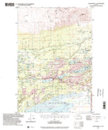
19 topographic sheets cover this place, the earliest surveyed in 1950 and the latest in 1994. It stands in Matanuska-Susitna census subarea. It lies in ZIP code area 99654. The Survey maps it on the Anchorage C-7 SW quadrangle. 9,054 people lived here at the 2020 count. It stands 341 feet above sea level.
Research this city
On record in Wasilla
Buildings and businesses the archive holds for this place. Each opens its own page, with the source record it came from.
On the National Register 7 records
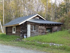 Knik Sitelisted 1973
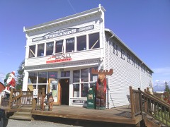 Teeland's Country Storelisted 1978
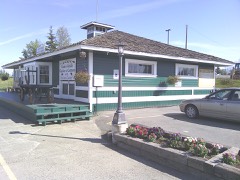 Wasilla Depotlisted 1977
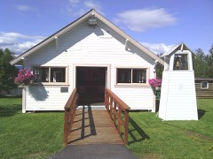 Wasilla Elementary Schoollisted 1980
- Blanche and Oscar Tryck Houselisted 2004
- Wasilla Community Halllisted 1982
- Whitney Section Houselisted 2004
Population over time
2 figuresWasilla grew from 7,831 to 9,054 between 2010 and 2020. These are the recorded population figures Wikidata holds for this place, reached through the Geographic Names Information System number this page is keyed on rather than by name, so they belong to this place and not to another of the same name. Most are census counts, but not all are: an early figure may be a founding or settlement estimate, and an estimate published within five years of a census is left out. The change column is computed, and is left blank where more than 20 years separate a figure from the one before it, because a gap that long is not a change between two counts.
| Year | People | Change |
|---|---|---|
| 2010 | 7,831 | |
| 2020 | 9,054 | +1,223 (+16%) |
Topographic sheets covering this place
9 surveys from 19 printed sheetsMatched by testing this settlement's coordinate against the published boundary of every sheet in the United States Geological Survey's historical collection. Each opens the scanned sheet at the Survey.
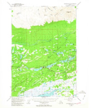
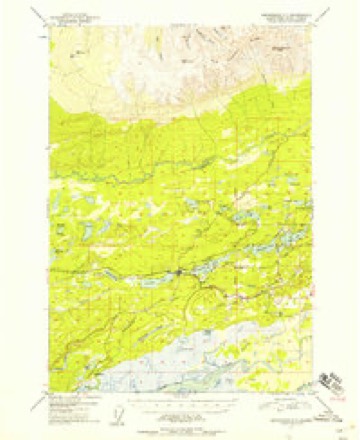
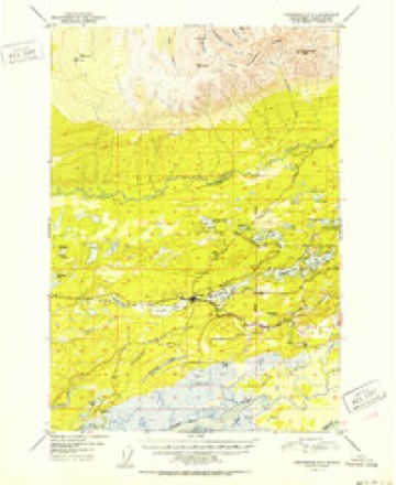
- 1950 USGS Anchorage C-7 quadrangle1:63360, 2 printings
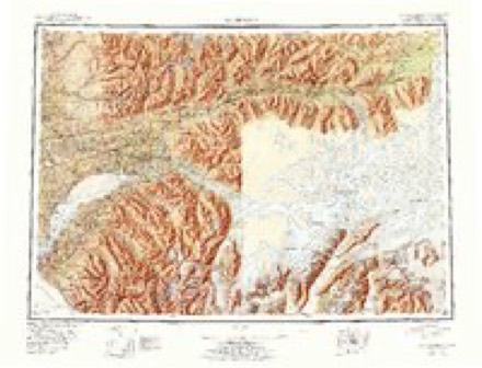
- 1951 USGS Anchorage quadrangle1:250000, 4 printings
- 1951 USGS Anchorage C-7 quadrangle1:63360
- 1952 USGS Anchorage C-7 quadrangle1:63360, 2 printings
- 1962 USGS Anchorage quadrangle1:250000, 6 printings
- 1979 USGS Anchorage quadrangle1:250000
- 1979 USGS Anchorage C-7 SW quadrangle1:25000
- 1992 USGS Anchorage C-7 SW quadrangle1:25000
- 1994 USGS Anchorage C-7 quadrangle1:63360
Fires near this place
582 since 1992Regional context, not property-specific evidence. The federal wildfire occurrence database lists 582 fires within 5 miles of Wasilla between 1992 and 2020, burning about 631 acres in total. None started naturally. 7 were recorded as arson. Distance is straight-line from the map coordinates, so a fire counted here may appear on a neighbouring settlement's page as well.
| Reported cause | Fires |
|---|---|
| Debris and open burning | 274 |
| Missing data/not specified/undetermined | 129 |
| Misuse of fire by a minor | 50 |
| Power generation/transmission/distribution | 34 |
| Recreation and ceremony | 29 |
| Equipment and vehicle use | 22 |
| Smoking | 16 |
| Fireworks | 11 |
| Other causes | 10 |
| Arson/incendiarism | 7 |
The most recent of them, most recent first, with the day each was reported and the service that recorded it.
| Date | Cause | Size | Reported by | Name on the report |
|---|---|---|---|---|
| 8 September 1998 | Debris and open burning | under an acre | Mat-Su Area | DIAMOND WAY |
| 5 September 1994 | Debris and open burning | under an acre | Mat-Su Area | LIMBERLST2 |
| 25 September 2010 | Power generation/transmission/distribution | under an acre | Mat-Su Area | MULCHATNA |
| 25 September 1996 | Debris and open burning | under an acre | Mat-Su Area | CRESTWOOD |
| 17 September 1996 | Recreation and ceremony | under an acre | Mat-Su Area | GREYBARK |
| 14 September 2007 | Power generation/transmission/distribution | under an acre | Mat-Su Area | not named |
| 12 September 1996 | Debris and open burning | under an acre | Mat-Su Area | DEFOREST |
| 10 September 1996 | Debris and open burning | under an acre | Mat-Su Area | TEELAND |
Settlements close enough to share some of these fires:
Mines and quarries near this place
8 within 5 milesRegional context, not property-specific evidence. The federal mineral resources record lists 8 workings within 5 miles of Wasilla: 5 past producers, 1 occurrence, 1 producer, 1 prospect. 1 still produces. What was taken out: Sand and Gravel, Construction, Calcium. Distance is straight-line from the map coordinates, so a quarry counted here may appear on a neighbouring settlement's page as well.
| Where | Site | Commodity | Status | Recorded |
|---|---|---|---|---|
| Lucille Lake | Calcium | Occurrence | ||
| Wasilla Lake | Calcium | Prospect | ||
| Central Rock and Sand | Sand and Gravel, Construction | Past Producer | ||
| Consteel | Sand and Gravel, Construction | Past Producer | ||
| Fairview Loop Road Pit | Sand and Gravel, Construction | Past Producer | ||
| Parks Highway Pit | Sand and Gravel, Construction | Past Producer | ||
| Wasilla Aggregate Pit & Plant | Sand and Gravel, Construction | Producer | ||
| Wasilla Pit | Sand and Gravel, Construction | Past Producer |
Storms near this place
8 since 2005Regional context, not property-specific evidence. The National Weather Service names Wasilla in 8 storm reports between 2005 and 2023: 5 flood, 2 hail, 1 lightning. No death or injury is recorded in these reports. Each account below is quoted exactly as the forecast office filed it, from the NOAA Storm Events Database, and each date opens the federal record of that event.
| When | Event | Place named | Harm | What the report says |
|---|---|---|---|---|
| January 2020 | Flood | Wasilla | $200,000 | Late on December 21, an ice jam on Willow Creek near the Deneki Bridge (61.77N, -149.956W) caused water to back up and flow through numerous residences. Deneki Road and access to the Deneki Bridge was closed for multiple weeks between December 21 and January 8, 2020. At least thirteen households evacuated on December 21-22 due to flooding or anticipation of road closures. Six homes were damaged by flood water; there was a report of knee-deep water in one home, as well as deep flowing water around the house, It formed a river in my yard . Numerous, (>10), cars were flooded and frozen in place. Also some cars had to be abandoned after owners tried to drive across the flood waters and became stuck. ||Examining the hydrographs, the most likely cause of the ice jam flooding was an ice dam which collapsed in the canyon, causing a mini breakup which was constricted and stopped at the Deneki Bridge. ||The MatSu Borough worked with private contractors to divert the water and allow access to the Deneki Bridge and the subdivision of homes and farms to which it provides the single point of access. Using heavy equipment, they mechanically removed the ice jam, which allowed the water flow to return to the channel, preventing it from flowing through the neighborhoods overland. |
| December 2019 | Flood | Wasilla | $200,000 | Late on December 21, an ice jam on Willow Creek near the Deneki Bridge (61.77N, -149.956W) caused water to back up and flow through numerous residences. Deneki Road and access to the Deneki Bridge was closed for multiple weeks between December 21 and January 8, 2020. At least thirteen households evacuated on December 21-22 due to flooding or anticipation of road closures. Six homes were damaged by flood water; there was a report of knee-deep water in one home, as well as deep flowing water around the house, It formed a river in my yard . Numerous, (>10), cars were flooded and frozen in place. Also some cars had to be abandoned after owners tried to drive across the flood waters and became stuck. ||Examining the hydrographs, the most likely cause of the ice jam flooding was an ice dam which collapsed in the canyon, causing a mini breakup which was constricted and stopped at the Deneki Bridge. ||The MatSu Borough worked with private contractors to divert the water and allow access to the Deneki Bridge and the subdivision of homes and farms to which it provides the single point of access. Using heavy equipment, they mechanically removed the ice jam, which allowed the water flow to return to the channel, preventing it from flowing through the neighborhoods overland. |
| April 2015 | Lightning | Wasilla | $2,000 | A lightning strike near Houston, AK knocked out power for more than 28,000 people. |The lightning strike at 5:42 p.m. affected the Intertie between Anchorage and Fairbanks, knocking out power from Willow to as far as North Pole and Salcha. According to Golden Valley Electric Association, strike knocked out 11 substations. |Power was restored to most people by 6:08 p.m., except some in the Cantwell area because of breaker problems in the Healy substation. Power was restored in Cantwell by 11:00 PM. |
| September 2023 | Flood | Wasilla | - | Heavy rains in the Matanuska Valley, specifically around Hatcher's Pass and the Enchanted Forest Subdivision in Houston, AK, reported minor flooding from 1-2 inches of rainfall that fell over the course of the 24 hour period September 1, 2023. |
| August 2022 | Flood | Wasilla | - | Flooding was verified by Alaska State Troopers in Wasilla. The Regional Operations Center and the State Emergency Operations Center reported on August 8th, 2022 at approximately 22:09 hours, Alaska State Troopers (AST) began receiving multiple 911 calls reporting flooding in the area of Schrock Road and Sitze Road in Wasilla. AST responded to the area discovering the road has been washed out and is impassible just past the Little Susitna River Bridge due to a culvert failing. Matsu Borough along with DOT is on scene working to repair the culvert and roadway. Its also been advised there is a bridge farther down Sitze Road that may be compromised and is being assessed. At this time, residence past this washout are un accessible. Additional patrols of the area also discovered North Sushana Drive is impassible due to the Little Susitna River flooding the road. These neighborhoods are also un accessible at this time. There were pictured posted on social media from the Alaska State Department of Transportation. SEOC also forwarded maps & pics of flooding in Houston. A news article with pictures can be seen here: https://www.adn.com/alaska-news/mat-su/2022/08/09/mat-su-flooding-closes-roads-threatens-homes-after-deluge-soaks-talkeetna-mountains/. |
| August 2022 | Flood | Wasilla | - | Numerous roads and low lying properties were reported to be flooded Monday night and Tuesday downstream from the Parks Highway Bridge and were impacted by flood waters for about 24-36 hours. |
| August 2015 | Hail | Wasilla | - | Largest hail reports were estimated from social media to be around 1.0 inch. An NWS employee reported 1.0 inch drifts of pea-sized hail. |
| July 2005 | Hail | Wasilla | - | no account filed |
Nearest settlements
The eight closest, with where each one stands in the county. Distances are straight-line, computed from the Geographic Names Information System coordinates.
| Map | Place | Distance | Sheets |
|---|---|---|---|
| Tanaina | 3.2 miles | 19 | |
| Cottonwood | 8.1 miles | 19 | |
| Meadow Lakes | 9.1 miles | 19 | |
| Gateway | 10.5 miles | 22 | |
| Matanuska | 11.4 miles | 22 | |
| Lucky Shot Landing | 13.5 miles | 18 | |
| Palmer | 17.4 miles | 22 | |
| Knik | 17.6 miles | 19 |
Elsewhere
Matched on this settlement's Geographic Names Information System number rather than its name, so it cannot be a different place of the same name in another state.
| Wikipedia article on Wasilla | An encyclopaedic summary. Its text is share-alike, so it is linked here rather than copied. |
| Wikidata item Q79957 | The structured record the population and elevation above come from. Public domain (CC0). |
Provenance
This settlement is recorded in the Geographic Names Information System as feature 1411788. The sheet list is computed by point-in-boundary test against the United States Geological Survey's historical topographic inventory. Both are works of the United States government and carry no copyright under 17 U.S.C. 105.
Wildfire. Short, Karen C. 2022. Spatial wildfire occurrence data for the United States, 1992-2020 [FPA_FOD_20221014]. 6th Edition. Fort Collins, CO: Forest Service Research Data Archive. https://doi.org/10.2737/RDS-2013-0009.6 Collected with United States Government funding and usable without additional permissions or fees.
Mines and quarries. USGS Mineral Resources Data System (MRDS) https://mrdata.usgs.gov/mrds/ A work of the United States government, no copyright under 17 U.S.C. 105.
Storms. NOAA National Centers for Environmental Information, Storm Events Database https://www.ncei.noaa.gov/stormevents/ A work of the United States government, no copyright under 17 U.S.C. 105. Narratives are quoted verbatim from the National Weather Service report and are not edited or summarised.