 Block
Coffeeville, Alabama
12 topographic sheets cover this place, the earliest surveyed in 1953 and the latest in 1984. It stands in the Coffeeville census division. It lies in ZIP code area 36524. It sits by Ball Bluff. The Survey maps it on the Coffeeville quadrangle. 263 people lived here at the 2020 count. It stands 177 feet above sea level.
Population over time
2 figuresCoffeeville fell from 352 to 263 between 2010 and 2020. These are the recorded population figures Wikidata holds for this place, reached through the Geographic Names Information System number this page is keyed on rather than by name, so they belong to this place and not to another of the same name. Most are census counts, but not all are: an early figure may be a founding or settlement estimate, and an estimate published within five years of a census is left out. The change column is computed, and is left blank where more than 20 years separate a figure from the one before it, because a gap that long is not a change between two counts.
| Year | People | Change |
|---|---|---|
| 2010 | 352 | |
| 2020 | 263 | -89 (-25%) |
Topographic sheets covering this place
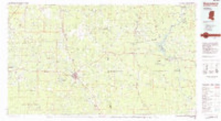
5 surveys from 12 printed sheetsMatched by testing this settlement's coordinate against the published boundary of every sheet in the United States Geological Survey's historical collection. Each opens the scanned sheet at the Survey.
- 1953 USGS Hattiesburg quadrangle1:250000, 4 printings
- 1958 USGS Hattiesburg quadrangle1:250000, 2 printings
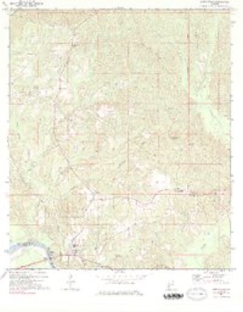
- 1971 USGS Coffeeville quadrangle1:24000, 2 printings
- 1984 USGS Hattiesburg quadrangle1:250000, 2 printings
- 1984 USGS Waynesboro quadrangle1:100000, 2 printings
Fires near this place
38 since 1994Regional context, not property-specific evidence. The federal wildfire occurrence database lists 38 fires within 5 miles of Coffeeville between 1994 and 2019, burning about 389 acres in total. 2 started naturally. 4 were recorded as arson. Distance is straight-line from the map coordinates, so a fire counted here may appear on a neighbouring settlement's page as well.
| Reported cause | Fires |
|---|---|
| Debris and open burning | 15 |
| Equipment and vehicle use | 5 |
| Arson/incendiarism | 4 |
| Recreation and ceremony | 4 |
| Missing data/not specified/undetermined | 3 |
| Natural | 2 |
| Smoking | 2 |
| Power generation/transmission/distribution | 2 |
| Railroad operations and maintenance | 1 |
The most recent of them, most recent first, with the day each was reported and the service that recorded it.
| Date | Cause | Size | Reported by | Name on the report |
|---|---|---|---|---|
| 4 September 1999 | Debris and open burning | under an acre | Alabama Forestry Commission | not named |
| 3 September 2019 | Debris and open burning | 10 acres | Alabama Forestry Commission | 20190903-1 |
| 3 September 2000 | Natural | 4.0 acres | Alabama Forestry Commission | not named |
| 21 September 2005 | Debris and open burning | under an acre | Alabama Forestry Commission | not named |
| 16 September 1997 | Equipment and vehicle use | 2.0 acres | Alabama Forestry Commission | not named |
| 31 August 2000 | Debris and open burning | 7.0 acres | Alabama Forestry Commission | not named |
| 28 August 2006 | Missing data/not specified/undetermined | 24 acres | Alabama Forestry Commission | not named |
| 27 August 2000 | Debris and open burning | 30 acres | Alabama Forestry Commission | not named |
Settlements close enough to share some of these fires:
Storms near this place
49 since 1994Regional context, not property-specific evidence. The National Weather Service names Coffeeville in 49 storm reports between 1994 and 2026: 27 thunderstorm wind, 13 hail, 4 tornado, 3 funnel cloud. No death or injury is recorded in these reports. Each account below is quoted exactly as the forecast office filed it, from the NOAA Storm Events Database, and each date opens the federal record of that event.
| When | Event | Place named | Harm | What the report says |
|---|---|---|---|---|
| March 1996 | Tornado (F1) | Coffeeville | $50,000 | no account filed |
| June 2016 | Thunderstorm Wind | Coffeeville | $10,000 | Winds estimated near 70 mph downed many trees and power lines near the city of Coffeeville. |
| July 2015 | Thunderstorm Wind | Coffeeville | $10,000 | Winds estimated at 60 mph downed trees and power lines just north of Coffeeville. |
| April 2019 | Thunderstorm Wind | Coffeeville | $5,000 | High winds downed a tree near Highway 84 and Winn Road. |
| July 2015 | Thunderstorm Wind | Coffeeville | $5,000 | Winds estimated at 60 mph downed trees and power lines which blocked a road. |
| April 2014 | Thunderstorm Wind | Coffeeville | $5,000 | Winds estimated at 60 mph downed trees on Highway 84. |
| February 2013 | Hail | Coffeeville | $5,000 | Large haul along with trees down. |
| December 2005 | Hail | Coffeeville | $5,000 | Golfball size hail fell along U. S. Highway 84 from Coffeeville to east of the city. Several vehicles were damaged by the large hail. The hail lasted several minutes and covered the ground. |
| July 1994 | Thunderstorm Wind | Coffeeville | $5,000 | Thunderstorm winds uprooted numerous trees along Highway 69 south of Coffeeville, in the area just east of Coffeeville, and along Highway 154 northeast of Coffeeville. Falling trees did minor damage to two houses. |
| July 2016 | Thunderstorm Wind | Coffeeville | $3,000 | Winds estimated at 60 mph downed a large tree across a road. |
| June 2012 | Thunderstorm Wind | Coffeeville | $3,000 | Winds estimated at 60 mph blew down trees near the intersection of Hwy 84 and County Road 3. |
| February 2016 | Thunderstorm Wind | Coffeeville | $2,000 | Winds estimated at 60 mph downed a large tree across Highway 69. |
| February 2016 | Thunderstorm Wind | Coffeeville | $2,000 | Winds estimated at 60 mph downed a tree on Highway 154 at MM 6. |
| July 2012 | Thunderstorm Wind | Coffeeville | $2,000 | Winds estimated at 60 mph downed a tree on Hwy 154 at mile marker 10. |
| March 2026 | Thunderstorm Wind | Coffeeville | - | Multiple trees down in Clarke county, blocking lanes of US-84 and AL-5. |
| February 2025 | Tornado (EF2) | Coffeeville | - | An EF2 tornado occurred just south of Coffeeville near Tattlersville. This tornado began on the west side of the Tombigbee River based on radar observed tornado debris signature. Prior to highway 69, high resolution satellite imagery revealed a substantial swath of EF1 tree damage with numerous convergent tree uproots in about a 650-yard-wide swath. The tornado first crossed Highway 69 where ground survey crew observed scattered to numerous trees snapped or uprooted. The tornado intensified as it went northeast quickly widening again to near 650 yards wide and beginning to produce EF2 tree damage between Highway 69 and Winn Road. Low end EF2 tree damage was observed by ground survey crew on Winn Road where many tree snaps occurred. The next road the tornado crossed was Center Point Road and Norris Road where multiple tree snaps were observed. The tornado briefly re-attained EF2 intensity with numerous tree snaps and uproots visible on high resolution satellite imagery between Norris Road and Reedy Hill Road. As the tornado approached and crossed Reedy Hill Road it gradually weakened, lifting just northeast of Reedy Hill Road. |
| January 2023 | Thunderstorm Wind | Coffeeville | - | High winds snapped trees and damaged a roof. |
| June 2023 | Thunderstorm Wind | Coffeeville | - | High winds downed trees a block west of Bend Road. |
| June 2023 | Thunderstorm Wind | Coffeeville | - | High winds downed trees. |
| April 2022 | Thunderstorm Wind | Coffeeville | - | High winds downed trees which blocked the road near Highway 69 and Ulcanush Lane. |
| April 2022 | Tornado (EF2) | Coffeeville | - | A strong EF2 tornado touched down on the Choctaw County side of|the Tombigbee River on 4/5/22 at 9:03 AM CDT. Aerial survey|revealed the tornado rapidly widened and intensified as it crossed|the river, reaching its peak intensity and width on the Clarke|County side at 130 mph and 800 yards in width. The forest along|and east of the river was mowed down with countless hardwood and|softwood trees snapped/uprooted. The tornado continued towards|West Bend Road where it produced EF1 damage over a wide swath|around 550 yards wide. The tornado entered a very distinct multi|vortex phase with three notable convergent damage patterns with|snapped softwood/hardwood trees at this point. This continued|east-northeast to Highway 69 where the tornado remained somewhere|between 500 to 600 yards wide as a multi-vortex doing EF1 damage,|snapping several hardwoods/softwoods and causing some minor to|moderate roof damage to homes. As the tornado moved northeast|towards Bethel Road, it weakened and narrowed in size considerably|only doing a small swath of EF0 damage. The tornado then turned|right towards the east and re-intensified into an EF1 at|Friendship Road with winds upwards of 95 mph as it snapped several|softwood trees. After this, the tornado weakened quickly coming|to an end on Smyer Road where only a couple snapped softwood trees|were noted. A special thanks to Alabama Law Enforcement Agency|and Clarke County EMA for conducting the aerial survey to help|ascertain the peak width and intensity of the tornado. |
| April 2022 | Tornado (EF1) | Coffeeville | - | A unique, brief satellite tornado began south of the Clarke County|EF2 tornado on 4/5/22 at approximately 9:10 AM CDT. This satellite|tornado produced EF1 damage where several softwood trees were|snapped/uprooted on Ice Plant Road. The tornado continued east-|northeast impacting a barn where there was significant loss of|roofing material and side covering. The tornado also uprooted a|large oak tree at this location. The tornado then quickly turned|east crossing Bethel Road and reaching Smyer Road as an EF0|snapping a couple softwood trees. The tornado completed its arc|around the southern periphery of the EF2 tornado with the|satellite tornado tracking due north along Smyer Road just before|Friendship Road, lifting just shy of the primary tornado|circulation. EF0 damage with a couple uprooted softwood trees were|the last observable damage at this point. |
| June 2022 | Thunderstorm Wind | Coffeeville | - | High winds downed treess on Highway 69 near Thronton Circle. |
| April 2021 | Hail | Coffeeville | - | Hail up to tennis ball size reported on Highway 69 between Coffeeville and Salipta. The hail caused vehicle damage. |
| May 2021 | Thunderstorm Wind | Coffeeville | - | High winds downed trees and blocked a road near Coffeeville. |
| January 2020 | Thunderstorm Wind | Coffeeville | - | High winds blew the roof off a mobile home on Hickory Street. |
| May 2020 | Thunderstorm Wind | Coffeeville | - | High winds downed trees that covered both lanes of Highway 154. |
| April 2020 | Thunderstorm Wind | Coffeeville | - | Severe thunderstorm wind gusts downed trees and power lines on Highway 154 near the 2 mile marker. |
| January 2019 | Flash Flood | Coffeeville | - | Multiple roads closed across northwestern Clarke County due to water over the road. |
| June 2019 | Thunderstorm Wind | Coffeeville | - | High winds downed trees along Highway 84 and also in the Scyrene community. |
| December 2015 | Thunderstorm Wind | Coffeeville | - | Severe thunderstorm wind gusts around 60 mph down trees on Highway 84 near the Tombigbee River Bridge. |
| May 2012 | Thunderstorm Wind | Coffeeville | - | Winds estimated at 60 mph downed a tree on house causing extensive damage. |
| April 2011 | Funnel Cloud | Coffeeville | - | Public reported funnel cloud near the intersection of Highway 69 and County Road 31. |
| April 2011 | Thunderstorm Wind | Coffeeville | - | Trees blown down by severe thunderstorm winds near 60 mph on West Bend Road. |
| April 2011 | Thunderstorm Wind | Coffeeville | - | Trees blown down by severe thunderstorm winds near 60 mph on West Bend Road. |
| January 2010 | Thunderstorm Wind | Coffeeville | - | Two trees were snapped in half and downed on West Bend Road about 1 mile off Highway 69. |
| May 1999 | Hail | Coffeeville | - | Quarter size hail was reported near the Coffeeville Lock and Dam. |
| April 1998 | Hail | Coffeeville | - | Dime size hail was reported near Coffeeville. |
| May 2010 | Funnel Cloud | Coffeeville | - | no account filed |
| May 2010 | Hail | Coffeeville | - | no account filed |
| April 2010 | Hail | Coffeeville | - | no account filed |
| April 2010 | Hail | Coffeeville | - | no account filed |
| May 2009 | Hail | Coffeeville | - | no account filed |
| April 2008 | Hail | Coffeeville | - | no account filed |
| January 2008 | Funnel Cloud | Coffeeville | - | no account filed |
| April 2008 | Flash Flood | Coffeeville | - | no account filed |
| March 2005 | Hail | Coffeeville | - | no account filed |
| April 2005 | Hail | Coffeeville | - | no account filed |
| December 1996 | Hail | Coffeeville | - | no account filed |
Nearest settlements
The eight closest, with where each one stands in the county. Distances are straight-line, computed from the Geographic Names Information System coordinates.
| Map | Place | Distance | Sheets |
|---|---|---|---|
| Fakit Chipunta (historical) | 3.4 miles | 12 | |
| Tattlersville | 3.6 miles | 12 | |
| Center Point | 3.8 miles | 12 | |
| West Bend | 5.1 miles | 12 | |
| McEntyre | 7.4 miles | 7 | |
| Salitpa | 9.6 miles | 12 | |
| Cunningham | 9.9 miles | 12 | |
| Smyer | 9.9 miles | 12 |
Elsewhere
Matched on this settlement's Geographic Names Information System number rather than its name, so it cannot be a different place of the same name in another state.
| Wikipedia article on Coffeeville | An encyclopaedic summary. Its text is share-alike, so it is linked here rather than copied. |
| Wikidata item Q66835 | The structured record the population and elevation above come from. Public domain (CC0). |
Provenance
This settlement is recorded in the Geographic Names Information System as feature 116356. The sheet list is computed by point-in-boundary test against the United States Geological Survey's historical topographic inventory. Both are works of the United States government and carry no copyright under 17 U.S.C. 105.
Wildfire. Short, Karen C. 2022. Spatial wildfire occurrence data for the United States, 1992-2020 [FPA_FOD_20221014]. 6th Edition. Fort Collins, CO: Forest Service Research Data Archive. https://doi.org/10.2737/RDS-2013-0009.6 Collected with United States Government funding and usable without additional permissions or fees.
Storms. NOAA National Centers for Environmental Information, Storm Events Database https://www.ncei.noaa.gov/stormevents/ A work of the United States government, no copyright under 17 U.S.C. 105. Narratives are quoted verbatim from the National Weather Service report and are not edited or summarised.