 Block
Enterprise, Alabama
12 topographic sheets cover this place, the earliest surveyed in 1942 and the latest in 1981. It stands in the Enterprise census division. It lies in ZIP code area 36330. The Survey maps it on the Enterprise quadrangle. 28,711 people lived here at the 2020 count. It stands 358 feet above sea level.
Research this city
On record in Enterprise
Buildings and businesses the archive holds for this place. Each opens its own page, with the source record it came from.
On the National Register 3 records
 Boll Weevil Monumentlisted 1973
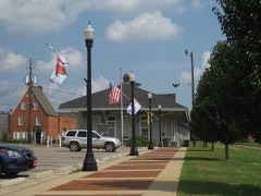 Seaboard Coastline Depotlisted 1974
- Rawls Hotellisted 1980
Population over time
2 figuresEnterprise grew from 26,562 to 28,711 between 2010 and 2020. These are the recorded population figures Wikidata holds for this place, reached through the Geographic Names Information System number this page is keyed on rather than by name, so they belong to this place and not to another of the same name. Most are census counts, but not all are: an early figure may be a founding or settlement estimate, and an estimate published within five years of a census is left out. The change column is computed, and is left blank where more than 20 years separate a figure from the one before it, because a gap that long is not a change between two counts.
| Year | People | Change |
|---|---|---|
| 2010 | 26,562 | |
| 2020 | 28,711 | +2,149 (+8%) |
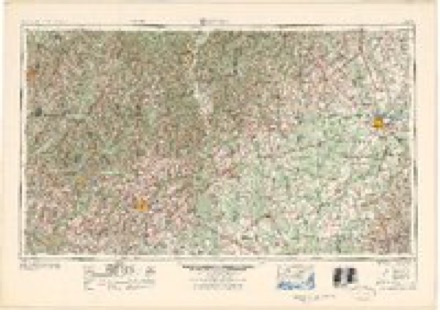
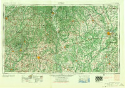
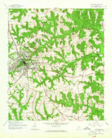
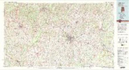
Topographic sheets covering this place
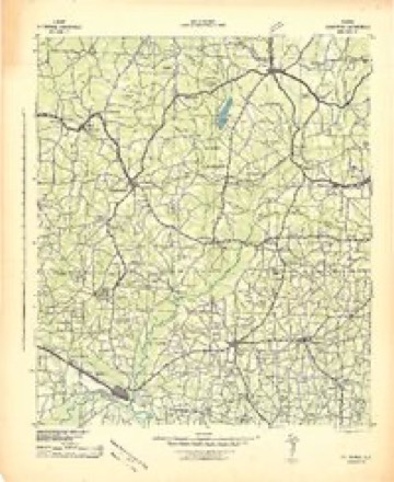
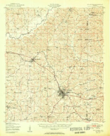
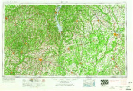
7 surveys from 12 printed sheetsMatched by testing this settlement's coordinate against the published boundary of every sheet in the United States Geological Survey's historical collection. Each opens the scanned sheet at the Survey.
- 1942 USGS Enterprise quadrangle1:125000
- 1950 USGS Enterprise quadrangle1:62500, 2 printings
- 1953 USGS Dothan quadrangle1:250000, 3 printings
- 1954 USGS Dothan quadrangle1:250000
- 1955 USGS Dothan quadrangle1:250000
- 1960 USGS Enterprise quadrangle1:24000, 3 printings
- 1981 USGS Dothan quadrangle1:100000
Photographs
5 photographs, 1939 to 1941Taken for the Office of War Information and the Farm Security Administration, who photographed the country between 1935 and 1944. Works of United States government photographers, with no known restriction on use. Each opens its catalogue record.

Wolcott, Marion Post, 1939. Library of Congress

Collier, John, Jr, 1941. Library of Congress
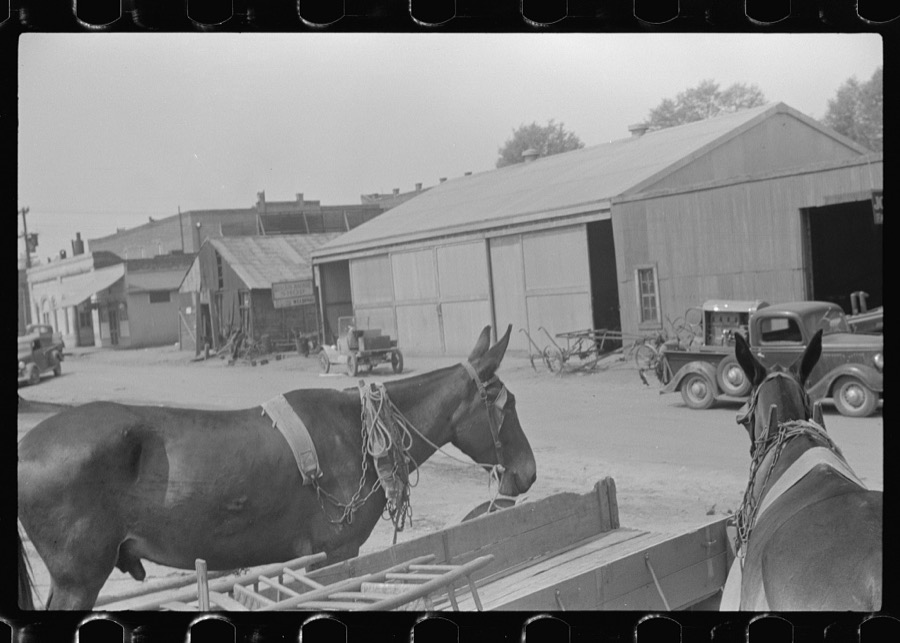
Wolcott, Marion Post, 1939. Library of Congress

Wolcott, Marion Post, 1939. Library of Congress

Wolcott, Marion Post, 1939. Library of Congress
Fires near this place
31 since 1994Regional context, not property-specific evidence. The federal wildfire occurrence database lists 31 fires within 5 miles of Enterprise between 1994 and 2017, burning about 150 acres in total. 1 started naturally. None was recorded as arson. Distance is straight-line from the map coordinates, so a fire counted here may appear on a neighbouring settlement's page as well.
| Reported cause | Fires |
|---|---|
| Debris and open burning | 15 |
| Missing data/not specified/undetermined | 5 |
| Recreation and ceremony | 3 |
| Equipment and vehicle use | 3 |
| Misuse of fire by a minor | 3 |
| Railroad operations and maintenance | 1 |
| Natural | 1 |
The most recent of them, most recent first, with the day each was reported and the service that recorded it.
| Date | Cause | Size | Reported by | Name on the report |
|---|---|---|---|---|
| 19 September 2007 | Missing data/not specified/undetermined | under an acre | Alabama Forestry Commission | not named |
| 1 September 2011 | Debris and open burning | 15 acres | Alabama Forestry Commission | 11367 HWY 84, AL |
| 30 August 1995 | Recreation and ceremony | under an acre | Alabama Forestry Commission | not named |
| 21 August 2000 | Natural | under an acre | Alabama Forestry Commission | not named |
| 6 July 2000 | Missing data/not specified/undetermined | 1.0 acres | Alabama Forestry Commission | not named |
| 15 July 2000 | Debris and open burning | under an acre | Alabama Forestry Commission | not named |
| 10 June 2011 | Missing data/not specified/undetermined | 18 acres | Alabama Forestry Commission | CR 167, AL |
| 31 May 2001 | Misuse of fire by a minor | 2.0 acres | Alabama Forestry Commission | not named |
Settlements close enough to share some of these fires:
Mines and quarries near this place
8 within 5 milesRegional context, not property-specific evidence. The federal mineral resources record lists 8 workings within 5 miles of Enterprise: 3 occurrences, 3 unknowns, 2 past producers. None of them still produces. What was taken out: Iron, Gold. Distance is straight-line from the map coordinates, so a quarry counted here may appear on a neighbouring settlement's page as well.
| Where | Site | Commodity | Status | Recorded |
|---|---|---|---|---|
| Chinca-Pine Mine | Gold | Past Producer | ||
| Eley Mine | Gold | Past Producer | ||
| Unnamed | Iron | Unknown | ||
| Unnamed | Iron | Unknown | ||
| Unnamed | Iron | Unknown | ||
| Unnamed Deposit | Iron | Occurrence | ||
| Unnamed Deposit | Iron | Occurrence | ||
| Unnamed Mine | Iron | Occurrence |
Storms near this place
60 of 72 shownRegional context, not property-specific evidence. The National Weather Service names Enterprise in 72 storm reports between 1994 and 2026: 46 thunderstorm wind, 17 hail, 3 lightning, 3 tornado. The reports record 1 death and 2 injuries. Each account below is quoted exactly as the forecast office filed it, from the NOAA Storm Events Database, and each date opens the federal record of that event.
| When | Event | Place named | Harm | What the report says |
|---|---|---|---|---|
| June 1996 | Lightning | Enterprise | 1 killed, 2 hurt | no account filed |
| October 2008 | Tornado (EF1) | Enterprise | $4,000,000 | A tornado touched down just south of the Enterprise Civic Center. It moved to the east-northeast and lifted just east of Boll Weevil Circle near the Walmart. It caused extensive damage to the civic center, with several windows blown out and much of its roof removed. The winds damaged several vehicles outside the Enterprise Senior Center. A building attached to the old Bama Cotton Mill collapsed. More than a hundred homes and businesses were also damaged. Fortunately, no injuries or deaths were reported. The tornado was rated an EF-1 with winds estimated from 100 to 105 mph. |
| September 1998 | Tornado (F1) | Enterprise | $1,500,000 | An F1 tornado touched down on CR 725 near Enterprise. One residence suffered roof damage. Camp Wiregrass sustained moderate to severe damage with several buildings crumpled, trees and power lines down, and scattered debris. Numerous customers in Enterprise were without electric service. A semi was blown over at Con Agra. |
| July 2004 | Lightning | Enterprise | $150,000 | Lightning struck a house, destroying the patio and attic. Another house struck by lightning lost its sprinkler system and air conditioner. Reported by the Coffee County EMA. |
| April 2015 | Flash Flood | Enterprise | $50,000 | Around a dozen streets were flooded in Enterprise. There was one water rescue of an SUV that stalled in high water. More than a foot of water entered the downtown fire station requiring sandbags and moving furniture. Flash flooding also occurred along a creek along Dixie Drive. Water entered some homes and some residents were evacuated briefly in that area. Damage was estimated. |
| August 1994 | Thunderstorm Wind | Enterprise | $50,000 | Strong wind ripped a substantial limb from a tree on Edwards Street in Enterprise early Monday morning according to newspaper reports. The limb fell on a late model car shattering the windshield and crushing the roof. Specific time entry is estimated. |
| August 2010 | Lightning | Enterprise | $25,000 | Lightning struck the Coffee county District Attorney's office, causing significant computer damage with monetary losses estimated at $25,000. |
| November 2006 | Thunderstorm Wind | Enterprise | $25,000 | Straight-line winds caused extensive damage to a chicken house at the intersection of State Road 27 and Boll Weevile Circle (Highway 192). |
| August 2000 | Thunderstorm Wind | Enterprise | $20,000 | Trees and power lines down. A high school's roof was damaged. Reported by an Enterprise TV station. |
| June 2018 | Thunderstorm Wind | Enterprise | $15,000 | Three large trees were blown down in a yard with one tree falling on a truck. Damage was estimated. |
| June 2010 | Thunderstorm Wind | Enterprise | $12,500 | Numerous trees and power lines were blown down around Enterprise. The monetary damage figure provided is a rough estimate. |
| July 2013 | Thunderstorm Wind | Enterprise | $10,000 | The public reported on facebook that tons of fences were ripped apart in Enterprise due to strong winds. |
| August 1996 | Thunderstorm Wind | Enterprise | $8,000 | no account filed |
| June 2023 | Thunderstorm Wind | Enterprise | $5,000 | Multiple trees and power lines were blown down across the county. |
| August 2016 | Thunderstorm Wind | Enterprise | $5,000 | Several trees, power lines, and poles were blown down mainly on the north side of Enterprise. |
| April 2015 | Thunderstorm Wind | Enterprise | $5,000 | Numerous trees and power lines were blown down. |
| June 2012 | Thunderstorm Wind | Enterprise | $5,000 | Several trees were blown down in Enterprise. Monetary damage was estimated. |
| June 2001 | Thunderstorm Wind | Enterprise | $5,000 | Numerous trees and power lines down. Reported by the Coffee County EMA. |
| April 2020 | Thunderstorm Wind | Enterprise | $3,000 | Several trees and power lines were blown down across the Enterprise area. |
| August 2013 | Thunderstorm Wind | Enterprise | $3,000 | The Coffee County Emergency Manager reported several trees down on the northern side of Enterprise. |
| June 2012 | Thunderstorm Wind | Enterprise | $3,000 | Trees and power lines were blown down in and around Enterprise. Monetary damage was estimated. |
| January 1996 | Thunderstorm Wind | Enterprise | $3,000 | no account filed |
| July 2018 | Thunderstorm Wind | Enterprise | $2,000 | Several trees were blown down with power outages in Enterprise. |
| March 2016 | Thunderstorm Wind | Enterprise | $2,000 | The Covington Electric Coop reported a billboard sign blown into power lines on Rucker Blvd in Enterprise. |
| May 2015 | Thunderstorm Wind | Enterprise | $2,000 | A tree was blown down onto power lines on Meredith Street. |
| March 2014 | Thunderstorm Wind | Enterprise | $2,000 | Power lines were blown down on Antler Dr. |
| May 2006 | Thunderstorm Wind | Enterprise | $2,000 | The Coffee County EMA reported power lines down on County Road 410. |
| November 2020 | Thunderstorm Wind | Enterprise | $1,000 | The Enterprise police reported a telephone wire blown down along with estimated wind gusts of 60 mph. |
| March 2016 | Thunderstorm Wind | Enterprise | $1,000 | Damage was reported to a few fences with a few fence sections blown over. In addition, large limbs were broken off two trees. A flag pole was also tilted by the wind to about a 35 to 40 degree angle. |
| April 2015 | Thunderstorm Wind | Enterprise | $1,000 | A tree was blown down on Antler Drive. |
| November 2014 | Thunderstorm Wind | Enterprise | $1,000 | A tree was blown down on Virginia Street and another on Highway 92 in Enterprise. |
| July 2013 | Thunderstorm Wind | Enterprise | $1,000 | A traffic signal fell at the intersection of Rucker Blvd and Dixie Dr. |
| January 2006 | Thunderstorm Wind | Enterprise | $1,000 | The Coffee County EMA reported downed trees in Enterprise. |
| June 2004 | Thunderstorm Wind | Enterprise | $1,000 | Downed trees reported by the Coffee County EMA. |
| March 2001 | Thunderstorm Wind | Enterprise | $1,000 | Trees down. Reported by the Coffee County Sheriff. |
| August 1995 | Thunderstorm Wind | Enterprise | $1,000 | Police department in New Brockton reported trees and power lines down. Sheriff's office reported several large trees down across roads near Enterprise. |
| April 2000 | Thunderstorm Wind | Enterprise | $500 | The Coffee County EMA reported some trees down on Timberlake Drive. |
| July 2007 | Thunderstorm Wind | Enterprise | $250 | A few utility poles were down in the northern part of the city. |
| January 2026 | Thunderstorm Wind | Enterprise | - | A tree was blown down in Enterprise. |
| March 2026 | Thunderstorm Wind | Enterprise | - | Trees were blown down across Coffee county. |
| March 2025 | Thunderstorm Wind | Enterprise | - | An oak tree was uprooted at Enterprise High School. |
| March 2025 | Thunderstorm Wind | Enterprise | - | Trees were blown down on Cherry Hill Road, Pinehurst Dr, Sylvan Dr, and Janice Street. |
| June 2025 | Thunderstorm Wind | Enterprise | - | A tree was blown down in Enterprise. |
| April 2022 | Thunderstorm Wind | Enterprise | - | A few trees were blown down. |
| March 2022 | Flash Flood | Enterprise | - | College Street in Enterprise was flooded. |
| April 2021 | Hail | Enterprise | - | A law enforcement officer reported quarter size hail hitting their patrol vehicle. |
| April 2021 | Thunderstorm Wind | Enterprise | - | A tree was blown down onto Iroquois Street. |
| January 2020 | Thunderstorm Wind | Enterprise | - | A picture was posted on social media showing a large tree branch snapped off in a driveway in Enterprise. |
| November 2020 | Hail | Enterprise | - | The public reported nickel sized hail in the Enterprise area via social media. |
| November 2020 | Hail | Enterprise | - | The public reported nickel to quarter sized hail near Enterprise via social media. |
| July 2018 | Thunderstorm Wind | Enterprise | - | Several trees were blown down in the Enterprise area. |
| May 2017 | Hail | Enterprise | - | Quarter sized hail was reported northeast of Enterprise. |
| September 2017 | Hail | Enterprise | - | Quarter sized hail fell near Enterprise with a picture posted on social media. |
| November 2016 | Thunderstorm Wind | Enterprise | - | A tree was blown down onto Grimes Street. |
| August 2015 | Hail | Enterprise | - | Dime to nickel size hail was reported between New Brockton and Enterprise with large tree limbs also blown down. |
| June 2015 | Thunderstorm Wind | Enterprise | - | A tree was blown down on Cahaba Drive. |
| June 2015 | Thunderstorm Wind | Enterprise | - | A tree was blown down on Silver Oak Dr. |
| March 2009 | Thunderstorm Wind | Enterprise | - | A citizen reported the tops of a dozen large pine trees were snapped. |
| March 2009 | Hail | Enterprise | - | Nickel sized hail was reported between County Road 625 and Boll Weevil Circle. |
| April 2006 | Hail | Enterprise | - | Penny size hail reported by the Coffee County EMA. |
Nearest settlements
The eight closest, with where each one stands in the county. Distances are straight-line, computed from the Geographic Names Information System coordinates.
| Map | Place | Distance | Sheets |
|---|---|---|---|
| Singing Brook | 0.9 miles | 12 | |
| Griffin Heights | 1.0 miles | 12 | |
| North Heights | 1.0 miles | 12 | |
| Green Acres | 1.1 miles | 12 | |
| Hillcrest | 1.1 miles | 12 | |
| Jamestown Colony | 1.1 miles | 12 | |
| College Heights | 1.2 miles | 12 | |
| Pine Forest | 1.5 miles | 11 |
Elsewhere
Matched on this settlement's Geographic Names Information System number rather than its name, so it cannot be a different place of the same name in another state.
| Wikipedia article on Enterprise | An encyclopaedic summary. Its text is share-alike, so it is linked here rather than copied. |
| Wikidata item Q79260 | The structured record the population and elevation above come from. Public domain (CC0). |
Provenance
This settlement is recorded in the Geographic Names Information System as feature 118005. The sheet list is computed by point-in-boundary test against the United States Geological Survey's historical topographic inventory. Both are works of the United States government and carry no copyright under 17 U.S.C. 105.
Wildfire. Short, Karen C. 2022. Spatial wildfire occurrence data for the United States, 1992-2020 [FPA_FOD_20221014]. 6th Edition. Fort Collins, CO: Forest Service Research Data Archive. https://doi.org/10.2737/RDS-2013-0009.6 Collected with United States Government funding and usable without additional permissions or fees.
Mines and quarries. USGS Mineral Resources Data System (MRDS) https://mrdata.usgs.gov/mrds/ A work of the United States government, no copyright under 17 U.S.C. 105.
Storms. NOAA National Centers for Environmental Information, Storm Events Database https://www.ncei.noaa.gov/stormevents/ A work of the United States government, no copyright under 17 U.S.C. 105. Narratives are quoted verbatim from the National Weather Service report and are not edited or summarised.