 Block
Hartselle, Alabama
19 topographic sheets cover this place, the earliest surveyed in 1888 and the latest in 1984. It stands in the Hartselle census division. It lies in ZIP code area 35640. It stands on Town Branch. The Survey maps it on the Hartselle quadrangle. 15,455 people lived here at the 2020 count. It stands 676 feet above sea level.
On record in Hartselle
Buildings and businesses the archive holds for this place. Each opens its own page, with the source record it came from.
On the National Register 2 records
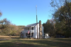 Crabb-Stewart-Key Houselisted 2019
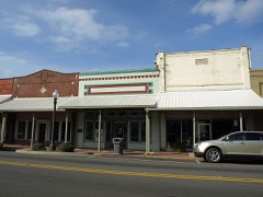 Hartselle Downtown Commercial Historic Districtlisted 1999
Population over time
2 figuresHartselle grew from 14,255 to 15,455 between 2010 and 2020. These are the recorded population figures Wikidata holds for this place, reached through the Geographic Names Information System number this page is keyed on rather than by name, so they belong to this place and not to another of the same name. Most are census counts, but not all are: an early figure may be a founding or settlement estimate, and an estimate published within five years of a census is left out. The change column is computed, and is left blank where more than 20 years separate a figure from the one before it, because a gap that long is not a change between two counts.
| Year | People | Change |
|---|---|---|
| 2010 | 14,255 | |
| 2020 | 15,455 | +1,200 (+8%) |
Topographic sheets covering this place
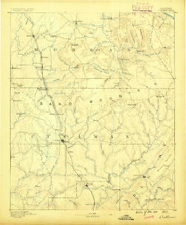
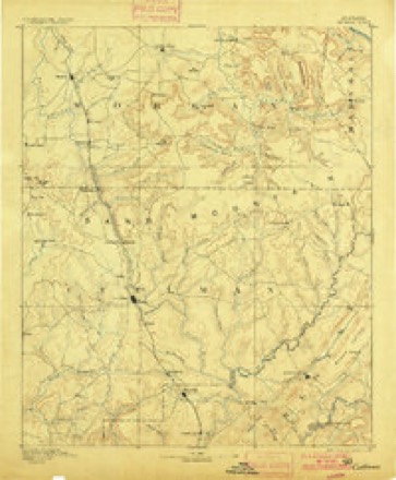
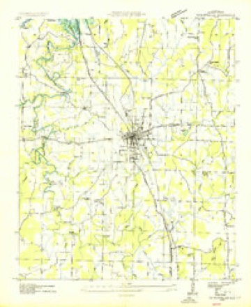
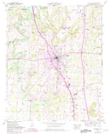
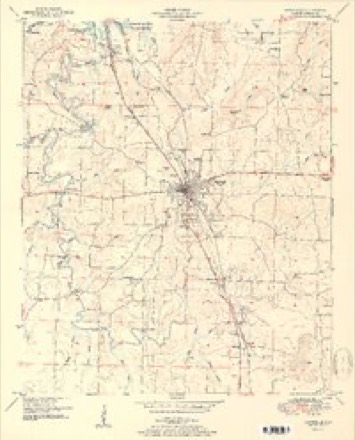
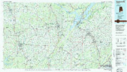
10 surveys from 19 printed sheetsMatched by testing this settlement's coordinate against the published boundary of every sheet in the United States Geological Survey's historical collection. Each opens the scanned sheet at the Survey.
- 1888 USGS Cullman quadrangle1:125000
- 1892 USGS Cullman quadrangle1:125000, 4 printings
- 1936 USGS Hartselle quadrangle1:24000
- 1949 USGS Hartselle quadrangle1:24000, 2 printings
- 1951 USGS Hartselle quadrangle1:24000, 2 printings
- 1956 USGS Gadsden quadrangle1:250000, 3 printings
- 1958 USGS Gadsden quadrangle1:250000
- 1960 USGS Gadsden quadrangle1:250000, 2 printings
- 1963 USGS Gadsden quadrangle1:250000
- 1984 USGS Guntersville quadrangle1:100000, 2 printings




Fires near this place
92 since 1994Regional context, not property-specific evidence. The federal wildfire occurrence database lists 92 fires within 5 miles of Hartselle between 1994 and 2020, burning about 460 acres in total. 1 started naturally. 13 were recorded as arson. Distance is straight-line from the map coordinates, so a fire counted here may appear on a neighbouring settlement's page as well.
| Reported cause | Fires |
|---|---|
| Debris and open burning | 33 |
| Missing data/not specified/undetermined | 14 |
| Arson/incendiarism | 13 |
| Equipment and vehicle use | 11 |
| Recreation and ceremony | 7 |
| Smoking | 6 |
| Misuse of fire by a minor | 4 |
| Railroad operations and maintenance | 2 |
| Natural | 1 |
| Fireworks | 1 |
The most recent of them, most recent first, with the day each was reported and the service that recorded it.
| Date | Cause | Size | Reported by | Name on the report |
|---|---|---|---|---|
| 7 September 1999 | Missing data/not specified/undetermined | under an acre | Alabama Forestry Commission | not named |
| 6 September 2018 | Equipment and vehicle use | 6.0 acres | Alabama Forestry Commission | 20180906-1 |
| 6 September 1999 | Debris and open burning | under an acre | Alabama Forestry Commission | not named |
| 4 September 1998 | Arson/incendiarism | 1.0 acres | Alabama Forestry Commission | not named |
| 3 September 2000 | Smoking | 1.0 acres | Alabama Forestry Commission | not named |
| 3 September 1998 | Arson/incendiarism | under an acre | Alabama Forestry Commission | not named |
| 29 September 2016 | Missing data/not specified/undetermined | 3.5 acres | Alabama Forestry Commission | 20160929-21 |
| 2 September 2000 | Missing data/not specified/undetermined | 5.0 acres | Alabama Forestry Commission | not named |
Settlements close enough to share some of these fires:
Storms near this place
60 of 91 shownRegional context, not property-specific evidence. The National Weather Service names Hartselle in 91 storm reports between 1994 and 2026: 50 thunderstorm wind, 26 hail, 6 flash flood, 4 lightning. The reports record 1 injury. Each account below is quoted exactly as the forecast office filed it, from the NOAA Storm Events Database, and each date opens the federal record of that event.
| When | Event | Place named | Harm | What the report says |
|---|---|---|---|---|
| March 2012 | Lightning | Hartselle | 1 hurt, $20,000 | Lightning struck a female who was taking photos with a cell phone of a storm with her arm outside the home through a doorway. The female felt a surge of electricity through her arm, into her neck and out her wrist which appeared bruised. She then fell backwards and suffered a seizure for several minutes, then called 911 for emergency assistance. She was hospitalized overnight and released the next morning. The Morgan County emergency manager reported at least 3 fires sparked by lightning their county. Two 46000 volt circuits were also damaged in Decatur with about 4250 utility customers losing power for a few hours. |
| May 2009 | Lightning | Hartselle | $2,000,000 | Lightning struck a four story, 20,000 square foot house on Breeding Drive north of Hartselle. A mother and child were in the home at the time and escaped without injury, as the fire erupted and quickly spread throughout the house. Tragically, this house was burned to the ground. In addition, the blaze destroyed two antique cars. |
| October 1997 | Lightning | Hartselle | $90,000 | Lightning struck a switch box and traveled into a house starting a fire in Falkville. The house was completely destroyed. A man inside the house died of smoke inhalation. |
| April 2006 | Hail | Hartselle | $40,000 | Tennis ball size hail was reported and produced slight to moderate damage to around ten vehicles and five homes. |
| February 2000 | Thunderstorm Wind | Hartselle | $40,000 | A large tree fell onto a home damaging it. One outbuilding was totally destroyed. A roof was torn off a car wash in Hartselle with no injuries reported. |
| May 1996 | Thunderstorm Wind | Hartselle | $25,000 | no account filed |
| April 1996 | Thunderstorm Wind | Hartselle | $25,000 | no account filed |
| April 2025 | Thunderstorm Wind | Hartselle | $20,000 | Two trees were knocked down onto townhomes at 708 Midway Street NW. |
| April 2014 | Thunderstorm Wind | Hartselle | $15,000 | A few trees were downed by thunderstorms from Hartselle to Somerville, Alabama. A tree also fell onto a home, producing some roof damage at Somerville, Alabama. |
| July 1996 | Thunderstorm Wind | Hartselle | $15,000 | no account filed |
| February 2011 | Thunderstorm Wind | Hartselle | $10,000 | Roof damage occurred due to high winds. |
| April 2025 | Thunderstorm Wind | Hartselle | $5,000 | Several trees were reported down in the Hartselle area. |
| April 2025 | Thunderstorm Wind | Hartselle | $5,000 | A photo of a large tree down onto a home casing significant damage on Rock Street in Hartselle was sent into social media. Time was estimated from radar. |
| April 2025 | Thunderstorm Wind | Hartselle | $5,000 | A tree was knocked down onto a house at 403 Rock Street SE in Hartselle. |
| February 2008 | Thunderstorm Wind | Hartselle | $5,000 | A horse barn was heavily damaged by thunderstorm winds. The metal roof was torn off and a piece of lumber was driven into the ground. Eight horses which occupied the barn were not injured. Time estimated. |
| August 2006 | Thunderstorm Wind | Hartselle | $5,000 | Strong winds heavily damaged a car wash business. An 80-foot long section of metal roof was torn off the 33 year old facility. A few trees and power lines were blown down in the area producing brief power outages. |
| June 1999 | Thunderstorm Wind | Hartselle | $5,000 | One large tree fell through the roof of a mobile home and severely damaged it. No injuries were reported. |
| June 1998 | Thunderstorm Wind | Hartselle | $5,000 | Trees were down on the road in Hartselle. |
| July 1995 | Thunderstorm Wind | Hartselle | $5,000 | A funnel cloud was reported by a spotter over Flint City just south of Decatur. Trees were down and one house was reported with structural damage just north of Neel in extreme western Morgan County on Boys Ranch Road. |
| July 1995 | Thunderstorm Wind | Hartselle | $5,000 | Large trees and some power lines were downed along Highway 36 west of Hartselle. |
| January 1997 | Hail | Hartselle | $5,000 | no account filed |
| January 1997 | Hail | Hartselle | $5,000 | no account filed |
| January 1997 | Hail | Hartselle | $5,000 | no account filed |
| April 2011 | Thunderstorm Wind | Hartselle | $4,000 | A large 60 foot Oak tree was block down on South Sparkman Street. |
| October 2009 | Thunderstorm Wind | Hartselle | $4,000 | Several large trees were blown down. |
| July 1995 | Thunderstorm Wind | Hartselle | $4,000 | Large trees and power lines were downed by thunderstorm wind in the western section of Morgan County around Neel. |
| May 2025 | Thunderstorm Wind | Hartselle | $2,000 | A tree was knocked down and completely blocking the road at 2214 Bethel Road. Time estimated by radar. |
| March 2024 | Thunderstorm Wind | Hartselle | $2,000 | Trees were knocked down near Ray Road and Tunsel Road. Time estimated by radar. |
| June 2024 | Thunderstorm Wind | Hartselle | $2,000 | A tree was down and transformer damaged at Curry Street at Highway 31. Time estimated by radar. |
| June 2024 | Thunderstorm Wind | Hartselle | $2,000 | A tree and power lines were knocked down on Sparkman Street NW. Time estimated by radar. |
| June 2015 | Thunderstorm Wind | Hartselle | $2,000 | A tree was downed by thunderstorm winds. |
| April 2011 | Thunderstorm Wind | Hartselle | $2,000 | Thunderstorm winds knocked three trees down. Pieces of a tin roof from a barn were blown off. |
| June 2001 | Thunderstorm Wind | Hartselle | $2,000 | Trees were blown down in Hartselle. Hail of unknown size also fell during this storm. |
| April 1998 | Thunderstorm Wind | Hartselle | $2,000 | A few trees were reported down near Hartselle. |
| April 2025 | Thunderstorm Wind | Hartselle | $1,000 | A tree was reported down on an apartment on Midway Steet. |
| April 2025 | Thunderstorm Wind | Hartselle | $1,000 | A large tree was split and knocked down onto Main Street near Morrow road in Hartselle. Time was estimated from radar. |
| December 2025 | Thunderstorm Wind | Hartselle | $1,000 | A tree was reported down near the intersection of Longhorn Pass Street and Georgia Street NE in Hartselle. |
| June 2024 | Thunderstorm Wind | Hartselle | $1,000 | A tree was knocked down onto a patio and home on Cherokee Lane NW in Hartselle. Time estimated by radar. |
| June 2017 | Thunderstorm Wind | Hartselle | $1,000 | Multiple tree was knocked down in Hartselle. |
| June 2011 | Thunderstorm Wind | Hartselle | $1,000 | A wind gust to 50 mph was reported. |
| July 2008 | Thunderstorm Wind | Hartselle | $1,000 | A few trees were downed by thunderstorm winds near the Morgan county 911 center. |
| August 1995 | Thunderstorm Wind | Hartselle | $1,000 | A large tree was blown down across a road in the east part of Hartselle. A roof was reported blown off an out-building in Danville. |
| June 2024 | Thunderstorm Wind | Hartselle | $500 | A tree limb was blocking the road at Tunsel Road Southwest at Rustic Lane in Hartselle. |
| June 2013 | Lightning | Hartselle | $500 | Lightning struck a transformer off of state highway 36 on Elrod Road. |
| June 2012 | Thunderstorm Wind | Hartselle | $500 | A tree was knocked down along Sparkman Street south of Hartselle. Time estimated by radar. |
| May 2021 | Thunderstorm Wind | Hartselle | $200 | A tree was knocked down on Sparkman Road near First Baptist Church in Hartselle. |
| August 2020 | Thunderstorm Wind | Hartselle | $200 | A tree was knocked down near the intersection of Corsbie Street Southwest and Speegle Street. Time estimated by radar. |
| April 2019 | Thunderstorm Wind | Hartselle | $200 | A tree was knocked down near Morning Side Road at the 2000 block. |
| May 2017 | Thunderstorm Wind | Hartselle | $200 | A tree was knocked down onto the road. |
| February 2026 | Hail | Hartselle | - | Half dollar sized hail was reported via mPING. |
| February 2026 | Hail | Hartselle | - | Half dollar sized hail was reported. Time estimated by radar. |
| April 2025 | Hail | Hartselle | - | Quarter size hail was reported by an observer from the MPING observing network. |
| May 2025 | Hail | Hartselle | - | A report of quarter size hail was reported at this location in Hartselle. |
| May 2025 | Flood | Hartselle | - | Heavy rain caused nuisance flooding on Hwy 31 in Hartselle, with water ponding in the right lane in the 500 block. Depth of water estimated at 3-4 inches. |
| May 2025 | Hail | Hartselle | - | Quarter sized hail was reported at this location via the MPING observing network. |
| May 2025 | Hail | Hartselle | - | Three quarter inch in diameter hail reported at this location from an MPING observing network. |
| May 2025 | Flash Flood | Hartselle | - | Main Street at Stewart Street in Hartselle flooded. Depth of water estimated at 6 to 8 inches and rising. |
| May 2025 | Flash Flood | Hartselle | - | Main Street at Corsbie Street flooded in Hartselle. Depth of water estimated at 4 to 6 inches and rising. |
| May 2024 | Hail | Hartselle | - | Penny sized hail was reported in the Hartselle area. |
| August 2023 | Flood | Hartselle | - | Flooding across Pattillo Street in Hartselle. Depth of water unknown. |
Nearest settlements
The eight closest, with where each one stands in the county. Distances are straight-line, computed from the Geographic Names Information System coordinates.
| Map | Place | Distance | Sheets |
|---|---|---|---|
| Georgia | 0.8 miles | 19 | |
| Tanner Heights | 1.5 miles | 19 | |
| Valley View | 1.7 miles | 19 | |
| Clemons Crossroad | 3.0 miles | 19 | |
| Mount Tabor | 3.6 miles | 20 | |
| Leesdale | 3.9 miles | 19 | |
| Oak Ridge | 4.0 miles | 19 | |
| Burningtree Estates | 5.2 miles | 25 |
Elsewhere
Matched on this settlement's Geographic Names Information System number rather than its name, so it cannot be a different place of the same name in another state.
| Wikipedia article on Hartselle | An encyclopaedic summary. Its text is share-alike, so it is linked here rather than copied. |
| Wikidata item Q79242 | The structured record the population and elevation above come from. Public domain (CC0). |
Provenance
This settlement is recorded in the Geographic Names Information System as feature 151802. The sheet list is computed by point-in-boundary test against the United States Geological Survey's historical topographic inventory. Both are works of the United States government and carry no copyright under 17 U.S.C. 105.
Wildfire. Short, Karen C. 2022. Spatial wildfire occurrence data for the United States, 1992-2020 [FPA_FOD_20221014]. 6th Edition. Fort Collins, CO: Forest Service Research Data Archive. https://doi.org/10.2737/RDS-2013-0009.6 Collected with United States Government funding and usable without additional permissions or fees.
Storms. NOAA National Centers for Environmental Information, Storm Events Database https://www.ncei.noaa.gov/stormevents/ A work of the United States government, no copyright under 17 U.S.C. 105. Narratives are quoted verbatim from the National Weather Service report and are not edited or summarised.