 Block
Monrovia, Alabama
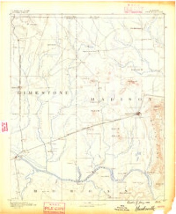
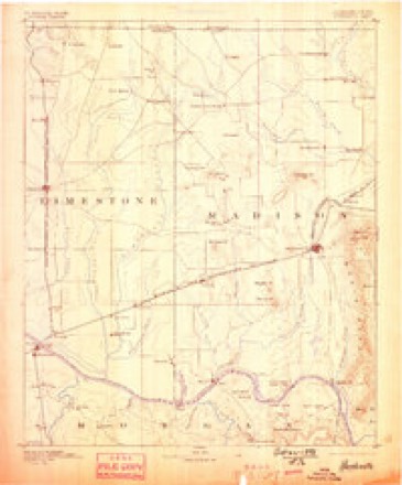
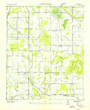
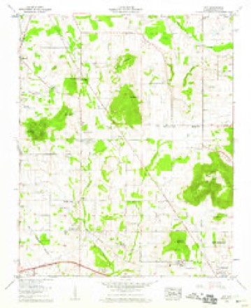
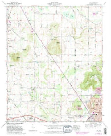
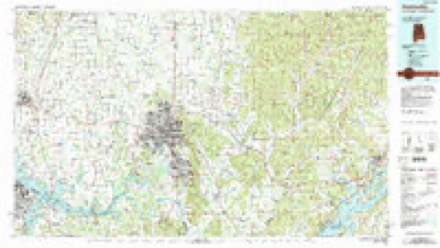
23 topographic sheets cover this place, the earliest surveyed in 1888 and the latest in 1984. It stands in the Huntsville census division. It lies in ZIP code area 35806. It stands on Nichols Spring Branch. The Survey maps it on the Jeff quadrangle. It stands 748 feet above sea level.
Topographic sheets covering this place
10 surveys from 23 printed sheetsMatched by testing this settlement's coordinate against the published boundary of every sheet in the United States Geological Survey's historical collection. Each opens the scanned sheet at the Survey.
- 1888 USGS Huntsville quadrangle1:125000
- 1892 USGS Huntsville quadrangle1:125000, 6 printings
- 1936 USGS Jeff quadrangle1:24000
- 1956 USGS Gadsden quadrangle1:250000, 3 printings
- 1958 USGS Gadsden quadrangle1:250000
- 1958 USGS Jeff quadrangle1:24000, 2 printings
- 1960 USGS Gadsden quadrangle1:250000, 2 printings
- 1963 USGS Gadsden quadrangle1:250000
- 1967 USGS Jeff quadrangle1:24000, 3 printings
- 1984 USGS Huntsville quadrangle1:100000, 3 printings




Fires near this place
54 since 1994Regional context, not property-specific evidence. The federal wildfire occurrence database lists 54 fires within 5 miles of Monrovia between 1994 and 2016, burning about 79 acres in total. None started naturally. 9 were recorded as arson. Distance is straight-line from the map coordinates, so a fire counted here may appear on a neighbouring settlement's page as well.
| Reported cause | Fires |
|---|---|
| Debris and open burning | 20 |
| Arson/incendiarism | 9 |
| Misuse of fire by a minor | 8 |
| Missing data/not specified/undetermined | 7 |
| Equipment and vehicle use | 4 |
| Smoking | 3 |
| Recreation and ceremony | 2 |
| Fireworks | 1 |
The most recent of them, most recent first, with the day each was reported and the service that recorded it.
| Date | Cause | Size | Reported by | Name on the report |
|---|---|---|---|---|
| 7 September 1999 | Equipment and vehicle use | under an acre | Alabama Forestry Commission | not named |
| 3 September 1995 | Recreation and ceremony | under an acre | Alabama Forestry Commission | not named |
| 19 September 2000 | Arson/incendiarism | 3.0 acres | Alabama Forestry Commission | not named |
| 19 September 2000 | Equipment and vehicle use | 10 acres | Alabama Forestry Commission | not named |
| 18 September 2000 | Misuse of fire by a minor | under an acre | Alabama Forestry Commission | not named |
| 17 September 2006 | Debris and open burning | under an acre | Alabama Forestry Commission | not named |
| 17 September 2000 | Misuse of fire by a minor | under an acre | Alabama Forestry Commission | not named |
| 17 September 2000 | Misuse of fire by a minor | under an acre | Alabama Forestry Commission | not named |
Settlements close enough to share some of these fires:
Mines and quarries near this place
1 within 5 milesRegional context, not property-specific evidence. The federal mineral resources record lists 1 working within 5 miles of Monrovia: 1 producer. All of them still produce. What was taken out: Stone, Crushed/Broken. Distance is straight-line from the map coordinates, so a quarry counted here may appear on a neighbouring settlement's page as well.
| Where | Site | Commodity | Status | Recorded |
|---|---|---|---|---|
| Huntsville North Quarry | Stone, Crushed/Broken | Producer |
Storms near this place
53 since 2002Regional context, not property-specific evidence. The National Weather Service names Monrovia in 53 storm reports between 2002 and 2025: 30 thunderstorm wind, 10 flash flood, 9 hail, 2 tornado. No death or injury is recorded in these reports. Each account below is quoted exactly as the forecast office filed it, from the NOAA Storm Events Database, and each date opens the federal record of that event.
| When | Event | Place named | Harm | What the report says |
|---|---|---|---|---|
| July 2011 | Lightning | Monrovia | $250,000 | A lightning induced fire burnt a home down to the ground on Oakhurst Drive near Slaughter road. |
| September 2002 | Thunderstorm Wind | Monrovia | $8,000 | Trees were blown down in and near Monrovia. One tree fell onto a vehicle causing minor damage. |
| June 2011 | Thunderstorm Wind | Monrovia | $5,000 | A power pole was snapped. |
| February 2011 | Thunderstorm Wind | Monrovia | $5,000 | A building was damaged on highway 72. |
| March 2022 | Thunderstorm Wind | Monrovia | $4,000 | A tree fell on a car at this location. |
| October 2009 | Thunderstorm Wind | Monrovia | $4,000 | Trees were blown down at the intersection of Nance road and Mcrary road. |
| October 2009 | Thunderstorm Wind | Monrovia | $3,000 | Trees were blown down on Nance road and Mercury Lane. |
| December 2025 | Thunderstorm Wind | Monrovia | $2,000 | Powerlines were reported down along Gooch road at this location. |
| July 2024 | Thunderstorm Wind | Monrovia | $1,500 | A tree was knocked down onto power lines causing an outage in the area of Bishop Road and South View Drive. Time was estimated by radar. |
| August 2021 | Thunderstorm Wind | Monrovia | $1,500 | Strong outflow winds from a thunderstorm knocked a tree down onto a home on Yancy Road in Madison. Time estimated by radar. |
| June 2011 | Thunderstorm Wind | Monrovia | $1,000 | Large tree had top broken off by winds. |
| October 2009 | Thunderstorm Wind | Monrovia | $1,000 | Thunderstorm winds knocked a tree down along Mount Zion Road. |
| May 2016 | Thunderstorm Wind | Monrovia | $500 | A large tree branch was knocked down by thunderstorm winds on Capshaw Road between Nance and Wall Triana Highway. The time was estimated by radar. |
| May 2012 | Thunderstorm Wind | Monrovia | $500 | A tree of unknown sized was knocked down along Nance Road. Time estimated by radar. |
| June 2011 | Thunderstorm Wind | Monrovia | $500 | A 55 mph gust was reported. |
| June 2011 | Thunderstorm Wind | Monrovia | $500 | An gust to 50 mph was estimated at this location. |
| July 2008 | Thunderstorm Wind | Monrovia | $500 | A few trees were downed by thunderstorm winds in the Monrovia area at the intersection of Dan Tibbs road and Indian Creek Road. |
| May 2020 | Thunderstorm Wind | Monrovia | $200 | A bradford pear tree was snapped onto Pettus Road at Hillgate Road. |
| May 2020 | Thunderstorm Wind | Monrovia | $200 | A large tree branch was knocked down at Indian Creek and Plummer Road. |
| December 2019 | Thunderstorm Wind | Monrovia | $200 | A hardwood tree was knocked down at this location. |
| June 2011 | Thunderstorm Wind | Monrovia | $200 | A 41 mph gust was measured on Hughes road. |
| November 2022 | Thunderstorm Wind | Monrovia | $100 | Large tree branches were snapped. Also, a power flash was observed about two miles north of this location, followed by intermittent power outages. Time was estimated from radar. |
| June 2013 | Thunderstorm Wind | Monrovia | $100 | Thunderstorm winds knocked a large tree branch down. |
| June 2013 | Thunderstorm Wind | Monrovia | $100 | Thunderstorm winds knocked down a large tree branch near the intersection of Jeff Road and Capshaw Road. |
| March 2024 | Flash Flood | Monrovia | - | Flash flooding near Indian Creek Road at Blake Bottom Road with residential properties flooded. Depth of water unknown. |
| May 2024 | Tornado (EF0) | Monrovia | - | A tornado touched down in the Hill Chase neighborhood on the west-facing slope of Rainbow Mountain. Several trees were uprooted in this neighborhood, with at least two trees on houses. The tornado continued east-southeast over Rainbow Mountain where additional trees were uprooted or snapped, fences damaged, and at least one power pole was toppled. The tornado damaged more trees in the Highland Lakes neighborhood, on the east-facing slope of Rainbow Mountain. Numerous trees were uprooted in this area with a snapped trunk of at least one weaker, softwood tree. This damage indicator was reduced to account for the condition of the tree. The tornado then continued eastward across Slaughter Road. More trees were uprooted along Mingo Road. Minor damage was observed in the Creekwood neighborhood and into the Indian Creek basin where the tornado lifted. |
| March 2023 | Flash Flood | Monrovia | - | Fast flowing water across the intersection near Indian Creek Road and Blake Bottom Road. Report relayed via social media. |
| May 2023 | Flash Flood | Monrovia | - | Water flowing over roadways at the intersection of Nick Fitcheard and Skylab Drive. Depth of water unknown. |
| May 2023 | Flash Flood | Monrovia | - | Rushing water reported over Plummer Road at Indian Creek rendering it impassable. Depth of water unknown. |
| July 2023 | Flash Flood | Monrovia | - | Research Park North of Hwy 53 closed due to flooding. Depth of water 6-12 inches. |
| July 2023 | Flash Flood | Monrovia | - | Trained spotter reported a foot of water flowing over Blake Bottom Road near the intersection of Indian Creek Road. |
| June 2023 | Hail | Monrovia | - | A social media report of penny to quarter sized hail near Hughes Road at Gillespie Road. |
| July 2023 | Hail | Monrovia | - | Hail of 0.75 inches in diameter reported from mPING. |
| July 2023 | Hail | Monrovia | - | Quarter sized hail was reported near the intersection of Research Park Boulevard and Highway 53. |
| October 2021 | Funnel Cloud | Monrovia | - | Several reports and videos were received of brief funnel clouds just north of U.S. Highway 72 in the Madison-Capshaw area. No damage was reported. A Baron Critical Weather Institute mesonet camera atop Rainbow Mountain captured this event as well with a well-defined wall cloud and small funnels. A social media video also showed a rotating wall cloud very low to the ground with a brief funnel in this same general area. |
| April 2021 | Hail | Monrovia | - | Hail up to 0.75 inches in diameter was reported via mPING. |
| December 2019 | Tornado (EF1) | Monrovia | - | Minor tree damage was noted just north of Harbin Road on Summer Cove Circle. The tornado started producing sporadic tree damage on Pettus Road as it approached the Summerfield Subdivision. It skipped along a path producing major structural damage off of Running Brook Court, removing nearly two thirds of a roof here. Minor roof and siding damage occurred to surrounding homes here as well. It was this damage that was rated EF-1, with wind speeds of 105 mph. Along Sarah Jane Drive, tornadic winds lifted up an awning and caused damage to a home, windows were broken and fences were not only blown over but broken apart and lofted onto and into a house on Jasmine Drive. This house experienced damage from additional debris along with fence segments and posts that impaled the home. Minor damage was noted as the tornado proceeded to move northeast with small branches and shingle damage observed in the Legacy neighborhood. A small outdoor metal shed was damaged and several trees were snapped or uprooted along Douglass Road near Golden Oak Drive before it lifted. |
| March 2017 | Hail | Monrovia | - | Half dollar sized hail in the Creekwood Subdivision near Creekwood Park in Huntsville. |
| December 2015 | Flash Flood | Monrovia | - | Dry Creek flowing over the bridge on Plummer Road west of Research Park Boulevard. |
| June 2014 | Thunderstorm Wind | Monrovia | - | Thunderstorm winds knocked down treeds onto a home and deck near Monrovia Middle School. Social media report. The time was estimated by radar. |
| June 2014 | Thunderstorm Wind | Monrovia | - | Thunderstorm winds knocked down numerous trees at a residence. |
| June 2014 | Thunderstorm Wind | Monrovia | - | A large tree was knocked down onto a garage in Monrovia. The time was estimated. |
| June 2014 | Thunderstorm Wind | Monrovia | - | Trees were knocked down with damage done to a gas station near the intersection of Highways 53 and 255. |
| June 2013 | Thunderstorm Wind | Monrovia | - | Thunderstorm winds knocked down two 4-6 inch diameter trees down near Red Wing Circle and Shimmer Pond Court. A trampoline was also thrown about. |
| January 2012 | Flash Flood | Monrovia | - | Flash flooding was reported on Plummer Road just east of Indian Creek Road. |
| November 2011 | Thunderstorm Wind | Monrovia | - | Thunderstorm wind gusts were estimated to be up to 65 mph in the Providence Main district. |
| March 2010 | Hail | Monrovia | - | Penny hail was reported covering the ground in the Monrovia area. |
| July 2010 | Flash Flood | Monrovia | - | Six inches of flowing water was reported on the intersection of Nance Road and Capshaw Road. |
| April 2009 | Flash Flood | Monrovia | - | Flash flooding was reported at Lawsons Ridge Road in Madison. |
| April 2009 | Hail | Monrovia | - | Baseball size hail was reported at the intersection of Hwy 72 and Shawnee Drive. |
| June 2008 | Hail | Monrovia | - | Nickel sized hail was reported. |
| June 2007 | Thunderstorm Wind | Monrovia | - | Trees were blown down in the Candlewyck Cross subdivision. |
| August 2002 | Hail | Monrovia | - | Dime size hail fell in the Monrovia community. |
Nearest settlements
The eight closest, with where each one stands in the county. Distances are straight-line, computed from the Geographic Names Information System coordinates.
| Map | Place | Distance | Sheets |
|---|---|---|---|
| Vaughn Corners | 1.0 miles | 23 | |
| Old Monrovia | 1.2 miles | 23 | |
| Western Hills Estates | 2.4 miles | 23 | |
| Northwood | 2.4 miles | 21 | |
| Jeff | 2.5 miles | 23 | |
| Rainbow | 2.6 miles | 23 | |
| Rainbow Mountain Heights | 2.7 miles | 27 | |
| Chickasaw Estates | 2.7 miles | 27 |
Elsewhere
Matched on this settlement's Geographic Names Information System number rather than its name, so it cannot be a different place of the same name in another state.
| Wikipedia article on Monrovia | An encyclopaedic summary. Its text is share-alike, so it is linked here rather than copied. |
| Wikidata item Q14679296 | The structured record the population and elevation above come from. Public domain (CC0). |
Provenance
This settlement is recorded in the Geographic Names Information System as feature 152361. The sheet list is computed by point-in-boundary test against the United States Geological Survey's historical topographic inventory. Both are works of the United States government and carry no copyright under 17 U.S.C. 105.
Wildfire. Short, Karen C. 2022. Spatial wildfire occurrence data for the United States, 1992-2020 [FPA_FOD_20221014]. 6th Edition. Fort Collins, CO: Forest Service Research Data Archive. https://doi.org/10.2737/RDS-2013-0009.6 Collected with United States Government funding and usable without additional permissions or fees.
Mines and quarries. USGS Mineral Resources Data System (MRDS) https://mrdata.usgs.gov/mrds/ A work of the United States government, no copyright under 17 U.S.C. 105.
Storms. NOAA National Centers for Environmental Information, Storm Events Database https://www.ncei.noaa.gov/stormevents/ A work of the United States government, no copyright under 17 U.S.C. 105. Narratives are quoted verbatim from the National Weather Service report and are not edited or summarised.