 Block
Nix, Alabama
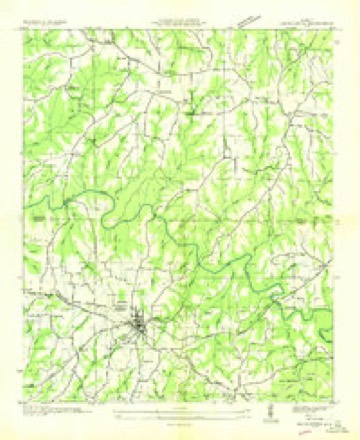
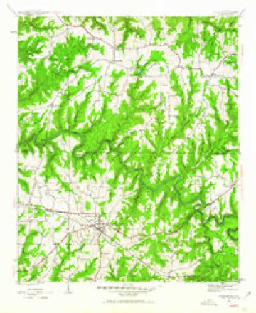
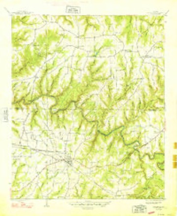
14 topographic sheets cover this place, the earliest surveyed in 1936 and the latest in 1980. It stands in the Phil Campbell census division. It lies in ZIP code area 35581. It stands on Ivy Branch. The Survey maps it on the Hackleburg quadrangle. It stands 965 feet above sea level.
Topographic sheets covering this place
8 surveys from 14 printed sheetsMatched by testing this settlement's coordinate against the published boundary of every sheet in the United States Geological Survey's historical collection. Each opens the scanned sheet at the Survey.
- 1936 USGS Hackleburg quadrangle1:24000
- 1946 USGS Hackleburg quadrangle1:24000, 3 printings
- 1948 USGS Hackleburg quadrangle1:24000, 2 printings
- 1956 USGS Gadsden quadrangle1:250000, 3 printings
- 1958 USGS Gadsden quadrangle1:250000
- 1960 USGS Gadsden quadrangle1:250000, 2 printings
- 1963 USGS Gadsden quadrangle1:250000
- 1980 USGS Haleyville quadrangle1:100000




Fires near this place
81 since 1995Regional context, not property-specific evidence. The federal wildfire occurrence database lists 81 fires within 5 miles of Nix between 1995 and 2017, burning about 822 acres in total. 1 started naturally. 17 were recorded as arson. Distance is straight-line from the map coordinates, so a fire counted here may appear on a neighbouring settlement's page as well.
| Reported cause | Fires |
|---|---|
| Missing data/not specified/undetermined | 29 |
| Debris and open burning | 24 |
| Arson/incendiarism | 17 |
| Railroad operations and maintenance | 4 |
| Equipment and vehicle use | 3 |
| Smoking | 2 |
| Other causes | 1 |
| Natural | 1 |
The most recent of them, most recent first, with the day each was reported and the service that recorded it.
| Date | Cause | Size | Reported by | Name on the report |
|---|---|---|---|---|
| 6 September 1998 | Debris and open burning | 5.0 acres | Alabama Forestry Commission | not named |
| 3 September 1999 | Debris and open burning | 1.0 acres | Alabama Forestry Commission | not named |
| 22 September 2010 | Other causes | 1.0 acres | Alabama Forestry Commission | not named |
| 18 September 2010 | Debris and open burning | 200 acres | Alabama Forestry Commission | WACO FIRE |
| 18 September 2000 | Equipment and vehicle use | 7.0 acres | Alabama Forestry Commission | not named |
| 15 September 1998 | Arson/incendiarism | 8.0 acres | Alabama Forestry Commission | not named |
| 10 September 2013 | Missing data/not specified/undetermined | under an acre | Alabama Forestry Commission | NOR-20130910-002 |
| 10 September 1998 | Debris and open burning | 1.0 acres | Alabama Forestry Commission | not named |
Settlements close enough to share some of these fires:
Mines and quarries near this place
10 within 5 milesRegional context, not property-specific evidence. The federal mineral resources record lists 10 workings within 5 miles of Nix: 6 unknowns, 4 producers. 4 still produce. What was taken out: Iron, Sand and Gravel, Construction. Distance is straight-line from the map coordinates, so a quarry counted here may appear on a neighbouring settlement's page as well.
| Where | Site | Commodity | Status | Recorded |
|---|---|---|---|---|
| Spruce Pine Mine | Sand and Gravel, Construction | Producer | ||
| Spruce Pine Pits | Sand and Gravel, Construction | Producer | Quartz | |
| Tennessee Valley Sand and Gravel Company | Sand and Gravel, Construction | Producer | Unconsolidated Sediments | |
| Trapptown No. 1 | Sand and Gravel, Construction | Producer | ||
| Unnamed | Iron | Unknown | ||
| Unnamed | Iron | Unknown | ||
| Unnamed | Iron | Unknown | ||
| Unnamed | Iron | Unknown | ||
| Unnamed | Iron | Unknown | ||
| Unnamed | Iron | Unknown |
Storms near this place
7 since 2008Regional context, not property-specific evidence. The National Weather Service names Nix in 7 storm reports between 2008 and 2023: 4 thunderstorm wind, 2 hail, 1 tornado. The reports record 27 deaths. Each account below is quoted exactly as the forecast office filed it, from the NOAA Storm Events Database, and each date opens the federal record of that event.
| When | Event | Place named | Harm | What the report says |
|---|---|---|---|---|
| April 2011 | Tornado (EF5) | Nix | 27 killed, $50,000,000 | A violent long track tornado continued it's path from Marion County into southern Franklin County north of Hackleburg. Significant devastation occurred throughout the city of Phil Campbell. Prolific damage was noted from the intersection of CR 51 and Alabama Highway 237, to the intersection of CR 81 and CR 75. Within a two mile corridor of either side of the railroad tracks the damage was significant. Within this corridor, several well constructed houses were destroyed. Along Bonner Street, multiple block homes were leveled to the ground with the block foundations destroyed. A twenty-five foot section of pavement was sucked up and scattered. Chunks of the pavement were found in a home over 1/3 of a mile down the road. The damage in this area was consistent with EF-5 damage. ||In addition, at least three churches along the path sustained significant damage. One church in Phil Campbell was completely destroyed with only the slab remaining.||Multiple mobile homes throughout the path were completely destroyed, and their mangled frames were tossed 25 to 50 yards. Cars were tossed and destroyed throughout the path of the tornado, with one car wrapped around a debarked tree in Phil Campbell. All along the path length, thousands of hardwood and softwood trees were snapped. Hundreds of trees were also debarked and twisted, and had only stubs of the largest branches remaining. EF-5 damage continued similarly northeast from Phil Campbell, roughly along County Roads 81 and 82 toward the community of Oak Grove.||In Oak Grove, the tornado may have reached a relative maximum in intensity well into the EF-5 category as the damage was slightly more intense and the path width was at a maximum of greater than one mile. A large swath of complete devastation was noted in Oak Grove along County Roads 38 and Smith Lane. A large well-constructed home with extensive anchoring was razed with debris carried well away from the site. A Corvette sports car was mangled and thrown 641 feet (measured). A block home next door was also disintegrated. Along Smith Lane a block home was wiped out and the only remains of a nearby chicken house was a small piece of a metal truss. In this same area, the tree damage was significant and a large percentage of trees were stripped bare. |
| April 2011 | Thunderstorm Wind | Nix | $30,000 | A few homes or farm buildings had damage to roofs along CR 57. Also a small Bradford Pear tree was uprooted in this area. ||However, more substantial damage occurred further northeast within this wind swath near the intersection of Cleveland Branch road and CR 57. In this area, multiple pines were uprooted or blown over. In addition, some tall thin pine trees were snapped off midway down to the ground, even a few near their base. Three very large pine trees and oak tree were uprooted further northeast of the Cleveland Branch road intersection with CR 57. In this same area some pine trees were also uprooted on the other side of the road. ||Additional damage continued along Cleveland Branch Road, where a farm building was totally destroyed. Additional tree damage and some minor roof damage continued along this road, but to a lesser extent. |
| April 2011 | Thunderstorm Wind | Nix | $10,000 | A chicken house was heavily damaged and some trees were uprooted in this area. Also some minor shingle damage was observed. This wind swath was observed along Gravel Hill road and further east along CR 59. |
| June 2023 | Thunderstorm Wind | Nix | $2,000 | Trees and power lines were knocked down at the intersection of Edgar Chapel Road and Cook Road outside of Phil Campbell. |
| July 2012 | Thunderstorm Wind | Nix | $500 | A tree was knocked down on Highway 43. Time was estimated by radar. |
| March 2010 | Hail | Nix | - | Quarter size hail was reported five miles west of Phil Campbell. |
| April 2008 | Hail | Nix | - | Half dollar diameter hail was reported. |
Nearest settlements
The eight closest, with where each one stands in the county. Distances are straight-line, computed from the Geographic Names Information System coordinates.
| Map | Place | Distance | Sheets |
|---|---|---|---|
| Liberty Hill | 1.1 miles | 14 | |
| Nix Mill | 1.2 miles | 14 | |
| Duketon | 2.7 miles | 14 | |
| Shady Grove | 3.7 miles | 14 | |
| Smith (historical) | 3.7 miles | 14 | |
| Phil Campbell | 4.1 miles | 14 | |
| Spruce Pine | 4.1 miles | 14 | |
| Rockwood | 7.1 miles | 14 |
Elsewhere
Matched on this settlement's Geographic Names Information System number rather than its name, so it cannot be a different place of the same name in another state.
| Wikipedia article on Nix | An encyclopaedic summary. Its text is share-alike, so it is linked here rather than copied. |
| Wikidata item Q18353758 | The structured record the population and elevation above come from. Public domain (CC0). |
Provenance
This settlement is recorded in the Geographic Names Information System as feature 123950. The sheet list is computed by point-in-boundary test against the United States Geological Survey's historical topographic inventory. Both are works of the United States government and carry no copyright under 17 U.S.C. 105.
Wildfire. Short, Karen C. 2022. Spatial wildfire occurrence data for the United States, 1992-2020 [FPA_FOD_20221014]. 6th Edition. Fort Collins, CO: Forest Service Research Data Archive. https://doi.org/10.2737/RDS-2013-0009.6 Collected with United States Government funding and usable without additional permissions or fees.
Mines and quarries. USGS Mineral Resources Data System (MRDS) https://mrdata.usgs.gov/mrds/ A work of the United States government, no copyright under 17 U.S.C. 105.
Storms. NOAA National Centers for Environmental Information, Storm Events Database https://www.ncei.noaa.gov/stormevents/ A work of the United States government, no copyright under 17 U.S.C. 105. Narratives are quoted verbatim from the National Weather Service report and are not edited or summarised.